Sugarloaf
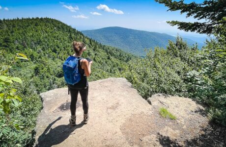
It’s big, it’s challenging, it’s the king of the park — Sugarloaf never disappoints. It’s the most Catskills you can get in a single mountain.
Peak Details
Height: 3,783ft (1,153m)
Range: Northeastern Catskills
Level: Hardest
Scenic: Yes
Trail Type: Fully Trailed
Sugarloaf Hiking Trails & Hikes
Eastern Devil’s Path
Completing this very challenging hike is a top Catskills hiking achievement.
Devil’s Path Trail (Ultimate Guide)
Everything you need to know about the Devils Path — one of the most difficult hiking trails in New York State.
Sugarloaf in Winter (Safest Route)
A beautiful hike to one of the grandest of Catskills high peaks.
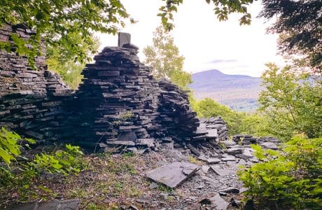
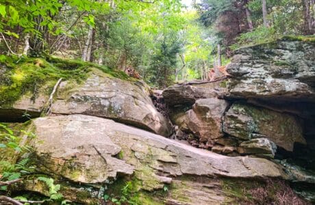
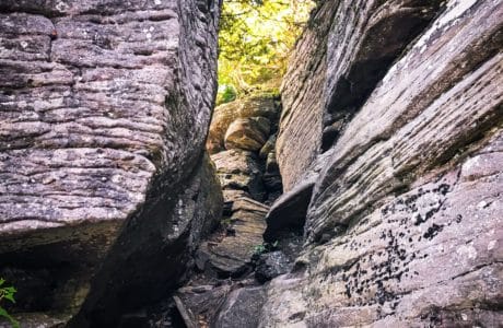
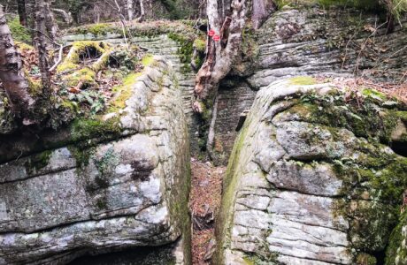
Dibbles Quarry & Beyond (Ultimate Guide)
A short, easy hike to the very memorable Dibbles Quarry in one of The Catskills’ loveliest notches.
Sugarloaf (Best Route)
A rugged, tough hike over one of the Catskills’ grandest mountains.
Hike Sugarloaf & Twin from Roaring Kill
Any hike that includes Twin Mountain is a great hike. From either side, Twin offers some the funnest ascents in the Catskill Park. But the western side of Twin, with its steep talus field and a section of technical open rock face, is perhaps the toughest 0.7 mile you’ll hike on any Catskill trail.
Hike Sugarloaf from Roaring Kill, Clockwise
Pass through Dibble’s Quarry, rock-hop over a stream and around a beaver pond, make your way up to the col between Sugarloaf and Twin, and then head west over Sugarloaf’s enormous boreal summit — to a fantastic view of the Southern Catskills. Sugarloaf is a lot of mountain. An awesome lot.
Seasonal Notes for Sugarloaf
Winter
Once the cold descends and Sugarloaf gets iced up, its western side is extremely dangerous for hikers. It’s one of the few places in the Catskill Park where you need full crampons, and maybe even technical climbing gear. For these reasons, in winter, Sugarloaf is known locally as “Suicide Mountain”. In winter, this is the safest route to the summit.
Sugarloaf Topography
Summit Forecast: Sugarloaf
The page URL below shows the weather at Sugarloaf’s summit for the next six days.
If a foreacast for a peak is not directly available, this page may display a link to a nearby location.
https://www.mountain-forecast.com/peaks/Sugarloaf-Mountain-Greene-County-New-York/forecasts/1161
Sugarloaf Information
Sugarloaf Mountain — located in Greene County, New York — is part of the Devil’s Path. Sugarloaf is separated from Twin Mountain by Pecoy Notch, and from Plateau Mountain by Mink Hollow Notch.
Get full access…
Get instant access to the full version of this site and enjoy great supporter benefits: full galleries, full trail notes, early access to the latest content, and more.
Hot on the website right now…
Follow for more…
Follow my @TotalCatskills content on Instagram for regular hiking inspo and safe, inclusive community.