Disclosure: This content may contain affiliate links. Read my disclosure policy.
An straightforward out-and-back from Roaring Kill trailhead.
Hiking Trail Description
Dibbles Quarry is a beloved destination in The Catskills, nestled just a mile into the hollow between Twin and Sugarloaf Mountains. This is a delightful, moderate mountain hike.
Want giant bluestone thrones of unknown origin? You got it. Epic views? That too. The moderate hike in to Dibbles Quarry is just shy of a mile.
But there’s more to Dibbles Quarry than meets the eye. A “secret” area behind the main quarry. A waterfall below it. And, above it, so much goodness…
Not far beyond the quarry is one of The Catskills’ most idyllic stream crossings. After crossing, climb through a gorgeous hemlock grove to stand at the edge of a massive beaver pond.
It’s well worth exploring beyond the quarry, even if you don’t intend to continue up to Pecoy Notch to hike Twin or Sugarloaf.
Allow two hours for this short, memorable, scenic, very fun hike.
You might also enjoy…
- Updated › Wittenberg & Cornell
- Updated › How to Winter Hike: The Essential Roundup
- Follow › Sean’s content on Instagram
- Identify › Bobcat/Coyote Tracks and Bear Prints
- Explore › Easy Hikes
- Hike More › Catskills, Adirondacks, Hudson Highlands, Gunks
Dibbles Quarry Hiking Trail
The Dibbles Quarry hiking trail includes…
- Less than 1 mile moderate hike in
- Beautiful mixed forest with several hemlock groves
- Massive bluestone quarry
- Epic views of Twin Mountain, Kaaterskill High Peak and the valley between
- Beyond Dibbles Quarry:
- Idyllic stream crossing with waterfalls
- Steep hemlock grove
- Vernal pool/meadow
- Enormous beaver pond
- Clear view of Pecoy Notch between Twin and Sugarloaf mountains
Dibbles Quarry Trail Notes & Gallery
This route begins at the Roaring Kill trailhead on Roading Kill Road in Elka Park.
Following the yellow blazes, hike in one quarter mile to the first junction. Bear left and head uphill, now following blue blazes.
After just 250 feet of elevation gain, the trail levels out and becomes nice and easy — although it can be muddy, here, so it’s wise to wear hiking boots rather than sneakers.
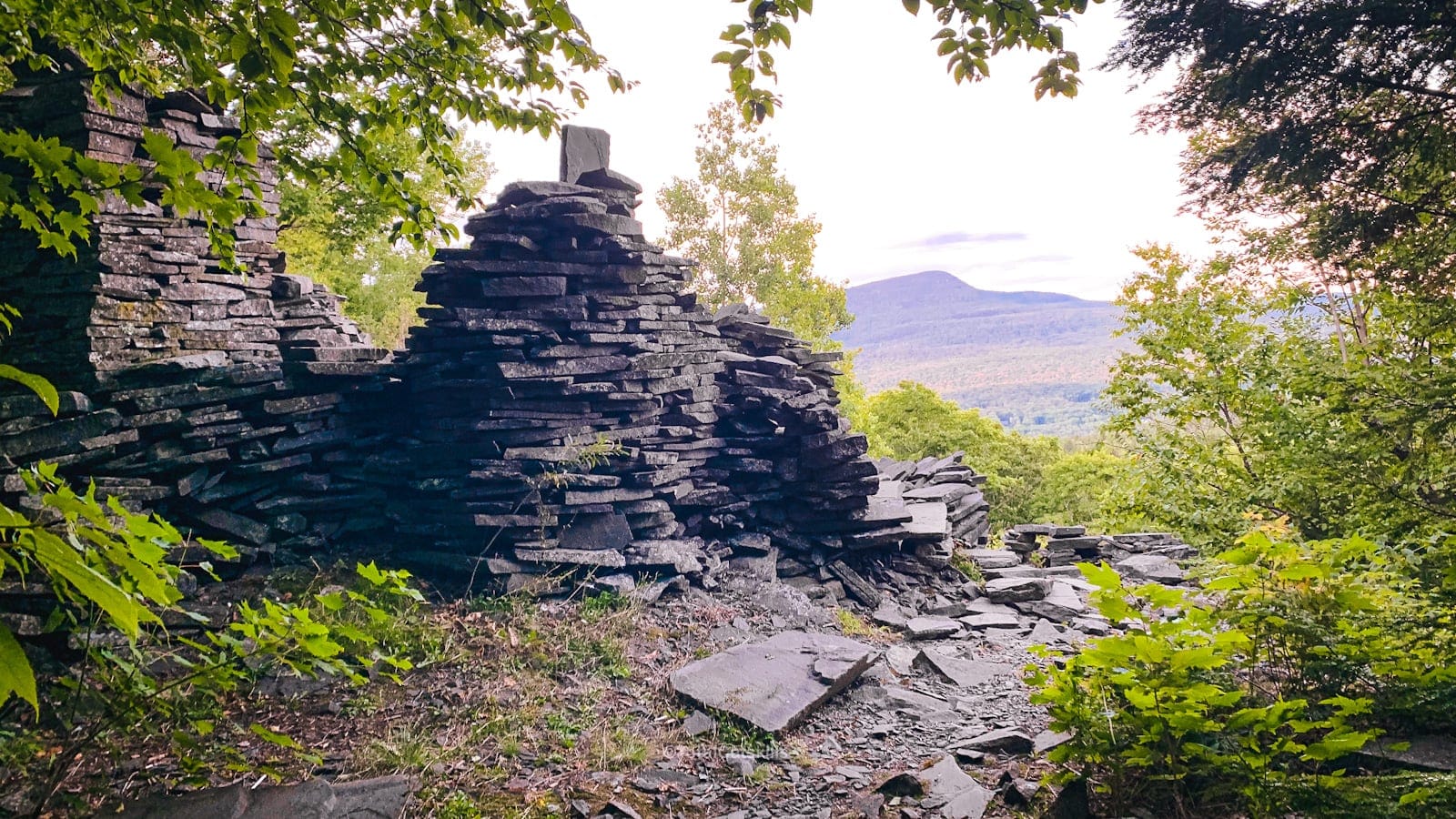
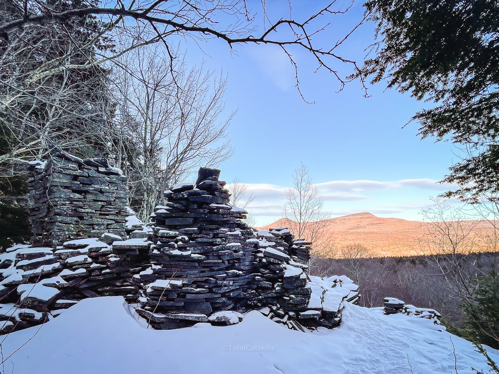
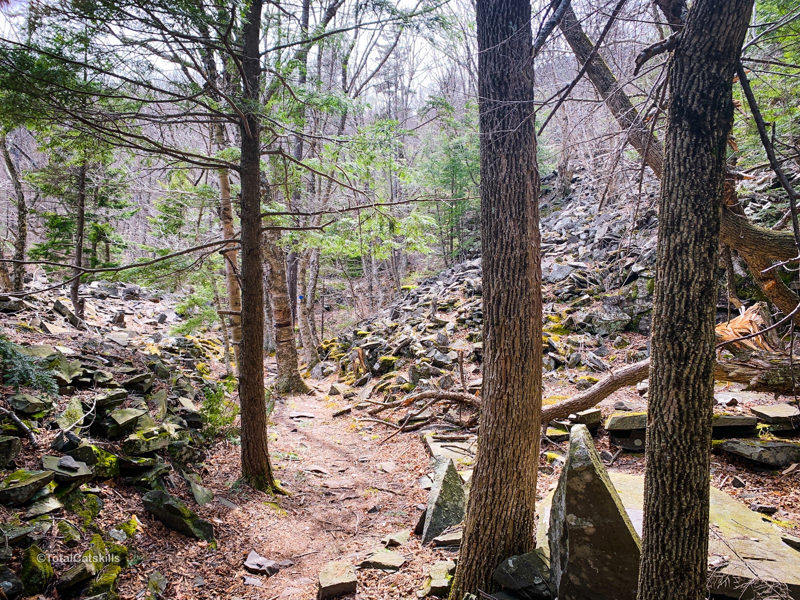
At 9/10ths of a mile from the trailhead, on the far side of a small hemlock grove, the trail dips down into Dibbles Quarry.
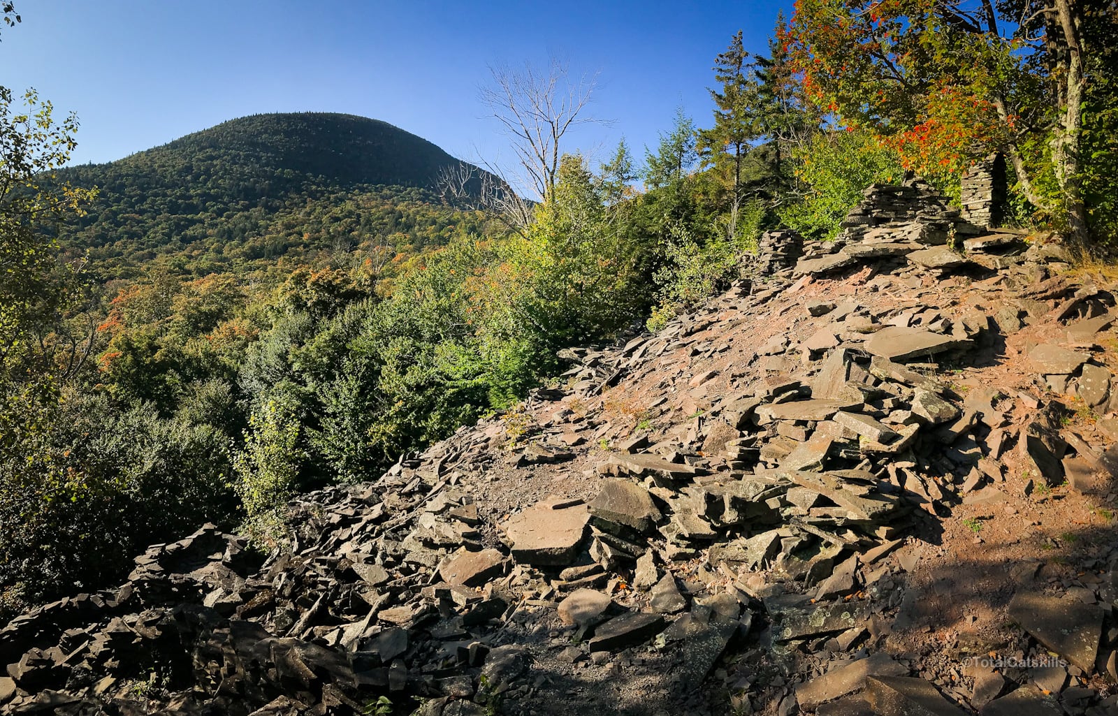
The mountain seen straight ahead is Twin Mountain.
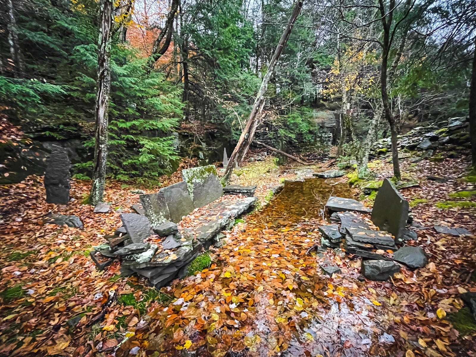
The thrones are super fun to sit on…
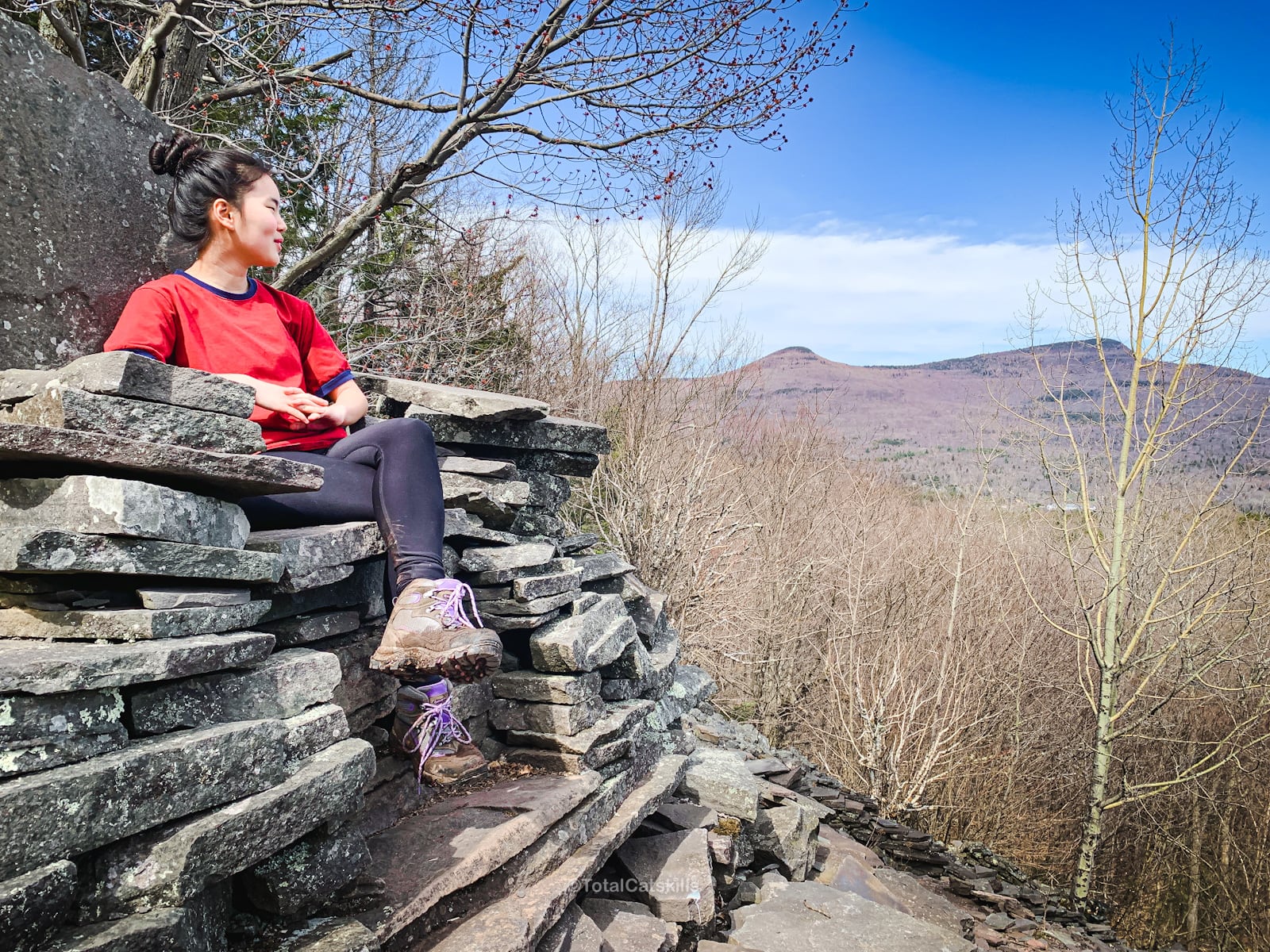
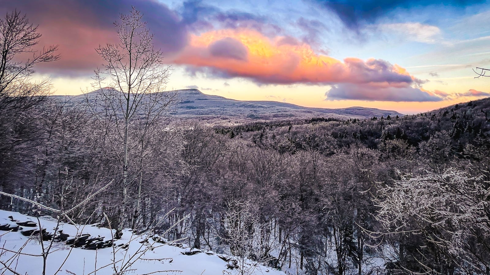
Standing by the thrones, to your left you can see Round Top and Kaaterskill High Peak. Straight ahead, you can see down through Platte Clove. To your right, the large prominent mountain is Twin Mountain. (The route up Twin from Pecoy Notch is one of the most rugged, sketchiest (and funnest) trail sections in The Catskills.)
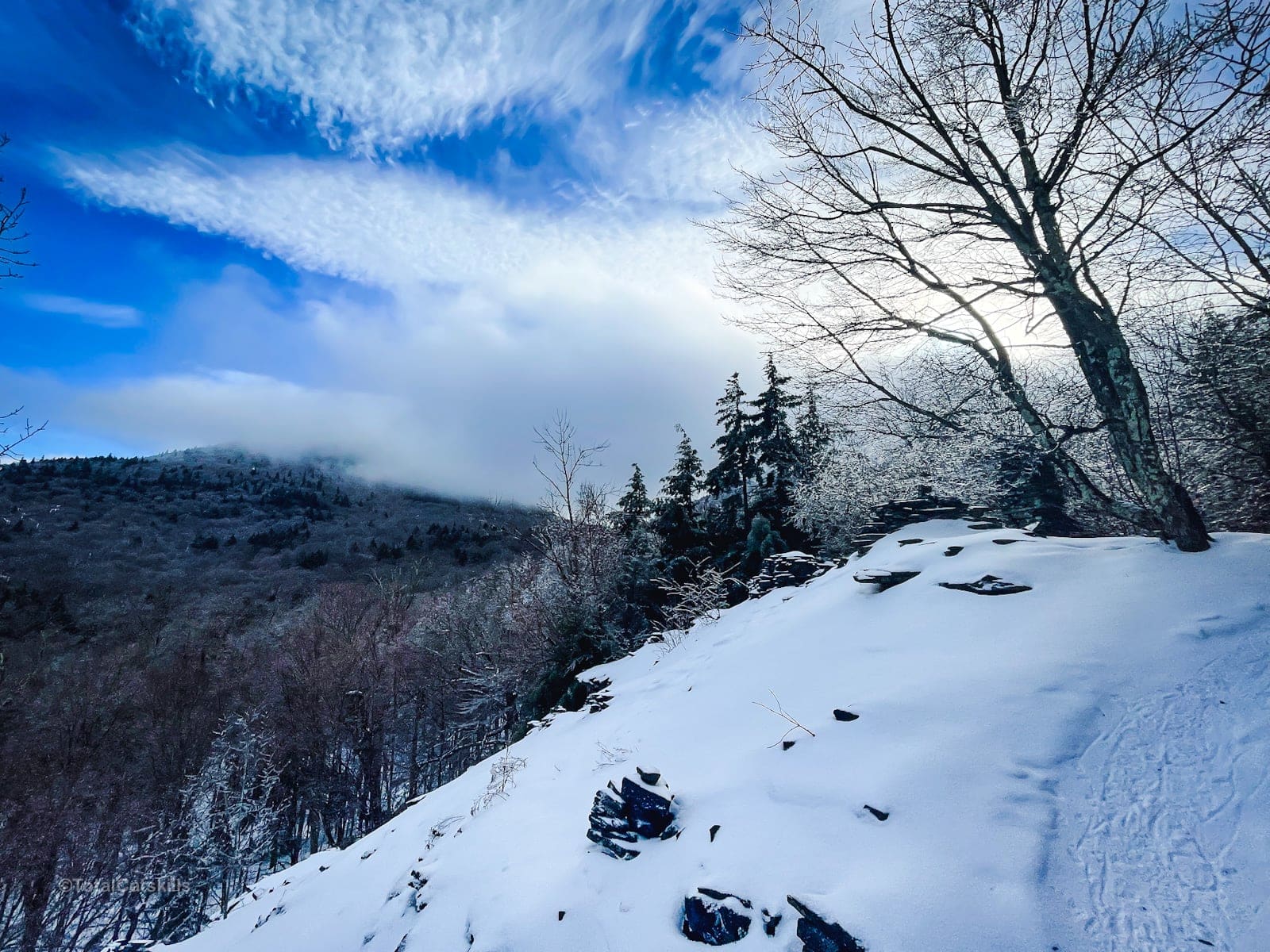
The view from Dibbles Quarry is magical at any time of year…
On the far side of the quarry, the trail winds through mounds of abandoned bluestone shards.
Look down and you’ll see some fun stone graffiti…
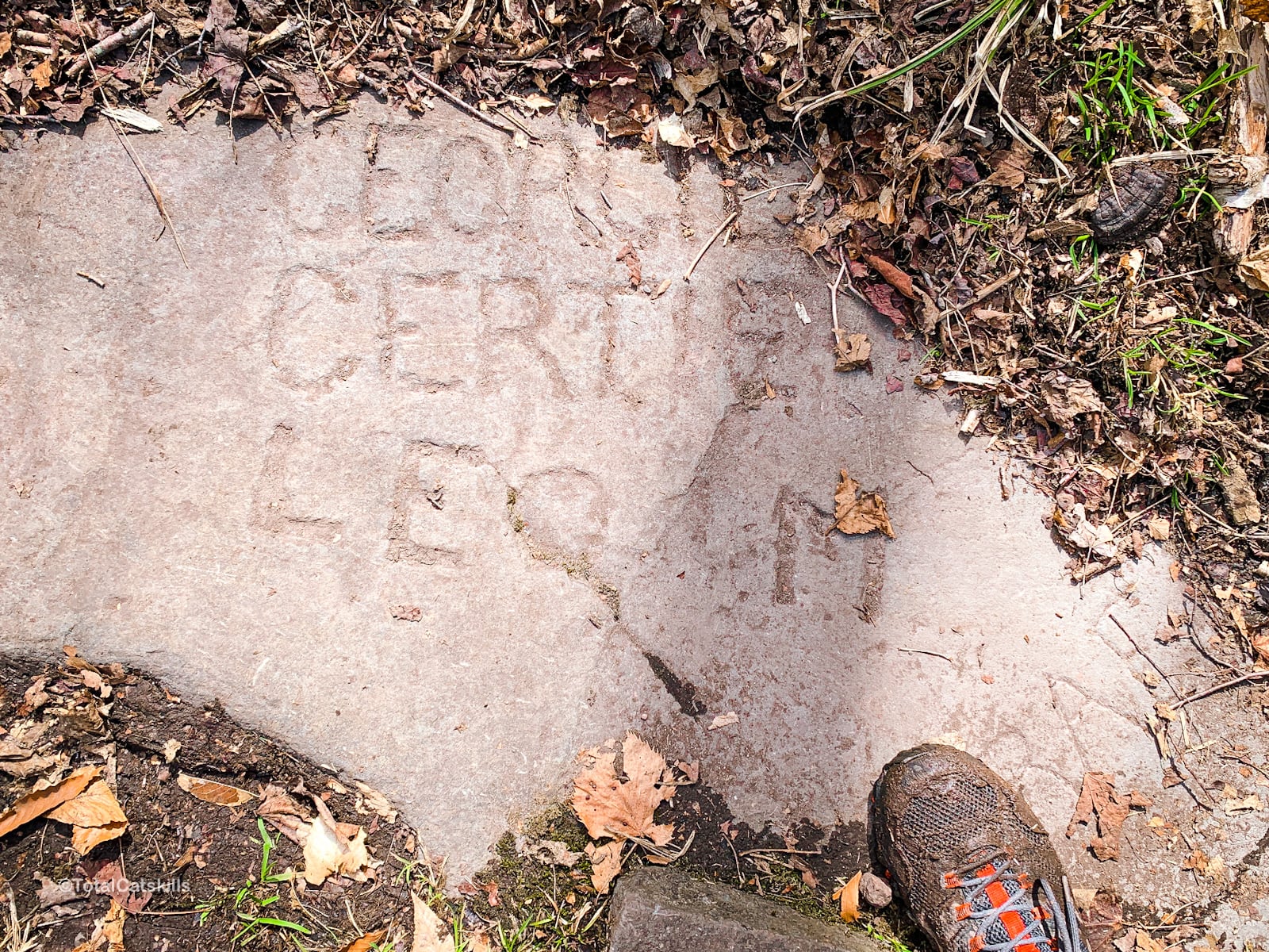
Remember to Leave No Trace.
About Bluestone
Bluestone from New York is a kind of sandstone defined as feldspathic greywacke. Its sand-sized grains were deposited in the Catskill Delta during the Devonian Period, 370 to 345 million years ago.
About Dibbles Quarry
Dibbles Quarry was active in the 1800’s. It was abandoned in the twentieth century, like most other Catskills bluestone quarries, after concrete usurped bluestone as a building material.
Is Dibbles Quarry named after a local man called Mr. Dibbell? I don’t know but I do know that until 1928, when the U.S. Geographic Board formalized its current name, Sugarloaf Mountain was locally known as Dibble Mountain.
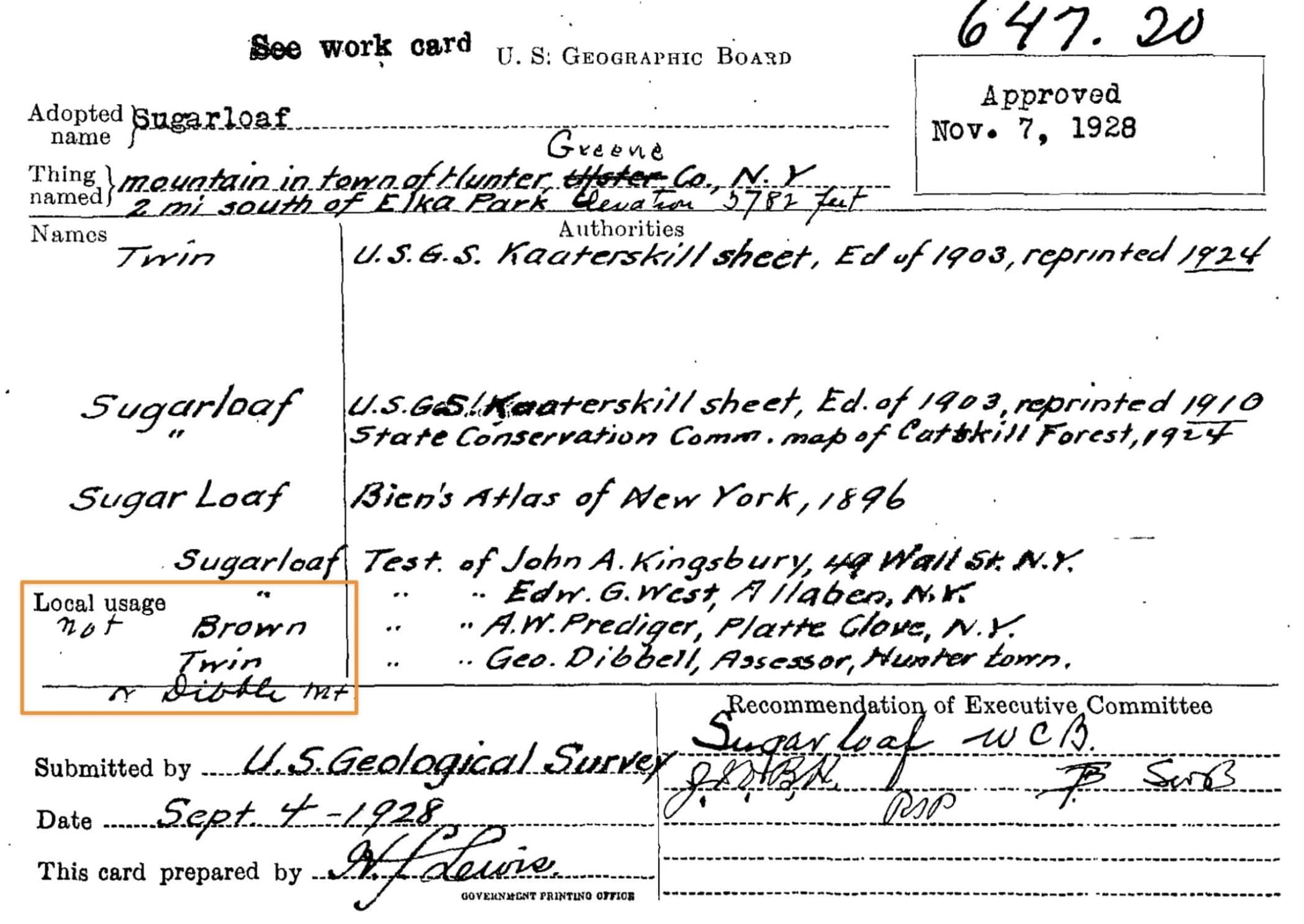
Notice the name of the assessor from Hunter: Geo. Dibbell. Also long ago, there was another assessor called H.E. Dibbell in Hunter. Perhaps they were related. Online, I’ve found recent references to current local Dibbells.
I also found references to a Dibbells Dam on Schohaire Creek which is nearby.
The Dibbells have a long history in this area.
Behind Dibbles Quarry
After the thrones, if you keep an eye to your right, somewhere along the tail you might find a way to get up behind the main quarry. Stepping off a hiking trail is a risk you have to assess for yourself. Proceed at your own risk.
I’ve passed through Dibbles Quarry many times before without noticing this back-of-quarry area.
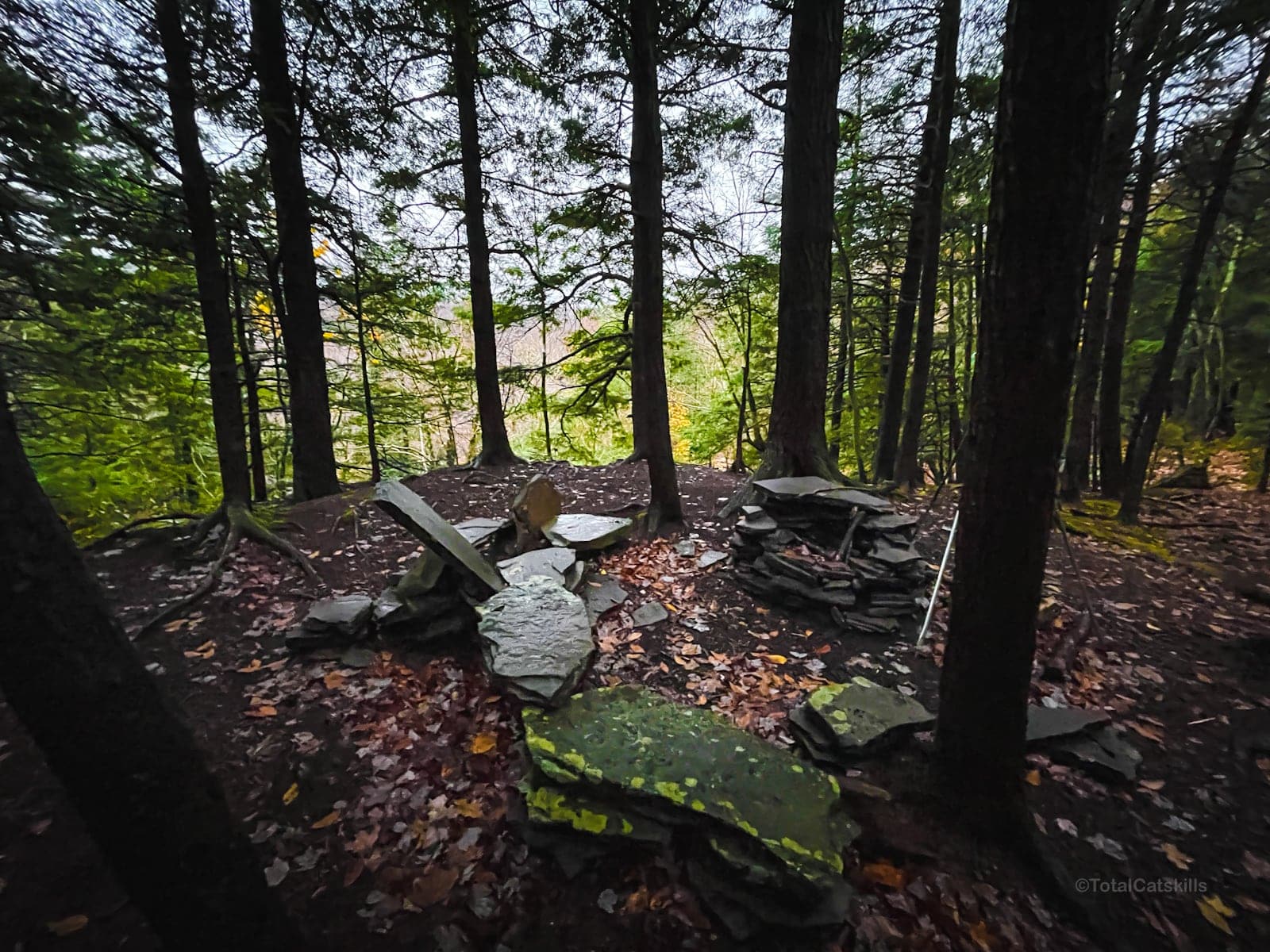
This section was flooded after rain. I can’t wait to revisit it in winter.
Below Dibbles Quarry
After rainfall, if you stand in Dibbles Quarry, you can hear gushing water below. On topographic maps, you’ll see a waterfall symbol in the area.
I’ve not yet visited these falls; the terrain directly around the quarry is too steep to hike down. But the falls sound fantastic. I need to find a non-sketchy route that heads down there…
This trail guide is free to all readers thanks to my subscribers. Get full access to this website instantly and enjoy great supporter benefits!
Beyond Dibbles Quarry
Back on the main trail, not far past the quarry, the route brings you to stunning riparian zone. The stream crossing, here, is one of my absolute favorites in The Catskills.
When the water is flowing heavily, it can be tricky to rock-hop to the far side. Trekking poles are helpful here for extra stability, or do like my hiking buddy did and pick up a sturdy branch …
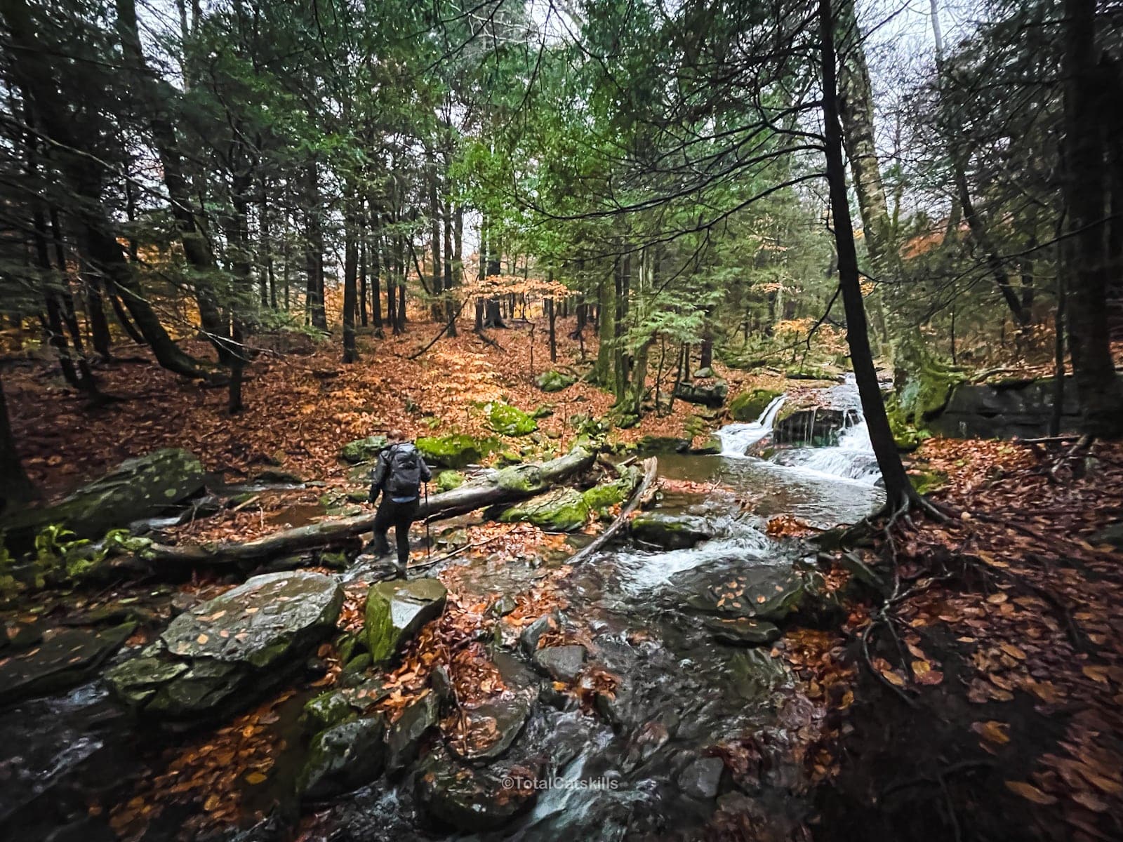
After the crossing, the trail heads uphill to the right, through a hemlock grove. At the top of the incline, the trail turns left and passes a small vernal pool/meadow on the right. Keep going.
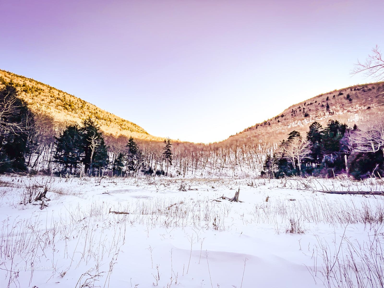
You’ll eventually pop out into a massive open area formed by what was once a beaver pond.
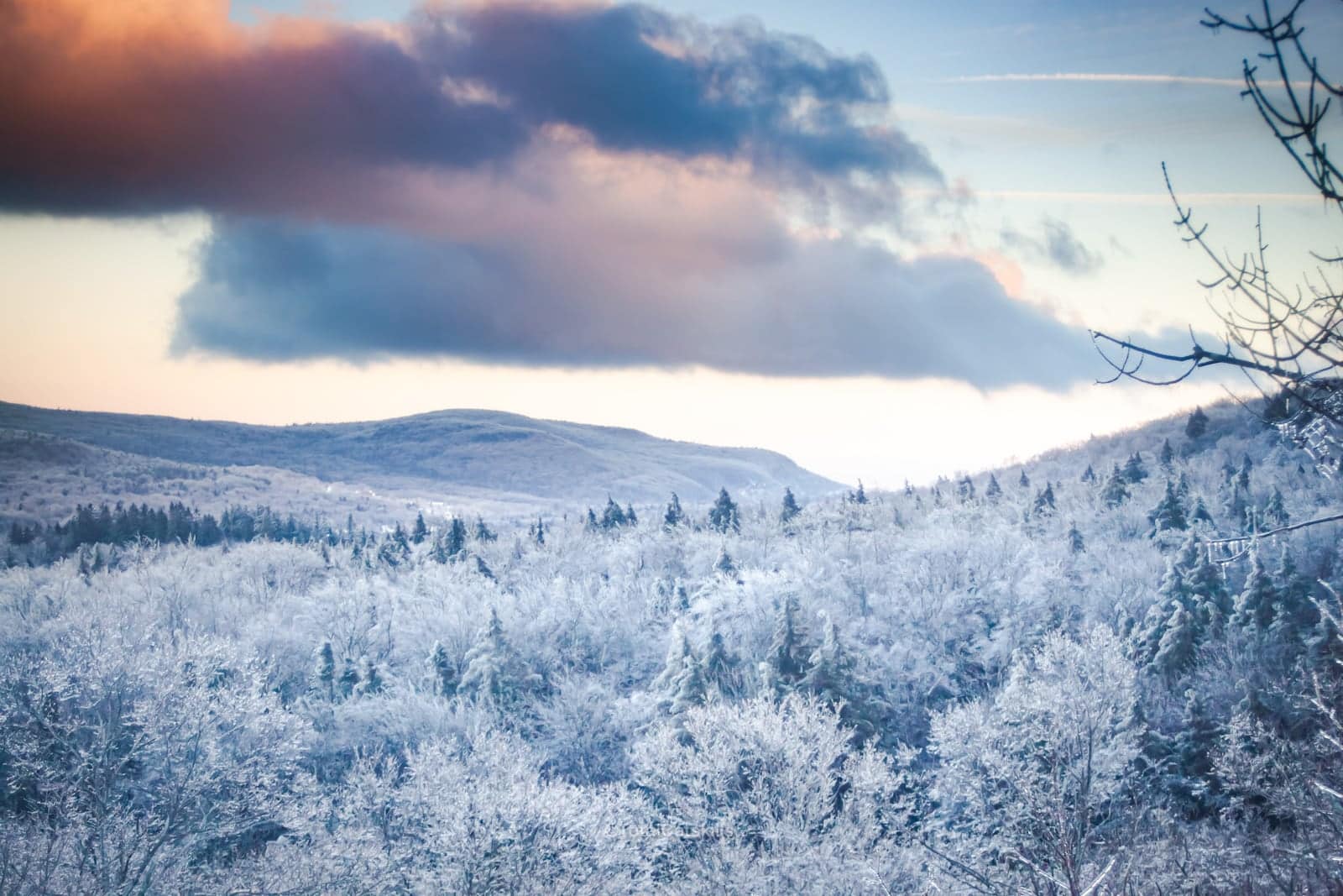
In winter it freezes over…
In summer it’s lush…
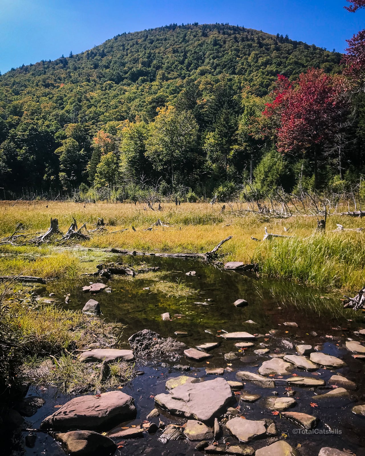
Enjoy the view of Twin and Sugarloaf mountains.
From here, you can make your way back to the trailhead, following the blue blazes until you get back to the junction, then the yellow blazes back to your car.
A Fun Fact
You’ve probably heard that bears hibernate in winter. Well, not quite. Not Catskills bears…
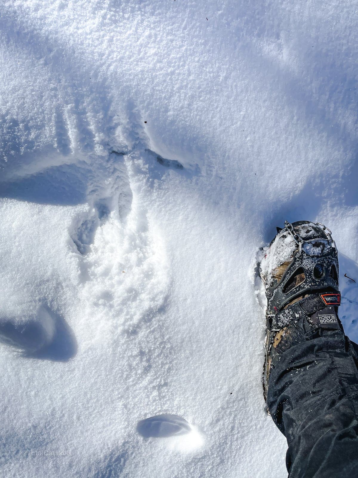
In New York, black bears don’t fully hibernate. Even in deep winter, they’ll often pop outside to poke around for a bit. This photo was taken on the way to Dibbles Quarry on a brutally cold day in February.
The print is extremely fresh.
Happy hiking!
Similar Hikes
The hike as far as Dibbles Quarry is short and gentle enough that it qualifies as a Nature Walk. After that, there’s the stream crossing and the steep section up through the hemlock grove, which earn this full route its moderate rating.
Check out the short and lovely hike around Sloan Gorge Preserve, suitable and fun for families.
Get full access…
Get instant access to the full version of this site and enjoy great supporter benefits: full galleries, full trail notes, early access to the latest content, and more.
Hot on the website right now…
Follow for more…
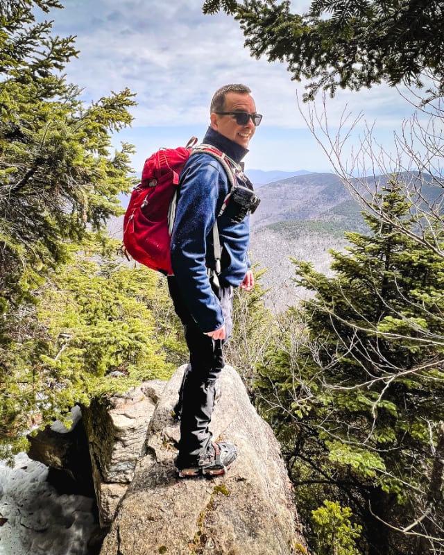
Follow my @TotalCatskills content on Instagram for regular hiking inspo and safe, inclusive community.
The parent mountain for this hike is Sugarloaf.
If you do this hike, LMK how it went…
Trailhead Info for this Hike
Medium-sized lot, popular, fills up quickly on weekends.
Google Maps Location: 42.151238, -74.131177
The map below shows the exact topographic location of the trailhead
Cell Service
Patchy and weak signal at trailhead and for the entire hike. My network is Verizon. YMMV.