Disclosure: This content may contain affiliate links. Read my disclosure policy.
A super easy hike along an old rail bed. Perfect for easy snowshoeing and cross-country skiing.
Hiking Trail Description
The Kaaterskill Rail Trail is short, super-easy hike to one of the most popular Catskills destinations.
This trail includes views not seen by those who park closer to the falls. It’s the perfect trail in winter for some easy snow-shoeing or cross country skiing.
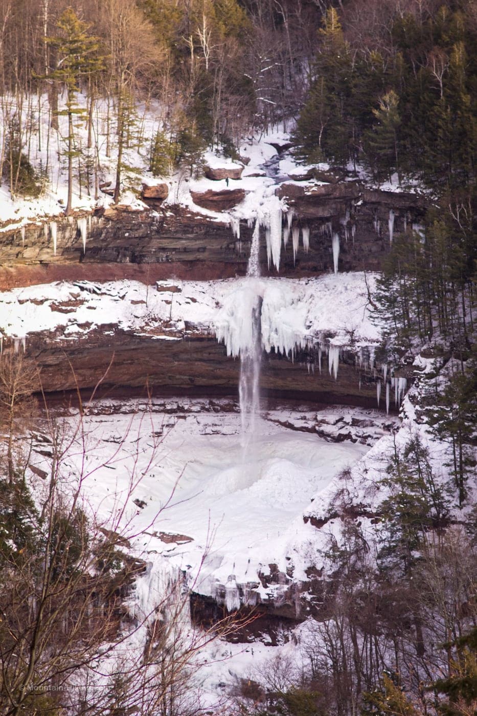
Kaaterskill Falls is one of the most popular destinations in the Catskills, with good reason. The falls here are the tallest cascading falls in New York State, dropping for a total of 260 feet in two plumes (which is much taller than Niagara Falls). But it’s really the incredible structure of the falls that makes it such a spectacular experience.
The falls are in two stages. The first plume pours into an enormous horseshoe-shaped structure known as The Amphitheater. There, the water pools in an enormous basin, before exiting over a ledge into the creek below in a second plume.
At any time of year — from above, below, or inside — Kaaterskill Falls are truly extraordinary to witness.
Keep in Mind…
An enjoyable outing to this destination requires some advance planning and research.
1. Popularity
Kaaterskill Falls been a major tourist attraction since the 1820’s when the painter Thomas Cole and the novelist James Fenimore Cooper made the site famous. Washington Irving and Henry David Thoreau also visited the site, as did many other luminaries.
Pretty consistently since then, it has drawn thousands of visitors every year — increasing to shocking problems of overuse in 2020 during the COVID crisis.
It’s hard to overstate just how beloved, well-known and much-visited these falls are. They are also severely abused, especially in summer. You should absolutely have a second destination in mind, in case the falls are overrun with people.
Please carry out anything you carry in. Although popular and well-trafficked, this is a sensitive wilderness environment. Always make sure to Leave No Trace.
2. Kaaterskill Falls & Rain
The waterfall’s flow is highly dependent on recent rainfall and/or flowing meltwater.
Spruce Creek, which flows over the falls, drains nearby North Mountain — so it’s a creek rather than a river. How intensely the creek is flowing is 100% dictated by recent weather.
The best time to visit is a day or two after rain. Otherwise, you may see only a low trickle. (Even so, the falls are always incredibly dramatic to view.)
3. Footwear
Of course, when the falls are wet is the when the maximum risk of slips, falls and injuries occur. Please make sure to wear proper hiking footwear: very grippy, luggy soles.
These falls are not a location for dress shoes, Vans, Converse, sneakers, etc.
You need good traction around the falls at all times.
4. Danger
The route described below — along the Kaaterskill Rail Trail — presents no dangers. However, stepping off-trail anywhere near the falls presents immediate life-threatening risks. Over the years, there have been many serious falls here, as well as several deaths.
- Read Death at Kaaterskill Falls
- Read The Top 6 Hiking Dangers
- Read Hiking Safety 101
Stay on the trail. Step off the trail at your own risk.
Kaaterskill Rail Trail Trailhead / Parking
This parking area for this hike is in Haines Falls, just off Route 23A, at the Mountain Top Historical Society. It’s a large lot but it’s important to stress again how popular this destination is. In the summer of 2020, there were long waits to even pull in to any lot associated with the falls.
- Your best bet is midweek, or very early in the morning.
- I would not think about visiting the falls on a weekend.
- Another lot — the Laurel-House Road parking area — is even closer. The trail from that lot to the observation deck is 0.3 miles of 7% grade with 541 feet greater than 8% (the slope of a standard ramp). The trail is firm crushed stone 60 inches wide with a typical cross slope of 1.25% and 376 feet greater than 2%. This makes it accessible to those with mobility concerns. It also makes it the most popular lot for getting to the viewing platform.
Warning! Do not park anywhere but in designated parking areas. Your car WILL be towed. The town is very strict.
Kaaterskill Rail Trail to Kaaterskill Falls
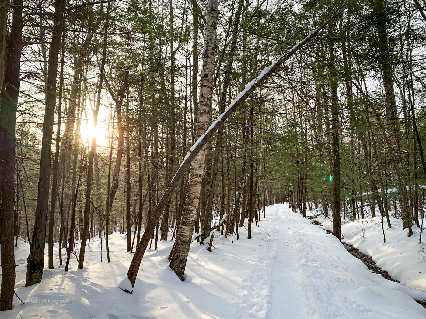
The trail from the Mountain Top Historical Society to Kaaterskill Falls was completed in May 2017. The trail was converted from an old Ulster & Delaware Railroad rail bed, so it’s completely level for almost its entire length.
This route is short, pleasant and easy. Nonetheless, it passes through some classic Catskills woods, with entertaining sights along the way, and ends with spectacular views of Kaaterskill Falls.
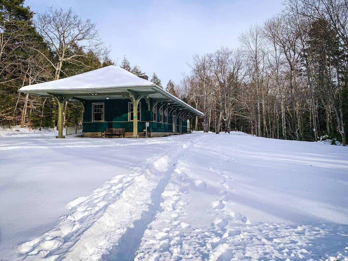
After parking your car, look for this structure; the Kaaterskill Rail Trail begins behind it…
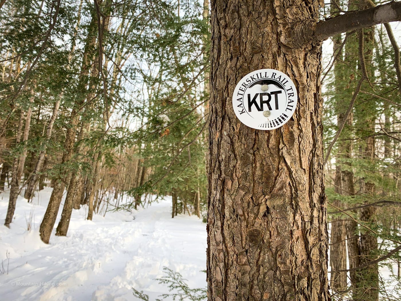
The trail is well blazed with white KRT blazes…
…but you likely won’t need them because it’s basically 1.5 miles of perfectly straight trail…
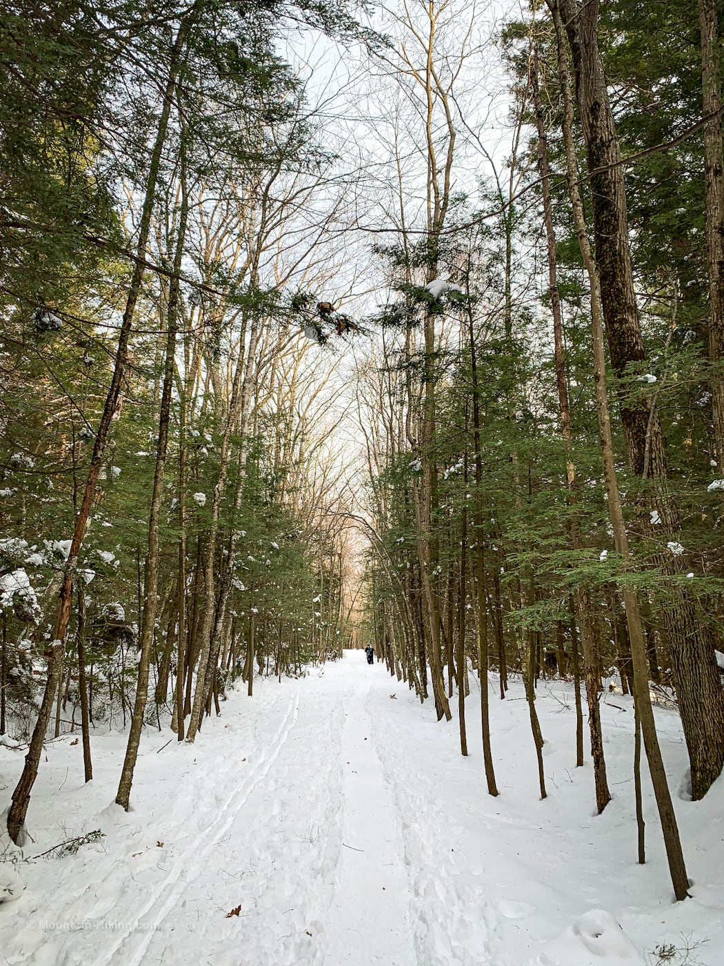
Kaaterskill Rail Trail Side View
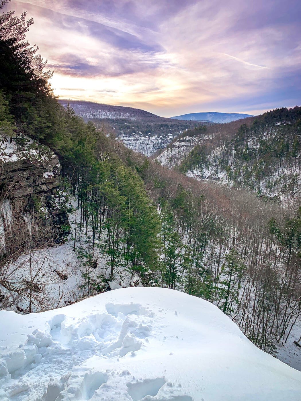
About 1¼ miles from where you parked your car, look for an unmarked herd path on the right side of the trail. The site is well-known and is marked as a scenic view on NYNJTC maps. Walk down 200 ft or so and you’ll come to an obvious lookout point from which you can view the falls (which are about a third-of-a-mile away).
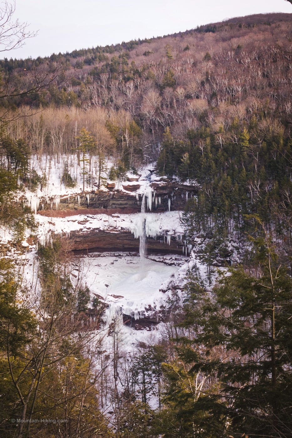
By the time I changed the camera lens to take this close-up, another hiker was standing at the top of the falls…
Return to the Kaaterskill Rail Trail and turn right to continue toward Kaaterskill Falls.
Kaaterskill Rail Trail to Viewing Platform
After a few minutes, you’ll pass the Laurel House parking area on your left, probably filled with cars.
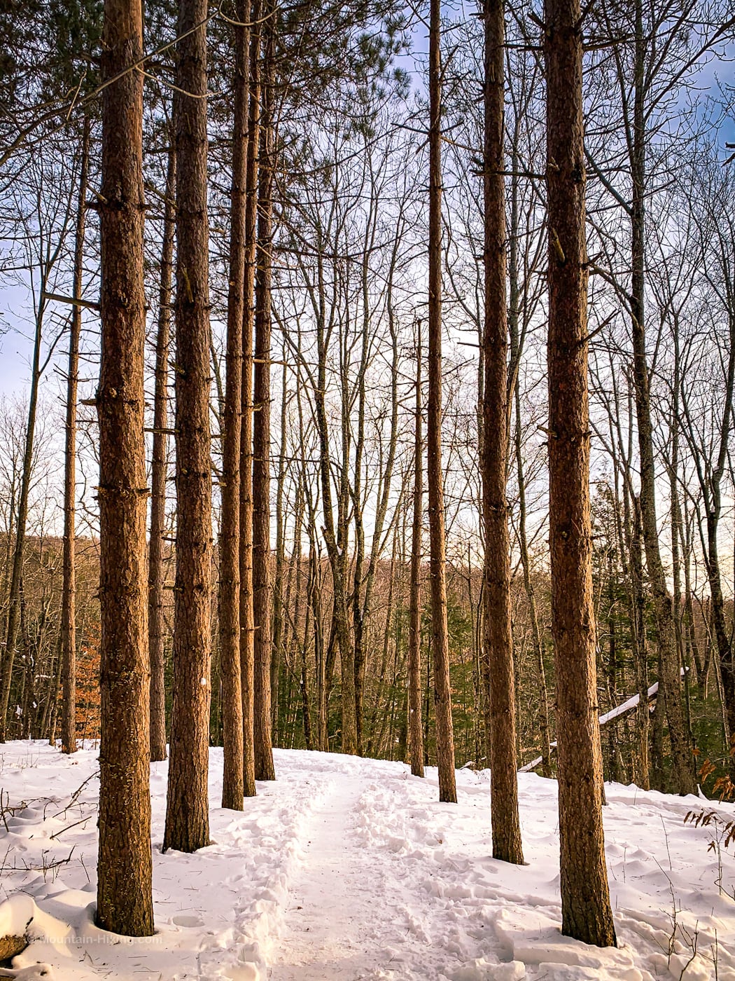
At the signposts by the parking area, turn right and walk through a lovely stand of pine trees…
At the fork, turn sharply right and head downhill again. (The fork is not well-signed. It needs a sign.)
[auMC5]
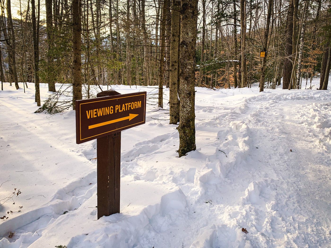
You’ll come to a crossroads in the trail. Again, turn right and follow the sign that says “VIEWING PLATFORM“.
From here, the the trail descends steeply via a switchback, terminating at a large information board.
Warning! This area is a little steep. In cold weather, without proper hiking footwear and additional traction, you run the risk of slipping on compacted snow and ice.
On this day, as I waited for a spot on the viewing platform to open up, I watched as half-a-dozen people slipped and fell on the trail just above the platform. Almost all of them were casual day-walkers who had come down from the Laurel House Parking Area. None had any traction.
IMO, the Laurel House Parking Area needs very large and clear warnings posted about the dangers near the viewing platform, necessity of proper winter traction, etc.
Anyhoo…
Kaaterskill Falls Viewing Platform
This is one of the most visited spots in the Catskills. It’s almost always busy and very often crowded.
Even on this cold, late December day, I had to wait 40 minutes for a spot to open up on the viewing platform. The view is stunning…
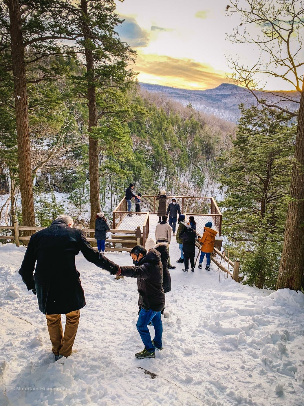
Eventually, however, the two large groups ahead of me finished up, and I was finally able to step down onto the platform…
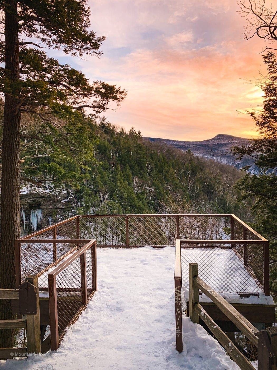
The view is so good. That’s Round Top in the distance, BTW.
To the left of the viewing platform, you look directly down into the Kaaterskill Falls upper cascade and The Amphitheater.
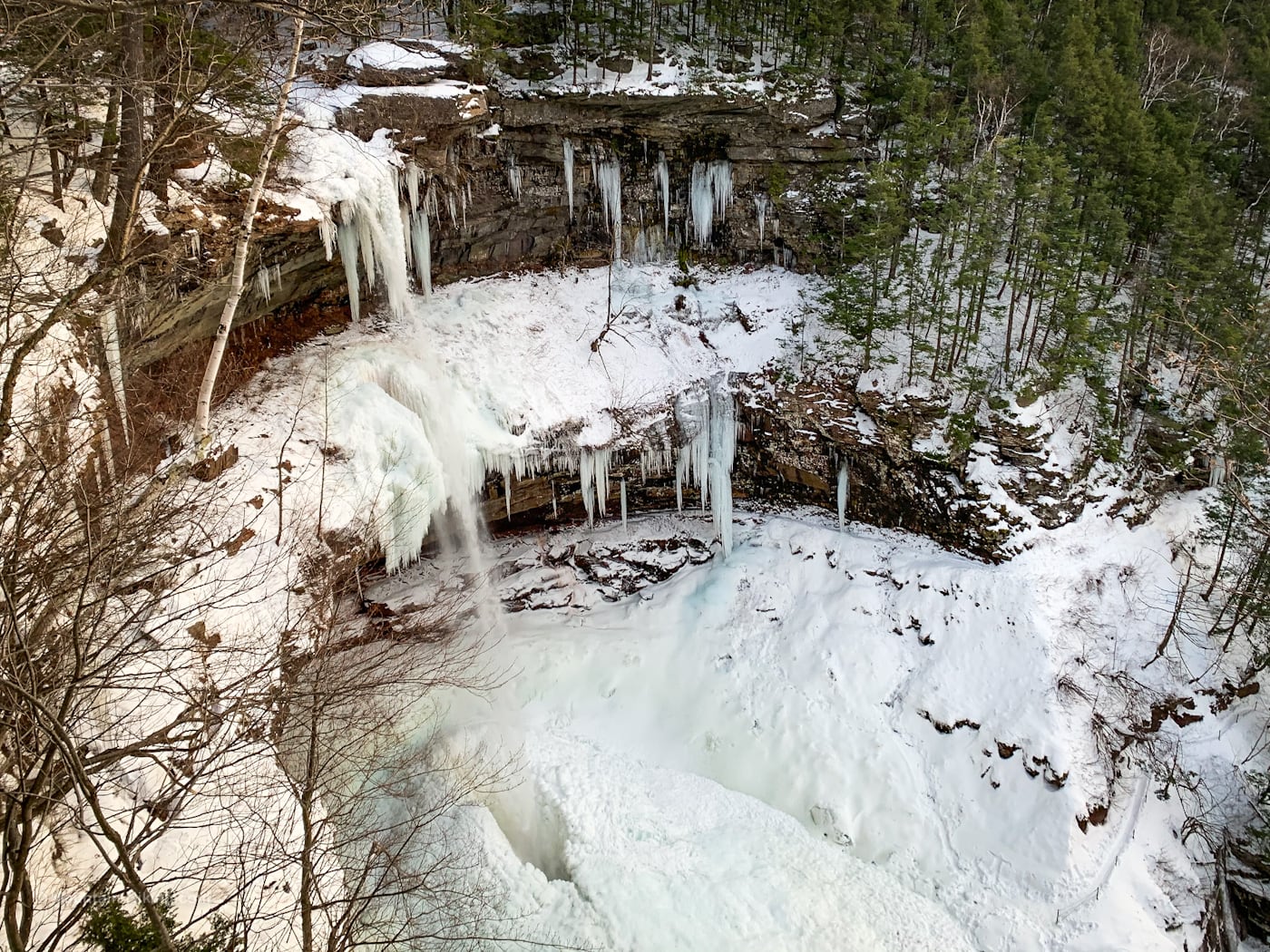
Ice Age glaciers and meltwater carved this shale and sandstone topography. Water plunges more than 260 ft over two tiers.
This site has been a major destination since the early 1800’s when Peter Schutt purchased the falls and turned it into a tourist destination. He installed the original stone staircase down to the falls’ dramatic amphitheater, and even dammed Spruce Creek so he could charge people extra to see a big gush of water flow over the falls.
Winter is a spectacular time to view the falls, festooned as they are with enormous icicles.
Here is some video of the falls as seen from the viewing platform…
This is early winter. Later in the season, the entire falls is covered in ice and icicles. It’s incredible to see.
The trail ends here.
Return to the Kaaterskill Rail Trail by the Laurel House parking area. Then turn left and hike the remaining 1.5 miles back to your car in Haines Falls.
Herd Path to Top of Kaaterskill Falls
Behind the noticed board is a short herd path which is both notoriously dangerous and historically deadly.
Proceed at your own risk.
Certainly, dogs and children should never be taken on this unsanctioned, unmarked, and unsafe route.
Warning! Heed the many signs you see on and near the information board. Beyond the info board, many people have fallen to their death. If you leave the marked trail you are proceeding at your own risk.
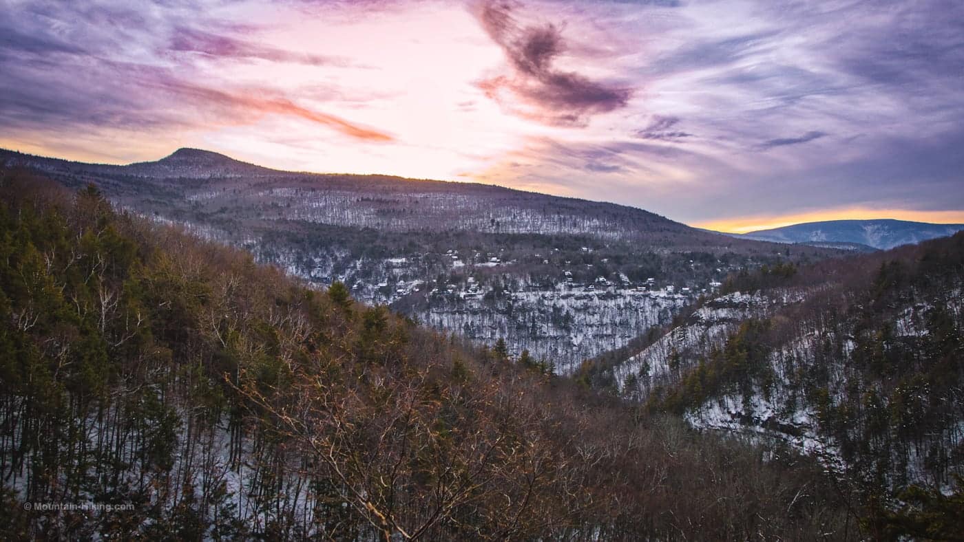
The herd path brings you out past this view of Round Top, the fancy homes of Twilight Park, and Hunter Mountain in the distance…
…to the very sketchy top of Kaaterskill Falls. The herd path ends at a large boulder. You can work your way around to Spruce Creek and the sheer cliff above the waterfall.
There are no guard rails. It is perilous. The drop is at least a hundred feet, onto brutal rocks.
Warning! A single misstep anywhere here will cost you your life.
In this video you can see the view, the top of the falls, and the snowshoe trail I followed around the boulder.
From here, proceed back to the viewing platform, ascend to the main trail, and hike back to your car along the Kaaterskill Rail Trail…
This hike will take 2-3 hours depending on how busy the platform is when you arrive.
Similar Hikes
Read the Kaaterskill Falls Ultimate Guide.
In terms of ease, this is one of the easiest Catskills hikes. It travels along an almost perfectly flat former rail bed. Only the last section, down to the falls, has some elevation loss, but it is minor.
You may enjoy these Catskills Nature Walks — all of which are easy, under four miles, and exceptional Catskills experiences.
Read More
Get full access…
Get instant access to the full version of this site and enjoy great supporter benefits: full galleries, full trail notes, early access to the latest content, and more.
Hot on the website right now…
Follow for more…
Follow my @TotalCatskills content on Instagram for regular hiking inspo and safe, inclusive community.
The parent mountain for this hike is South Mountain.
If you do this hike, LMK how it went…
2 responses to “Kaaterskill Rail Trail”
Your comments are welcome here…
Trailhead Info for this Hike
Very large (and popular) lot just off Route 23A.
Google Maps Location: 42.194776, -74.092693
The map below shows the exact topographic location of the trailhead
Cell Service
Patchy throughout. My network is Verizon. YMMV.
Thank you for introducing us to this way to hike Kaaterskill Falls. We did this on 1/22/21 and it was a really nice hike. However, we couldn’t find the herd path before the Laurel House parking area. The view from the upper platform was spectacular and the Rail Trail was beautiful too.
Yeah, it can be tricky to spot. It’s about a third of a mile before the Laurel House Parking Area.