Disclosure: This content may contain affiliate links. Read my disclosure policy.
This track leaves out the northwestern 0.8 mile section of the loop. I can’t wait to go back and explore this missing section.
Hiking Trail Description
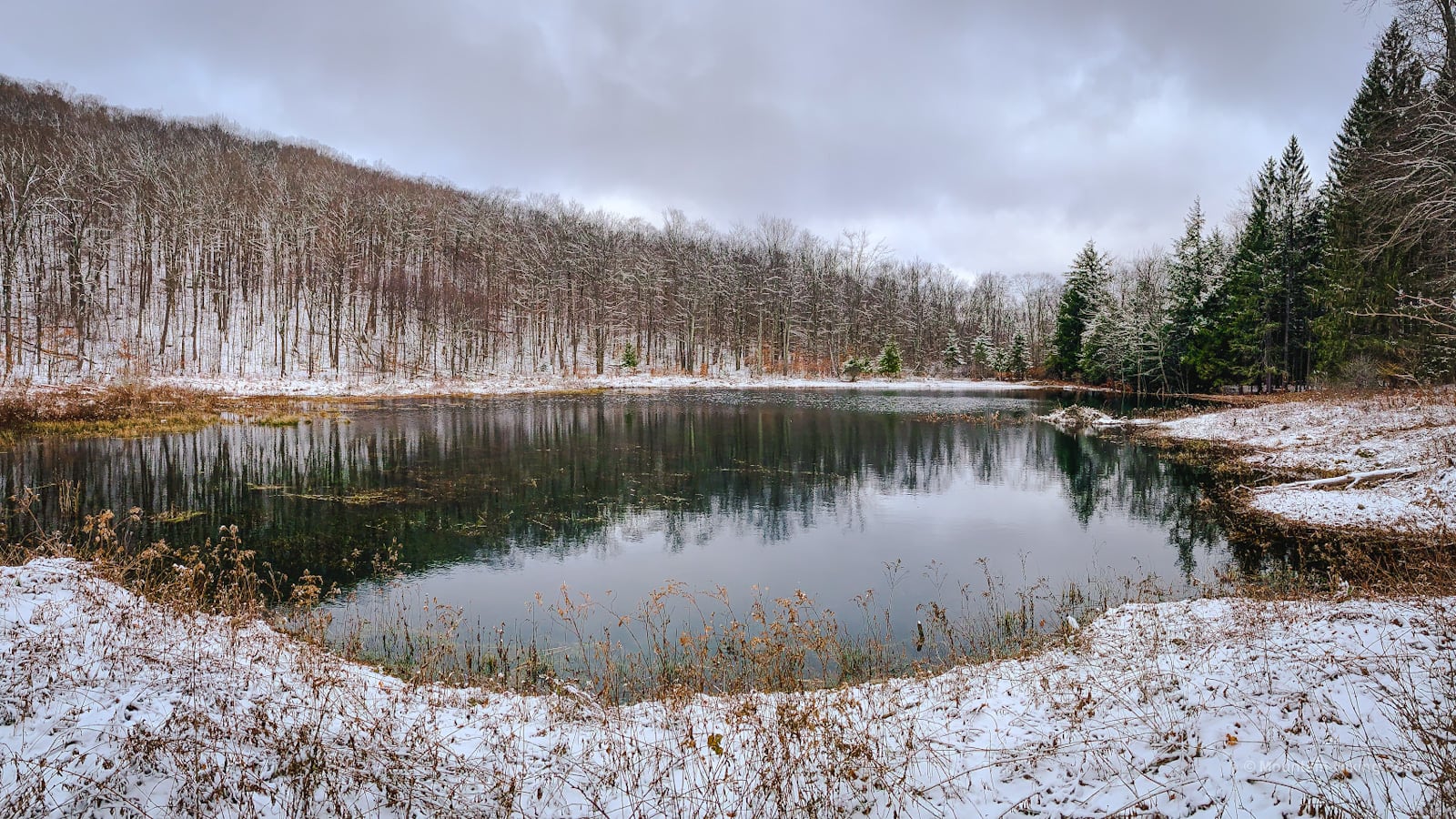
Short, easy and thoroughly absorbing, Kelly Hollow Loop is one of the most beautiful trails in the Catskills. It came highly-recommended to me from several friends and it absolutely delivered.
The drive out to Mill Brook Road, from Rte 28, passes through a picturesque area of rural New York that includes many working farms.
From there, the day only improves.
Kelly Hollow Loop Hiking Trail
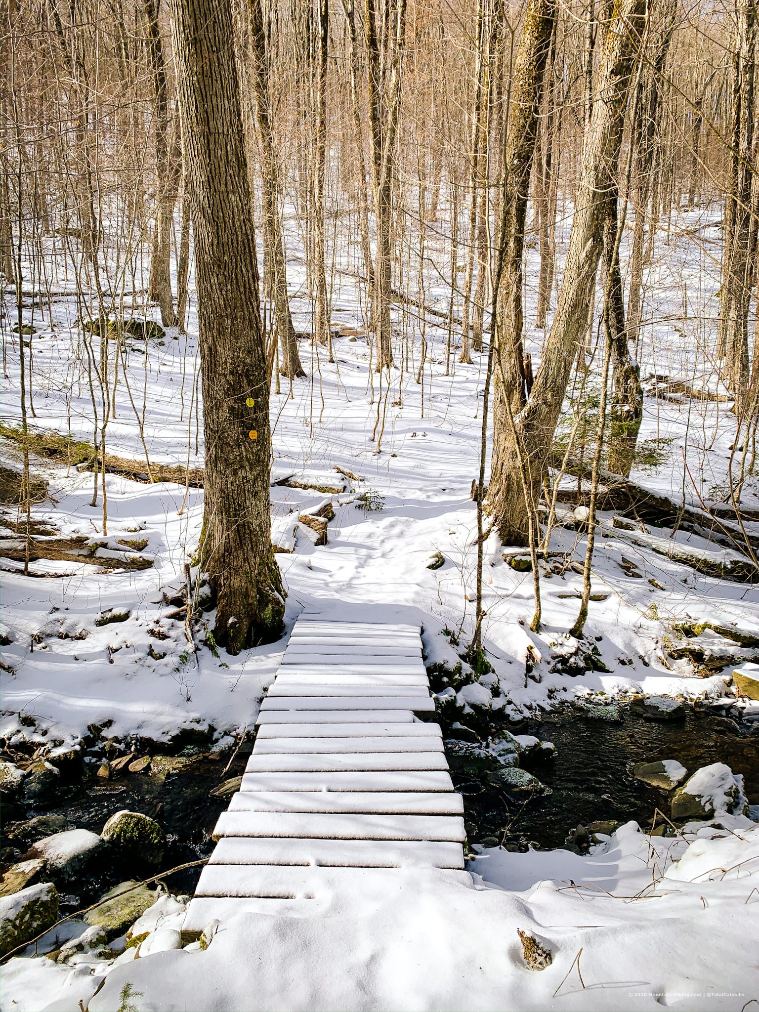
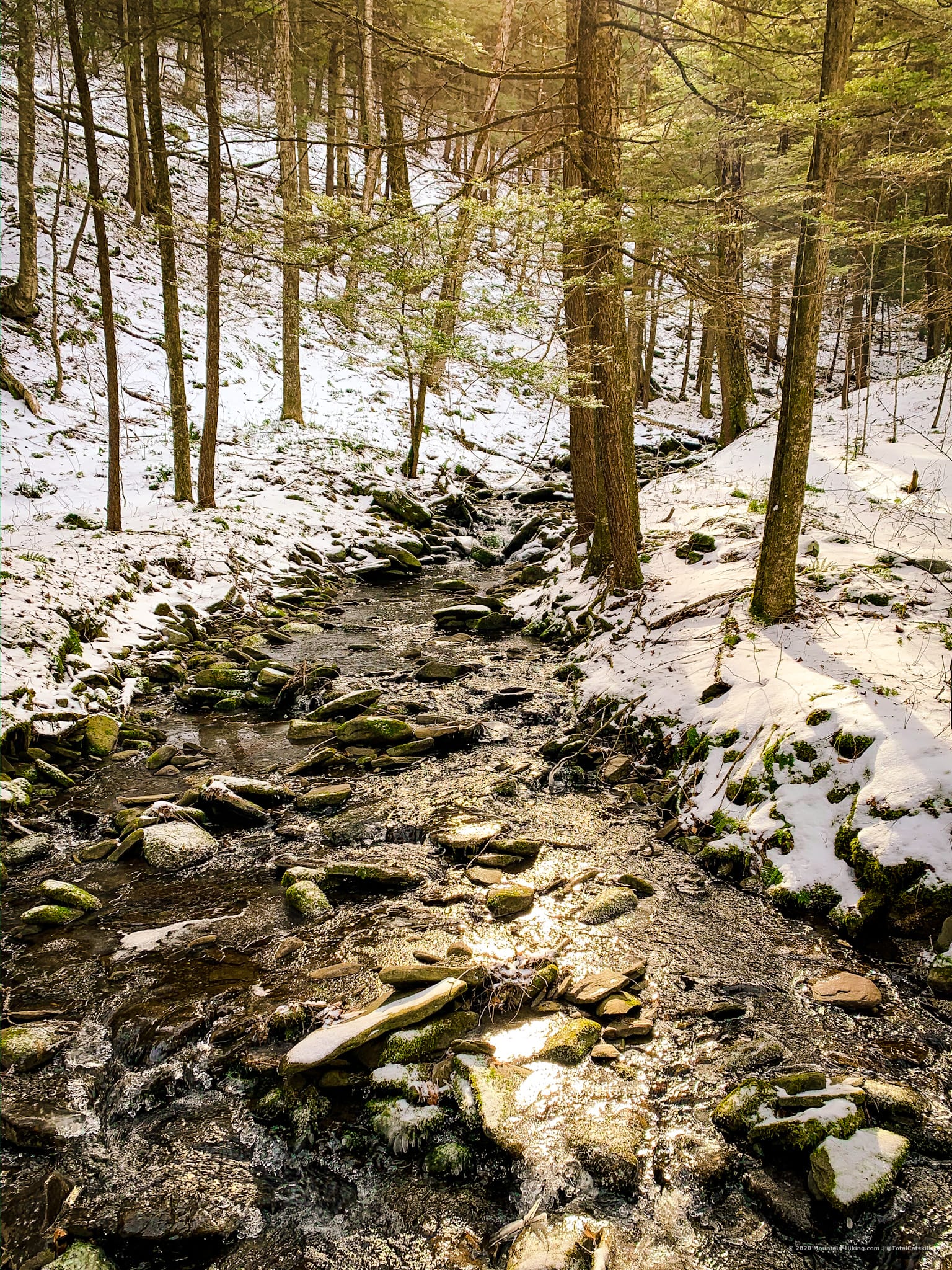
After a short walk from the parking area and trail register, the trail crosses a small stream, turns right, and heads uphill past an iron gate.
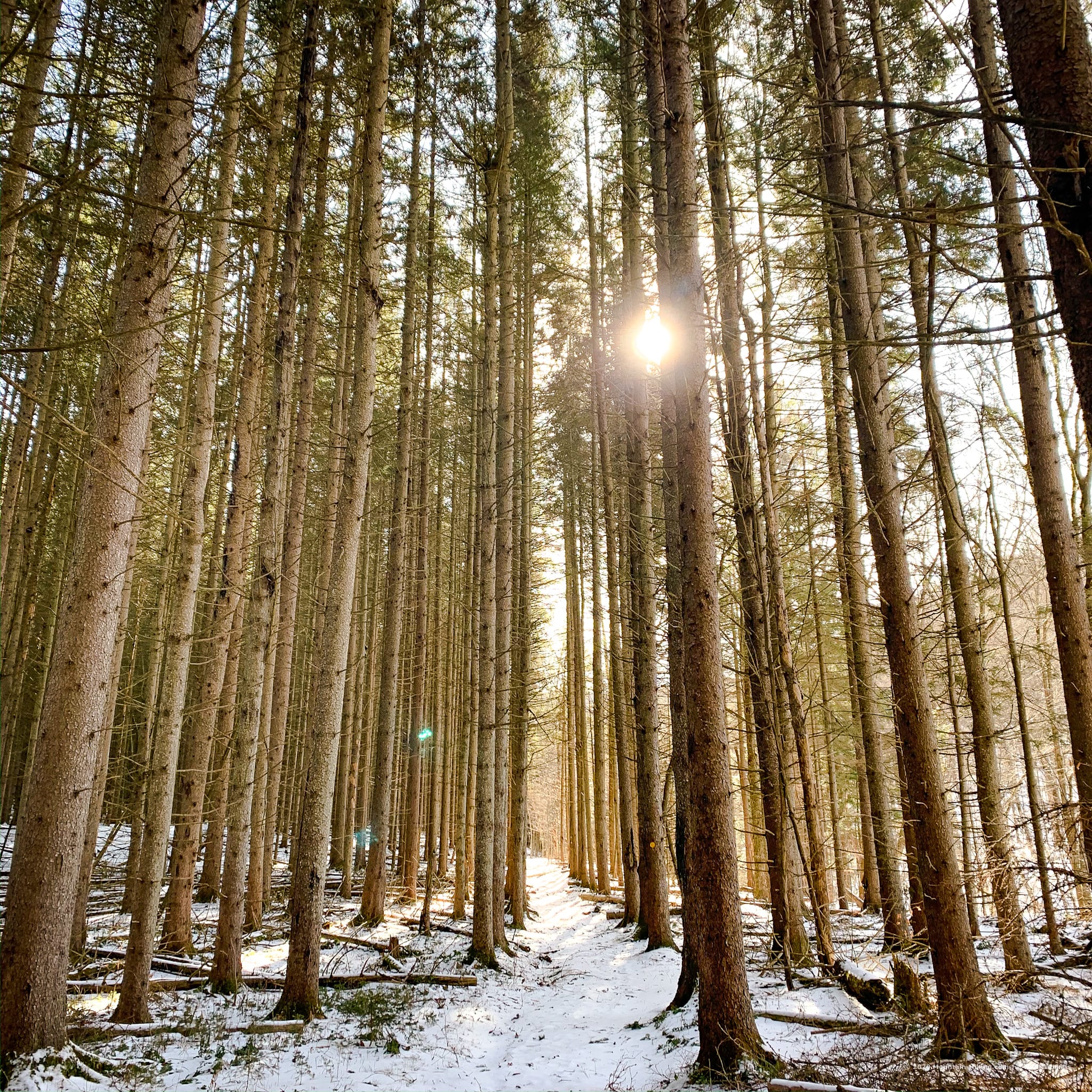
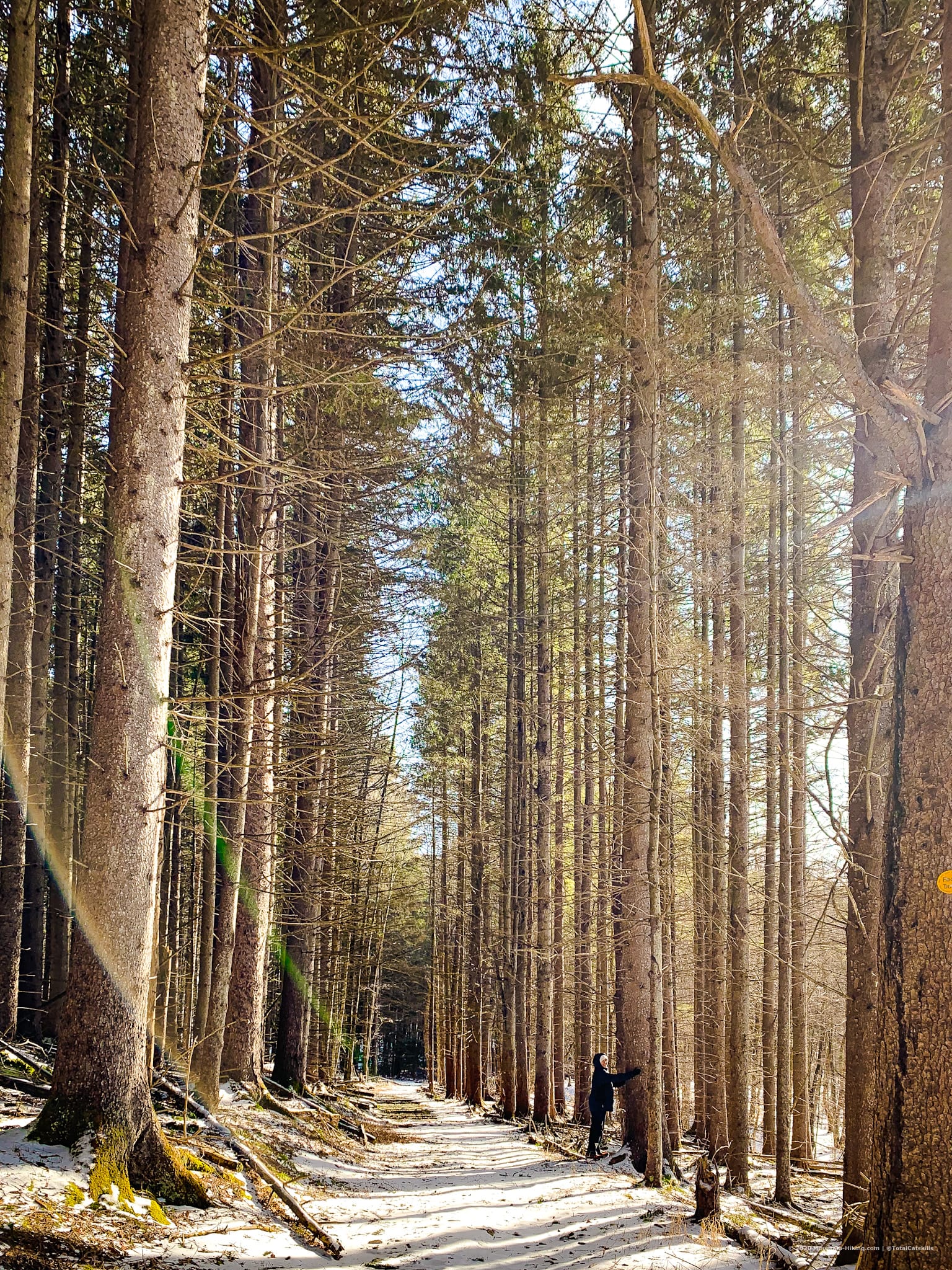
The trail, an old road, soon passes through a Norway Spruce forest that was planted by the Civilian Conservation Corps in the 1930’s.
There are many such plantations in the Catskills, all exceptionally beautiful.
The CCC was a voluntary public work relief program that operated from 1933 to 1942, as a New Deal initiative — part of FDR’s response to the Great Depression. The Corps provided manual labor jobs for unemployed, unmarried men. It focussed on the conservation and development of natural resources owned by federal, state, and local governments. To this day, the Catskills are peppered with many traces of the CCC’s work.
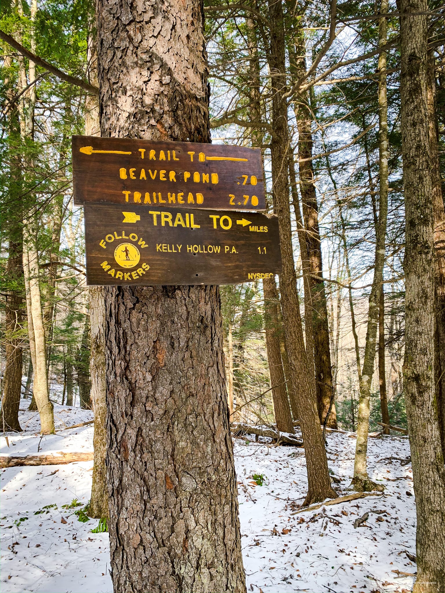
After half a mile of moderate incline, you come to a junction. You’ll arrive back here via the connector trail to your right. For now, stay to the left. The next two miles are the heart of the hike.
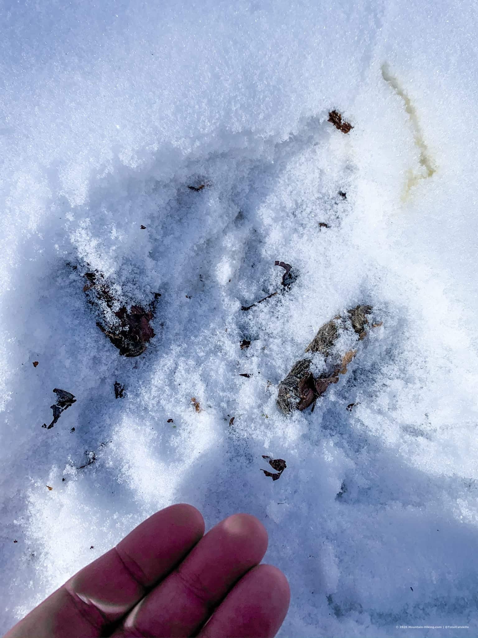
Right away, my wife and I picked up an abundance of tracks in the snow: mice, rabbit, chipmunk, deer, and a steady bobcat track that patrolled the hollow almost the whole way around the entire 4 mile loop.
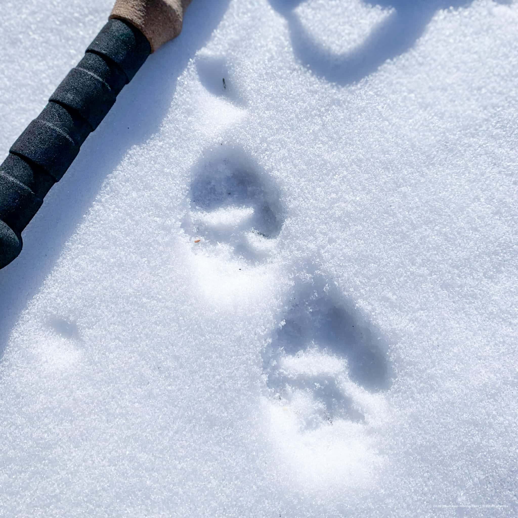
- Learn how to identify bobcat and coyote tracks
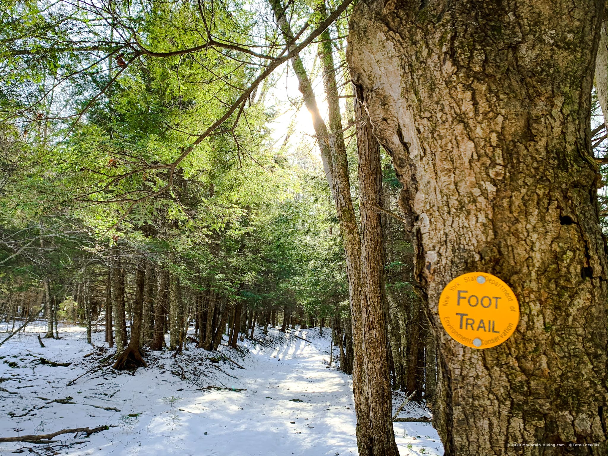
The yellow-blazed trail is marked for cross-country skiing. The east side is flat and easy. The west side offers a more drama. Mountain hikers will find it all exceptionally easy.
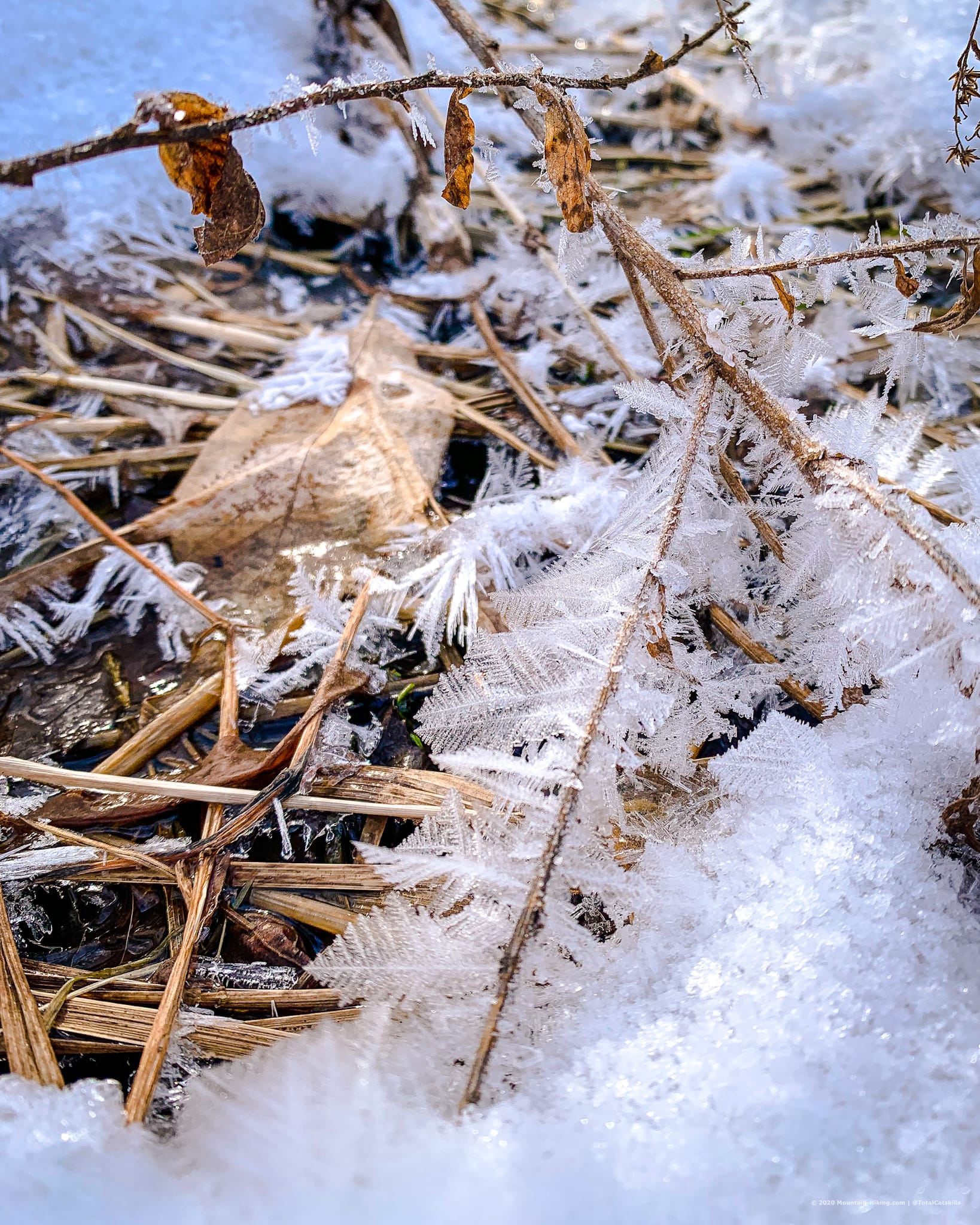
Continuing on, the woods in Kelly Hollow switch back and forth continually between soaring spruce and hemlock, and stands of bare deciduous trees.
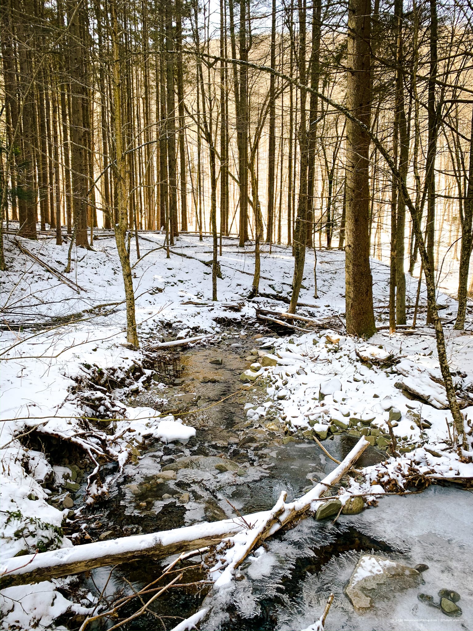
After leaving the spruce woods, the trail turns right and heads down to cross a stream. (This spot, just before crossing the stream, is the jumping-off point for a bushwhack hike up to Mill Brook Ridge.)
Cross the stream and follow the trail heading northwest. To your right, across the hollow, you can see the spruce woods you just walked through.
We found some quality poop…
After working your way around the shoulder, the trail heads up into another Norway spruce plantation.
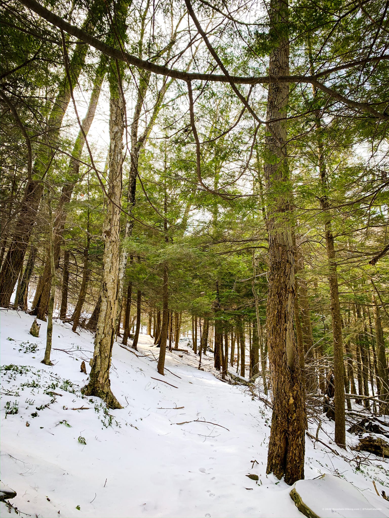
And there are lots more hemlocks, too.
[auMC5]
Kelly Hollow Lean-To
The lean-to here is situated beautifully.
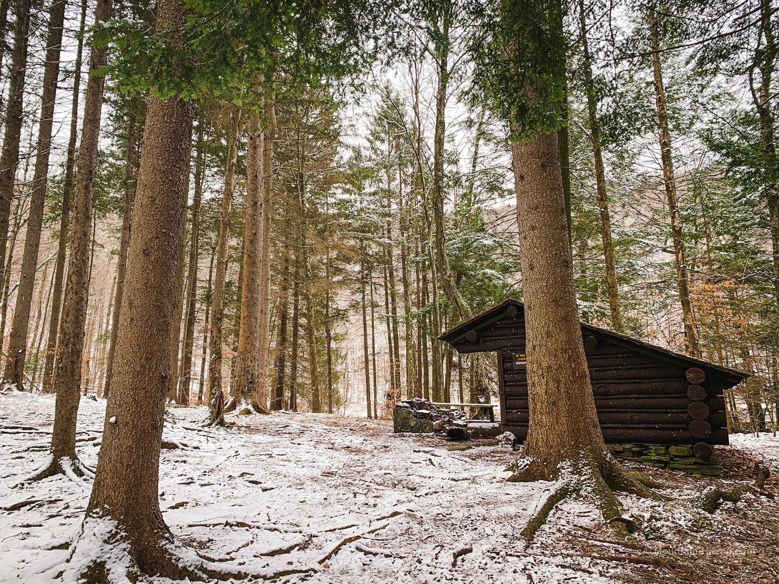
This is a great spot to camp overnight and listen to the coyotes yip and howl.
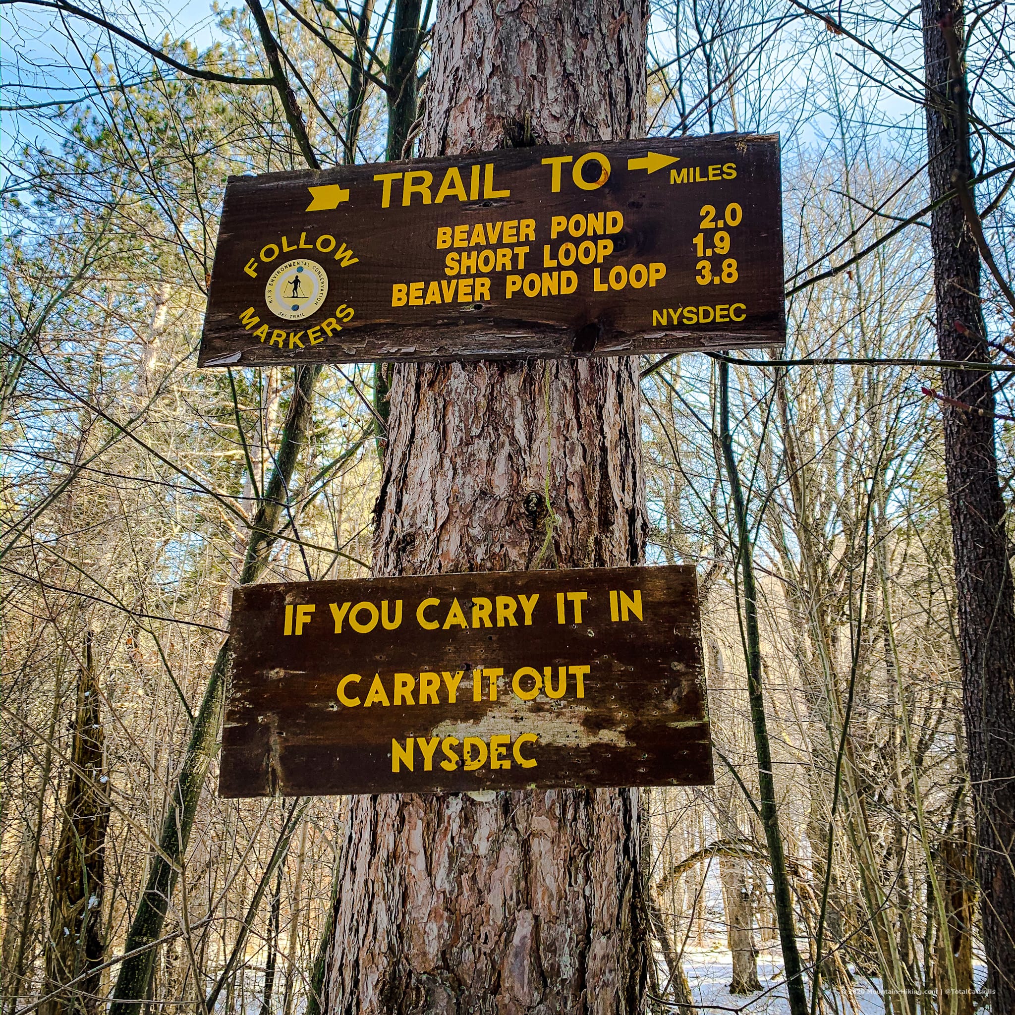
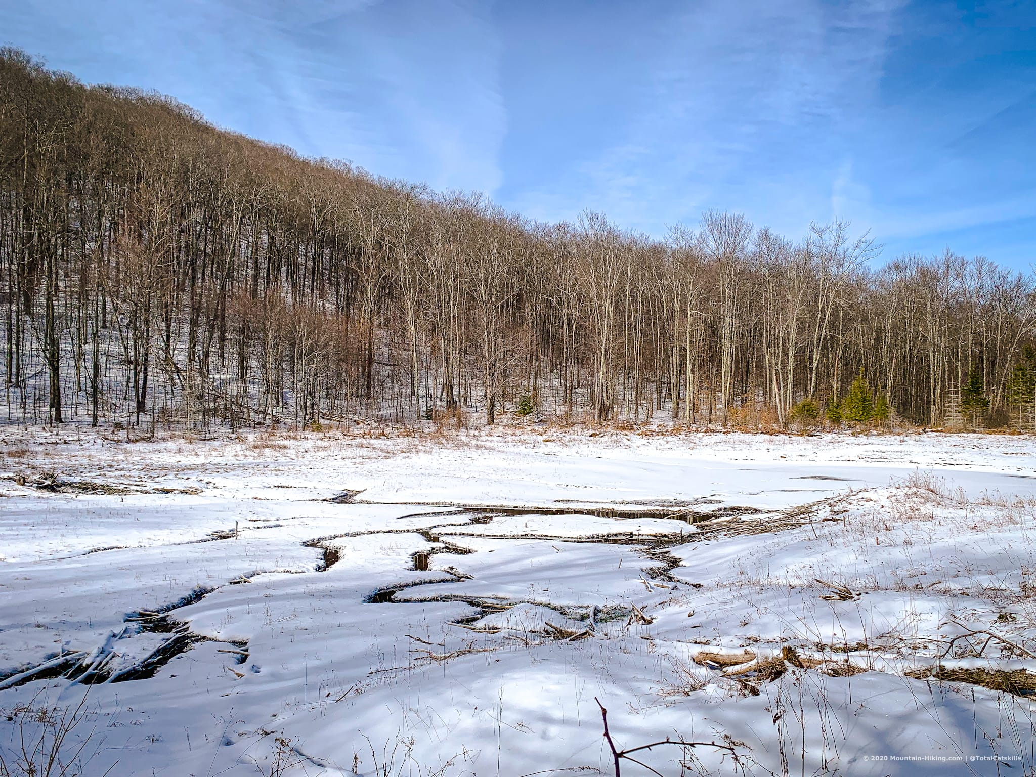
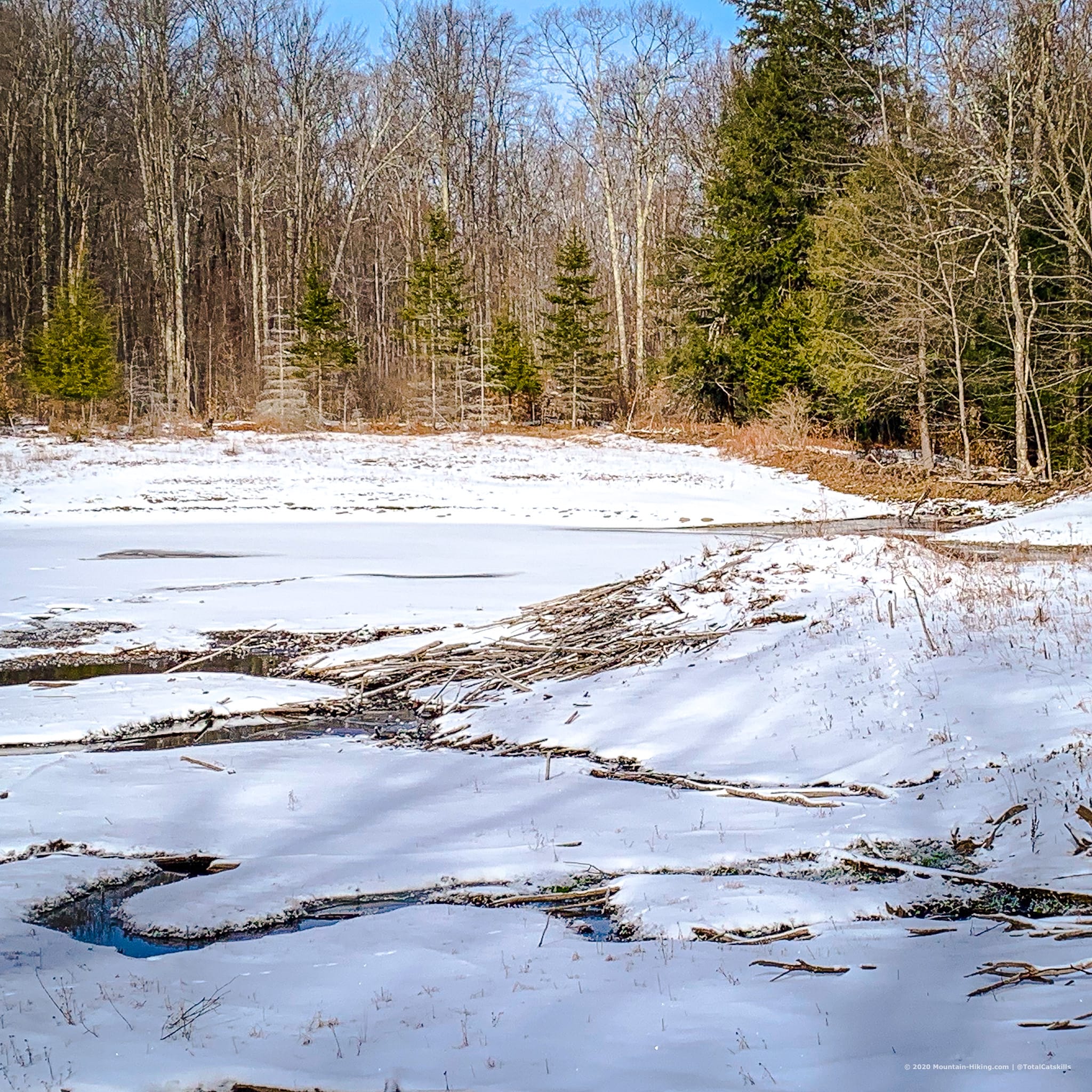
Beaver Pond
Work your way around the beaver pond. This was another CCC project, but now the beavers own it. You’ll see their lodge as a low hump on the right side of the pond.
Here, the bobcat tracks we’d been following left the trail and headed out to the lodge for an inspection.
The trail now turns right and heads north. The northern flanks of Mill Brook Ridge tower over the hollow. It’s really a beautifully-protected enclosure. Bless the glaciers.
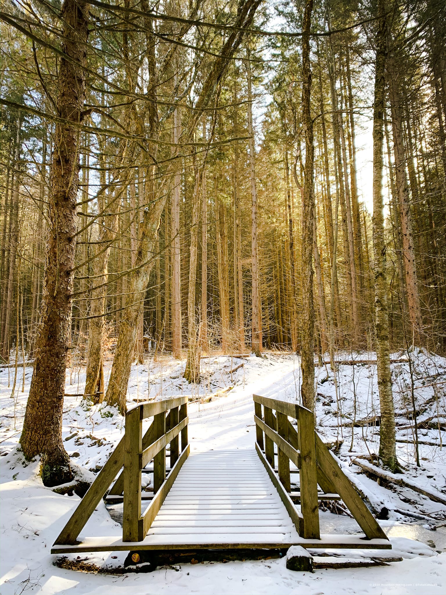
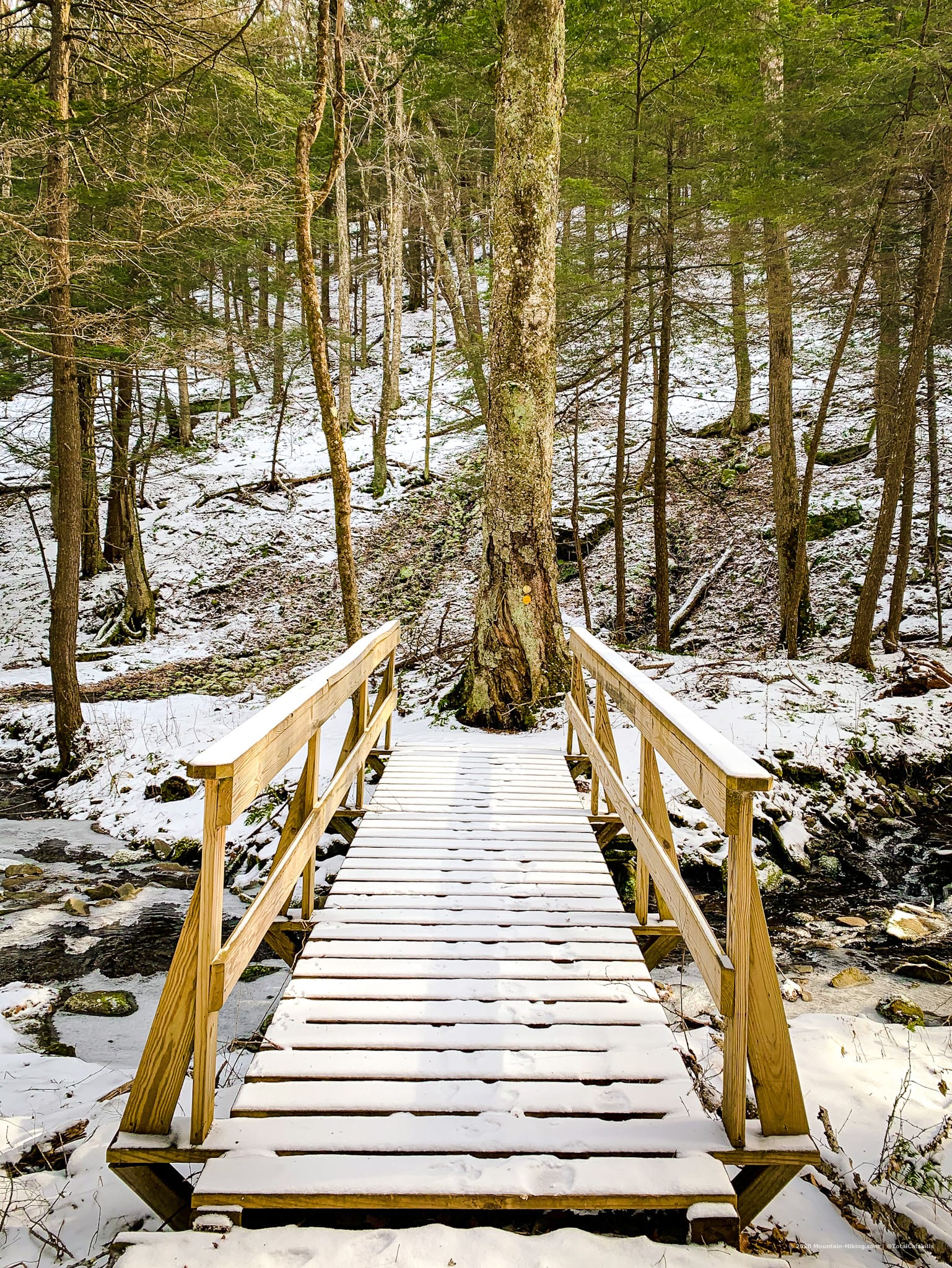
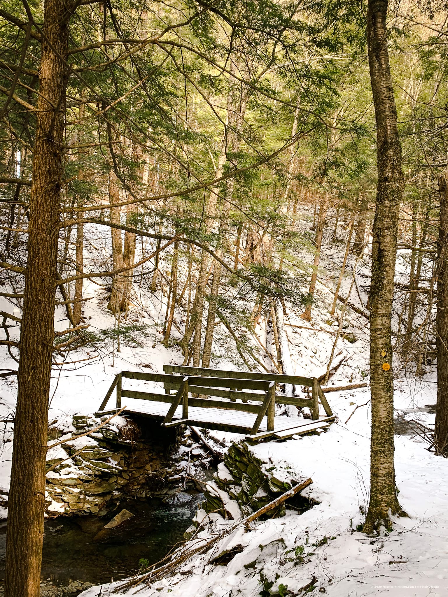
There are so many cute footbridges in Kelly Hollow I lost track of how many we’d crossed. On the way out, there are a handful more to cross…
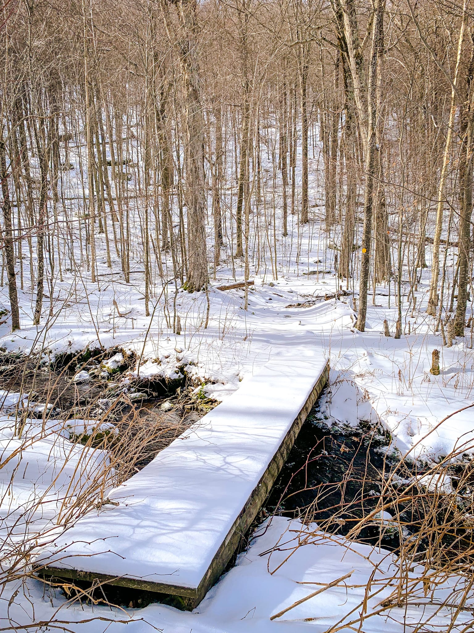
The Walk Out
The descent on the way out is mostly gradual with a few spots that are a little steep and, in winter, require extra care — and microspikes!
From the far side of the pond, before you leave this spot, turn around one last time and look back at those towering hollow walls.
Decision Time
My track from this hike leaves out the northwestern section of the full loop. Adding that section, which is lovely and very easy, completes the loop. I did it on a later hike up to Mill Brook Ridge from Kelly Hollow. Near the end of that hike, I discovered a picturesque cemetery that contains the graves of several Civil War veterans. Highly recommended.
On this day, however, we took the…
Connector Trail
The 0.2 mile connector trail back to the east side of the trail is really charming and not to be missed. If you do the whole loop as a figure-eight, you’ll cross it from both directions.
We turned right here and followed the connector trail. It descends windingly to a stream, where there’s one more footbridge.
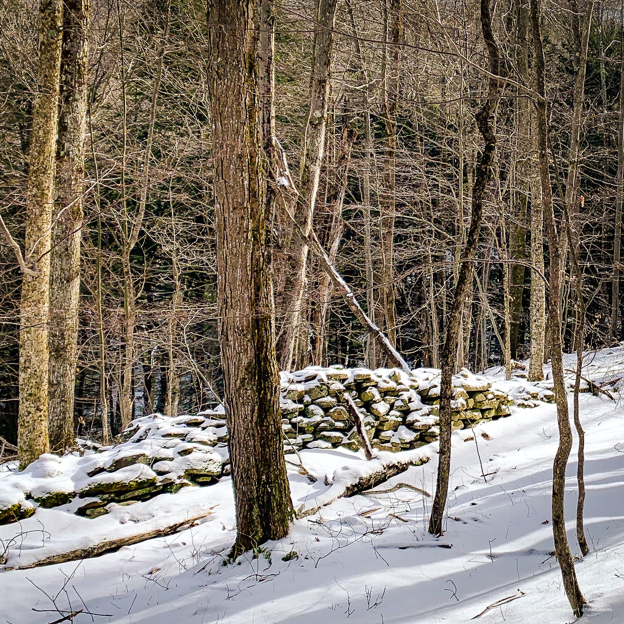
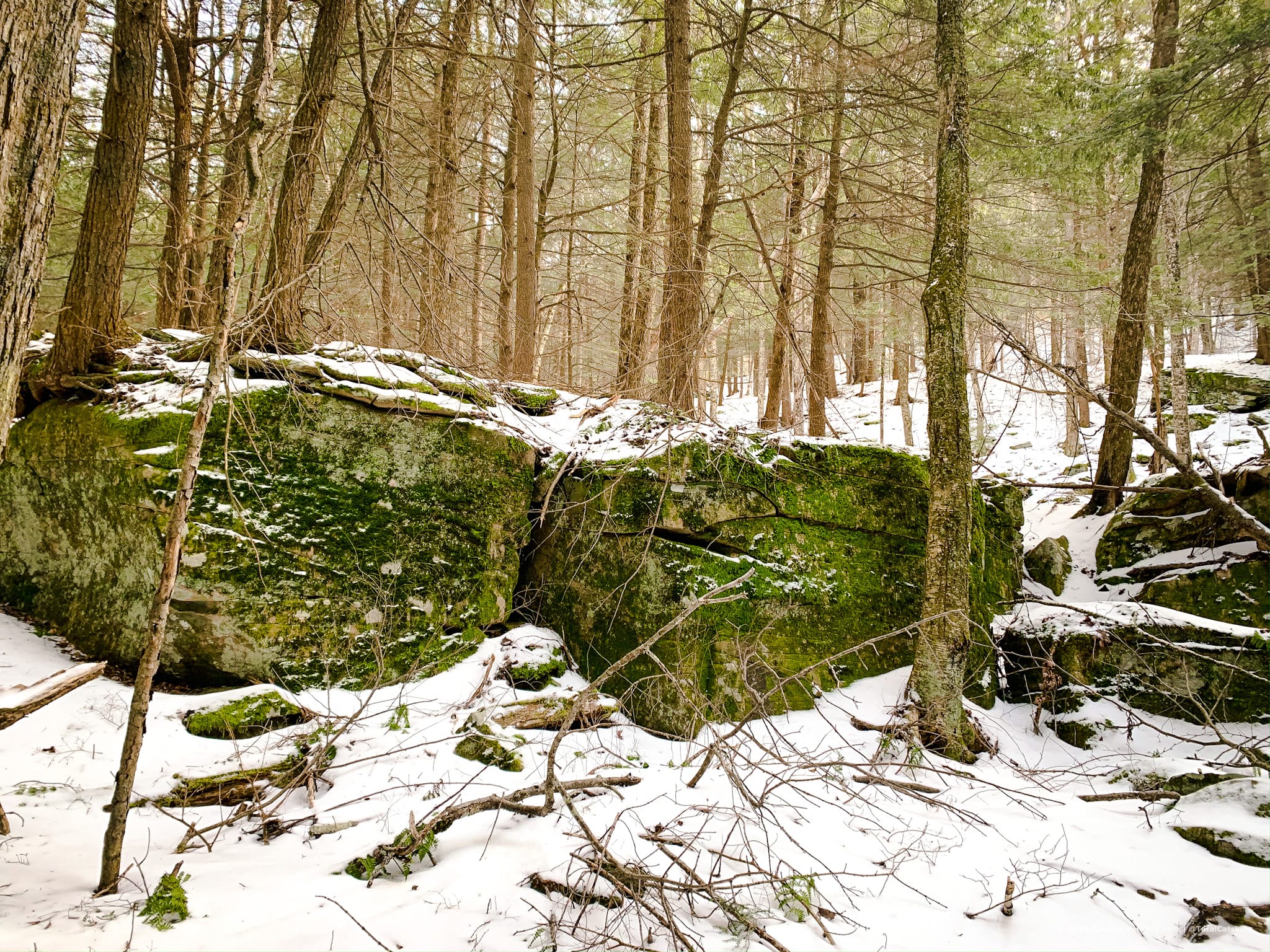
There are not many rock outcroppings along the trail so it was nice to pass by these grand moss-covered boulders near the end of the hike. This trail gives you a little of everything.
The trail curves left again and you come to the final footbridge, which might be the prettiest of the lot.
Finally, the connector trail then ascends sharply to the first junction with the main trail. Turn left to head back down to your car in less than half a mile.
Similar Hikes
The interconnected loops of Rochester Hollow in Phoenicia offer a similar hiking experience but with even more history and some interesting ruins.
Enjoy this list of beautiful hikes in the Catskills.
This trail is next to Mill Brook Ridge, one of the Lower Catskills Mountains — many of which offer exceptional hiking trails and wonderful scenic views.
Get full access…
Get instant access to the full version of this site and enjoy great supporter benefits: full galleries, full trail notes, early access to the latest content, and more.
Hot on the website right now…
Follow for more…
Follow my @TotalCatskills content on Instagram for regular hiking inspo and safe, inclusive community.
The parent mountain for this hike is Mill Brook Ridge.
If you do this hike, LMK how it went…
7 responses to “Kelly Hollow Loop”
Your comments are welcome here…
Trailhead Info for this Hike
Medium-sized lot.
Google Maps Location: 42.078885, -74.650236
The map below shows the exact topographic location of the trailhead
Cell Service
This hiking trail is so beautiful and so engaging, I totally forgot to check for cell service! My network is Verizon. YMMV.
I have hiked the Kelly Hollow Trail many times since I was introduced to it more than 40 years ago. I am now nearly 80 years old and am still a regular visitor. In fact, I regularly lead hikes there with the Catskill Mt. Club (https://catskillmountainclub.org) including the Annual Spring Ephemeral Wild Flower Hikes (https://catskillmountainclub.org/events/annual-ephemeral-wildflower-hike-at-kelly-hollow-saturday-may-1st-at-1100-am/), a number of night time hikes, recreational hikes and snow-shoes with friends, and the NYS DEC First Day Hike (https://www.dec.ny.gov/outdoor/112174.html#Catskills) which I led on Jan.1st this year.
I believe that some of your history of the Hollow to be incorrect. I would refer you to the newsletter “The Bridge” published by The Historical Society of Middletown, Delaware County, issue No. 40, April 2021 of which you might request a copy. This issue contains a detailed history of Kelly Hollow by local historian, author, and naturalist Michael Kudish. There is also a detailed hand drawn map by Mr. Kudish of all the properties and structures that once made up the hollow.
On May 15, 2021, Mike led a “Secrets of Kelly Hollow” hike wherein he talked about all the farmsteads and properties that had at one time made up the community of that hollow as well as the CCC plantings and other changes made after the farms were abandoned. He also described the logging railroad that was built along the upper level from the lean-to at the beaver pond to the small foot bridge on the east side.
Hopefully they might still have some copies left. I think you will find it a very interesting read.
To request a copy of “The Bridge” issue #40 April 2021, contact:
Diane Galusha
Historical Society of Middletown, Delaware County
P.O. Box 734
Margaretville, NY 12455
Sincerely
Howard Raab
Howard, thank you for this wonderful response. I will absolutely be requesting a copy of The Bridge!
For those reading later, this is (was) the hike Howard mentions: https://mtownhistory.org/2021/04/13/secrets-of-kelly-hollow-revealed/
Hello. I love Kelly Hollow and have been many times. What interests me most is the history that pre-dates the CCC work. In the area of the evergreens is an obvious fine cellar home and perennial spring. A short distance away, off the trail, is the faint remains of a driveway that leads to an impressive area of numerous farm remains. Stone walls, cellar holes, foundations, cylo base etc. Do you have any idea who owned and worked the property before the state came in? Thanks.
What great details. Thanks so much. I don’t know off the top of my head. I do know that, for example, in other hollows like the one that runs along Kanape Brook up to Ashokan High Point, early settlers had farms and such. The CCC stepped in to some of these locations after farms had been abandoned. So maybe that’s what happened here too. I’ll check a book I have and follow up on this. Thanks again.
Another great hike! We did this on 1/18/21 and we did the northwestern section of the full loop, passing the old cemetery near the end. This was a very beautiful hike.
I’m always happy when I get to go up there. Super special Hollow.