Disclosure: This content may contain affiliate links. Read my disclosure policy.
A long steep, exhausting out-and-back to Santanoni Ridge.
This day hike to Panther Peak was one of my favorite hikes of 2020. My hiking partner and I had perfect summer conditions, faced no difficulties en route, and had an amazing hike – but it was so challenging!
This hike is an Adirondack adventure. It’s very beautiful and entertaining, and offers tons of variety along the trail: terrain, forest, streams, ponds, logs, rocks and views.
I can’t wait to get back to this range for redemption…
The Santanonis
There are three Adirondack 46er summits in the Santanoni Range. Our plan was to hike up to Couchsachraga together, for safety, pick up Panther and Santanoni Peak on the way back, and then hike out via the Santanoni Express.
That is exactly what we did not do. At all.
I grossly underestimated how tough this terrain would be. In particular, I underestimated how long and steep the climb to Times Square would feel.
Strength- and fitness-wise, you definitely should be in good condition before attempting this route. (I will be prepping with some long, tough hikes before I re-attempt this range.) In addition, you should have rock solid navigational and backcountry way-finding skills.
This is a remote and rugged hike. Do not rely on your phone on this hike. Do not attempt this hike if your only research has been on AllTrails.
After a long hike, you might really enjoy tapping the 10 Best Post-Hike Hacks.
Loss of Cell Coverage
If you’re driving up from the southeast, from I-87, the sharp right turn to get off Route 28 (onto Blue Ridge Road) is the last spot you’ll have reliable cell signal.
From that junction, which is almost 10 miles from Bradley Pond trailhead, cell coverage disappears basically immediately. For the rest of the day, you may get one or two bars here and there, but no LTE.
In the Santanonis, you should plan on being unable to send texts in case of an emergency.
A Personal Locator Beacon (PLB) may be advisable for this hike.
Bradley Pond Trailhead & Parking Area
The trailhead for this route to the Santanoni Range is before the Upper Works trailhead (which is about 1.5 miles further north on Upper Works Road).
The Bradley Pond Parking Area is a generous medium-sized lot.
The Santanonis are a tough but popular range. We arrived at 7:00am on a Sunday morning in August and were surprised to see half a dozen cars already parked.
Santanoni Road
Like many Adirondack hikes, this hike has a long walk in before the hike up begins.
Sign in at the trail register. You should sign in at every trail register, of course, but you should definitely sign in at this trail register.
Pass the gate which blocks the road heading west.
The first 1.8 miles of this route uses Santanoni Road, which is more or less level, and is only moderately washed out in a few spots.
After 30 minutes of easy hiking, keep watch for a modest opening in the woods on your right. There may be a sign or a cairn but, in general, the Adirondacks are not well signed.
Santanoni Hiking Trail
Turn right and head into the woods, following what the National Geographic Illustrated Map #742 calls the Santanoni Trail but both GaiaGPS and AllTrails call the Bradley Pond Trail.
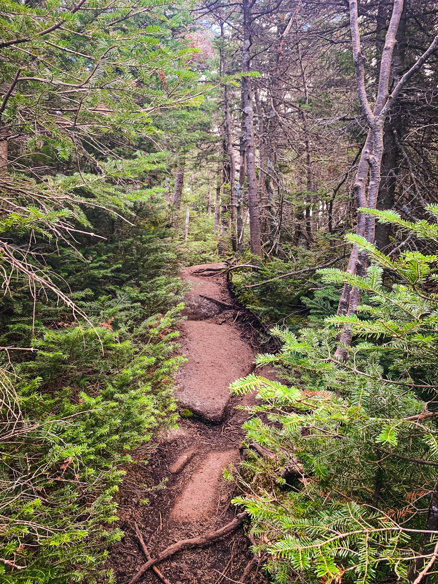
This section is hiking trail proper; welcome to the woods.
You will hike up mostly gentle grades for about 2 miles.
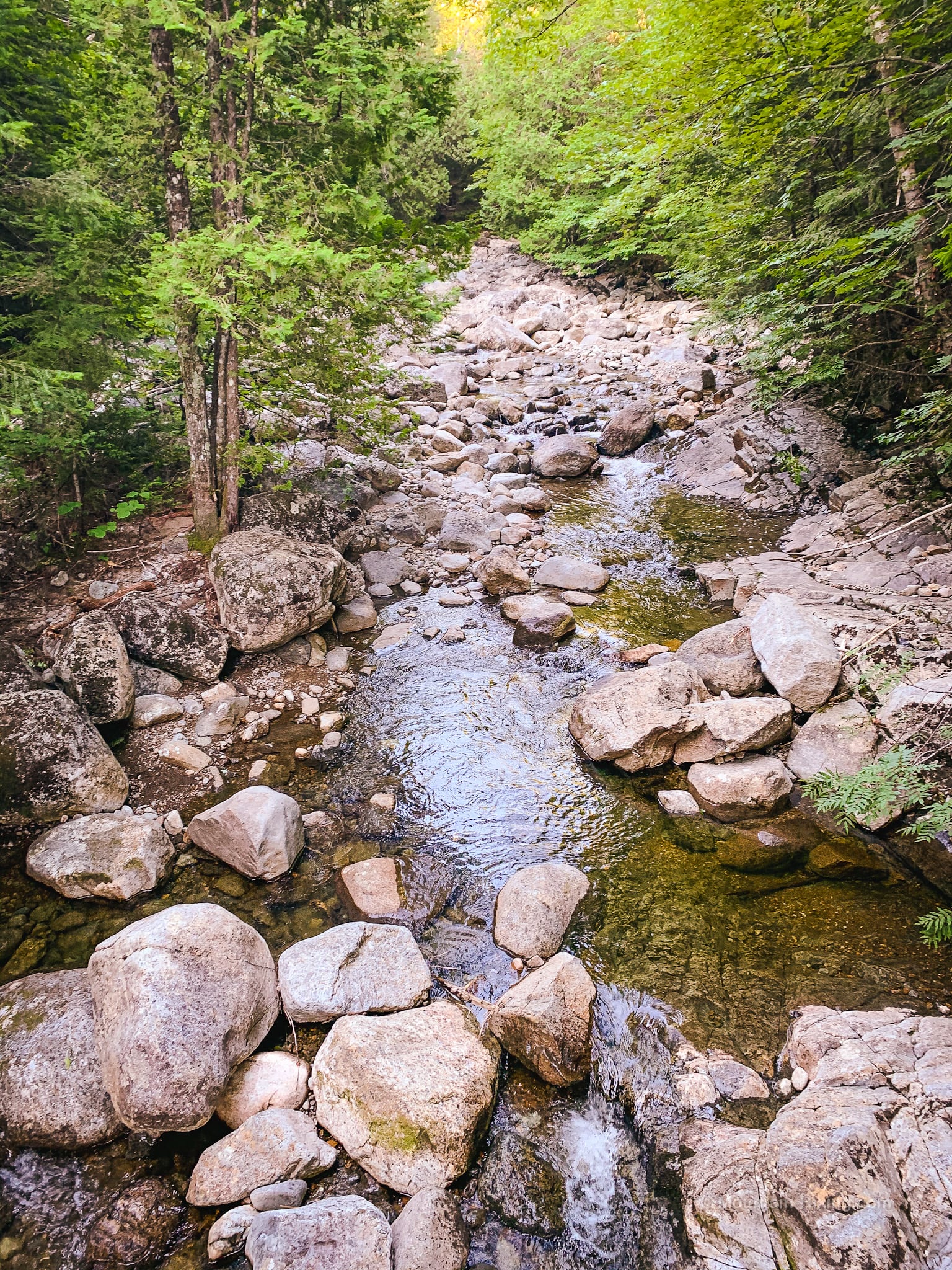
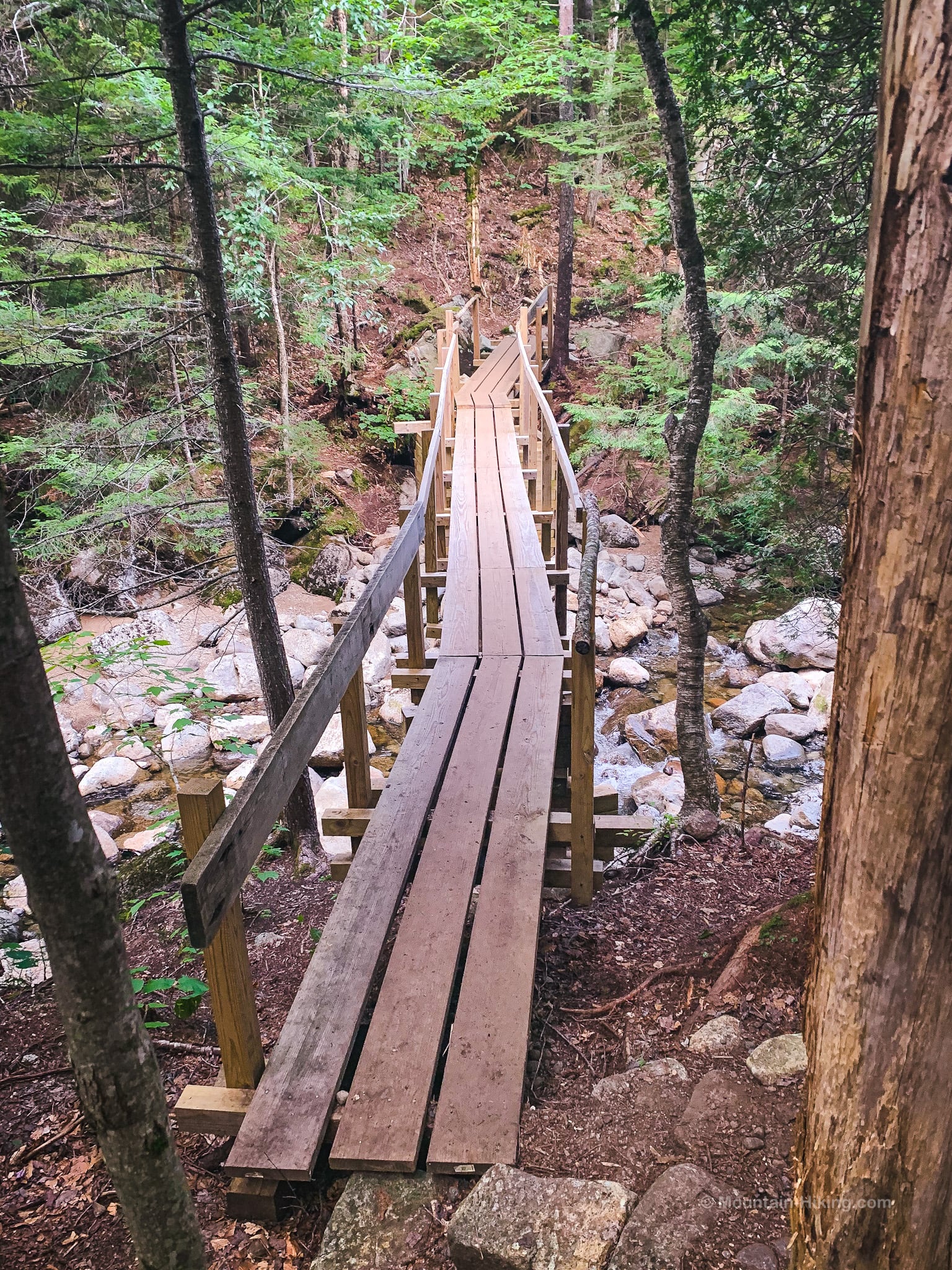
A few minutes from Santanoni Road, you will cross Santanoni Brook…
…via this lovely footbridge…
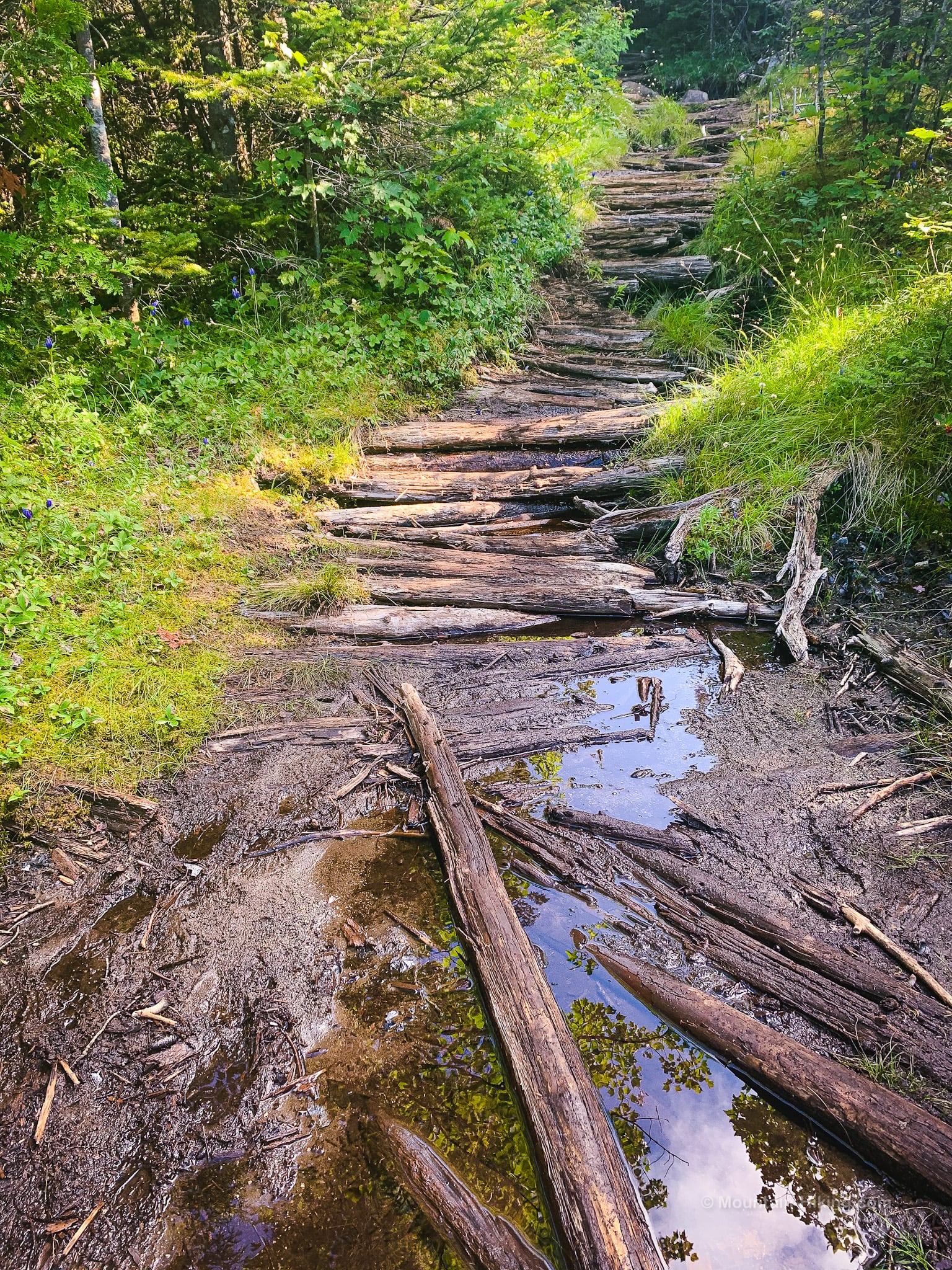
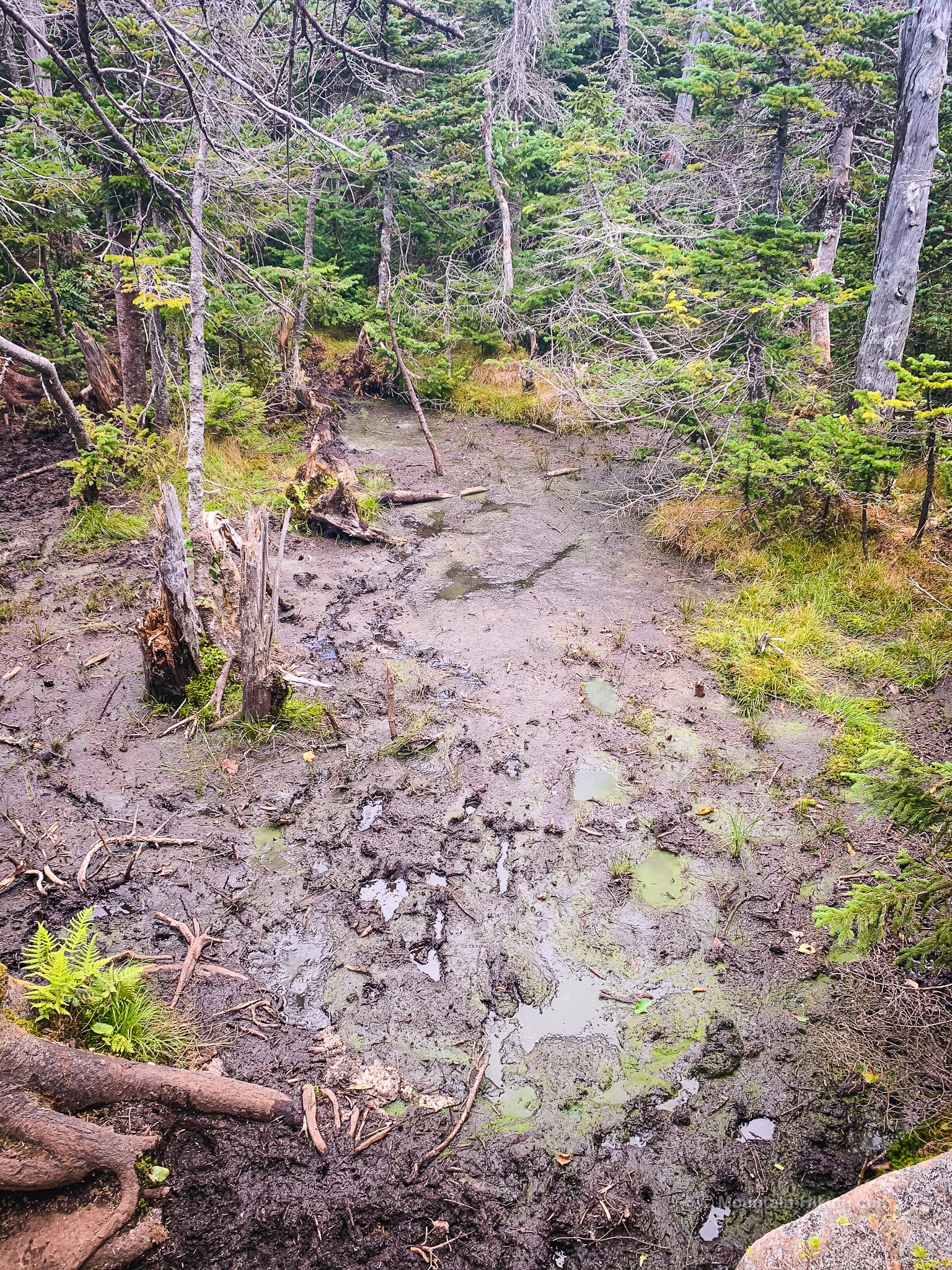
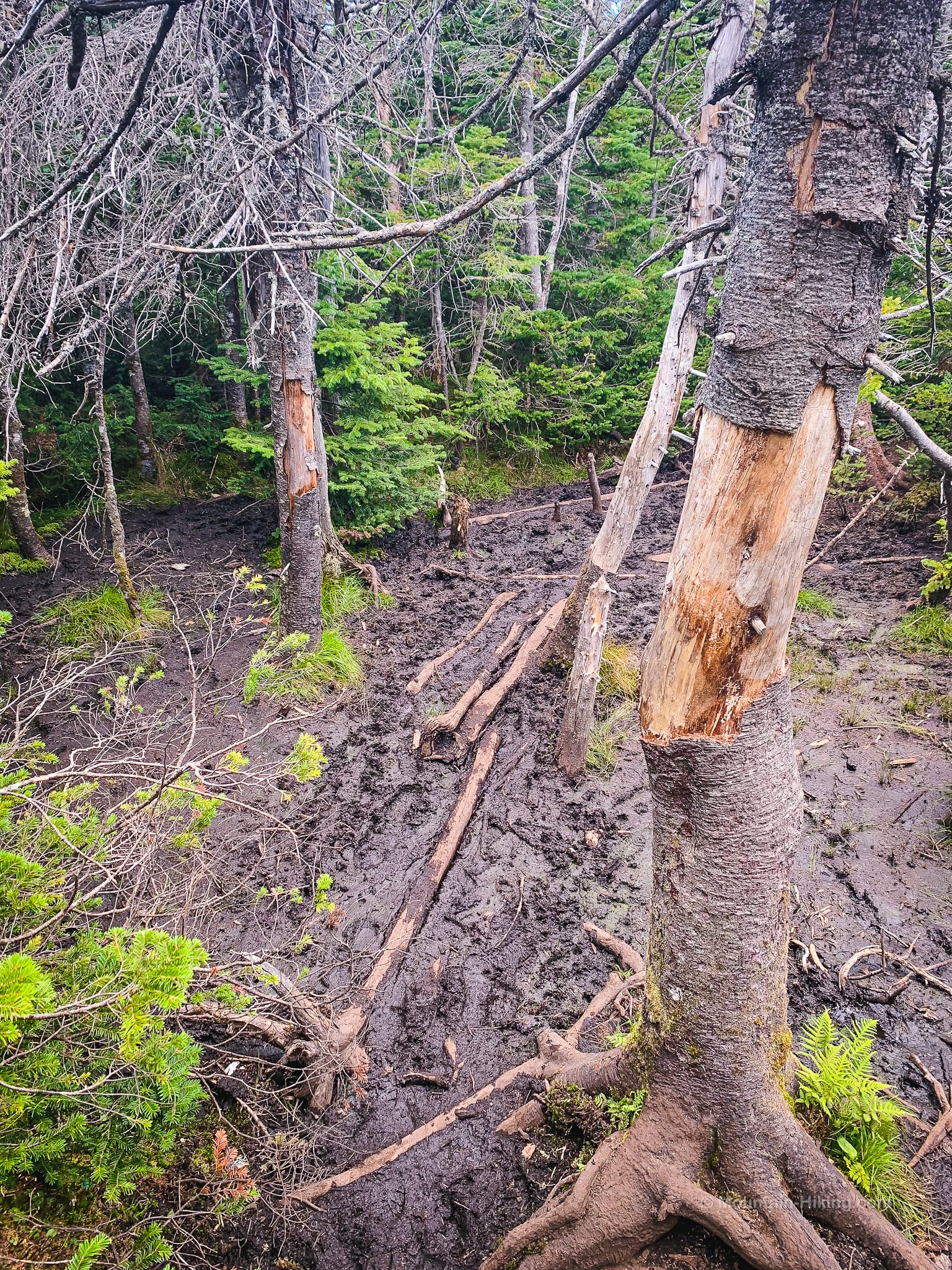
There are several muddy sections, and some are paved with corduroy logs…
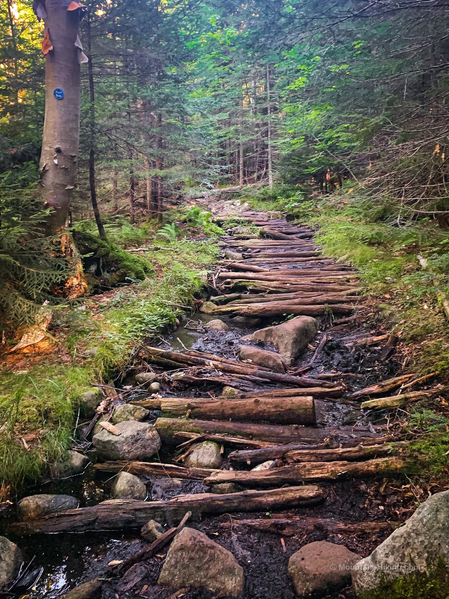
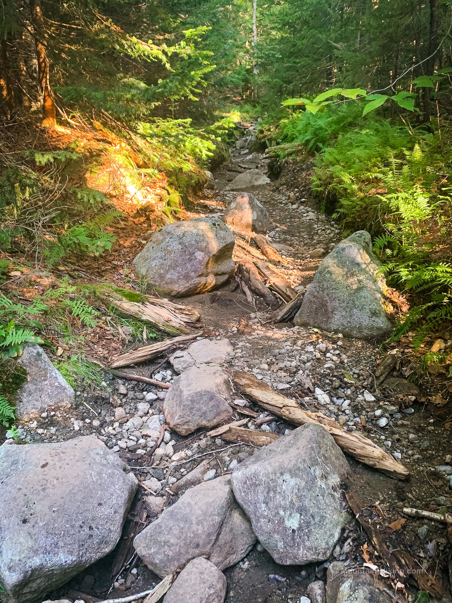
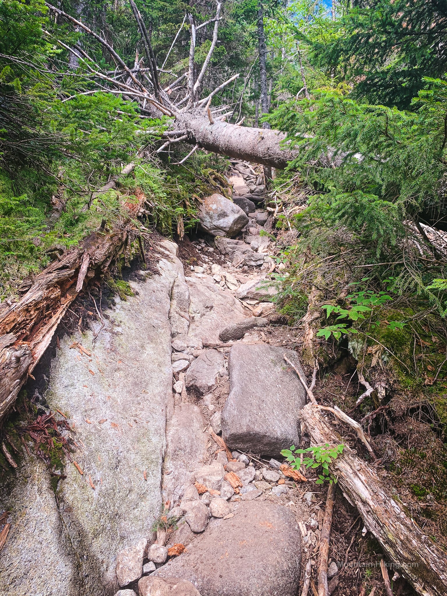
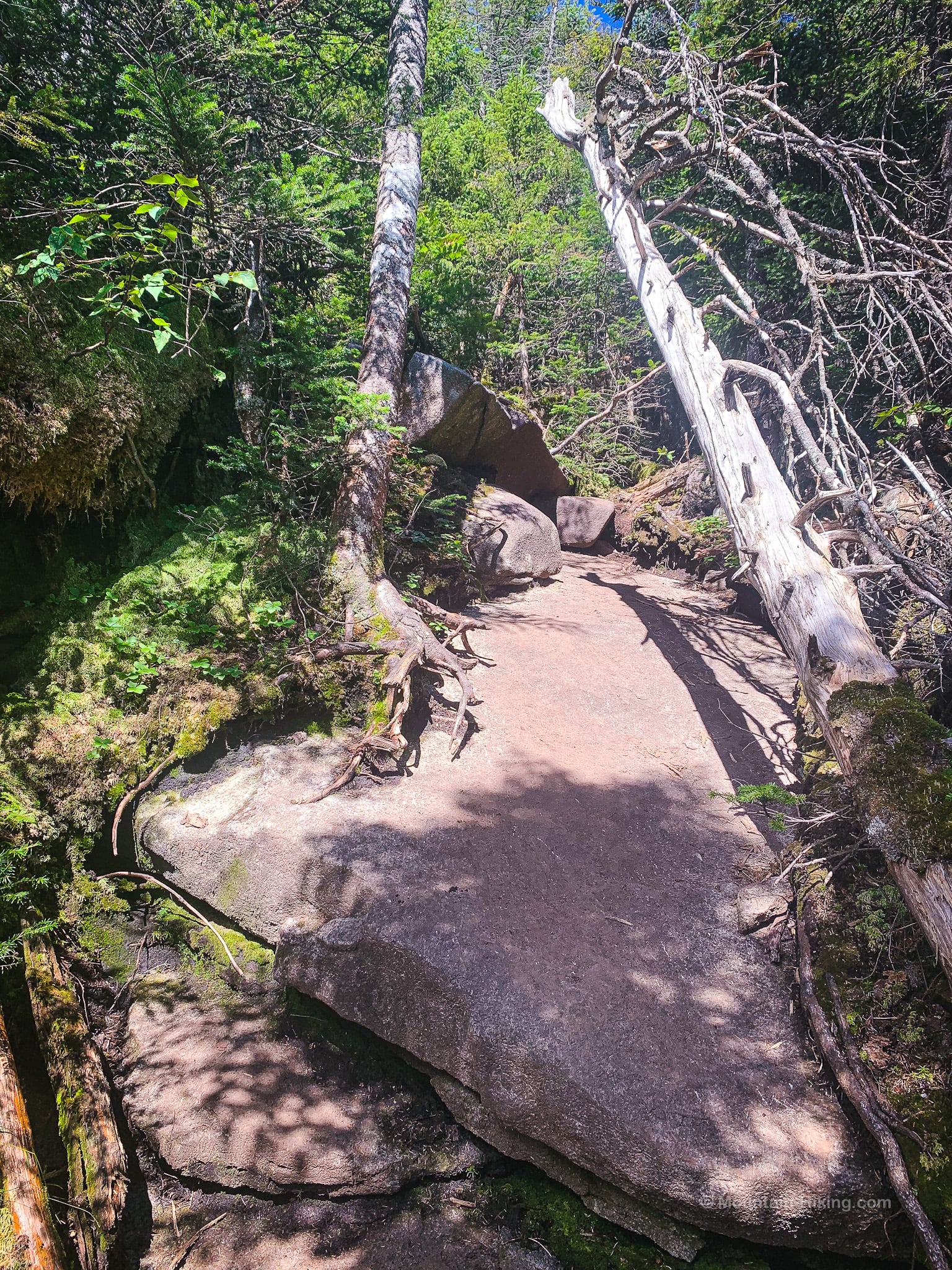
There are rugged sections…
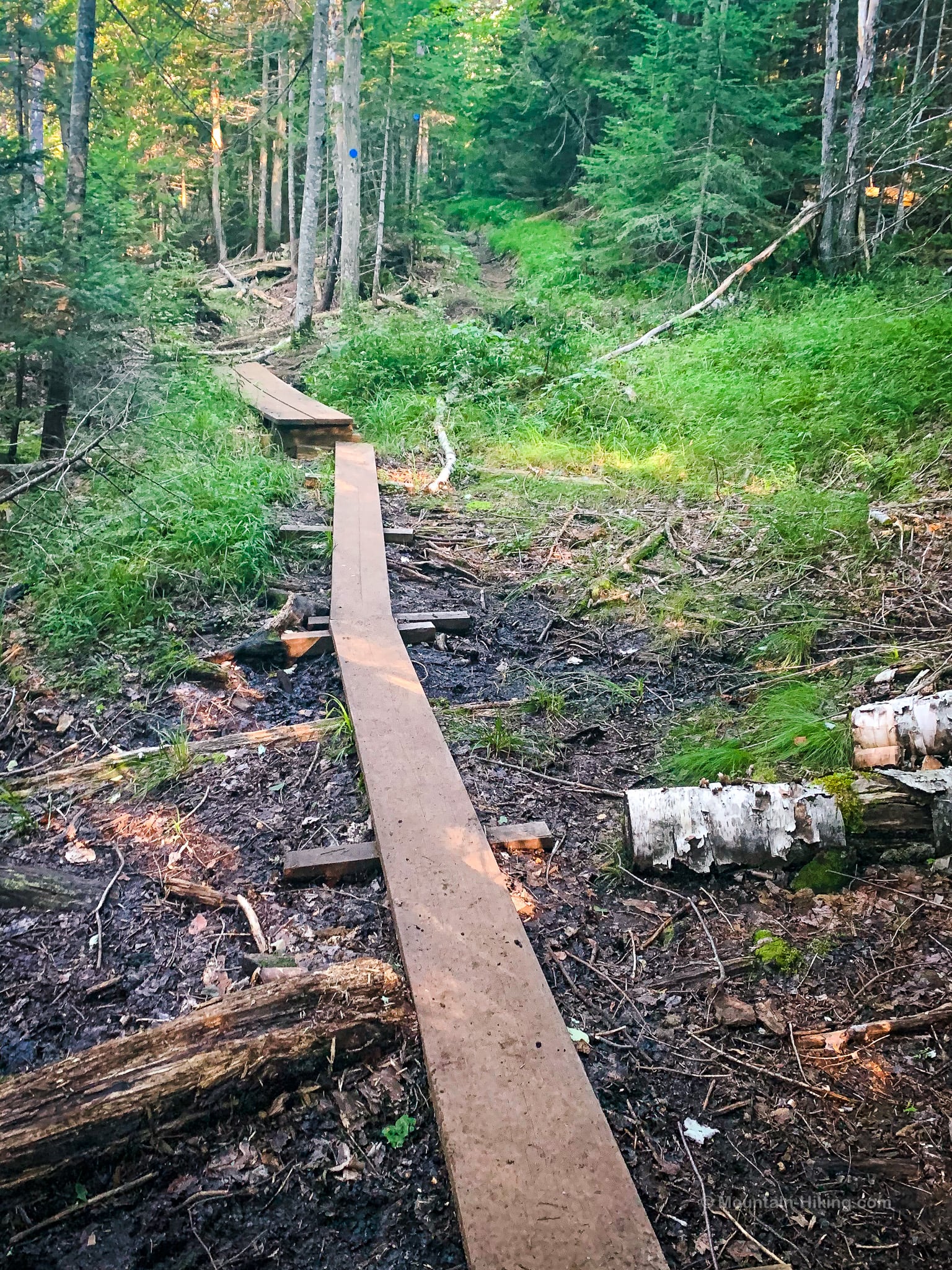
…and sweet boardwalks…
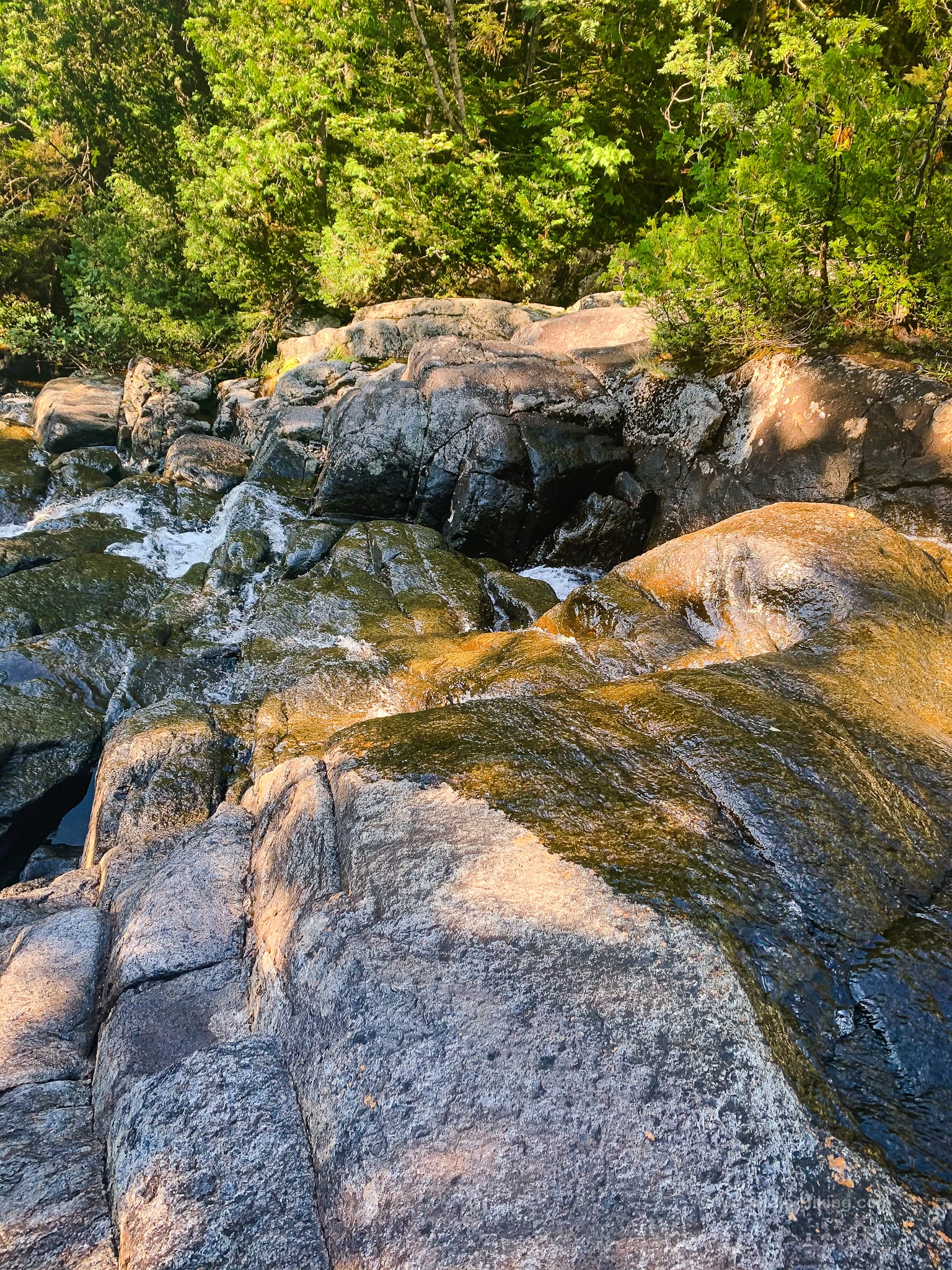
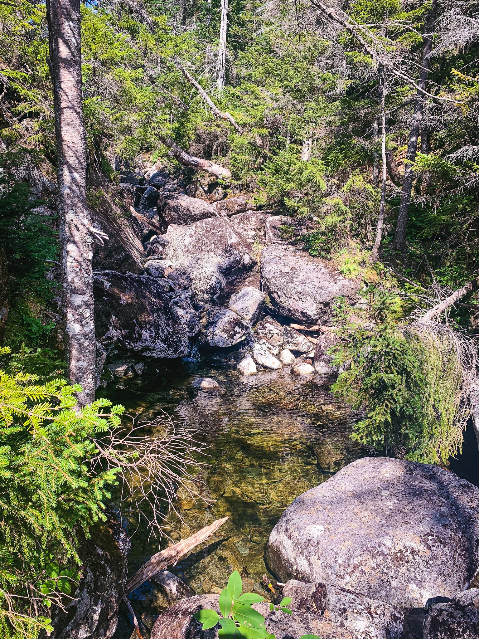
Just below 2700’, watch for an opening on the left side of the trail which leads onto an open rocky section of Santanoni Brook…
After about 90 minutes total hike time, just below 2800’ you will pass a turn-off on your left. This is the Santanoni Express which leads directly up to Santanoni Peak via a very steep trail.
Continue straight uphill, staying right.
Around 2900’, you’ll hit another corduroy section…
The whole trail is lovely, and never boring. Each section feels distinct. It feels like hiking through a dozen episodes of a show, each of which focuses on a different microclimate.
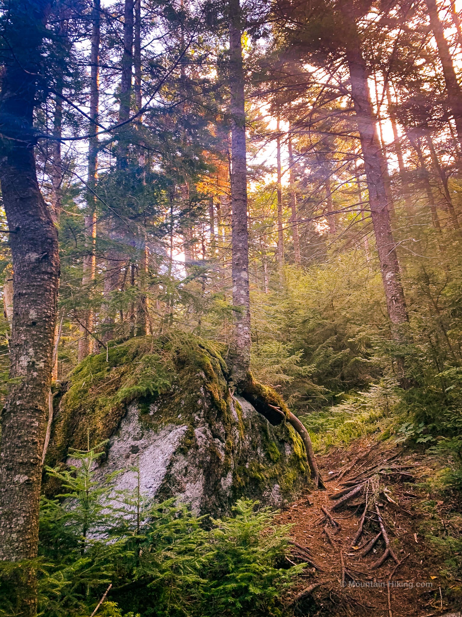
The mountain on the right side of the trail is Henderson Mountain.
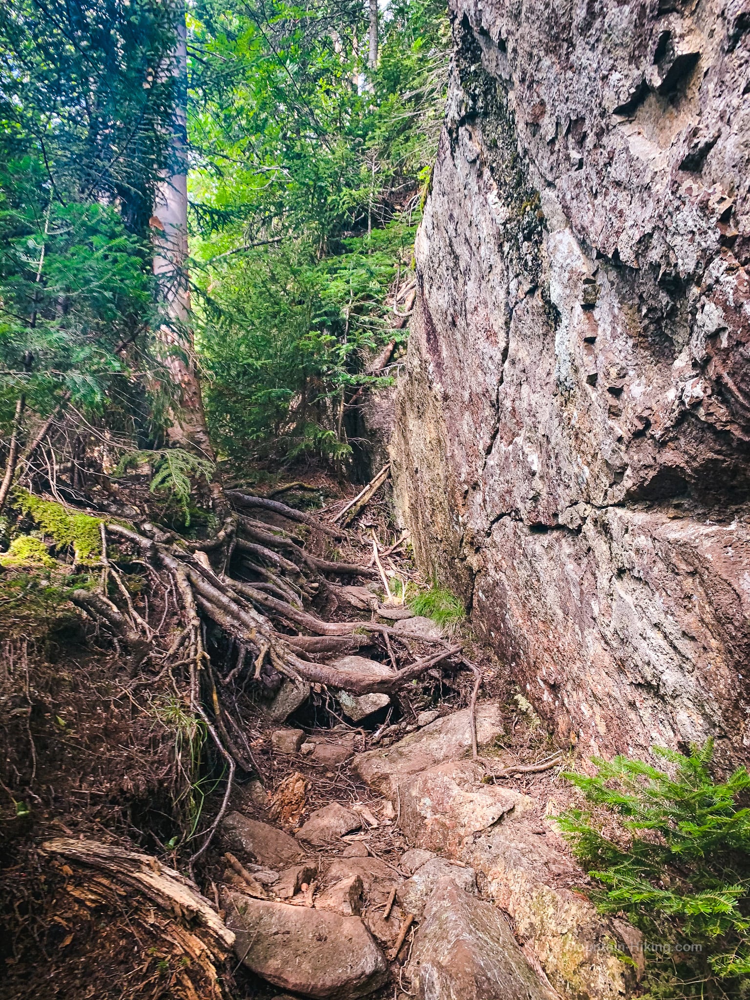
The trail descends a for a while, passing through a rugged, cliffy section…
To your left, you may be able to see Bradley Pond through the trees.
Finally, after a total of about 4 miles, the trail flattens out. You come to the signpost that marks the start of the herd path to Times Square.
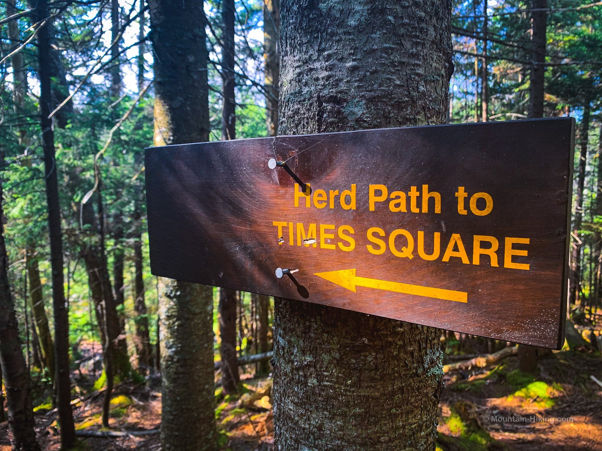
Up to this point, there have been precious few trail blazes. From this point on, there will be none.
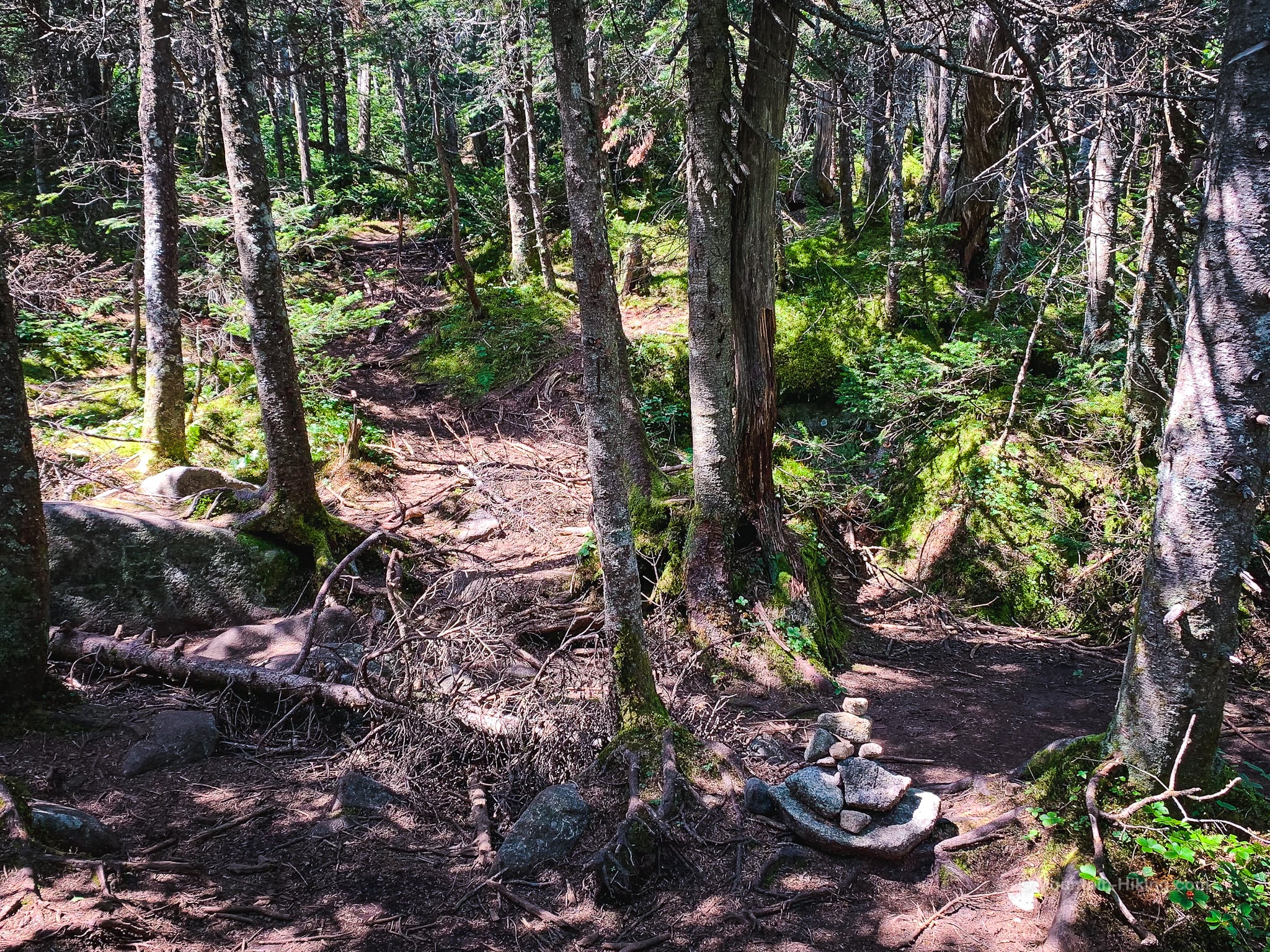
The herd path to Times Square is clear, and well trod, but you must have solid backcountry skills to navigate the rest of this hike without any helpful trail handrails.
Hike to Times Square & Panther Peak
The herd path dips down into a flat marshy area next to Bradley Pond. It can take a minute to figure out which way to go. We took our first rest here, sitting on some rocks, and had a snack.
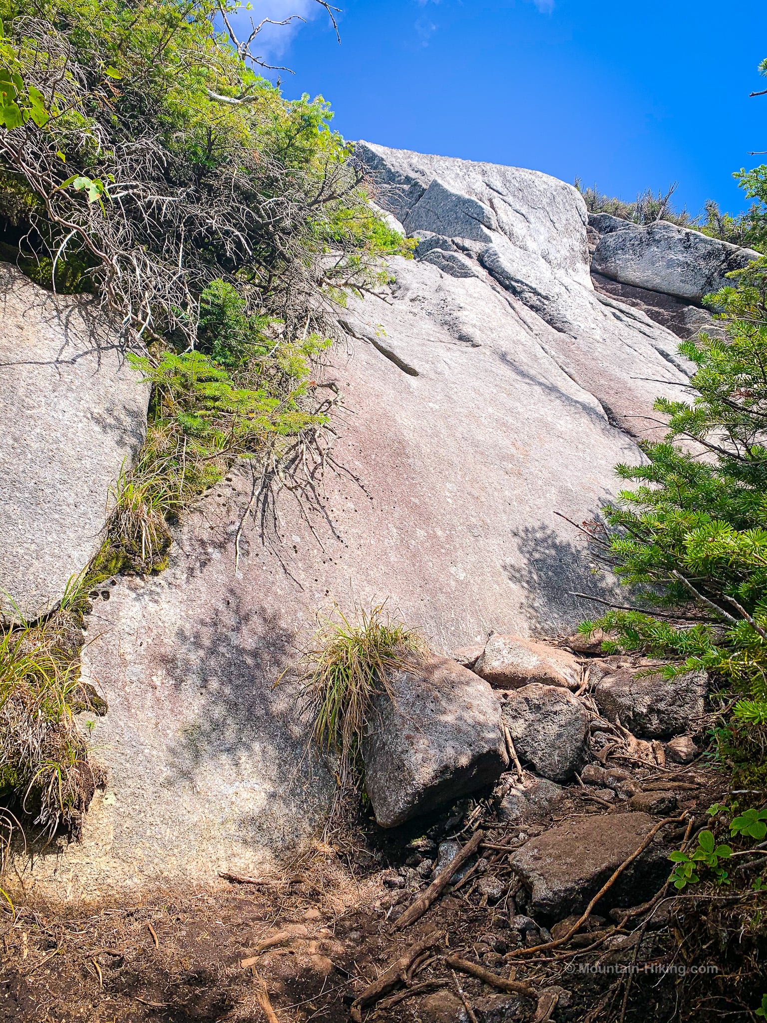
After Bradley Pond, the work starts in earnest. Once the trail winds around the back of the pond, it becomes increasingly steep and rugged.
But it’s beautiful the whole way, mostly following a drainage that runs down off the Santanoni Ridge like a long thin scar on the mountain. Climbing this section is definitely Type II Fun.
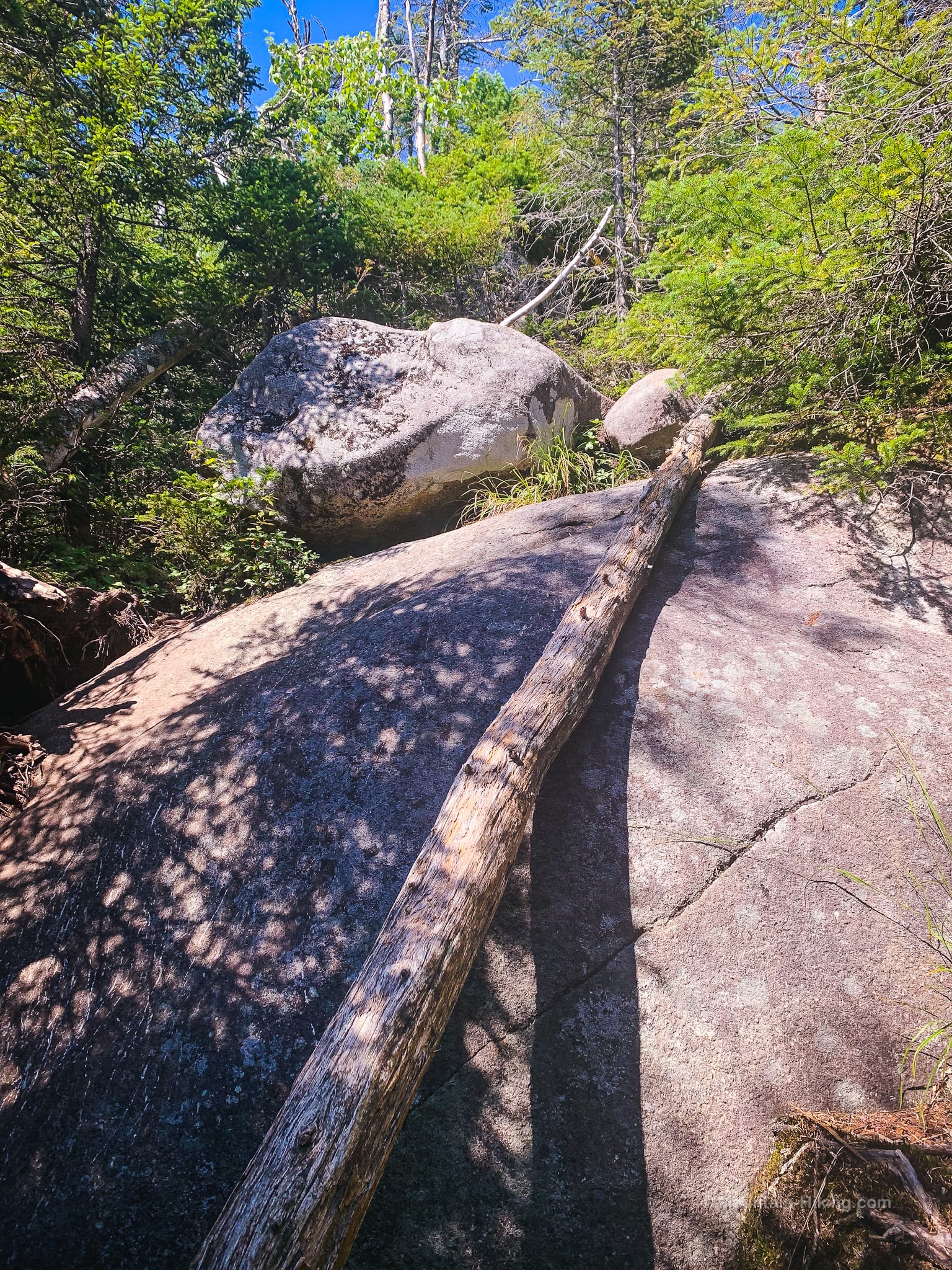
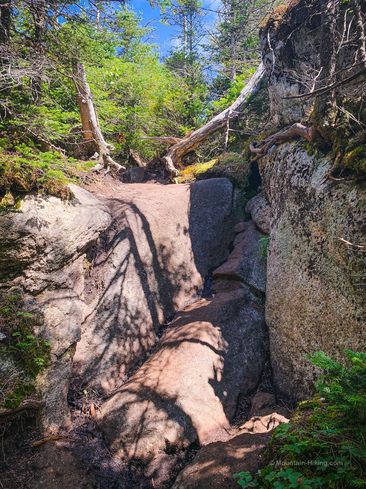
Climb over this…
Climb over that…
There are sections with stone staircases, sections where you’re not sure if you’re still on the herd path, or if you’re on the correct side of the drainage.
And it keeps getting steeper.
At first, I didn’t feel it but, after an hour, it started to wear me down.
It’s such hard work, I only took a few photos.
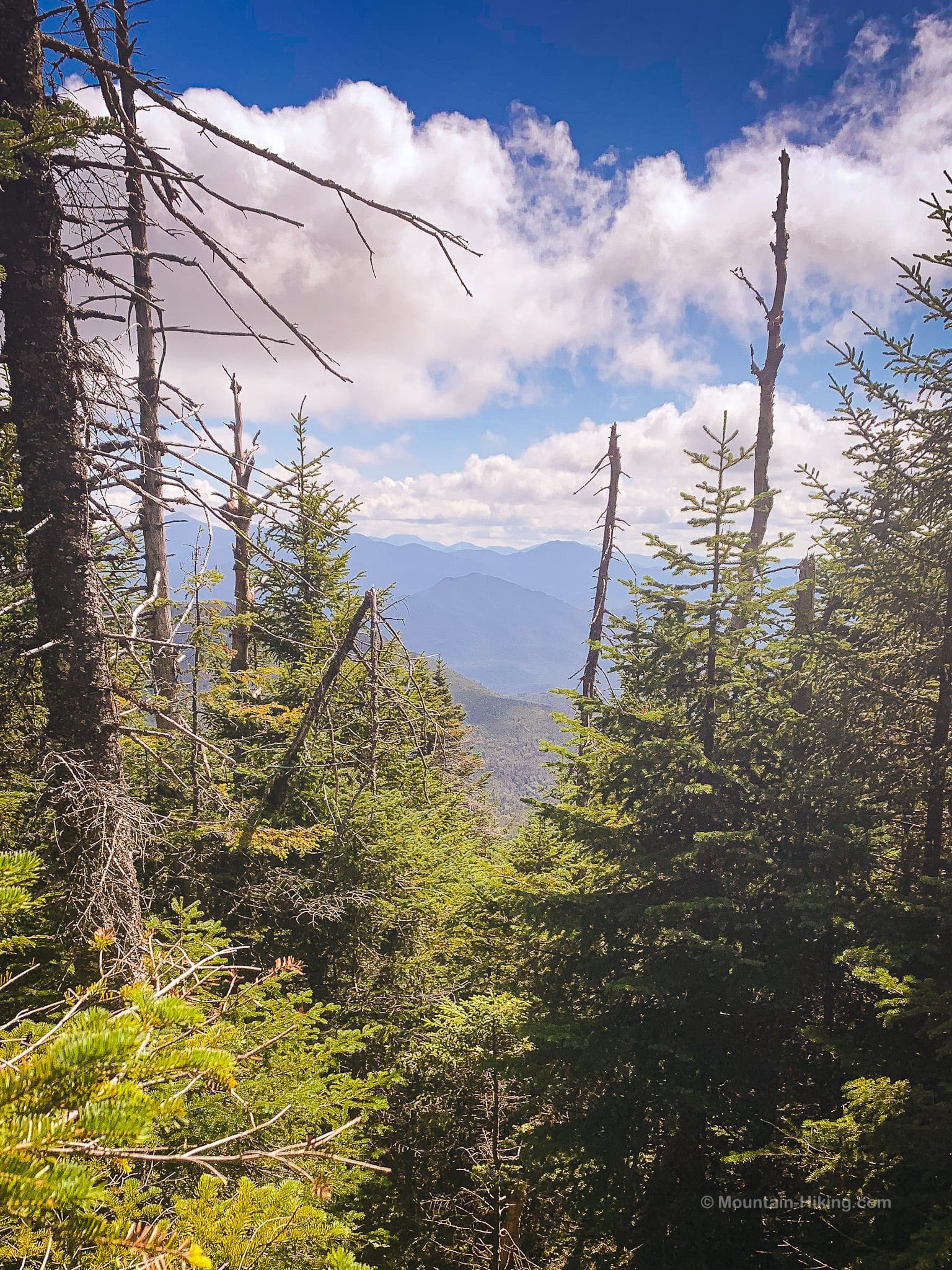
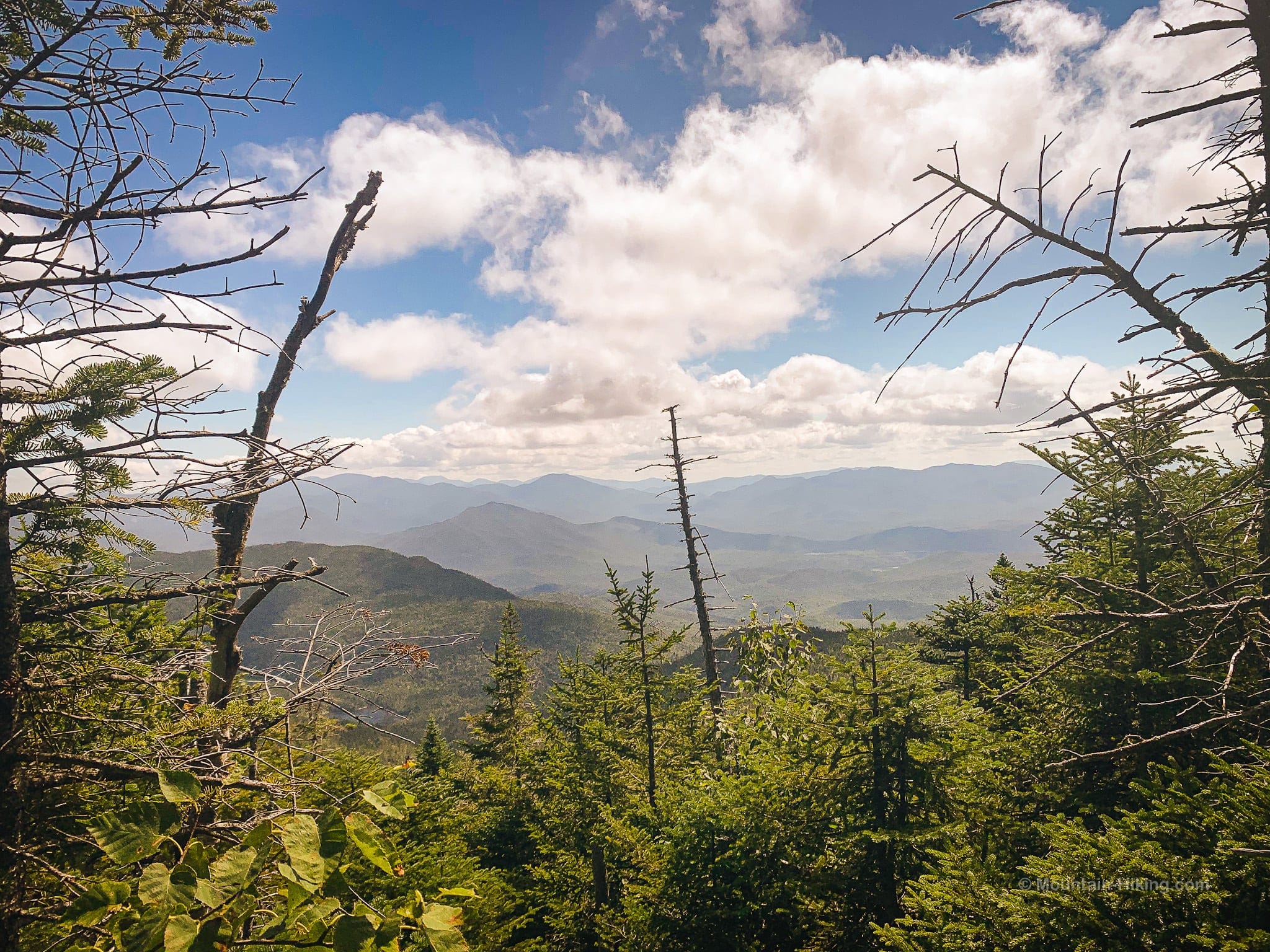
Higher up, a few modest views do open up behind you…
But there’s still plenty of work to do…
Near the col, my legs were really getting worn down and starting to turn to jelly.
GaiaGPS says the herd path to Times Square is 1.4 miles long with an elevation gain is 1200’+, so it’s definitely steep. But somehow it feels is even harder! There are technical sections and lots of boulder hopping. I bless anyone who can power up this ridge and keep going.
Just below the col, one last turnaround gave me this view…
Times Square
Finally — after two hours of steep! — we made it to Times Square, which turns out to be an unprepossessing junction, marked with a simple cairn…
Change of Plan
Here, I had to let my hiking partner know there was no way, on this day, that I would be hiking down to Couchsachraga, or up to Santanoni. My legs were wrecked. She took it like a champ and we quickly came up with a plan for her to hike out to Couchsachraga by herself while I rested in Times Square — and maybe at least made it out to Panther. When she returned from Couchsachraga’s swamps, we’d just hike out the way we’d come.
There is no better plan than going with reality, and no better hiking partner than a flexible hiking partner.
It’s great to set goals, but these mountains have a way of adding reality checks to your day.
Times Square to Panther Peak
My buddy headed off to “Couch”. I rested for a while and then set off for Panther Peak.
The herd path from Times Square to Panther is very short — it’s less than a quarter mile, and only takes a few minutes — but it contains multitudes: thick woods, narrow channels, deep mud, rock scrambles, open rock face, an epic view, and a sweet ADK summit.
Narrow trail…
This muddy section is a fraction of what the route down to Couchsachraga offers…
Some logs strewn on the left side helped me cross…
Soon the herd path opens onto this open bald spot…
…above which is the best view of the day.
To the west, far below, you can see the frustum-shaped Couchsachraga…
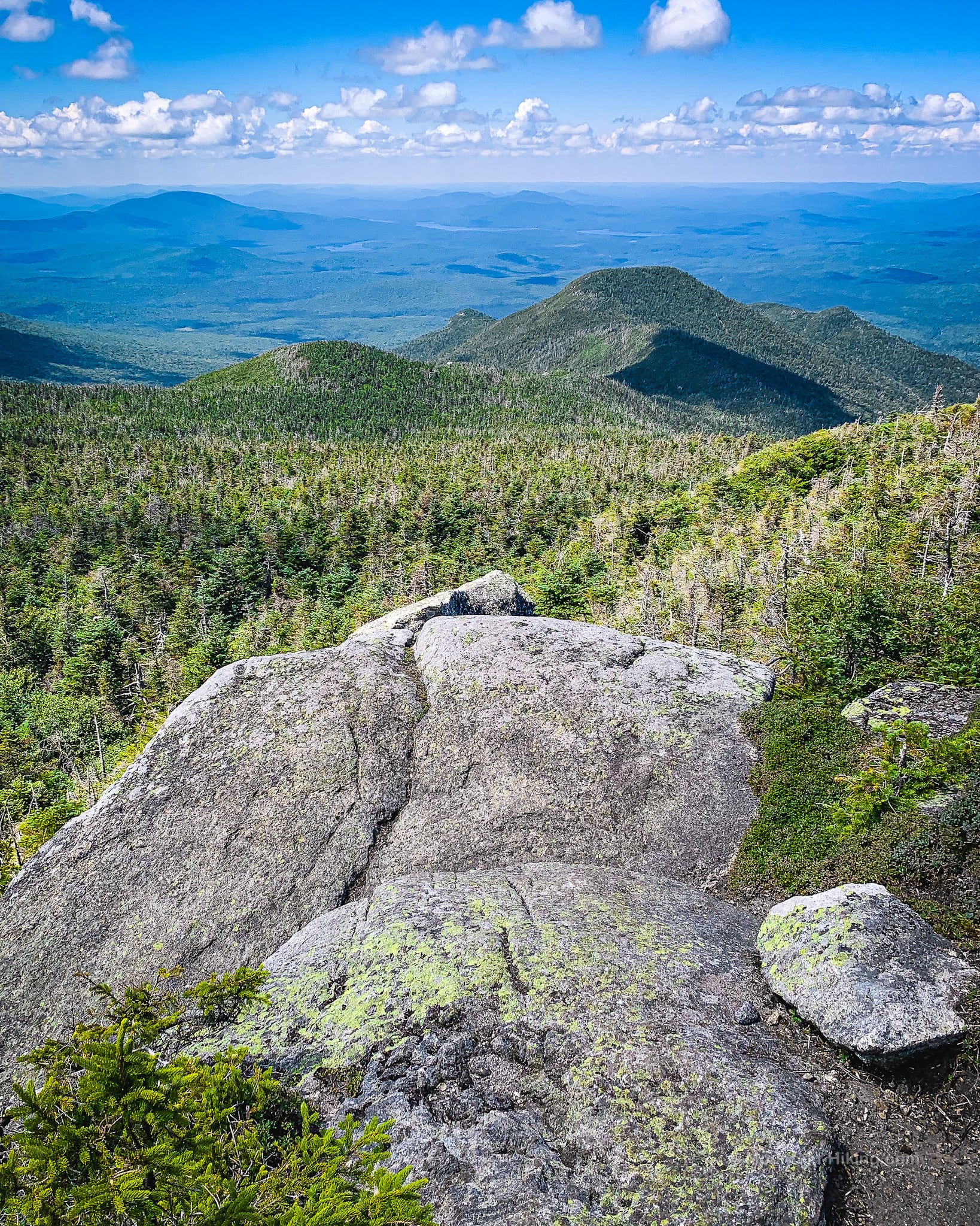
Meanwhile, to the south, Santanoni Peak looks glorious…
From Panther’s summit just above, the view is not as good. This is definitely the spot to enjoy a well-earned wilderness view.
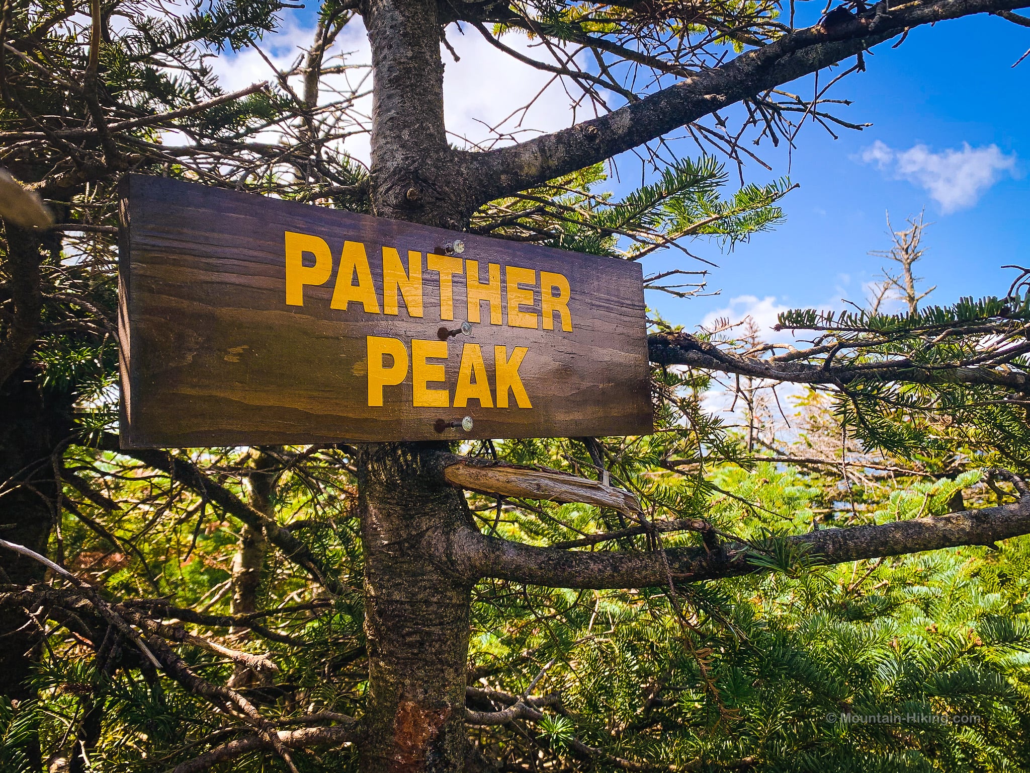
Panther Peak Summit
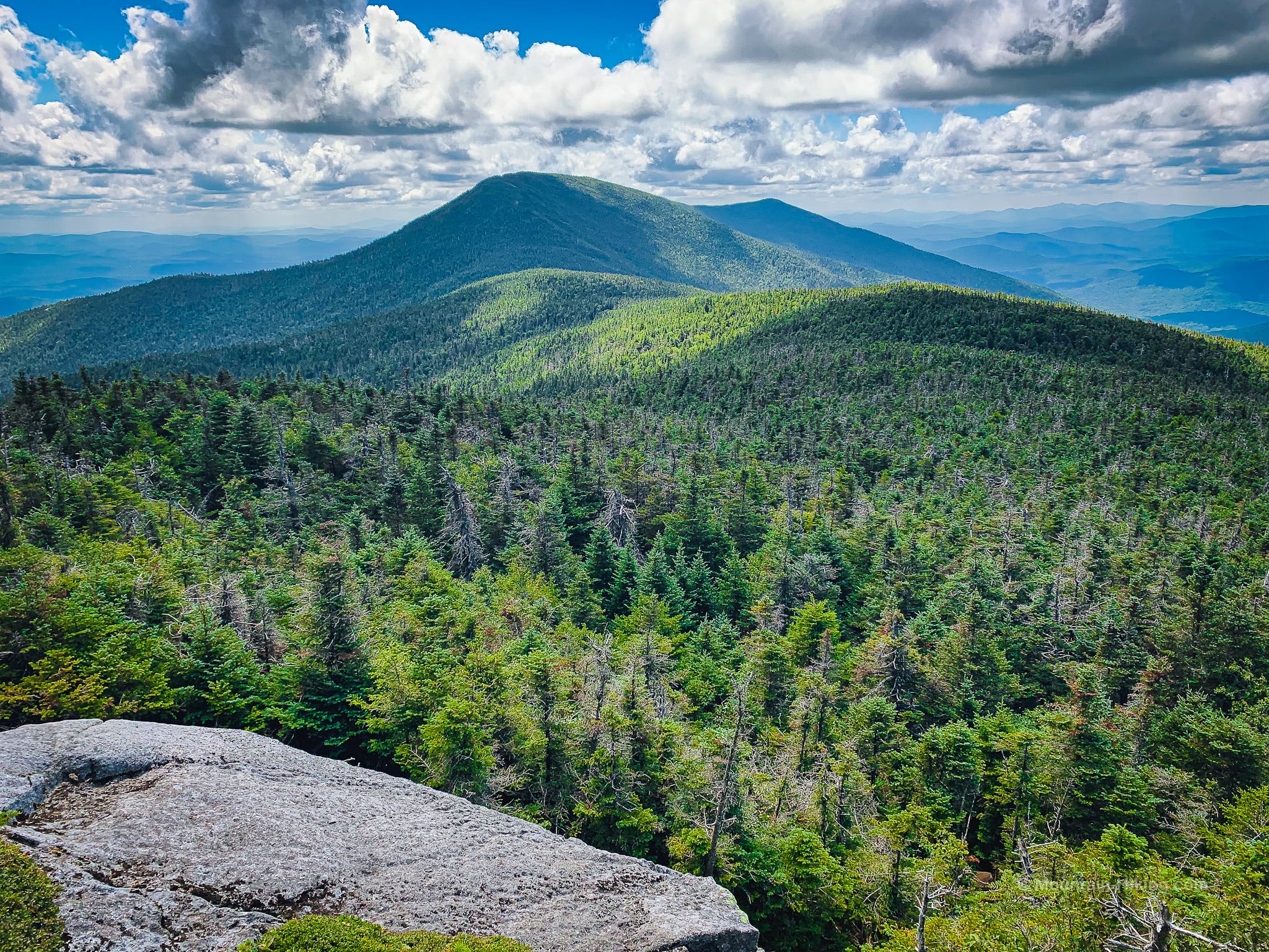
A short distance above the scenic spot, you’ll come to Panther Peak’s summit which offers partial views of the surrounding high peaks…
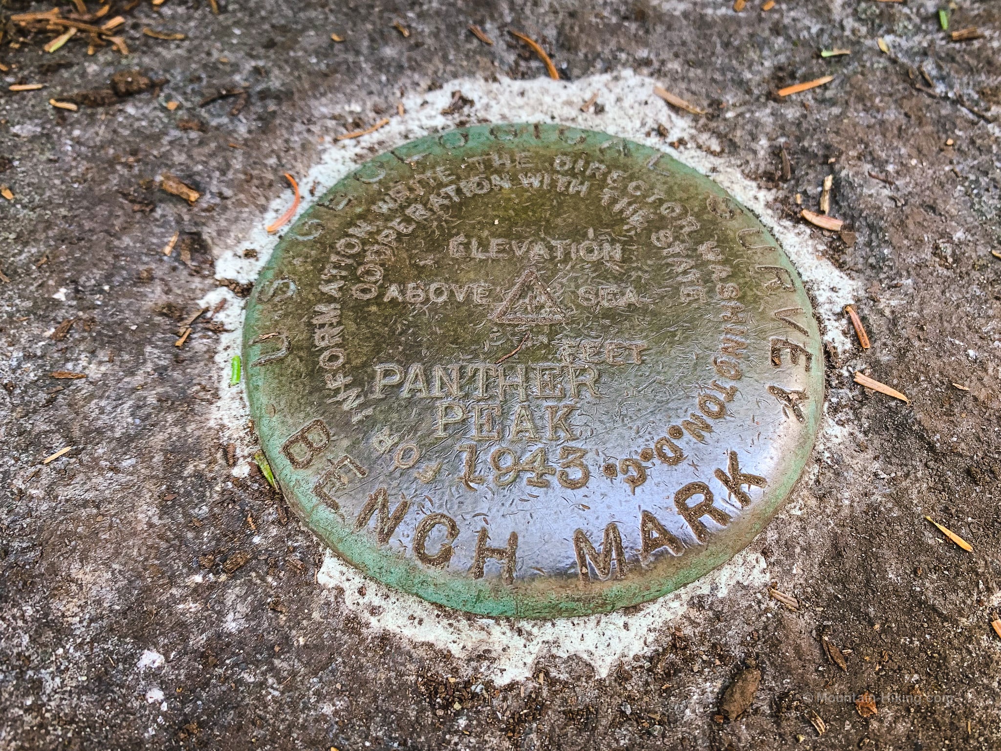
There’s a geodetic survey marker embedded in the rock…
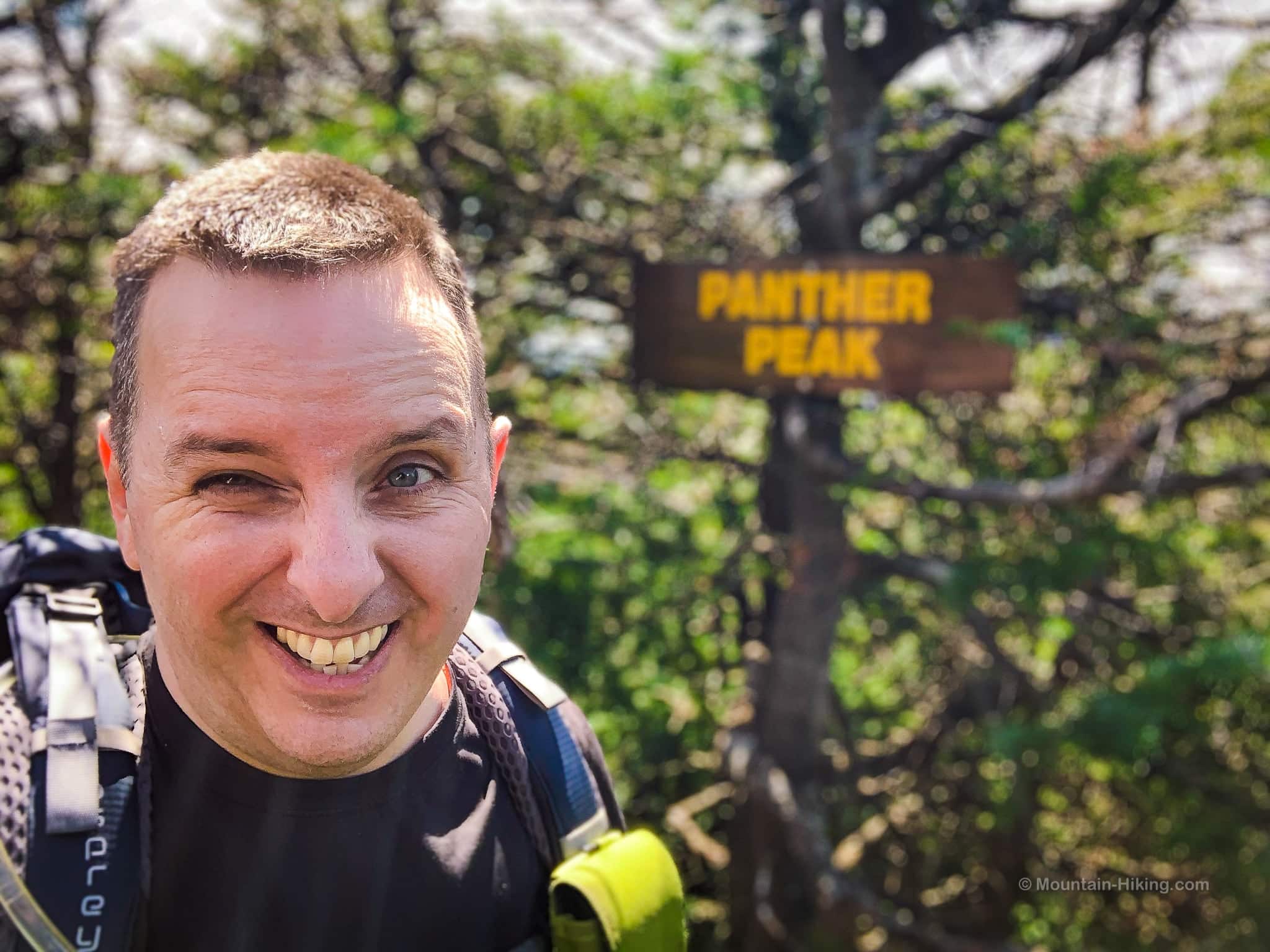
…and a wooden summit sign in great condition.
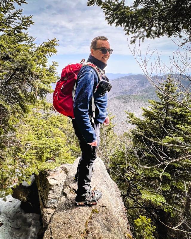
After 5+ hours of work, this was my expression…
Final Notes…
I barely managed to eke out this hike. Even after resting at Times Square for a while, my legs barely got me to the summit of Panther.
Back at Times Square, I was able to rest for even longer as I waited for my hiking partner to return. We made it back to our cars by 6:30 pm. I would say my partner’s day hike to Couchsachraga took about 11 hours in total. And I’d allow 8-9 hours for a hike to Panther Peak.
The parent mountain for this hike is Panther Peak.
If you do this hike, LMK how it went…
Trailhead Info for this Hike
Medium-sized lot.
Google Maps Location: 44.069032, -74.061619
The map below shows the exact topographic location of the trailhead
Cell Service
Very sketchy in this part of the ADKs. You may be able to get some texts out from Times Square or Panther’s summit. My network is Verizon. YMMV.