Disclosure: This content may contain affiliate links. Read my disclosure policy.
A straightforward out-and-back, with a short spur to a gushy spring.
Hiking Trail Description
This is one of the loveliest short hikes you can do in the Catskills. With less than 800’ of elevation gain over 1.2 miles, and ending with dramatic fire tower views, it’s so rewarding.
Even the drive out to the trailhead, through Claryville and Denning — some of most bucolic landscape in the Catskills — is a delight.
I drove up from the south, from Route 209 and up the east side of the Rondout Reservoir along Route 55A along which there are several places to pull over and enjoy some watery views. I took Sugar Loaf Road until the very sharp hairpin turn onto Dinch Road (aka Coons Road or Old Dinch Road).
Dinch Road Parking Area
Dinch is an unpaved, dirt road, made of the rich red dirt that’s so prevalent in this area, and from which Red Hill gets its name. The road descends several hundred feet into the hollow between Red Hill and a small unnamed mountain to its east. The parking area is on the left.
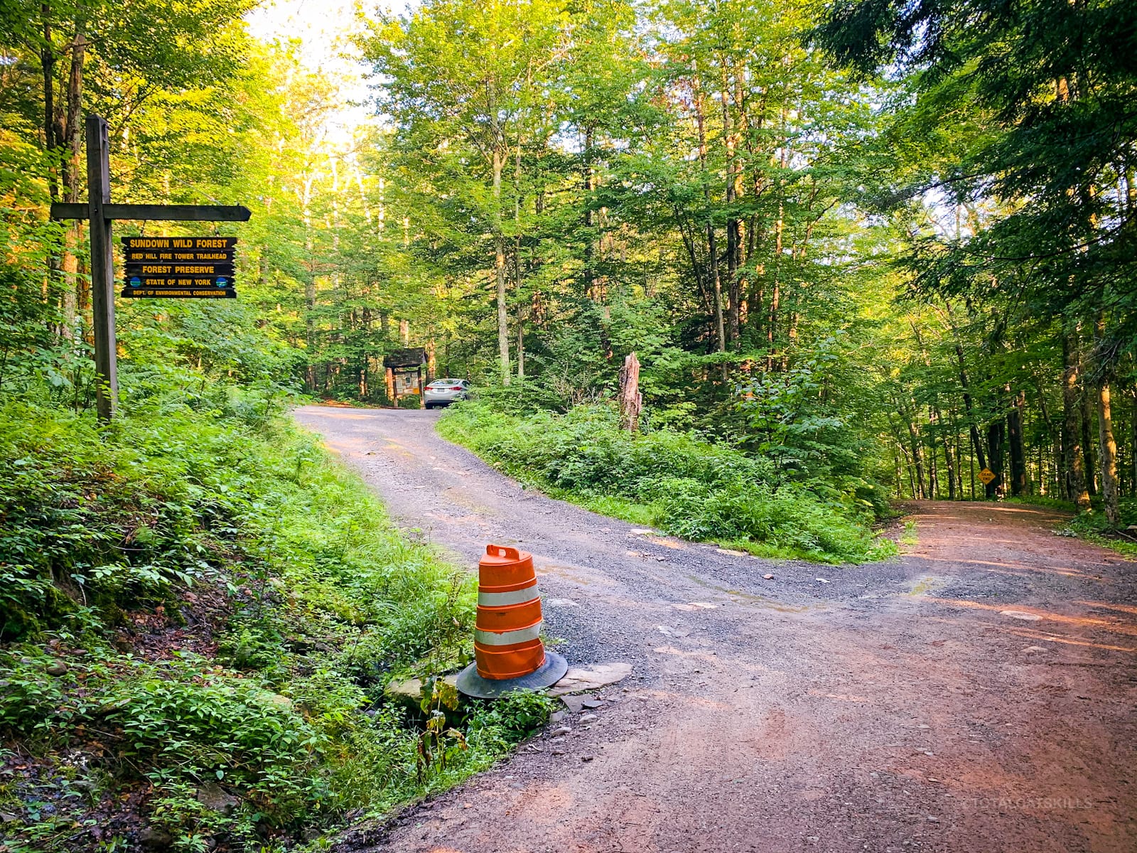
The locals who use and care for this trail tend to park on the road outside the parking lot, leaving the lot for visitors. This is typical of their love for and generosity toward the area, which is evident the moment you step on to the trail.
Red Hill Fire Tower Classic Trail
This trail guide is free to all readers thanks to my Patreon subscribers who kindly support this content…
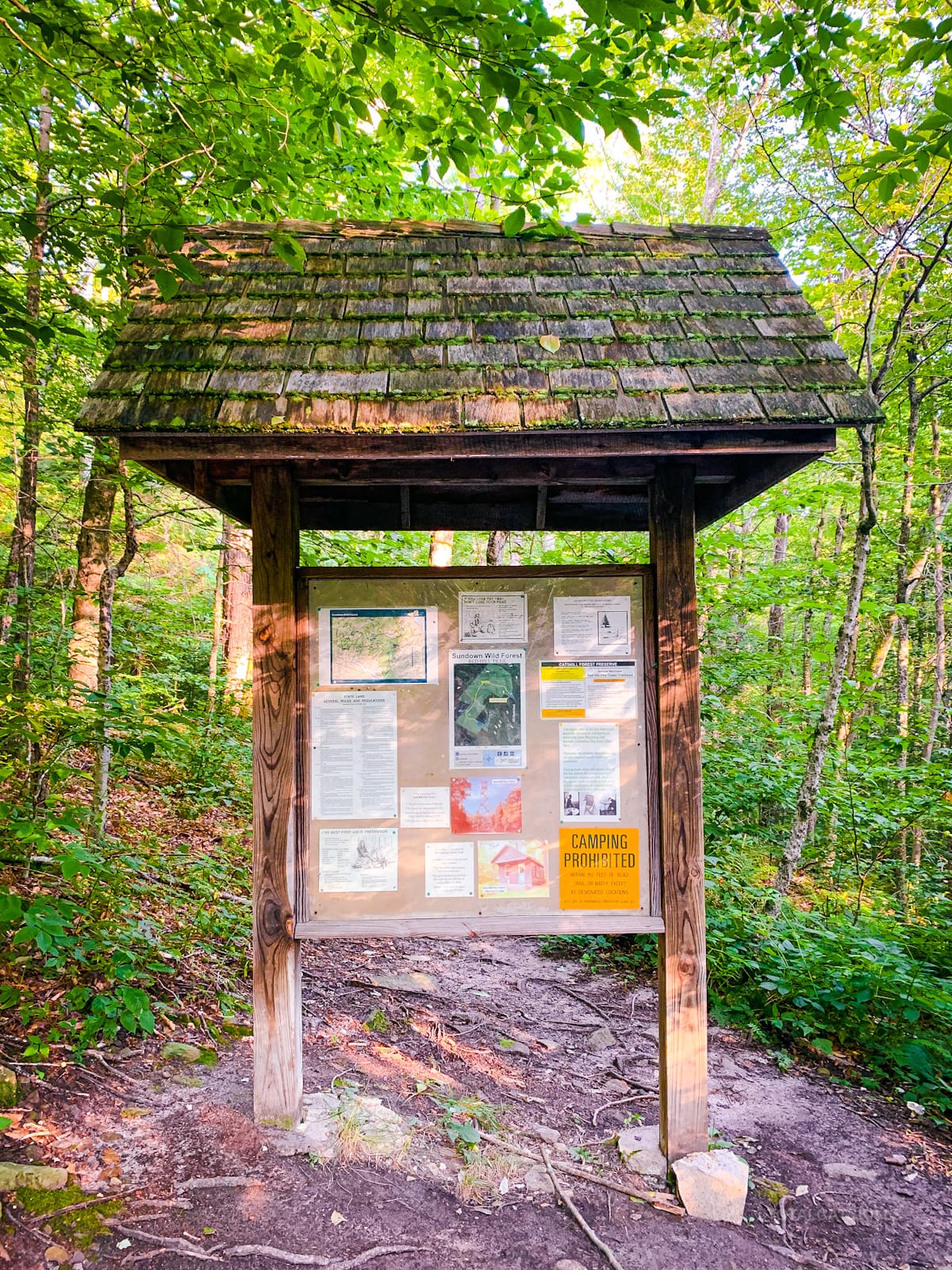
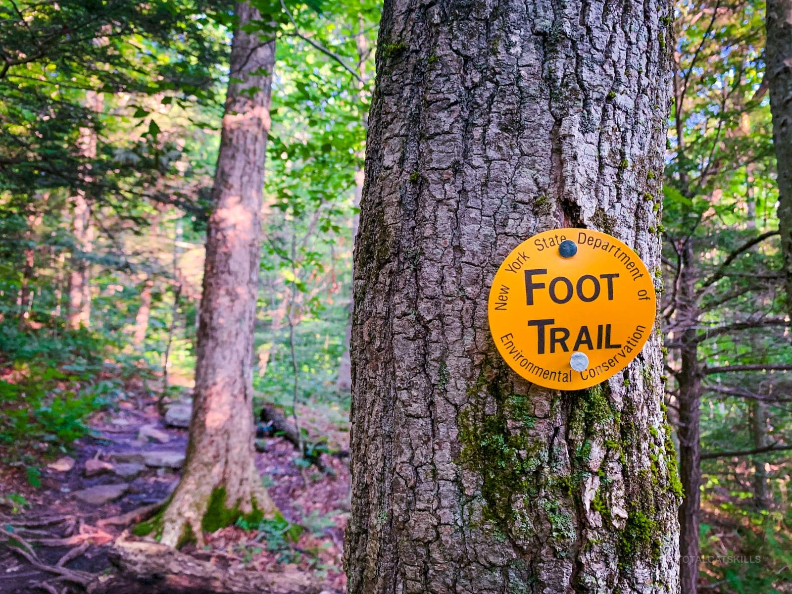
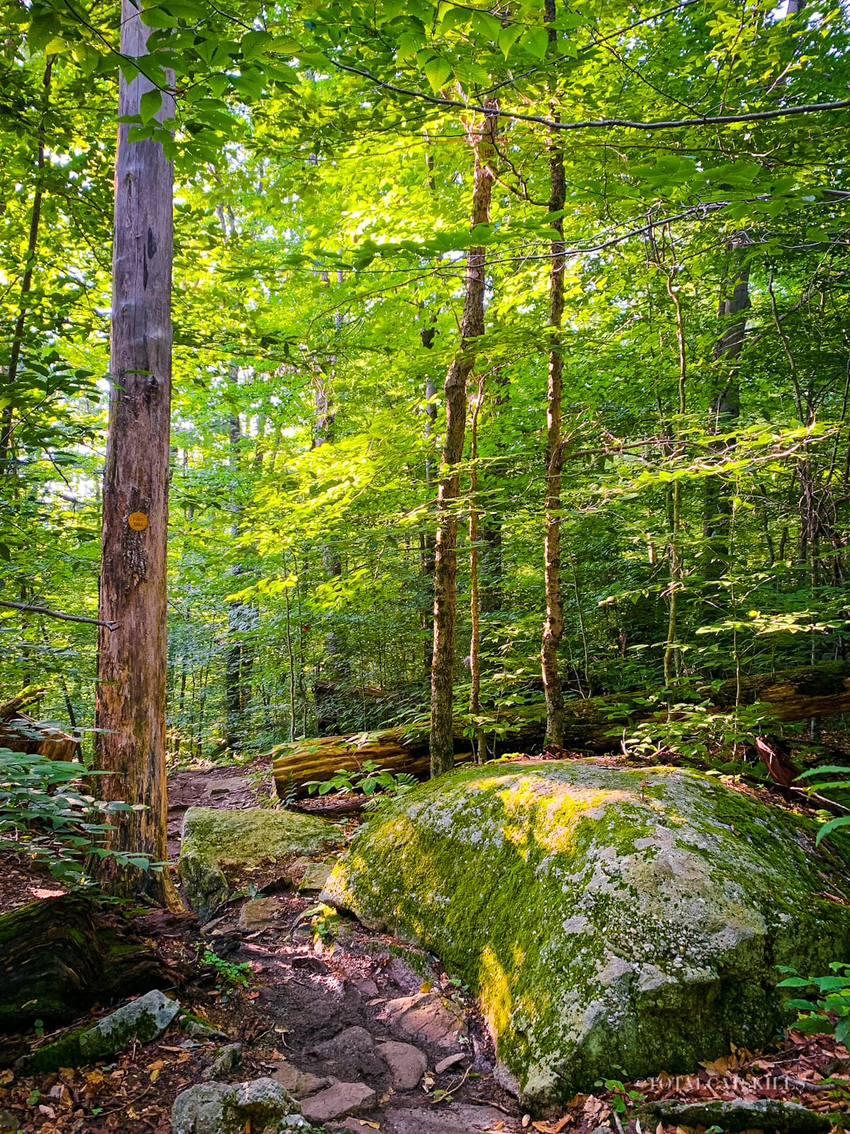
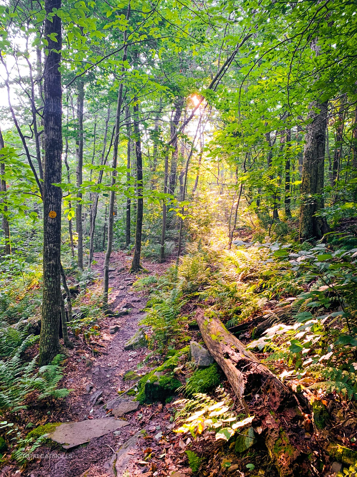
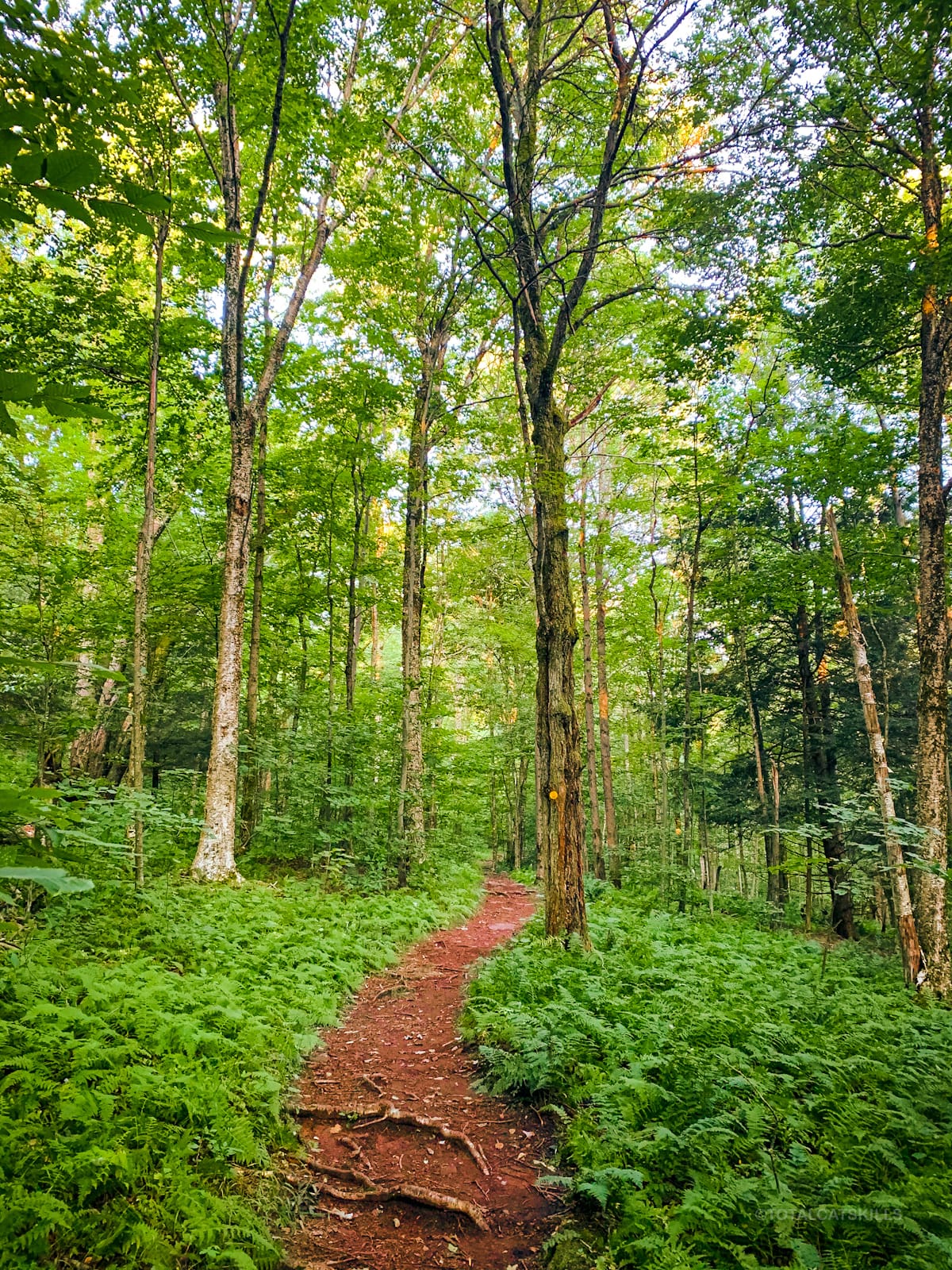
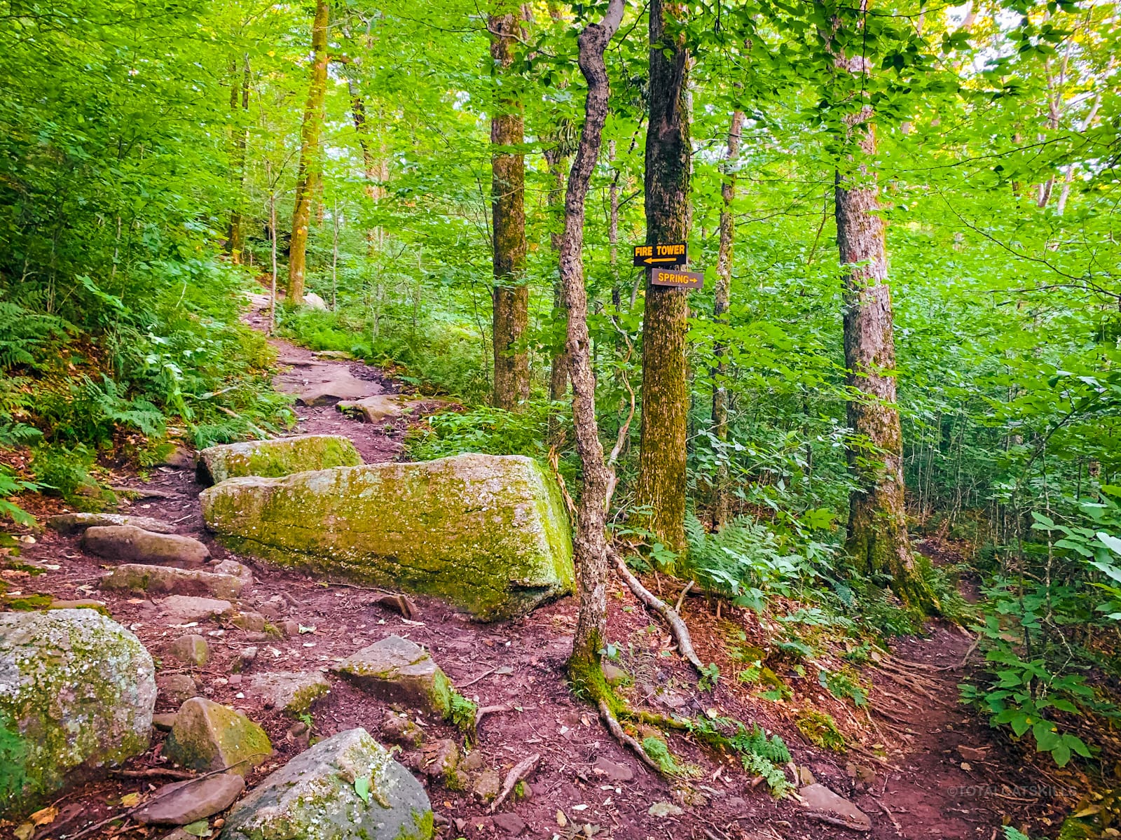
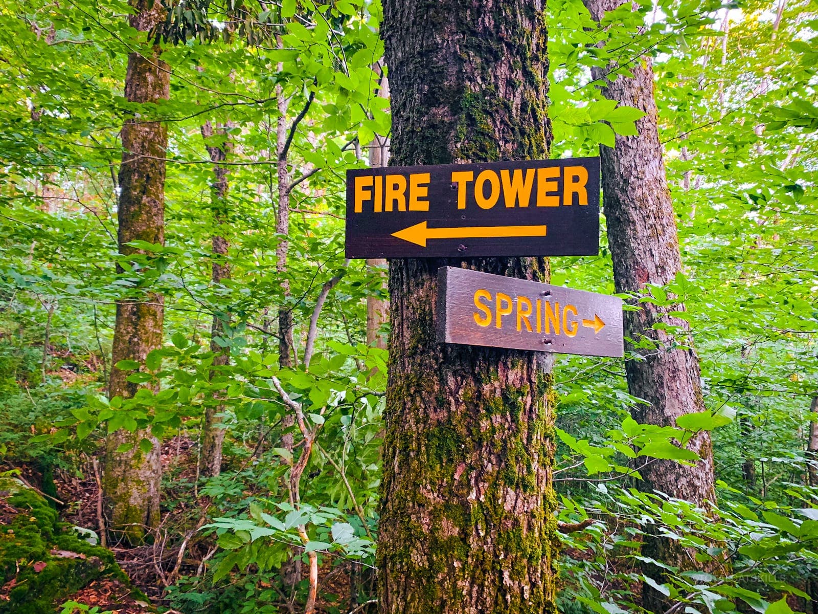
Step past the notice board and follow the yellow trail markers. The trail is very well blazed.
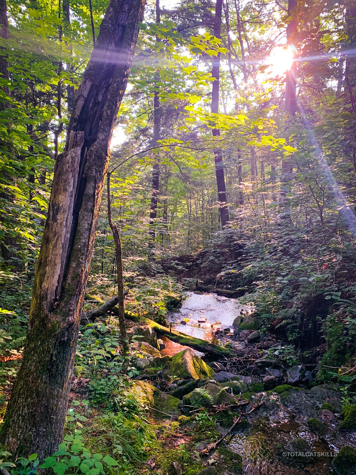
Very soon, you cross a sweet brook that I was delighted to find out is called Dinky Brook. That’s exactly what it is.
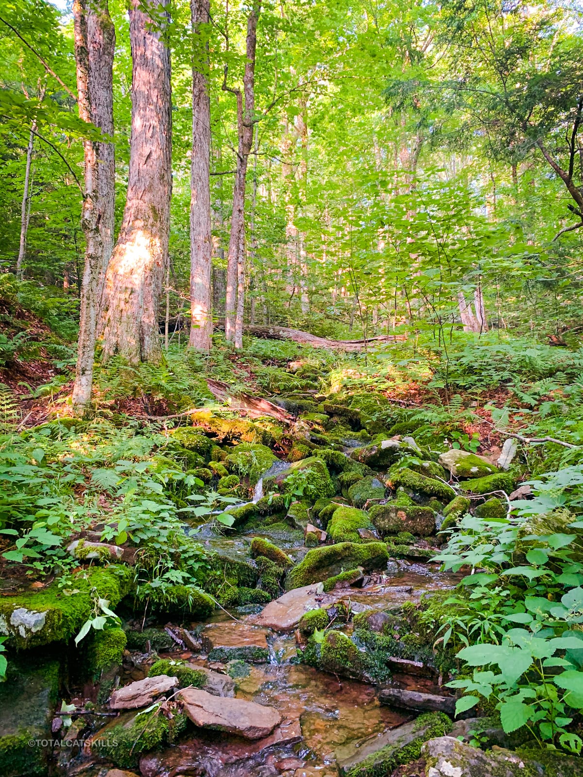
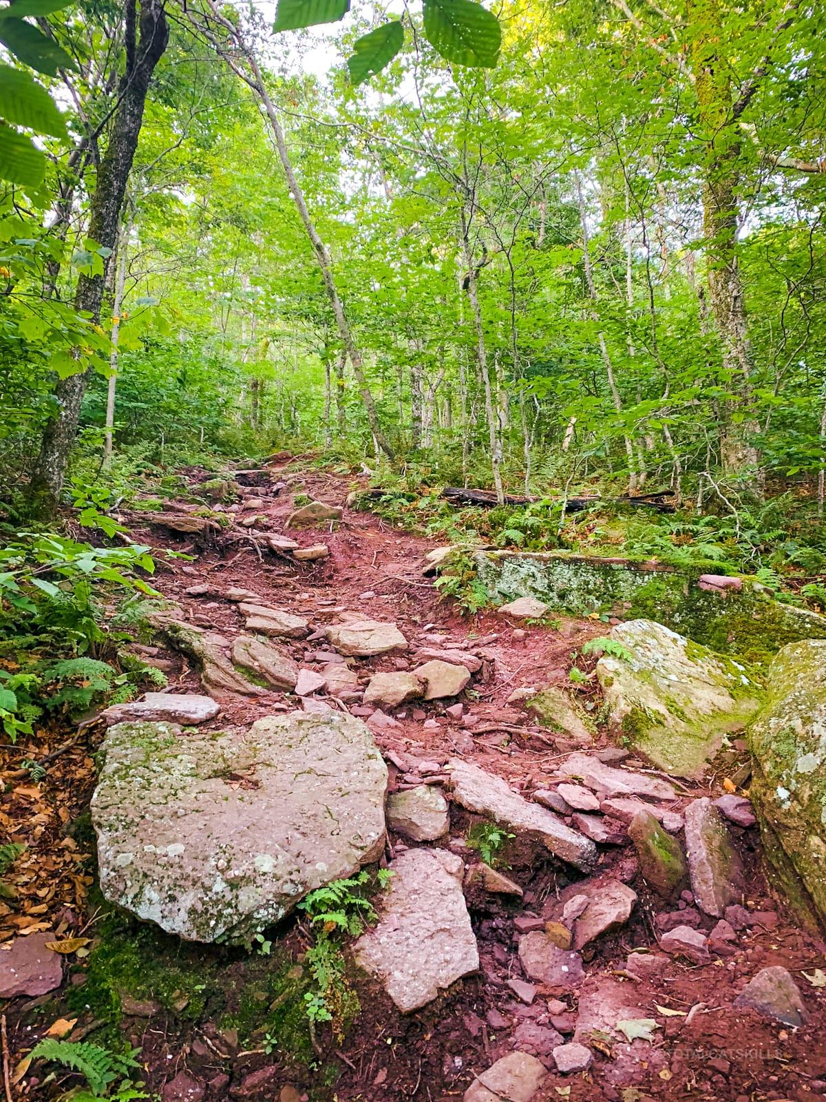
The trail winds uphill pretty easily. There are no technical or tricky sections.
There are lots of ferns on Red Hill. You love to see it.
The trail alternates between short inclines and easier flat sections.
Basically, it’s perfect.
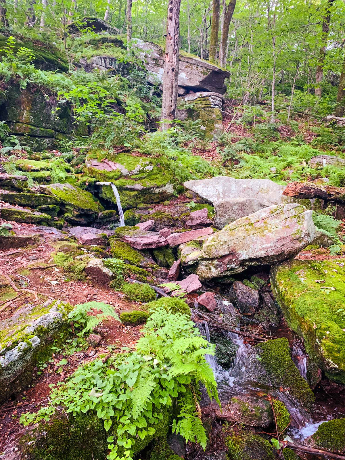
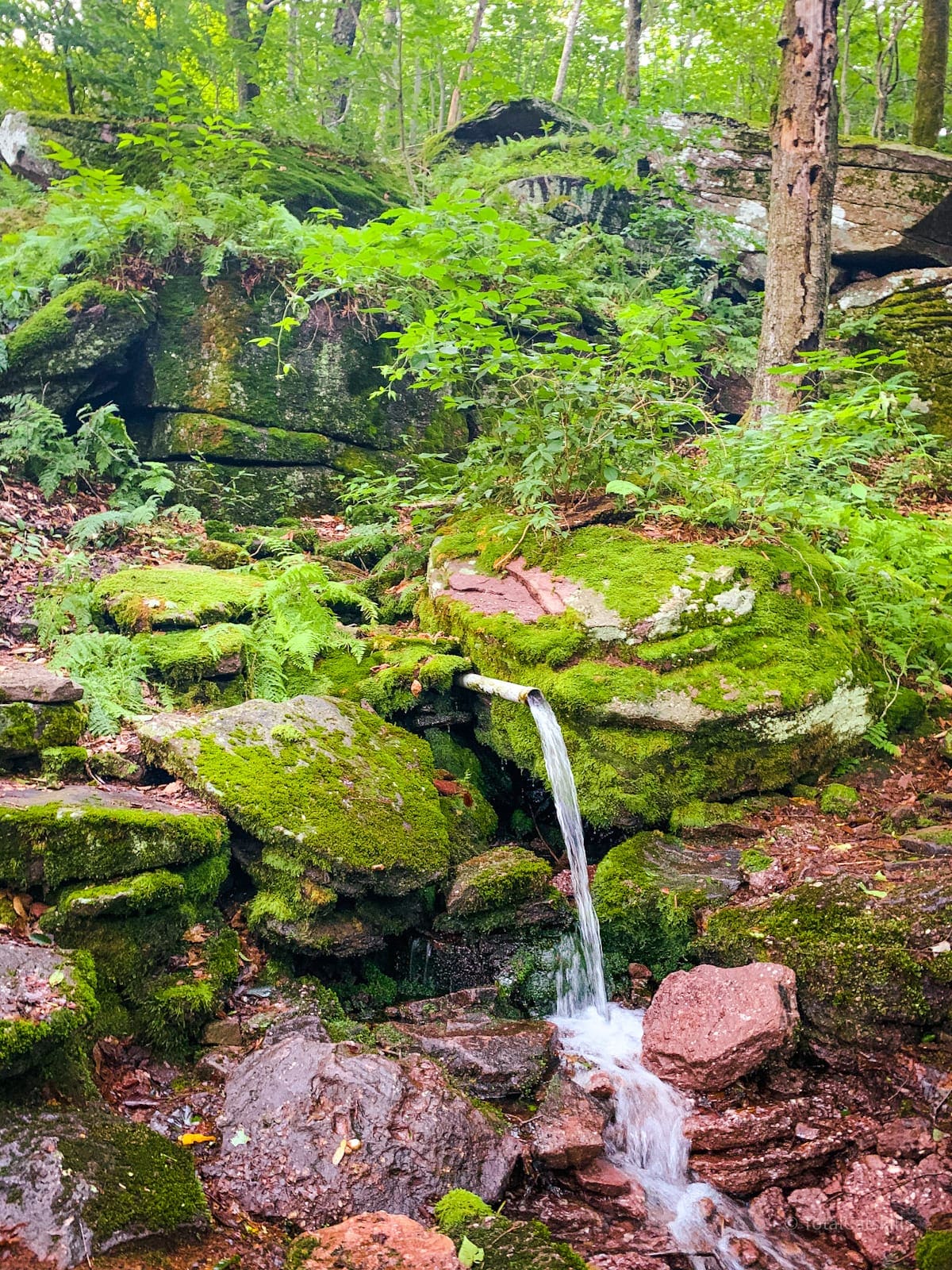
Red Hill Spring
You’ll soon reach this junction. The trail to the fire tower continues to the left. But the short spur trail to the right leads down to a very productive spring in not much more than 200’. It’s definitely worth the extra minutes.
Red Hill seems very wet in general and this spring is the most active I’ve seen so far.
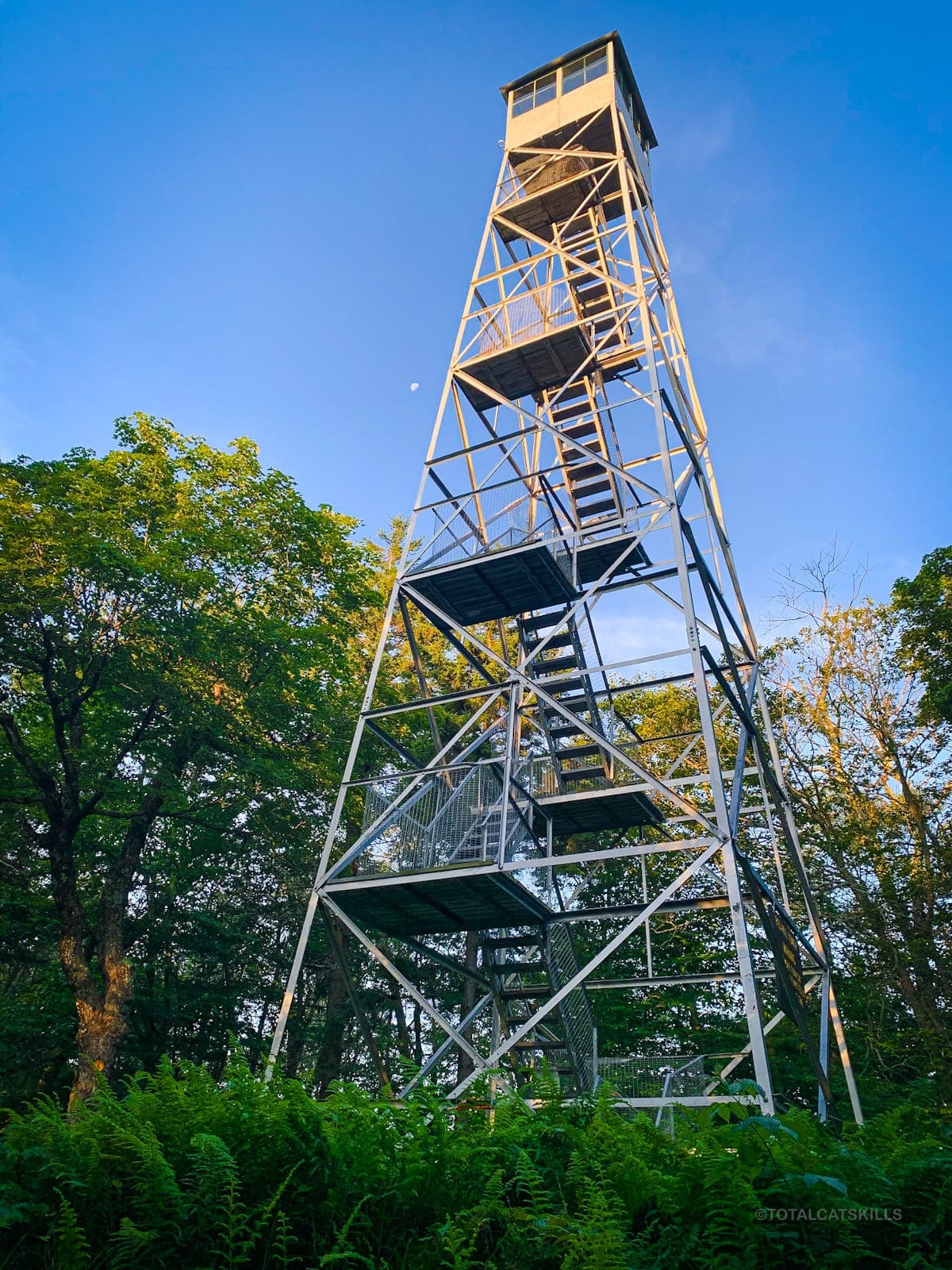
Red Hill Summit & Fire Tower
Back on the main trail, the summit is only about 1000 feet past the junction.
Make your way through the woods to what is perhaps the sweetest Catskills summit.
On the right, you’ll pass the fire tower cabin. To its left is a small outhouse. Both were locked when I got there before dawn, on this morning, as was the cabin.
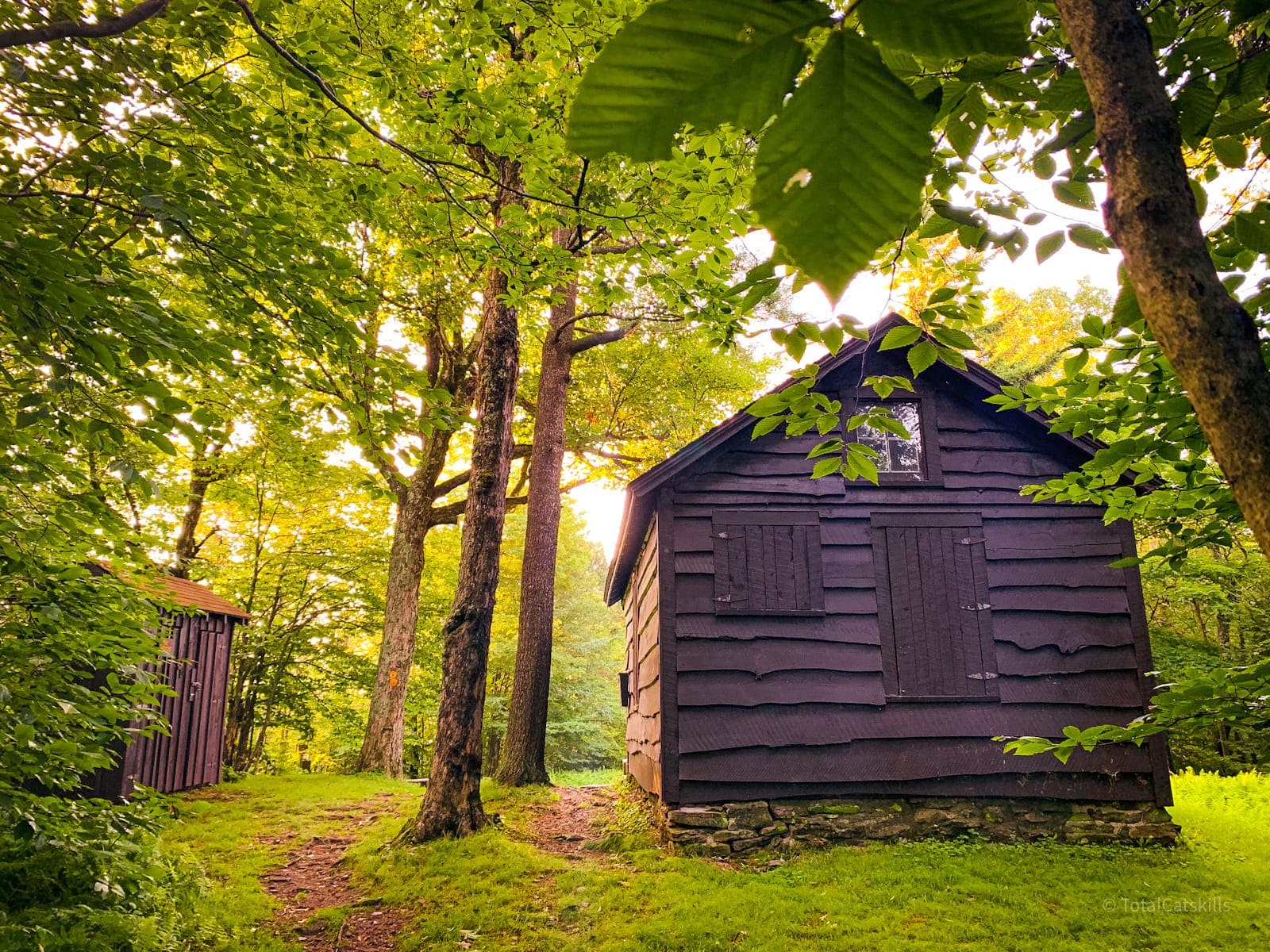
Pass between these small structures to enter the beautifully-maintained summit grounds.
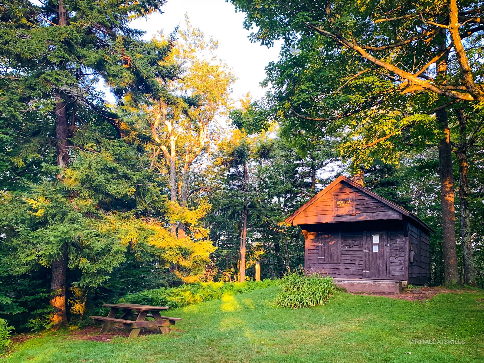
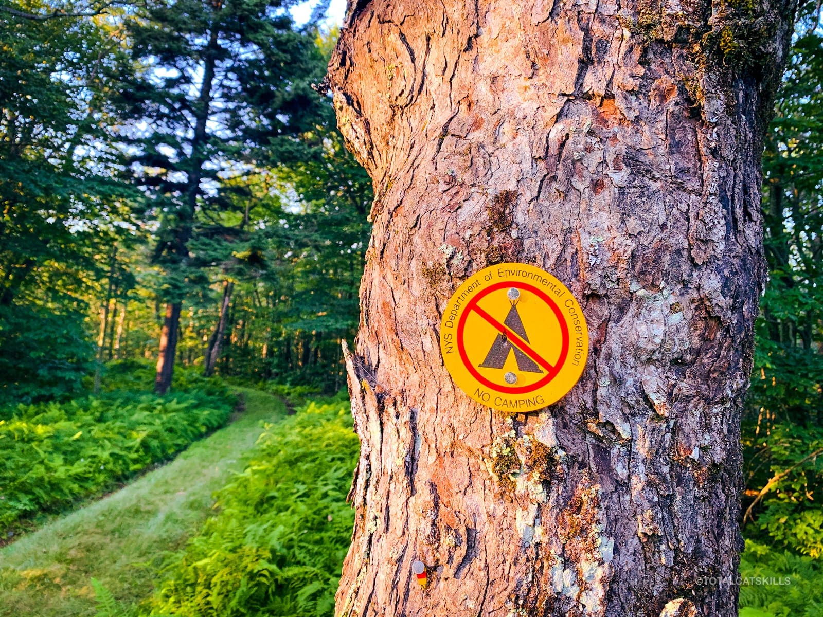
This summit is loved. It’s maintained by the DEC and by volunteers who take exceptional care of this mountain, with particular attention to the summit. Please be respectful and enjoy it fully. Make sure to pack out every single thing you bring in. Leave no trace. This summit is sometimes trashed by ill-raised goobers, which is heartbreaking. Look how beautiful it is…
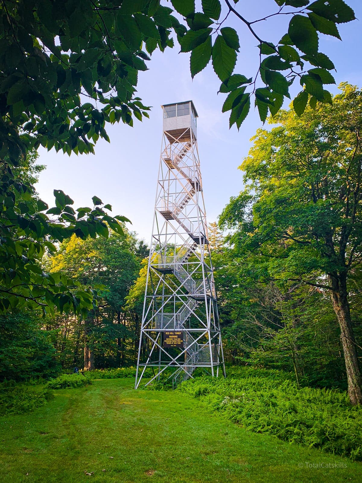
Red Hill Fire Tower
The Red Hill fire tower is 60’ tall. Its cab is open most weekends when staffed by volunteers (from Memorial Day through Columbus Day). On all other days, the tower is open to just below the cab. A large sign says, “NO MORE THAN SIX PERSONS PERMITTED ON TOWER AT ONE TIME”. This is just a physics thing. Please don’t mess with physics.
No Camping, No Trashing
Please also understand how delicate these mountains are. The flora and wildlife in the Catskills Wilderness is hyper-sensitive to overuse and to trash of any kind. If you carry it in, carry it out. Leave no trace.
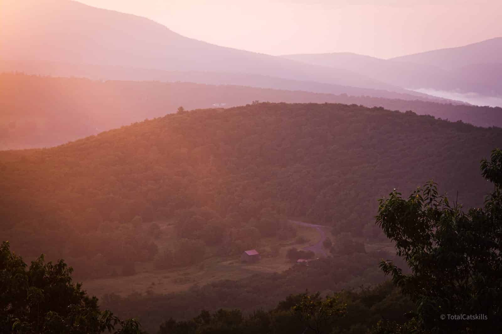
Fire Tower Views
I got to this fire tower around 5:30 am which was about 40 minutes before the sun popped above the ridges to the east. Sunrise colors are often best before dawn, as the sun’s rays light up the clouds from below the horizon. (Get a ton of sunrise photography tips here.)
At Red Hill, all the drama is to the east…
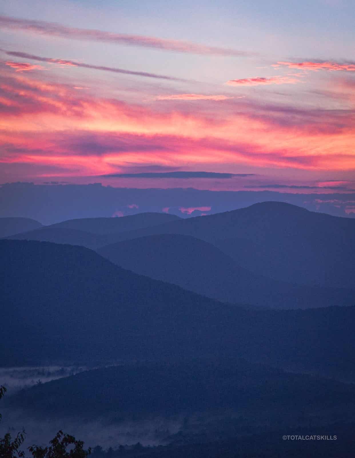
These layers in order of distance (starting with the closest large mountain) are: Woodhull, Van Wyck, Table, Lone, and Friday.
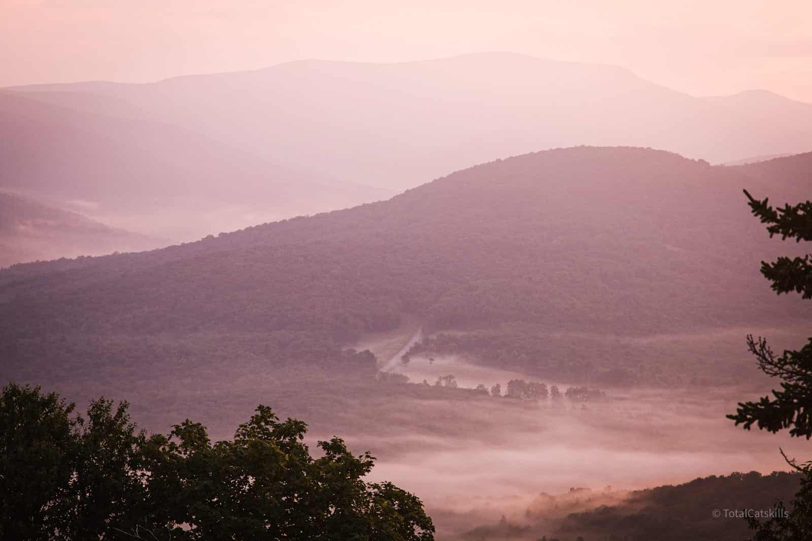
The same scene around 6:20 am…
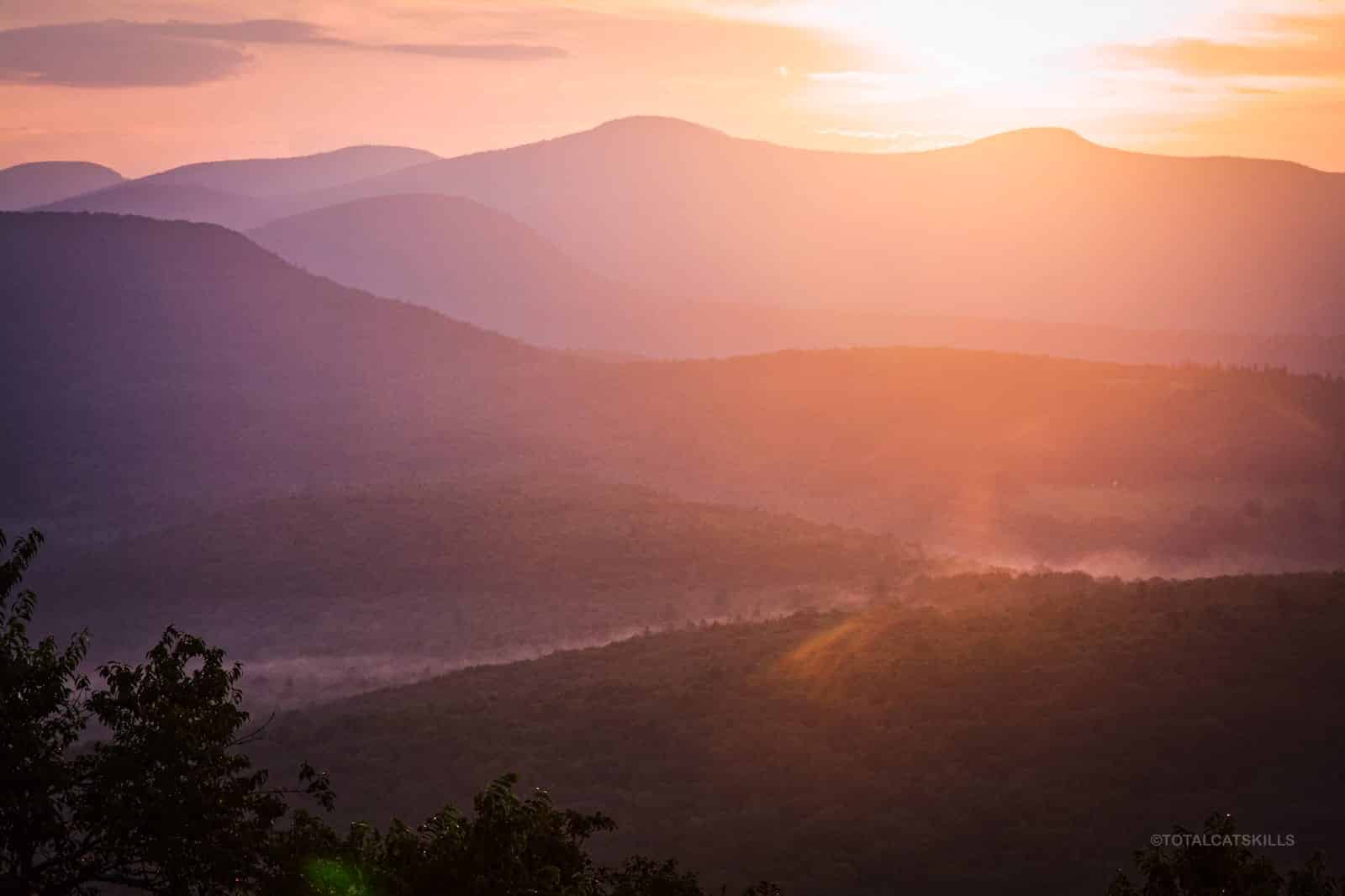
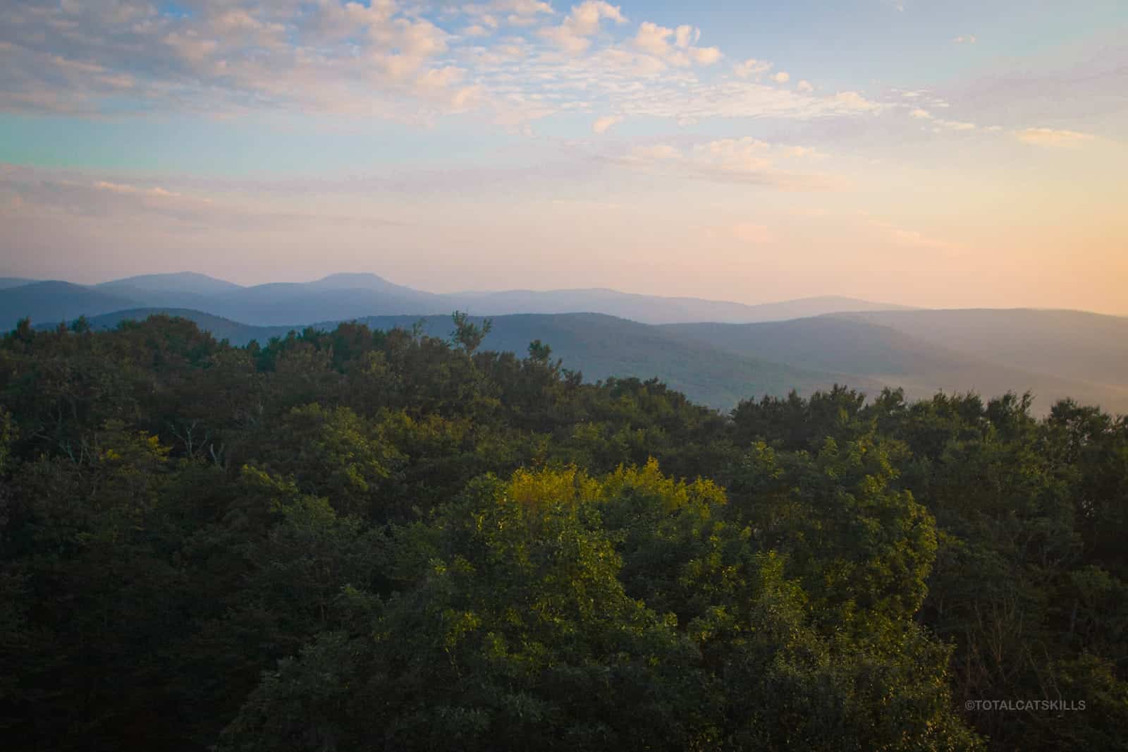
To the north you can see, along the horizon in a line, Graham and Doubletop, Big Indian and Fir Mountain.
This is a very popular destination, which attracts lots of nature lovers — but also a small number of morons who don’t know any better. If you see trash, please pack it out, even though it’s not yours.
Similar Hikes
This hike is short enough and lush enough that it qualifies as a nature walk — it does have some elevation gain, but nothing strenuous.
It’s also a beautiful hike in and of itself.
And it’s definitely an easy, kid-friendly, very scenic hike.
It is absolutely one of the best Catskill hikes.
Get full access…
Get instant access to the full version of this site and enjoy great supporter benefits: full galleries, full trail notes, early access to the latest content, and more.
Hot on the website right now…
Follow for more…
Follow my @TotalCatskills content on Instagram for regular hiking inspo and safe, inclusive community.
The parent mountain for this hike is Red Hill.
If you do this hike, LMK how it went…
6 responses to “Red Hill Fire Tower Classic Trail”
Your comments are welcome here…
Trailhead Info for this Hike
Medium sized lot that holds 6-8 cars.
Google Maps Location: 41.929954, -74.506906
The map below shows the exact topographic location of the trailhead
Cell Service
Decent signal from the fire tower. Elsewhere, very sketchy. My network is Verizon. YMMV.
What is the exact address of this trail? I want to be able to type it into my Waze app. Thank you. Name is Matt by the way
Hi Matt. Addresses in rural areas are not exact I can’t give a precise address for this trailhead. But it’s on Old Dinch Road. You can use the link to see the exact location in Google Maps.
Ty Sean. I was thinking of coming one Saturday morning. Was planning on arriving may around nine in the morning. Do you think I would find parking at that hour on a Saturday? I know weekends are worse than weekdays but figured if I got there early say around nine. Thanks for the info. Look forward to your reply. Oh and about how long does it take to hike to the top?
I’d guess you should be fine. There are now two trailheads for this mountain. A new trail opened on the other side of the summit recently. See notes on the website. Both hikes are quite short. There’s an article on the site about how to figure out your hiking pace: “how long will my hike take?”
That spring looks inviting. Can you drink from that?
Not without filtering or treating. At least, I wouldn’t. (You’d be gambling with getting giardiasis.)