Disclosure: This content may contain affiliate links. Read my disclosure policy.
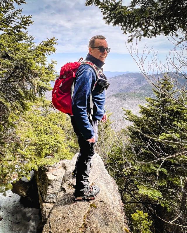
A full loop up and over Balsam Lake’s summit. The southern ridge is steep, which is what males this hike "moderate" rather than "easy".
Hiking Trail Description
This route to the Balsam Lake fire tower pairs one of the easiest ascents of a Catskill high peak with a super fun descent down the far side of the mountain.
I also tried to find a scenic view, and visited a lean-to.
Balsam Lake is one of the two high peaks I typically recommend to new hikers who are curious about hiking The Catskills — the hike in is very straightforward and the payoff is exceptional.
This trail guide is free to all readers thanks to my subscribers. Get full access to this website instantly and enjoy unique supporter benefits.
You might also enjoy…
- Updated › Wittenberg & Cornell
- Updated › How to Winter Hike: The Essential Roundup
- Follow › Sean’s content on Instagram
- Identify › Bobcat/Coyote Tracks and Bear Prints
- Explore › Easy Hikes
- Hike More › Catskills, Adirondacks, Hudson Highlands, Gunks
Balsam Lake Fire Tower Hiking Trail
The Balsam Lake Fire Tower hiking trail includes…
- Easy mountain hike option
- Tougher loop route option
- Incredible 360° wilderness views
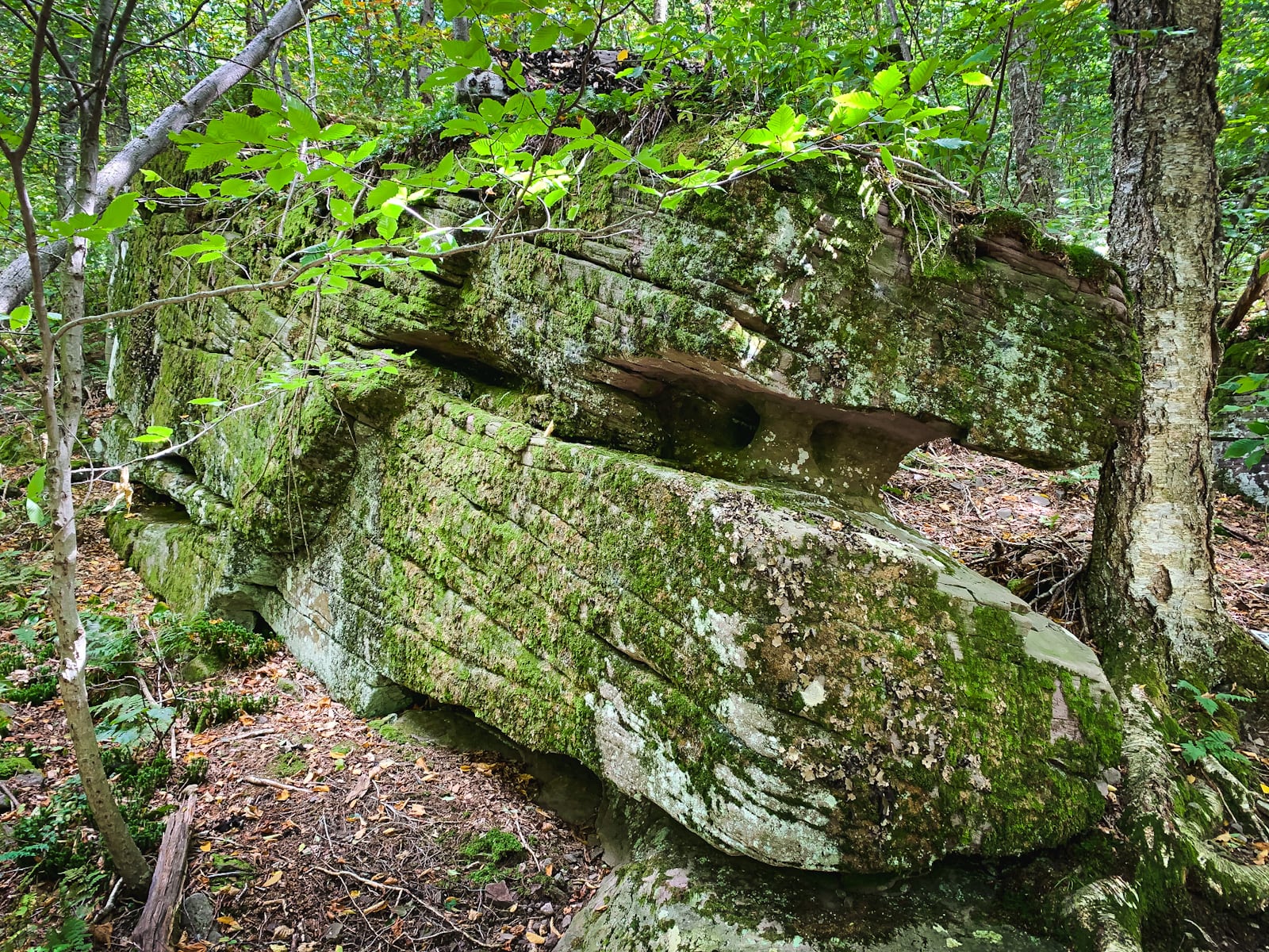
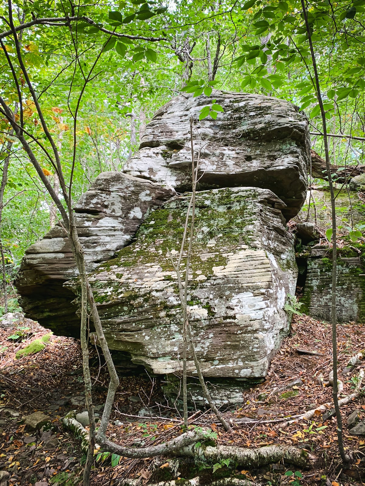
- Interesting geology
- A mountain spring
- A wonderful lean-to
- A dense Balsam forest
It’s easy to drive past the parking area for Balsam Lake because it’s directly after a curve on Millbrook Rd. The DEC lot is large, with two entrances and a very full information kiosk.
Balsam Lake Fire Tower Trail Notes & Gallery
There are no tough sections on this route to the summit of Balsam Lake; it’s easy mountain hiking the whole way.
Like the hike up Slide Mountain, the whole ascent takes barely 90 minutes but this route is even easier.
Hiking Slide Mountain from Route 47 sometimes involves an immediate river crossing, and has a rocky section, plus a few steep inclines.
In comparison, hiking to Balsam Lake Fire Tower feels like walking on an airport travelator.
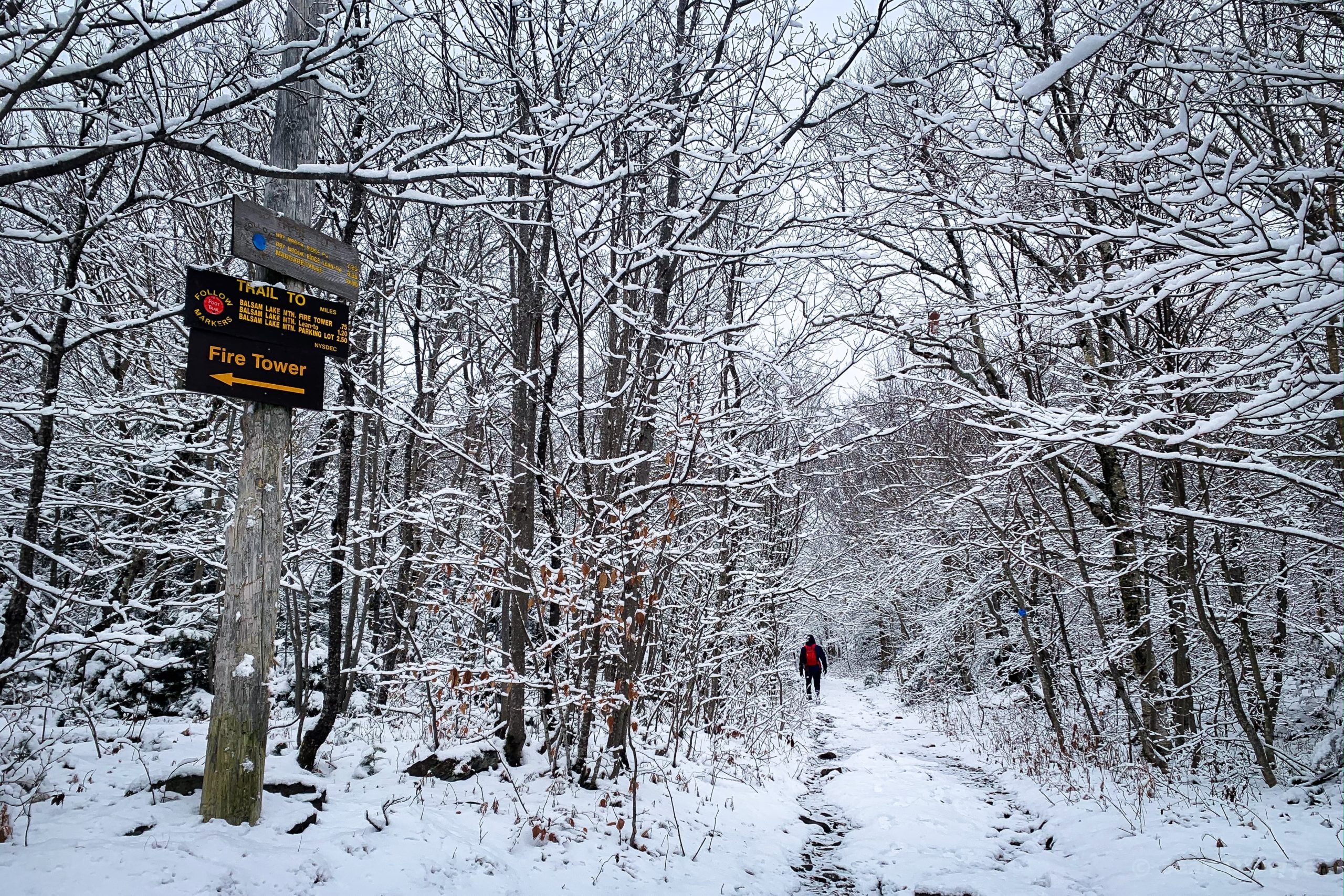
Start at the information kiosk…
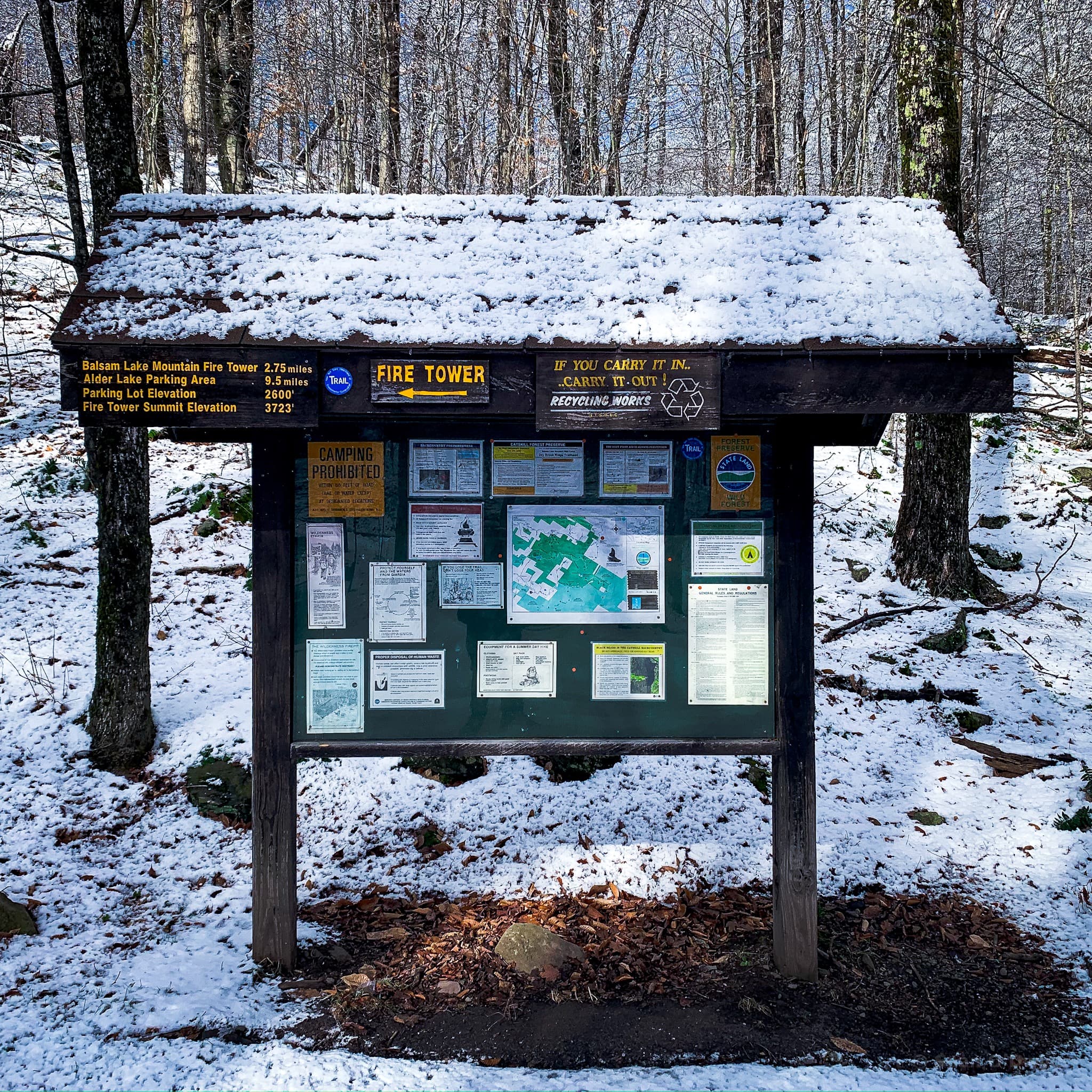
Notice the sign for FIRE TOWER which points to the left.
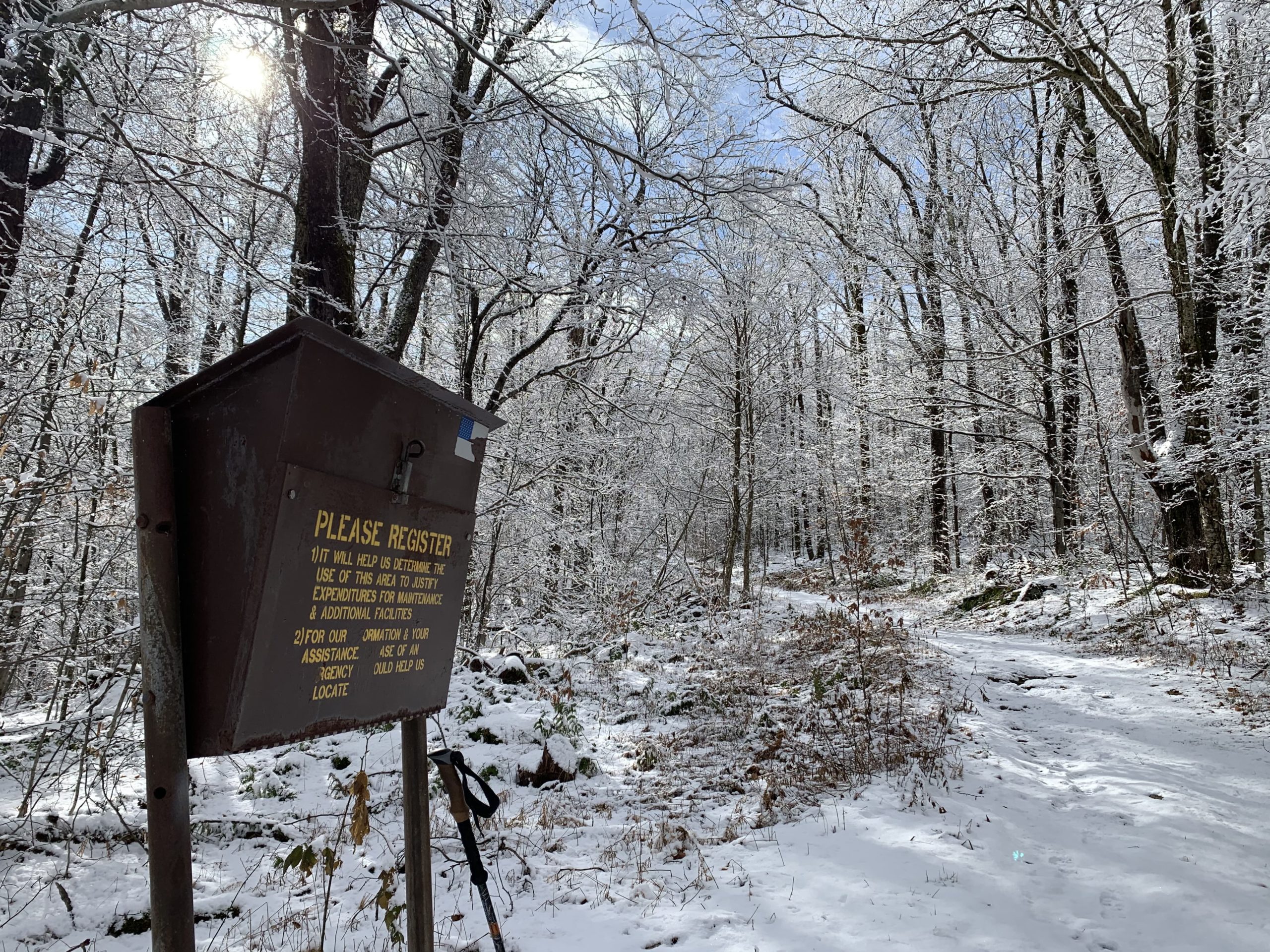
Leave the parking lot, cross the road, and pick up the blue trail which ascends immediately from the opposite side of the road.
Note: The trail register for Balsam Lake is quite a distance from the road, so don’t be surprised when you don’t get to it immediately.
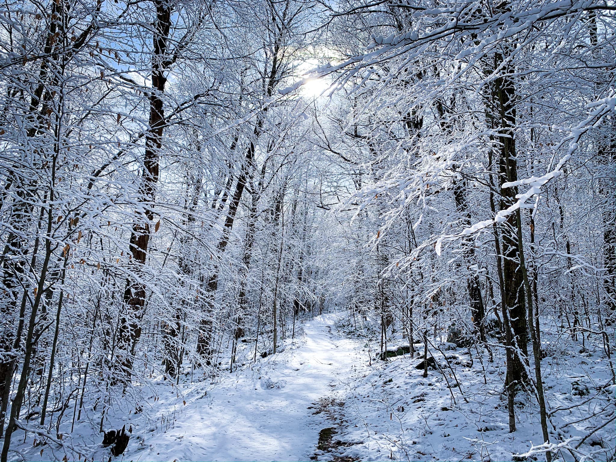

The first mile has a moderate amount of incline. The second mile is a mix of long flat sections, and even a little elevation loss.
Balsam Lake Signposts
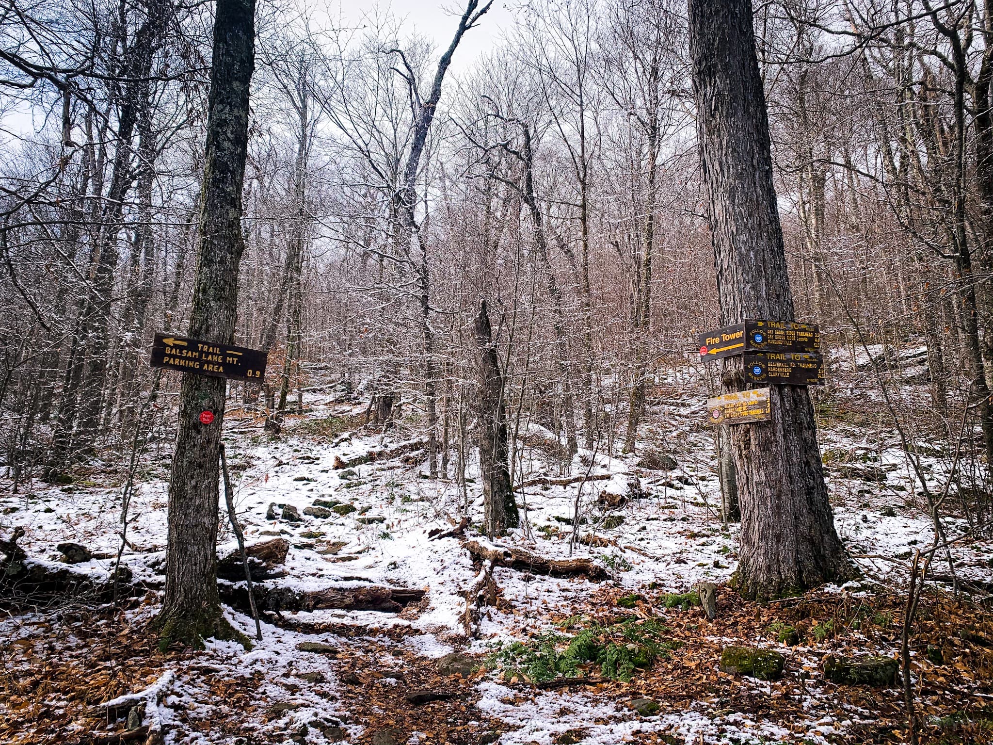
Continue to reach the signposted junction where the trail splits.
Head directly to your right, along the red-blazed trail.
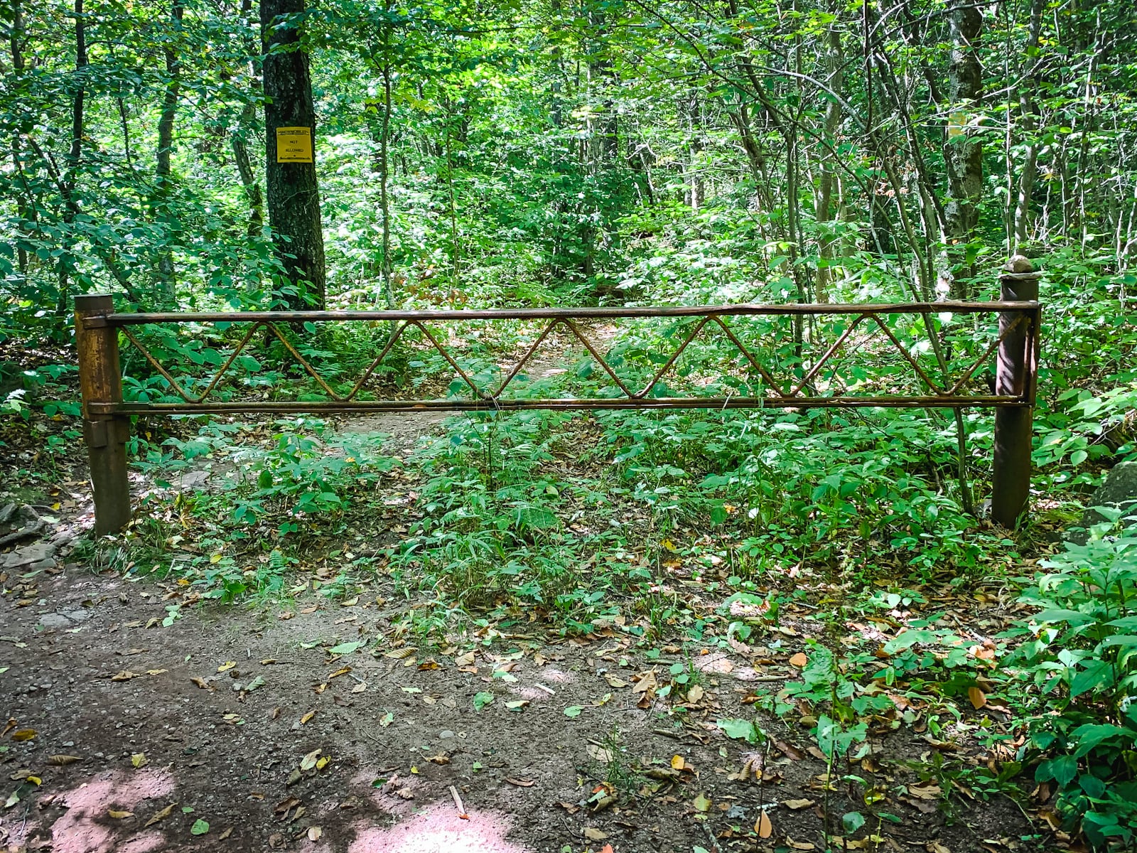
Pass around the gate and continue climbing.
There are several steep/flat switches.
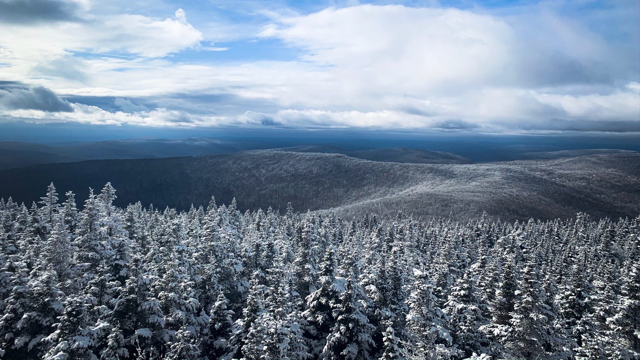
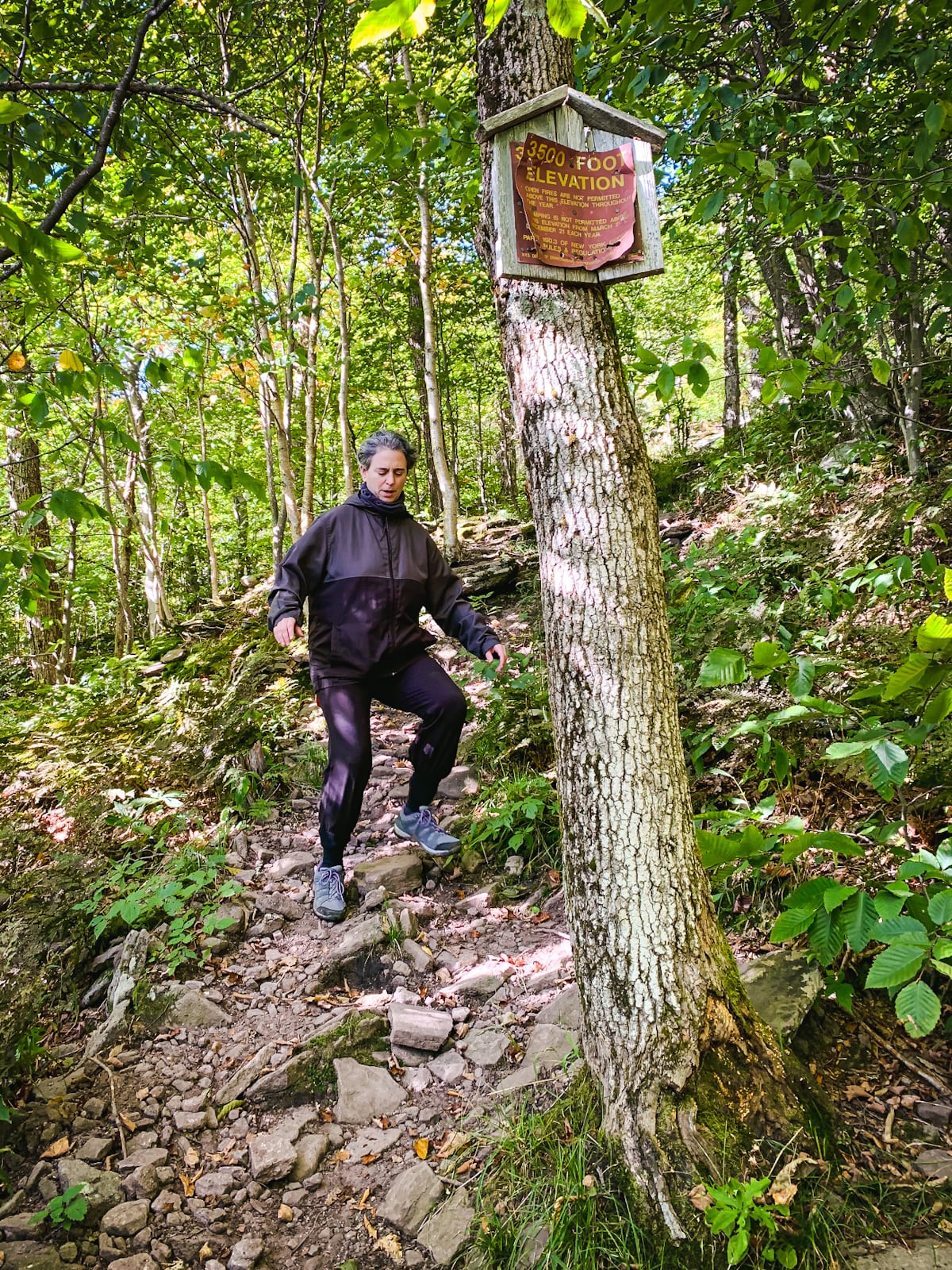
Not long after the 3500 FOOT ELEVATION sign, the woods change suddenly from deciduous to a massive stand of fir trees.
Finally, the trail flattens out along the summit ridge. It’s very pleasant.
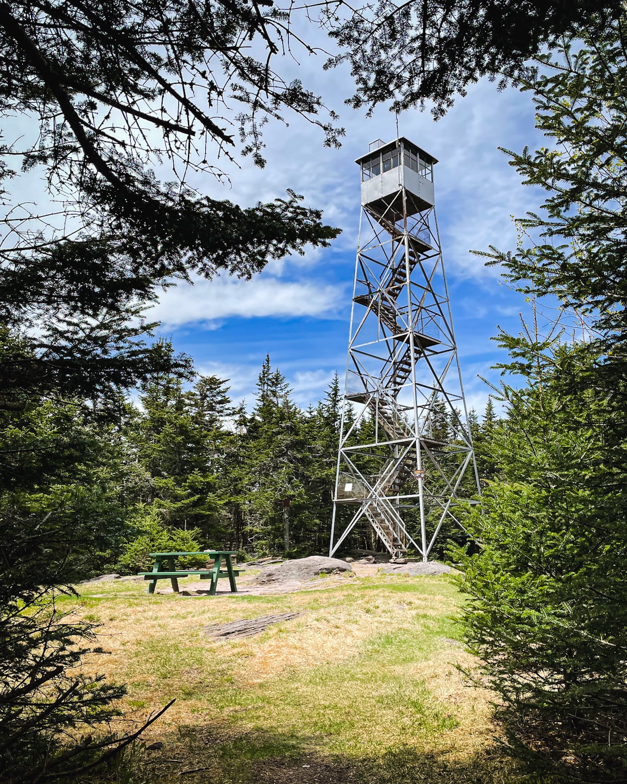
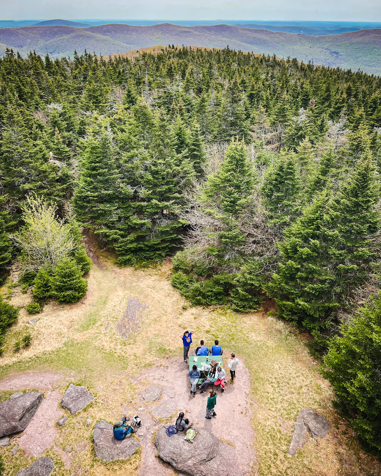
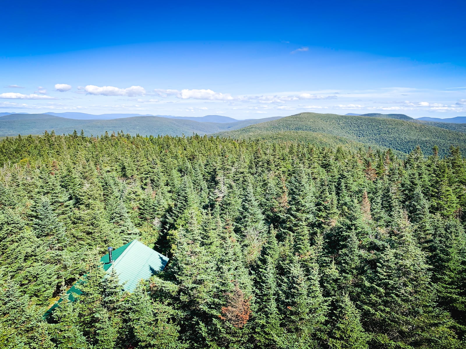
After just a few minutes in the pine woods, you’ll pass the observer’s cabin on your right and then enter the clearing with the picnic table and the fire tower. At the edge of the clearing, you’ll pass this gorgeous old weathered signpost…
This is the summit of Balsam Lake Mountain.
Balsam Lake Fire Tower
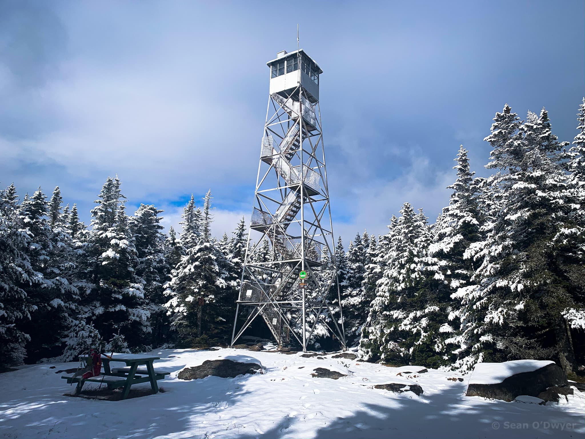
The fire tower, here, is one of the true gems of the Catskill Park.
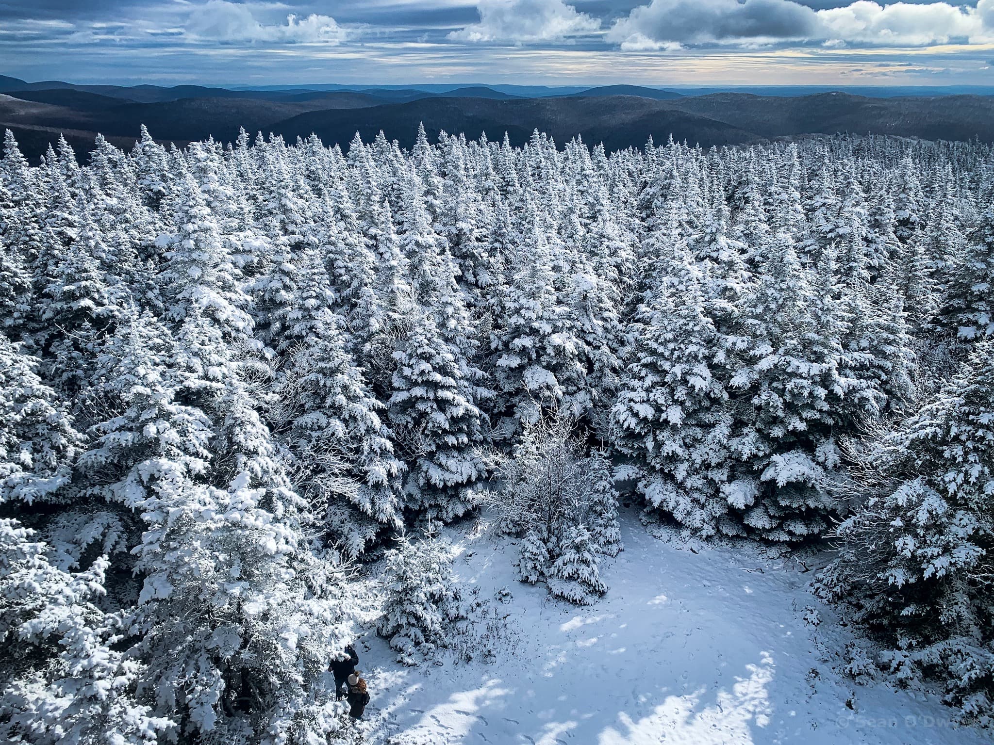
The views from the cabin extend for miles, all around. In every direction, there’s almost no indication of human habitation. The scene is primordial.
If the tower cabin is closed, as it is most of the time, you can still climb the tower; just not all the way. It’s well worth getting over your heebeejeebeees…
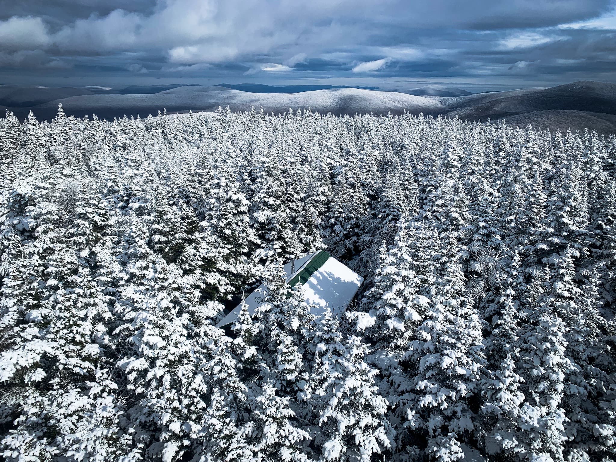
The wind up there is often bananas. You can hear it on this video. I didn’t stick around long. I took my shots and scurried down the tower. This has been the case with almost every visit I’ve made to this tower — it’s always crazy windy and wind-chill-y up there!
It can be difficult to orient yourself up there but the observer’s cabin is a big help.
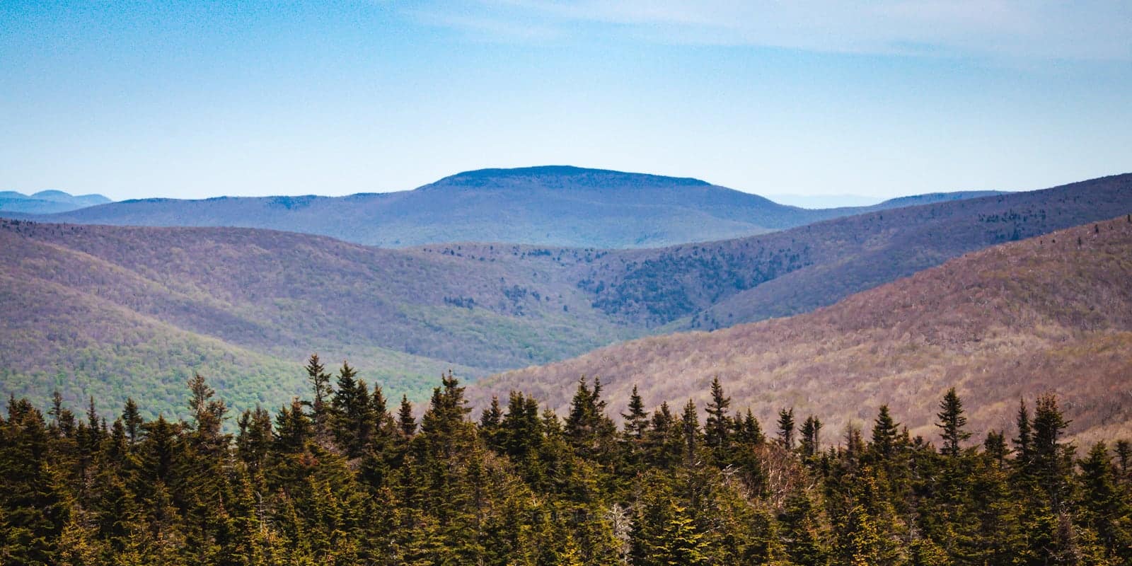
Once you climb the tower, the roofline of the cabin points away, roughly to the east — toward the southern Catskills. The large mountain in the foreground is Graham. Beyond it, to the right, you can see Slide, Doubletop, Lone, Table and Peekamoose.
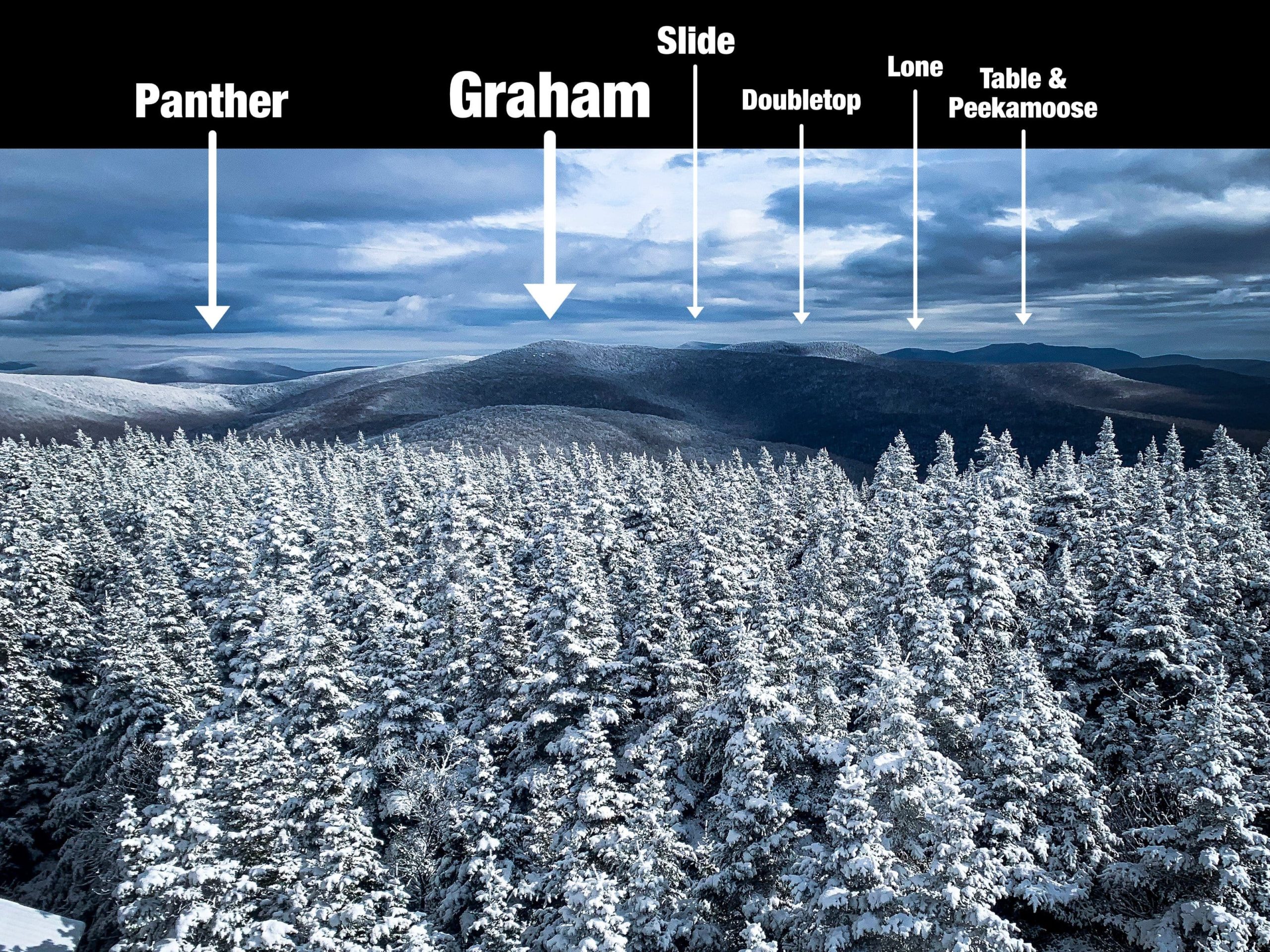
To the left of Graham, Panther Mountain is also visible. From this angle, it looks incredible; you can see the long northern flat ridge that forms Fox Hollow, and that enormous evergreen summit…
I think Eagle Mountain and Haynes may also be visible. They’d be to the left of the above photo, out of frame.
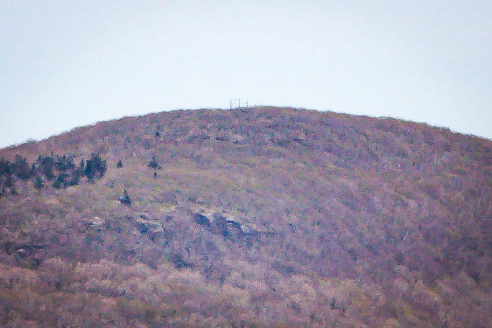
The ruins of the repeater station on top of Graham are clearly visible from Balsam Lake…
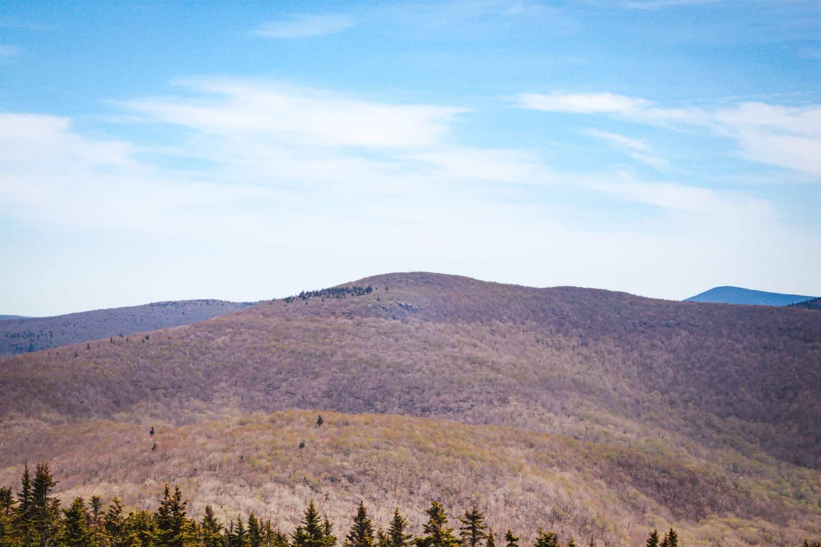
I remember seeing Balsam Lake’s fire tower from Graham’s summit the last time I was up there. I love seeing one summit from another and then, later, reversing the view.
Now that I know what I’m looking at, I can’t wait to get back up there with my good lens.
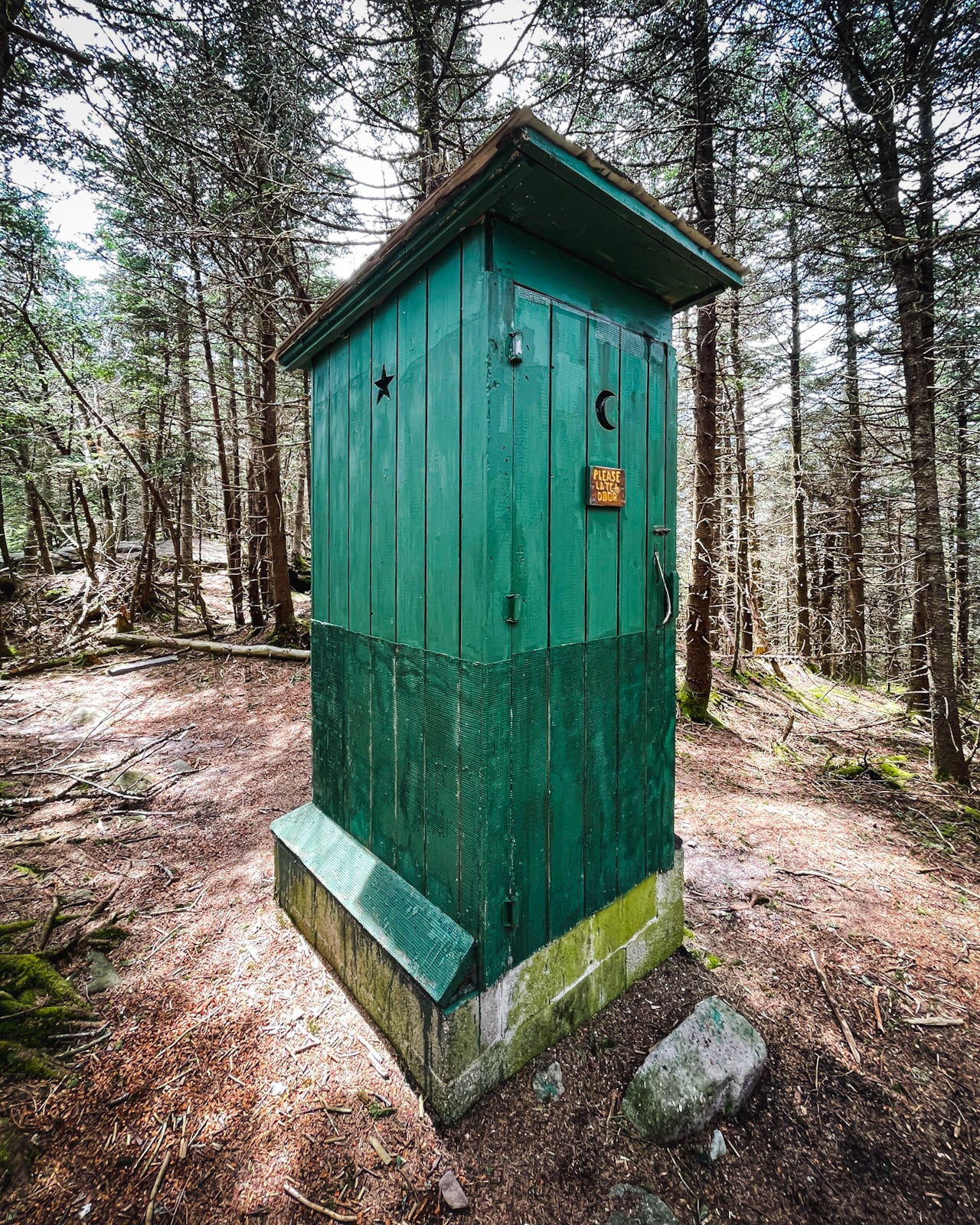
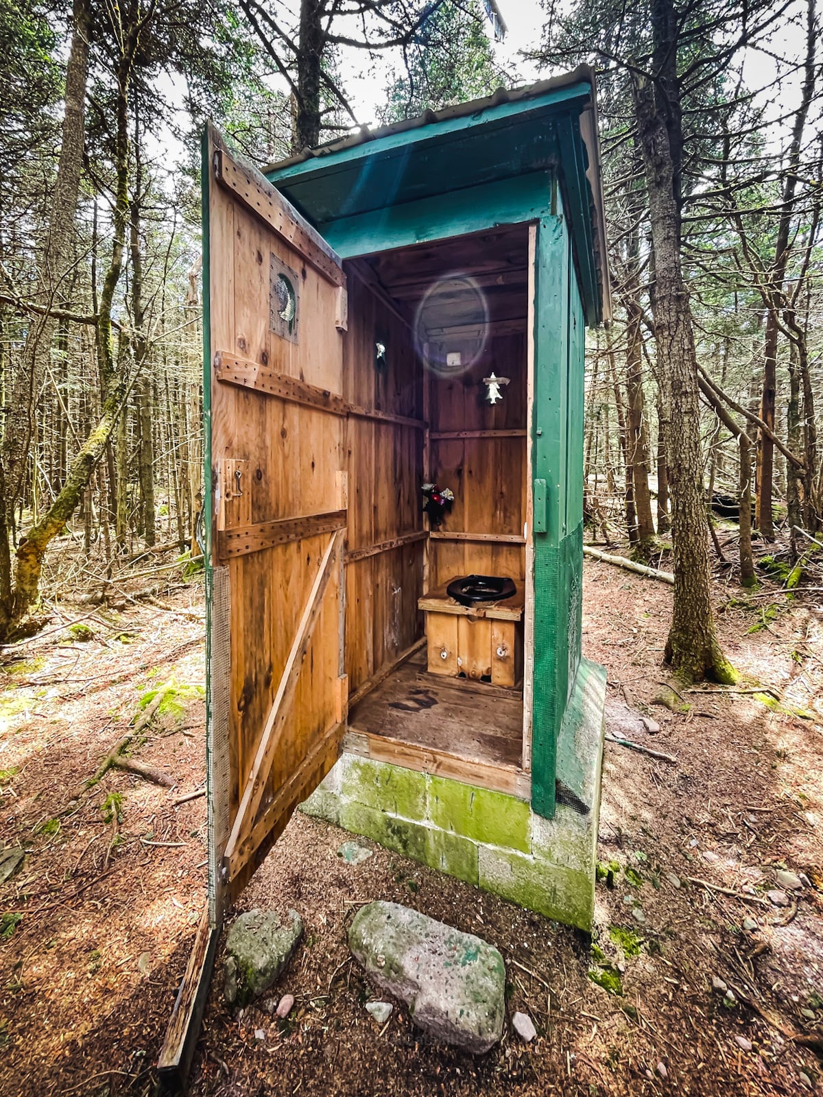
Balsam Lake Privy
This privy is so nice, it deserves special mention. Please treat this glorious poop TARDIS with great care. It’s a true Catskills gem.
Hike Out
At this point, most people turn around and head back out the way they came in. To do this, simply head back toward the observer’s cabin and downhill. At the junction, turn left and head out to your car on Millbrook Road.
However, if you’d prefer a more adventurous descent, you can also return via the more challenging (and far more beautiful) southern route…
Balsam Lake’s Southern Ridge
When you first came into the clearing, you may have noticed another opening in the woods on your left. From the tower, if you look down at the picnic table, you’ll see it clearly.
This trail leads down the steep south ridge. The character of the trail going down the south side of the mountain is very different from the trail you came up. It’s steep and rugged, and much more authentically Catskills.
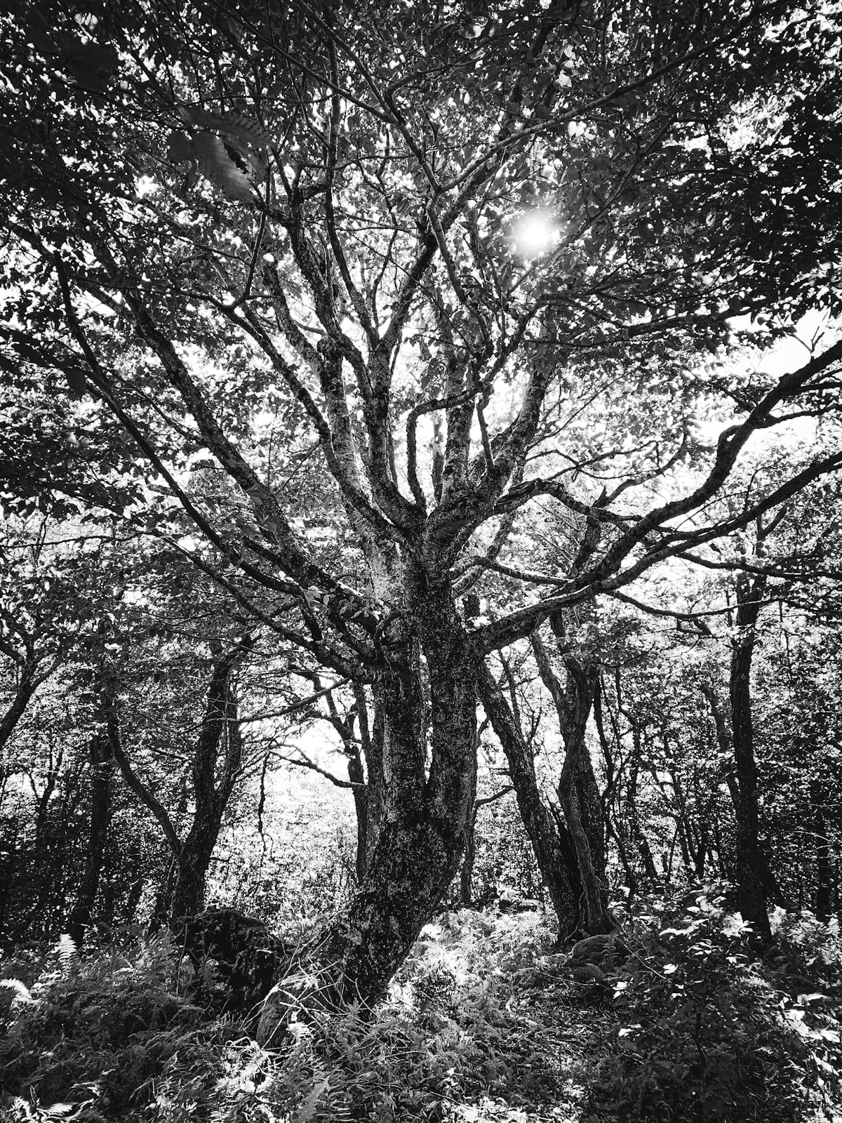
There are some fantastic old trees…
In these conditions, even with an inch or two of snow on the ground, I’d been able to bare-boot my way to the summit. Not for the descent. Before heading down, I put on my microspikes.
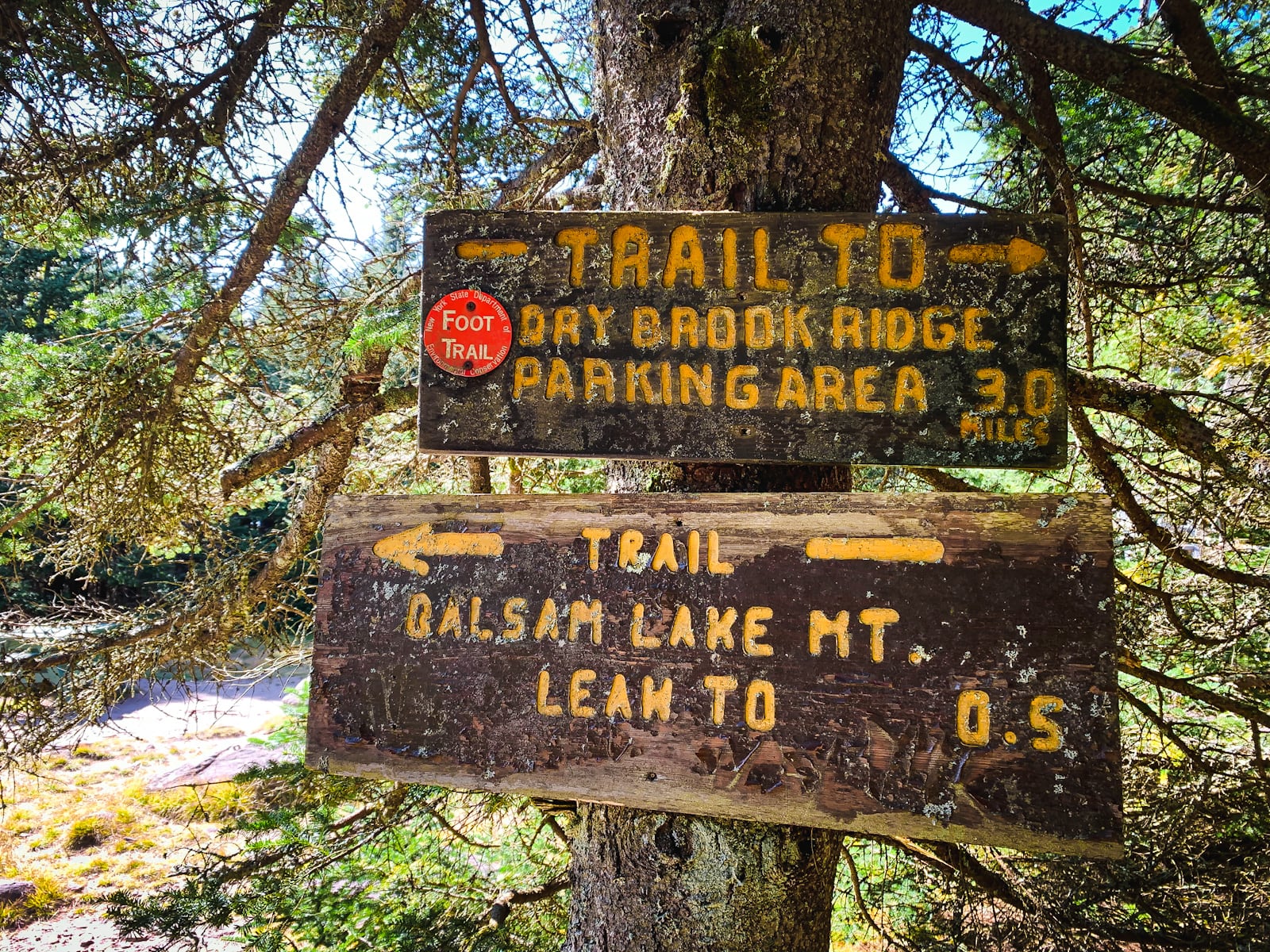
The trail descends gradually at first, until the first junction, where you’ll see signs on the right for Mill Brook Ridge.
Scenic View…
Not far down that trail, there’s a scenic view marked on the NYNJTC maps that I wanted to check out. You lose some elevation, and there’s an intense switchback which you can see on my Gaia track.
Through the trees, I saw what I think was Woodpecker Ridge. But I found no amazing lookout. Stepping off the trail right here to bushwhack didn’t seem wise; it’s very steep at this spot. More research needed, I think.
I re-climbed to the junction, turned right, and continued down the red trail.
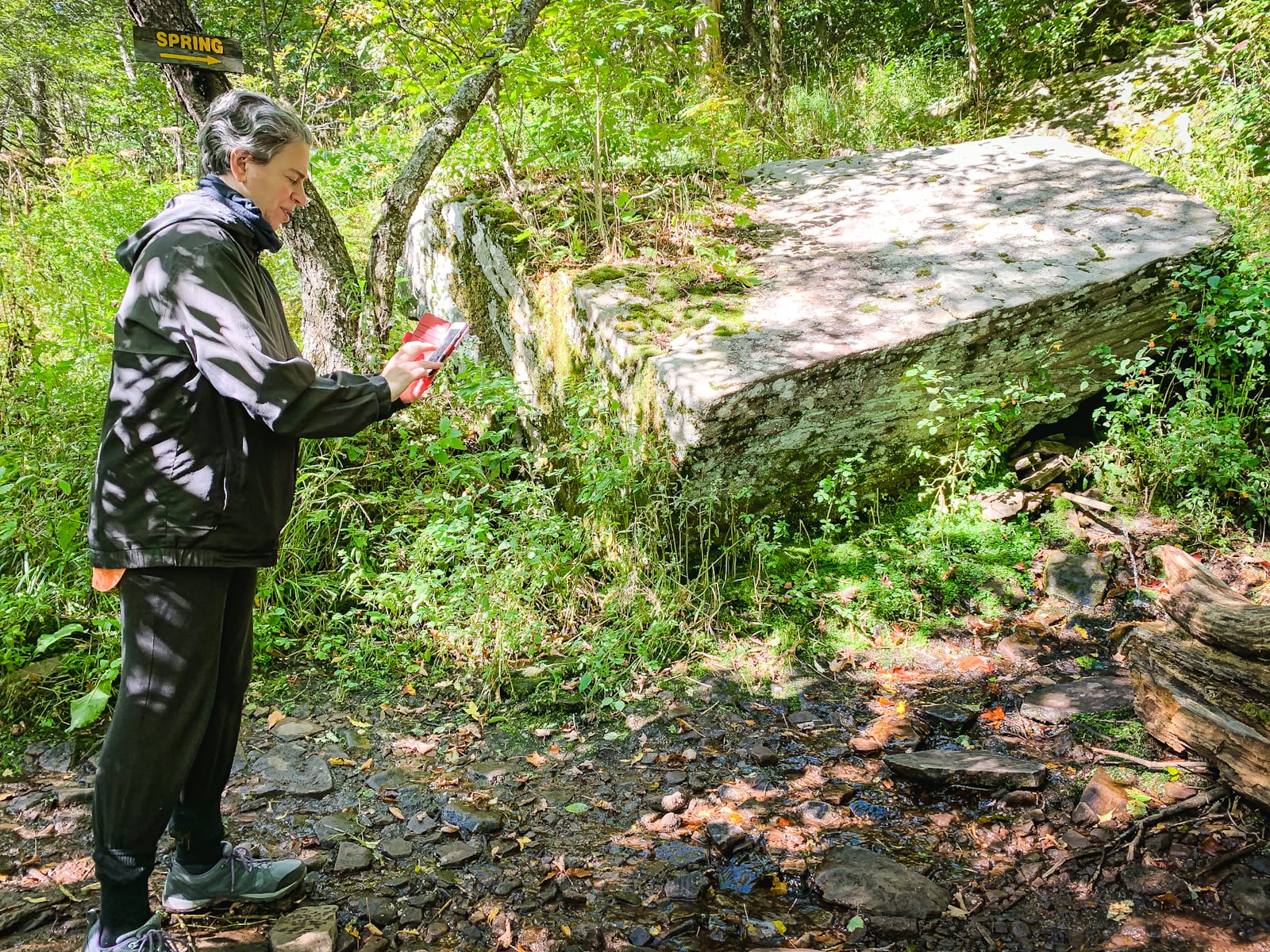
Balsam Lake Spring
The spring not far below always seems to be flowing pretty well. You come to a large, very-rectangular boulder and the spring is just to its right — a small metal pipe sticking out of the mountain.
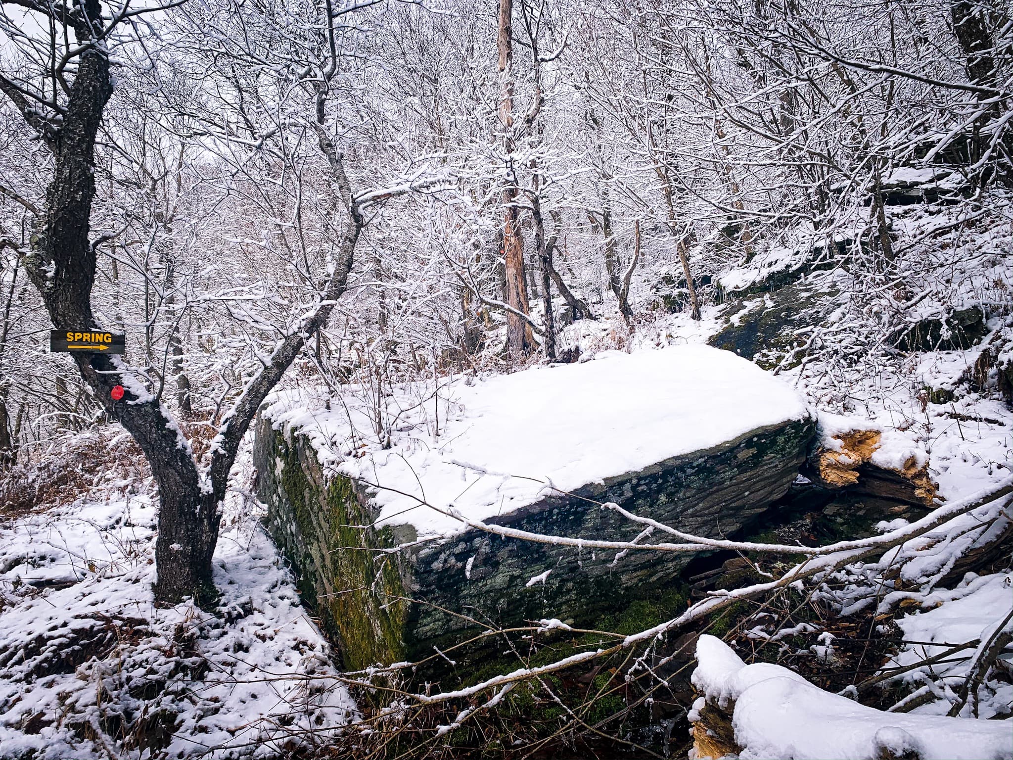
Below here, the trail is very steep. If there’s any snow or ice at all, you’ll absolutely need microspikes or snowshoes.
Balsam Lake Lean-To
The next side-trail leads down to a very sweetly-situated lean-to. The blazing is patchy so keep your eyes peeled, but it’s not far down the trail.
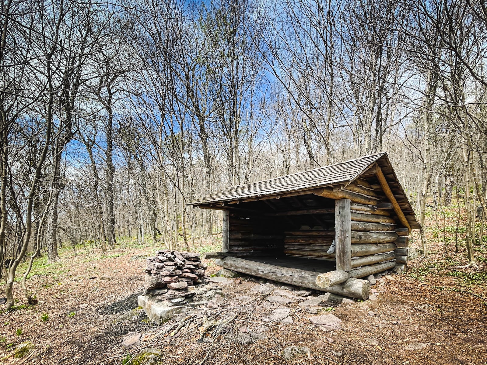
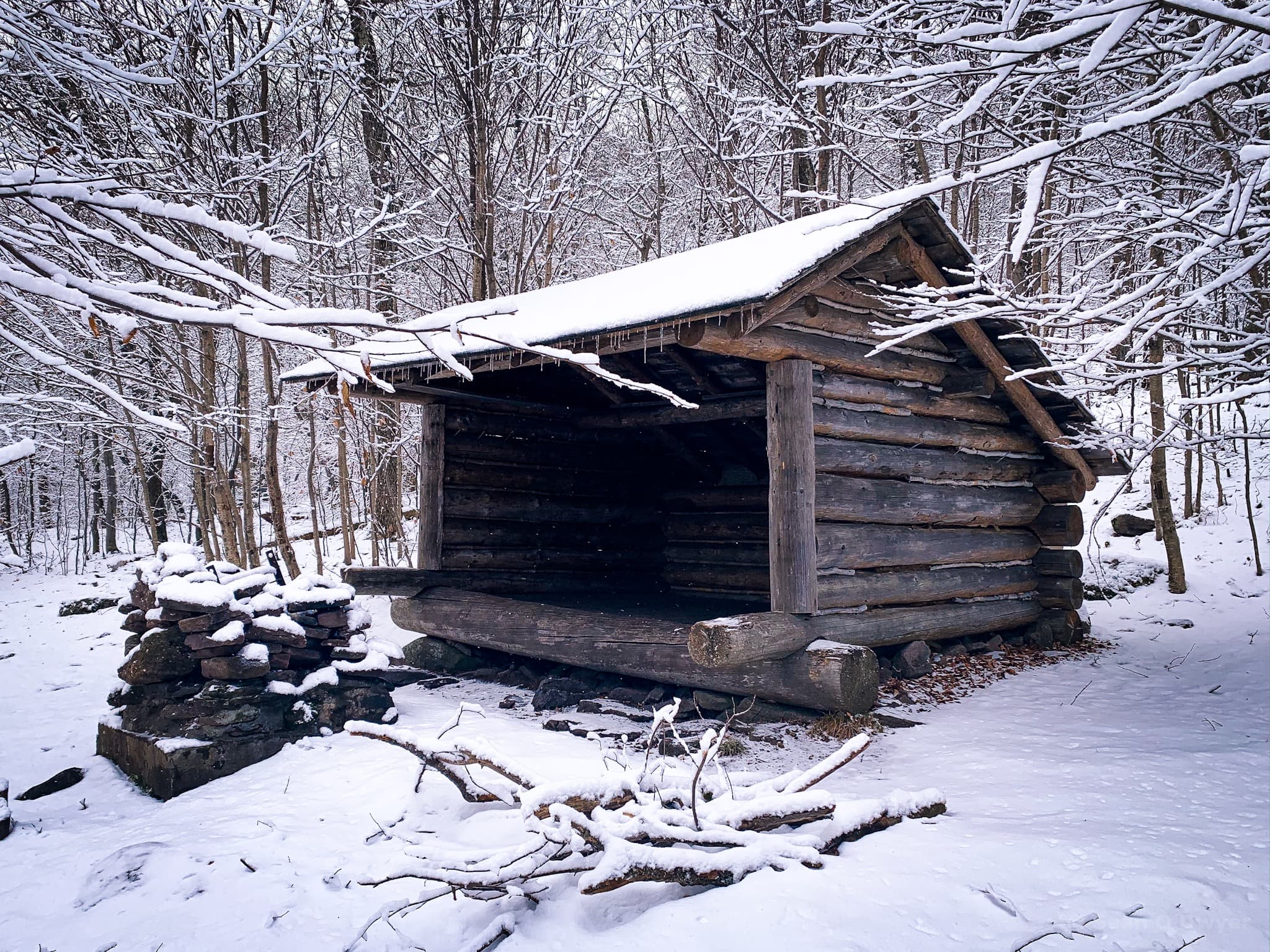
I hung out here for a few minutes — it’s extremely peaceful — then headed back to the main trail.
The trail continues winding down the mountain, sometimes steeply, sometimes more easily. The blazing is pretty good. Eventually, reaching the bottom, you’ll reconnect with the blue trail.
This view is looking back up the trail I’d just come down…
Turn north/left. It’s just a mile back to the junction with the red trail which you took up to the summit. I do trail maintenance on this section of trail. It’s nice and quiet here, too; I don’t think this trail mile gets used a ton.
The brook downhill to your right is Black Brook.
From the junction with the red trail that goes up to fire tower, it’s 2¼ very easy miles to your car.
Similar Hikes
If this is one of the few Catskill Mountains you’ve climbed, I encourage you to tackle the remaining easier peaks.
Maybe you’ll even try Indian Head. Maybe it’ll change your life the way it changed mine.
Read More
Get full access…
Get instant access to the full version of this site and enjoy great supporter benefits: full galleries, full trail notes, early access to the latest content, and more.
Hot on the website right now…
Follow for more…
Follow my @TotalCatskills content on Instagram for regular hiking inspo and safe, inclusive community.
The parent mountain for this hike is Balsam Lake.
If you do this hike, LMK how it went…
Trailhead Info for this Hike
Large parking area!
Google Maps Location: 42.070019, -74.574074
The map below shows the exact topographic location of the trailhead
Cell Service
Pretty great for most of this hike. Which, for the Catskills, is quite unusual. From the trailhead (where I was able to send texts) all the way to the fire tower, the signal dropped only a few times. Coming down the south side of the mountain, I lost coverage more frequently. My network is Verizon. YMMV.