Alander
A tranquil, beautiful, scenic mountain with highly-varied terrain and geology.
Peak Details
Height: 2,239ft (682m)
Range: Southern Taconics
Level: Moderate
Scenic: Yes
Trail Type: Fully Trailed
Alander Hiking Trails & Hikes
Alander from Bash Bish
This is a great hike if you crave solitude among mountain laurel and pitch pines, as well as interesting geology — but also enjoy solid scenic views! The parking area is the same lot used by visitors to Bash Bish Falls.
Seasonal Notes for Alander
Spring, Summer, Fall
Like Tremper and Overlook in the Catskills, Alander Mountain is home to many timber rattlesnakes. In the warmer months, they will warm themselves in the sun, sometimes in the middle of a trail. Just be aware, keep an eye out, and give them a wide berth; they are pretty docile creatures unless you get in their space.
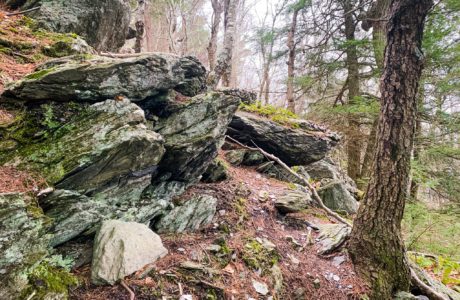
Alander Topography
Summit Forecast: Alander
The page URL below shows the weather at Alander’s summit for the next six days.
If a foreacast for a peak is not directly available, this page may display a link to a nearby location.
https://www.mountain-forecast.com/peaks/Alander-Mountain/forecasts/682
Alander Information
Alander Mountain, located in the Taconic Range on the border between Massachusetts and New York, offers a delightful hiking experience that attracts outdoor enthusiasts of various skill levels. It’s known for its panoramic views, lush forests, and a good mix of terrains. Here’s a more detailed breakdown:
Trail Options
- Primary Trail: The main route to the summit is around 3 to 4 miles one way, depending on your starting point. This trail is well-marked but can be steep and challenging in parts.
- Loop Options: For those who prefer loop hikes, there are ways to combine different trails for a longer and more diverse experience.
- Connecting Trails: Alander Mountain trails can also be connected with other trails in the area, allowing for multi-day hiking opportunities.
Skill Level
- Moderate to Difficult: Most trails are moderate but can have sections that are quite steep and rocky, requiring a decent level of physical fitness.
Scenery
- Forest: Expect to pass through hardwood forests filled with a variety of trees, including oak, maple, and birch.
- Views: The summit offers panoramic views of the Hudson Valley, the Catskills, and even as far as the Berkshire Hills in Massachusetts.
Wildlife and Flora
- You might come across deer, foxes, and a variety of bird species—also rattlesnakes (see the seasonal notes)
- Seasonal wildflowers and ferns add to the landscape’s beauty.
Amenities
- Trailheads: Generally offer parking, but it can be limited.
- Camping: There are designated camping spots in the nearby areas for those interested in overnight hiking.
Safety Considerations
- Weather can change rapidly, so always check forecasts and be prepared.
- Some areas may have limited cellphone reception.
Get full access…
Get instant access to the full version of this site and enjoy great supporter benefits: full galleries, full trail notes, early access to the latest content, and more.
Hot on the website right now…
Follow for more…
Follow my @TotalCatskills content on Instagram for regular hiking inspo and safe, inclusive community.