Disclosure: This content may contain affiliate links. Read my disclosure policy.
The full glorious loop: so much to see.
The Bull Hill (a.k.a. Mount Taurus) Full Loop is a challenging route that’s absolutely packed with views and ruins.
Bull Hill is the mountain directly north of the village of Cold Spring on the Hudson River in New York. This is one of my favorite hikes in the Hudson Highlands. It’s close to New York City and has excellent parking and public transport options.
Get here early because the trailhead parking fills up quickly. Park along 9D if the main lot is full.
Note: In May 2023, NYS Parks introduced significant blazing changes to simplify the trail system around Bull Hill and Breakneck Ridge. This route description is up-to-date and reflects these changes.
BTW, you might also enjoy…
- NEW › Winter Skincare for Hikers
- CATSKILLS › Best Catskills Waterfalls
- STAY › Find Your Perfect Catskills Stay
- ADIRONDACKS › Hike Van Hovenberg
- ENTERTAINMENT › Best & Worst Hiking Movies
- Follow › My Instagram @TotalCatskills
- Follow › My Substack @TotalCatskills
- Follow › My writing for Times Union
Bull Hill Full Loop Hike
The Bull Hill (Mount Taurus) hiking trail includes…
- An enormous abandoned quarry
- Multiple excellent scenic overlooks
- One outrageously gorgeous scenic view
- Some light rock scrambling
- Multiple historic ruins (Cornish Barns and Cornish Estate)
A full breakdown is provided in the hike notes below, with 19 photos.
Bull Hill Full Loop Hike Time
Allow 3-4 hours for this hike.
Bull Hill Full Loop Elevation Gain
You will tackle 1400 feet of elevation gain on this route.
Bull Hill Full Loop Trail Notes & Gallery
Begin at the Little Stony Point parking area just north of Cold Spring, then take the Washburn Trail which follows an old road to an abandoned rock quarry. The quarry itself is striking, but the views from above the quarry mark the start of the amazing scenery on this hike…
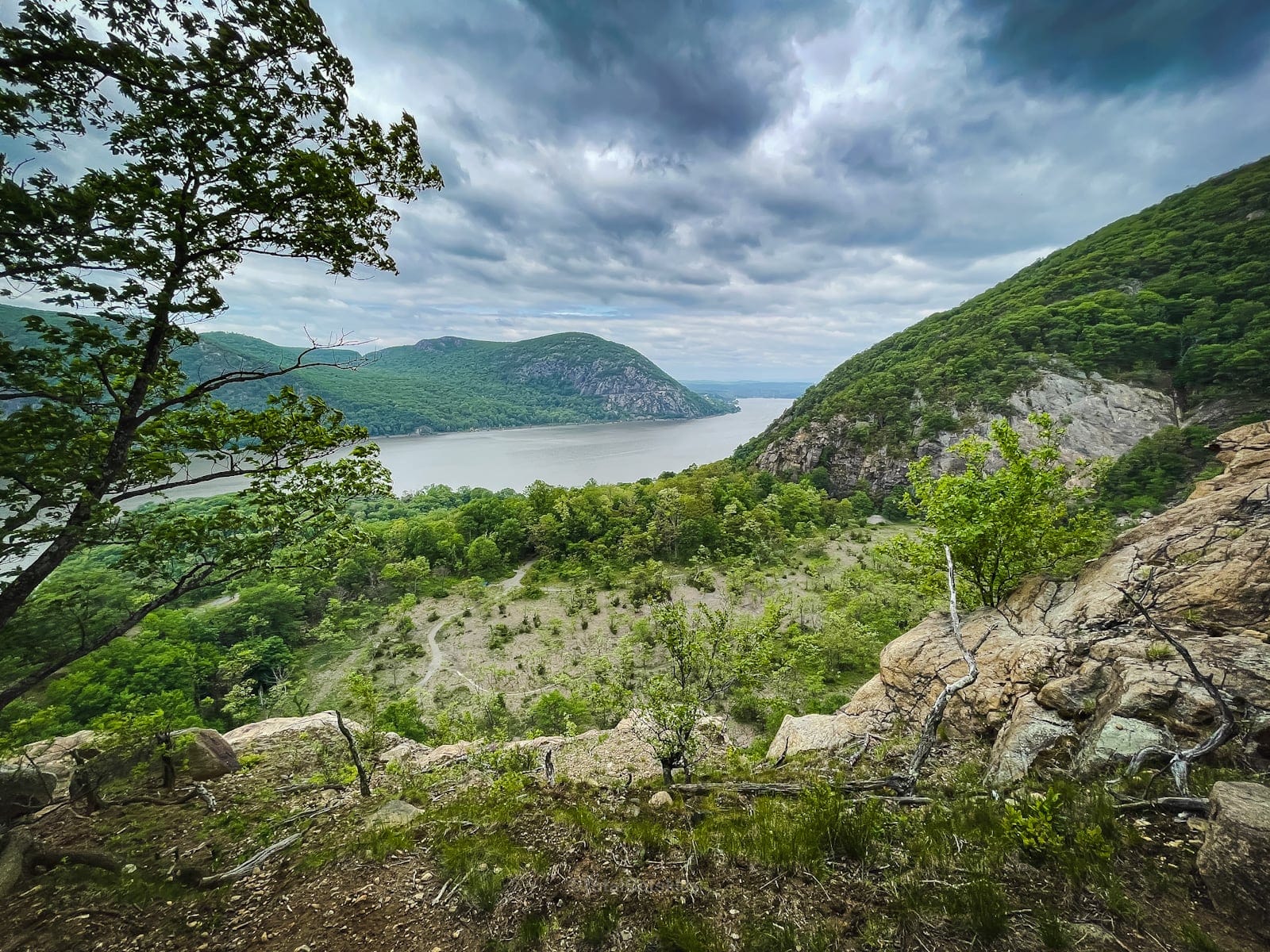
Across the Hudson River, you can see Storm King Mountain.
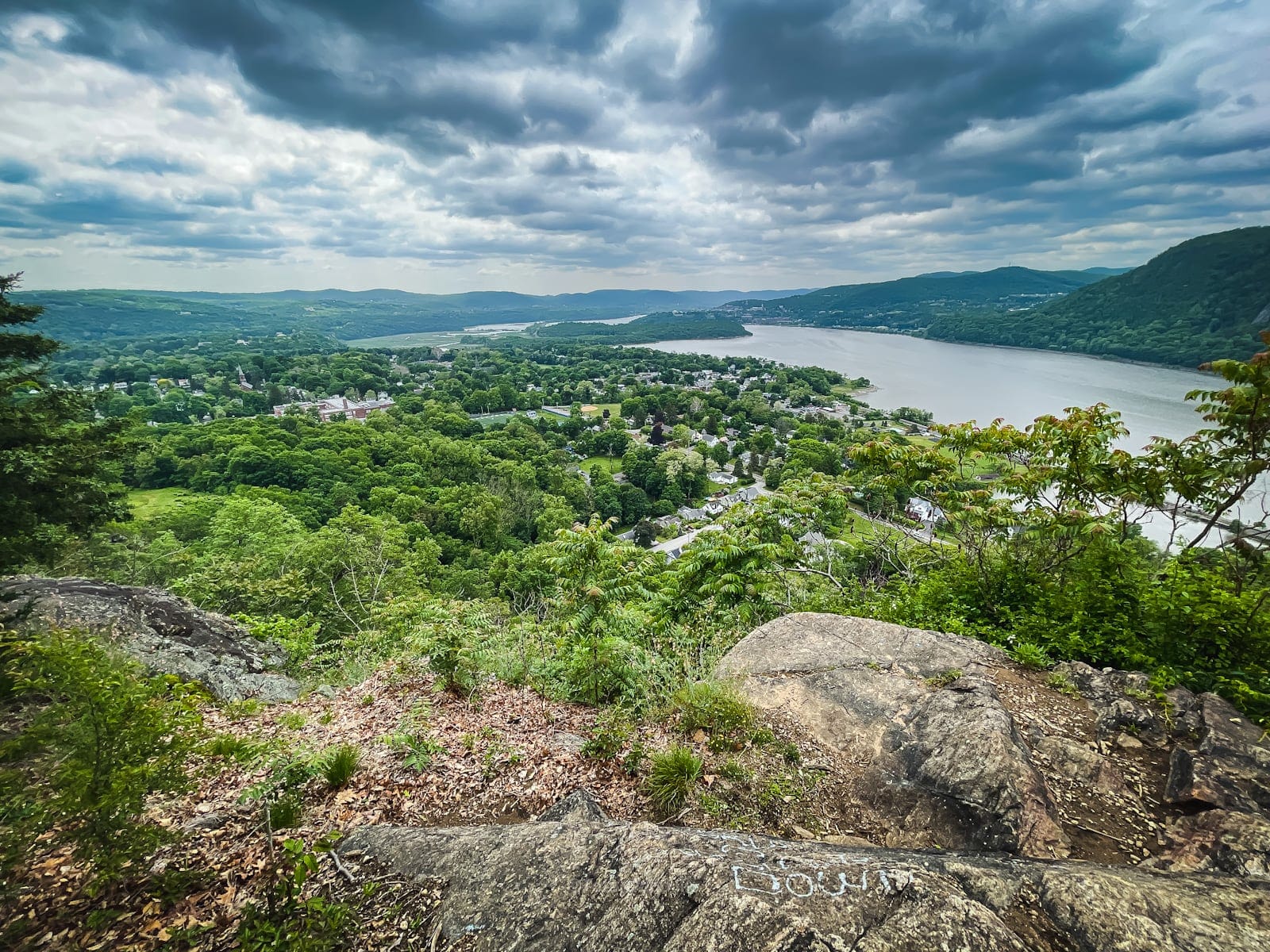
One of many first rate overlooks on this route, this one looking south over the town Cold Spring is not far from the start of the trail…
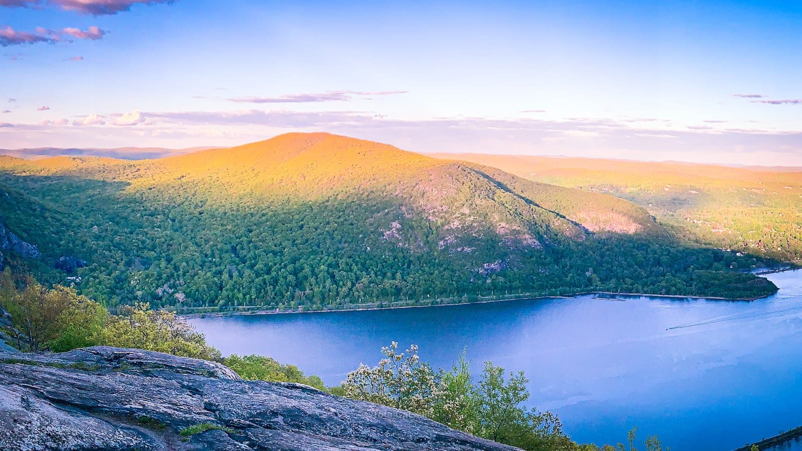
The Big View
Just above 1200’, this amazing view opens up…


View South
And just above that is a sweet view south…

NYC View
A little higher up, watch for a graffiti tag that says “* NYC VIEW”. Turn around on a clear day and you’ll see the spires of New York City to the south. No luck on this day, however…

Descent
The back side of the loop is marked with some really grand old trees…

…and several sets of ruins. The first of which is the Cornish Barns…
Cornish Barns
A sign here reads: “There were three barns associated with the dairy. The larger stone barn included a hay silo and an overhead conveyor to transport hay throughout the barn. This system was connected to the smaller farm building near the corner of the main barn. The concrete ruins show the location of another building, which may have been used as storage for equipment and farm vehicles.”

Bridge to Breakneck
You’ll pass a footbridge which connects Bull Hill to Breakneck Ridge.

More Ruins…
You’ll also pass this old water cistern…

But the big treat near the end of this hike is the ruins of the Cornish Estate aka Northgate…

I have a separate guide for those ruins, and they’re so fun. Read Cornish Estate Ruins.
From here, the walk back to the Washburn Trailhead on 9D is a very easy going 9/10ths of a mile.
Similar Hikes
Read Cornish Estate Ruins. And check out my growing list of Hudson Highlands trail guides.
Read More
Get full access…
Get instant access to the full version of this site and enjoy great supporter benefits: full galleries, full trail notes, early access to the latest content, and more.
Hot on the website right now…
Follow for more…
Follow my @TotalCatskills content on Instagram for regular hiking inspo and safe, inclusive community.
Bull Hill (Mount Taurus) Full Loop Hike Trailhead
Large, popular lot. Overflow is roadside parking along Route 9D.
Google Maps Location: 41.426085, -73.964659
The map below shows the exact topographic location of the trailhead
Cell Service
Decent coverage throughout this hike, with only a few patchy spots. My network is Verizon. YMMV.
The parent mountain for this hike is Bull Hill (Mount Taurus).
