Disclosure: This content may contain affiliate links. Read my disclosure policy.
An easy-to-follow loop with a few spurs.
This classic Mount Tammany trail loop hike combines the steep, scrambly Red Dot Trail ascent with a gentler descent along the Blue Dot Trail, offering a full-on mountain experience in just a few miles.
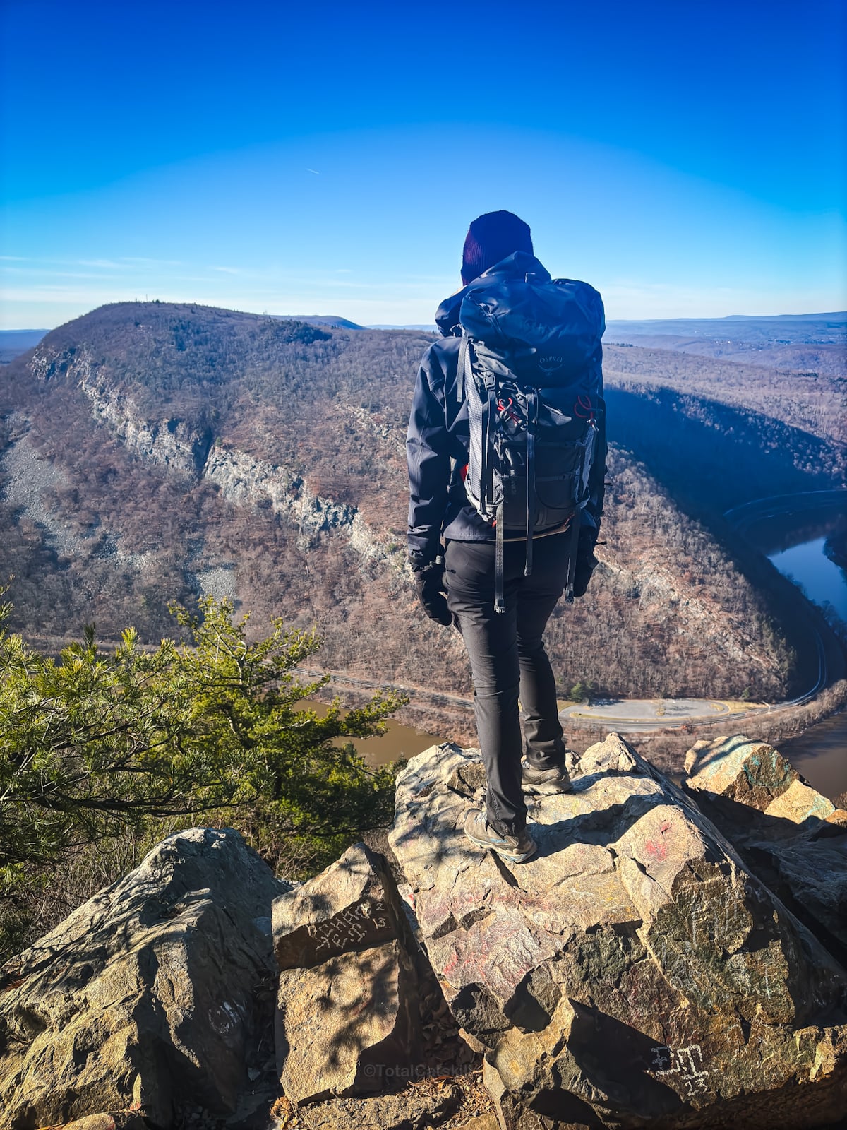
The Red Dot climb is short and intense—expect to gain over 1,200 feet of elevation in under 1.5 miles. But the payoff at the top is immediate: open ledges, panoramic views, hawks soaring on thermals, and the wide Delaware River winding far below.
From there, the Blue Trail brings you down gradually through dense forest and past Dunfield Creek, a lovely, shaded stream that’s perfect for cooling off on a summer day. The full loop is well-maintained, well-marked, and one of the most popular in New Jersey for good reasons: it’s dramatic, it’s beautiful, and it’s highly rewarding.
This is a true mountain loop, not a walk in the woods. The footing is rocky, the Red Dot climb can be punishing in the heat, and the trails get crowded, especially on weekends. But if you go early, or off-season, you’ll understand why Mount Tammany has become a rite of passage for Northeast hikers.
Frequently Asked Questions
Is Mount Tammany a difficult hike?
Mount Tammany is a short but steep and rocky hike. The Red Dot Trail ascends more than 1,200 feet in under 1.5 miles, with several scrambly sections and little shade. While the trail is well-marked and manageable for fit hikers, it can feel strenuous (especially in hot or icy conditions). Proper footwear and water are essential.
How hard is Mount Tammany?
It’s harder than it looks. The Red Dot Trail starts climbing almost immediately and doesn’t let up until you reach the summit. There’s some rock scrambling involved, and the trail can be slick when wet. That said, the full Red Dot / Blue Dot loop is only about 3.5 miles, and the descent is much gentler. For experienced hikers, it’s a fun challenge. For beginners, it may feel quite tough but very doable with breaks.
Mount Tammany Trail
The Mount Tammany hiking trail includes…
- Steep and rocky ascent
- Fantastic views along the way and from the lookout
- An easier, mellower descent
- Dunfield Creek is lovely
A full breakdown is provided below in the hike notes with 10 photos.
Mount Tammany Hike Time
Allow 2½-3 hours for this hike.
Mount Tammany Trail Elevation Gain
The elevation gain for this hike is 1196 feet (apx 365 meters).
BTW, you might also enjoy…
- NEW › Winter Skincare for Hikers
- CATSKILLS › Best Catskills Waterfalls
- STAY › Find Your Perfect Catskills Stay
- ADIRONDACKS › Hike Van Hovenberg
- ENTERTAINMENT › Best & Worst Hiking Movies
- Follow › My Instagram @TotalCatskills
- Follow › My Substack @TotalCatskills
- Follow › My writing for Times Union
Mount Tammany Trail Notes & Gallery
Here is the Mount Tammany AllTrails track of the exact route I hiked for this trail guide.
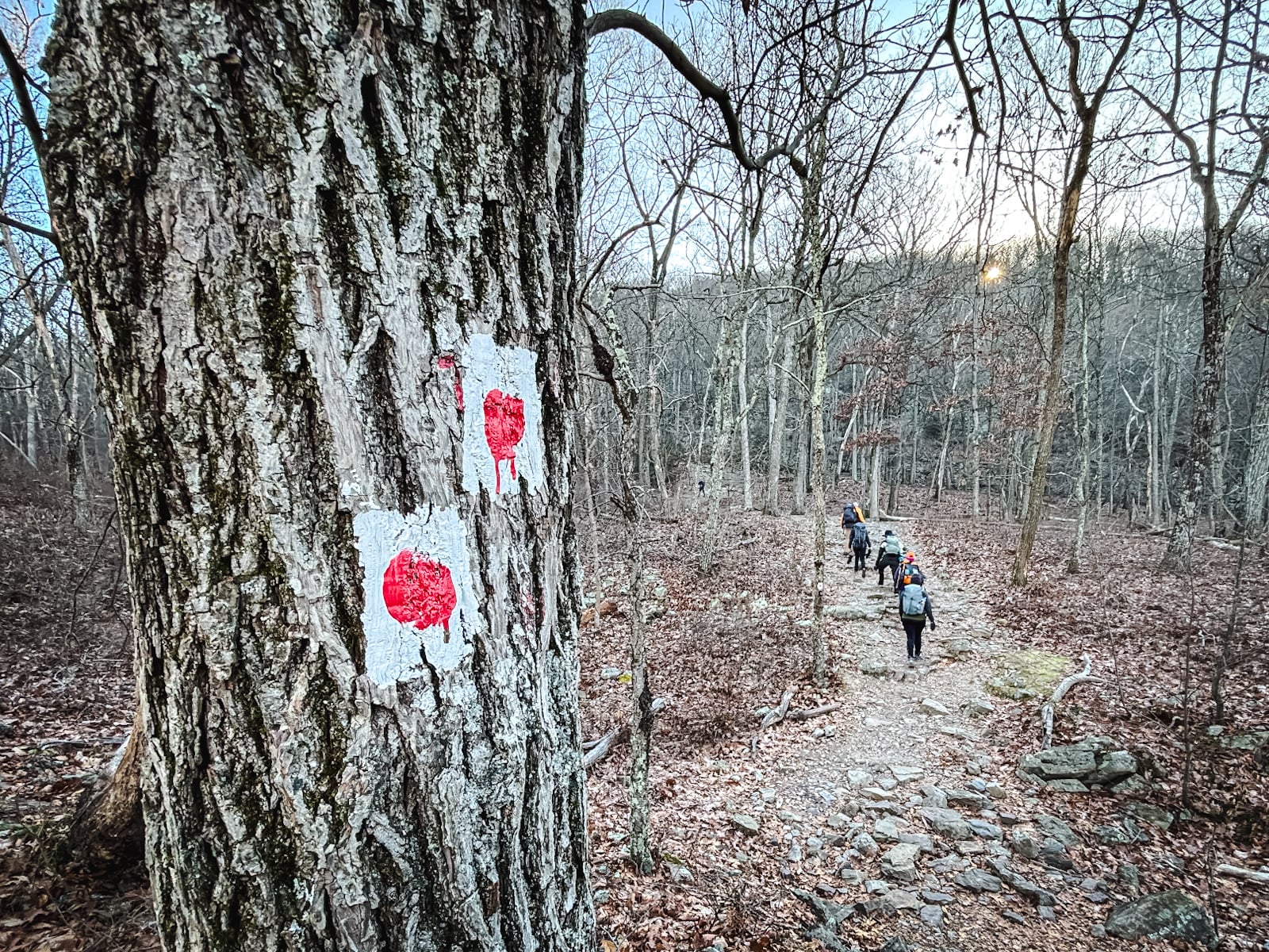
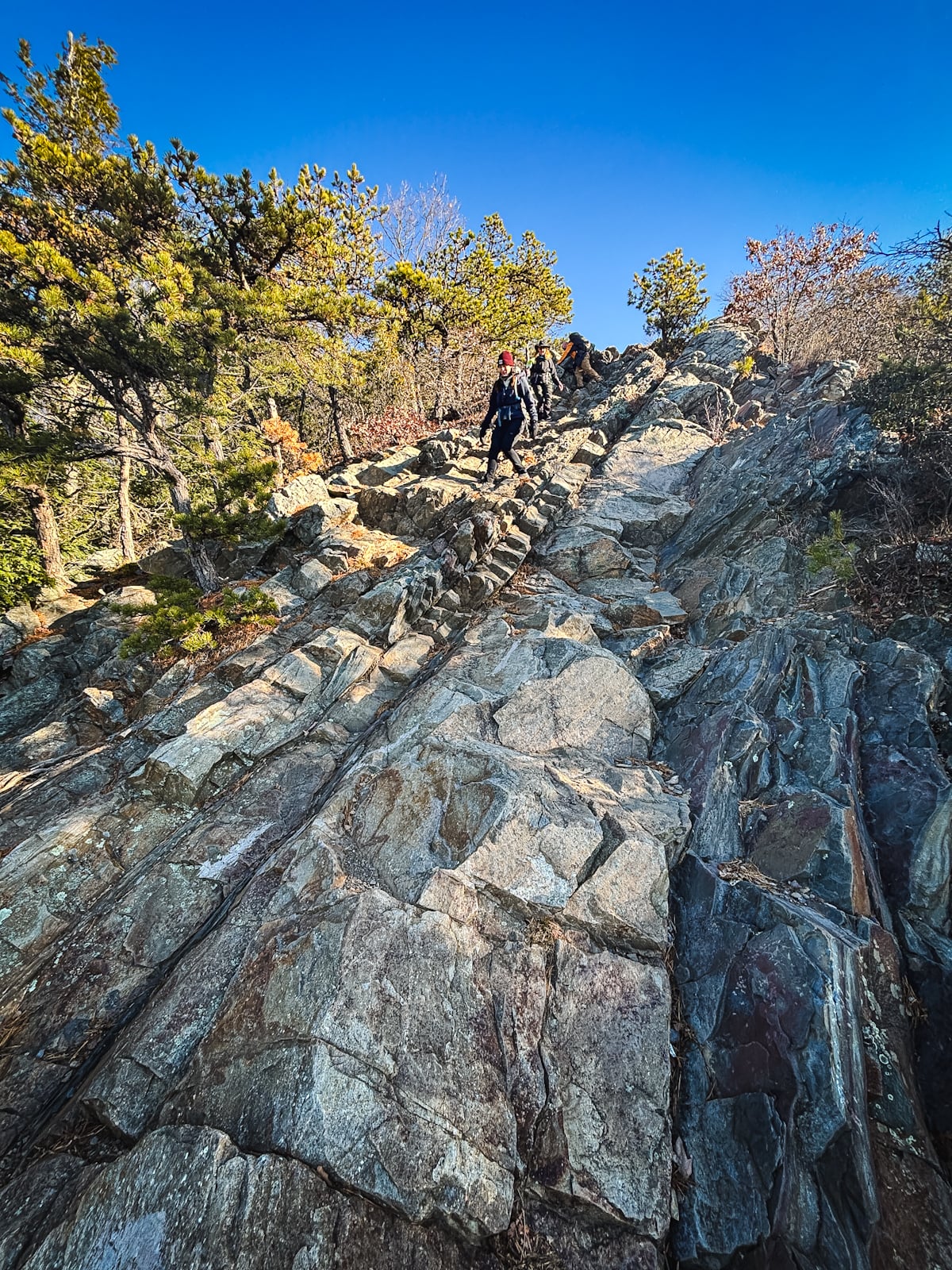
Begin at the parking lot and look for the start of the Red Dot Trail to Mount Tammany.
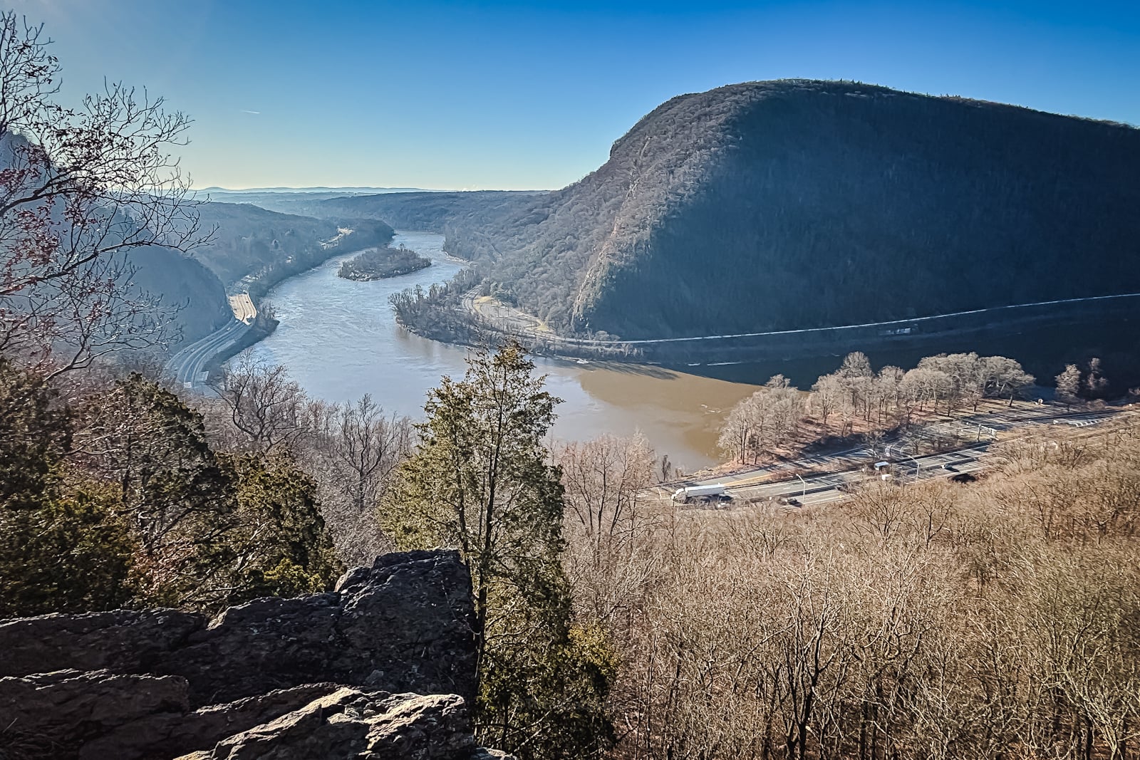
There are some great views of Mount Minsi on the way up Mount Tammany trail…
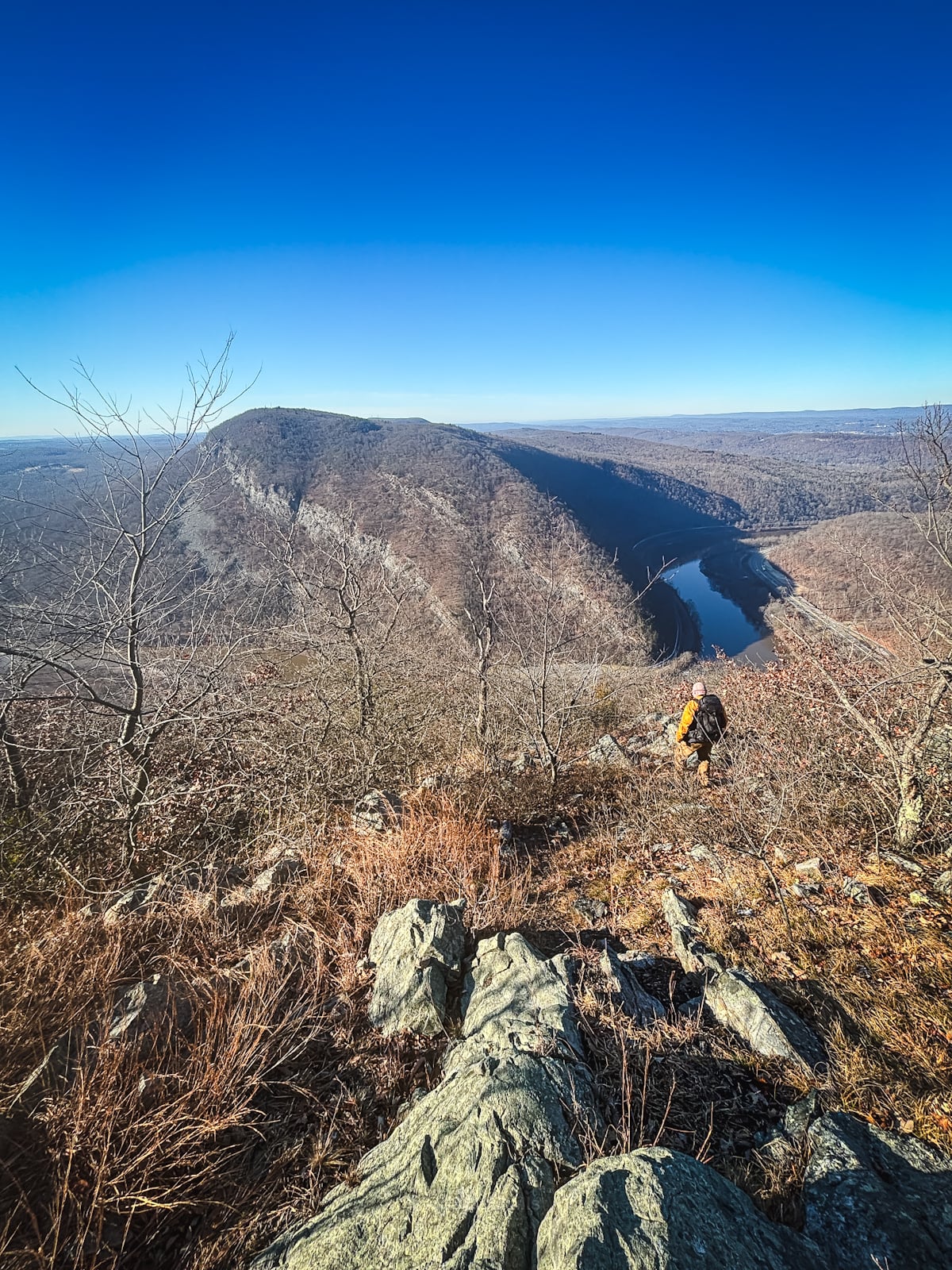
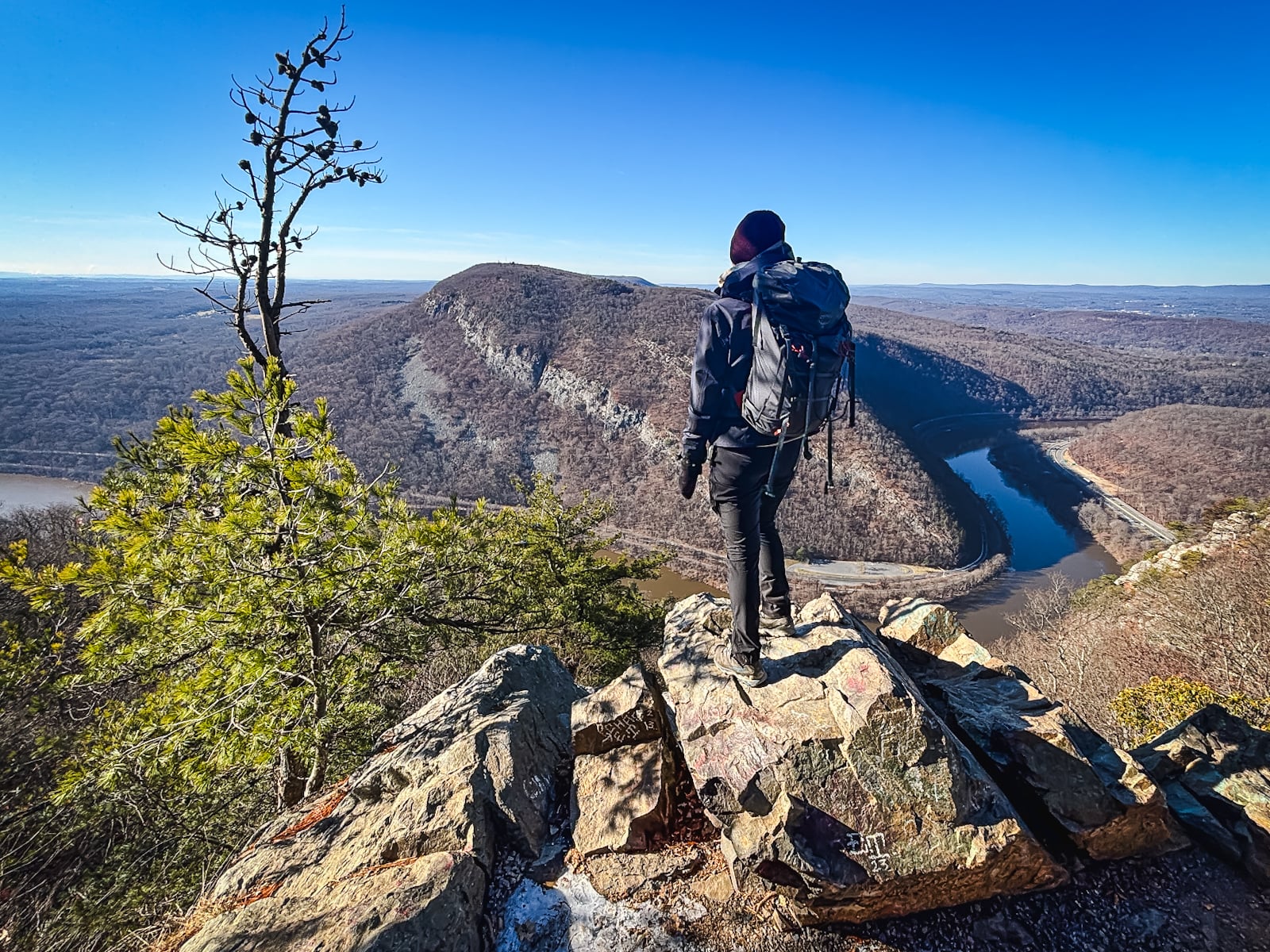
Spot the hiker…
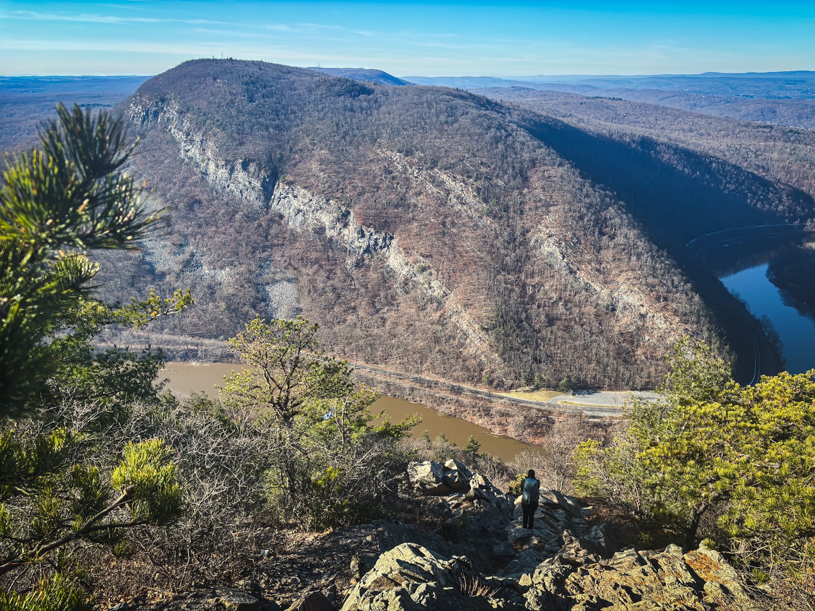
Mount Tammany Trail Lookout
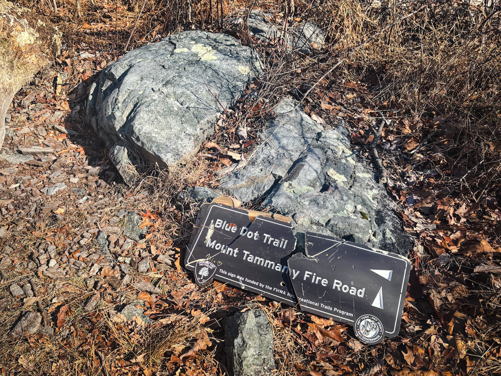
Just below the summit, look for a spur to your right and head down this rocky section…
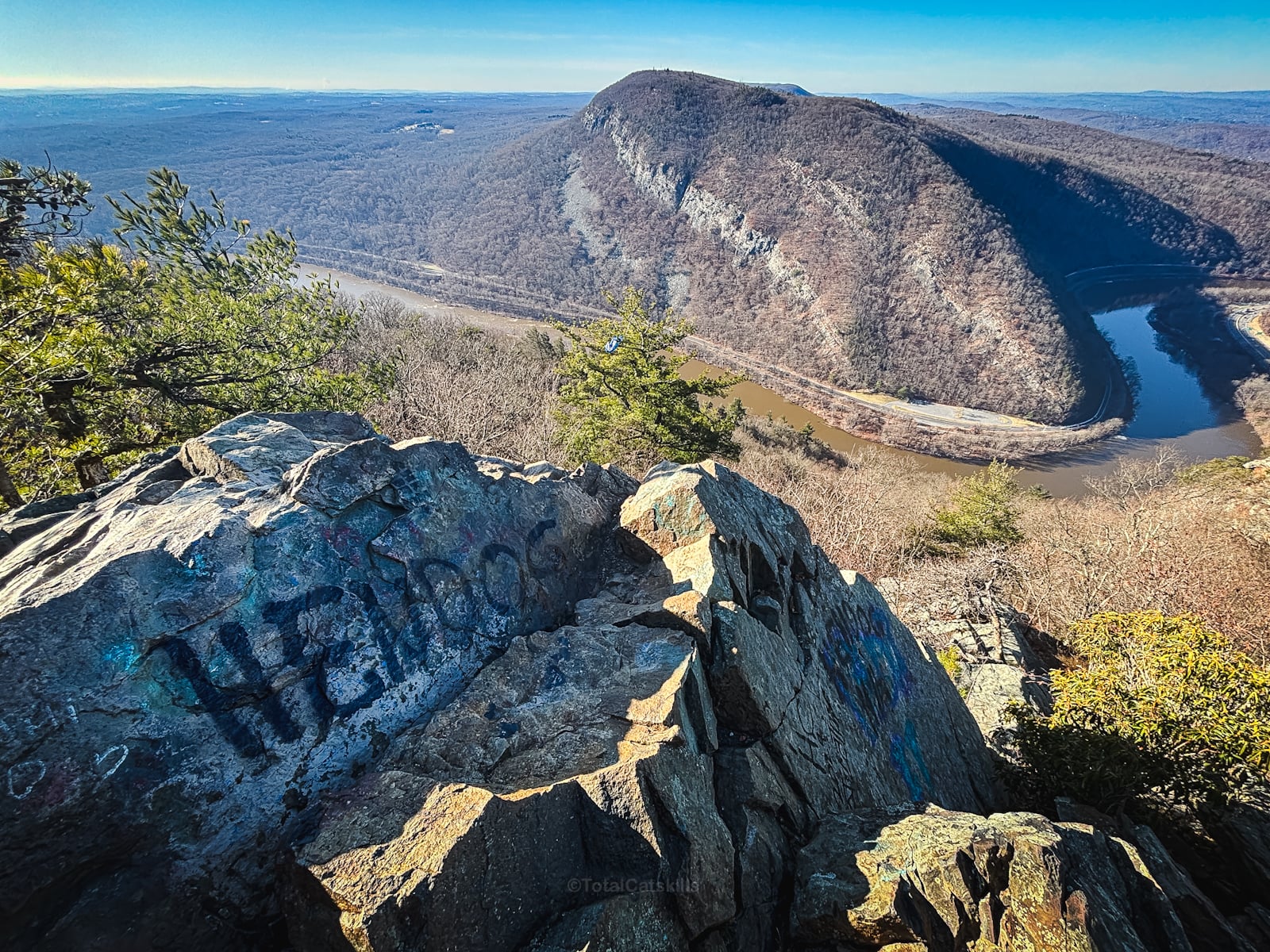
This is the big view, made extra famous from Instagram…
You’ve got the basic details, but there’s so much more…
Unlock this exclusive content to get deep intel on this hike, including my personal tips. Immerse yourself in every layer of the journey. With Mountain-Hiking.com, you’re not just skimming the surface; you’re delving into a passionate hiker’s in-depth experience.
Become a Patreon supporter today and immediately elevate your hiking adventures with full trail beta, comprehensive insights, and stunning visuals. Experience hundreds of trails to their absolute fullest!
Descent
From here, you can head up over the summit. All the hard work is done and the descent is easy-peasy.
When you get down to the flats, take a few minutes to explore this section around Dunfield Creek…
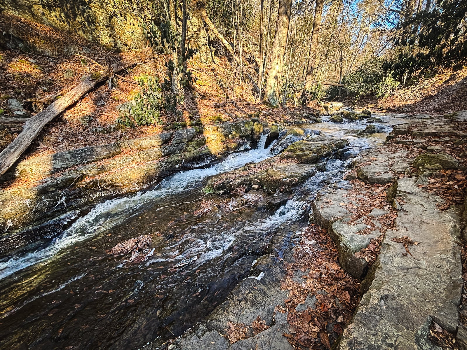
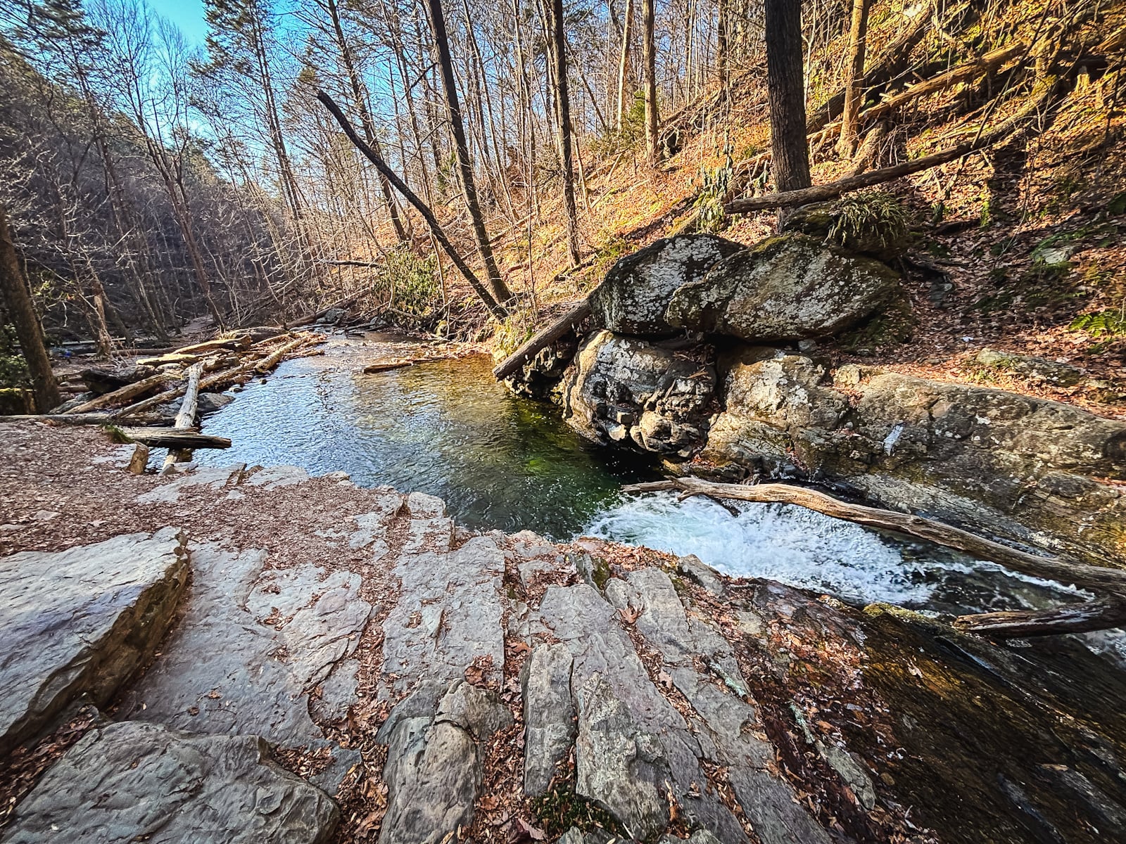
It must be delightful, here, on a hot summer day. Great spot to cool off!
Similar Hikes
The Hudson Highlands are the closest in terms of terrain and iconic water views.
Read More
Get full access…
Get instant access to the full version of this site and enjoy great supporter benefits: full galleries, full trail notes, early access to the latest content, and more.
Hot on the website right now…
Follow for more…
Follow my @TotalCatskills content on Instagram for regular hiking inspo and safe, inclusive community.
Mount Tammany Trail via Red Dot and Blue Dot Loop Trailhead
Large lot with another large lot slightly to the east.
Google Maps Location: 40.971863, -75.123199
The map below shows the exact topographic location of the trailhead
Cell Service
Good throughout. My network is Verizon. YMMV.
The parent mountain for this hike is Mount Tammany.
