
Disclosure: This content may contain affiliate links. Read my disclosure policy.
An easy-to-navigate (but steep) out-and-back.
Hiking Whiteface Mountain via Marble Mountain (from the Atmospheric Sciences Research Center trailhead) is a direct and challenging route that gets you to one the most recognizable summits in the Adirondacks.
This route begins at the Atmospheric Sciences Research Center trailhead on Marble Mountain Lane, then climbs directly up the steep Marble Mountain Trail before connecting with the Wilmington Trail to reach the summit.
Instead of using the paved Veterans Memorial Highway, this route approaches the summit via the ridge below the Field Station, following the Wilmington trail all the way to the top.
Expect a steady and often steep ascent, with several long sections of exposed rock and rough trail conditions.
Whiteface is known for its sweeping summit views, but it also offers a challenging and rewarding hike from base to summit without the crowds often found on the road.
I recommend Whiteface Mountain via Marble Mountain Trail wholeheartedly.
Frequently Asked Questions
How hard is the Whiteface Mountain trail?
Hiking Whiteface Mountain is considered challenging. The trails are steep and rocky in places, with a significant amount of elevation gain. The Marble Mountain/Wilmington Trail route, in particular, is a steady climb that can be strenuous even for experienced hikers.
How long does it take to get to the top of Whiteface Mountain?
Depending on your typical mountain pace, the weather and trail conditions, it takes most hikers 3-5 hours to get from the Atmospheric Sciences Research Center trailhead to the summit of Whiteface Mountain.
In terrible winter conditions, it took us 3 hours 20 minutes to get to summit — but my hiking partner on this day and I are regular mountain hikers, though we are the typically the slower members of our usual crew.
Is it free to hike Whiteface Mountain?
Yes, hiking Whiteface Mountain via trails like the Marble Mountain Trail and Wilmington Trail is free. However, if you drive up the Veterans Memorial Highway (seasonal road to near the summit), there is a toll.
Is Whiteface Mountain good for beginners?
Whiteface Mountain is not recommended for true beginners. The hike is steep and long, and the weather around the summit can change rapidly. Hikers should have some mountain hiking experience before attempting Whiteface.
Should I hike Whiteface in winter?
As you will see below, in winter conditions even experienced hikers can get into serious trouble in the Adirondack high peaks. Whiteface itself was fine but, on the way down, we tried for Esther and it was a disaster.
Is Whiteface Mountain via Marble Mountain Trail the best route?
This is the shortest and quickest route to the summit Whiteface. Notes below.
BTW, you might also enjoy…
- ADK › Whiteface Mountain via Marble Mountain
- DANGER › 6 Feet Under? How Our Adirondack Hike Turned Deadly Serious (Substack)
- ADK › Hurricane Mountain Fire Tower
- CATSKILLS › Catskills Fire Tower Challenge 2025
- Follow › My Instagram @TotalCatskills
- Follow › My writing for Times Union
Whiteface Mountain via Marble Mountain Trail
The Whiteface Mountain via Marble Mountain hiking trail includes…
- A steep and steady climb
- Easily navigable trails
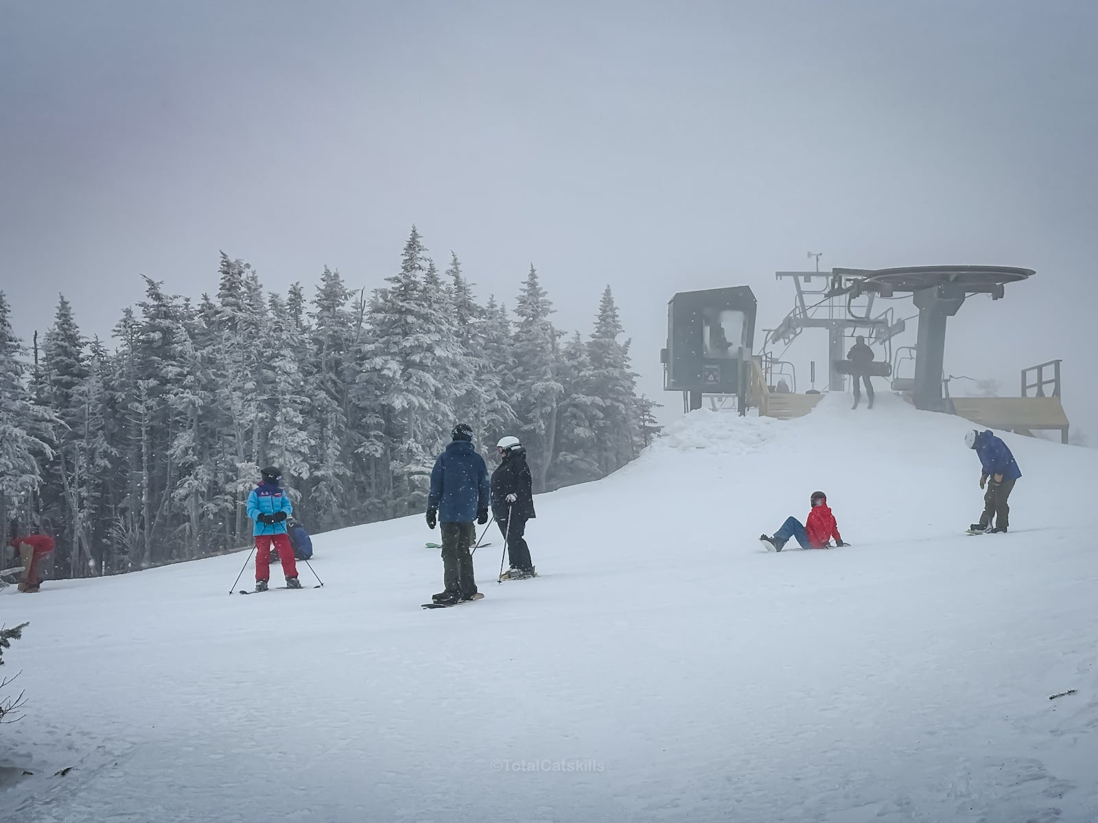
- Skiers on ski runs
- Stunning views (even in whiteout conditions!)
- An iconic summit with iconic Adirondack views
- Whiteface Mountain Field Station
- A long stone staircase
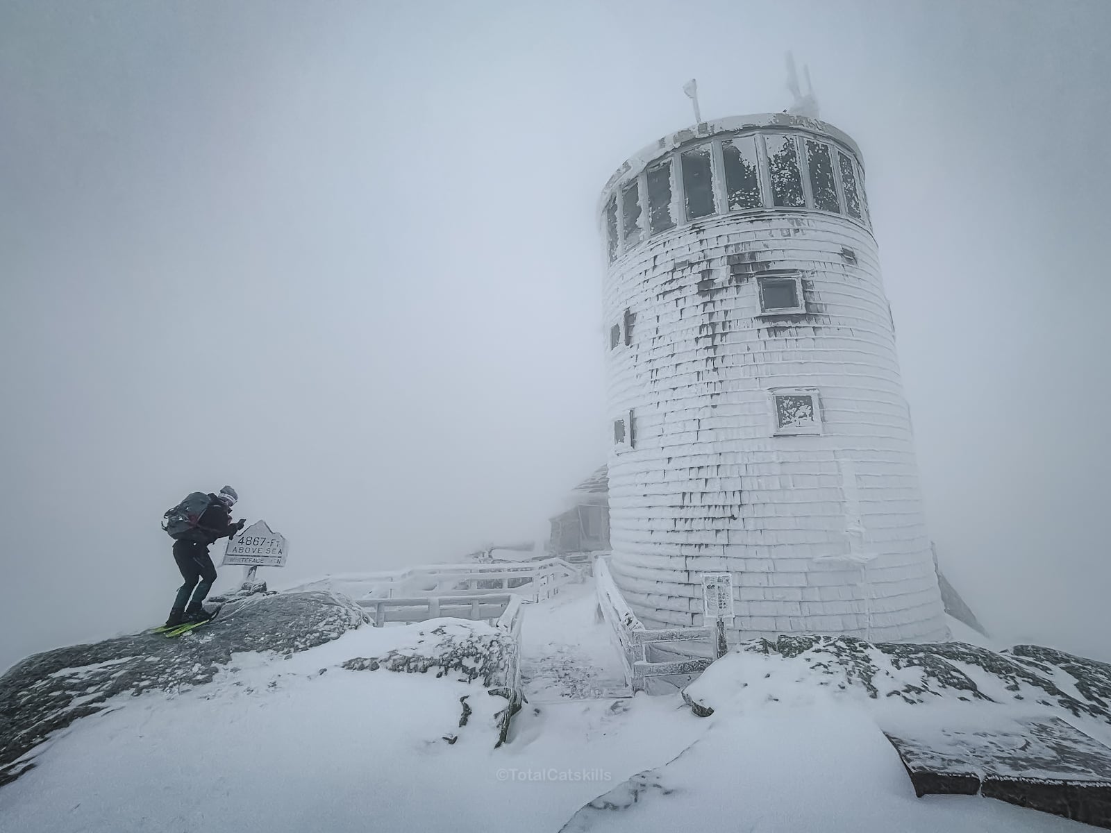
- Whiteface Castle
- Optional side-quest to Esther Mountain
A detailed breakdown of this route is provided in the hike notes below, with 20 photos.
Whiteface Mountain via Marble Mountain Hike Time
Allow 5-7 hours for this out-and-back route.
Whiteface Mountain via Marble Mountain Elevation Gain
The elevation gain for this hike is 3,400 feet (apx 1,040 meters).
Whiteface Mountain via Marble Mountain Trail Notes & Gallery
Begin at the area marked for Hiker Parking on Marble Mountain Lane. Step downhill onto the trail and sign the register for your safety.
Initially, this route passes along the top of a ravine until you get to the base of the Marble Mountain Trail, which runs in a straight line to the summit…
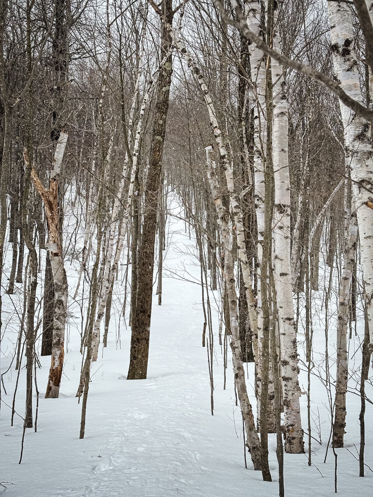
There are other routes to the summit of Marble Mountain—longer and, I’m guessing, more scenic. But hiking Whiteface Mountain via Marble Mountain Trail is the shortest and quickest route to the summit of Whiteface.
From Marble’s summit, you can see the surrounding mountains, and a ridge that blocks your view directly to the summit of Whiteface…
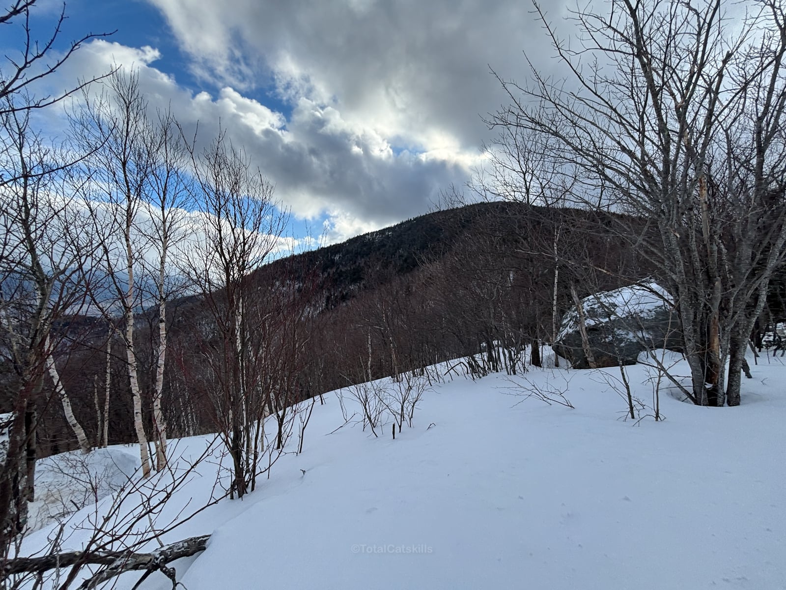
When the leaves are off the trees, in clear conditions, you should be able to see the summit of Esther Mountain to your right.
Make sure you have all the gear
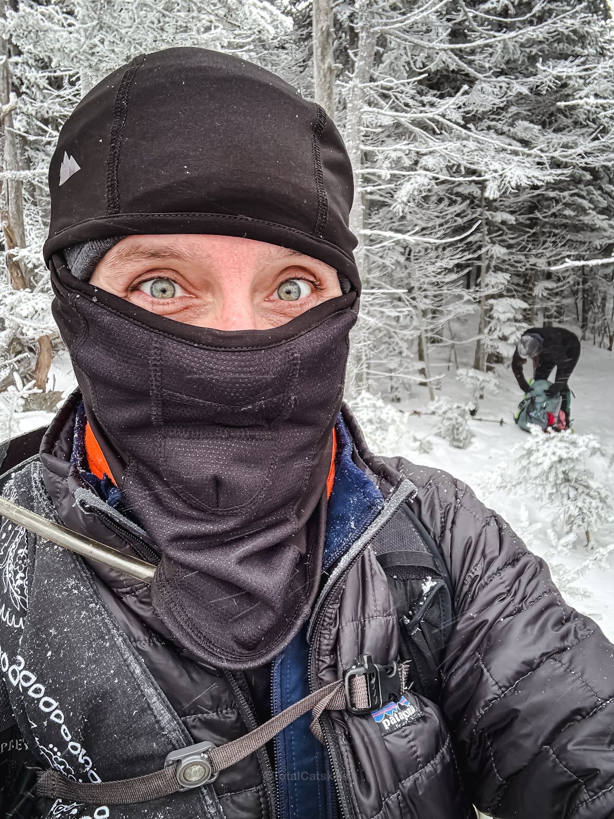
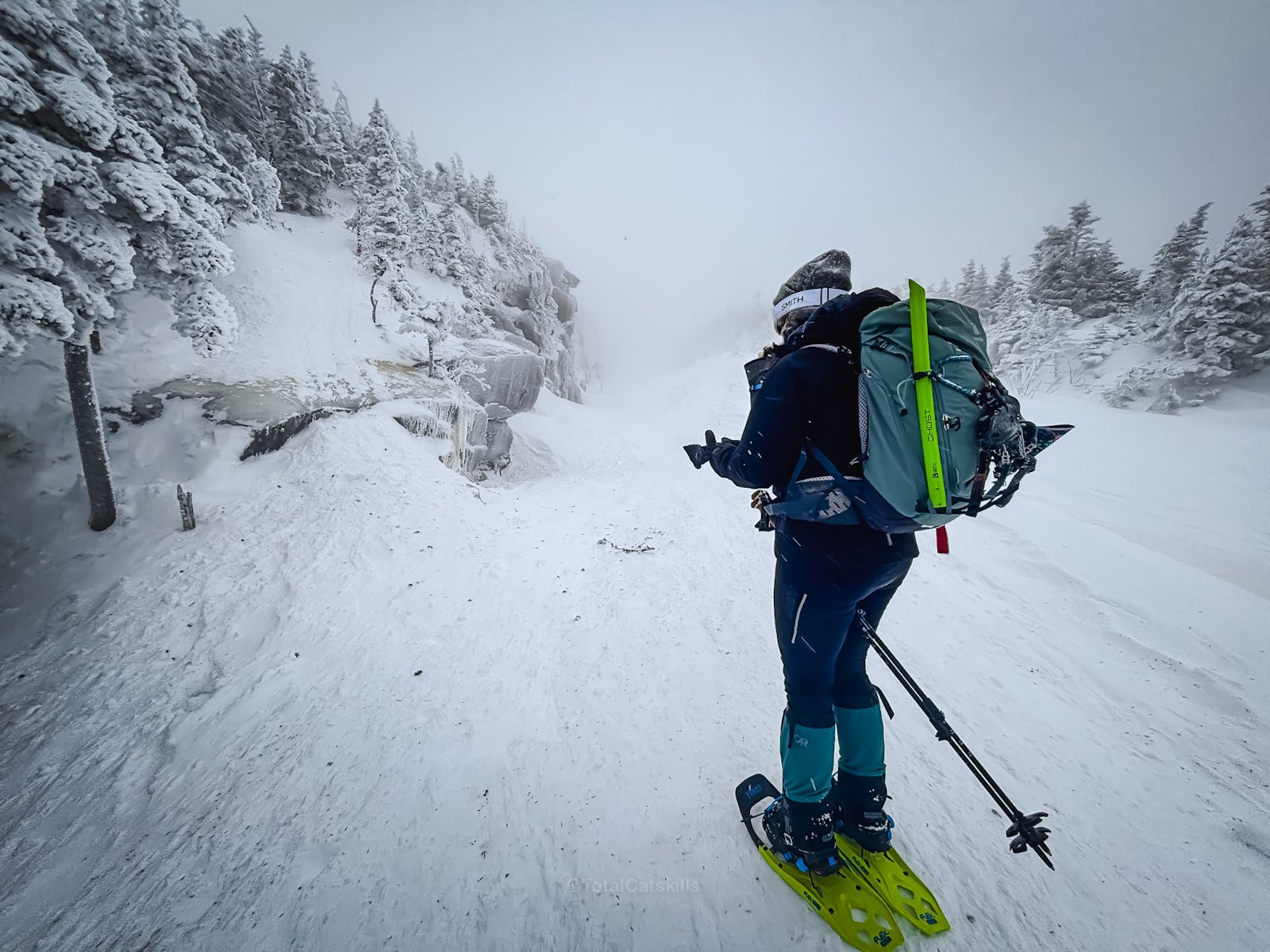
At about 3,800’, on a bitter day in early March, we stopped to prepare for the open areas ahead. Balaclavas and ski goggles were donned.
This section was very beautiful…
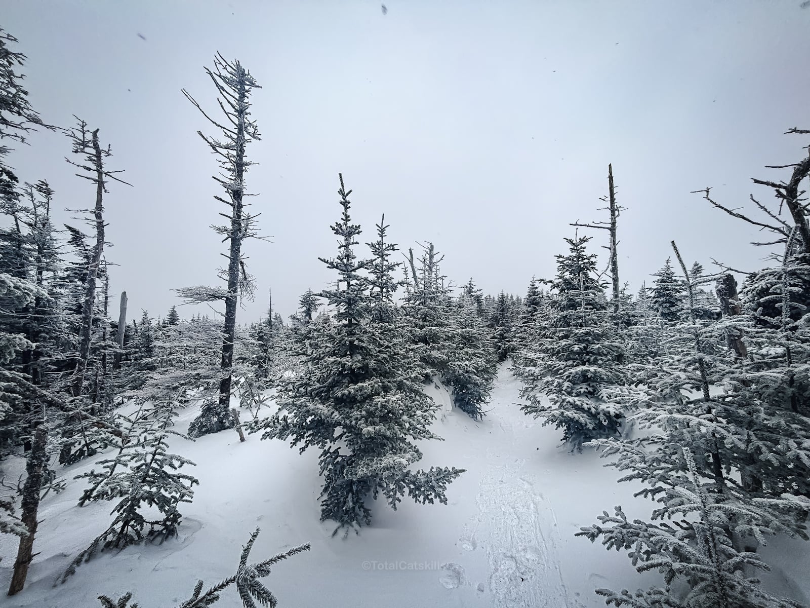
Then we dipped back into the pine forest until we came to the junction for Esther. Esther is a bushwhack, so there is no maintained trail, only a herd path—which is obliterated in deep winter conditions.
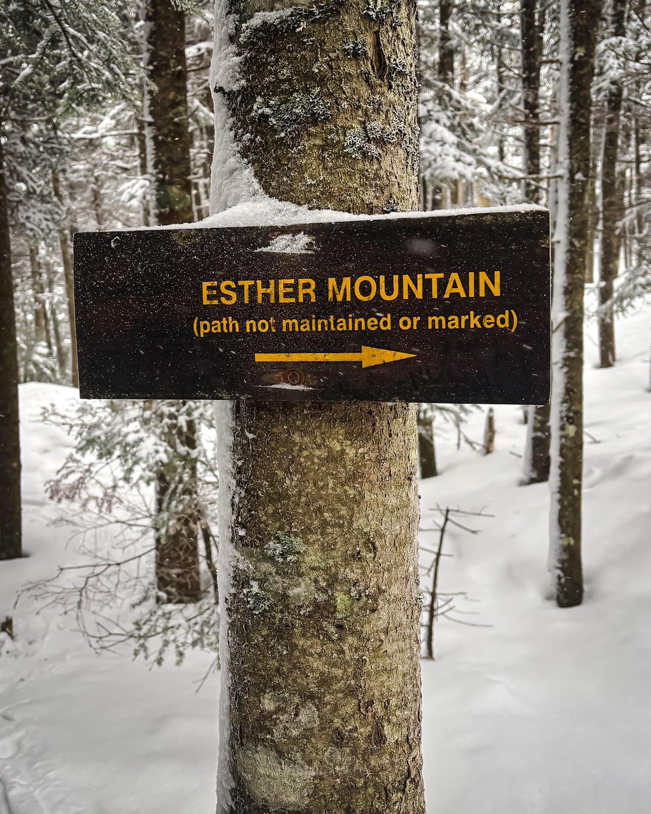
We decided to get to Whiteface first, a smart decision considering how badly our try for Esther went later.
We crossed the trail that connects several of the ski runs on Whiteface Mountain Ski Resort, and watched the fun for a few minutes…
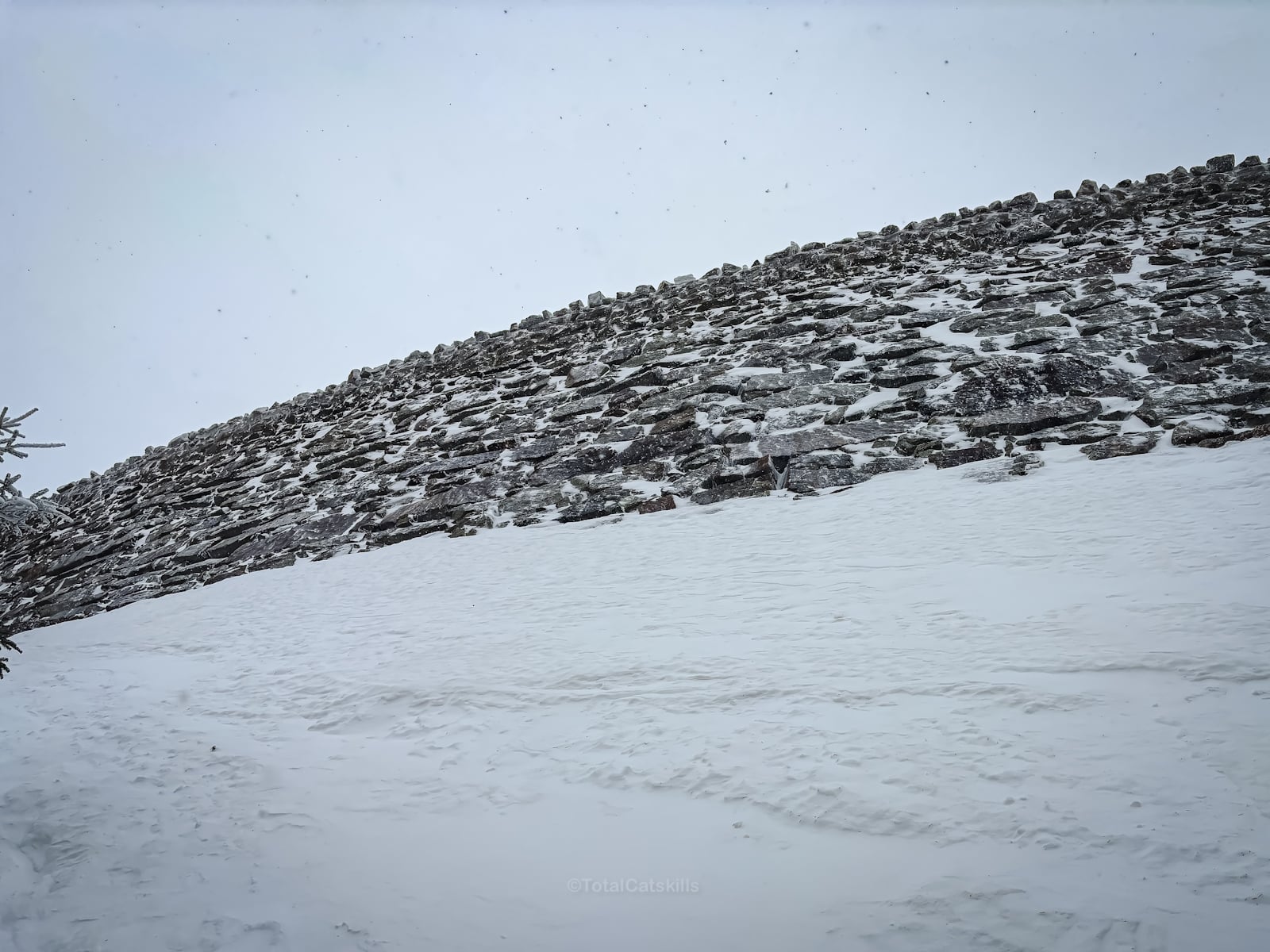
Just below the last push to the summit, this is the retaining wall that supports Veterans’ Highway.
From here, the big fun began in earnest.
Whiteface Mountain Summit
This turned out to be, by a very wide margin, the most challenging, intense and beautiful hiking experience I’ve had to date.
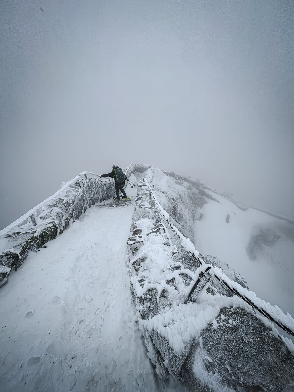
In these conditions, we missed the connection to the ridge trail and stepped on to the Veterans’ Highway for a short time before doubling back.
But it was crazy beautiful…
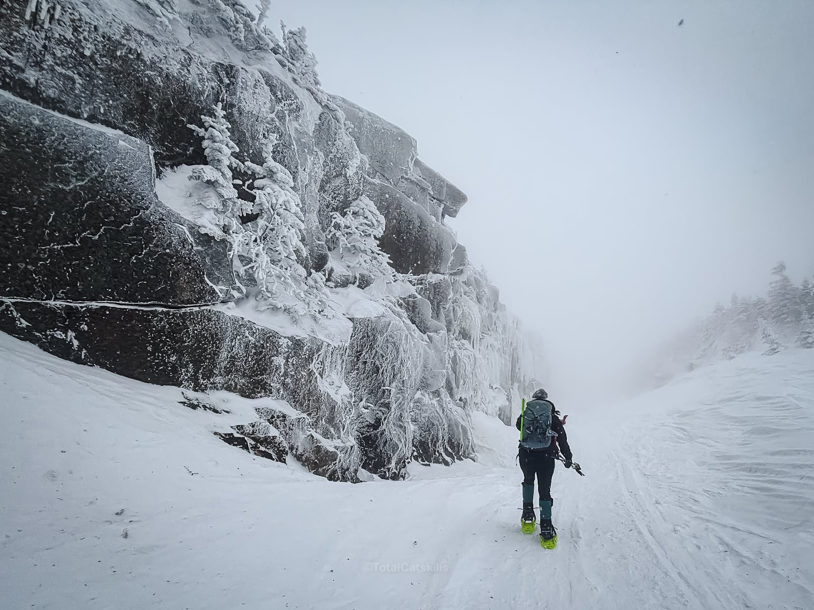
We found this way up…
In fact, in non-winter conditions, you can see the Wilmington Trail never pops onto the highway at all. It stays below the retaining wall and guides you straight up the ridge…
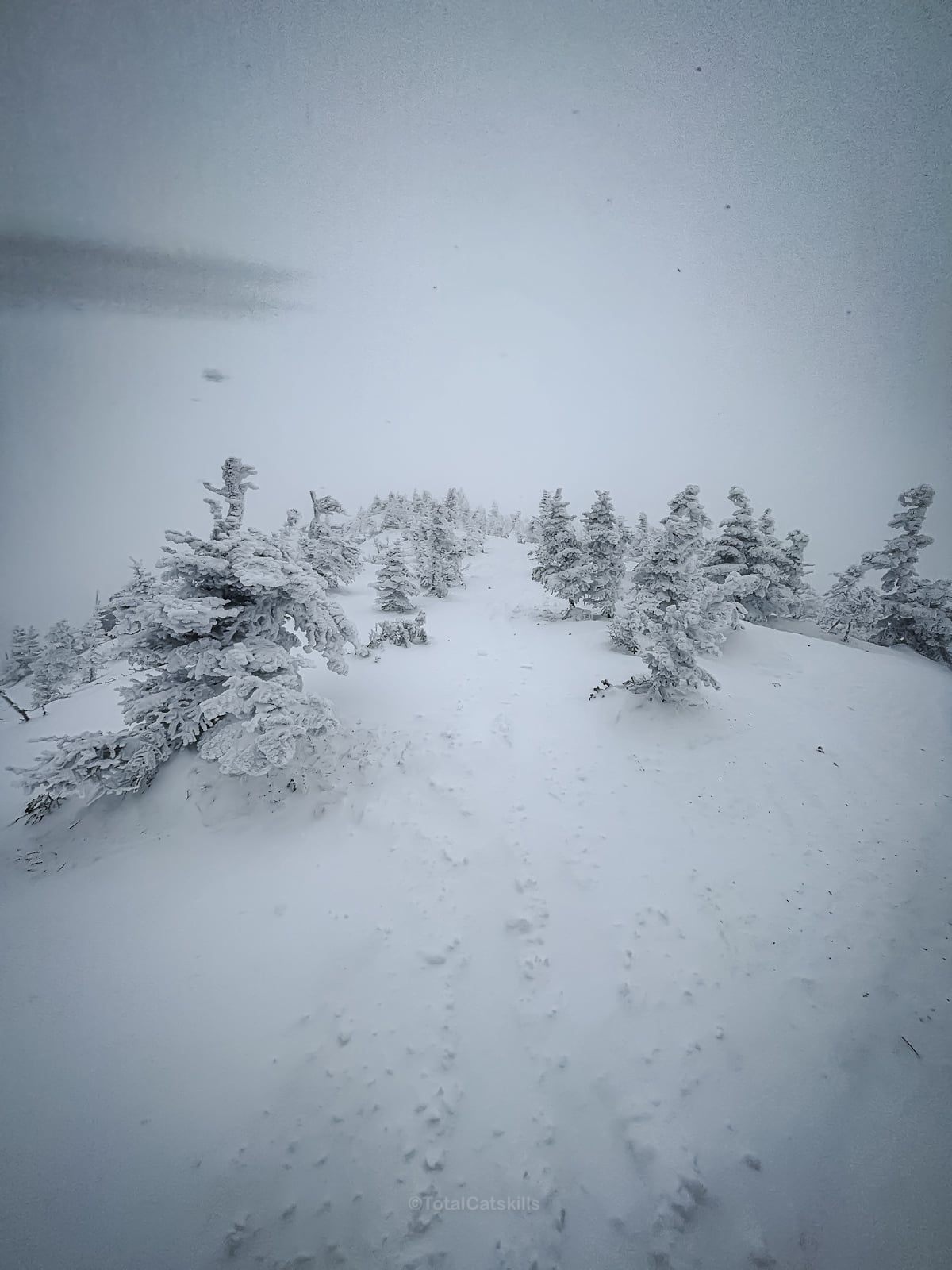
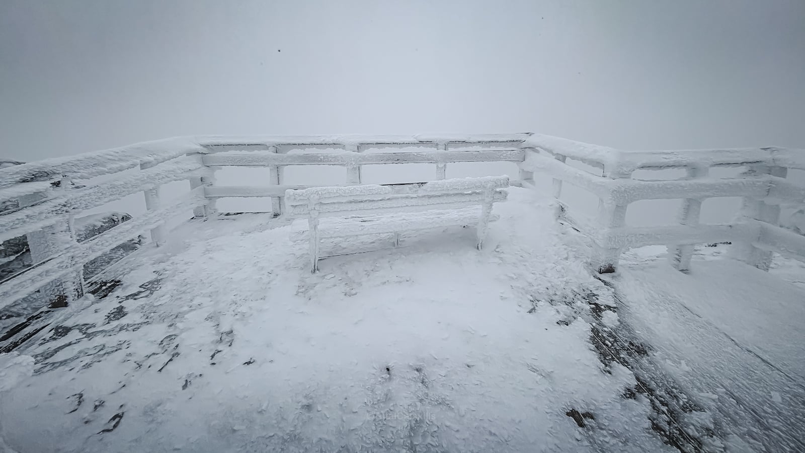
Zero views on this day, but we didn’t care even a bit.
The winter moonscape was a new love language.

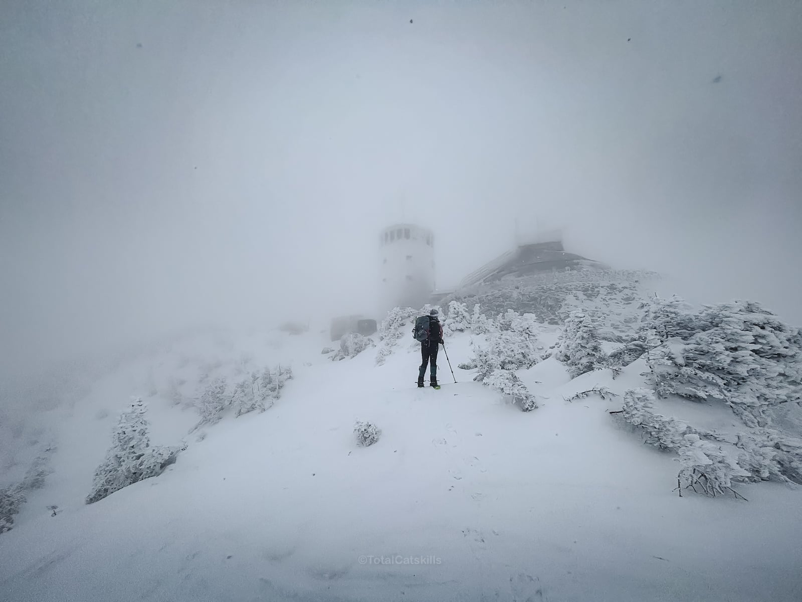
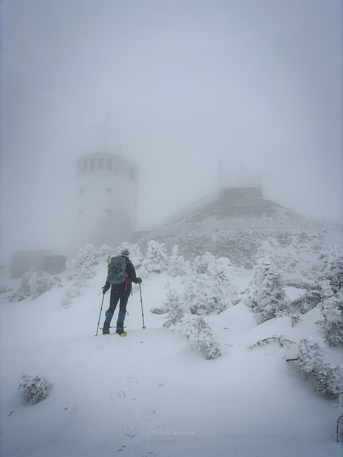
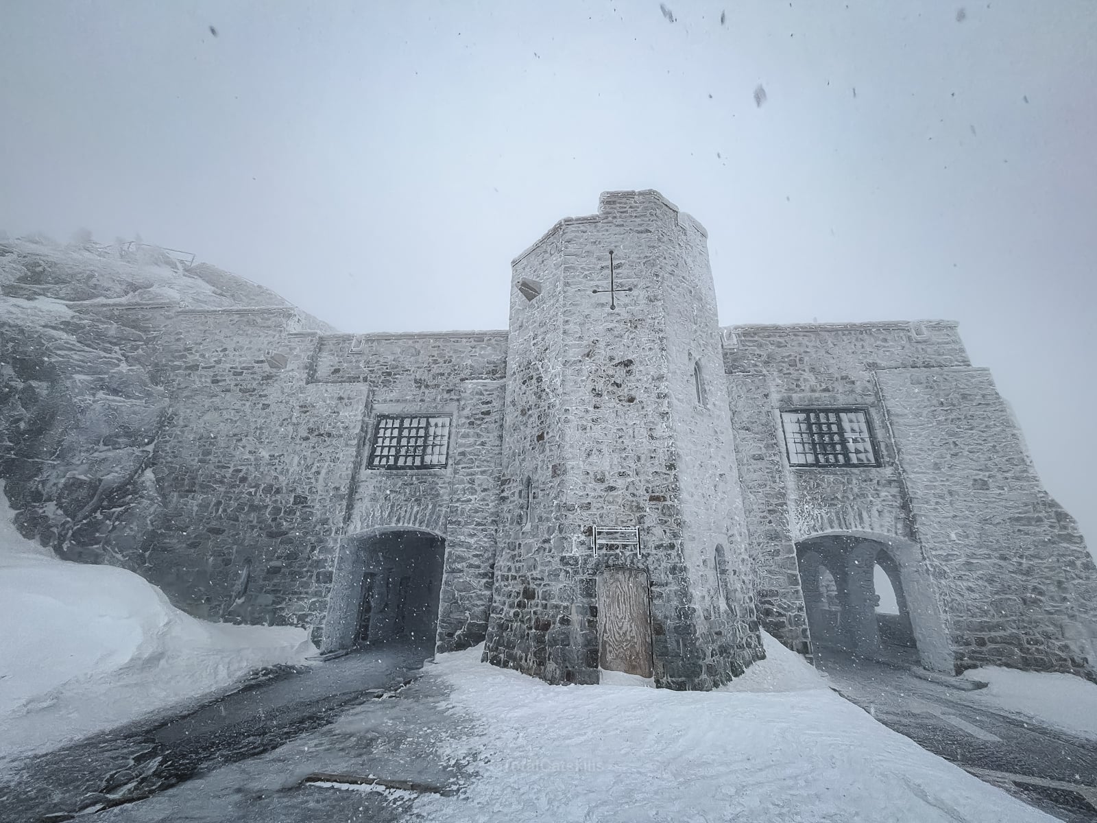
Field Station
The ASRC Whiteface Mountain Field Station came into view, like something in a spy movie…
Whiteface Mountain Summit
After 3h 20m, we got to stand on this amazing summit.
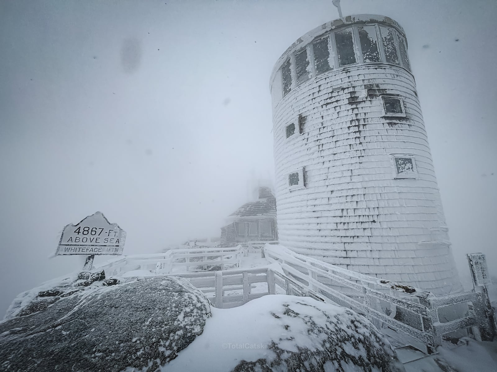
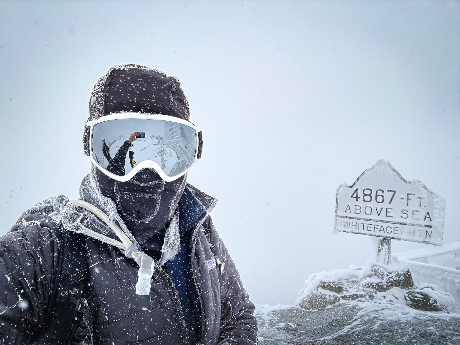
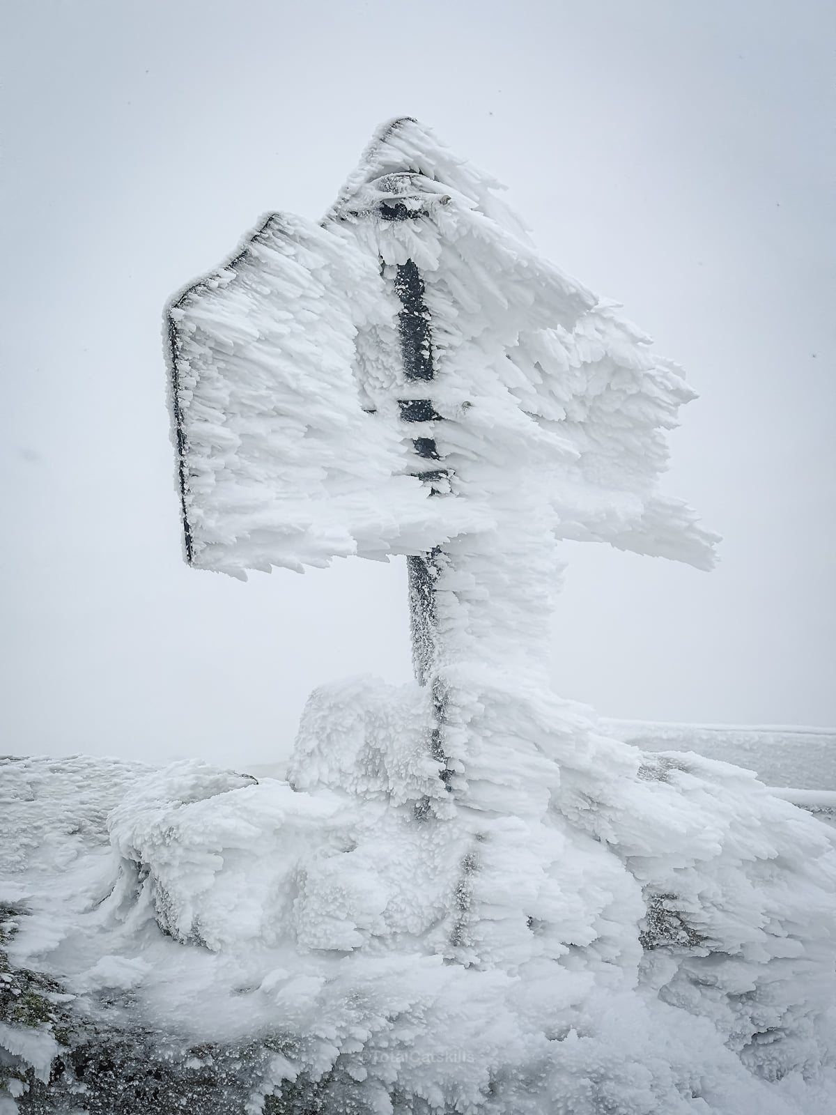
Conditions were bonkers: 5°F / -15°C and winds over 40mph…
We stuck around for quite a while, considering how intense it was.
But it was incredible up there.
Descent via Staircase
It turned out that conditions at the summit were comparatively mild. Evidently, the field station had acted as an enormous wind break.
Once we started down the stone steps, we were hanging on for dear life…
Things were much calmer near the castle. Whiteface Castle is built from rock left over from building the highway. It’s stunning.
One positive of this adventure was realizing how we had our gear well dialed in. Despite the brutal conditions, we never felt uncomfortable.
So that was getting to Whiteface Mountain via Marble Mountain Trail. From here, we made our way back to the junction to Esther.
6 Feet Under
What happened next turn the very best day hike into the very worst day hike. You can read about it on my Substack: 6 Feet Under? How Our Adirondack Hike Turned Deadly Serious.
Similar Hikes to Whiteface Mountain via Marble Mountain Trail
This is a big ADK hike. In terms of energy expenditure and incredible summit views, it’s quite similar to Giant Mountain.
Read More
Get full access…
Get instant access to the full version of this site and enjoy great supporter benefits: full galleries, full trail notes, early access to the latest content, and more.
Hot on the website right now…
Follow for more…
Follow my @TotalCatskills content on Instagram for regular hiking inspo and safe, inclusive community.
Whiteface Mountain via Marble Mountain Trail Trailhead
Large loop road, park only where indicated.
Google Maps Location: 44.394791, -73.858045
The map below shows the exact topographic location of the trailhead


Cell Service
Good throughout. My network is Verizon. YMMV.
The parent mountain for this hike is Whiteface.