Disclosure: This content may contain affiliate links. Read my disclosure policy.
A steep first mile on this out-and-back.
This route to Mount Beacon Fire Tower is one of the most popular and beloved trails in the Hudson Highlands.
Known locally (and on the Internet) as “Mount Beacon,” this mountain is more properly known as South Beacon Mountain and, technically, this is the “South Beacon Mountain via Casino Trail” hike — that’s what you’ll see on maps, though hardly anyone ever refers to it as such.
Whatever you call it, prepare for a super fun hike that’s a little steep and strenuous but also so rewarding.
There are several fantastic views along the way and, of course, an amazing 360° view from Mount Beacon’s fire tower itself.
This destination is free and open year-round, dawn to dusk.
Get access to hyper-detailed trail guides, insider tips, and expert advice. Join a vibrant community of like-minded hikers, receive exclusive content, and embark on unforgettable outdoor adventures. Whether you’re a seasoned outdoor enthusiast or just starting out on your hiking journey, this website provides invaluable resources to help you explore the best trails in the Catskills, Adirondacks, Hudson Highlands, Berkshires, and beyond. Get access now to all content on this website instantly and enjoy unique supporter benefits.
BTW, you might also enjoy…
- NEW › New York Hike Finder Tool
- CATSKILLS › Escarpment Trail Guide
- STAY › Find Your Perfect Catskills Stay
- ADIRONDACKS › Dix Range from Elk Lake
- ENTERTAINMENT › 15 Best & Worst Hiking Movies
- Follow › My Instagram @TotalCatskills
- Follow › My Substack @TotalCatskills
- Follow › My writing for Times Union
Mount Beacon Fire Tower Hiking Trail
The Mount Beacon Casino Trail includes…
- A immediate work-out thanks to a lengthy metal staircase
- A fairly relentless climb for the first mile
- Fun ruins
- Fantastic views
- Some rugged trail
- Epic views of the Hudson Valley
Allow 2-3 hours for this hike.
Getting There
The City of Beacon offers a free loop bus that takes hikers — every 30 minutes, Monday through Saturday — from the Metro North Train Station to the trailhead. To view the latest schedule, click here.
If you’re driving, a large parking lot is maintained by Scenic Hudson at this location with two free electric vehicle charging stations for park users. However, this is a very popular destination so have a Plan B destination in mind in case the lot is full. (Bull Hill is relatively nearby.)
Casino Trail Notes & Gallery
Take your time on this hike. The Casino Trail up Mount Beacon is one of the steeper hikes in the Hudson Valley, though switchbacks keep the workout manageable. The hike actually begins on a staircase following the course of the Beacon Incline Railway, once the world’s steepest funicular line — a mountainside cable railroad on which ascending and descending cars are counterbalanced.
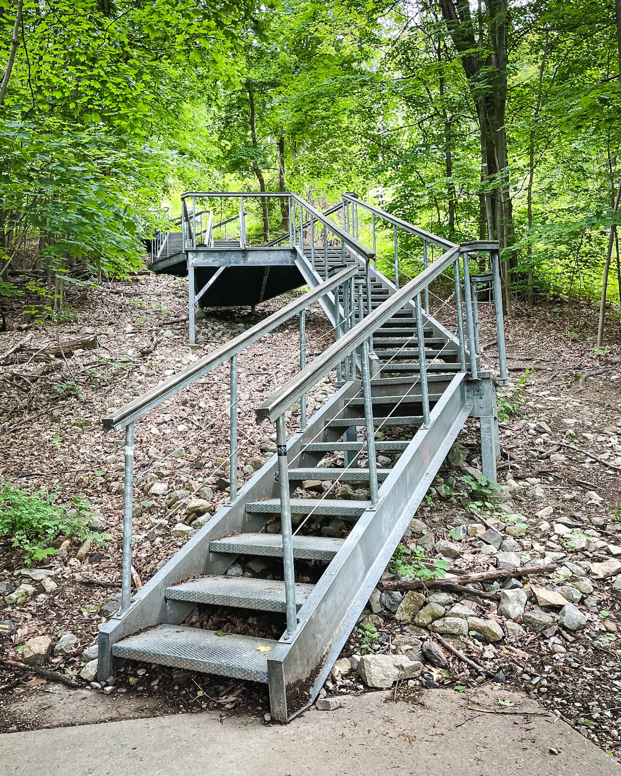
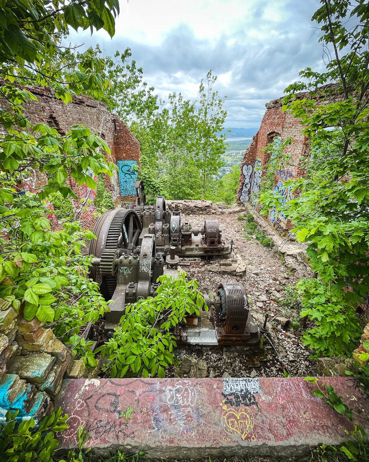
After the staircase, the trail ascends via switchbacks ascends to an observation deck offering the first long-distance views and remnants of the railway’s original powerhouse machinery.
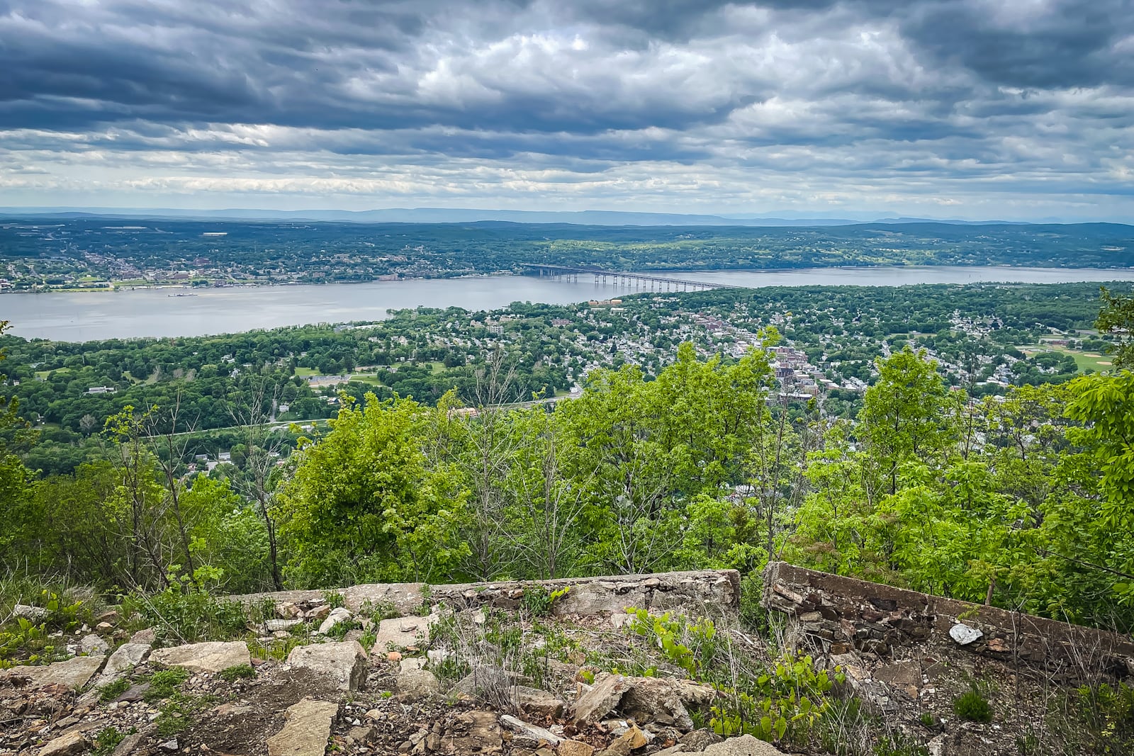
Reaching the foundations of the Beaconcrest Hotel and Casino (in reality a dance hall), spectacular vistas overlook the City of Beacon, the Hudson Valley and the Hudson Highlands.

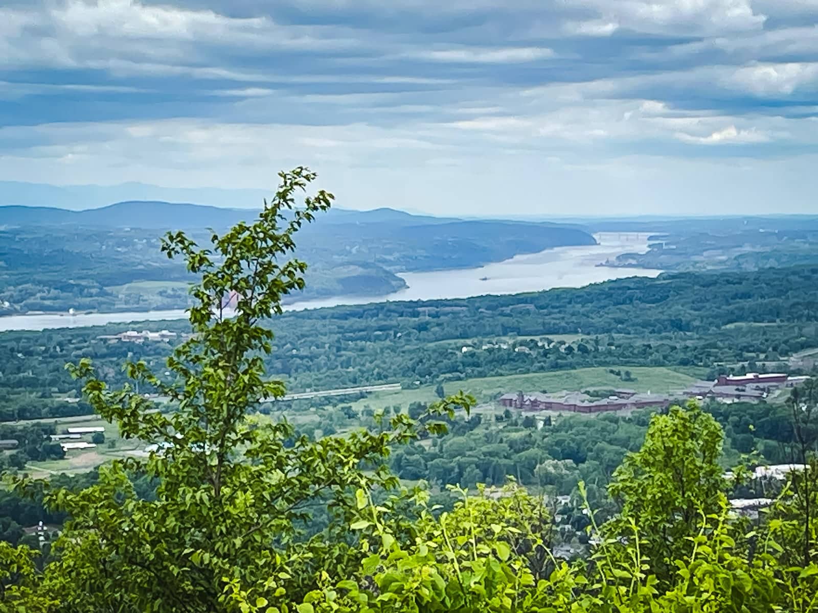
From here, the trail continues up…
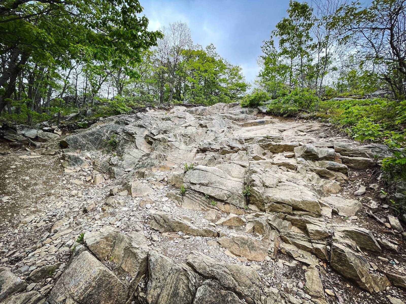
…and it’s a little rugged, but at least it’s not as steep as the first mile was.
Junction for Mount Beacon Fire Tower
At the junction, which is unmarked, a herd path leads uphill to the right in about 0.2 miles.
Mount Beacon fire tower comes into view very soon and you will likely meet other hikers, ascending and descending, on the trail.
You will need traction — proper hiking boots and, in winter, microspikes — to hike safely on the exposed slab rock.
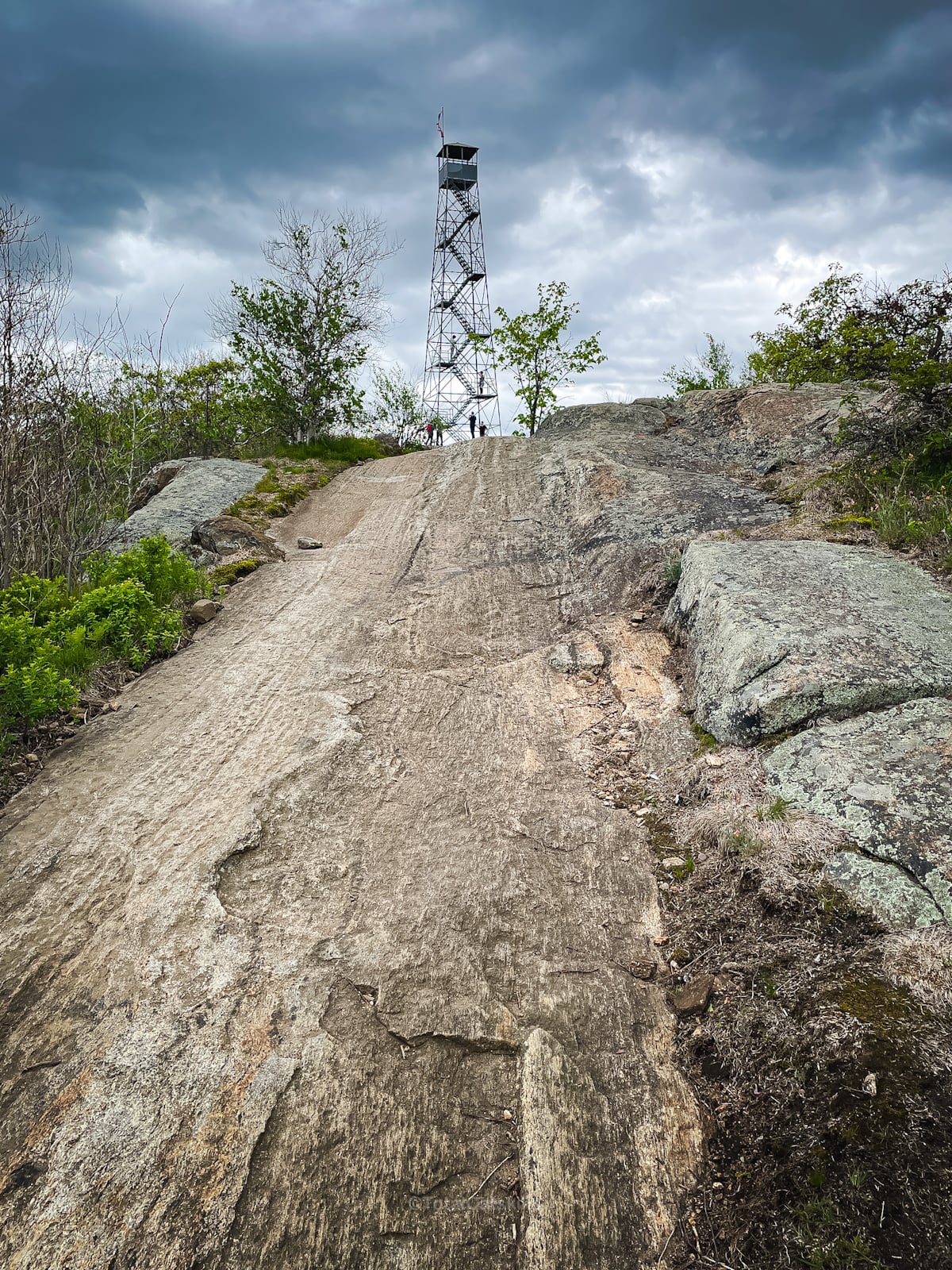
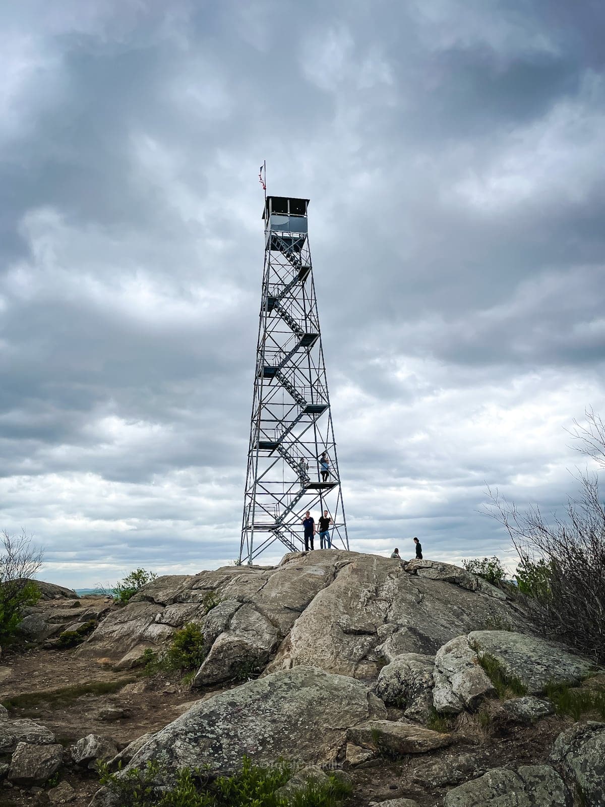
Fantastic Views
Looking south from Mount Beacon Fire Tower…

On a clear day, from this fire tower, you can see both Manhattan and Albany. Here’s Manhattan in the distance…

Looking north toward Beacon Reservoir and the Hudson River (left)…


Descent
There are several ways to return to the parking area. The easiest is to retrace your route and head back down the way you came.
You can also follow a fun loop around the reservoir via Schofield Ridge — trail guide coming soon.
Similar Hikes
There’s so much good hiking in the Hudson Highlands, so much to explore, and all within a short distance from New York City and The Catskills.
Read More
Get full access…
Get instant access to the full version of this site and enjoy great supporter benefits: full galleries, full trail notes, early access to the latest content, and more.
Hot on the website right now…
Follow for more…
Follow my @TotalCatskills content on Instagram for regular hiking inspo and safe, inclusive community.
Mount Beacon Fire Tower via Casino Trail Trailhead
Large but very popular lot.
Google Maps Location: 41.493614, -73.959983
The map below shows the exact topographic location of the trailhead
Cell Service
Good throughout. My network is Verizon. YMMV.
The parent mountain for this hike is South Beacon.
