Disclosure: This content may contain affiliate links. Read my disclosure policy.
A challenging through-hike. Half bushwhack, half trailed.
Hiking Trail Description
This is challenging bushwhack up the side of Panther Mountain to classic Catskills views, and includes a stunning easter egg.
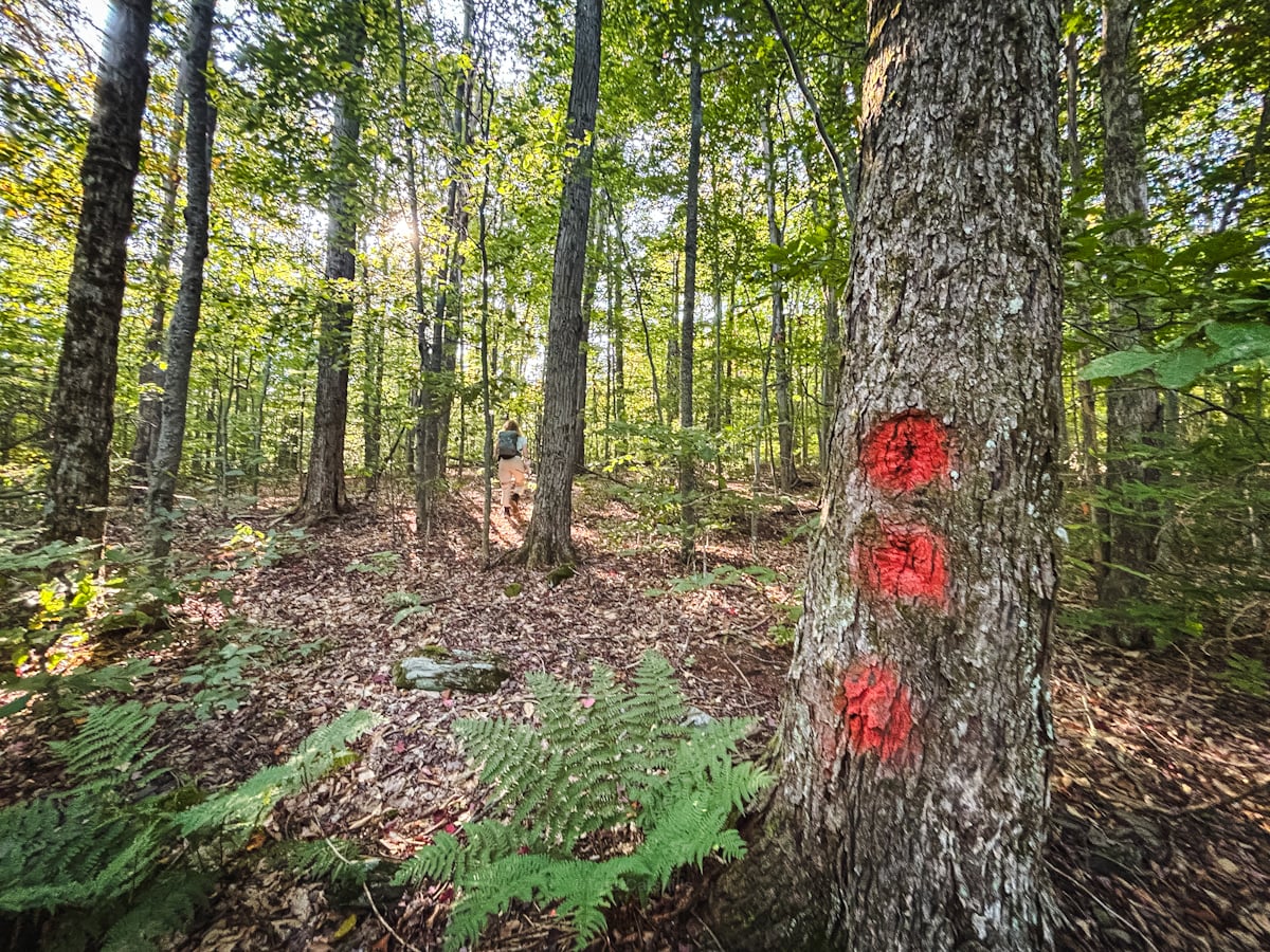
The bushwhack portion of this route has an odd start, then is immediately steep. After 900 ft of elevation gain in a half-mile, the route levels out into an long, easy middle section that consists of open forest—and some of the quietest Catskills terrain I’ve hiked. The last portion of the climb is steep again, including some fun ledges and a black raspberry patch.
Note: this is a true bushwhack; there are no herd paths. Strong backcountry navigation skills are a must.
Once you make it to the trail on Panther’s ridge, you’re not done: it’s an additional ¾ mile to the summit with 500 ft of elevation gain — which doesn’t sound like much but, on the hot and humid day we did this route, it felt like a lot.
Bear Poop Ridge is not a real name, of course. It’s just what I’ve decided to call the unnamed hump near Route 47 — summit at 2,379′ — because, in all my hiking days combined, I’d never seen so much bear poop.
This route requires a car shuttle between terminuses.
Frequently Asked Questions
How long does it take to hike this route
Allow 7-9 hours for this hike. Bring plenty of snacks, hydration, and electrolytes.
What is the elevation gain for Panther via Bear Poop Ridge
The elevation gain for this hike is 2,800 feet (apx 855 meters).
Panther via Bear Poop Ridge Route Guide
This route includes…
- Hidden parking area
- Very steep start
- Long bushwhack through true bushwhack territory
- A substantial plane wreck
- Excellent views from Panther and Giant Ledge
- Trails all the way out
A full breakdown is provided in the hike notes below, with a ton of photos.
BTW, you might also enjoy…
- NEW › Winter Skincare for Hikers
- CATSKILLS › Best Catskills Waterfalls
- STAY › Find Your Perfect Catskills Stay
- ADIRONDACKS › Hike Van Hovenberg
- ENTERTAINMENT › Best & Worst Hiking Movies
- Follow › My Instagram @TotalCatskills
- Follow › My Substack @TotalCatskills
- Follow › My writing for Times Union
Panther via Bear Poop Ridge Trail Notes & Gallery
This route begins on a NYC DEP parcel but no permit is required.
Because I don’t want the exact location of the plane wreck blasted online, the route shown does not depict where the wreck is located. Those details are behind the paywall.
You’ve got the basic details, but there’s so much more…
Unlock this exclusive content to get deep intel on this hike, including my personal tips. Immerse yourself in every layer of the journey. With Mountain-Hiking.com, you’re not just skimming the surface; you’re delving into a passionate hiker’s in-depth experience.
Become a Patreon supporter today and immediately elevate your hiking adventures with full trail beta, comprehensive insights, and stunning visuals. Experience hundreds of trails to their absolute fullest!

Similar Hikes
For equally challenging routes, check this list of true bushwhacks.
And here’s my growing list of plane wrecks.
Read More
Get full access…
Get instant access to the full version of this site and enjoy great supporter benefits: full galleries, full trail notes, early access to the latest content, and more.
Hot on the website right now…
Follow for more…
Follow my @TotalCatskills content on Instagram for regular hiking inspo and safe, inclusive community.
Bushwhack Panther via Bear Poop Ridge Trailhead
A very difficult to spot / overgrown old woods road to the left of the open green area. Do not park in the green area.
Google Maps Location: 42.076219, -74.455666
The map below shows the exact topographic location of the trailhead
Cell Service
Patchy throughout. My network is Verizon. YMMV.
The parent mountain for this hike is Panther.
