Disclosure: This content may contain affiliate links. Read my disclosure policy.
The MacIntyre Range—sometimes called the MacIntyre Mountains—is one of the most striking ridge-lines in the High Peaks region of the Adirondacks.
Located just west of Mount Marcy, this rugged chain stretches roughly 8 miles (13 km) from Indian Pass to Avalanche Pass, forming some of the most dramatic alpine terrain in New York State.
From southwest to northeast, the range includes Mount Marshall, Iroquois Peak, Boundary Peak, Algonquin Peak, and Wright Peak. Together, these summits form one of the classic Adirondack ridge hikes, with Algonquin Peak standing as the second-highest mountain in New York, just behind Mount Marcy.
The Classic MacIntyre Range Traverse
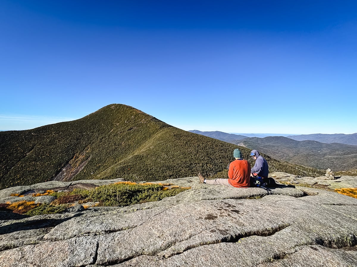
Most hikers tackle the Wright/Algonquin/Iroquois trio as a single, demanding day-hike that begins and ends at Adirondak Loj, near Lake Placid.
- Trailhead: Adirondak Loj (Van Hoevenberg Trailhead)
- Distance: ~12 miles round-trip (Wright, Algonquin, and Iroquois)
- Elevation Gain: ~4,300 feet
- Difficulty: Challenging
- Time: 8–10 hours
The trail starts on the Van Hoevenberg Trail, then branches off toward Wright Peak, a steep but rewarding 4,580-foot summit with wide open views of the High Peaks.
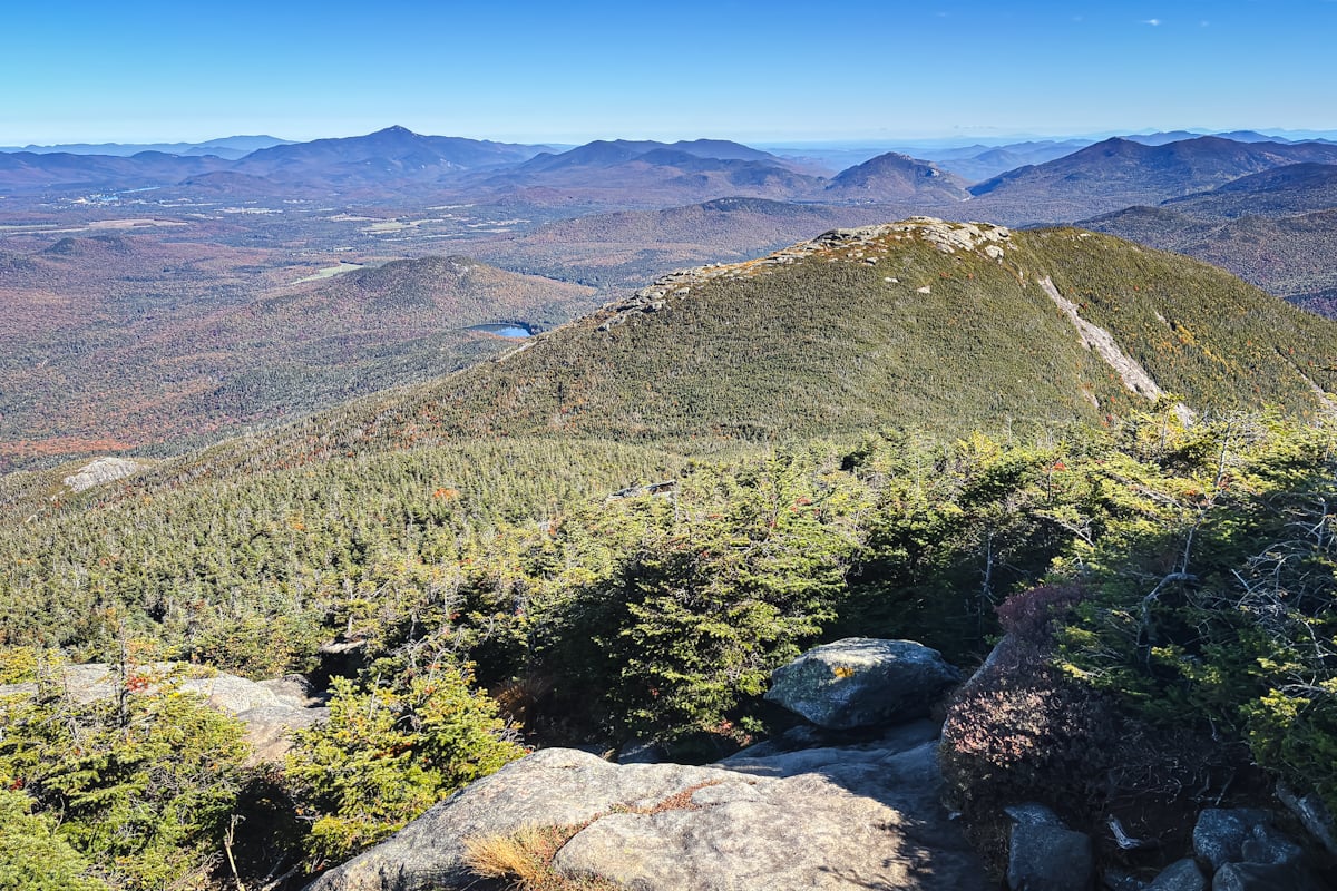
From there, the trail climbs to Algonquin Peak (5,114 feet)—a fully alpine summit with sweeping 360° views that rival Marcy’s.

Continuing south, a short and often muddy herd path leads to Iroquois Peak (4,840 feet) via Boundary Peak.

This full traverse is one of the most popular high-elevation hikes in the Adirondacks, offering alpine exposure and panoramic views. Hikers should come prepared for steep terrain, strong winds above treeline, and variable conditions—even in summer.
Mount Marshall: A Separate Climb
Although Mount Marshall (4,360 feet) belongs to the MacIntyre Range, it must be climbed separately. There is no maintained trail connecting it to the other MacIntyre peaks.
The usual route begins from the Upper Works Trailhead in Tahawus and follows the Calamity Brook Trail to Herbert Brook, which leads to the summit via an unmarked herd path.
- Trailhead: Upper Works (Tahawus)
- Distance: ~14.5 miles round-trip
- Elevation Gain: ~2,700 feet
- Difficulty: Strenuous
- Time: 8–9 hours
This quieter hike passes through forested terrain, with views limited compared to the open alpine peaks nearby, but it offers solitude and a sense of remoteness rare in the High Peaks.
About That Name
Despite the spelling difference, the MacIntyre Range was named after Archibald McIntyre, who founded the McIntyre Iron Works at nearby Tahawus. The name was first given to Algonquin Peak in 1837 by geologist Ebenezer Emmons, and later extended to the whole range by mountaineer Russell Carson.
The earliest known ascent of any peak in the range dates back to 1797, when surveyor Charles Brodhead crossed Boundary Peak while mapping the Old Military Tract.
Planning Tips
- Best Season: Late June through early October. Winter ascents require full gear and alpine experience.
- Permits: No permits required, but day-use and parking fees apply at Adirondak Loj.
- Leave No Trace: Much of the range lies above treeline; stay on rock surfaces to protect fragile alpine vegetation.
- Weather: Conditions can change fast. Expect cold, wind, and poor visibility even in midsummer.
Read More
Get full access…
Get instant access to the full version of this site and enjoy great supporter benefits: full galleries, full trail notes, early access to the latest content, and more.
Hot on the website right now…
Follow for more…
Follow my @TotalCatskills content on Instagram for regular hiking inspo and safe, inclusive community.
