Disclosure: This content may contain affiliate links. Read my disclosure policy.
A long difficult loop with several entry/exit points — but no easy bail-out points.
Hiking Trail Description
The Huckleberry Loop Trail is the only true loop hike in the Catskills. It’s long and difficult and deeply rewarding. You likely don’t know about this hike, but you absolutely should.
Catskills hikers tend to be focussed on The Catskills 3500 Challenge. But Huckleberry Loop is a prime example of how much the Catskills have to offer hikers “off-list”. While this route is not on most people’s radar, it might be my favorite trail in the entire Catskills.
So far, I’ve hiked Huckleberry Loop twice — once in June and once in September — and both times I’ve had an intensely special experience. I’m committed to hiking this trail in every month of the year.
When I first completed the trail in 2021, I had such an amazing experience that, actually, I began to doubt it was truly as amazing as it seemed. I was so blown away, I thought that maybe I’d had some kind of weird mental experience unrelated to the qualities of the trail. LOL.
But I hiked it again in 2022 and now I’m certain: this hike really is an amazing experience!
BTW, a week later, a friend also did the loop and texted me from the trail, “This is the most beautiful hike in the Catskills.” Indeed.
This hike is for the soul.
If you hike this hike — however it went, good or bad — I’m deeply interested in hearing about your experience. Comment below or shoot me a DM on Instagram.
BTW, you might also enjoy…
- NEW › New York Hike Finder Tool
- CATSKILLS › Escarpment Trail Guide
- STAY › Find Your Perfect Catskills Stay
- ADIRONDACKS › Dix Range from Elk Lake
- ENTERTAINMENT › 15 Best & Worst Hiking Movies
- Follow › My Instagram @TotalCatskills
- Follow › My Substack @TotalCatskills
- Follow › My writing for Times Union
Parking for Huckleberry Loop Trail
Bear with me, because I have strong opinions on the best place to begin and end this route.
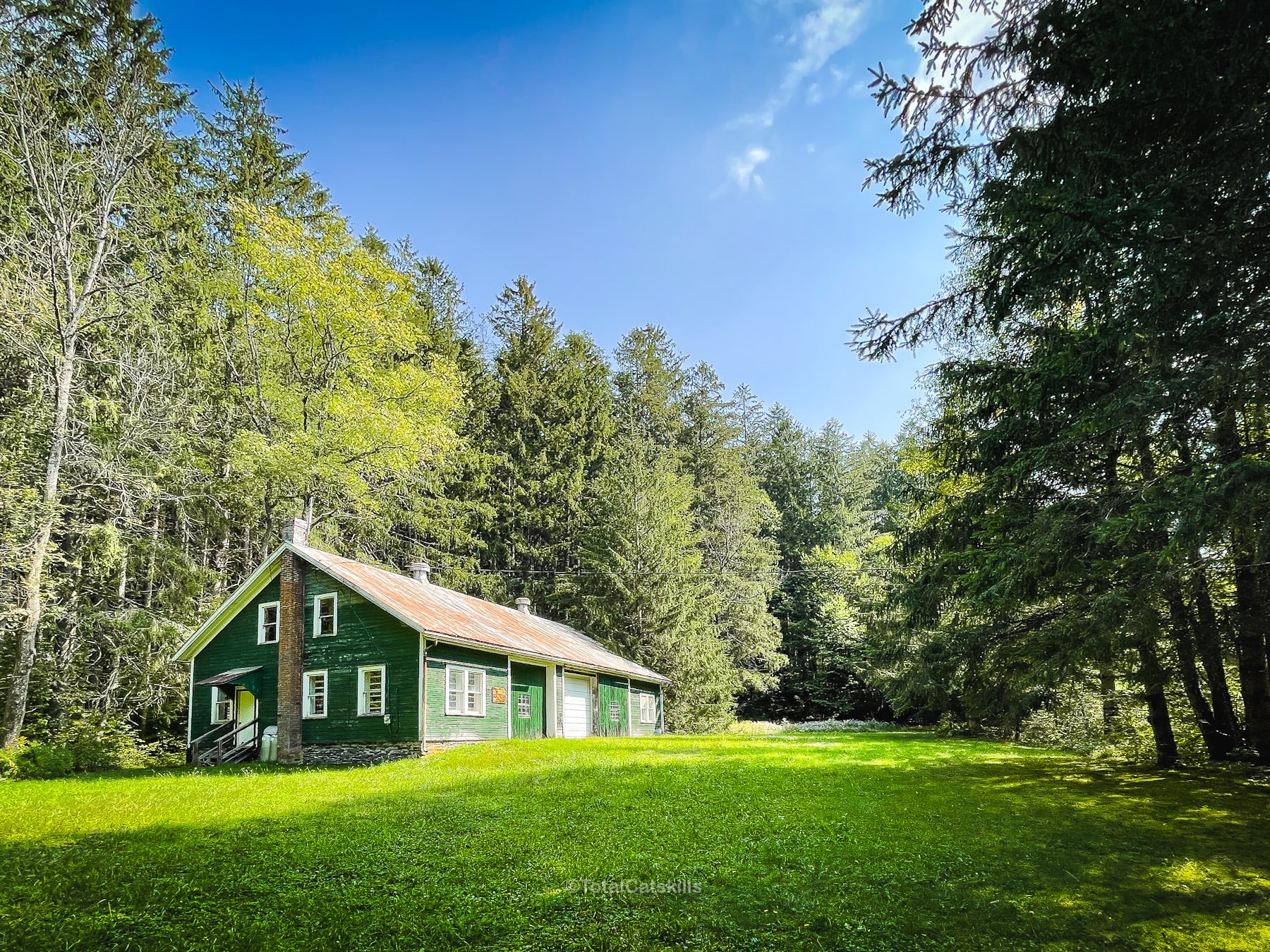
There are two lots on Huckleberry Brook Road. The lower trailhead is near the footbridge that marks the route’s entrance into the forest. The upper trailhead is near a large green DEC storage shed, which makes a fun landmark for the beginning and end of this hike.
IMO, the upper trailhead is the best place to begin and end the hike.
A third lot is 0.4 miles to the north on Hill Road which runs parallel to Huckleberry Brook Road.
There’s also a fourth lot on Ploutz Road, which is what I consider the half-way point on the loop.
Direction: Clockwise or Counterclockwise?
Because Huckleberry Loop Trail is a loop, it can be hiked in either direction. Here’s the skinny…
If you hike the route clockwise, both the beginning and end of your hike will be hiked uphill. Hiking ¾ mile uphill after 12¼ miles is not for me.
If you hike counter-clockwise, both the beginning and end of your hike will be hiked downhill. You’ll also end the hike walking through the magical red spruce plantations, shuffling the last miles on wonderfully soft pine-bed trail, right when your knees need a break.
So counter-clockwise is my strong recommendation. (If you want to do it clockwise, park at the lower trailhead so, at the end, you don’t have to do an uphill road walk.)
Hike the Huckleberry Loop Trail
At 13 miles, and with 2700 feet of elevation gain, including a few steep sections, Huckleberry Loop is not technically challenging.
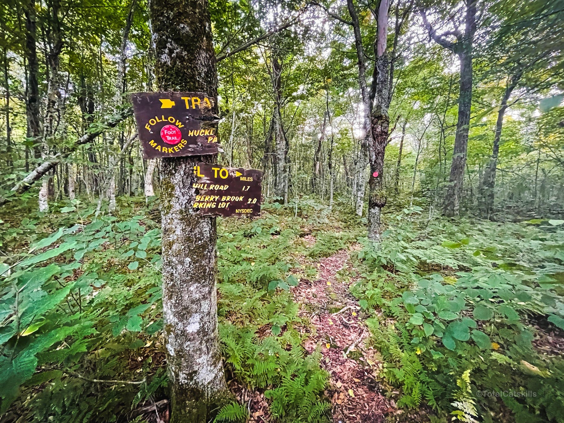
However, it is navigationally challenging. Sections of the trail are so remote they’re barely maintained.
Once you step on the loop, you quickly enter a remote and rarely-visited part of The Catskills. Overall, this hike will test your legs and knees.
There are several parking spots along the route where you can hop on and off the trail, but there are no easy bail-out points.
The Huckleberry Loop Trail DOES NOT include…
- High-peaks or substantial summits
- Fun rock scrambles
- Epic views
- Well-maintained trail
Huckleberry Loop Trail DOES include…
- A big green shed
- A different mile every mile
- A large meadow on top of a 7000-year-old bog
- One of the only legit navigational cairns in the Catskills
- Fantastic historical ruins
- Streams, blowdown, prickers, nettles
- One billion ferns
- Extreme solitude
- A small stream at the half-way point
- One solid scenic view
- Rare plants like wineleaf cinquefoil
- Old-growth forest
- One cliff walk
- A demon tree
- Four amazing spruce plantation forests
- An absolutely spectacular ending
BTW, this is not the same hike as the much shorter, and much easier, hike to Huckleberry Point in the Eastern Catskills.
Huckleberry Loop Hiking Trail Notes & Gallery
Huckleberry Loop has none of the things I would normally look for and expect from an amazing hike. Yet, mile for mile, it’s consistently interesting. Every mile feels different. And it ends (or begins) in spectacular fashion.
This route is absolutely magical. I don’t even know what to say.
Here are my mile-by-mile notes and photos for Huckleberry Loop…
Huckleberry Loop Trail South
Assuming, you begin at the upper trailhead on Huckleberry Brook Road, you’ll see this large green DEC storage shed through the trees…
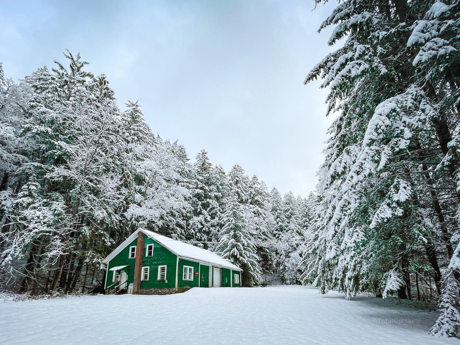
In winter, it looks like this…
Mile 1: From the DEC shed, hike downhill. The first ¾ mile is a road walk. But at least it’s by the very lovely Huckleberry Brook which is dotted with small waterfalls and edged with hemlock trees.
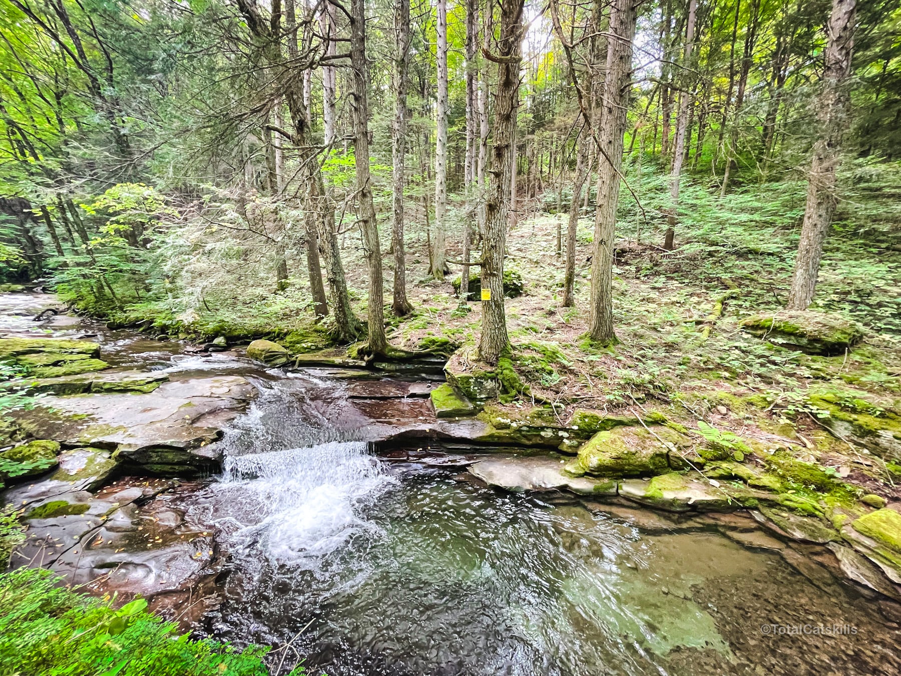
At the footbridge you’ll also find the trail register…
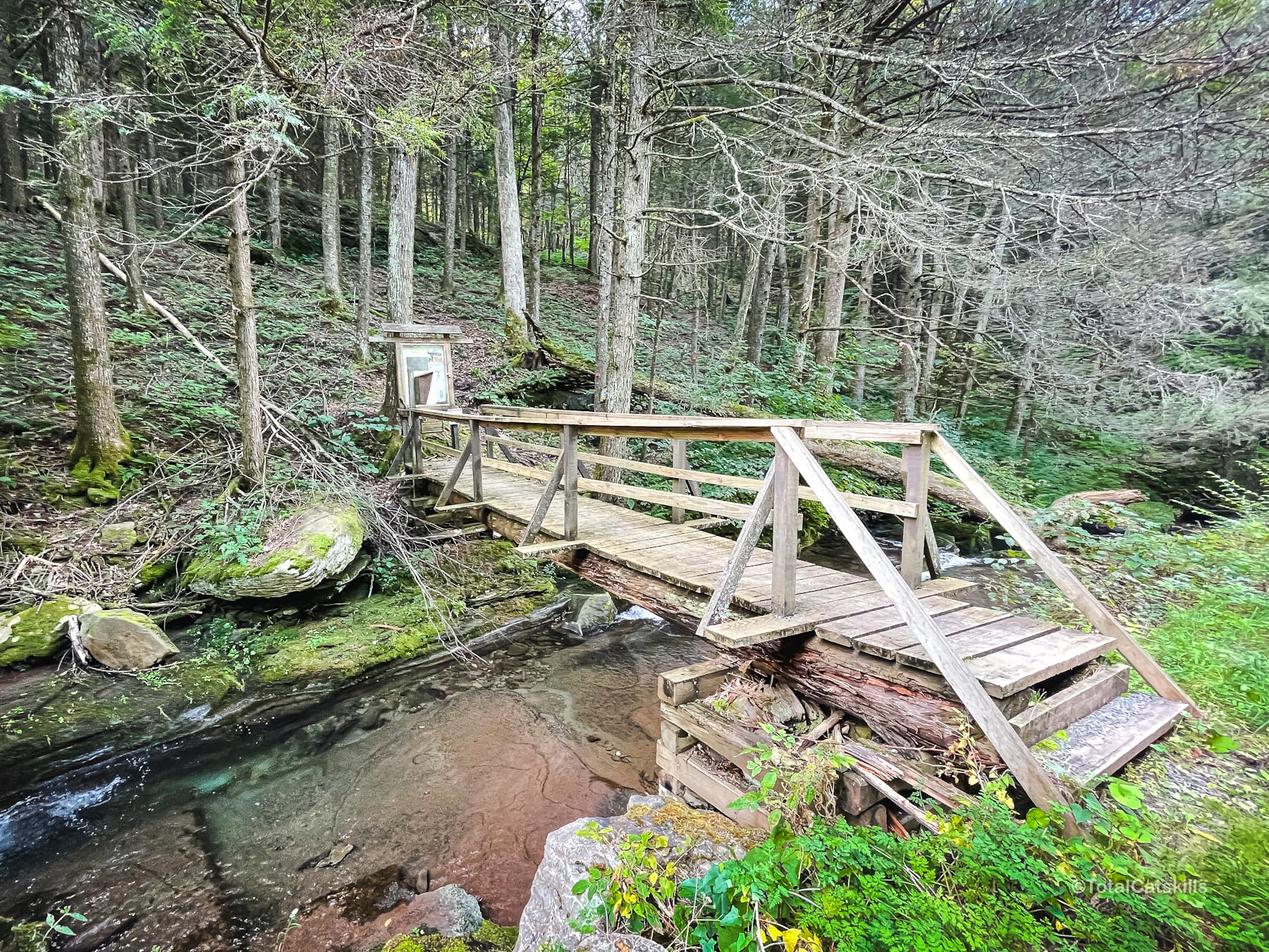
The next quarter mile is the first section in the woods. It’s immediately beautiful — although, in summer, nettles alongside the trail are something of an issue, so long pants are advised.
Mile 2: This mile has some of the steepest sections on the route, but there is also some elevation loss and several gentle switchbacks, and the nettles are less of an issue. The end of this mile is marked by a large glacial boulder.
Mile 3: Much easier going. Climb up/around the ridge and descend into an open meadow that sits atop a 7000 year old bog — one of the lowest elevation bogs in the Catskills. Look for a cairn on the left side of the meadow.
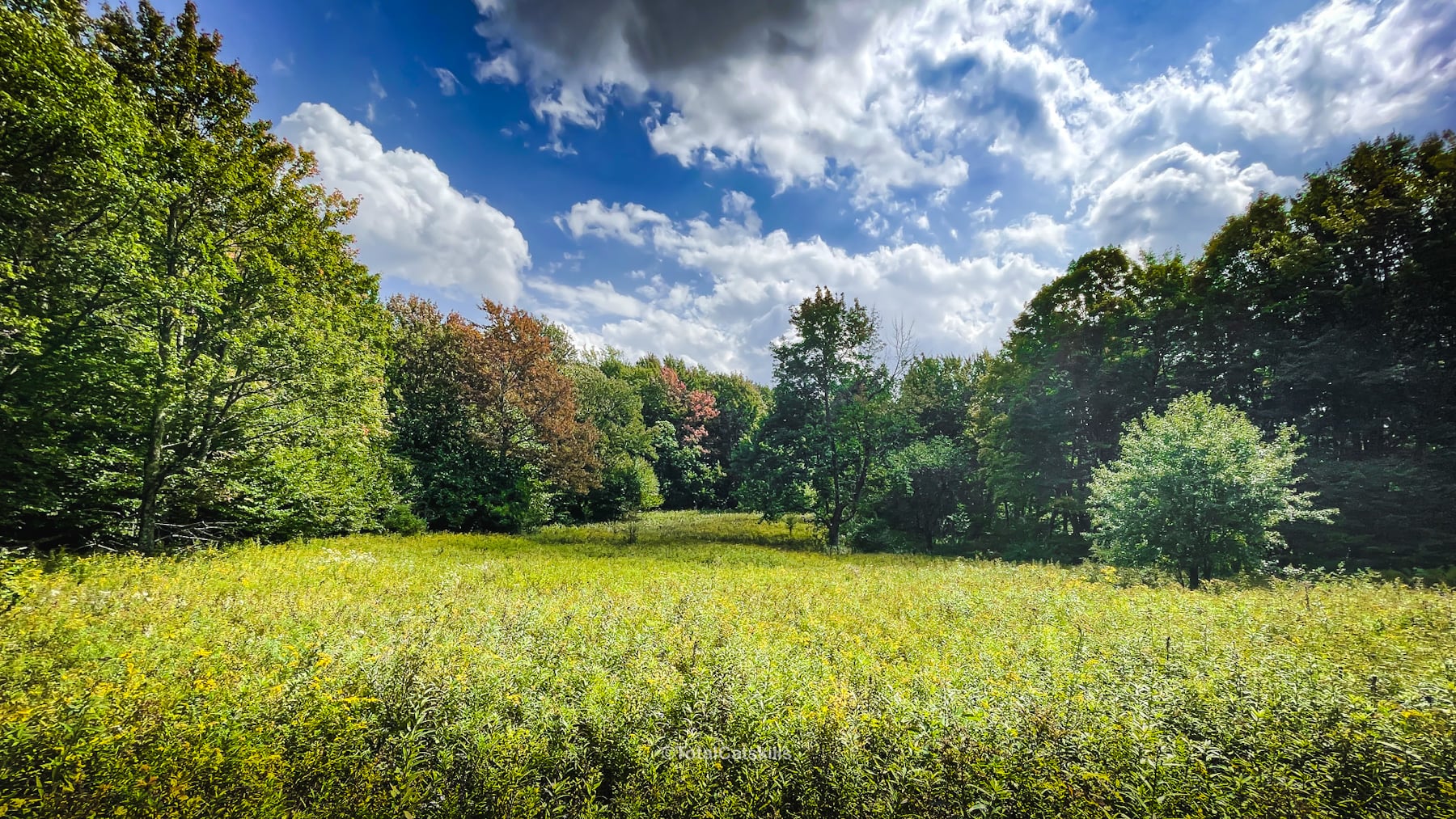
By late summer, the meadow is overgrown and the cairn can be difficult to see. Exit the meadow on the left.
The next section is also “shagbark hickory mile”, as you’ll pass many fine shagbark trees which are not common in the Catskills. It’s also the beginning of the ferny woods — including some wonderful giant ferns.
Finally, the end of Mile 3 marks the beginning of a welcome flat section. Overall, mile 3 is awesome.
Mile 4: Flat and easy but the trail is sometimes hard to follow. Note: at a junction in the ferns at the edge of a spruce stand, don’t go downhill to the left. Instead, keep going straight to pass through the spruces and reenter the fern forest. There’s lots of blowdown in this section which makes navigation tricky in spots.
Mile 5: This is the only boring mile. Lots of blowdown. And there’s a section with dense prickers. You’ll be glad of hiking poles or a selfie stick. This is the worst mile for blowdown obscuring the trail, and for in-grown trail. (Huckleberry Loop is not popular so the route is not well worn or maintained.)
The next mile, however, is super great…
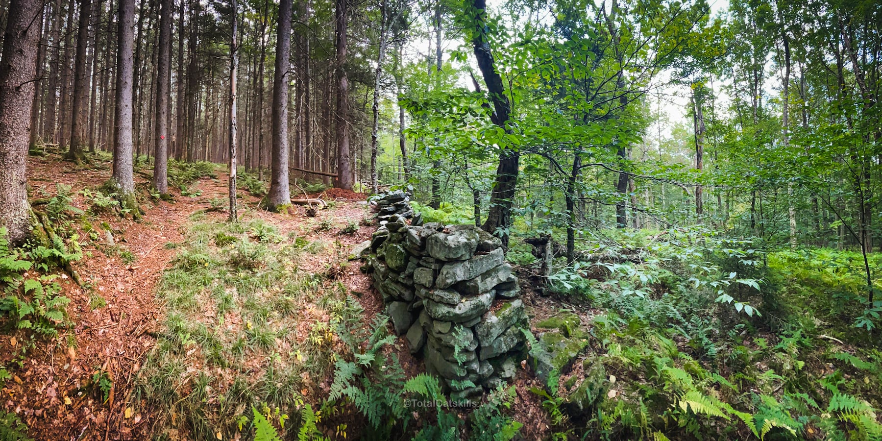
Mile 6: Some elevation loss before entering the first large spruce plantation. At first, you’ll notice some spruce saplings along the trail. Then you’ll pass through two large boulders at the edge of the plantation. These spruce plantations are common in the Catskills. Typically, they’re in reclaimed pasture from the old farming days. The state bought the land and FDR’s Civilian Conservation Corps (which ran from 1933 to 1942 as part of his New Deal response to the Great Depression) planted a bunch of forests, among other projects for the outdoors. So we have FDR to thank for these amazing woods.
This spot, shown above and below, just blows me away. It shows clearly, on either side of a stone fence, the human-planted spruce forest inside the walls and the deciduous forest beyond them, lush and wild.
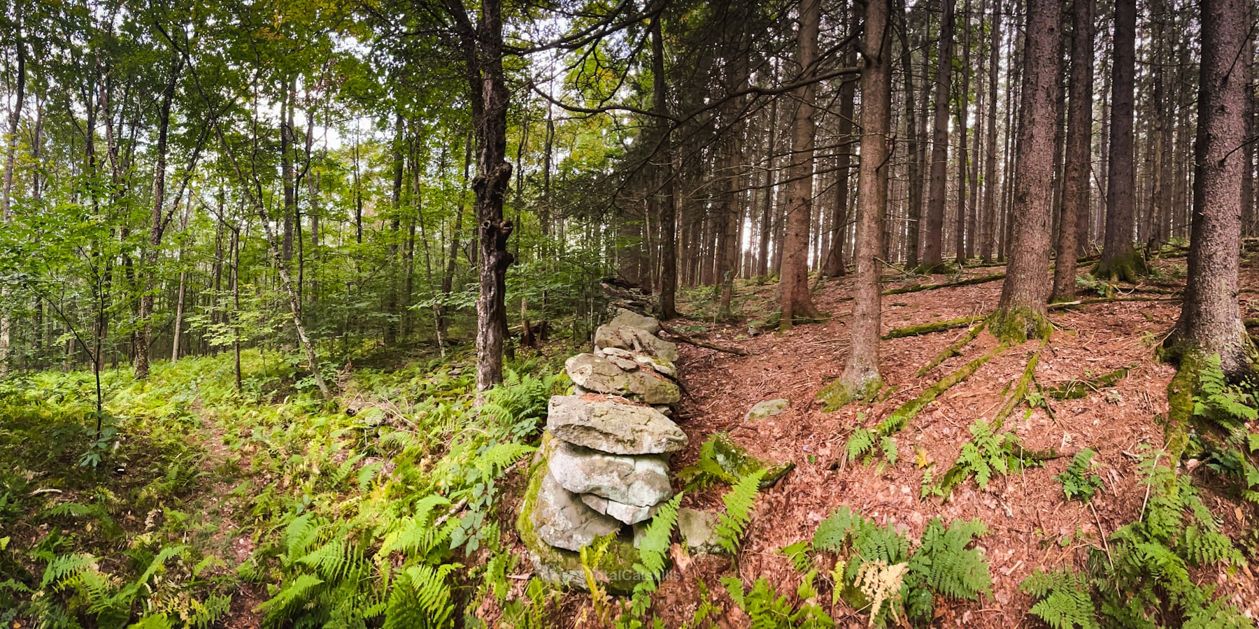
This almost looks like a Photoshop job, showing the same scene in two seasons — but these are just basic iPhone panoramic photos taken on the same day.
Congrats on completing the first half of the Huckleberry Loop Trail!
Huckleberry Loop Trail North
The following content is accessible to my Patreon subscribers who kindly support this independent website. Get full access to every post on this site instantly. Support local, independent content and enjoy great supporter benefits: full galleries, full trail notes, early access to the latest content, and more.
Why get just the highlights when you can immerse yourself in every layer of the journey? With Mountain-Hiking.com, you aren’t merely skimming the surface; you’re delving into a passionate hiker’s in-depth experience.
Become a Patreon supporter today and elevate your hiking adventures with comprehensive insights and stunning visuals. Experience trails like never before!
Similar Hikes
There are none. In the Catskills, Huckleberry Loop Trail is truly unique.
Read More
Get full access…
Get instant access to the full version of this site and enjoy great supporter benefits: full galleries, full trail notes, early access to the latest content, and more.
Hot on the website right now…
Follow for more…
Follow my @TotalCatskills content on Instagram for regular hiking inspo and safe, inclusive community.
Huckleberry Loop, Catskills: a Mile-by-Mile Guide Trailhead
Very small road-side lot.
Google Maps Location: 42.112896, -74.650374
The map below shows the exact topographic location of the trailhead
Cell Service
You will have patchy cell services once you gain some elevation. Count on having none at any trailhead. My network is Verizon. YMMV.
The parent mountain for this hike is Dry Brook Ridge.
