Disclosure: This content may contain affiliate links. Read my disclosure policy.
Easy-peasy lollipop loops. No dogs allowed.
Trailhead info at bottom of this post.
Hiking Trail Description
Israel Wittman Sanctuary’s three serene loops have so much to recommend them: lovely quiet mixed forest, delightful footbridges, dozens of stone fences built by early settlers, abandoned quarries, a gorge, exposed rock faces, even a field of glacial erratics.
Located in the Zena Highwoods area where the towns of Woodstock, Saugerties, and Ulster meet, the sanctuary offers 4.4 miles of beautiful, walkable, bikeable trails.
The sanctuary’s three loops — A, B, and now C — are generally quite level; the total elevation gain of all three combined is just 180 feet, so all walkers can enjoy these trails.
However, note: dogs are not allowed on the property.
The land is managed by Woodstock Land Conservancy who were donated the parcel by Elaine Chaback; the sanctuary is named in honor of her father.
BTW, you might also enjoy…
- UPDATED › Best Bug Spray & Bug Repellent for Hikers
- CATSKILLS › Peakbagging The Catskills High Peaks (Ultimate Guide)
- STAY › Find Your Perfect Catskills Stay
- ADIRONDACKS › Wright, Algonquin & Iroquois Peaks
- LEARN › Teach Yourself How to Use a Compass
- ENTERTAINMENT › Best & Worst Hiking Movies
- Follow › My Instagram @TotalCatskills
- Follow › My Substack @TotalCatskills
- Follow › My writing for Times Union
Israel Wittman Sanctuary Trails
The Israel Wittman Sanctuary trail system includes…
- Newly enlarged parking area
- Three loops totaling 4.4 miles
- Very easy woods walking
- Quarries
- A gorge
- Footbridges
- Vernal ponds
- Trails suitable for walking, hiking, trail running, biking
Allow 1-2 hours for this hike.
Israel Wittman Sanctuary Notes & Gallery
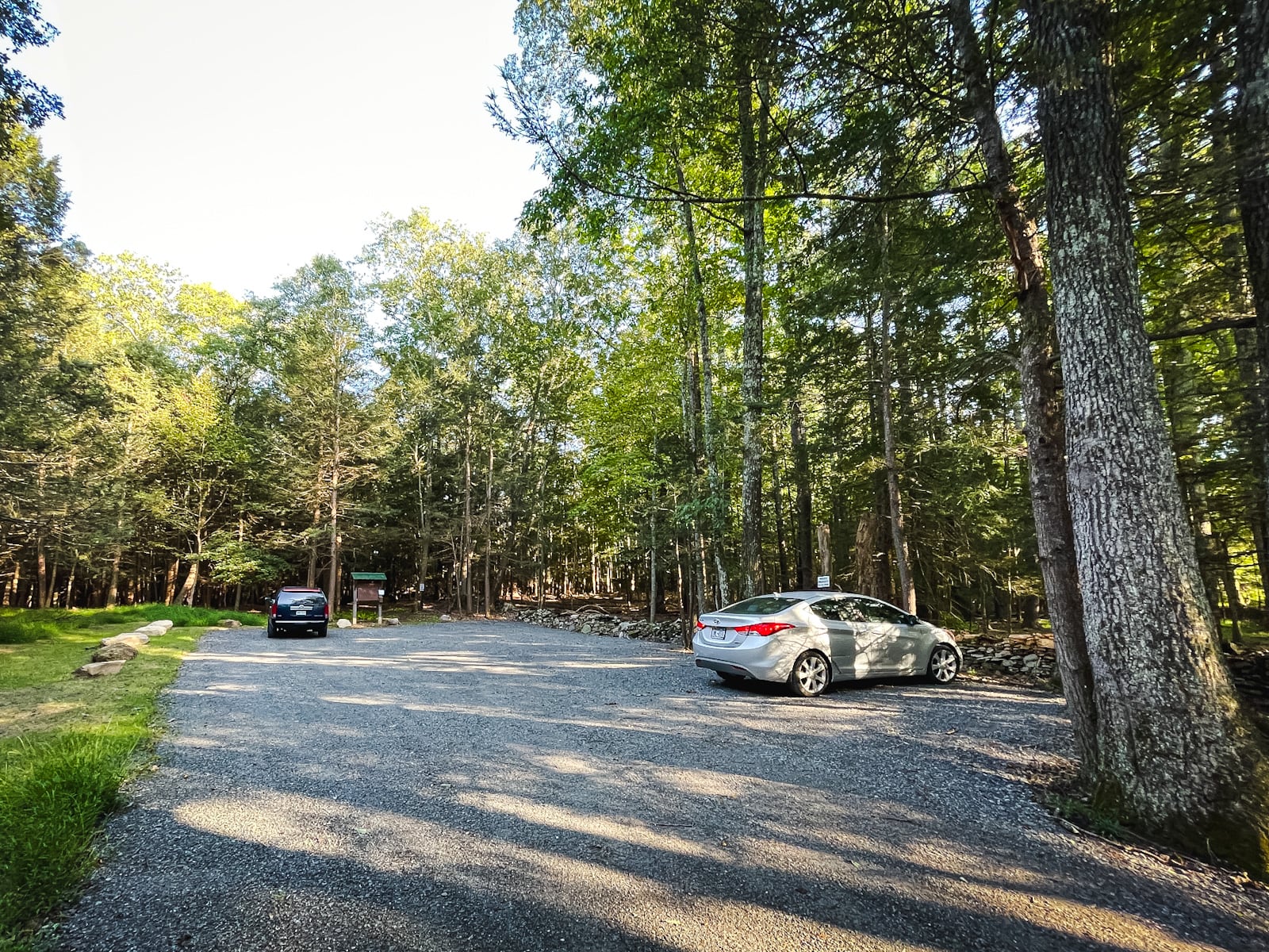
The previous parking area was tiny. Enlarged in 2023 through grant funding awarded by The New York State Conservation Partnership Program, the new lot provides, finally, a fitting space for this locally beloved sanctuary.
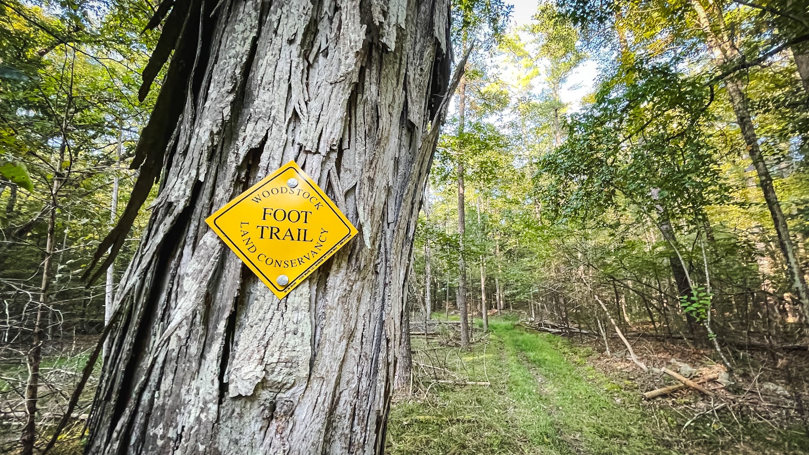
Walk past the information kiosk and through the stand of hemlock trees, following the yellow blazes. Although there are homes in the area, the sanctuary quickly feels remote and peaceful.
 You’ve got the basic details, but there’s so much more…
Unlock this site now to get complete intel on every route, including my full photo galleries, personal insights and tips. Elevate your next hike with deep trail beta. Experience hundreds of amazing routes at their absolute finest. With Mountain-Hiking.com, you’re not just skimming the surface.
Sean

Over the years, I’ve been back to this sanctuary many, many times. It’s only 20 minutes from Kingston and is just so lovely and peaceful.
Similar Hikes
This sanctuary is one of my favorite Catskills nature trails.
It’s short and kid-friendly and beautiful.
Read More
Get full access…
Get instant access to the full version of this site and enjoy great supporter benefits: full galleries, full trail notes, early access to the latest content, and more.
Hot on the website right now…
Follow for more…
Follow my @TotalCatskills content on Instagram for regular hiking inspo and safe, inclusive community.

Israel Wittman Sanctuary Hiking Trails Trailhead
Enlarged lot now allows for maybe a dozen cars.
Google Maps Location: 42.029147, -74.040656
The map below shows the exact topographic location of the trailhead
Cell Service
Patchy throughout. My network is Verizon. YMMV.
The parent mountain for this hike is Overlook.