Disclosure: This content may contain affiliate links. Read my disclosure policy.
Tough loop with a quick spur for great views near the beginning.
Trailhead info at bottom of this post.
The Nun-Da-Ga-O Ridge Loop is not an Adirondack High Peaks hike — but it is one of the most magical trails I’ve ever hiked.
I “discovered” this range accidentally. I was looking on my maps for a nice quiet route between Big Crow and Hurricane Mountain, and saw that the contours for this hike look very mild.
LOL. This hike is not mild. This hike is a difficult hike.
I lost track of the number of sketchy scrambles, open ledges, and insane views this incredible trail provides. I think there are maybe seven? Who knows. At some point, I stopped counting and just enjoyed the hell out of this super fun route. This hike is a first-rate Adirondack hiking experience.
You must be physically strong and used to hiking to complete this hike. I would recommend that you do not bring a dog on this route.
Nun-Da-Ga-O Ridge Trailhead & Parking
From Keene, NY, head east on Hurricane Road for 2.2 miles. Watch for a fork on the left side of the road, and turn left onto O’Toole road.
In winter and spring, you may need to walk the final section of road to the trailhead. O’Toole Road is an unmaintained dirt road: unplowed after snow and very muddy after rain or snow melt.
The parking area is a large loop. The trailhead on the SE side of the loop is the beginning of the trailed hiking route to Hurricane Mountain.
For this trail, use the NW trailhead which leads to Big Crow Mountain.
BTW, you might also enjoy…
- UPDATED › Best Bug Spray & Bug Repellent for Hikers
- CATSKILLS › Peakbagging The Catskills High Peaks (Ultimate Guide)
- STAY › Find Your Perfect Catskills Stay
- ADIRONDACKS › Wright, Algonquin & Iroquois Peaks
- LEARN › Teach Yourself How to Use a Compass
- ENTERTAINMENT › Best & Worst Hiking Movies
- Follow › My Instagram @TotalCatskills
- Follow › My Substack @TotalCatskills
- Follow › My writing for Times Union
AKA The Soda Range
The Nun-Da-Ga-O mountain range is also known as The Soda Range.

Nun-Da-Ga-O Ridge / Soda Range Hiking Trail
This hike begins with a short side hike to Big Crow which you can read about in detail here.
From the trailhead, it took about 20 minutes to get to the junction / turn-off for Nun-Da-Ga-O trail. Look for a small unofficial sign posted on a tree on the right side of the trail…
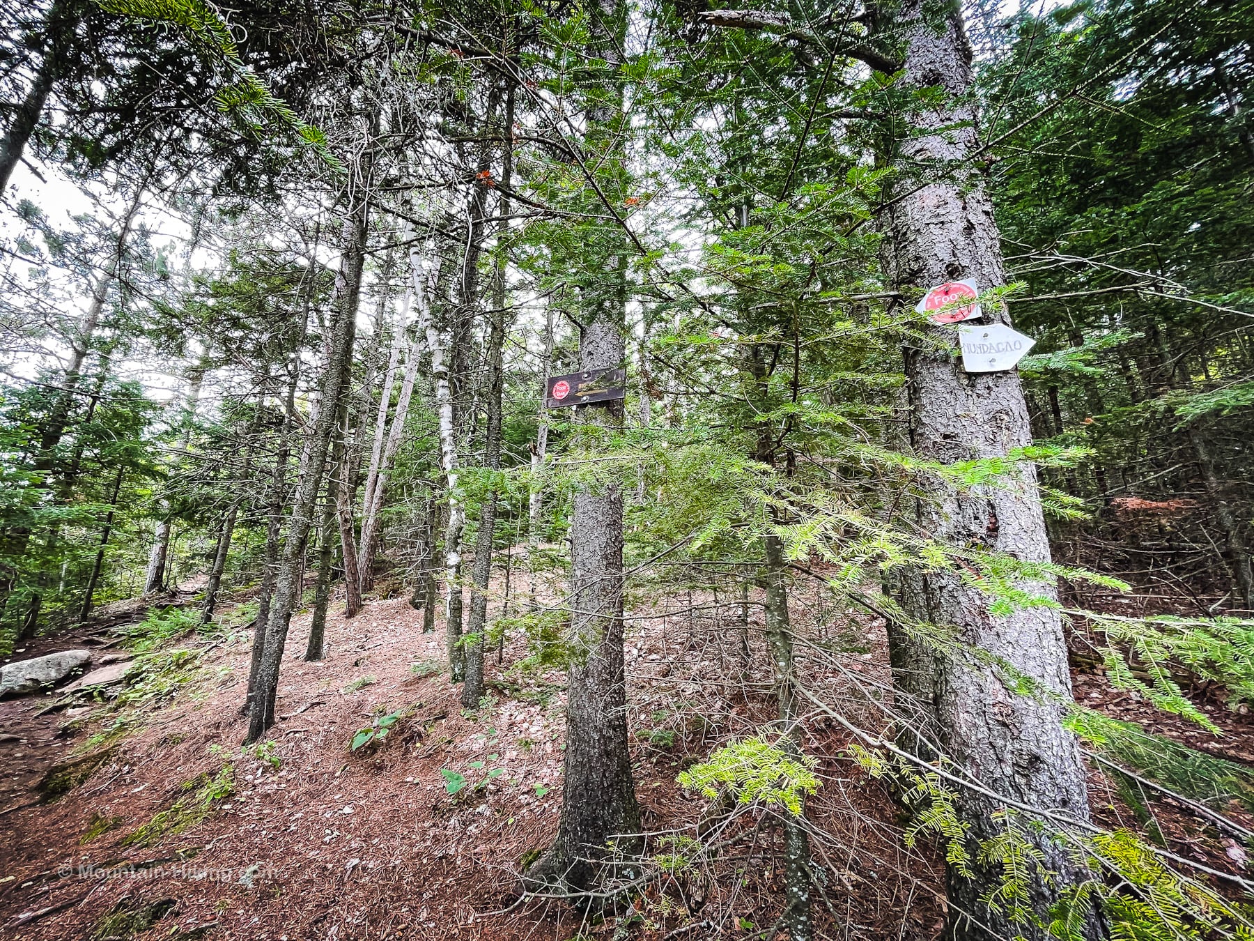
The trail is blazed with white diamonds — but only at first. You will need good navigation skills and steady nerves to deal with this hike. This unofficial trail is confusing.
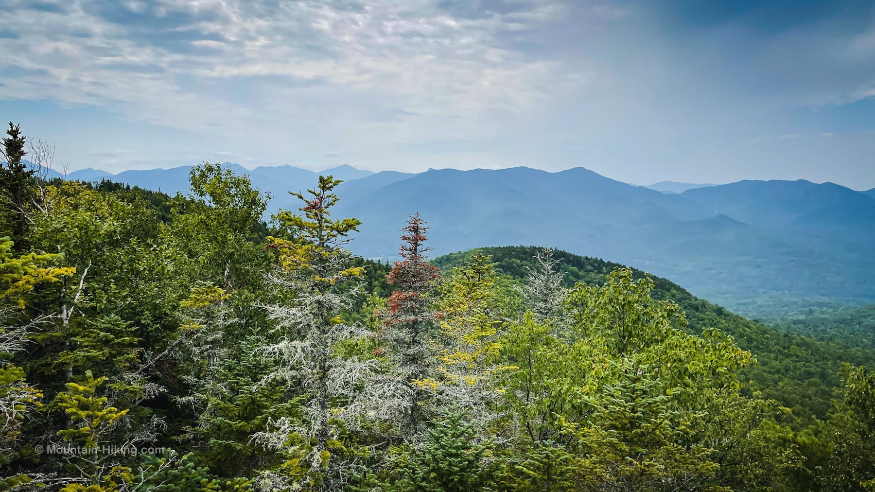
The first section is easy. There are some nice views of Adirondack High Peaks on both sides of the trail from rocky nubs and outcrops.
Nun-Da-Ga-O Ridge
The fun begins when you come face-to-face with this massive cliff…
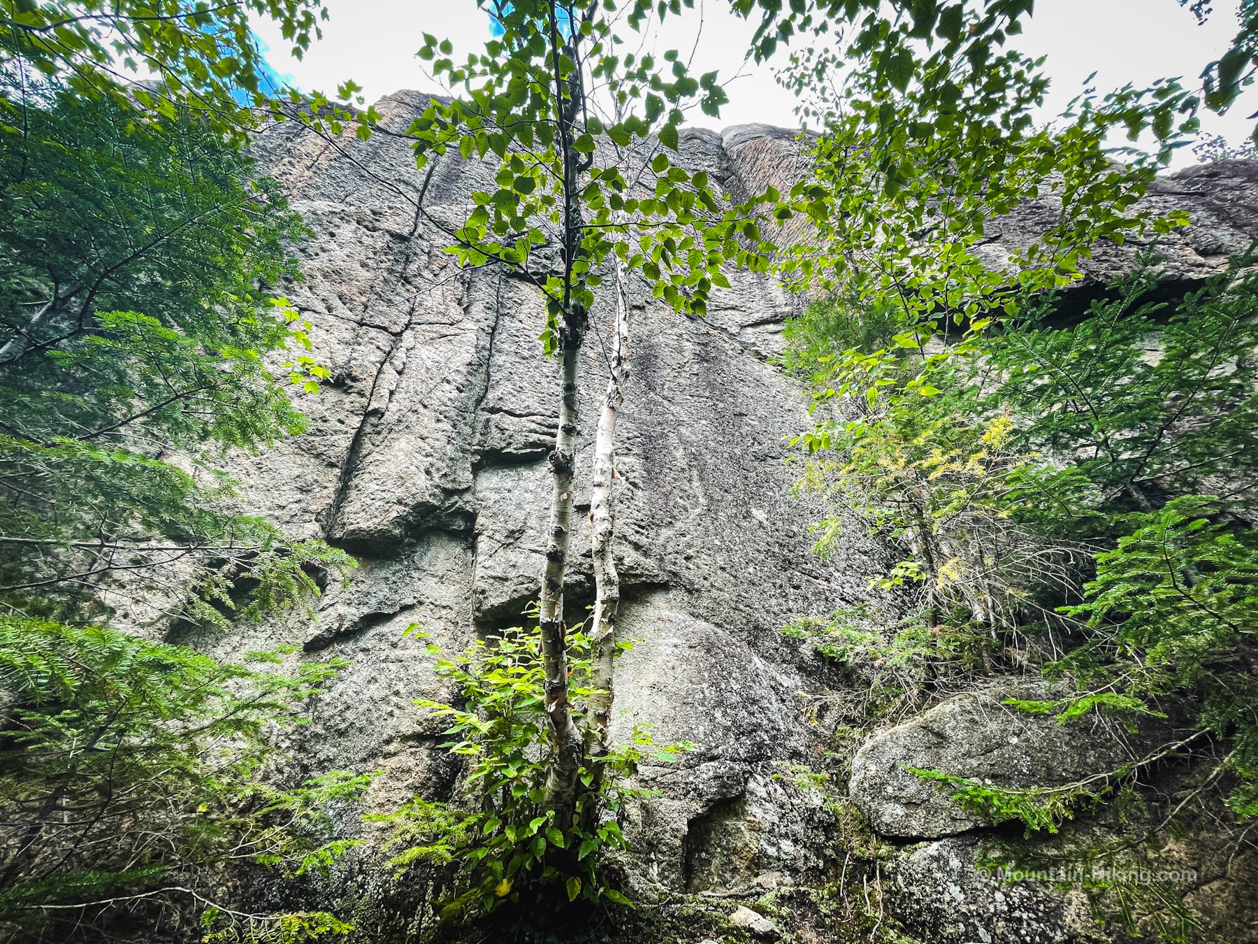
I made my way around to the right side of this seemingly impenetrable wall and found a way up.
After six or seven minutes of extremely sketchy scrambling, my first (very unexpected) reward was this fantastic panoramic view from atop a massive narrow ledge…
The remainder of this trail guide is accessible to members who kindly support this content — get full access now and unlock this website.

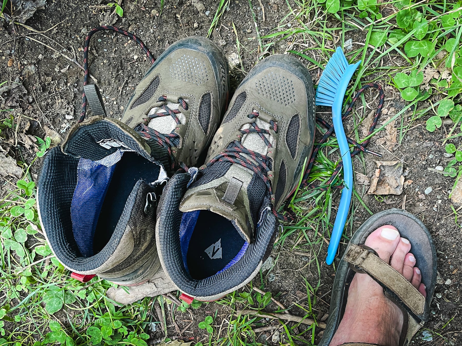
Post-Hike Tricks…
Because I hike mostly in the Catskills, when I go to the Adirondacks, after a hike, I always clean off my hiking boots at the trailhead before the drive home. Here are nine more useful post-hike hacks.
Similar Hikes
If you enjoy challenging hikes, check out these lists of difficult hikes and hardest hikes.
And this hike is definitely included in my list of scenic hikes.
Get full access…
Get instant access to the full version of this site and enjoy great supporter benefits: full galleries, full trail notes, early access to the latest content, and more.
Hot on the website right now…
Follow for more…
Follow my @TotalCatskills content on Instagram for regular hiking inspo and safe, inclusive community.
Nun-Da-Ga-O Ridge Loop Trailhead
Sizeable loop-shaped parking lot — but this a popular lot that serves several popular hikes.
Google Maps Location: 44.261671, -73.732618
The map below shows the exact topographic location of the trailhead
Cell Service
Good cell service throughout hike. My network is Verizon. YMMV.
The parent mountain for this hike is Coal Dirt Hill.
