Disclosure: This content may contain affiliate links. Read my disclosure policy.
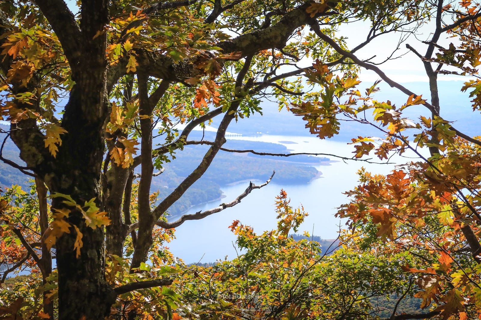
Samuels Point is a steep mountain on the west side of the Ashokan Reservoir in The Catskills. It’s the prominent ridge that flows east from Wittenberg Mountain toward the reservoir — but it’s also a cliff with great views of the Devil’s Path.
This might be the shortest-but-toughest bushwhack I’ve completed. The route a friend and I took was definite Type II Fun, with patches that were strong contenders for never-to-be-repeated Type III Fun.
I first tried Samuels Point with another friend in November 2021. We turned around below the col when it began to snow and I didn’t like the look of the ice on such uneven terrain. In retrospect, because of what I found subsequently, that was probably one of my best decisions ever to turn around.
In October 2022, I hiked Samuels Point again. Even on a beautiful perfect hiking day, it still kinda sucked. But it was totally worth it, too.
I can’t wait to go back in the dead of winter.
This hike is obviously on Samuels Point, but it contains a handful of sensitive spots so I have made it a secret hike.
Samuels Point Hike
This route includes…
- Steep abandoned roads wood
- Historical ruins
- Thick spruce and hemlock forest
- Incredibly dense stands of mountain laurel
- Meadows of blueberry and reindeer moss
- Stone alters
- Stone fire rings
- Great view of the Devil’s Path
- Peekaboo views of the Ashokan Reservoir
Note About Maps & Apostrophes
There are almost no apostrophes on American maps, since about 1890 when the US Board on Geographic Names was established and discouraged their use.
This makes it very difficult to find out if a place is named after, say, a Samuel Bobbington or a Bob Samuels. So is it Samuel’s Point or is it Samuels’ Point? If somebody lets me know in the comments below, I’ll update this page.
BTW, you might also enjoy…
- UPDATED › Best Bug Spray & Bug Repellent for Hikers
- CATSKILLS › Peakbagging The Catskills High Peaks (Ultimate Guide)
- STAY › Find Your Perfect Catskills Stay
- ADIRONDACKS › Wright, Algonquin & Iroquois Peaks
- LEARN › Teach Yourself How to Use a Compass
- ENTERTAINMENT › Best & Worst Hiking Movies
- Follow › My Instagram @TotalCatskills
- Follow › My Substack @TotalCatskills
- Follow › My writing for Times Union
Samuels Point Notes & Gallery
This hike begins in Traver Hollow on Bradkin Road, a really lovely stretch along the Traver Hollow Stream. You’ll see a lot of small pull-offs along the road, and there’s a number of spots that look great for easy camping. But there’s also a lot of private property around here, so make sure to stay on public land.
There are no trail markings for this hike. Finding the old woods road at the beginning of this route can be confusing. Poke around using the attached GPS track to get started.
Follow the woods road uphill. It’s mostly very clear but there are patches where it disappears altogether, or is just completely overgrown with saplings, or is obscured with blowdown. And in summer, the wet sections can be a little nettle-ly.
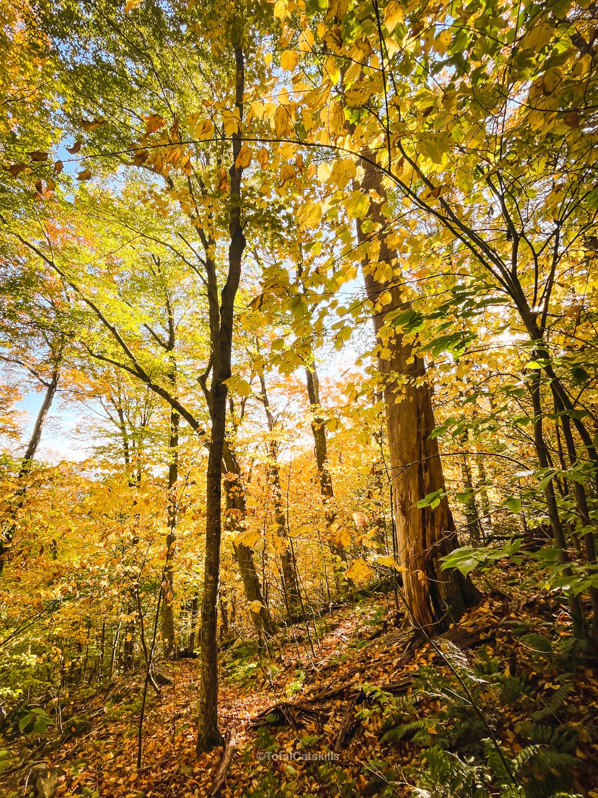
Around the 2200’ contour, the trail takes a sharp left and ascends toward the southeast. The forest becomes increasingly evergreen with spruces and hemlock.
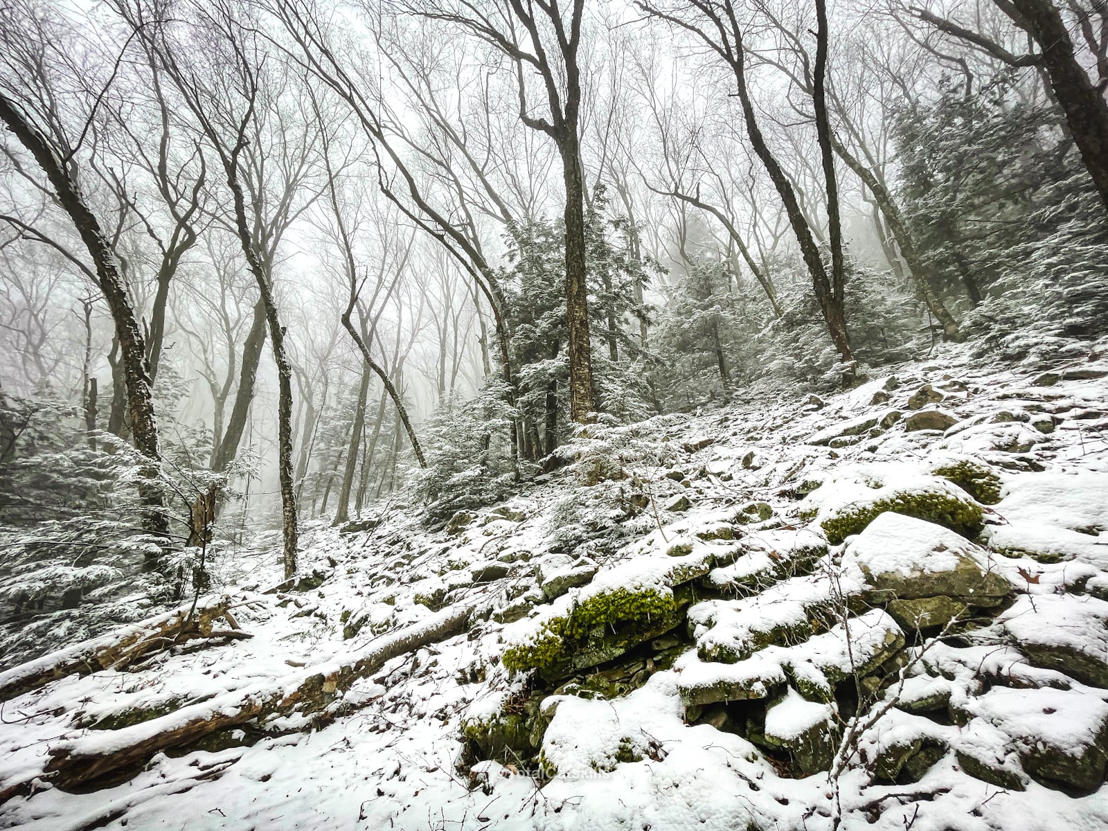
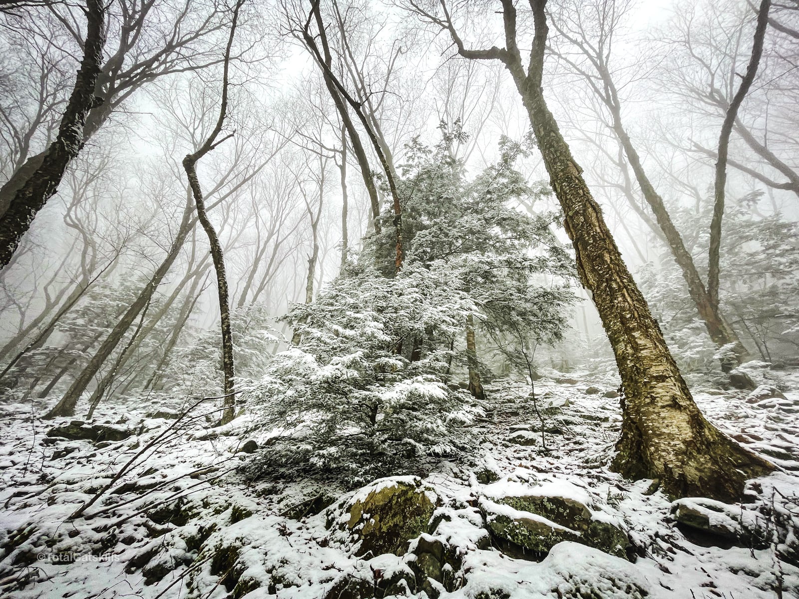
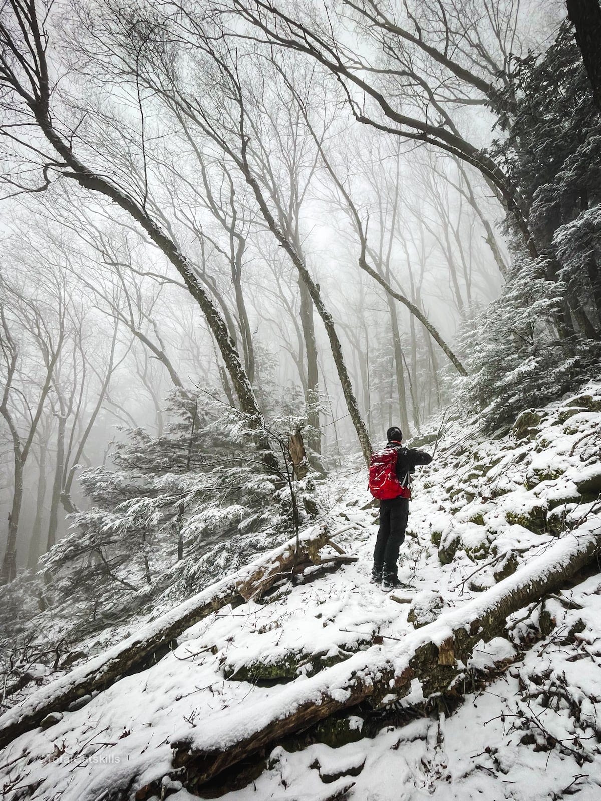
In winter, this area is particularly desolate and beautiful…
End of Woods Road
The woods road shown on GaiaGPS runs out at 2400’ but the “trail” is clear until you get a little higher. Eventually, however — at 42.003657 N, 74.320242 W — you’ll come to a hemlock wall that blocks the trail.
Push through the trees.
Again, the “trail” remains clear but only for a little bit more before it peters out. You are now just below the col.
Starting here, you are in true bushwhack territory — which is no longer that common in The Catskills.
But it is where the fun starts…
The remainder of this trail guide is accessible to subscribers who kindly support this content. Get full access to this website and enjoy great supporter benefits!

Similar Hikes
For more bushwhack difficulty, as well as solid views of the Ashokan Reservoir, think about hiking Ticetonyk Mountain on the north side of the reservoir.
Get full access…
Get instant access to the full version of this site and enjoy great supporter benefits: full galleries, full trail notes, early access to the latest content, and more.
Hot on the website right now…
Follow for more…
Follow my @TotalCatskills content on Instagram for regular hiking inspo and safe, inclusive community.

