Disclosure: This content may contain affiliate links. Read my disclosure policy.
An unusual, quieter way to loop Storm King Mountain.
Storm King Mountain is one of the most popular destinations in the Hudson Highlands. The scenic views it offers up and down the Hudson River are unbeatable.
This is short and relatively easy hike, though it has a few steep-ish sections, and one minor rock scramble.
Allow 3 hours for this loop, which includes a quick side-trip to a beautiful scenic view at the top of Butter Hill.
BTW, you might also enjoy…
- ADK › Whiteface Mountain via Marble Mountain
- DANGER › 6 Feet Under? How Our Adirondack Hike Turned Deadly Serious (Substack)
- ADK › Hurricane Mountain Fire Tower
- CATSKILLS › Catskills Fire Tower Challenge 2025
- Follow › My Instagram @TotalCatskills
- Follow › My writing for Times Union
Storm King Hiking Trail
Etsy & Hellie Stowell Trailhead
The trailhead for this hike is in Cornwall-on-Hudson, just off of Bayview Avenue.
Pass through the gate and then drive past the houses on the right. About 500 feet from the road you’ll arrive at the parking loop.
Etsy & Hellie are longtime supporters of Scenic Hudson, the organization that began the modern environmental movement by stopping an industrial project that would have turned Storm King into a ConEd hydroelectric plant.
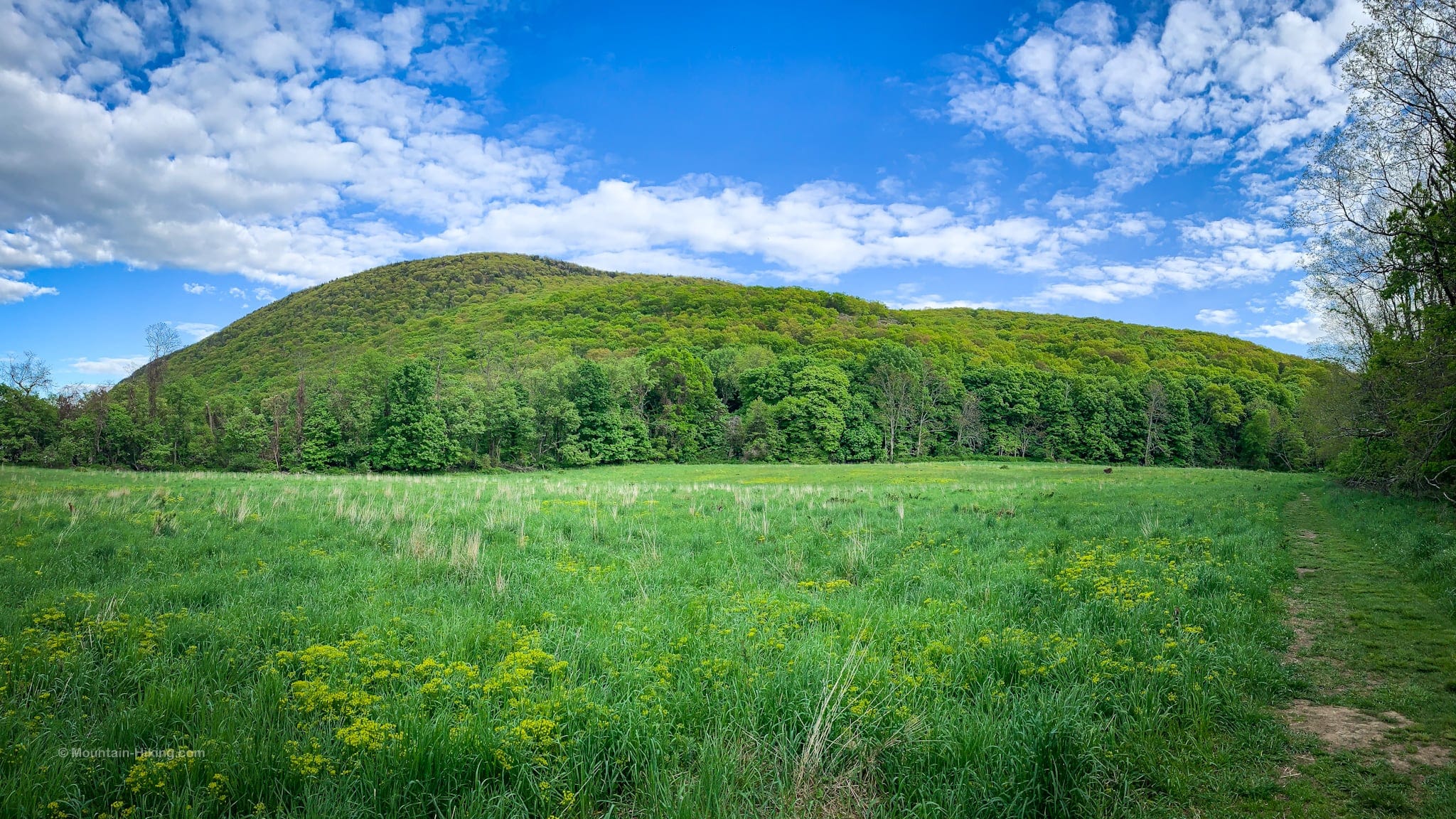
Storm King Mountain Hiking Trail
Begin at the information kiosk. The trail winds around a pasture field — I saw two Orioles here — then enters a hardwood forest following aqua blazes uphill on an old woods road that parallels a small brook.
After crossing the brook, a switchback leads to the first view from a rocky outcrop. The scene looks north toward Snake Hill and the Hudson upriver.
From there, connect with the yellow-blazed Stillman Trail.
There are lots of hairpin turns and switchbacks on this trail to ease your climb, and modest views north through the trees keep your eye entertained. It’s really lovely the whole way.
Storm King Mountain: Scenic Views
Below the summit of Storm King, I found four great scenic spots.
The first is a patch of open rock on the left side of the trail, with views south down the Hudson, and east to Breakneck Ridge and Bull Hill.

A little higher up, is the main view south which is quite incredible…

After this view, the trail continues just 300-400 feet before it comes to a junction. Turn right and head uphill, continuing to follow the yellow blazes of Stillman Trail.
You’ll pass by this knob with a giant boulder on the right. I climbed up on the boulder and the view toward Bull Hill (Mount Taurus) and Cold Spring was pretty good…
The fourth view is also a spectacular panorama, looking upriver toward Snake Hill, the Marlboros and the Catskills (on the left) and the eastern Hudson Highlands (on the right) and Mount Beacon…
You’ve got the basic details, but there’s so much more…
Unlock this exclusive content to get deep intel on this hike, including my personal tips. Immerse yourself in every layer of the journey. With Mountain-Hiking.com, you’re not just skimming the surface; you’re delving into a passionate hiker’s in-depth experience.
Become a Patreon supporter today and immediately elevate your hiking adventures with full trail beta, comprehensive insights, and stunning visuals. Experience hundreds of trails to their absolute fullest!
Similar Hikes
Amazing views of Storm King Mountain can be had from the other side of the Hudson River, via Breakneck Ridge and Bull Hill.
Read More
Get full access…
Get instant access to the full version of this site and enjoy great supporter benefits: full galleries, full trail notes, early access to the latest content, and more.
Hot on the website right now…
Follow for more…
Follow my @TotalCatskills content on Instagram for regular hiking inspo and safe, inclusive community.
Storm King Mountain Trailhead
Large-ish lot, generally less busy than the lots on 9W.
Google Maps Location: 41.439768, -74.006668
The map below shows the exact topographic location of the trailhead
Cell Service
Close to cities so coverage is mostly pretty good throughout this loop. My network is Verizon. YMMV.
4 responses to “Storm King Mountain”
Your comments are welcome here…
The parent mountain for this hike is Storm King Mountain.









Just came back from a SKM hike today – loved your comments – loved the hike and the views – stunning!
First time there – definitely not going to be the last.
Pura Vida.
Fantastic! Yeah, it’s definitely a keeper of a hill. Amazing views and fun to hike too. 🙌🏻
What address do I type in to get to the parking lot for this trail? And is there a fee?
There is no fee. See the location panel at the bottom of the post. It shows the exact location with a link to Google Maps.