Disclosure: This content may contain affiliate links. Read my disclosure policy.
A long, tricky out-and-back.
Trailhead info at bottom of this post.
Running right to the northern tip of Point Reyes National Seashore, the Tomales Point Trail offers more than just a hike—it’s a walk through the rich history of the San Francisco Bay.
Tomales Point Trail is not just a maritime haven for hikers, it’s also a sanctuary for wildlife. The trail is renowned for its tule elk reserve, an initiative that has successfully reintroduced these majestic creatures to their native habitats. Hikers are often treated to the sight of elk herds grazing among the wildflowers or silhouetted against the horizon, a reminder of the area’s ongoing conservation efforts. These elk play a crucial role in the ecological balance of the peninsula.
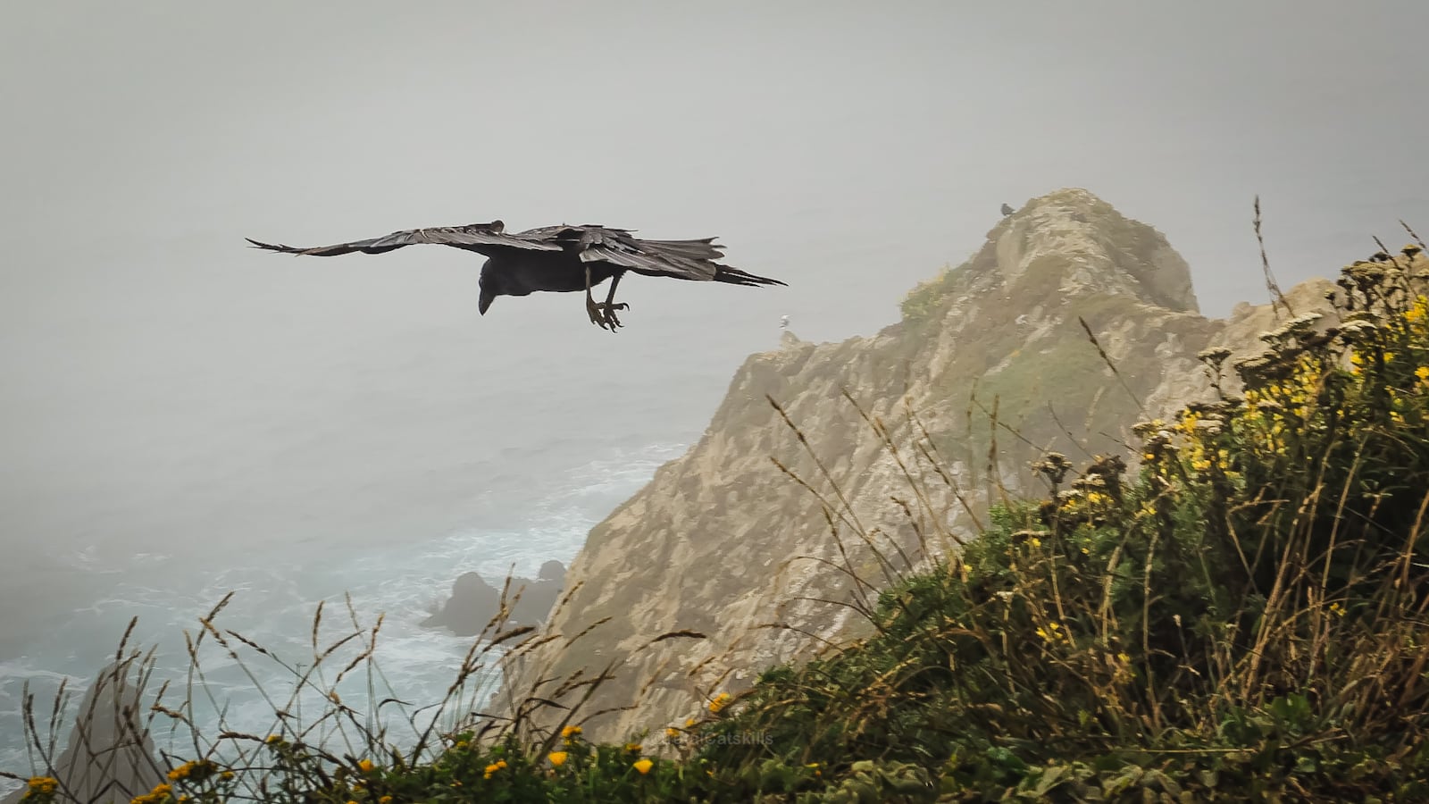
Birdwatchers can watch cormorants, crows, and a plethora of other avian species that make their home along the coastline.
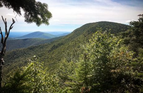
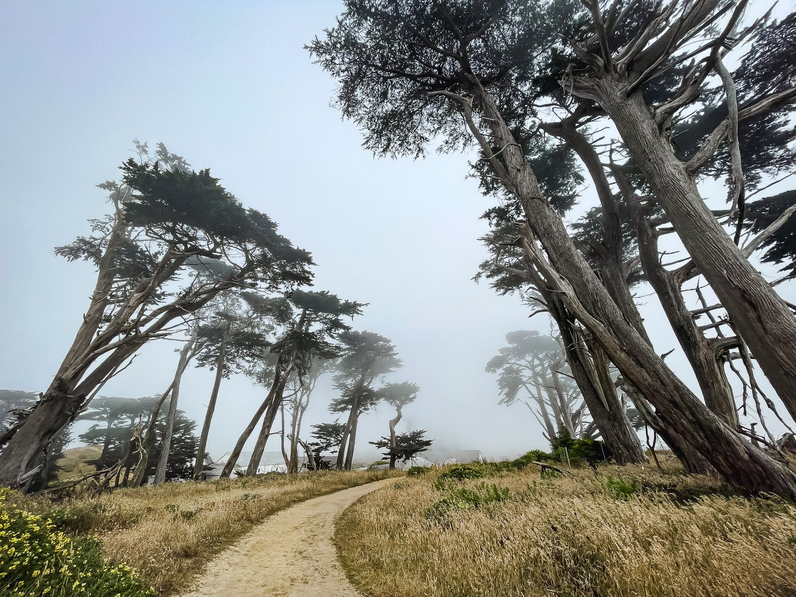
Tomales Point Trail meanders through fields of coastal scrub and wildflowers, leading hikers through tunnels of windswept cypress trees, their forms twisted by the relentless maritime winds.
BTW, you might also enjoy…
- UPDATED › Best Bug Spray & Bug Repellent for Hikers
- CATSKILLS › Peakbagging The Catskills High Peaks (Ultimate Guide)
- STAY › Find Your Perfect Catskills Stay
- ADIRONDACKS › Wright, Algonquin & Iroquois Peaks
- LEARN › Teach Yourself How to Use a Compass
- ENTERTAINMENT › Best & Worst Hiking Movies
- Follow › My Instagram @TotalCatskills
- Follow › My Substack @TotalCatskills
- Follow › My writing for Times Union
As you make your way towards Tomales Point, the Pacific Ocean becomes a vast, blue expanse to the west. The trail’s end offers a breathtaking panoramic view of Tomales Bay and the Point Reyes coastline.
Whether you’re drawn by the history, the wildlife, or the sheer beauty of the landscape, this trail promises an unforgettable experience for all.
Tomales Point Trail
Your hike along Tomales Point Trail includes…
- Historic ruins
- Iconic cypress trees
- Majestic elk
- Whales migrating
- Sand dunes
- Dangerous cliffs
- Thistles
- Spectacular cormorant colonies
- Incredible scenery
- Controversial cows
A full breakdown is provided in the hike notes below, with 21 awe-inspiring photos.
Tomales Point Trail Hike Time
Allow 4-5 hours for this hike.
Tomales Point Trail Elevation Gain
The elevation gain for this hike is 995 feet (apx 300 meters).
Tomales Point Trail Notes & Gallery
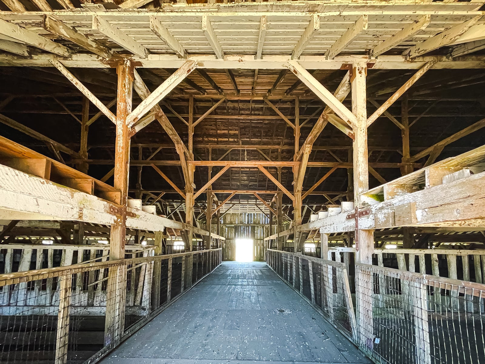
The hike begins near the historic Pierce Point Ranch, a testament to the area’s pastoral heritage.
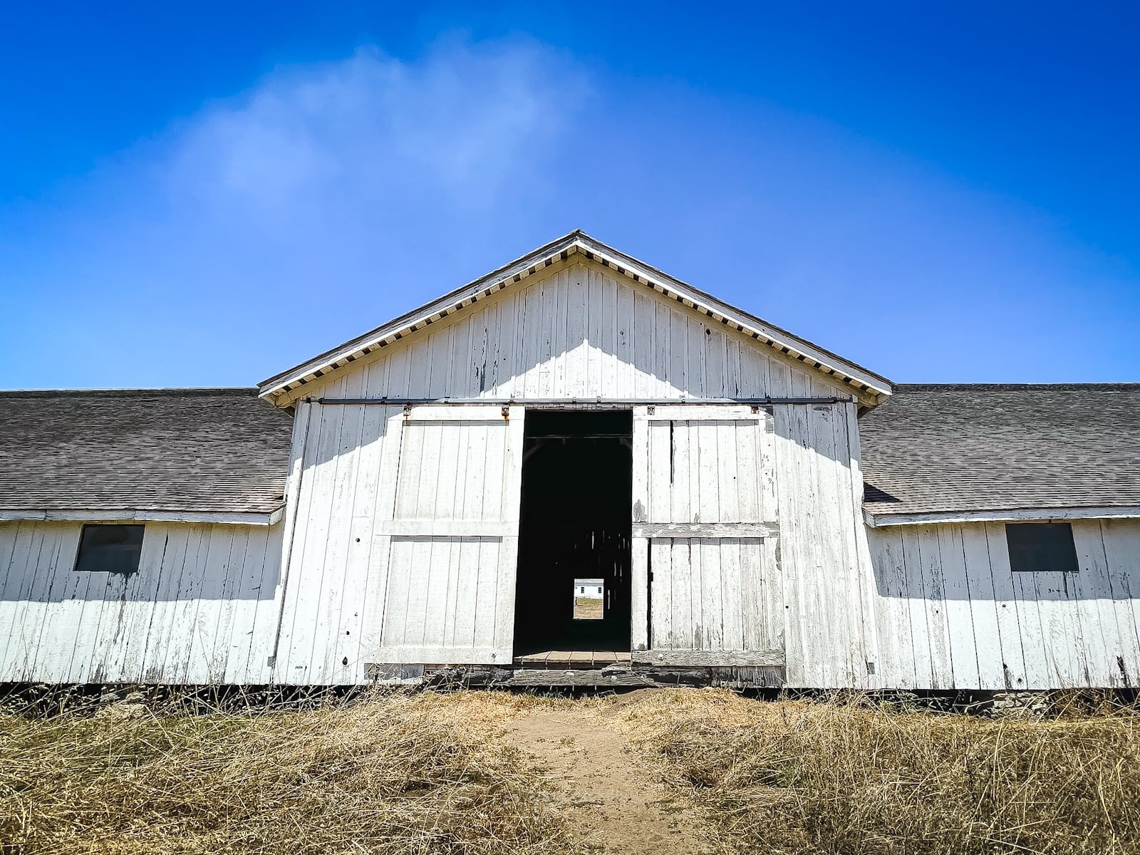
These old barns, remnants of the dairy farming era of the late 19th and early 20th centuries, stand like soundless sentinels at the trail’s outset, offering a peek into the human history that has shaped this land.
You’ll pass these iconic cypress trees, and other cypress stands, on the way out to Tomales Point, and again on your return.
From here, everything just gets more and more beautiful…
 You’ve got the basic details, but there’s so much more…
Unlock this site now to get complete intel on every route, including my full photo galleries, personal insights and tips. Elevate your next hike with deep trail beta. Experience hundreds of amazing routes at their absolute finest. With Mountain-Hiking.com, you’re not just skimming the surface.
Sean

Similar Hikes
Keep on eye on this growing list of the best hikes near San Francisco.
Read More
Get full access…
Get instant access to the full version of this site and enjoy great supporter benefits: full galleries, full trail notes, early access to the latest content, and more.
Hot on the website right now…
Follow for more…
Follow my @TotalCatskills content on Instagram for regular hiking inspo and safe, inclusive community.

Tomales Point Trail Trailhead
Large popular lot for several superb hikes.
Google Maps Location: 38.188978, -122.954138
The map below shows the exact topographic location of the trailhead