Disclosure: This content may contain affiliate links. Read my disclosure policy.
A straightforward out-and-back one-peak route.
Hiking Trail Description
Twin from Roaring Kill is one of the most entertaining trails in the Catskills — but it also contains what might be the Catskills’ most challenging, technical, and potentially dangerous trail section.
The Devil’s Path is famous for being one of the most difficult hiking trails in the US. The west side of Sugarloaf is rugged and long, both ends of Plateau are beasts to climb, and West Kill is a truly vast mountain. By any standards, though, the west side of Twin is exceptionally difficult hiking. The ascent from Pecoy Notch to the summit is arguably the hardest ¾ mile of trail in the entire Catskill Park — and is therefore one of the Park’s prime hiking experiences.
On the other hand, the trail below Pecoy Notch is travelled almost daily by hikers, new and old. The hike out to Dibbles Quarry and a little beyond is famous and beloved because of the wealth of easy, wonderful hiking it provides: sun-drenched forest, cool hemlock stands, stream crossings, the roar of a hidden waterfall, on the Park’s finest bluestone quarries, an enormous beaver pond, and great views along the way.
The Roaring Kill trailhead serves two mountains: Twin and Sugarloaf. The parking lot is small and fills up early on weekends. Once it’s full, people park along the side of the road. This road itself is very rugged and, like many dirt roads in the area, is not snow-plowed in winter.
Twin Mountain Hiking Trail
Start by following the yellow connector trail for ¼ mile to the first junction.
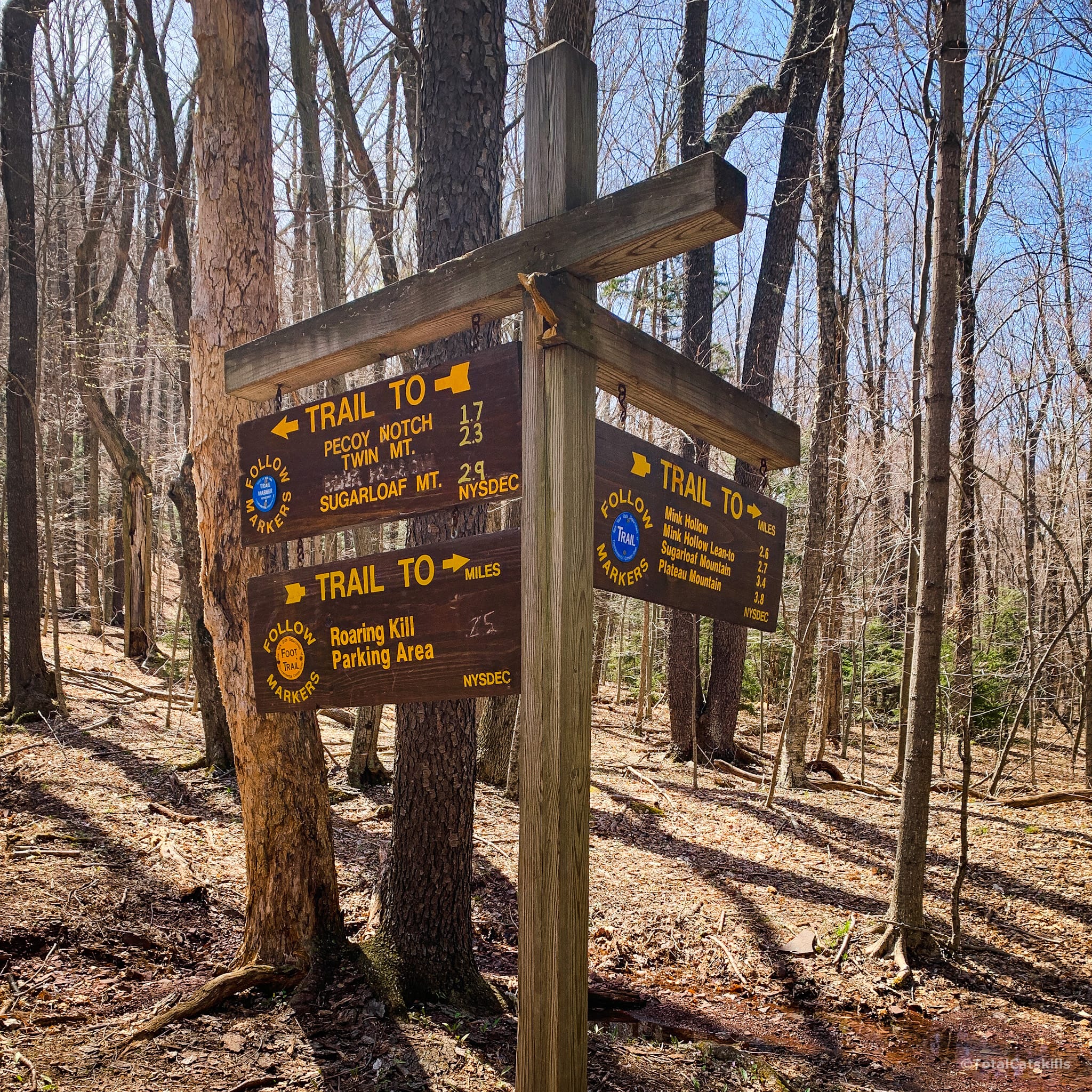
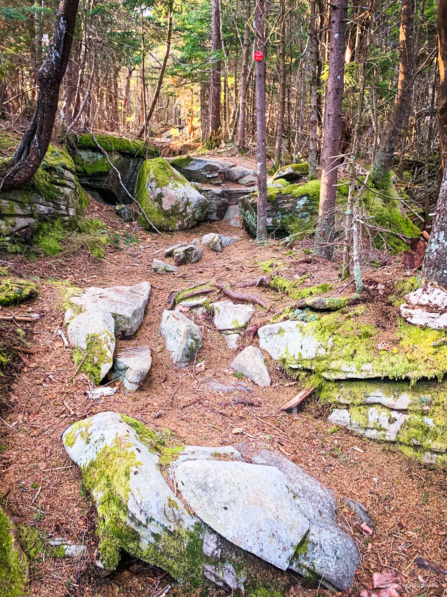
Continue to the left, through the open woods, and you’ll start the ascent to Pecoy Notch. The trail alternates between dirt, lumpy/rock, and this odd loosely-paved section.
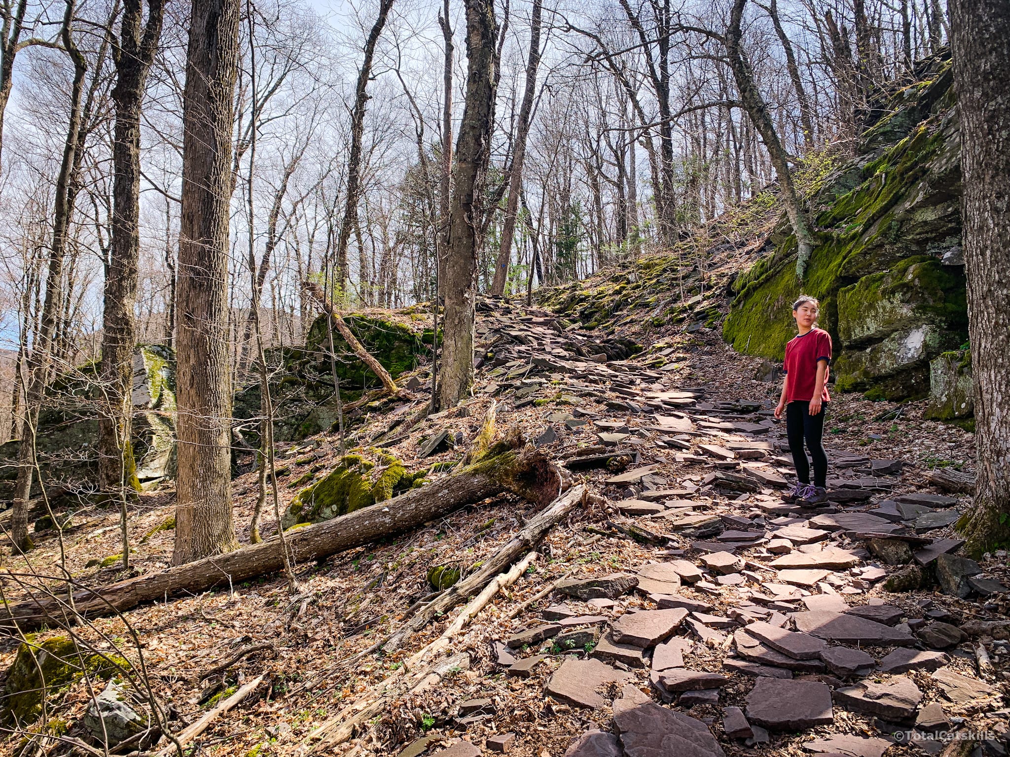
As you climb, you’ll see Round Top and Kaaterskill High Peak through openings in the woods to your left.
About ⅓ mile from the junction, pass through a small quarry. The terrain on this flat section can be a little muddy, so hiking boots (rather than shoes) will serve you best for this hike.
BTW, you might also enjoy…
- ADK › Whiteface Mountain via Marble Mountain
- DANGER › 6 Feet Under? How Our Adirondack Hike Turned Deadly Serious (Substack)
- ADK › Hurricane Mountain Fire Tower
- CATSKILLS › Catskills Fire Tower Challenge 2025
- Follow › My Instagram @TotalCatskills
- Follow › My writing for Times Union
After about 1 mile total from the trailhead, the trail passes through a small, dark hemlock grove before dropping down an easy ledge and turning sharply to the right to enter Dibbles Quarry.
Dibbles Quarry
The quarry itself is large and fun, and has many nooks and crannies. There’s lots to explore here. Read Dibbles Quarry & Beyond (Ultimate Guide).
These bluestone “thrones“ are Catskills famous…
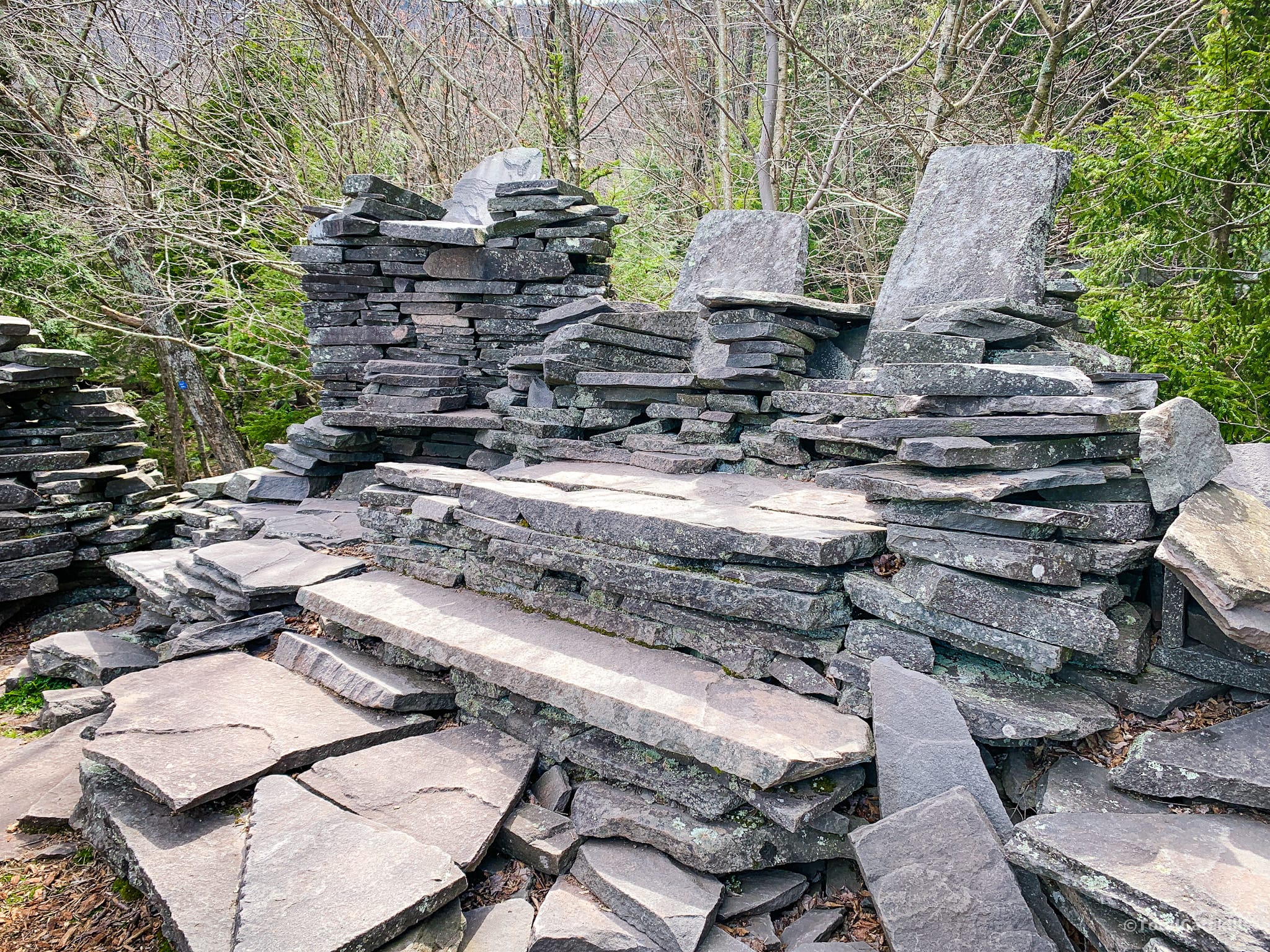
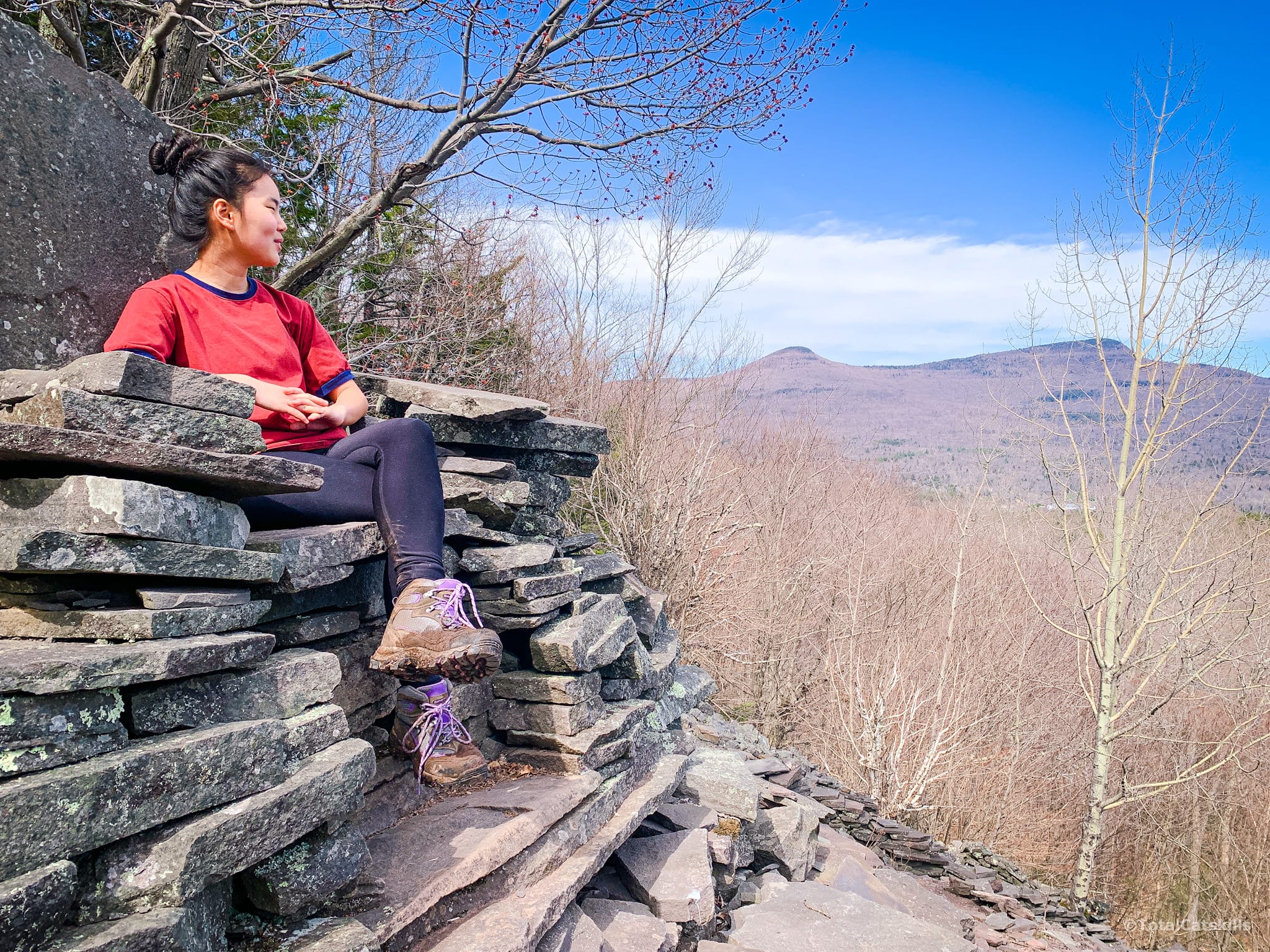
Looking out to the left, you see Kaaterskill High Peak. The mountain on the right is Twin.
The roar you hear is from a hidden waterfall further downhill.
My favorite part of the quarry is the back end, where there’s a whole other area to explore, including the remains of some buildings right next to the open rock face.
Keep an eye out, here, for some graffiti chiseled into the flagstones.
Stream Crossing
From the quarry, the trail heads south for 800’ or so until it descends to an idyllic stream crossing. Rock-hop across the stream which drains the east side of Sugarloaf.
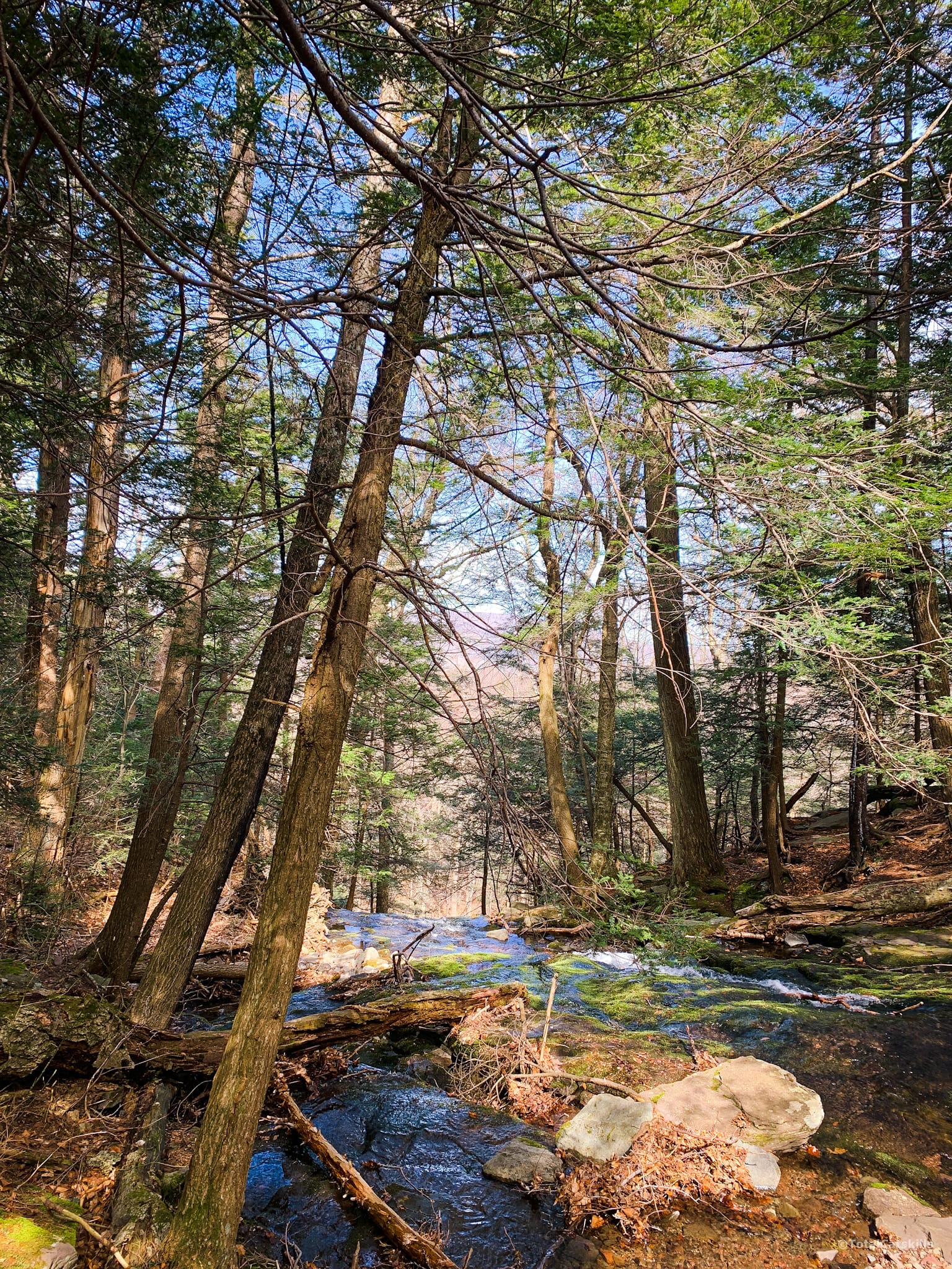
A steep climb through a large hemlock stand leads to a small opening on the right which is sometimes a small pond and sometimes an open grass meadow.
The Beaver Pond
A few hundred feet after the small opening you arrive at a much larger open area called The Beaver Pond…
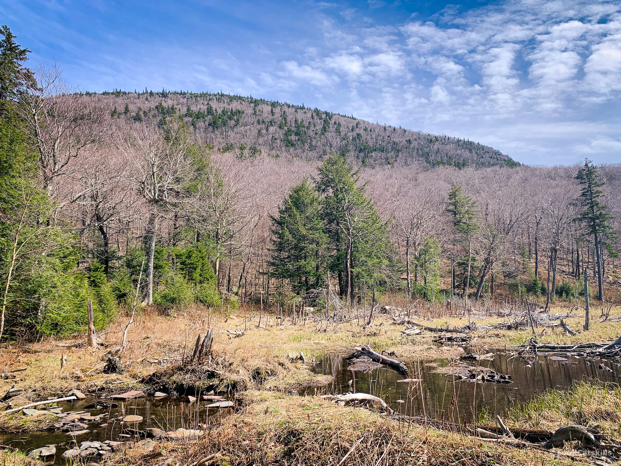
The trail passes along the northern edge of the pond via a lengthy rock trail. On your left, again, is Twin. On your right is Sugarloaf. Neither looks like much of a mountain from here but don’t be fooled: both are extremely challenging climbs.
Onwards…
From the beaver pond, the trail switches to Twin’s western flank for a few minutes, as you climb through deciduous woods toward the notch.
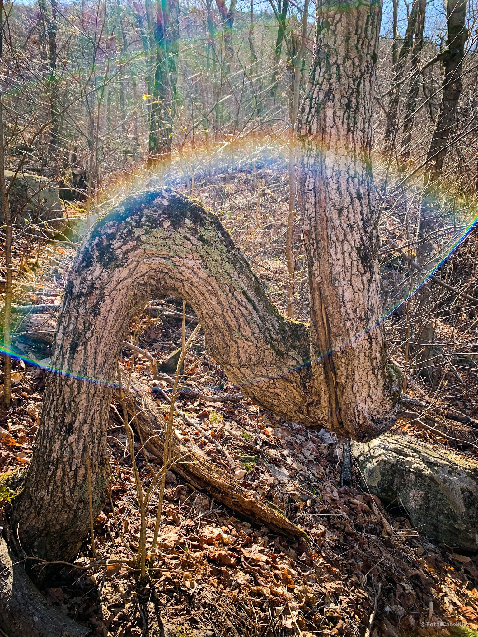
Right below Pecoy Notch is this tree, bent in a manner that is sometimes said to have been used by Native Americans as a way-finding marker. There are many such trees in the Catskills, e.g. the well-known landmark tree on Friday Mountain, and I noticed another one recently climbing Romer Mountain.
Pecoy Notch
Like Jimmy Dolan Notch between Indian Head & Twin, Pecoy Notch is quite small. It’s a good place to stop and have a snack. To climb Twin’s west side, you need all the sugar.
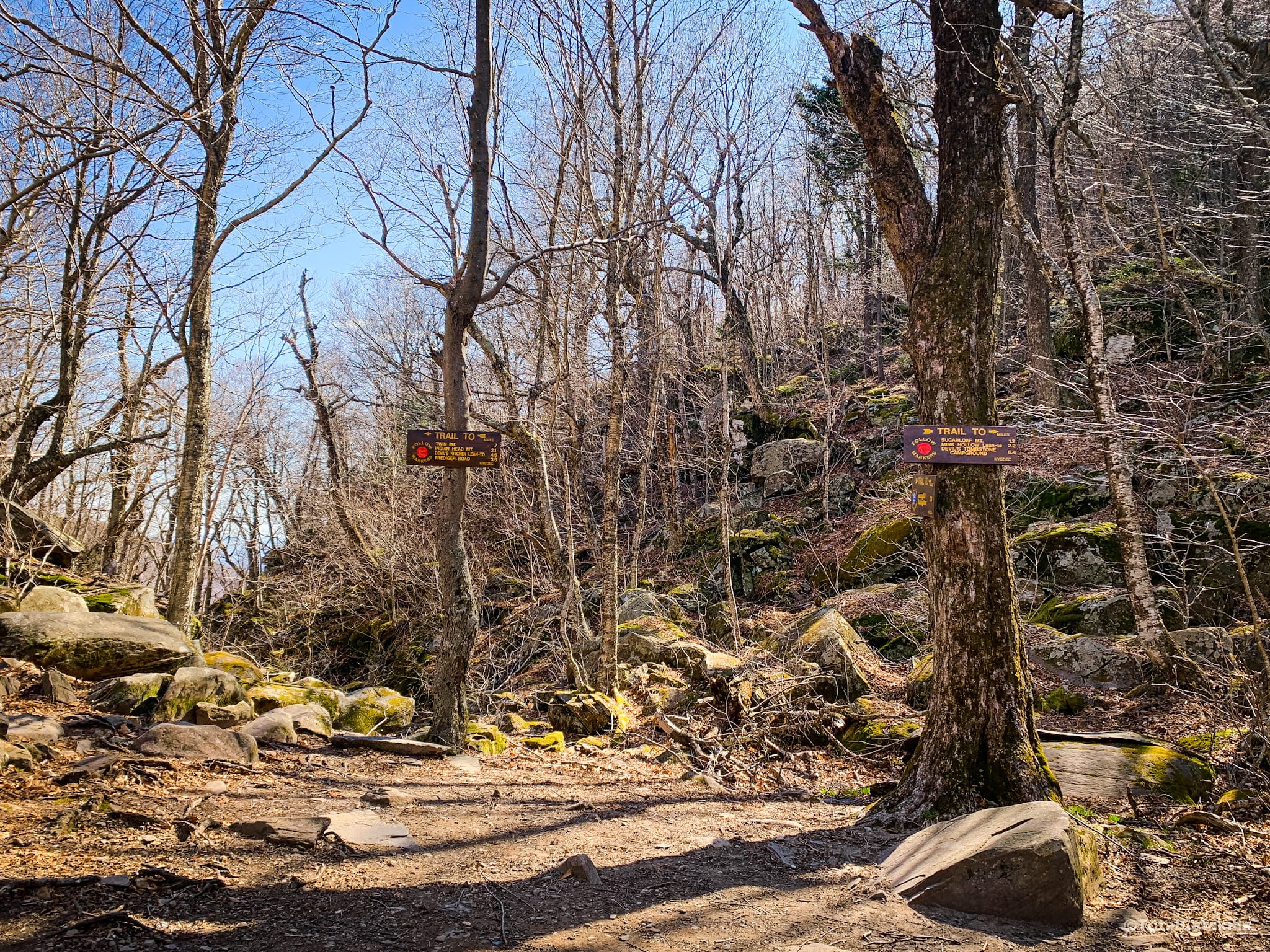
After 500’ or so, you’ll come to the start of the trickiest section.
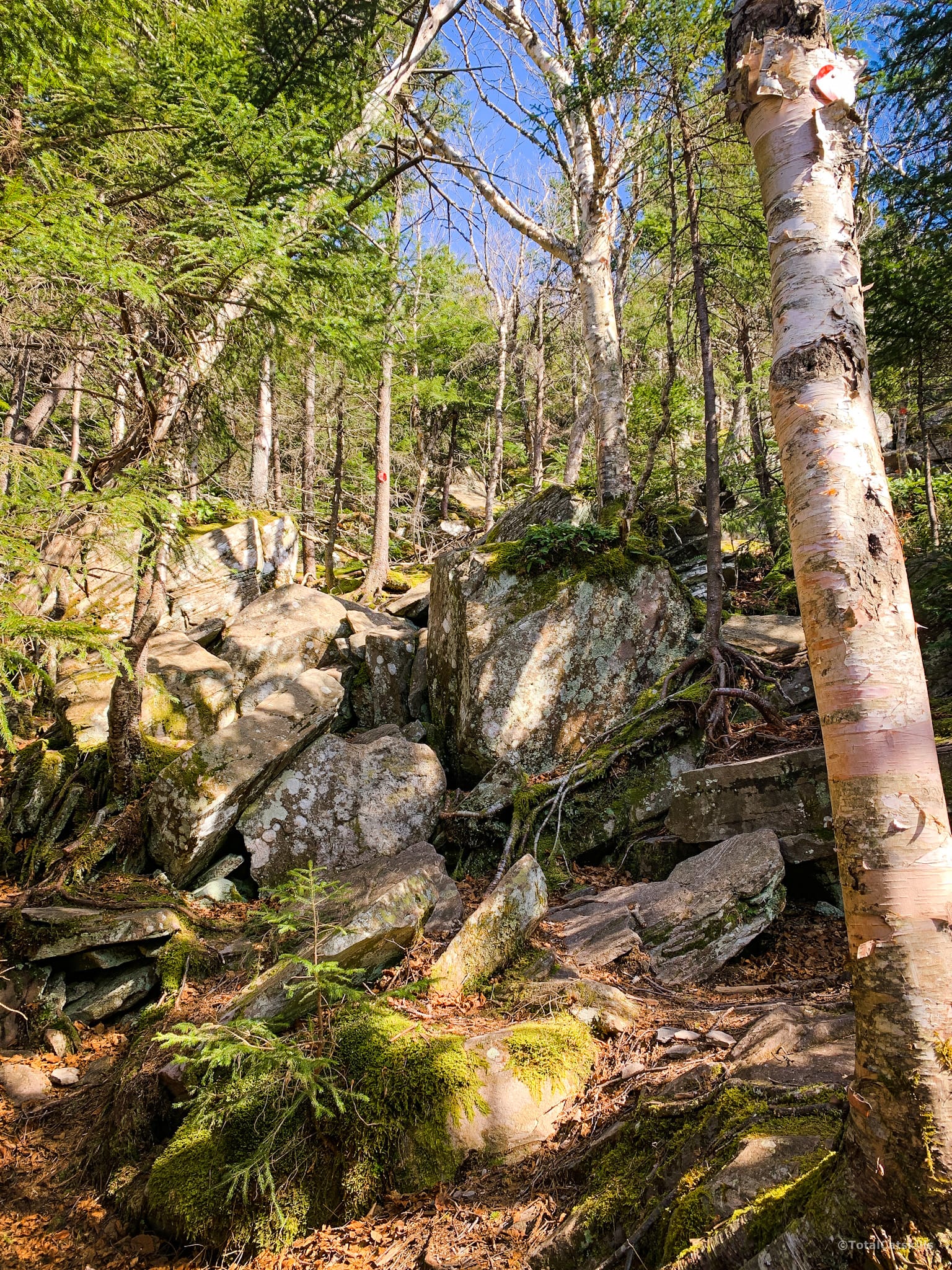
Although this section is short it requires intense focus. I didn’t take any photos — and I love to take photos. But there are too many sketchy boulder puzzles to work out to mess around.
A fall anywhere here is extremely dangerous. It’s nothing but open rocks with ankle-twisting and skin ripping holes. You are at risk for a broken arm or leg, topped with a catastrophic head injury. Being super-patient on this section to secure your footing and handholds will reduce your chance of injury. This is absolutely the riskiest trail I’ve hiked in these hills. I love it so much.
After the tricky section, you’ll pass this wonderful boulder which looks like a giant’s pulled tooth, or maybe is another of the Catskills’ many Devonian space cruisers…
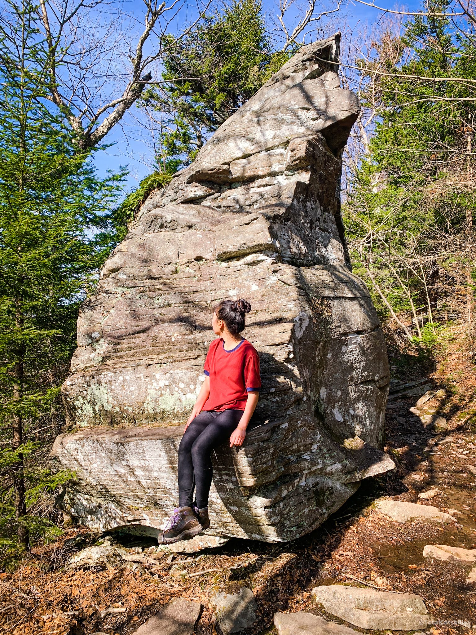
Directly after the giant molar, you come to an extremely controversial section of trail…
The 2019 Reroute
The trail now takes a sharp right and heads, briefly, along a new section of trail that was opened in November of 2019. It’s a great new route that gets hikers around a dangerous area while maintaining the rugged spirit of the Devil’s Path.
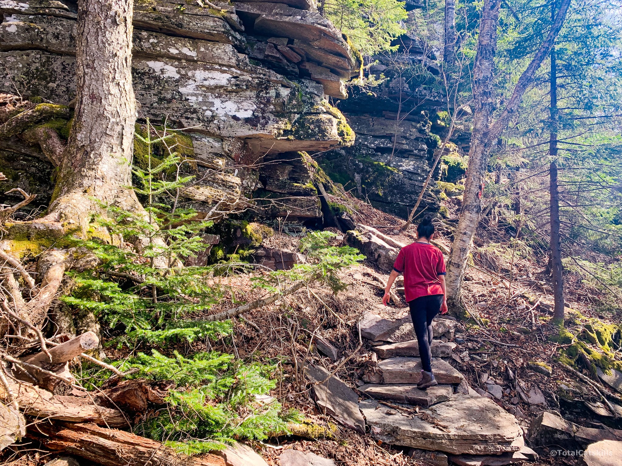
Once you climb this section, the most difficult parts of the ascent are behind you. But there’s still a lot of mountain to climb.
The Lemon Squeeze
A few hundred feet after the reroute you’ll come a tight lemon squeeze which is great fun to wriggle through…
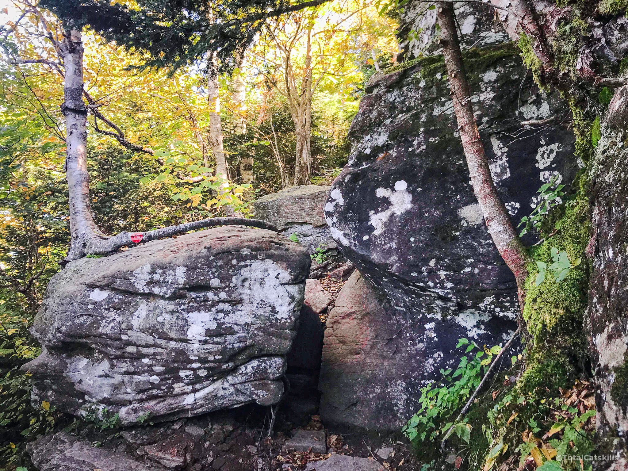
The trail is narrow and winds up the mountain through increasingly evergreen stands until you come to a giant rock overhang.
The Cave
The cave itself is small but fun to poke around in for a minute.
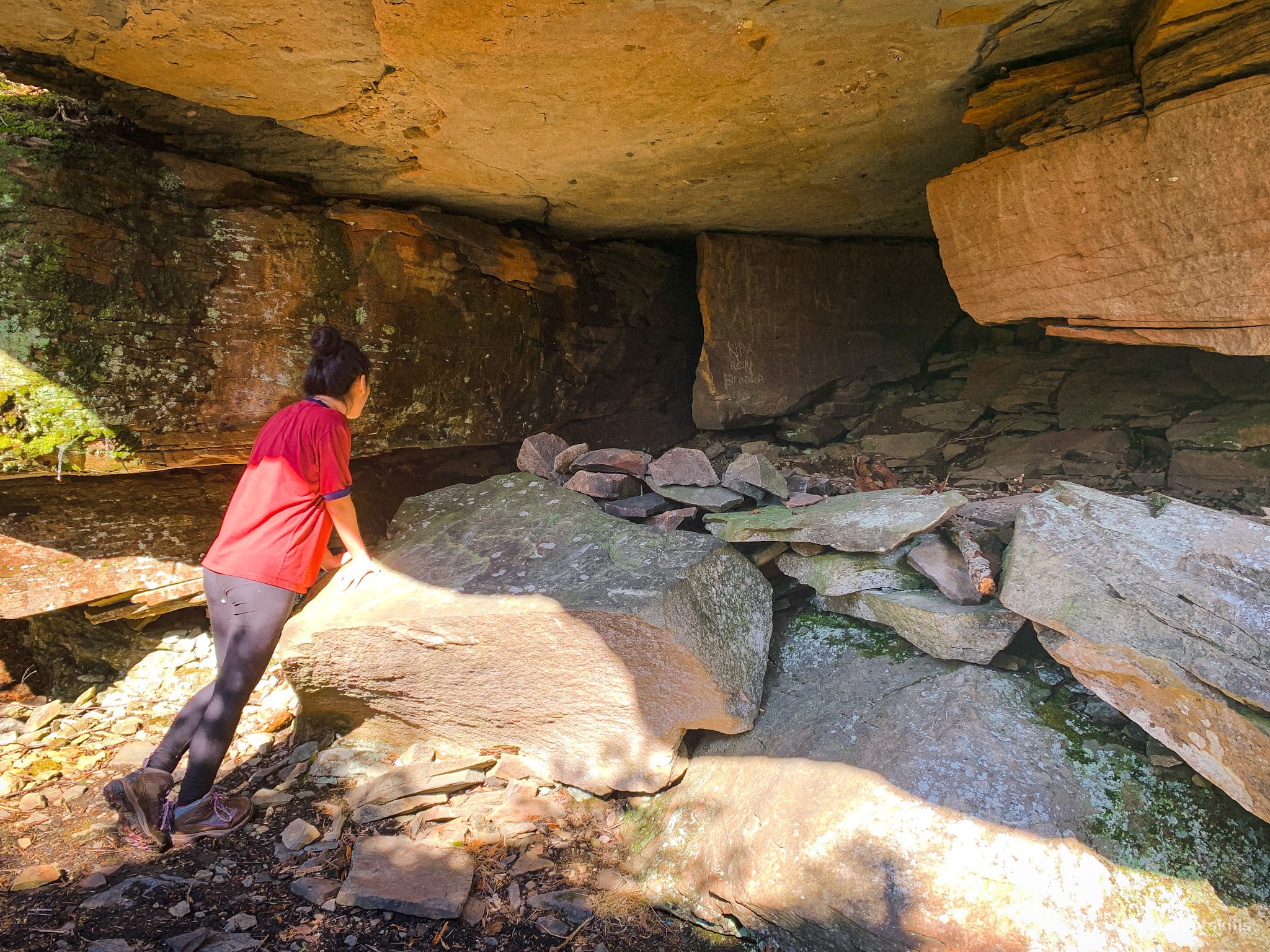
This is the last landmark before the summit.
There are two side trails near here. My daughter and I investigated them briefly but the herd paths seemed to peter out and lead to nothing in particular. But maybe they do lead to something…?
The final ascent starts… where exactly? Poke around. You’ll find it.
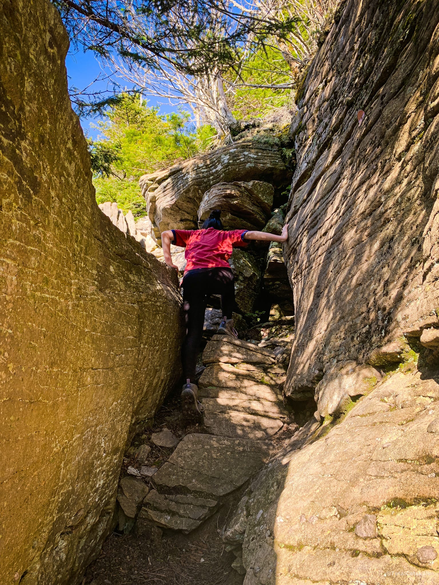
Continue climbing the rugged trail through dense hemlock and fir.
Twin Mountain Summit Ledge
The trail levels out briefly to pass below the summit ledge which hovers above the trail, then sharply bends left and up to bring you to this view…
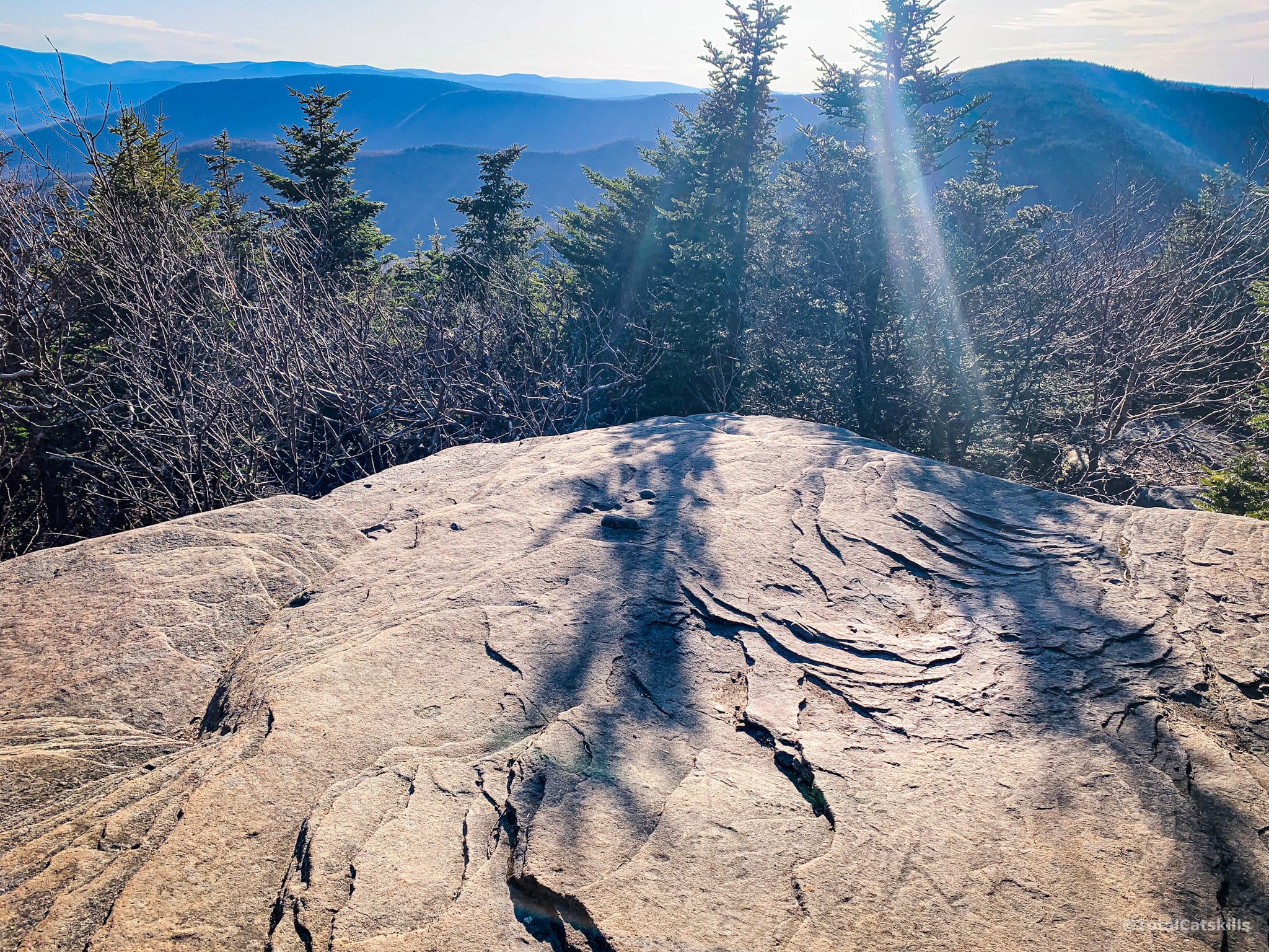
From here you can see Sugarloaf and Olderbark, and many more Catskills peaks.
But this is not the best view from Twin.
Notice there are two trails off the ledge. You came up the one on the right and so, remember, that’s the way back down. The trail on the left heads into the woods, past Twin’s true summit and onwards toward the lower summit, with its far more dramatic viewing ledge.
I think this boulder (again, on the left side of the trail) is much closer to the true summit of Twin than the viewing ledge.
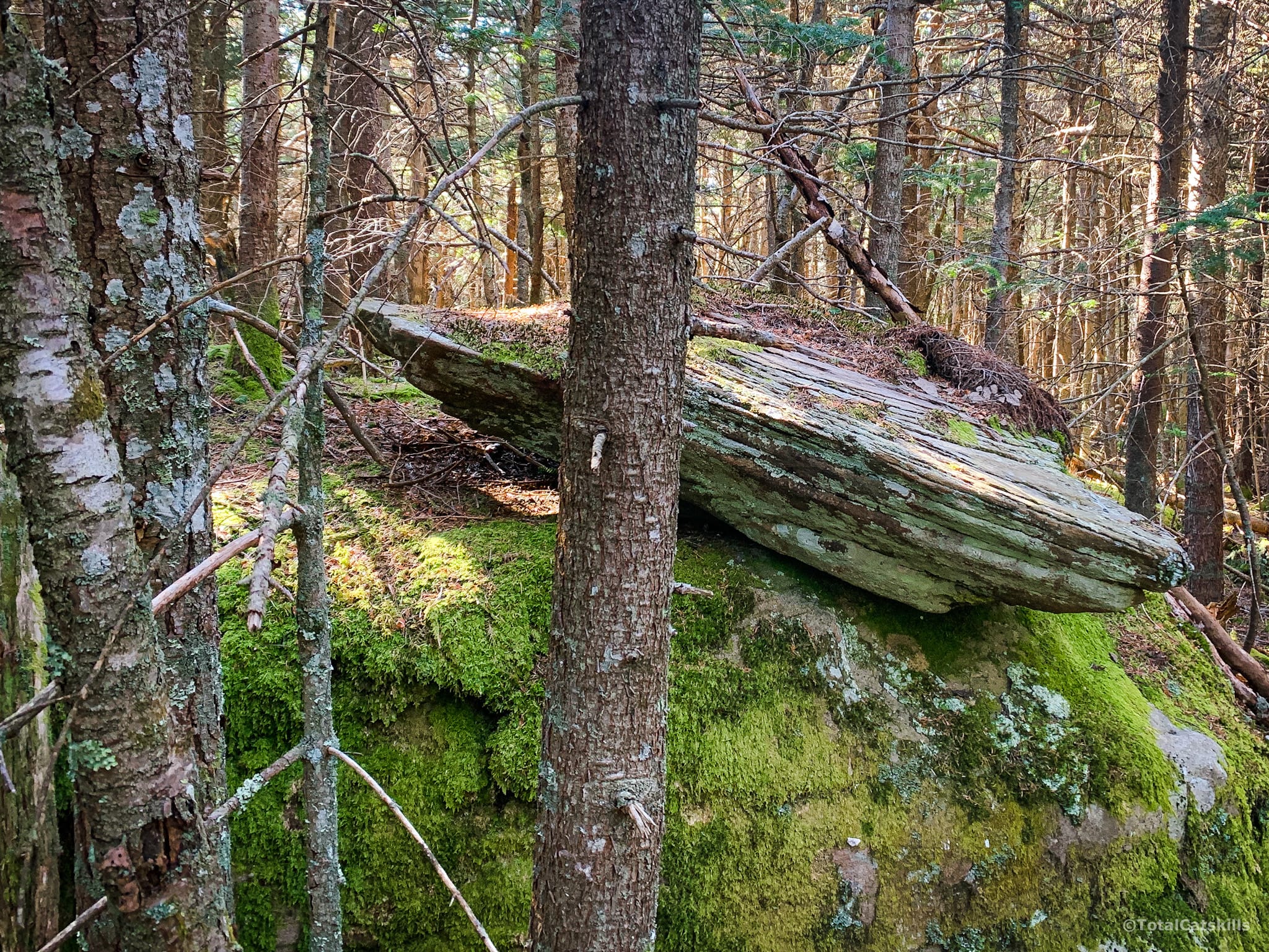
From here, the trail descends sharply through several rugged crags until it levels out for the easy 20 minute walk to the southern summit with its incredible panoramic vista.
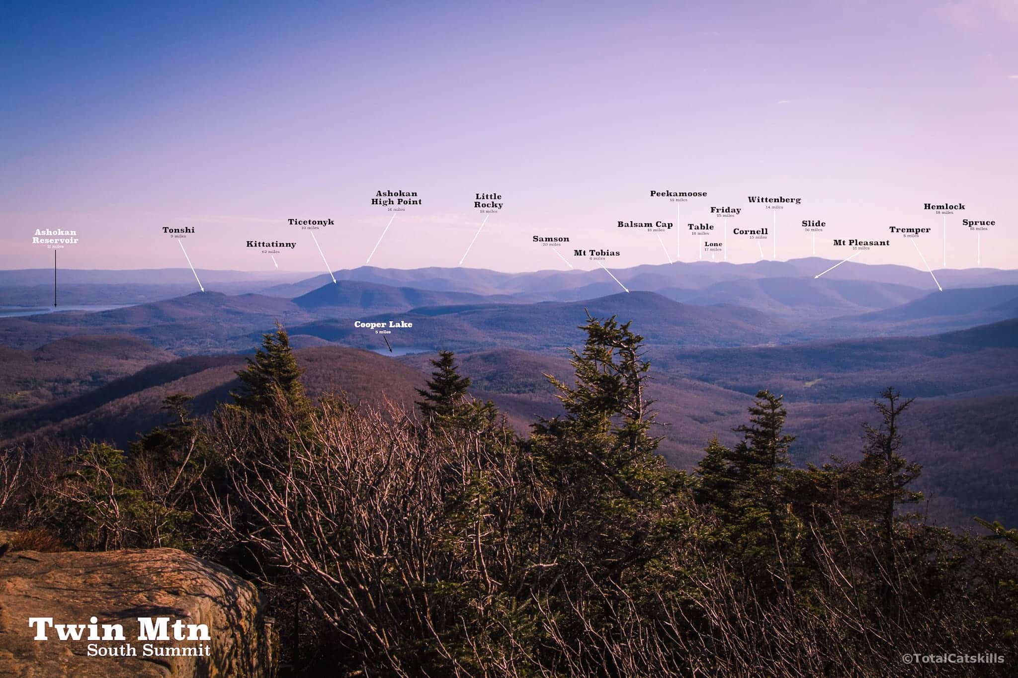
Twin’s South Summit
This view is such a treat and is only bested in the Catskills by the epic view from Wittenberg’s summit ledge.
But what a view…
An Alternate Route
This view is much easier to get to from the east side of Twin by coming up Jimmy Dolan Notch. That trail is steep, and the east side of Twin has plenty of its own drama, but coming up that trail is far easier, and far less dangerous, than coming up the west side via Pecoy Notch.
Descent from Twin Mountain
Your hike is not over by a long shot. The ascent was difficult but descending Twin is even tricker and even more dangerous, especially on tired legs. On your way down, be cautiously careful and carefully cautious!
Just before you get to Pecoy Notch you will have to tackle, once again, that super sketchy section…
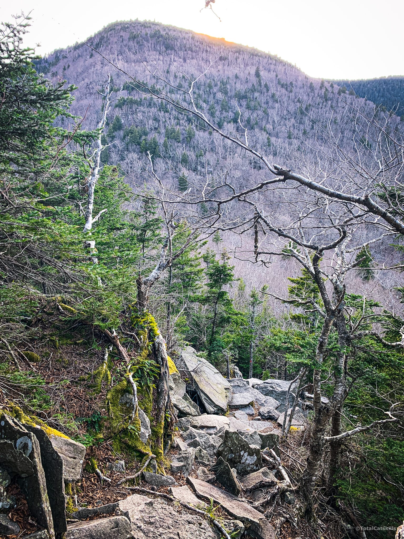
From Pecoy Notch, the hike out through Dibbles Quarry will feel like a very easy two miles.
Similar Hikes
This is absolutely one of the best hikes in the Catskills. It contains some of the most scenic views. It’s also a great single mountain hike you can complete in 5-6 hours. However, this route is also exceptionally risky and comes with a real chance of injury. Know your limits. Choose your adventure wisely.
Get full access…
Get instant access to the full version of this site and enjoy great supporter benefits: full galleries, full trail notes, early access to the latest content, and more.
Hot on the website right now…
Follow for more…
Follow my @TotalCatskills content on Instagram for regular hiking inspo and safe, inclusive community.
Twin from Roaring Kill Trailhead
Pretty small lot on a rough road that’s not plowed in winter.
Google Maps Location: 42.151242, -74.131185
The map below shows the exact topographic location of the trailhead
Cell Service
Patchy: strong signal in some spots, nothing in others. My network is Verizon. YMMV.
The parent mountain for this hike is Twin.
