Disclosure: This content may contain affiliate links. Read my disclosure policy.
The fastest and least difficult route to Twin’s summit.
Hiking Trail Description
This quick route to the summit of Twin Mountain uses the Jimmy Dolan trail to climb the notch between Indian Head and Twin.
The trail to the col is woodsy and increasingly rugged, and the last stretch is quite steep. After that, you’ll hike one of the most beautiful and fun sections of the Devil’s Path.
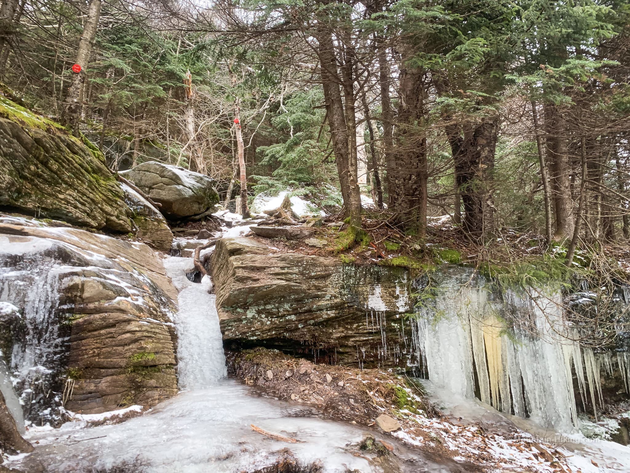
In winter, it’s madness to hike any mountain without microspikes — at the least. In the cold season, this trail includes long steep sections of ice-flow and many ice-covered boulders. Do not attempt without adequate winter hiking gear.
Twin Mountain Prediger Trailhead
The parking area at the end of Prediger Road is a generous loop, with space for lots of cars. But this lot serves two popular mountains — at peak times, plan to arrive early.
How to Get There in Fall & Winter
Between November 1 and April 15 every year, the eastern end of Platte Clove Road is closed. Use this alternate route instead.
Twin Mountain Hiking Trail
From the Prediger Rd parking area, the trail leads easily to the first junction with its signpost. Technically, Prediger Rd is 0.5 miles away — thus the distance on the sign below — but the actual trail section from the parking area to this junction is only 0.2 miles.
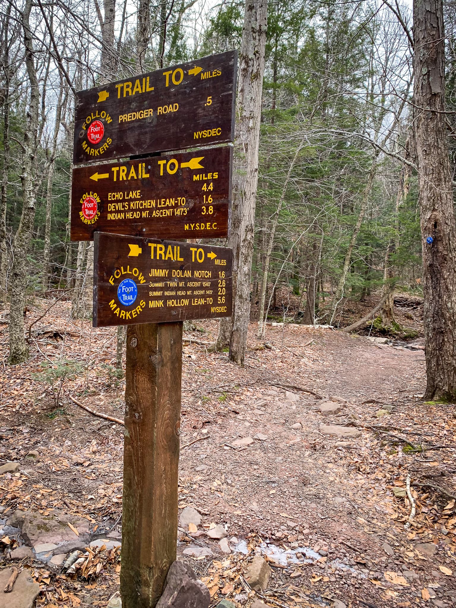
From here, the Devil’s Path (red blazes) continues straight to Indian Head, but also to Echo Lake and Overlook Mountain.
Jimmy Dolan Notch Trail
Today, to head up to Twin, turn right and walk a few feet downslope to rock-hop across a stream.
Follow the blue blazes.
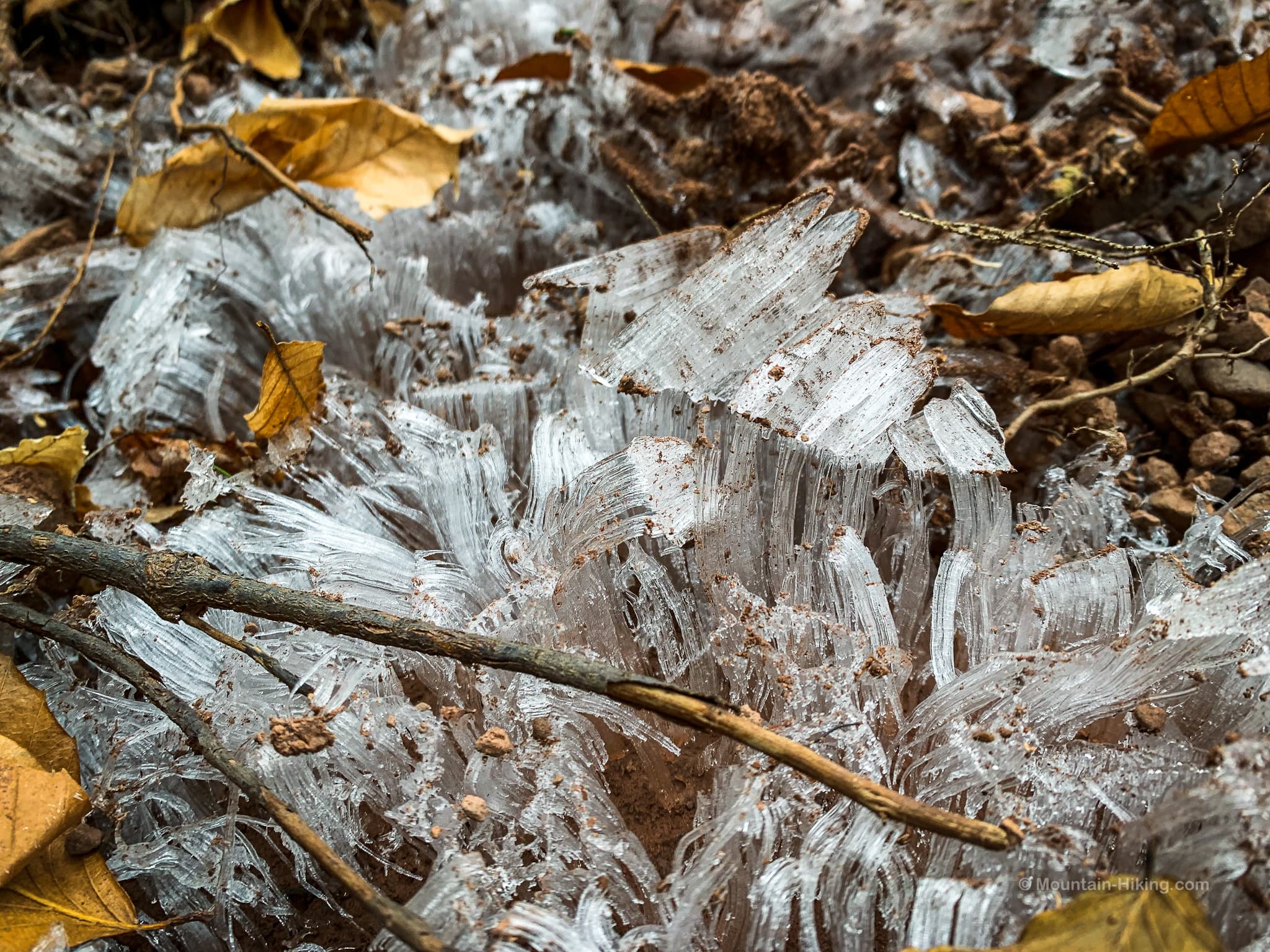
All around here in the cold months, you’ll find needle ice growing out of the wet ground. It’s fun to pick some up and crush it between your fingertips.
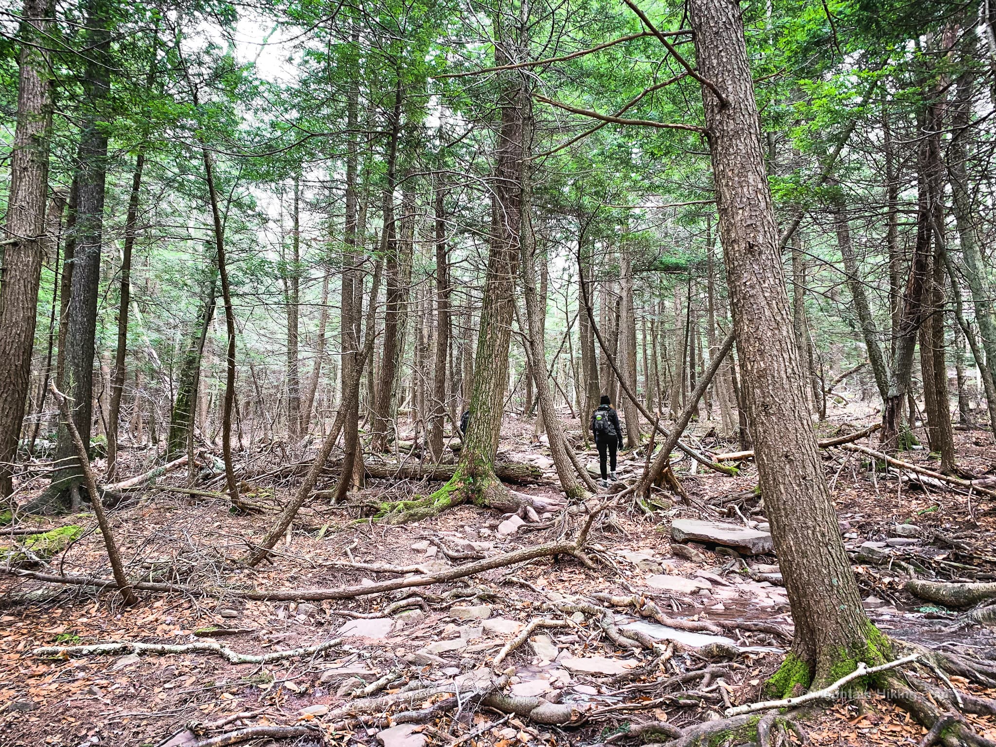
For the first mile or so, the trail is woodsy and very easy-going. Some of these hemlocks are very old…
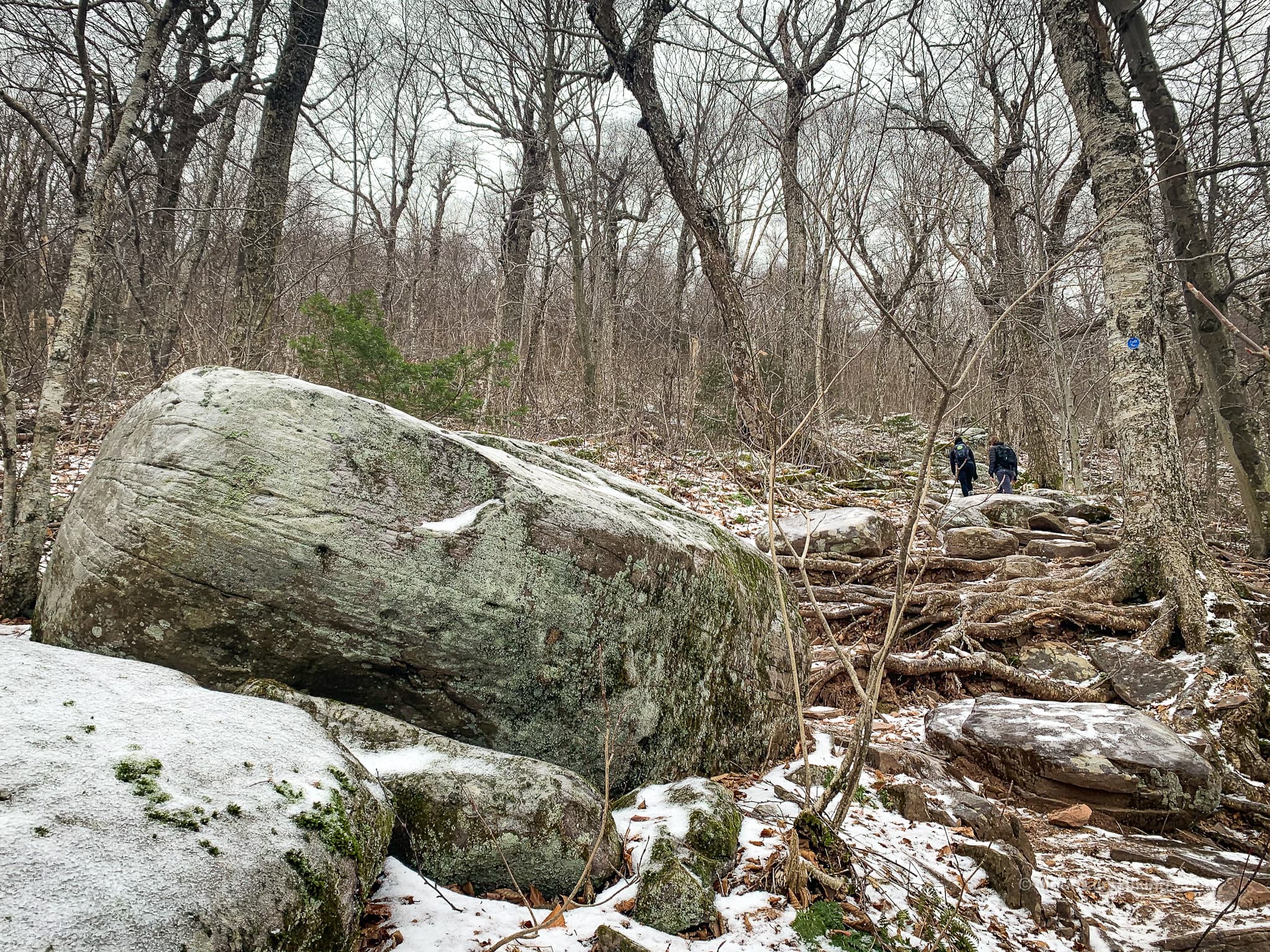
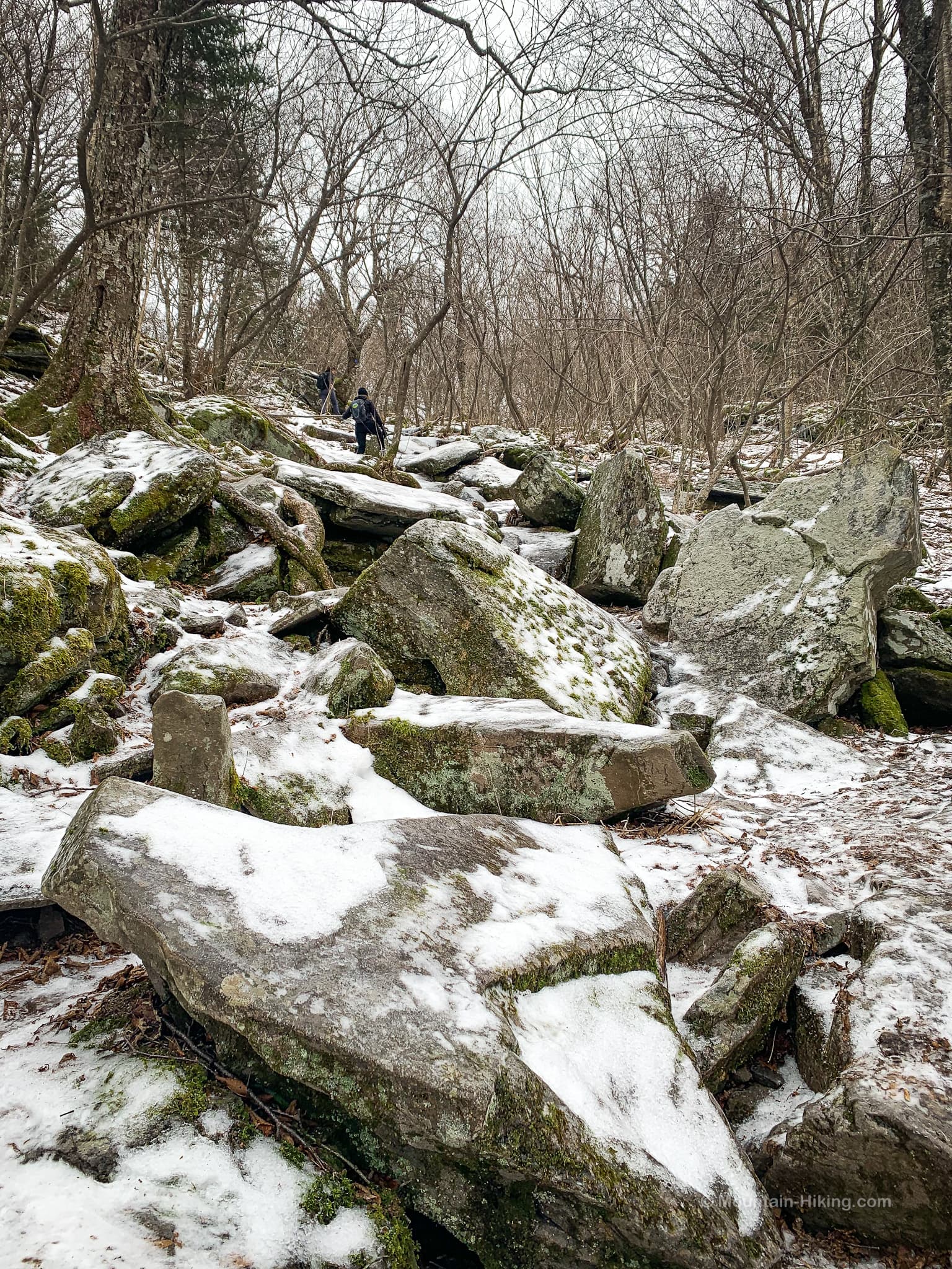
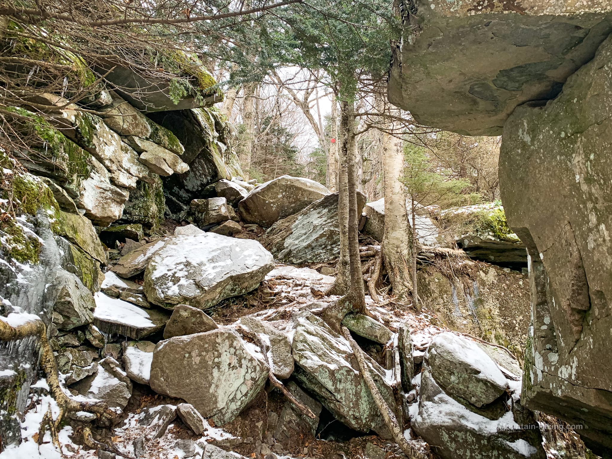
As the trail winds uphill, the forest changes to mostly deciduous and there are many dramatic glacial erratics.
At 2800’, this large boulder marks the beginning of the steepest section of trail…
Although this is not yet the Devil’s Path, the higher you go the more rugged the terrain becomes…
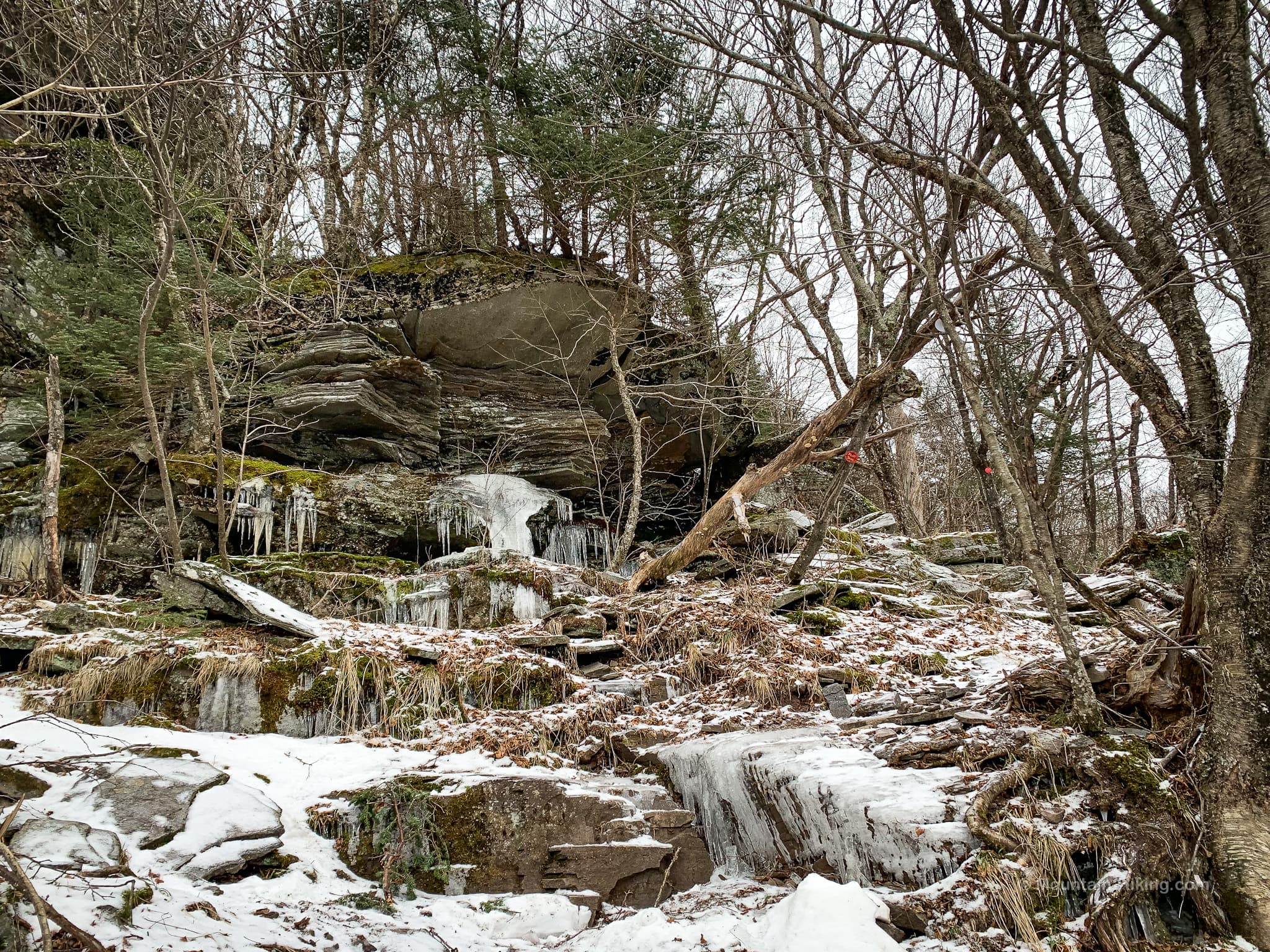
These kinds of ice-flows are very common in the winter. Absolute death without proper winter traction. Our group met several people who had turned around wisely before this section.

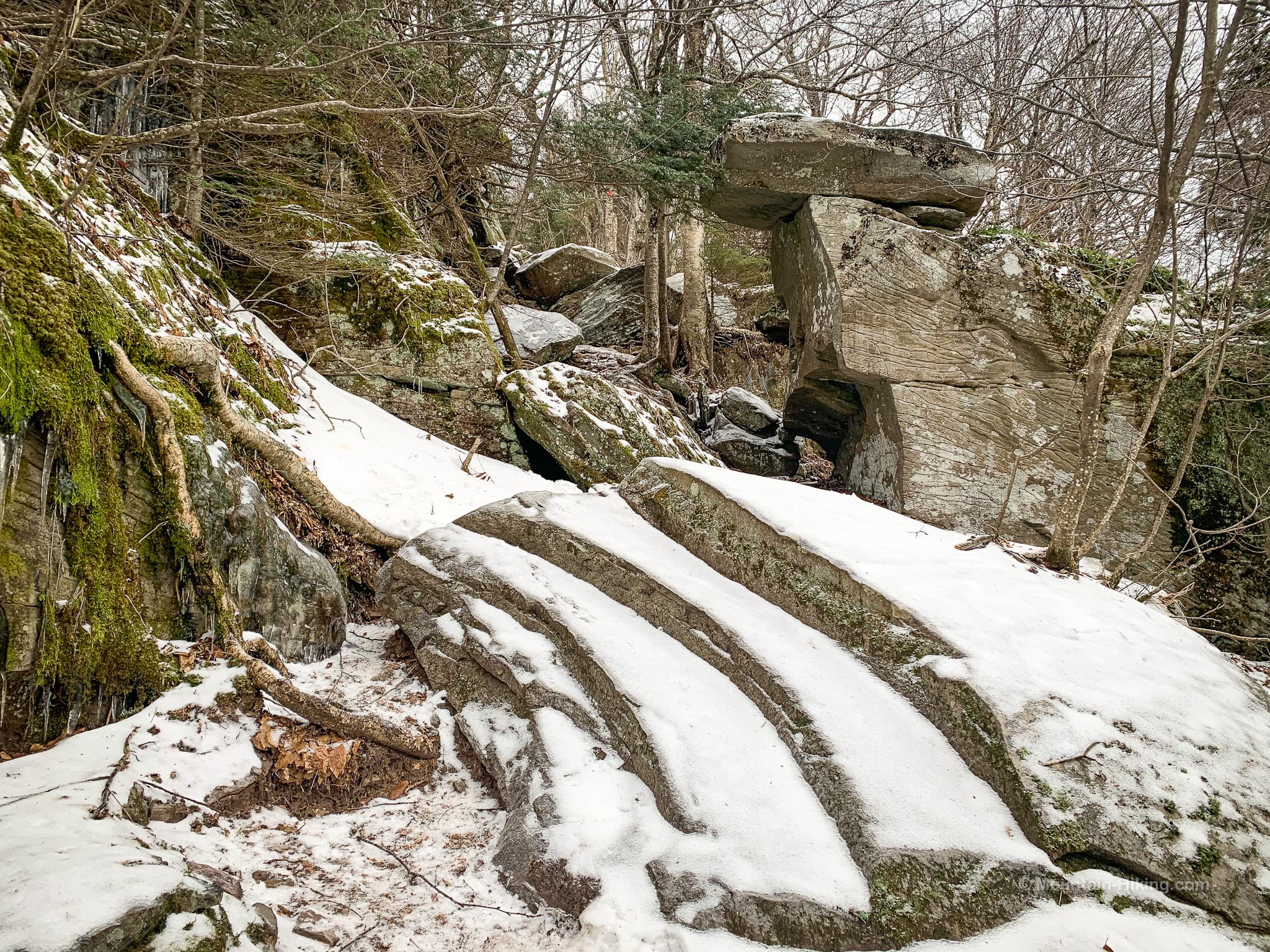
The last 500’ of elevation before the col is steep. Take your time, resting as necessary.
This was the first trail I ever hiked in the Catskills — and I had turned around here before even making it to the col. I tried again a few weeks later, with more prep and knowledge, and that time made it up to Indian Head. It was very sweet to climb this trail again after so long, on much stronger legs.
Jimmy Dolan Notch
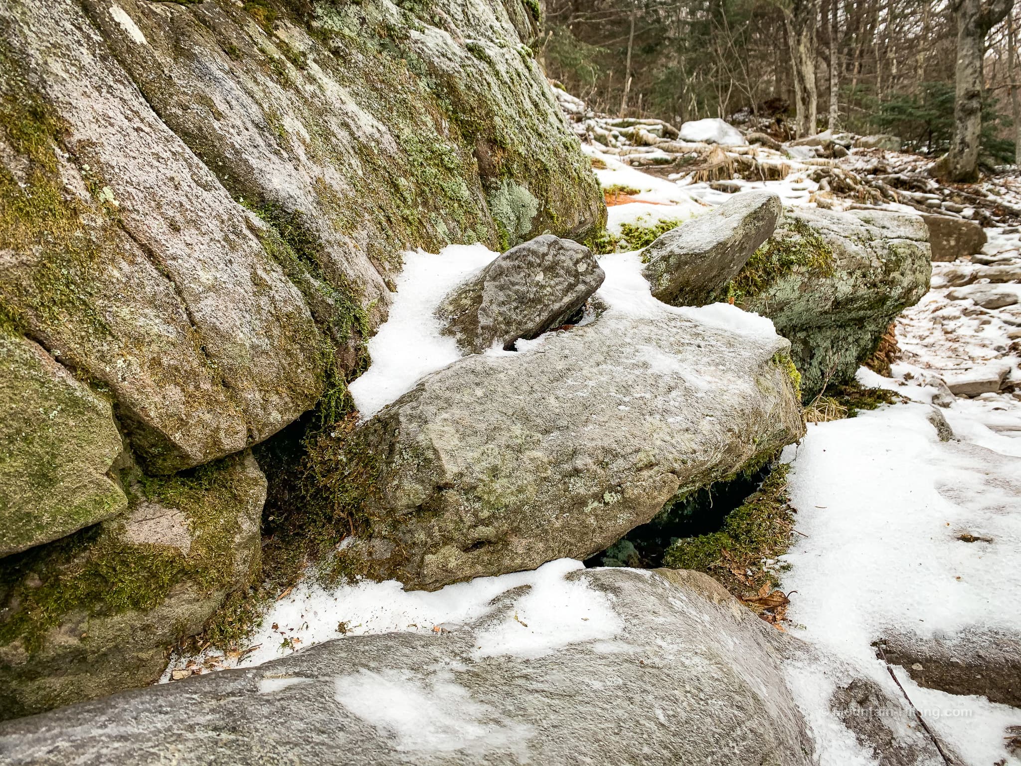
After 90 mins or so, you’ll arrive at the junction with the Devil’s Path. Jimmy Dolan Notch was once a well-travelled route and a pub stood in this notch.
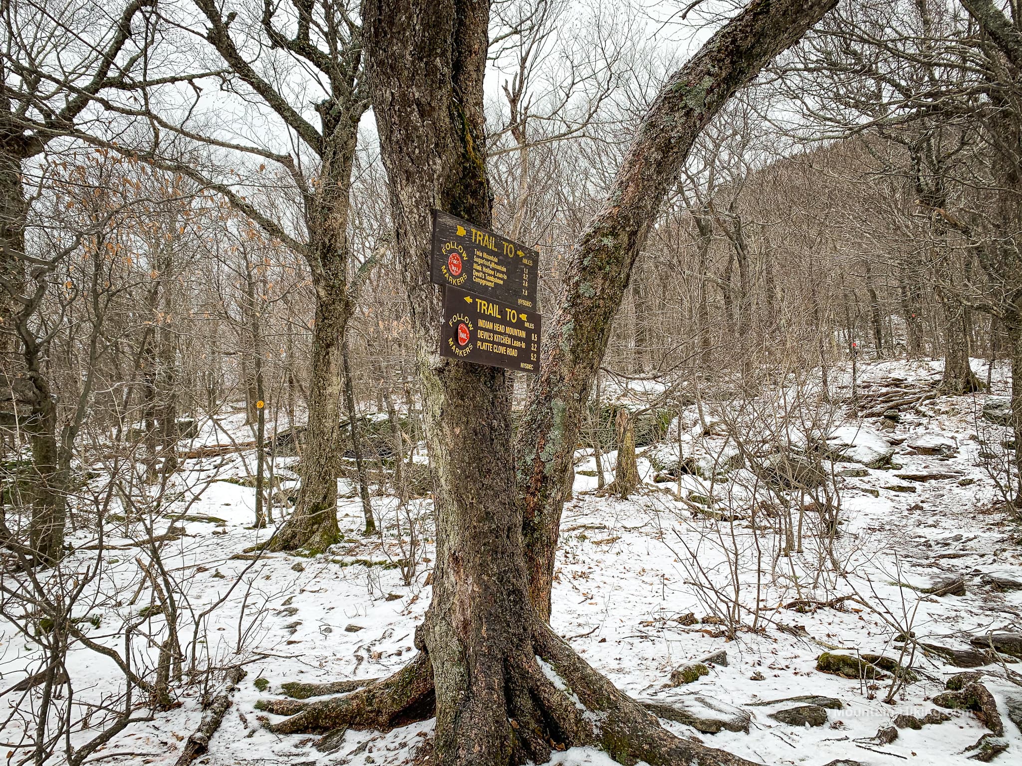
The notch itself is worth exploring, as is the primitive campsite on the west/right side of the notch — see the yellow disc above, to the left of the tree with the sign-posts.
This is a good spot to sit and have a quick snack before turning west/right to begin your ascent of Twin via the Devil’s Path. (To the east/left of the notch is Indian Head.)
Ascent to Twin Mountain
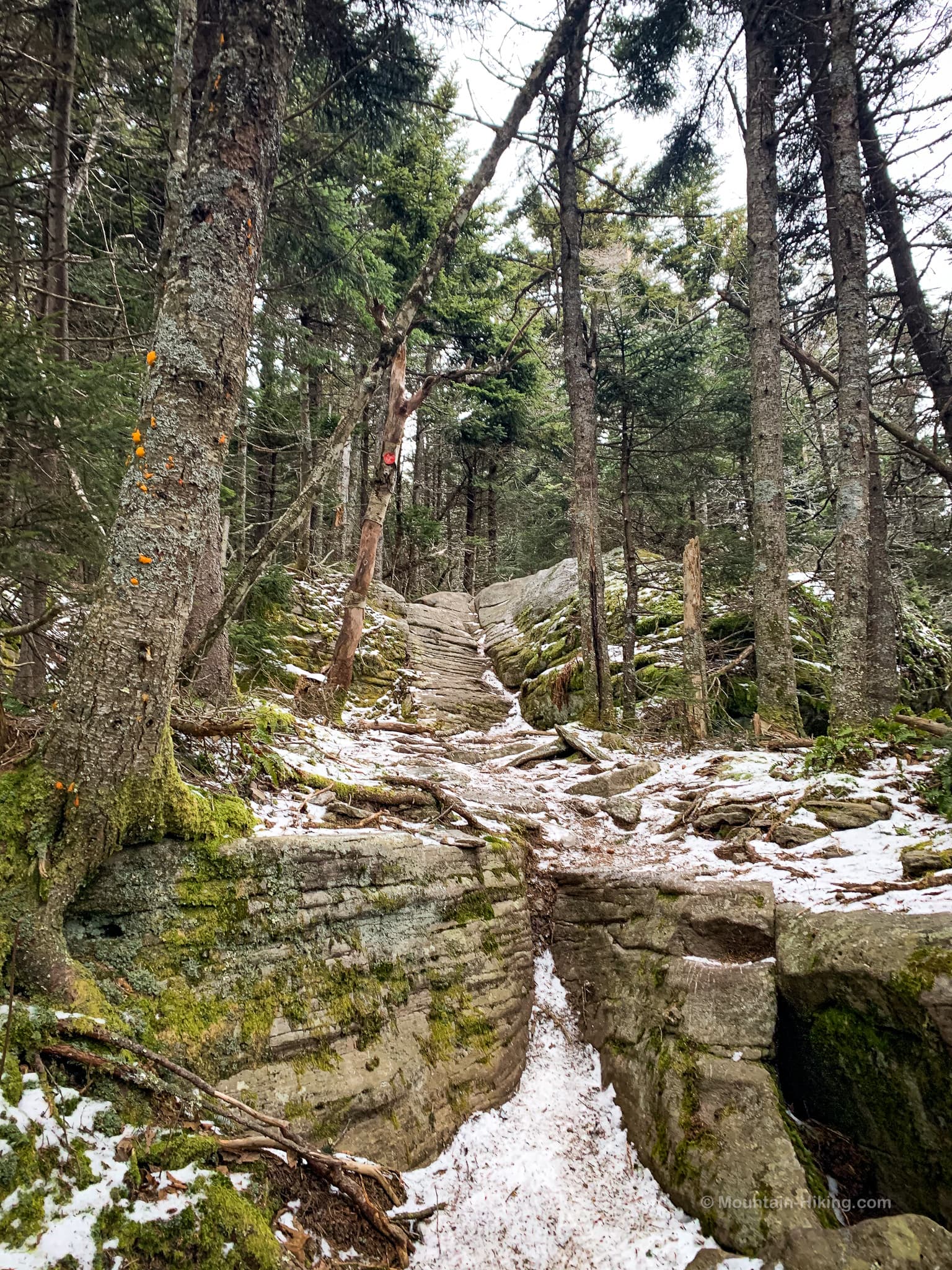
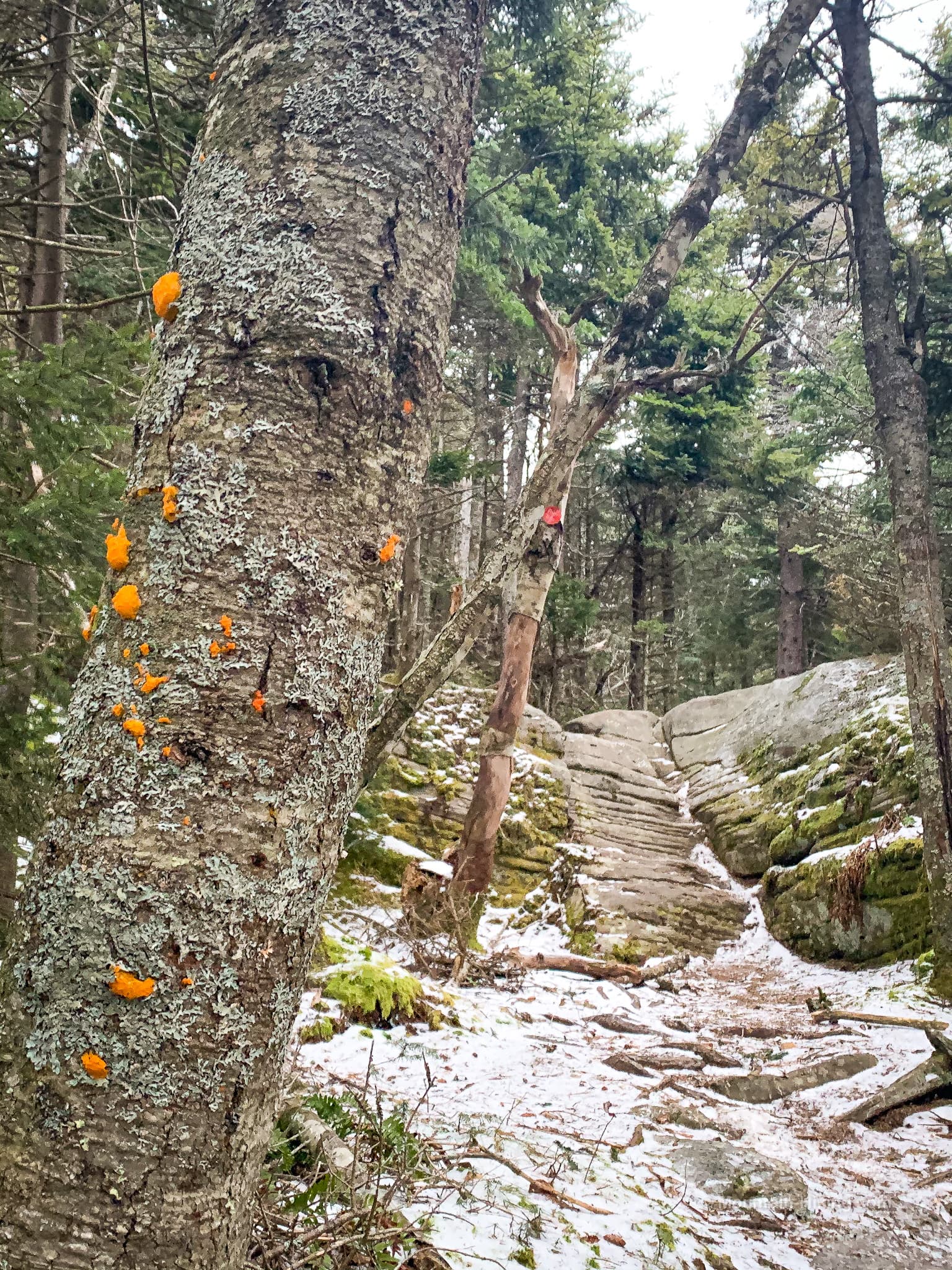
The 0.4 mile section to the first summit is one of the most beautifully rugged and fun trail sections in the Catskills. Follow the red blazes.
Twin Mountain Eastern Rock Scramble
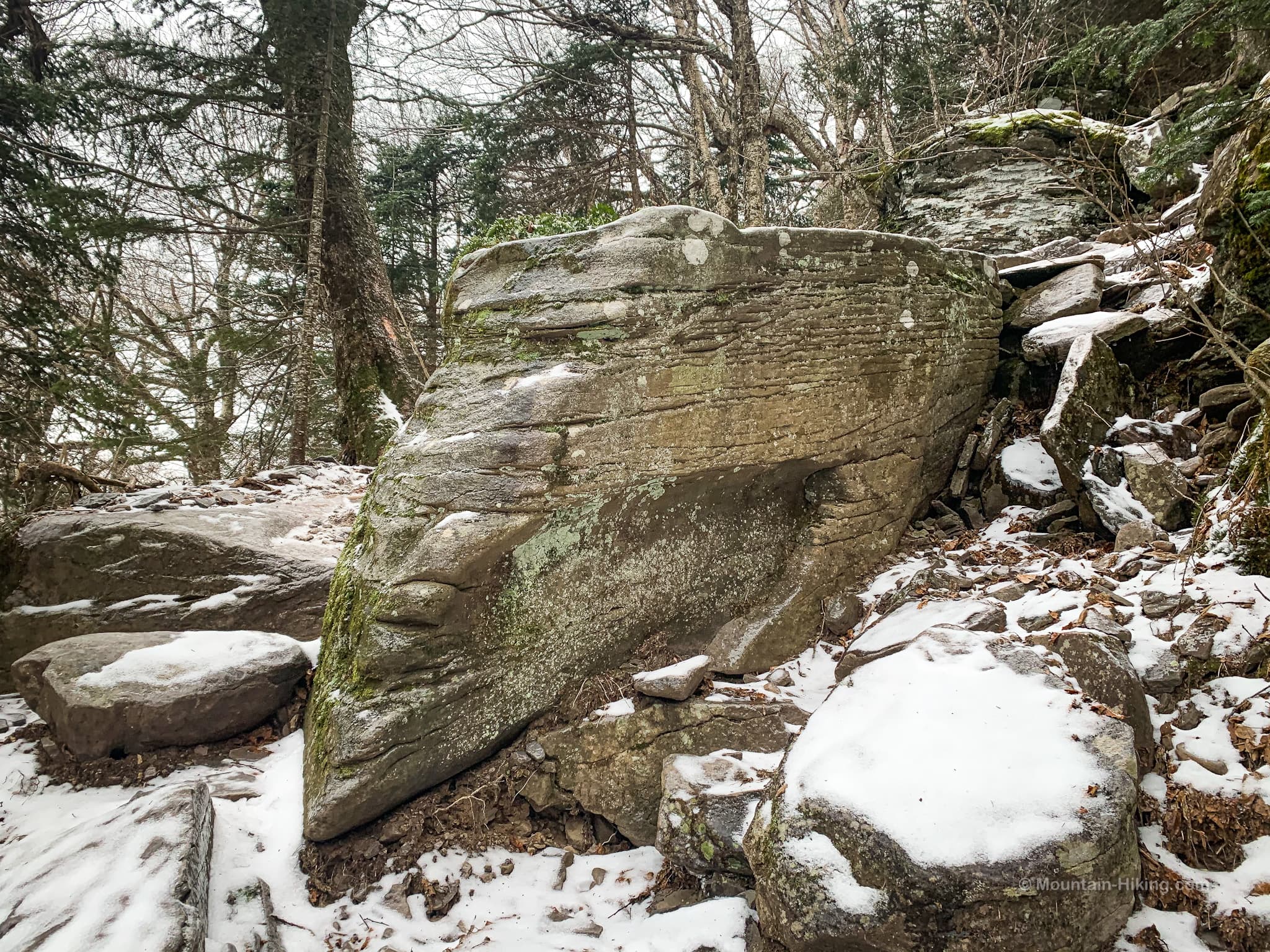
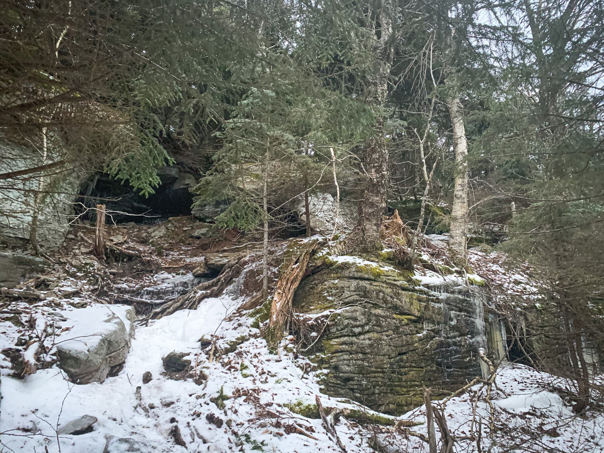
At 3250’, you’ll come to the trickiest part of the hike: a short rock scramble that looks and feels like an ancient stone portal.
The first part of the scramble is straightforward. Climb over the large boulders and head to the back of the enclosure.
Warning! This rock scramble is tricky. Proceed with extreme caution. Turn around if you are not 100% confident in your abilities. You are far from any help. Cell coverage in this spot is not good.
There are ways up both sides. Both are awkward with a high potential for falling backwards and serious injury.
On this day, the trick for me was finding a small dry handhold on the left side of the scramble. Everything else was covered in a thin layer of smooth, slippy, glassy ice.
This handhold gave me just enough leverage to hoist myself…
The left-side lift is a very tight spot — a good place to give yourself a concussion if you don’t monitor and move your head carefully.
Ascent to First Summit
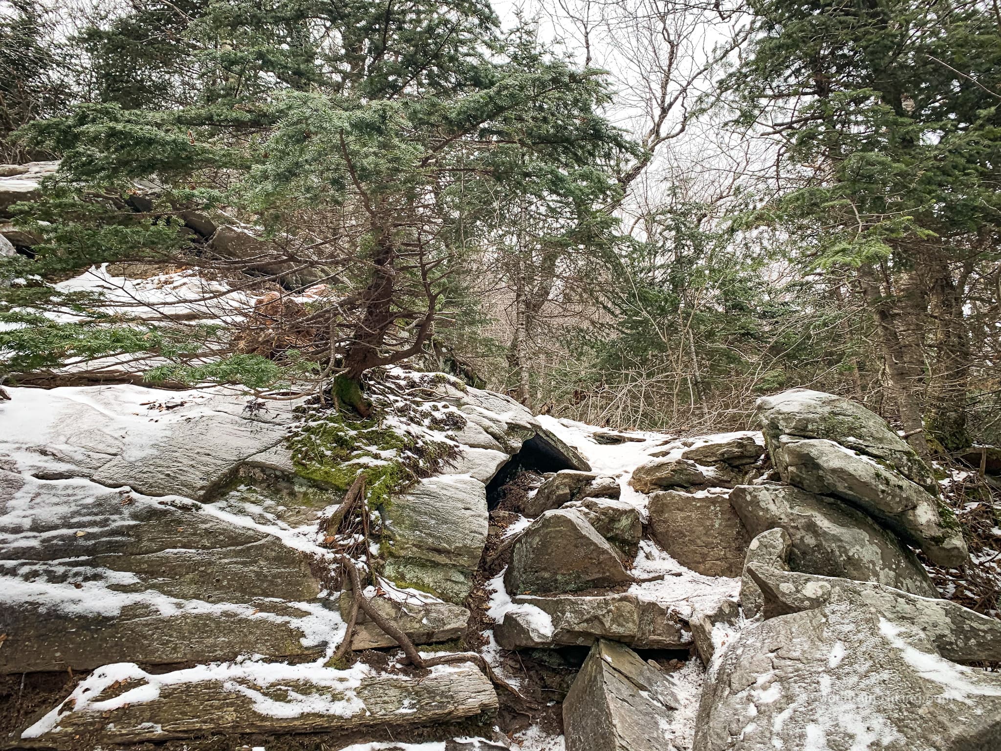
Not long after the rock portal, you’ll pass this incredible boulder protruding from the mountain…
At 3370’, pass this beautiful tree on a rock ledge that has very strong bonsai vibes. It was difficult to photograph well but, in person, it’s so striking, so beautiful, so clear…
At 3450’, another stunning spot. This is just one small section of it…
After this, the trail levels out briefly, passing a small open ledge on the left (at 3500’) where you can get a pretty solid look at Indian Head to the east.
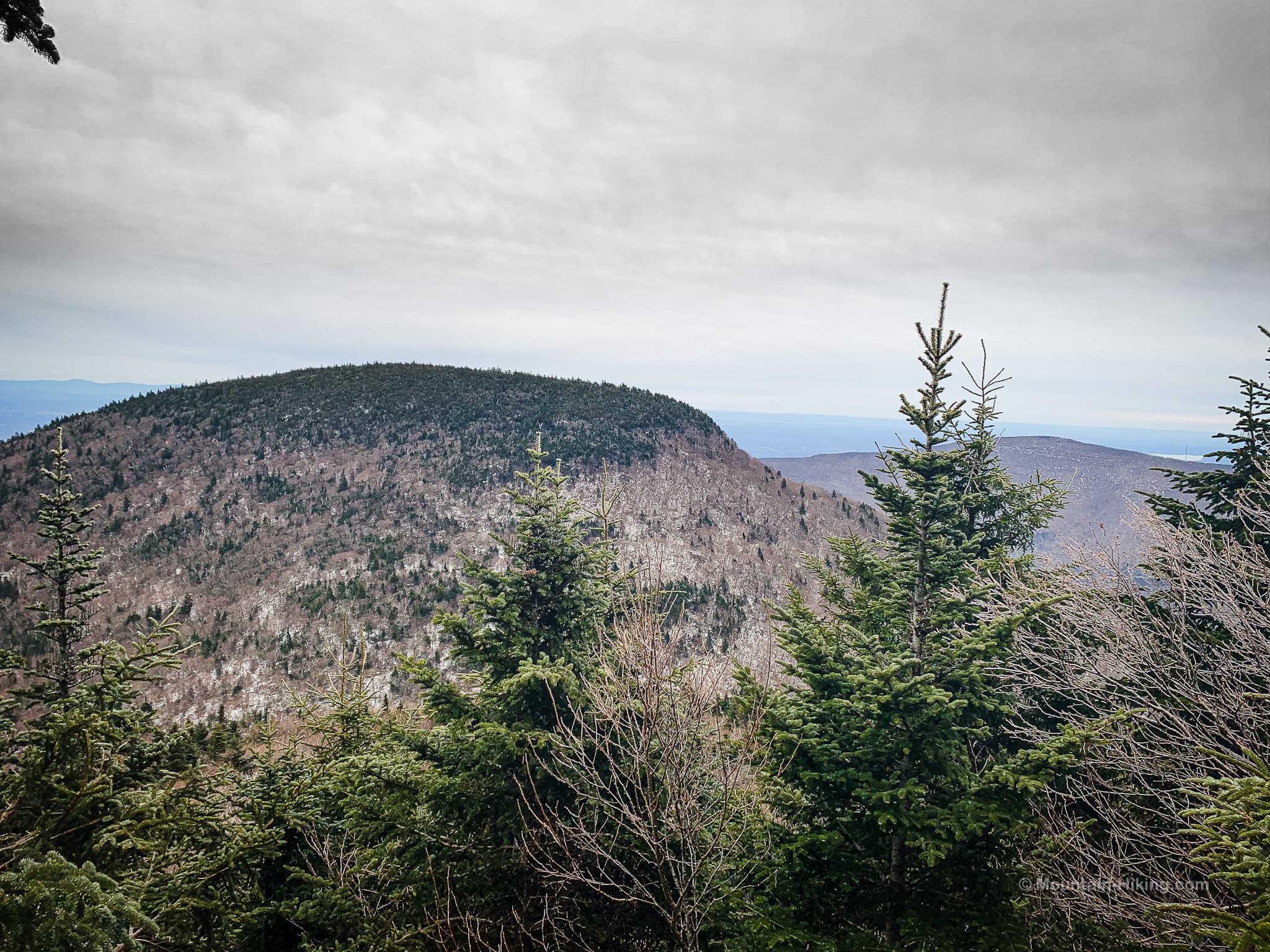
Overlook Mountain is also visible. If the weather is clear, you can see the fire tower and radio mast.
From here, it’s just two or three easy minutes to Twin’s lower summit.
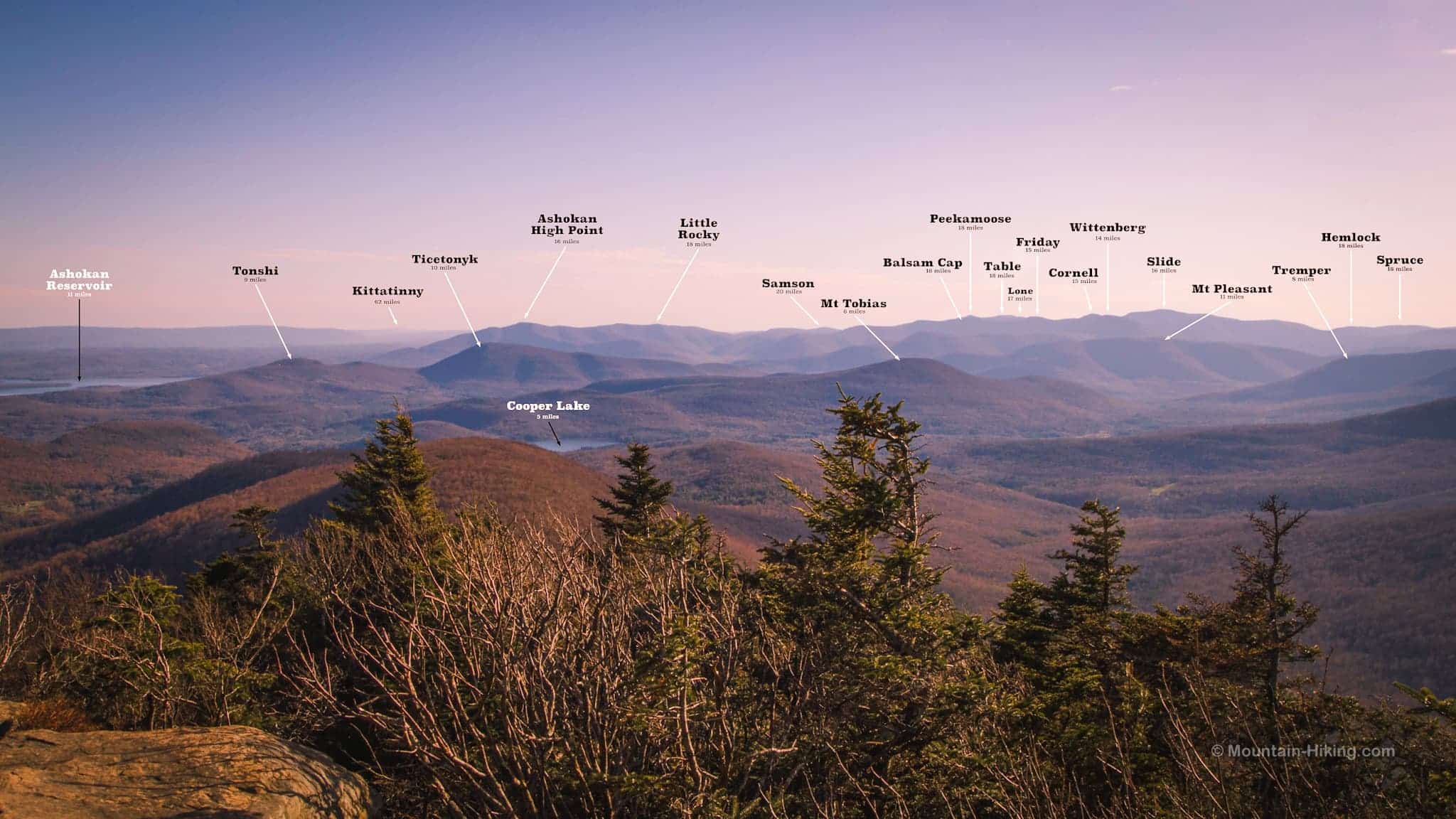
Twin Mountain Big View
The trail itself is beautiful. Then it suddenly opens out onto a large open rock ledge that gives an expansive 180° view of the Ashokan Reservoir, the Burroughs Range, and much more.
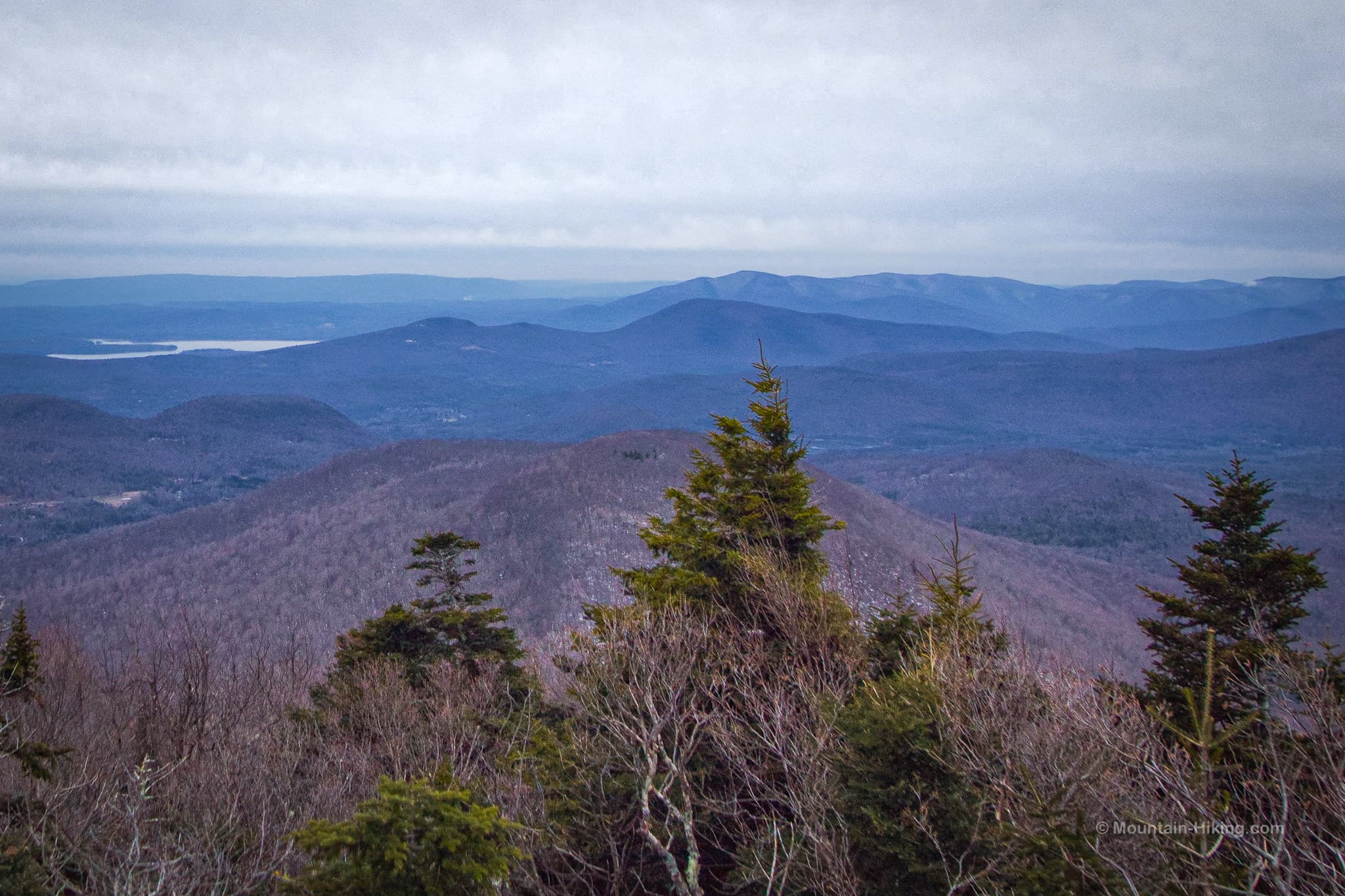
The ledge has several places to stand or sit: some higher, some lower. Poke around for the best angles.
On this day, the Burroughs Range was in the clouds…
On a previous, sunnier day, I was able to shoot a clearer image — which allowed me to work out what I was looking at and add labels to the sights…
Hike to Twin Mountain’s True Summit
This ledge marks Twin Mountain’s lower peak. The trail to the summit is on the left side of the ledge which, counterintuitively, means you need to step down a few feet to find the red blazes that lead the way.
The hike descends 100’ or so into the col between the two peaks. I love this trail section (and this whole mountain).
About ⅔ the way to the summit, you’ll reach the bottom of the main summit knob…
From here, the trail gains a rugged 174’ of elevation before popping out on to a second ledge, much smaller than the first but with its own charms.
Twin Mountain Summit
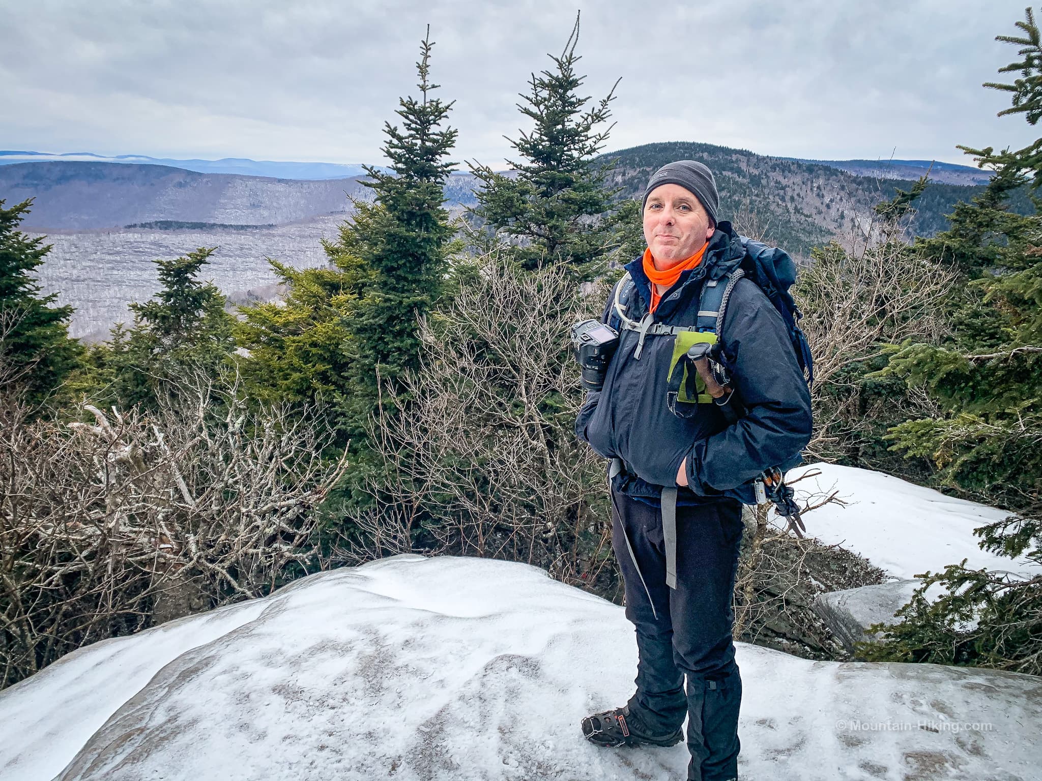
On this hike, we were running short on time and daylight so I have only this quick summit photo of myself taken by Zoeann Murphy — an award-winning Washington Post reporter! A fews days later, Zoeann was shooting video on the steps of the Capitol Building in Washington DC at the moment insurrectionists breached its doors. You’ve probably seen some of her video footage, crucial documentation of the day’s violence and madness. Zoeann is one of those old school Fourth Estate people who’s work prevents democracy from becoming a black hole of propaganda and disinformation.
Anyhoo…
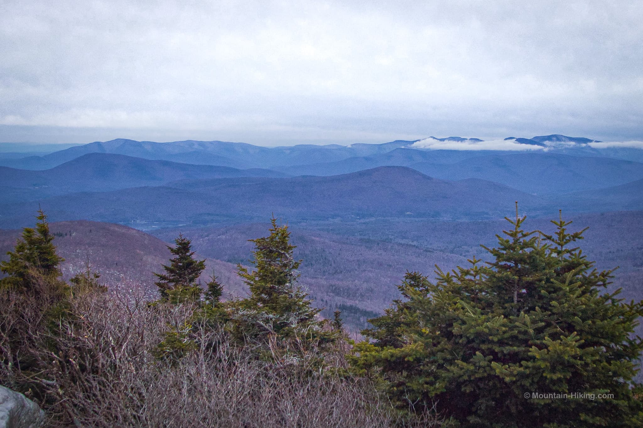
Over my left shoulder, Sugarloaf is prominent — but the western ridge of Plateau is also visible, as is Hunter’s summit in the distance. (Now, I’m wondering if Hunter’s fire tower can be seen from this angle…)
To my right, the long low mountain is Olderbark, a difficult bushwhack mountain I’ve yet to hike. Behind Olderbark, 25 miles away, Balsam Mountain is the prominent frustum-shaped peak. Yeah, I just learned that word, too. To the left of Balsam, you can also see Eagle and Panther mountains.
Descent
One last note: there are two ways down from this summit. At the east side of the ledge, the trail splits in two.
Make sure you take the left fork to return to Twin’s lower summit.
The right fork descends down the far side of the summit — toward Pecoy Notch, Dibble’s Quarry, and Roaring Kill Road — via one of the most rugged trail sections in the Catskills.
Similar Hikes
You can also Hike Twin Mountain from Roaring Kill to this same spot via Twin’s tough western slope. That is a beautiful hike — but has a short section that might be the trickiest section of trail in the Catskills. The Jimmy Dolan route above is the less-difficult route of the two.
Pair Twin with Indian Head for an absolutely kick-ass Catskills double-peak hike.
For scenic majesty, the only view that beats the view from Twin is the big view from Wittenberg.
Twin Mountain via Jimmy Dolan Notch Trailhead
Large lot, popular destination. Arrive early, especially at weekends and on vacation days.
Google Maps Location: 42.134282, -74.104102
The map below shows the exact topographic location of the trailhead
Cell Service
Service in parking area. Spotty elsewhere. My network is Verizon. YMMV.
The parent mountain for this hike is Twin.
