
Disclosure: This content may contain affiliate links. Read my disclosure policy.
A straightforward out-and-back, a little steep at times.
Trailhead info at bottom of this post.
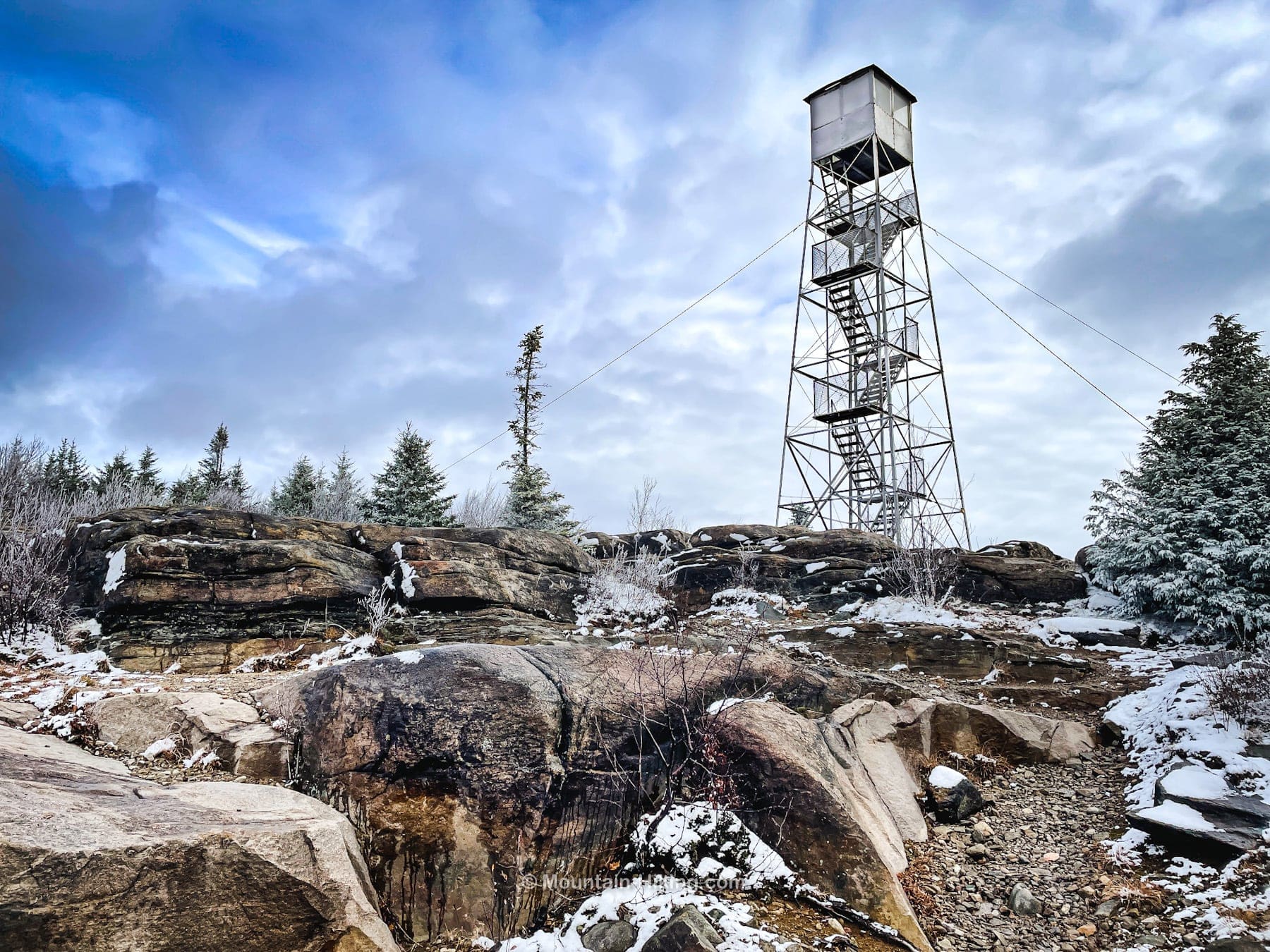
Hadley Mountain Fire Tower is a quick, moderate hike with amazing views. This is, very understandably, one of the most popular hiking destinations in the Adirondacks.
At the summit of this modest peak, at an elevation that affords breath-taking vistas, stands the Hadley Mountain Fire Tower, an enduring sentinel and a tribute to the legacy of forest conservation.
The original wooden tower was erected in 1916 and the current steel tower was built in 1920. Hadley Mountain Fire Tower is one of the few remaining fire towers in New York State that has weathered the elements and the test of time. These structures, once pivotal for spotting forest fires across the vast timberlands, now serve as beacons for hikers and history enthusiasts alike.
The Hadley Tower, in particular, has been meticulously restored, ensuring that its rugged structure continues to offer safe passage to those eager to survey the Adirondacks from an eagle’s vantage point.
The hike is a little steep, especially for new mountain hikers. But there are no rock scrambles or difficult technical sections. It’s a moderate hike, accessible to beginners yet satisfying for seasoned trailblazers, offering a variety of terrains that speak to the geological richness of the region. Just take your time, and make sure you have proper footwear and traction.
Hadley Mountain Fire Tower is more than a lookout—it’s a link to the past and a place of present wonder.
BTW, you might also enjoy…
- UPDATED › Best Bug Spray & Bug Repellent for Hikers
- CATSKILLS › Peakbagging The Catskills High Peaks (Ultimate Guide)
- STAY › Find Your Perfect Catskills Stay
- ADIRONDACKS › Wright, Algonquin & Iroquois Peaks
- LEARN › Teach Yourself How to Use a Compass
- ENTERTAINMENT › Best & Worst Hiking Movies
- Follow › My Instagram @TotalCatskills
- Follow › My Substack @TotalCatskills
- Follow › My writing for Times Union
Hadley Mountain Fire Tower Trail
The Hadley Mountain fire tower trail includes…
- Ample parking
- Beautiful moderate hiking trails
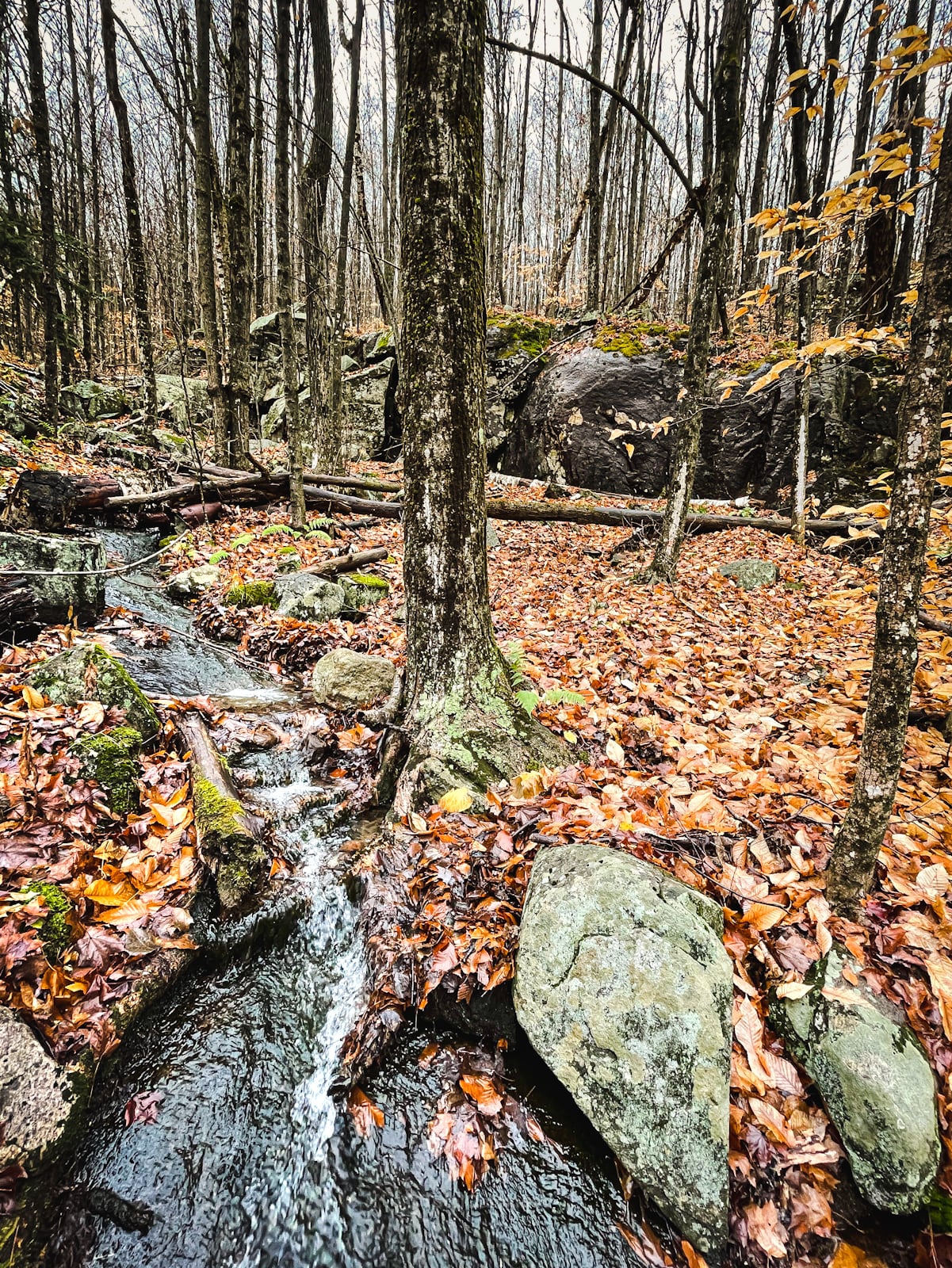
- Stream crossing
- Hadley Mountain Tree (the toughest little tree in the ADKs)
- The world’s smallest fire tower hatch?
- Fantastic 360° view
Allow 2-3 hours for this hike. A full breakdown is provided in the trail notes below, with 15 gorgeous photos.
Hadley Mountain Fire Tower Parking
Tower Road, where the trailhead is located, is a dirt road. I’m not sure of the status during winter and if this last section of road gets plowed or not. Check ahead/online after snow. However, it’s a generous parking lot. There’s enough room for 20 cars.
Hadley Fire Tower Trail Notes & Gallery
This hike does include a stream crossing — really, more of a brook. There is lots of open rock face on the lower sections of trail so, when it’s wet and slippery, make sure you’ve got on your best hiking boots. Any kind of ice will necessitate spikes.
 You’ve got the basic details, but there’s so much more…
Unlock this site now to get complete intel on every route, including my full photo galleries, personal insights and tips. Elevate your next hike with deep trail beta. Experience hundreds of amazing routes at their absolute finest. With Mountain-Hiking.com, you’re not just skimming the surface.
Sean

Similar Hikes
If you like short hikes, check out this list of short hikes.
And here’s a list of the fire tower hikes I’ve completed so far.
Read More
Get full access…
Get instant access to the full version of this site and enjoy great supporter benefits: full galleries, full trail notes, early access to the latest content, and more.
Hot on the website right now…
Follow for more…
Follow my @TotalCatskills content on Instagram for regular hiking inspo and safe, inclusive community.
Hadley Mountain Fire Tower Trailhead
Medium-sized lot for a very popular destination.
Google Maps Location: 43.373462, -73.950604
The map below shows the exact topographic location of the trailhead
Cell Service
Cell service only when up high. At lower elevations you’ll need to get to the nearby town of Hadley. My network is Verizon. YMMV.
The parent mountain for this hike is Hadley.