Disclosure: This content may contain affiliate links. Read my disclosure policy.
Very easy trails, plus one tricky off-trail section.
Trailhead info at bottom of this post.
The High Falls Conservation Area, Philmont, NY is a stunning destination and a great place to cool down in New York’s brutal summer heat.
This hike in is very short. Really, it’s more of walk — though there is a wet rock scramble to contend with so do be careful and make sure you bring proper footwear.
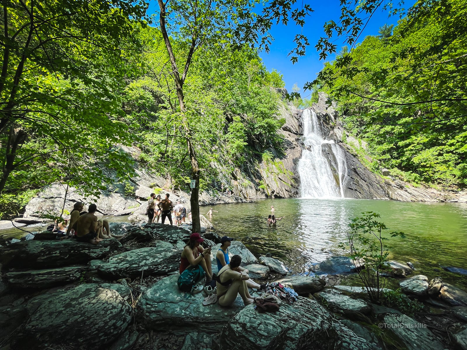
There are at least two glorious waterfalls, with the tallest falls being over 150 feet (tallest in Columbia County). And there are excellent viewing spots from above and at the base of the falls.
I explored most of the High Falls Conservation Area’s trails and clocked my stay at 1.6 miles.
Allow an hour to visit the falls, walk the trails, and see all the sights. Many people stay much longer to picnic around the gorgeous natural pool at the base of the falls.
Dogs are welcome but must be leashed at all times. (And please pick up any poop your pooch poops!)
BTW, you might also enjoy…
- UPDATED › Best Bug Spray & Bug Repellent for Hikers
- CATSKILLS › Peakbagging The Catskills High Peaks (Ultimate Guide)
- STAY › Find Your Perfect Catskills Stay
- ADIRONDACKS › Wright, Algonquin & Iroquois Peaks
- LEARN › Teach Yourself How to Use a Compass
- ENTERTAINMENT › Best & Worst Hiking Movies
- Follow › My Instagram @TotalCatskills
- Follow › My Substack @TotalCatskills
- Follow › My writing for Times Union
High Falls Conservation Area Hiking Trails
The High Falls Conservation Area hiking trails include…
- Short, easy, interconnected trails
- Lots of beautiful stream-side forest (hemlock trees galore)
- Stunning waterfalls
- Two great views of the main falls
Allow 2 hours for this hike. A full breakdown is provided in the trail notes below, with 10 sensational photos.
High Falls Conservation Area Trail Notes & Gallery
The parking area is large and well-tended. High Falls is home to several fragile habitats and unique plants. Please stay on the trails to protect them.
 You’ve got the basic details, but there’s so much more…
Unlock this site now to get complete intel on every route, including my full photo galleries, personal insights and tips. Elevate your next hike with deep trail beta. Experience hundreds of amazing routes at their absolute finest. With Mountain-Hiking.com, you’re not just skimming the surface.
Sean

Similar Hikes
Check out the list of waterfall hikes on this website.
Enjoy easy hikes to Bash Bish Falls and Kaaterskill Falls.
This hike also reminded me of the fun, short loops around Sloan Gorge Preserve.
This trail is short and easy enough, and rewarding enough, to be considered a Nature Trail.
Read More
Get full access…
Get instant access to the full version of this site and enjoy great supporter benefits: full galleries, full trail notes, early access to the latest content, and more.
Hot on the website right now…
Follow for more…
Follow my @TotalCatskills content on Instagram for regular hiking inspo and safe, inclusive community.

High Falls Conservation Area Trailhead
Large, popular lot
Google Maps Location: 42.246876, -73.658209
The map below shows the exact topographic location of the trailhead