Disclosure: This content may contain affiliate links. Read my disclosure policy.
A straight run up to the summit following the well-established herd path.
Trailhead info at bottom of this post.
Hiking Trail Description
Doubletop Mountian is currently closed to public hiking.
The drive down from Route 28 passes through Hanley Corner and Mapledale. It’s a really lovely, bucolic area, with rolling hills and working farms and small herds of cows.
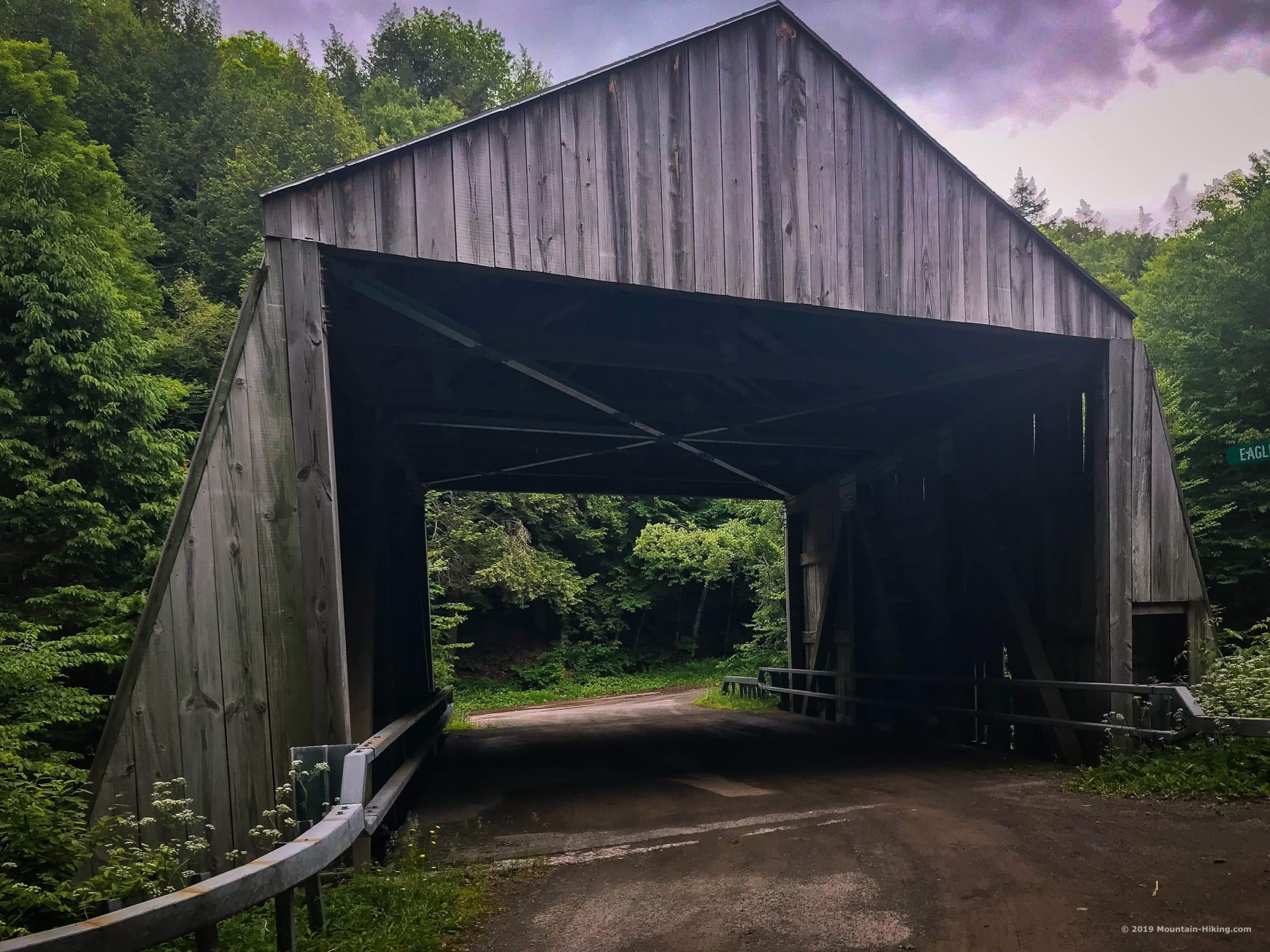
Driving south on Dry Brook Road, you’ll pass two covered bridges. The first is on your right. The second (shown below) is on your left. Drive past both bridges.

Park at the trailhead, sign in, and notice the second sign: THIS IS PRIVATE LAND.
BTW, you might also enjoy…
- UPDATED › Best Bug Spray & Bug Repellent for Hikers
- CATSKILLS › Peakbagging The Catskills High Peaks (Ultimate Guide)
- STAY › Find Your Perfect Catskills Stay
- ADIRONDACKS › Wright, Algonquin & Iroquois Peaks
- LEARN › Teach Yourself How to Use a Compass
- ENTERTAINMENT › Best & Worst Hiking Movies
- Follow › My Instagram @TotalCatskills
- Follow › My Substack @TotalCatskills
- Follow › My writing for Times Union
A full breakdown is provided in the hike notes below, with 14 photos and 2 videos.
Hike Doubletop Mountain
My favorite part of this hike was actually the first mile of trailed section along Dry Brook. By mid-June, the banks on both sides of the brook are lush and all along the stream feels wild and natural. The crossings are a lot of fun.
Closed! Graham & Doubletop mountains are no longer accessible to the public. Both mountains are on private land. Trespassers will be prosecuted. The information presented here is for historical puproses only.
 You’ve got the basic details, but there’s so much more…
Unlock this site now to get complete intel on every route, including my full photo galleries, personal insights and tips. Elevate your next hike with deep trail beta. Experience hundreds of amazing routes at their absolute finest. With Mountain-Hiking.com, you’re not just skimming the surface.
Sean

Read More
Get full access…
Get instant access to the full version of this site and enjoy great supporter benefits: full galleries, full trail notes, early access to the latest content, and more.
Hot on the website right now…
Follow for more…
Follow my @TotalCatskills content on Instagram for regular hiking inspo and safe, inclusive community.

Hike Doubletop from Seager Trailhead
Medium-sized lot. Pay attention to the private property signs.
Google Maps Location: 42.058204, -74.539796
The map below shows the exact topographic location of the trailhead
Cell Service
Spotty service with low-to-no signal depending on where you’re standing My network is Verizon. YMMV.
The parent mountain for this hike is Doubletop.