Disclosure: This content may contain affiliate links. Read my disclosure policy.
A mix of trail and true bushwhack.
Trailhead info at bottom of this post.
Hiking Trail Description
This is a made-up loop I designed to hike some of the Catskill 67 lower summits near Hodge Pond in Rockland, New York. It turned out to be one of the weirdest and most surprising hikes.
This route includes Beech, Mongaup and Hodge Pond mountains. Of those, only Mongaup and Hodge Pond are official Catskill 67 peaks. But Beech has delights of its own.
For me, the narrow ridge that runs north/south between Beech and Mongaup was one of the highlights of this route.
Before that, I was blown away by the stunning boardwalks of Frick Pond.
And then I was shocked to come across not one, but three blackened trees — clearly struck by lightning.
After completing this route, I noticed the odd shape of my GPS track. It looked to me like the outline of a ring-wraith from Lord of the Rings and so I’ve named this strange, witchy route The Nazgûl Loop.
Honestly, this route combines so many weird and disparate elements it might as well be called The Hodgepodge Loop.
You’ll see.
Mountain-Hiking.com is independently owned and supported by readers and a small group of sponsors. If you’d like to help me continue producing content like this, please consider becoming a Patreon supporter.
BTW, you might also enjoy…
- UPDATED › Best Bug Spray & Bug Repellent for Hikers
- CATSKILLS › Peakbagging The Catskills High Peaks (Ultimate Guide)
- STAY › Find Your Perfect Catskills Stay
- ADIRONDACKS › Wright, Algonquin & Iroquois Peaks
- LEARN › Teach Yourself How to Use a Compass
- ENTERTAINMENT › Best & Worst Hiking Movies
- Follow › My Instagram @TotalCatskills
- Follow › My Substack @TotalCatskills
- Follow › My writing for Times Union
Hodge Pond 3 / Nazgûl Loop Hiking Trail
The Hodge Pond 3 route includes…
- Two Catskill 67 lower peaks
- The most epic swamp boardwalks in the Catskills
- One of the most unique cliff locations in the Catskills
- A very old white pine tree
- A shocking number of black cherry trees
- A geocache
- Two scenic views
- A bluestone quarry
- Some of the best junction names in The Catskills
- Two beautiful ponds
- Three lightning-struck trees
This hike requires excellent backcountry navigation skills. Allow 5-6 hours to complete this strange route.
Hodge Pond 3 Trail Notes & Gallery
Begin at the DEC lot on Beech Mountain Road in Willowemoc Wild Forest at the Frick Pond Trailhead. (The general location is the far southwest Catskills, a few miles east of the towns of Livingston Manor and Roscoe, and just west of Mongaup Pond Campground.)
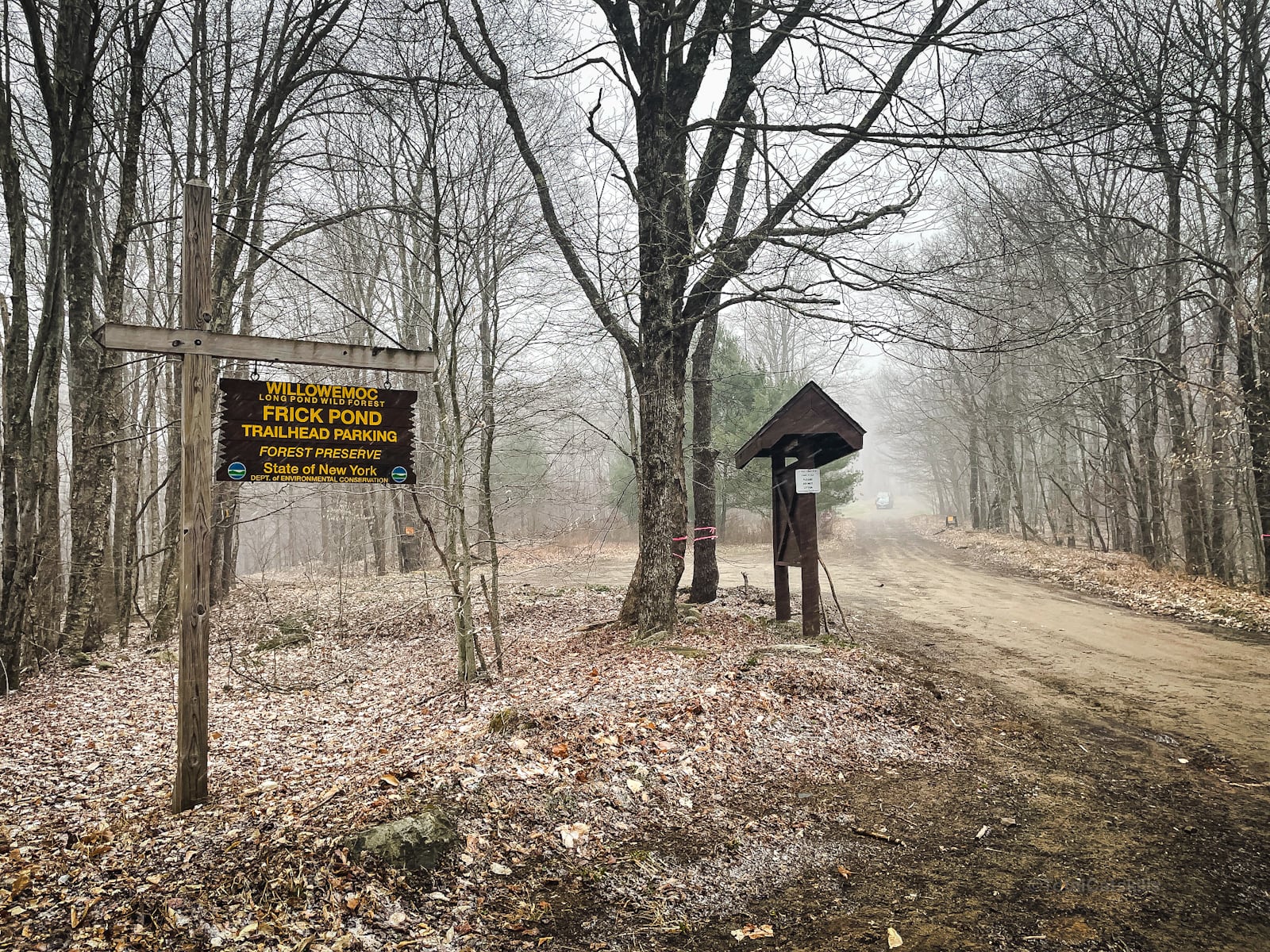
The parking area is up on a slight rise. To begin the hike, enter the woods on the northwest side of the lot and descend onto the trail which heads east for a short while before turning north.
The route, at first, follows an old woods road that can be waterlogged and muddy in spots.
There are lots of trails in this area, providing a lot of options to hike in and out. Ignore the first junction, known as Gravestone Junction, which leads to a spur trail. Shoot for the second junction which leads to a second spur trail.
You’ll pass over this footbridge…
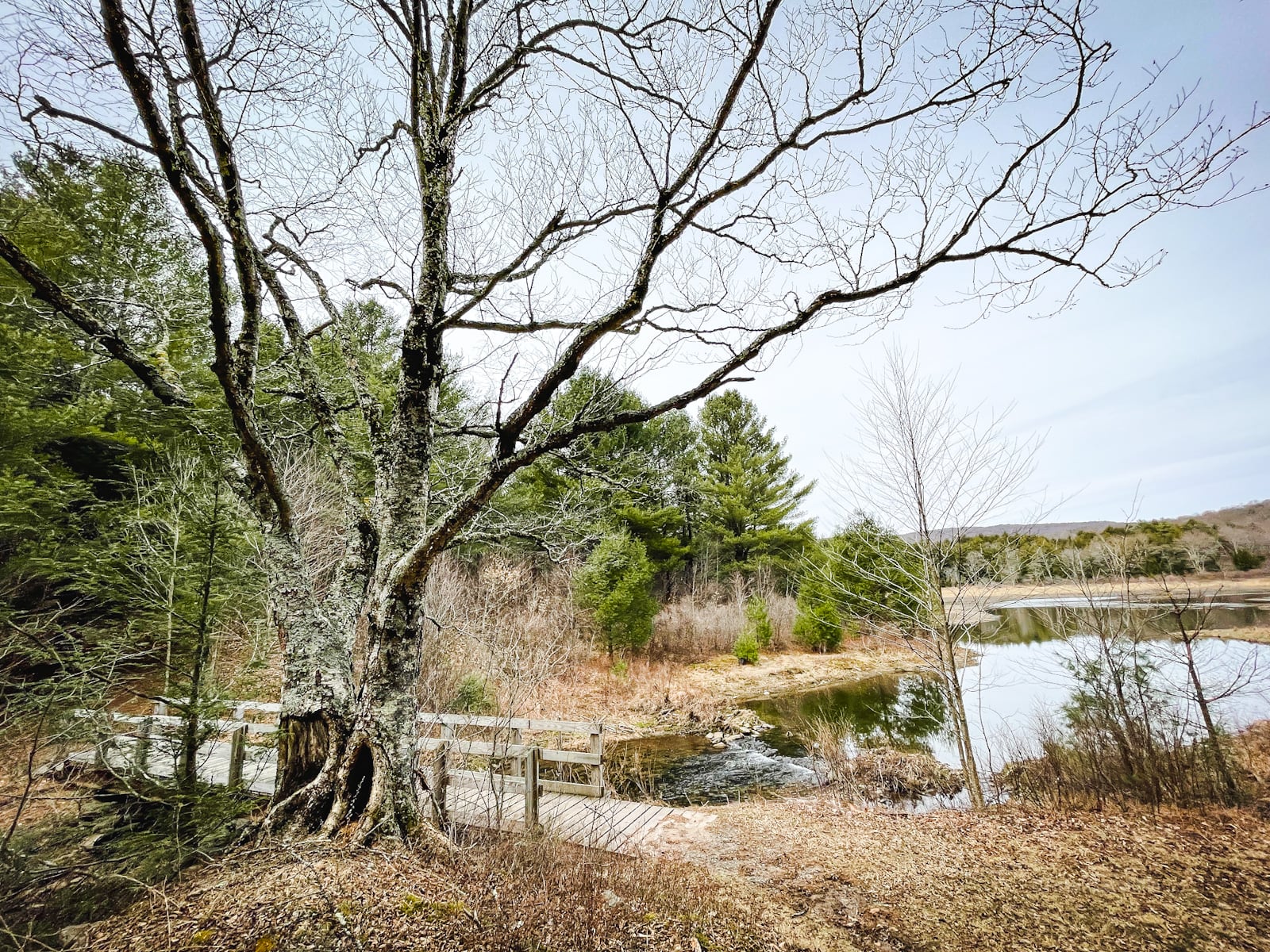
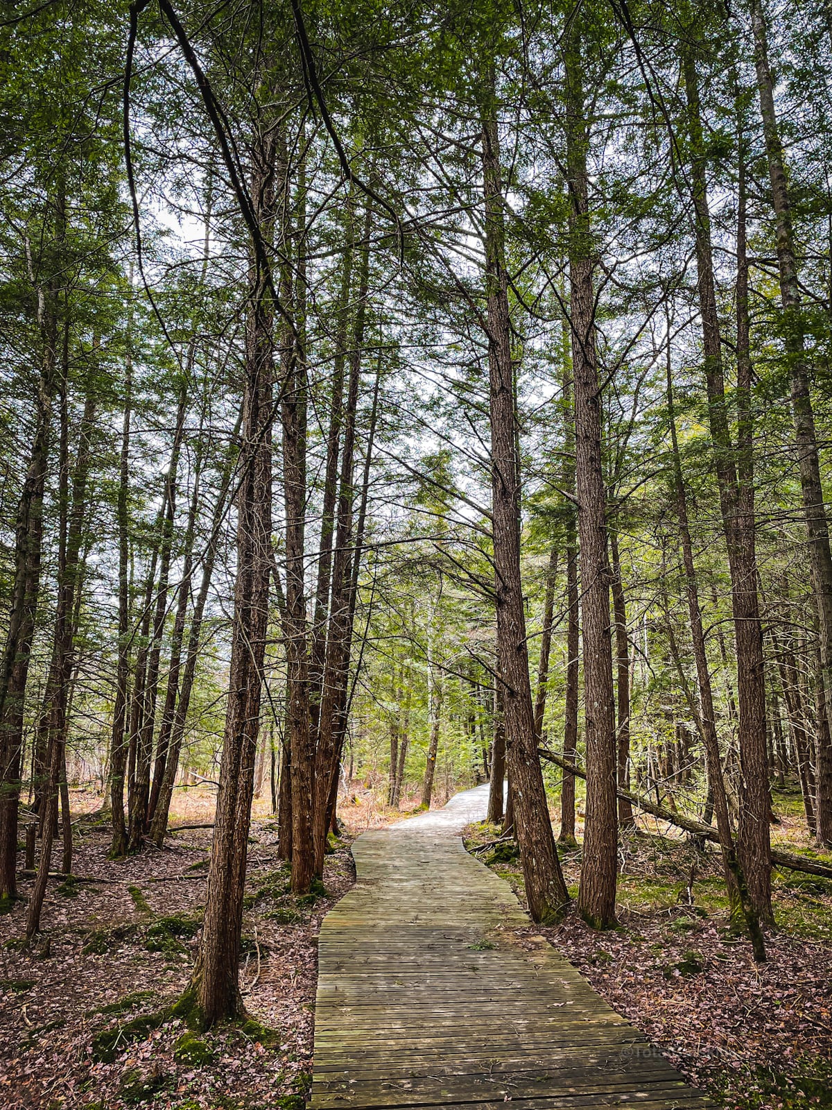
Both spur trails are blazed yellow and they both lead to the same spot, a third junction called Times Square. But the Big Rock trail on the west side of Frick Pond has the amazing boardwalks you see below. They’re so so great and such a joy to walk.
Hang on, first you’ll pass a very large, very old pine tree…
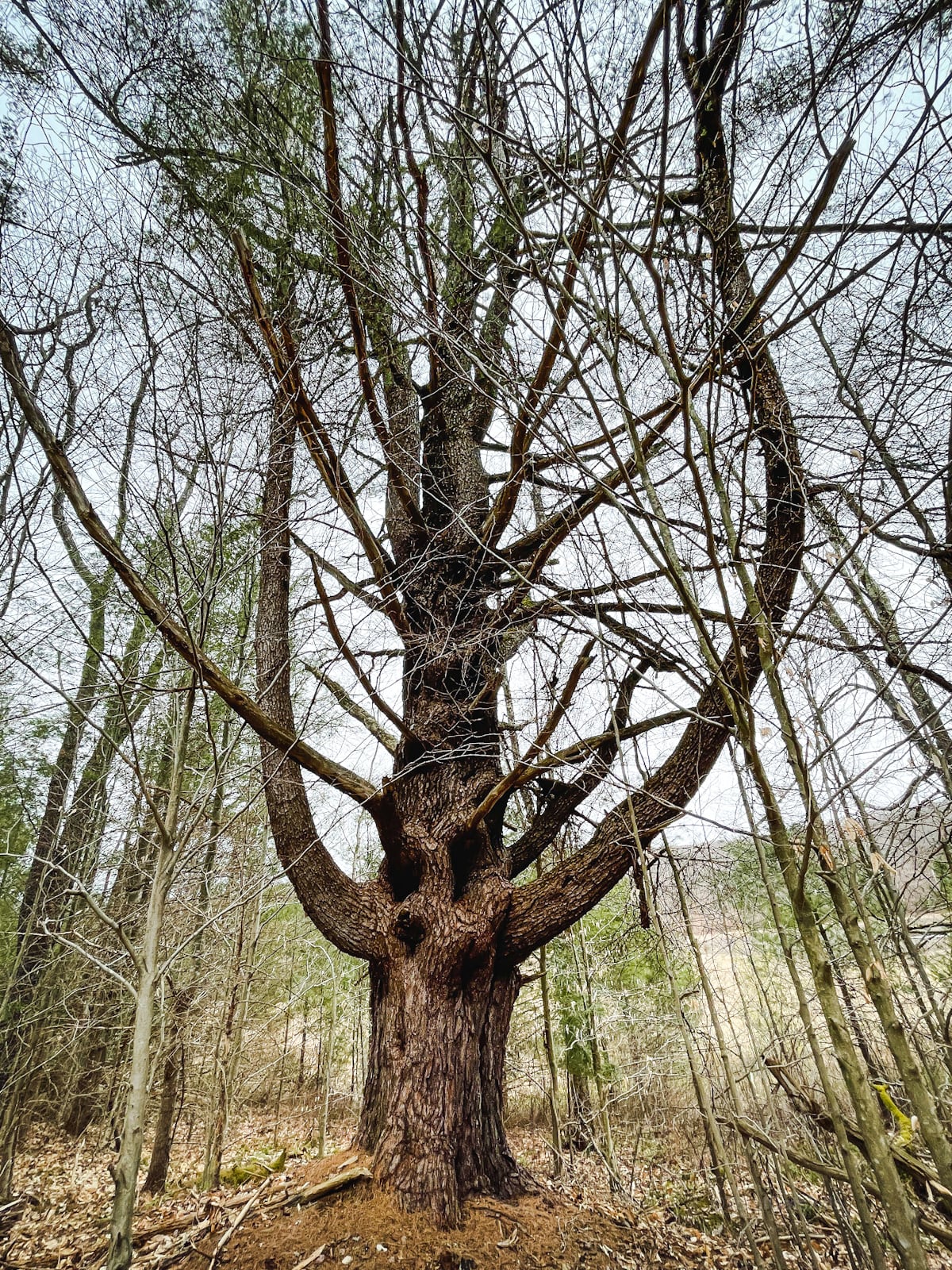
A real glory. Okay, then you hit the…
Frick Pond Boardwalks
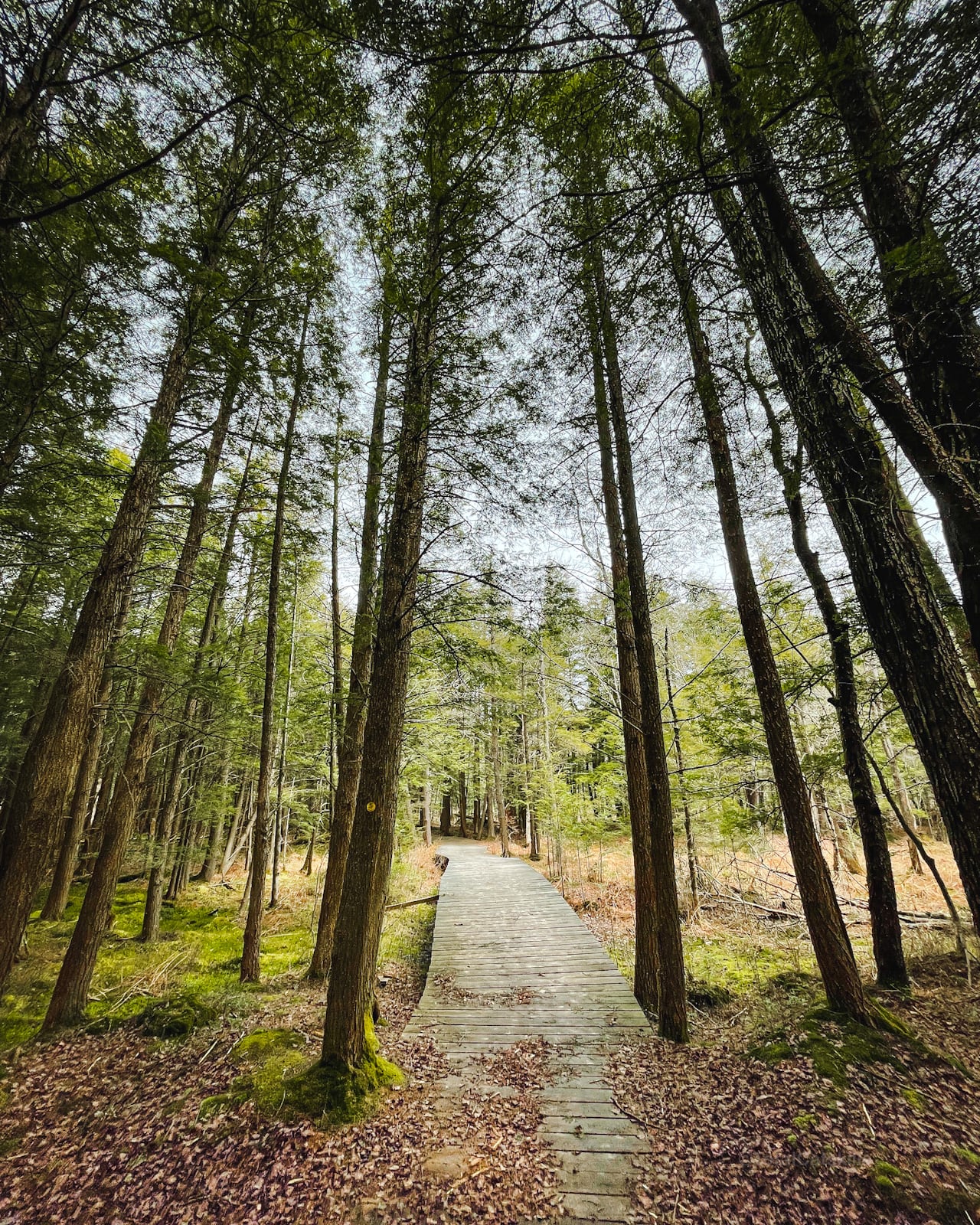
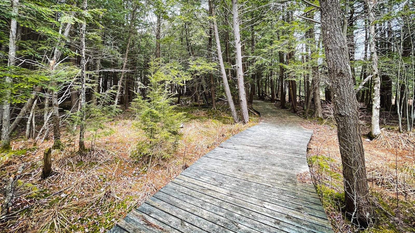
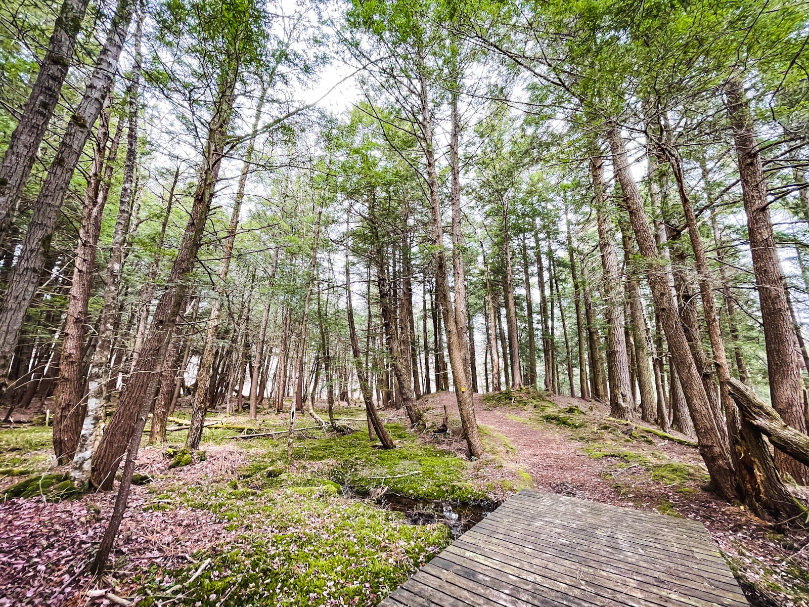
So much boardwalk. The boardwalks on the north side of Colgate Lake are great. But these boardwalks are next level boardwalks!
Times Square
Times Square is a massive open grassy crossroads. From the junction, keep following the Big Rock Trail which heads northeast toward Beech Mountain.
There are more junctions to navigate but the hiking is very easy.
Beech Mountain Bushwhack
Make your way to the southern ridge of Beech Mountain and begin your bushwhack. I got a little off track and ended up having to scramble up a steep incline. You’ll be better off sticking to the center of the ridge as you make your way up to the summit.
On the other hand, if you follow the smart route, you won’t get to visit the first of the three lighting trees. The one on Beech mountain is at 41.978138 N, 74.702100 W.
Beech Mountain has no obvious summit. You’ll have to mosey around until you’re satisfied you’ve found the highest hump.
At this point, I took a break and paused my GPS recording — and then forgot to turn it back on for 30 or 40 minutes; so you’ll notice a short lacuna in my track above.
I remember that making my way to the unmaintained woods road that runs around the north edge of the summit was not easy. The terrain is not as flat as suggested by the contours.
However, the old woods road is hard to miss, and makes a good handrail for coming and going to Mongaup.
Beech / Mongaup Col
The col between Beech and Mongaup mountains is one of the most strange and special locations in all the Catskills. I will redo this hike some day just to revisit it. Let me tell you why.
The following content is accessible to my Patreon subscribers who kindly support this independent website. Get full access to every post on this site instantly. Support local, independent content and enjoy great supporter benefits: full galleries, full trail notes, early access to the latest content, and more.
Sean

Similar Hikes
LOL, what? This is a truly unique route. I can think of nothing similar at all.
Read More
Get full access…
Get instant access to the full version of this site and enjoy great supporter benefits: full galleries, full trail notes, early access to the latest content, and more.
Hot on the website right now…
Follow for more…
Follow my @TotalCatskills content on Instagram for regular hiking inspo and safe, inclusive community.

Hodge Pond 3: The Nazgûl Loop Trailhead
Large-ish, remote lot.
Google Maps Location: 41.950810, -74.706867
The map below shows the exact topographic location of the trailhead
Cell Service
Patchy as all-get-out. My network is Verizon. YMMV.
The parent mountain for this hike is Hodge Pond.

One response to “Hodge Pond 3: The Nazgûl Loop”