Disclosure: This content may contain affiliate links. Read my disclosure policy.
A fun and easy to navigate out-and-back route.
Mount Van Hoevenberg offers one of the Adirondacks’ most accessible, astonishing, and rewarding short hikes.
Van Hoevenberg is often overlooked by hikers chasing High Peaks. That’s a mistake. This short but engaging trail delivers steady climbing, forest immersion, and excellent summit views, all without the crowds, logistics, or commitment required by bigger Adirondack objectives.
The Mount Van Hoevenberg trail is ideal for hikers looking for a half-day outing, a first Adirondack summit, or a scenic hike near Lake Placid that pairs well with other local attractions.
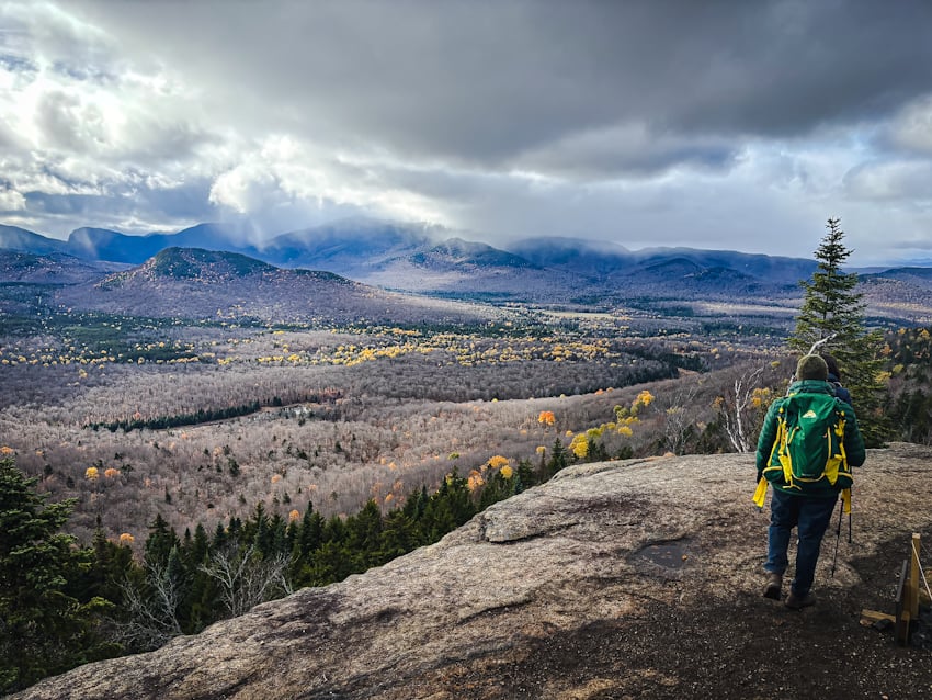
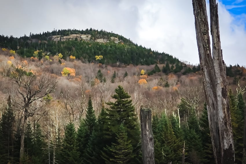
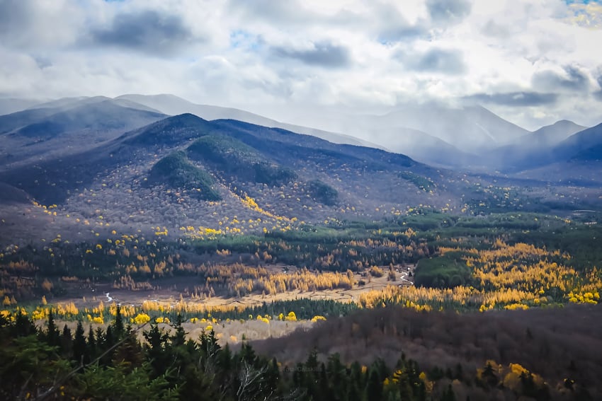
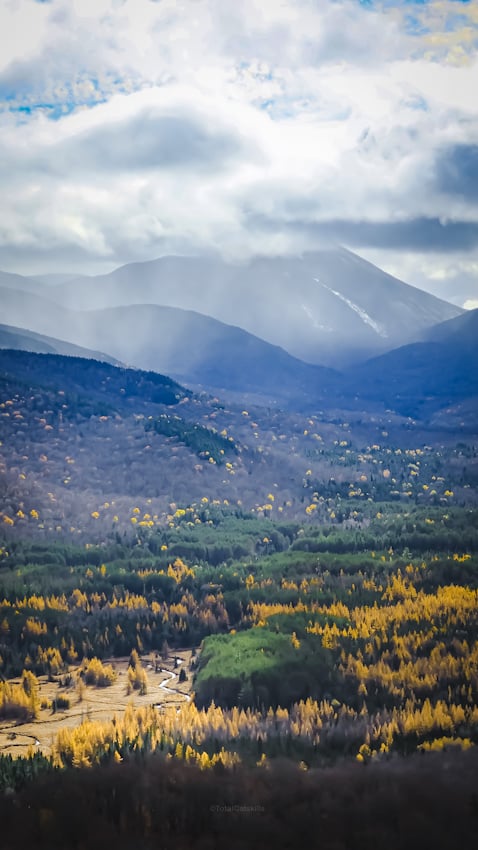
The route is well-maintained and clearly marked, making it a solid choice for beginners, families, and anyone easing into Adirondack hiking. At the same time, the summit payoff is substantial. Open rock ledges near the top provide wide views of the rugged interior of the Adirondacks High Peaks.
Because of its proximity to Lake Placid, Mount Van Hoevenberg also makes sense year-round. It’s popular in summer and fall for hiking, sees light snowshoe traffic in winter, and offers a quieter alternative when nearby High Peaks trails are crowded or muddy.
Van Hoevenberg is a trail that consistently over-delivers. It’s a small mountain with a big return, and one that earns its place on any ADK hiking itinerary.
Frequently Asked Questions
How long does it take to hike the Van Hoevenberg Trail
Allow 3 hours for this hike.
What is the elevation gain for Van Hoevenberg Trail
The elevation gain for this hike is 850 feet (apx 260 meters).
Van Hoevenberg Trail Hiking Trail Guide
The Van Hoevenberg Trail hiking trail includes…
- An easy walk in
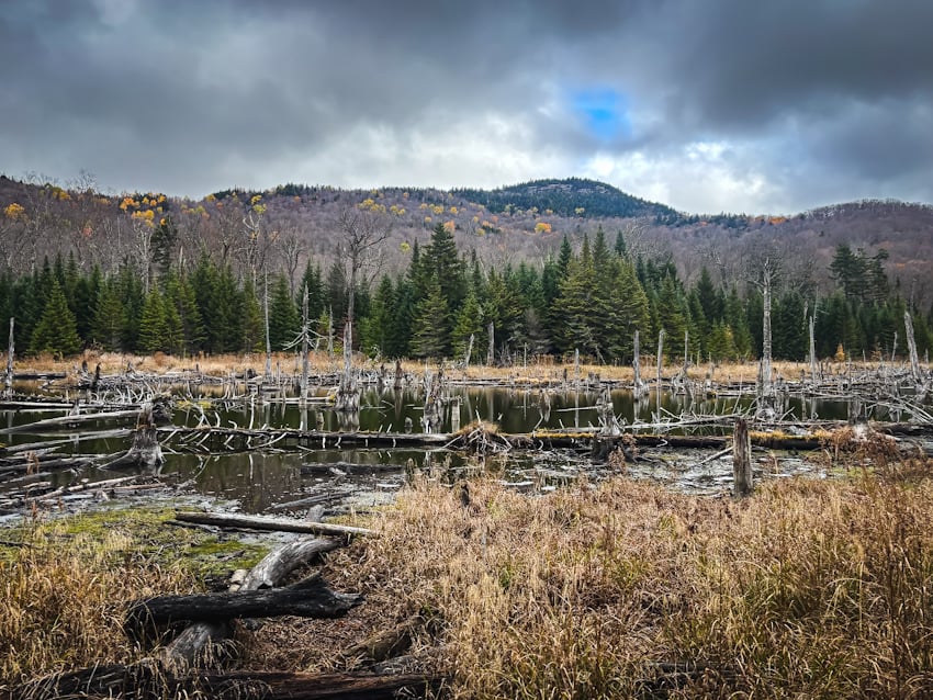
- An old beaver pond
- Solid forest immersion
- A series of open ledges with crackerjack ADK views
A full breakdown is provided below in the hike notes with lots of photos.
BTW, you might also enjoy…
- NEW › Winter Skincare for Hikers
- CATSKILLS › Best Catskills Waterfalls
- STAY › Find Your Perfect Catskills Stay
- ADIRONDACKS › Hike Van Hovenberg
- ENTERTAINMENT › Best & Worst Hiking Movies
- Follow › My Instagram @TotalCatskills
- Follow › My Substack @TotalCatskills
- Follow › My writing for Times Union
Van Hoevenberg Trail Trail Notes & Gallery
Begin at the South Meadow trailhead where it intersects with Adirondack Loj Road. You can also hike in from the High Peaks Information Center which adds about a mile at the start and the end, bringing the total mileage to 7 miles.
A mile from the trailhead, you’ll come to the beaver pond. Make your way around its west edge.
Make your way toward Mount Van Hoevenberg’s summit…
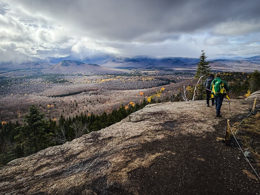
From here, it’s 1.1 miles to the summit ledges where the views are immediately epic.
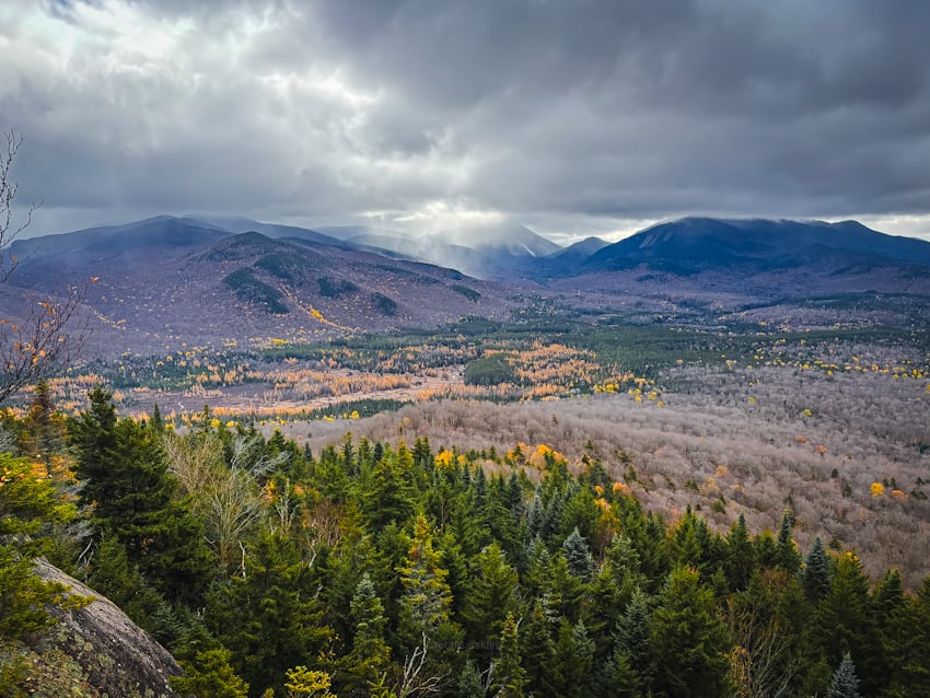
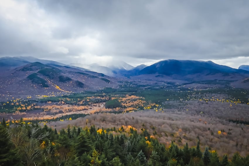
You can see Mount Jo clearly across the valley floor…
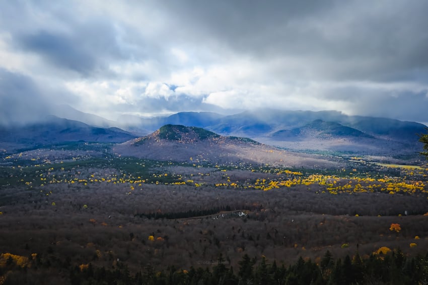
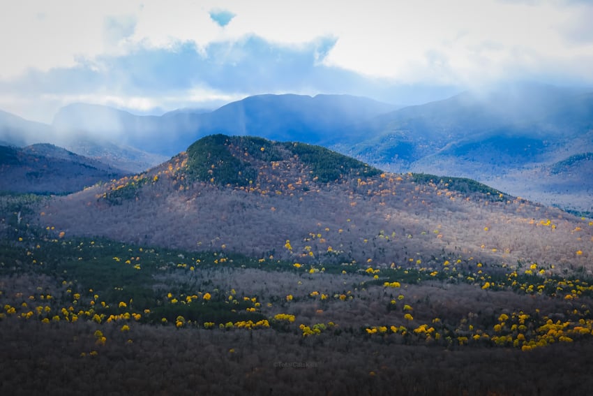
Also visible (among so many others) is Algonquin & Wright. , Wallface, Santanoni, Street & Nye, Avalanche, Colden, Phelps. Gothics, Yard, Big Slide, and Marcy. It’s a really special view.
Make sure to check out all the ledges. My friends and I camped at the first great view, watched a snow squall blow through, and then realized there was another view just a minute or two farther uphill.
I found Van Hoevenberg much more compelling than that far more popular Mount Jo — which is no shade on that smaller/easier mountain, which was also gorgeous. It just speaks to what an enjoyable hike Van Ho was.
From the summit, it’s 2.3 easy miles back to the South Meadow Trailhead.
Similar Hikes
In the Adirondacks? Check out Crane, Rooster Comb, Ampersand, Peaked, Hadley or Moxham — you won’t regret doing any of these. All of them are first rate.
Read More
Get full access…
Get instant access to the full version of this site and enjoy great supporter benefits: full galleries, full trail notes, early access to the latest content, and more.
Hot on the website right now…
Follow for more…
Follow my @TotalCatskills content on Instagram for regular hiking inspo and safe, inclusive community.
Mount Van Hoevenberg Trailhead
Small lot, very popular.
Google Maps Location: 44.193539, -73.955458
The map below shows the exact topographic location of the trailhead
Cell Service
Good signal at elevation. My network is Verizon. YMMV.
The parent mountain for this hike is Mount Van Hoevenberg.
