Disclosure: This content may contain affiliate links. Read my disclosure policy.
A long never-boring loop via the Pantoll trailhead.
Trailhead info at bottom of this post.
The storied Steep Ravine/Dipsea/Matt Davis loop, famed for its varying climates and ecosystems, offers hikers an opportunity to traverse through misty redwood groves, climb sun-drenched ridges, and stroll beside cascading streams—all within the span of very do-able day hike.
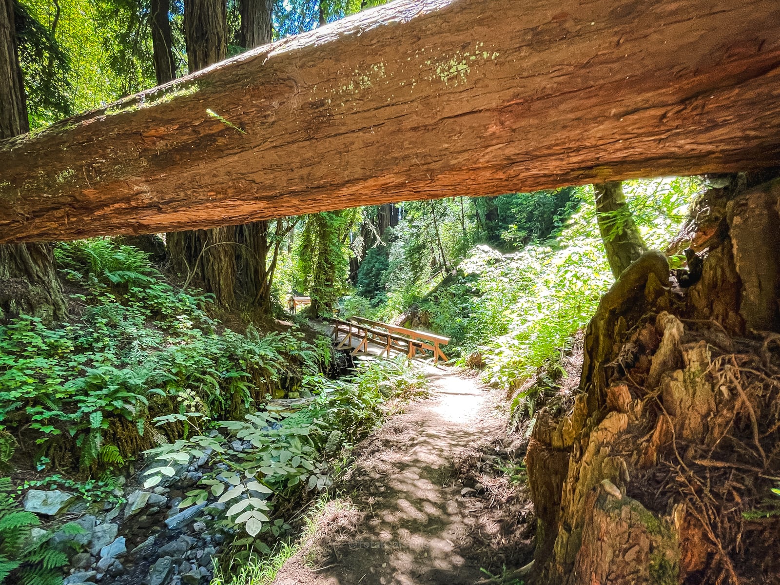
The adventure begins at the Pantoll trailhead. You will descend via the Steep Ravine Trail, a well-worn path that feels plucked from a fairy tale. Shrouded by a canopy of towering redwoods and lush ferns, the trail meanders beside a babbling brook, complete with wooden ladders and bridges that add a charming touch to the already magical landscape.
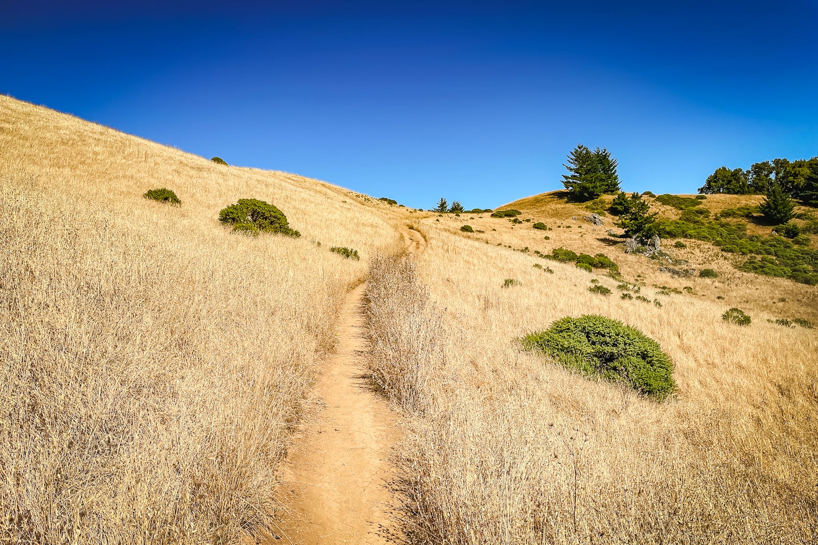
As you leave the embrace of the Steep Ravine, the trail spills onto the historic Dipsea. Here, the world opens up to embrace the sky, the air tinged with the salt of the sea, and sweeping views that gaze out over the Pacific.
The loop concludes with an easy ascent via the Matt Davis Trail, a path that zigzags back towards the Pantoll Trailhead. Climbing the contours of Mount Tam, the trail is a vibrant mosaic where sun-filtered clearings reveal the expansive beauty of the coastline. With every upward step, the Matt Davis Trail offers a different perspective, showcasing the stunning contrast between the dense greenery below and the open skies above.
Completing the Steep Ravine/Dipsea/Matt Davis loop is a trip through a microcosm of the area’s natural splendor. It’s a hike that presents both a physical challenge and a sensory feast, leaving you with a profound appreciation for the wild beauty that lies just footsteps from San Francisco’s hum.
Let’s uncover the secrets of this beloved trail…
BTW, you might also enjoy…
- UPDATED › Best Bug Spray & Bug Repellent for Hikers
- CATSKILLS › Peakbagging The Catskills High Peaks (Ultimate Guide)
- STAY › Find Your Perfect Catskills Stay
- ADIRONDACKS › Wright, Algonquin & Iroquois Peaks
- LEARN › Teach Yourself How to Use a Compass
- ENTERTAINMENT › Best & Worst Hiking Movies
- Follow › My Instagram @TotalCatskills
- Follow › My Substack @TotalCatskills
- Follow › My writing for Times Union
Steep Ravine/Dipsea/Matt Davis Hike
The Steep Ravine/Dipsea/Matt Davis hiking trail includes…
- Giant redwoods and glorious redwood portals
- Wooden bridges and ladders
- A mix of forested and exposed hiking
- A short road walk
- Lots of switchbacks to help your legs
- An incredible mix of wild California coastal environments
A full breakdown is provided in the hike notes below, with 35 captivating photos.
Steep Ravine/Dipsea/Matt Davis Hike Time
Allow 3-4 hours for this hike.
Steep Ravine/Dipsea/Matt Davis Elevation gain
The elevation gain for this hike is 1550 feet (apx 475 meters).
Steep Ravine/Dipsea/Matt Davis Trail Notes & Gallery
This loop is most often started and finished at Stinson Beach. However, on this day, I chose to begin and end my hike at the top, at the Pantoll Trailhead in Mount Tamalpais State Park— which made it easy to get to Mount Tamalpais directly after. Big day for me!
 You’ve got the basic details, but there’s so much more…
Unlock this site now to get complete intel on every route, including my full photo galleries, personal insights and tips. Elevate your next hike with deep trail beta. Experience hundreds of amazing routes at their absolute finest. With Mountain-Hiking.com, you’re not just skimming the surface.
Sean

Similar Hikes
What a special hike. I would re-do this route again in a heartbeat. I hope you check it out and I hope you love it as much as I did. This hike has so many parts! If you want more redwoods, visit Muir Woods or the less touristy Reinhardt State Park. If you love arid chaparral terrain, Mount Diabolo might be for you, if you’re up to it! If you want coastal vibes, check out Año Nuevo or Tomales Point.
Read More
Get full access…
Get instant access to the full version of this site and enjoy great supporter benefits: full galleries, full trail notes, early access to the latest content, and more.
Hot on the website right now…
Follow for more…
Follow my @TotalCatskills content on Instagram for regular hiking inspo and safe, inclusive community.

Steep Ravine, Dipsea Trail & Matt Davis Loop Trailhead
Very large trailhead, with Wifi!
Google Maps Location: 37.903388, -122.604126
The map below shows the exact topographic location of the trailhead
Cell Service
I had signal for the majority of this hike though, in the deep recesses of the Steep Ravine trail, service was little sketchy. My network is Verizon. YMMV.
The parent mountain for this hike is Mount Tamalpais.