Disclosure: This content may contain affiliate links. Read my disclosure policy.
A long but very easy out-and-back.
Hiking Trail Description
The Colgate Lake trail starts at Colgate Lake but actually runs up around Lake Capra. It’s such a lovely stretch of trail.
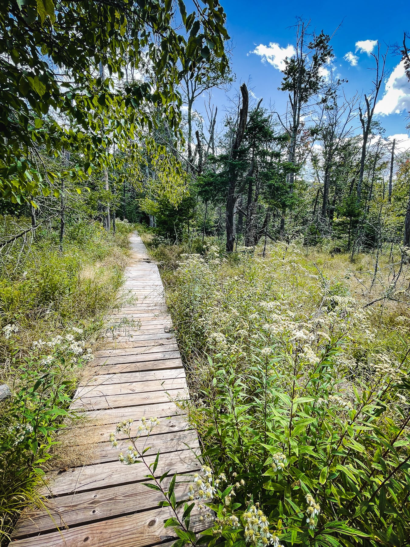
Very easy hiking through constantly an ever-changing array of meadows, woods and marshes, with lots of stream crossings, footbridges, and even a boardwalk. The Stoppel Point Plane Crash sits just below the summit.
Many people hike to Stoppel Point from the Stork’s Nest Road on the east side of the escarpment, or from North Mountain — and while the Colgate Route route is longer, it’s also much easier.
The first 2½ miles of this hike could be done as an easy nature trail walk. It’s so varied and interesting and charming.
Colgate Lake Trailhead & Parking
The trailhead for this hike is a small field on the north side of Colgate Road. After the first parking area, Colgate Road becomes an unpaved dirt road. Keep an eye out for the brown DEC trailhead sign on the left.
After parking, walk around the right side of the iron gate and head into the meadow. There are no blazes here, or only one or two, so the beginning of this hike is a bit of a bushwhack. But the herd path through the meadow is very clear and easy to follow.
BTW, you might also enjoy…
- NEW › New York Hike Finder Tool
- CATSKILLS › Escarpment Trail Guide
- STAY › Find Your Perfect Catskills Stay
- ADIRONDACKS › Dix Range from Elk Lake
- ENTERTAINMENT › 15 Best & Worst Hiking Movies
- Follow › My Instagram @TotalCatskills
- Follow › My Substack @TotalCatskills
- Follow › My writing for Times Union
Colgate Lake Hiking Trail
Follow the herd path uphill to the edge of the woods. Near the top, you’ll notice some branches, right and left. These head across the top of the meadow, into the woods, and are used mostly by hunters. Stay on the main herd path. Keep plowing uphill and enter the woods.
A little way into the forest you’ll find the trail register.
The first half of this hike follows the yellow-blazed Colgate Lake trail.
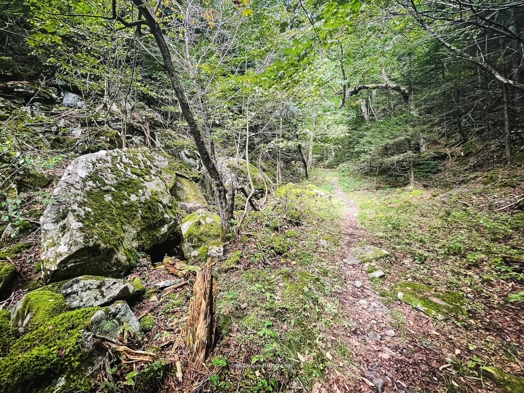
Much of the trail is old woods roads. There are plenty of sudden turns on this hike. Most are well-signed but some are not. Watch for trail signposts and yellow blazes.
Enjoy the many footbridges. I lost count of how many there were.
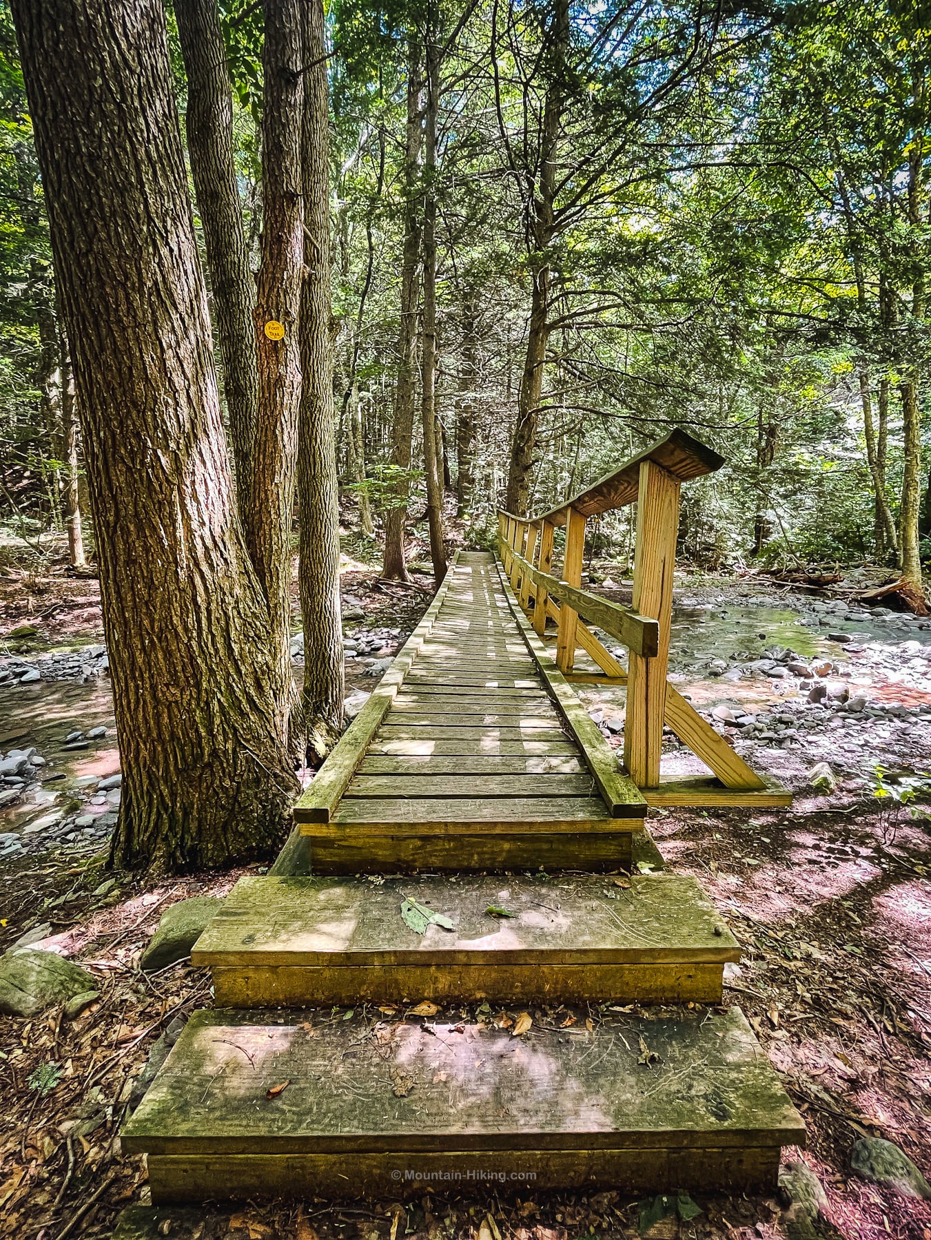
And there’s this very sweet boardwalk.
In a hemlock grove, keep an eye out for a short herd path on the left that opens into a wide open marsh with a good view of Arizona Mountain, Dutcher Notch and Stoppel Point.
There are some muddy sections on this trail. You’ll be grateful for ankle boots and summer gaiters. A muddy boot is a good boot. Always walk directly through mud so as not to widen the trail or trample the plants along its edge.
After you cross the East Kill, and once you get away from the lakes, the trail becomes less interesting for a while as it follows some old woods roads. But then things pick up again near Dutcher Notch.
Dutcher Notch
As you start to approach Dutcher Notch itself, there’s a small gorge on the left. The deeper into the notch you get, the steeper the sides of the col become — until it feels like you’re in a hallway made of moss and rock.
Dutcher Notch Junction
After about 2½ hours, I made it to the junction. (I’m slow and do lots of photography, so your hike times may be a lot shorter.)
Here, you can turn left and head up Arizona Mountain which is lovely, rugged and steep, with a great scenic lookout. And the trail eventually leads up to Blackhead mountain.
On this hike to Stoppel Point, though, turn right and follow the blue blazes east.
The climb is not steep. Along the way, the woods are a mix of deciduous trees (striped maple, sugar maple, beech) with some spruce mixed in.
Pass over a small knob into a long flat col before beginning the short, moderate climb to Milt’s Lookout. I’m guessing this part of the trail is extra beautiful in the fall, as the leaves change.
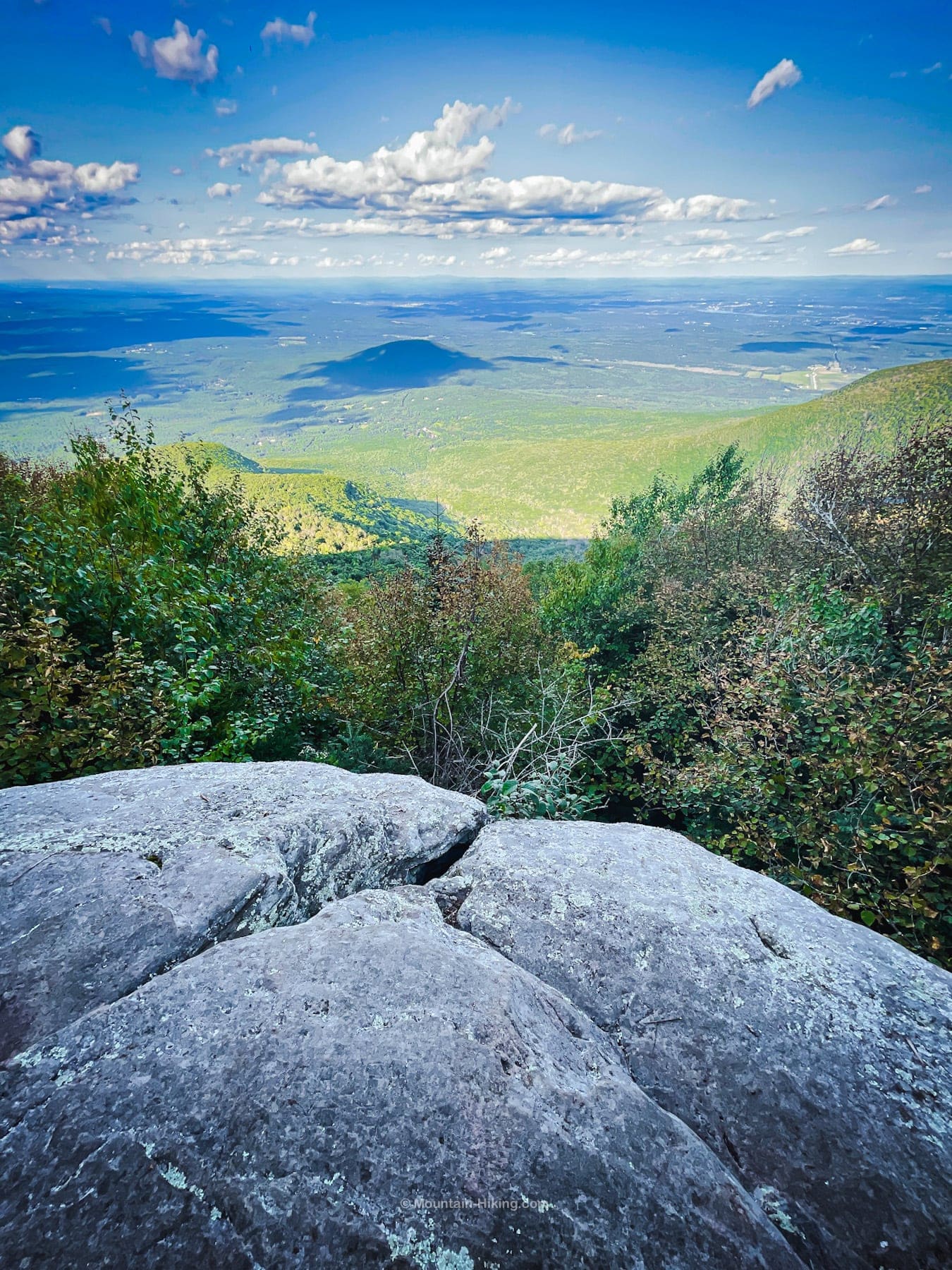
Milt’s Lookout
On the right, a large distinctive boulder marks the entrance to Milt’s Lookout. I’m not usually the biggest fan of Catskills Escarpment views but this one is definitely a banger.

From the open ledge, looking to your right, you can see North Mountain and Stoppel Point’s summit.
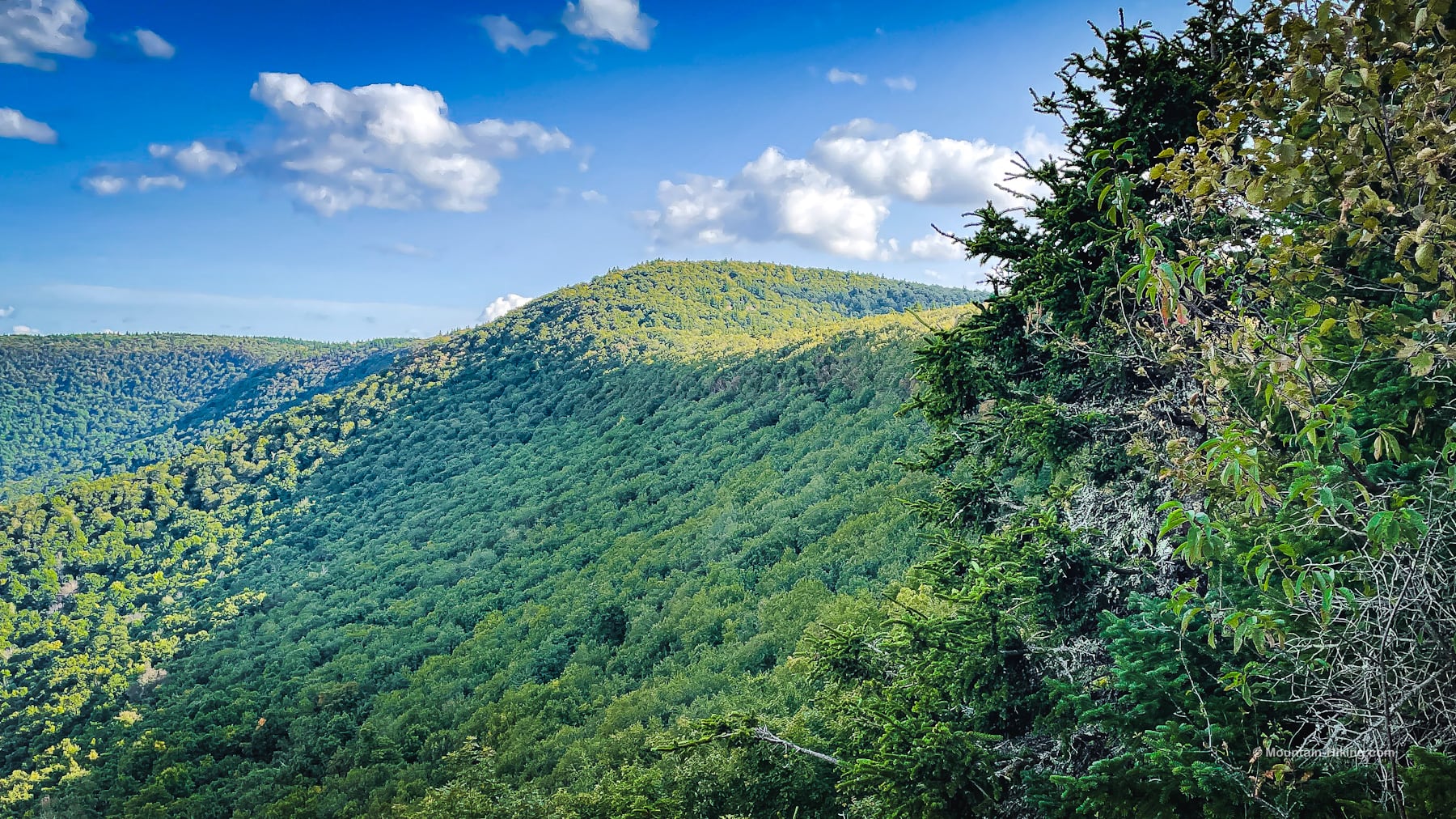
In front, below, lies Cairo and Round Top. In the distance, the Taconic summits of Mount Everett and Mount Greylock. And maybe even the Green Mountains of Vermont, or the southern Adirondacks — or both? (It was hazy on the horizon so I couldn’t be sure.)
There are two fir trees at Milt’s Lookout, one on either side. Weird. I don’t remember seeing any other firs on Stoppel Point, only spruce, and there is a spruce at the back of the lookout. Maybe these firs are ornamental?
Anyway, enjoy the view from here. It’s a great place to rest and snack. By the time you get back from the summit, the light will have changed and it’ll be worth the second visit.
Before you leave, make sure to check the ground around you for any inadvertent trash you might have dropped. This was one of the few scenic spots in the Catskills where I found a high number of dropped trash items. (I packed them out.)
Stoppel Point Plane Crash
The walk from Milt’s Lookout along Stoppel Point’s ridge is easy and flat and lovely. At the end, the climb to Stoppel Point is short. Just below the summit, you’ll pass the Stoppel Point plane crash.
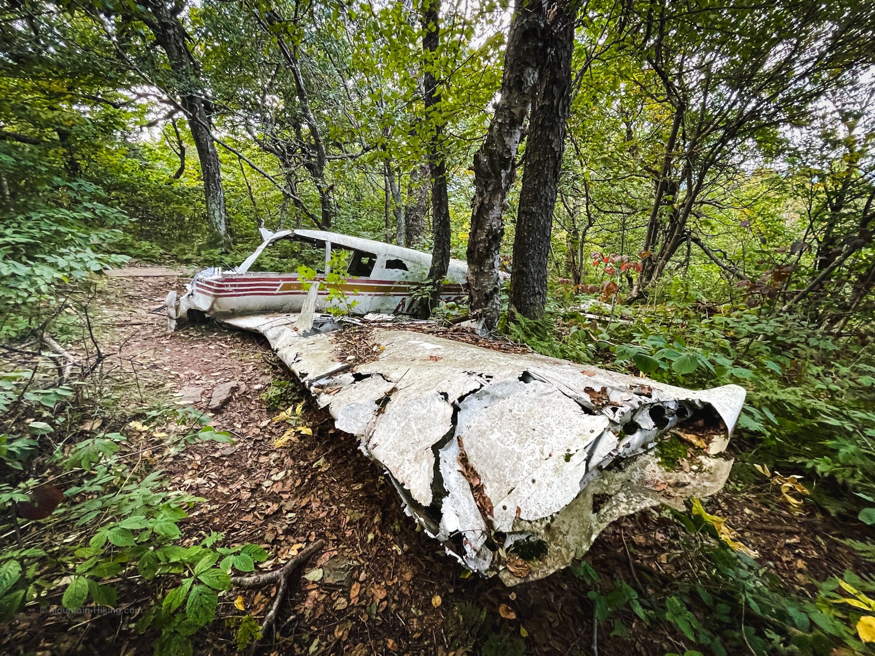
The awful bad luck of this plane wreck (Piper PA-28 / N1316T) literally just feet below the summit.

Apparently, the pilot, John T. Grace, was a headstrong type who flew in foul weather — on a revoked student pilot certificate — against the advice of several other pilots. Just a few feet higher and he would have missed the summit. The crash dates from May 26, 1983. (More details here.)
Stoppel Point Summit
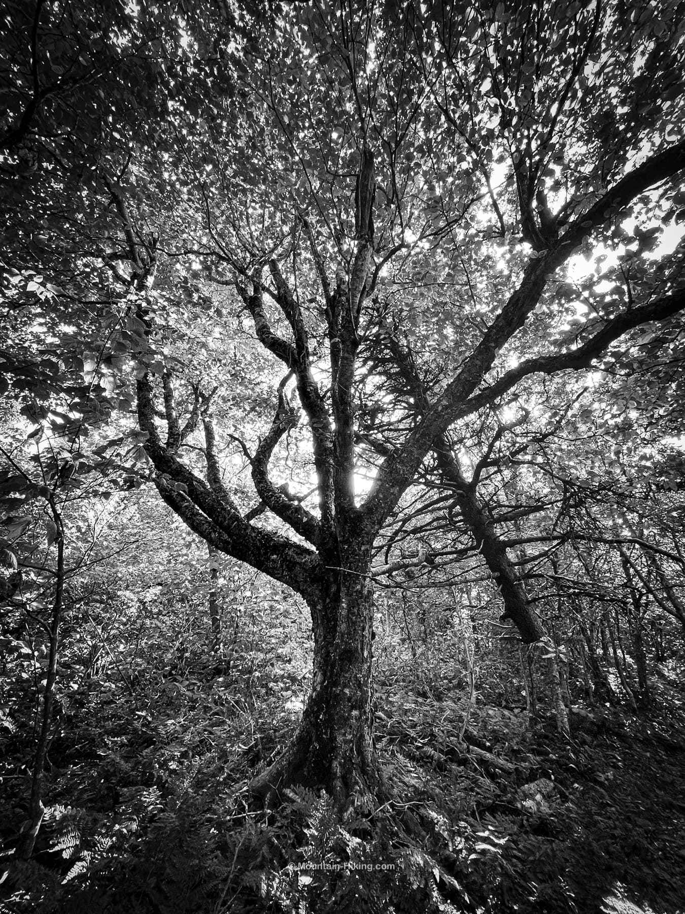
The summit of Stoppel Point has a lot of gnarly birch trees, a favorite of mine to photograph because they’re always so weird and creepy and beautiful. The very summit appears to be an area of old-growth forest.
Just after the summit, there is a modest view on the right side of the trail. You can just about make out the tops of the Blackhead range; pretty nice for Catskills High Peaks nerds.
Continue on a little while downhill from the summit. Pass through some more magical woods. In just a few easy minutes, you’ll come to a junction with a trail sign that says “North Mountain 1.7 Miles”. Right beside the trail sign is a nice lookout — not as awesome as Milt’s Lookout, but still pretty sweet. It makes a great turn-around point.
Or you, if you have the time and energy, you could continue on another 1.7 miles to North Point, with its incredible view.
Similar Hikes
If you enjoy this hike, you’ll also love the hike from Windham High Peak via Burnt Knob.
Read More
Get full access…
Get instant access to the full version of this site and enjoy great supporter benefits: full galleries, full trail notes, early access to the latest content, and more.
Hot on the website right now…
Follow for more…
Follow my @TotalCatskills content on Instagram for regular hiking inspo and safe, inclusive community.
Stoppel Point (Plane Crash) Trailhead
Third lot as you approach from the west.
Google Maps Location: 42.238114, -74.115776
The map below shows the exact topographic location of the trailhead
Cell Service
I had cell service at this trailhead, lost it for a while, but got it back again from several parts of Stoppel Point’s escarpment. Overall, patchy but pretty good for The Catskills. My network is Verizon. YMMV.
The parent mountain for this hike is Stoppel Point.
