Disclosure: This content may contain affiliate links. Read my disclosure policy.
An out-and-back route with a loop in the middle
Trailhead info at bottom of this post.
Hiking Trail Description
This quick route to North Point and North Mountain packs in a whole lot of excellent hiking: beautiful deciduous and pine forests, fun boardwalks, multiple forest waterfalls, many glacial erratics, an easy rock scramble, a delightful cave — and, of course, one of the most famous Catskills views.
As it has been for many people, North Point was one of my first experiences of the Catskills. And what an introduction it was. I hiked to North Point from North/South Lakes before I knew anything about hiking. Re-hiking it again in 2021 was a complete treat, from start to finish.
The trail from Scutt Road makes for a much more secluded and remote-feeling route. And it has the benefit of being free; you don’t have to pay the North/South Lake campground fee to park at this trailhead.
Note: This trail report includes three additional viewing spots beyond North Point’s famous ledge.
Scutt Road Trailhead & Parking
The parking area is just off North Lake Road, right before the entrance to North/South Lake Campground.
Turn right onto Scutt Road, drive 200ft or so, then turn right again into the parking area. The lot is large, and a second lot is attached.
Rock Shelter Hiking Trail to North Point
From the parking lot on Scutt Road, stroll back uphill to North Lake Road, turn left, and walk a short distance to the trailhead signpost.
Carefully cross the road and enter the woods. Look for and follow the yellow blazes.
The boardwalks begin immediately.
In a short distance, you’ll come to the trail register, which you should sign.
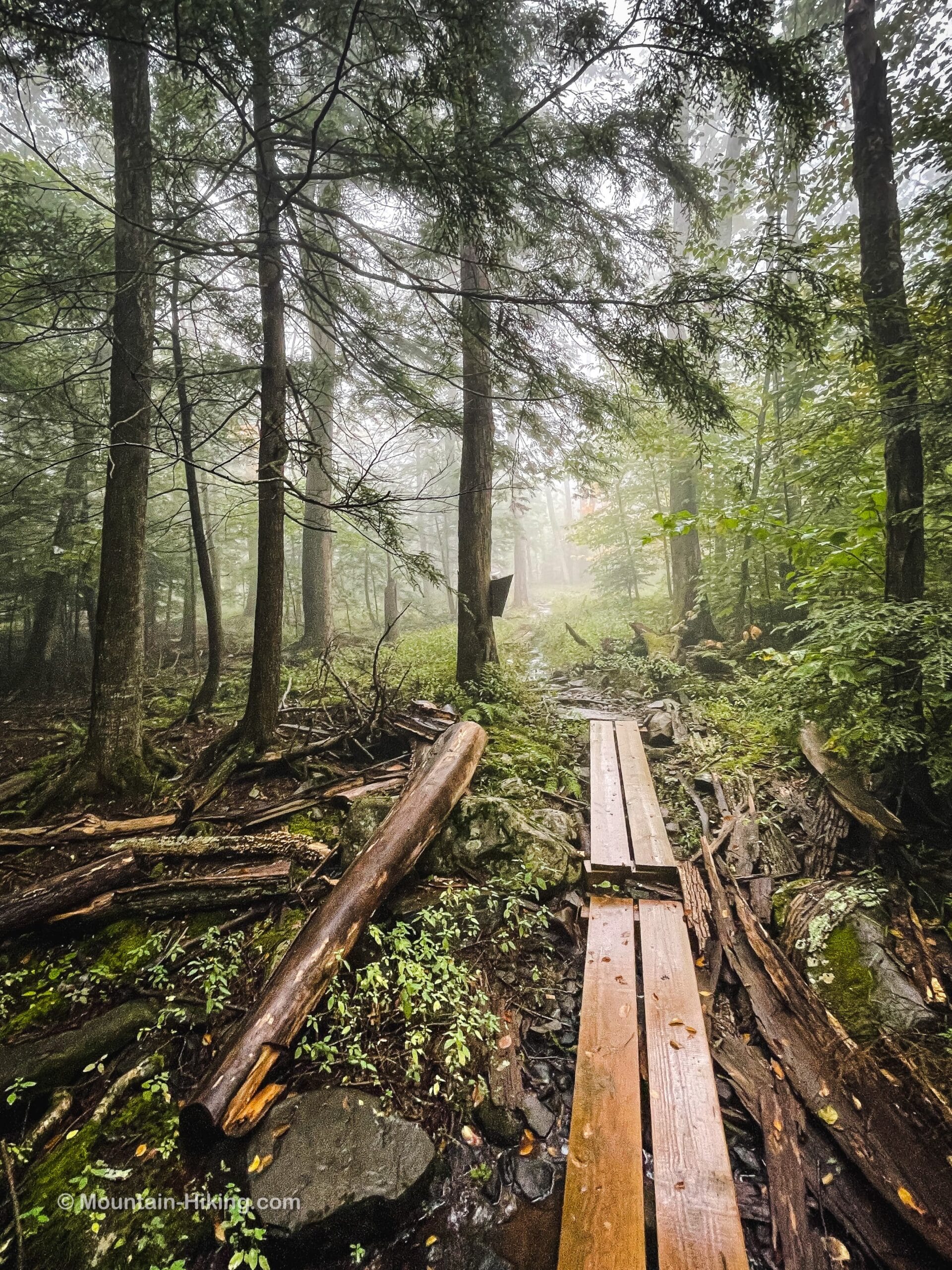
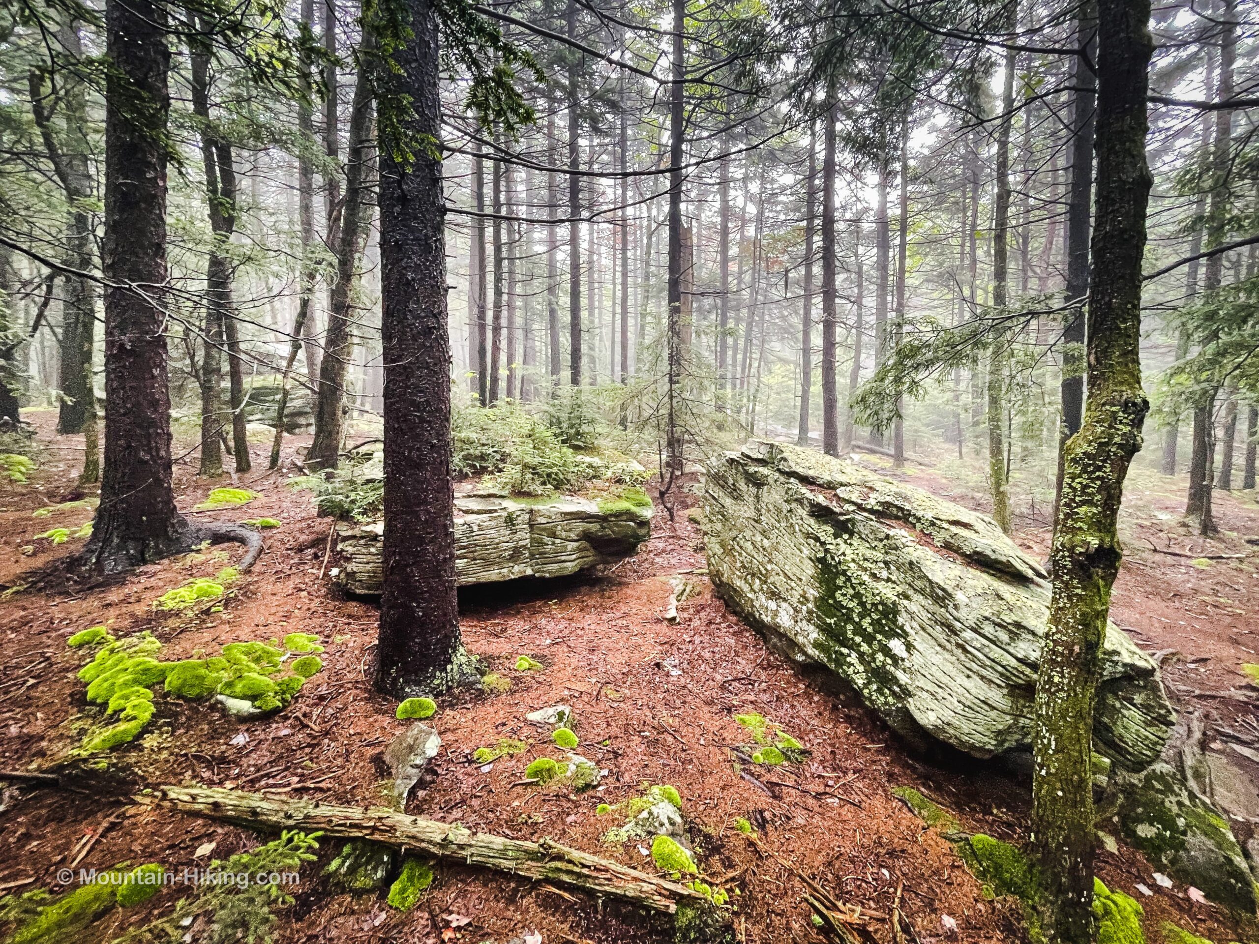
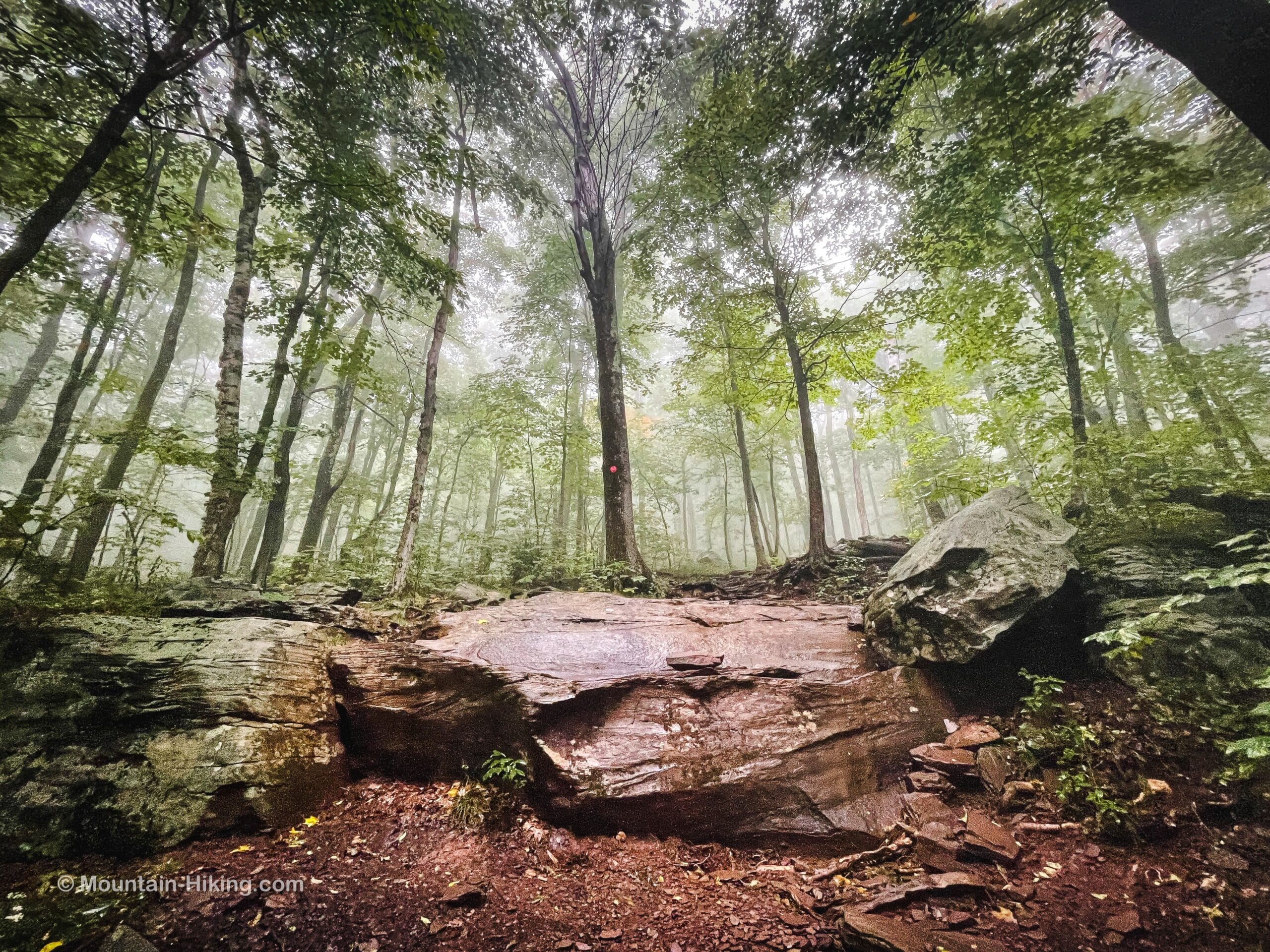
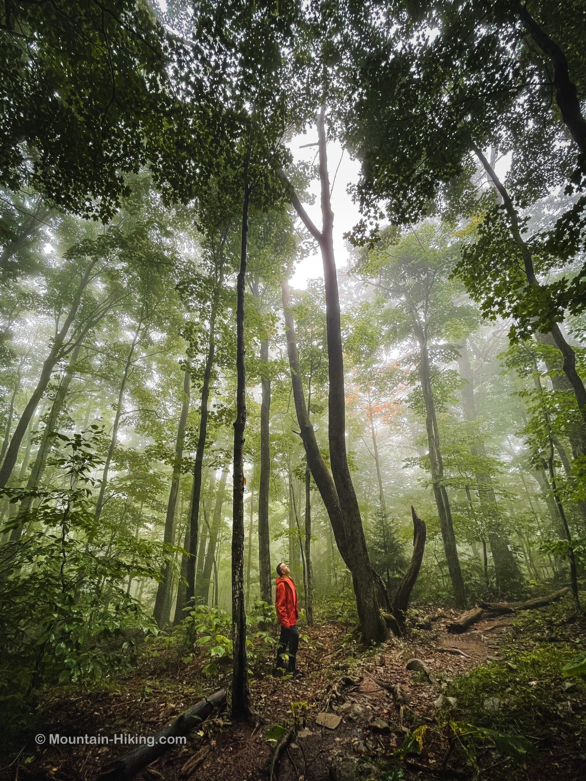
A foggy forest is hard to beat. I didn’t mind the wet weather at all, having solid rain gear in my backpack — part of the ten essentials hikers pack on every hike.
The woods the whole way along this trail are beautiful, a mix of deciduous and evergreen, open areas and enclosed, so the trail never feels boring.
After 1.2 miles you’ll come to the first junction of many on this hike. You will return to this first junction later. For now, just make a mental note of your surroundings.
To continue along the Rock Shelter trail, turn slightly right and head downhill past this ledge and its waterfall…
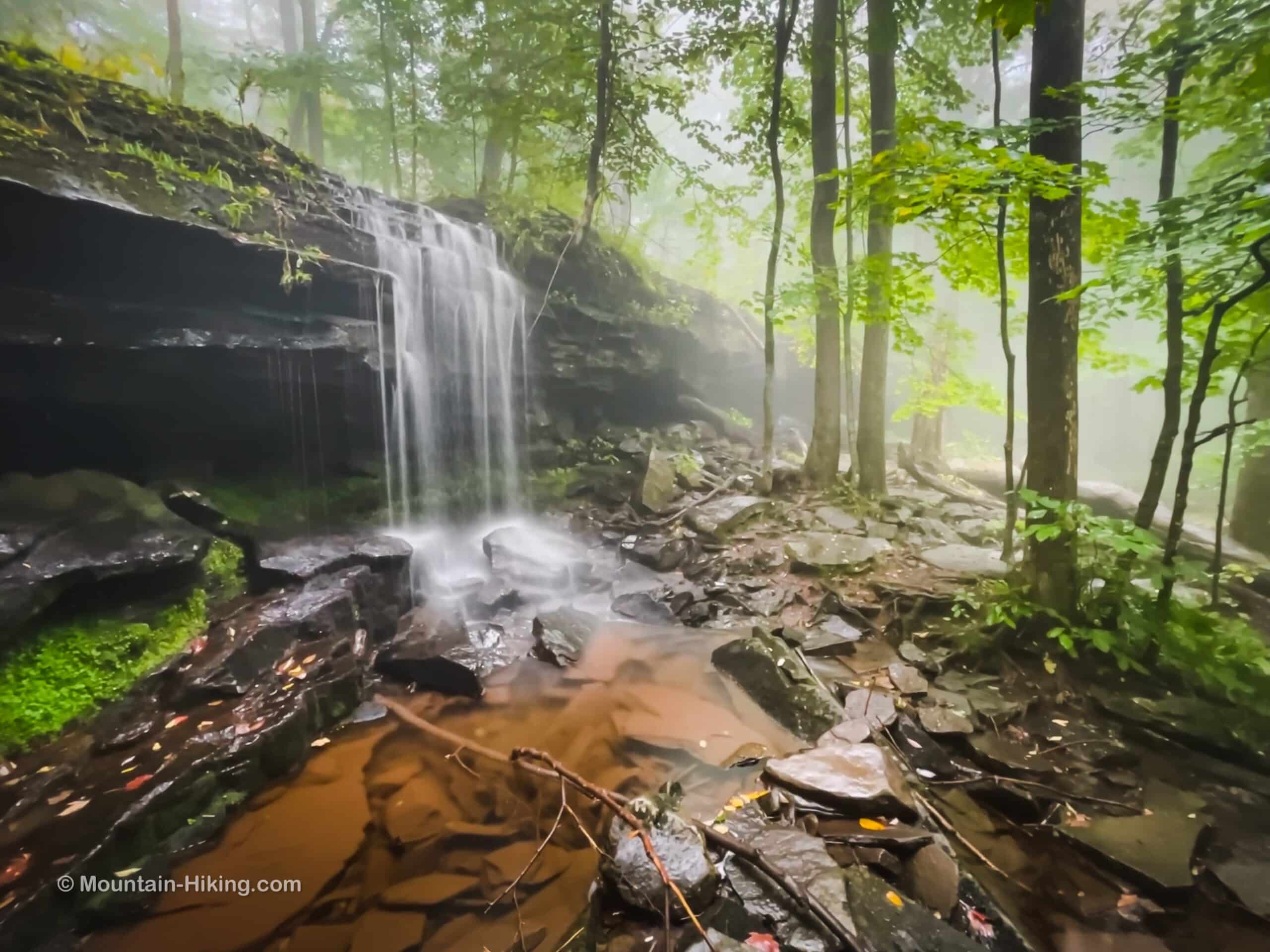
Keep an eye again for the yellow blazes. It’s only a very short distance to the second junction.
At the second junction, you can turn right to head down to Ashley Falls. For this hike, however, turn left and head northeast.
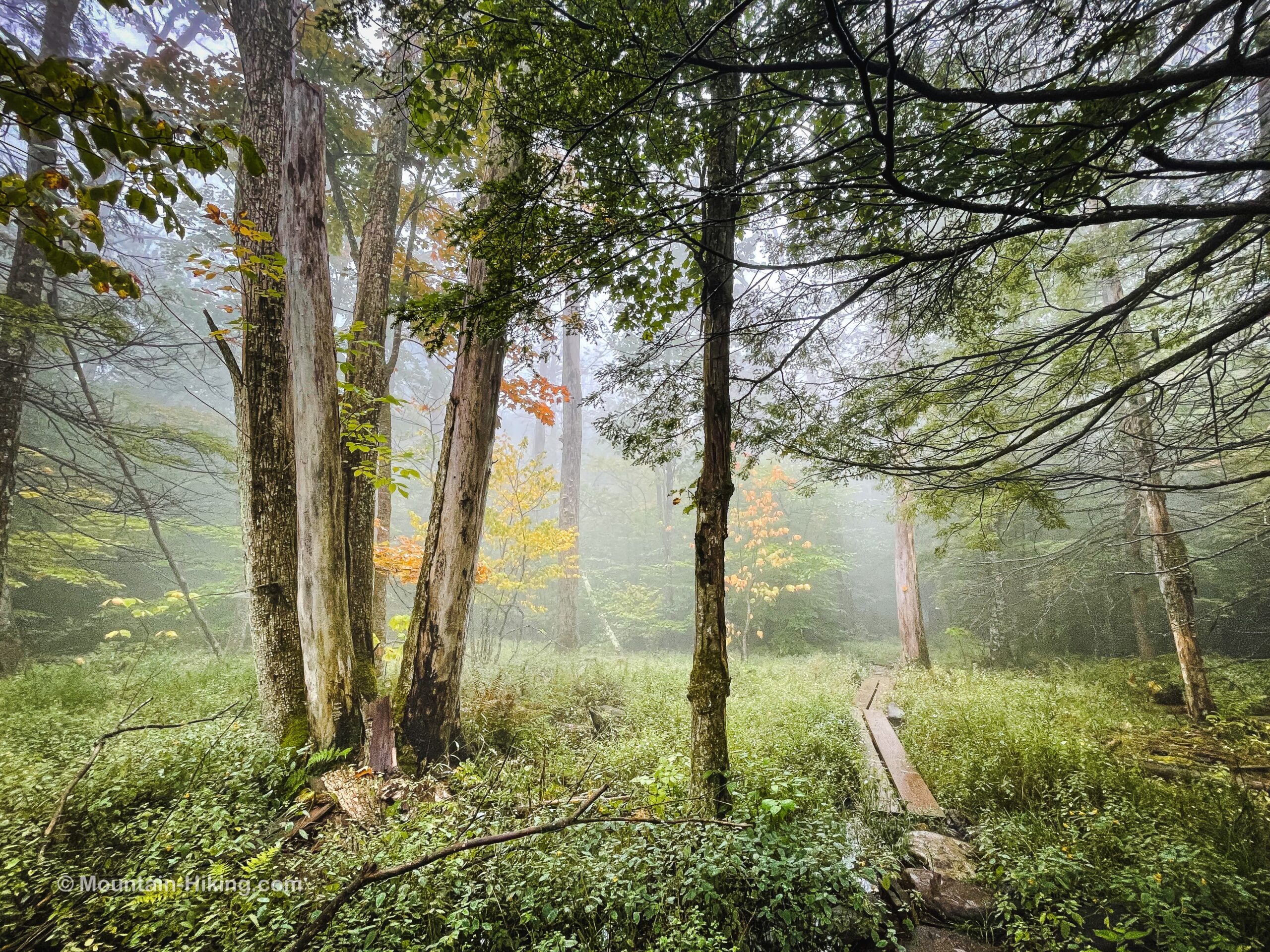
Pass through a wonderful hemlock and spruce stand that’s dotted with dramatic erratic boulders, deposited here by melting glaciers 12,000 years ago, at the end of the Last Glacial Period.
Escarpment Trail to North Point
After less than half-a-mile, keep an eye out for some signposts at another junction. North Point is 0.85 mile from this third junction.
Switch to the blue-blazed Escarpment Trail and head uphill.
Immediately, you will spot Badman’s Cave.
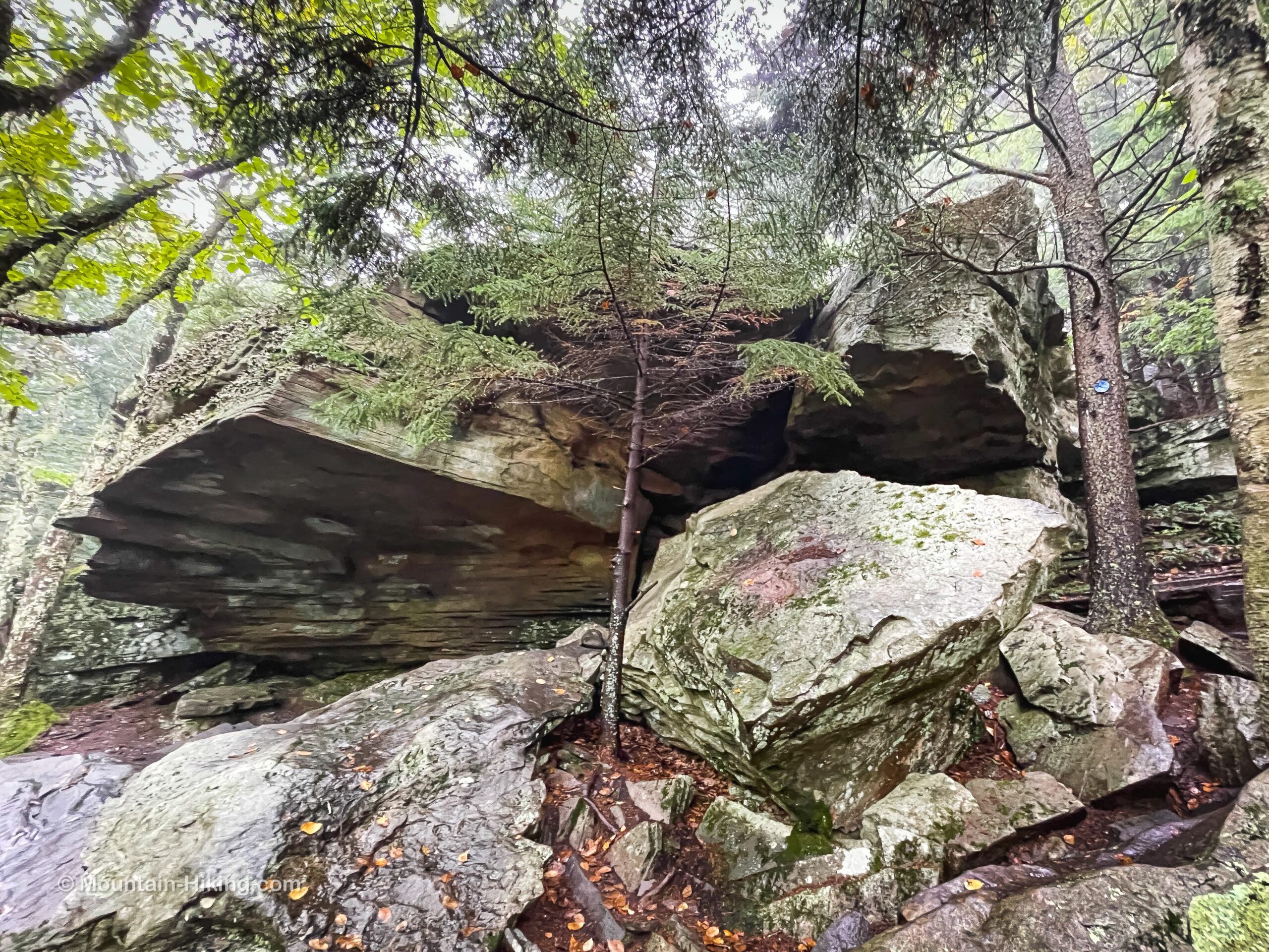
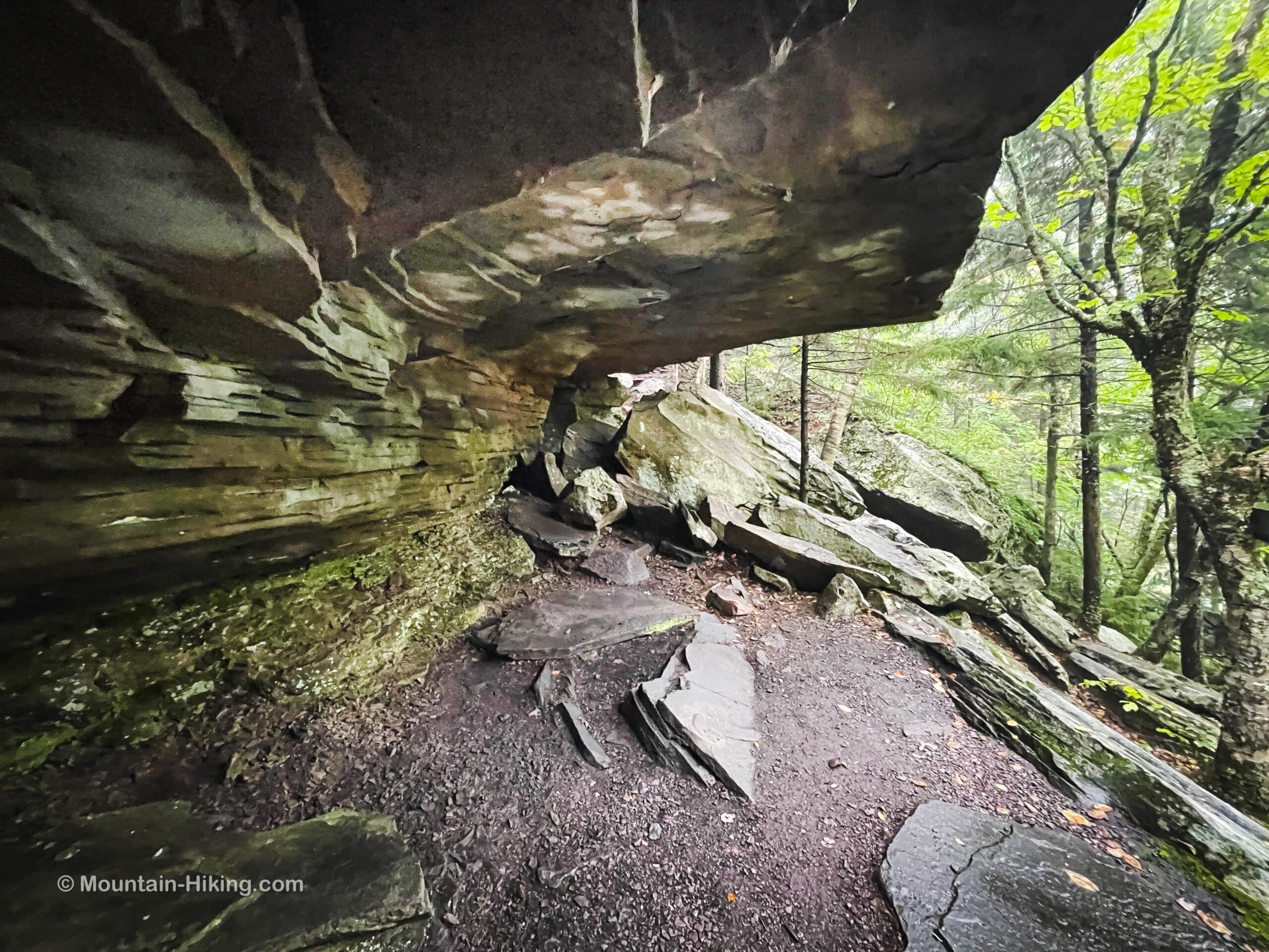
Climb past the cave, through the rock channel on its right side.
You’ll pass through an almost bald area, keeping watch for an entrance on the right, marked by a glacial erratic, that leads back into the woods.
Climb to North Point
The trail winds around the base of a ridge until it comes to one more junction, this one between the Escarpment Trail and Mary’s Glen Trail. Make a mental note of this junction, too. You’ll return here on your way back down.
Begin your final climb to North Point, uphill but only 0.3 miles away. It doesn’t take long.
Shortly after a small rock channel — which new hikers may find a little tricky — you’ll pass a small lookout on the right side of the trail.
On this day, with the whole mountain shrouded in fog, I was not able to enjoy the view. But it looks like the line of sight is toward North/South Lakes below; so, probably a nice appetizer…?
North Point Ledge
After climbing over some rough, semi-steep trail, you’ll pass along the bottom of North Point’s massive open rock ledge. Find your way up.
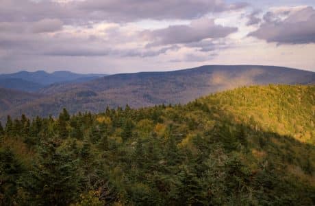
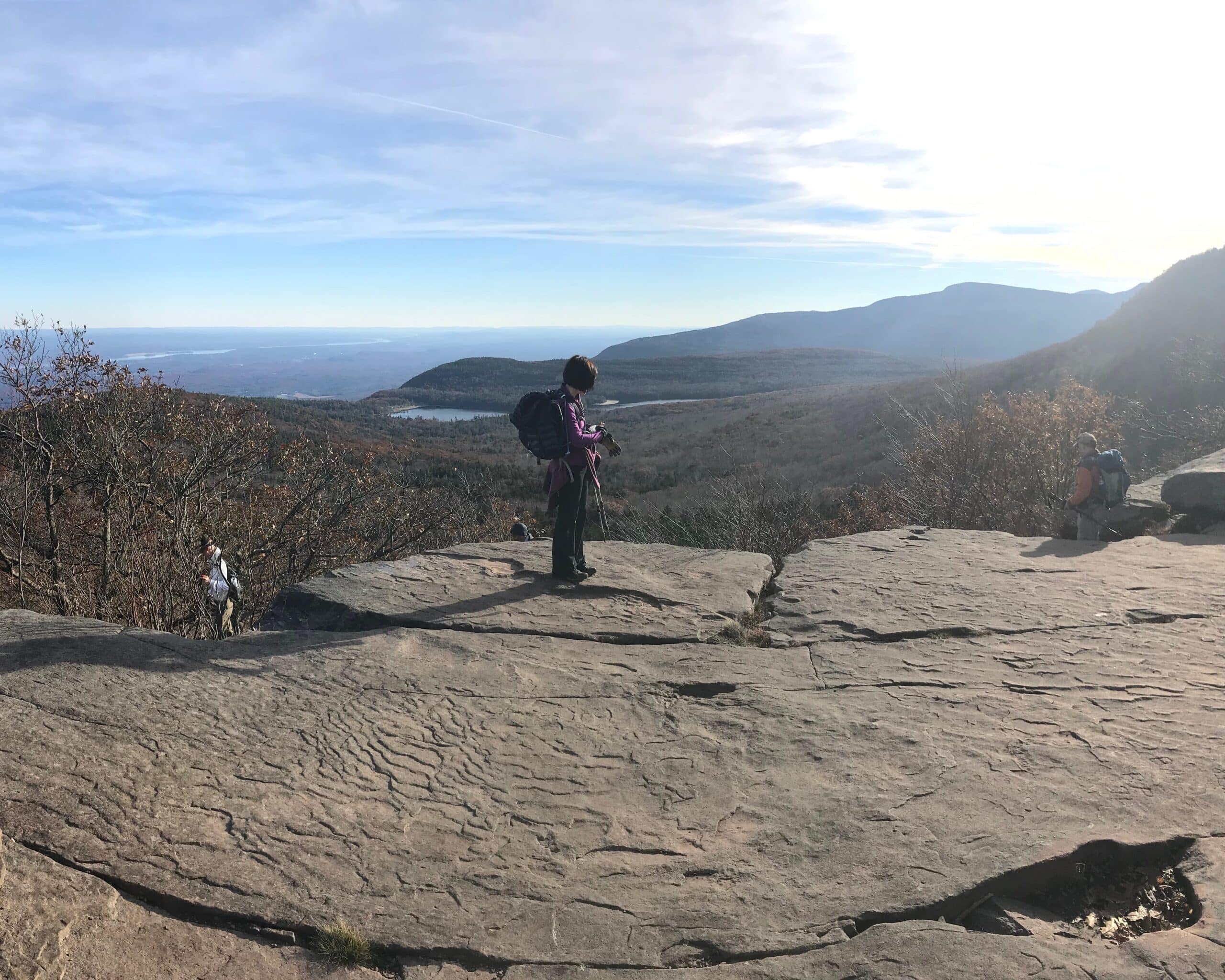
There are multiple viewing spots on North Mountain. The first ledge is the main ledge, and it’s one of the most famous viewing spots in the Catskills. During the summer, it’s almost always packed with hikers.
On this day, though, I arrived in whiteout conditions. I have some old photos from my earlier hike to give you an idea of what the scene offers.
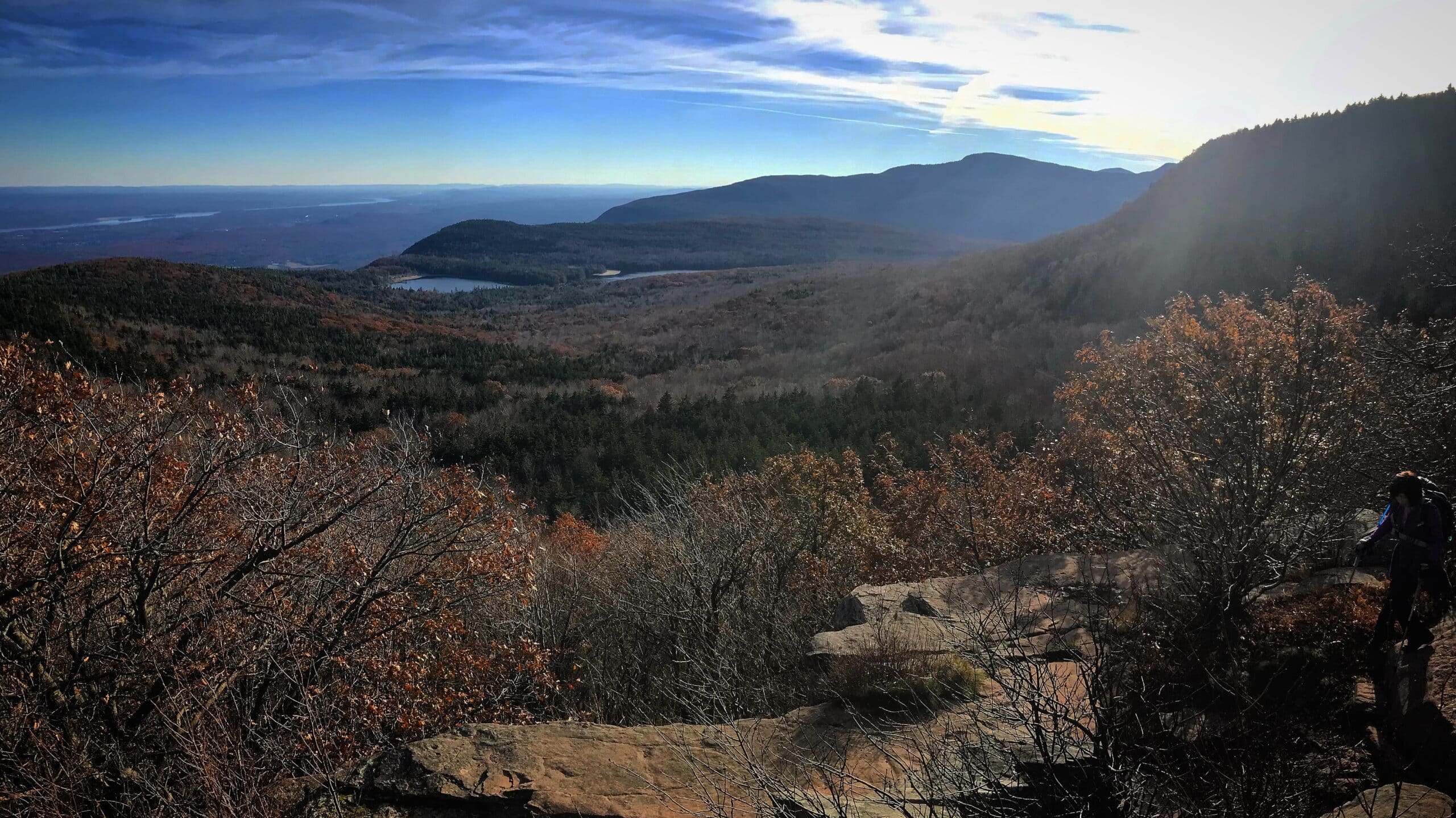
The view looks down on North/South Lakes and beyond to Kaaterskill High Peak and Round Top. In the valley below, the Hudson River is visible
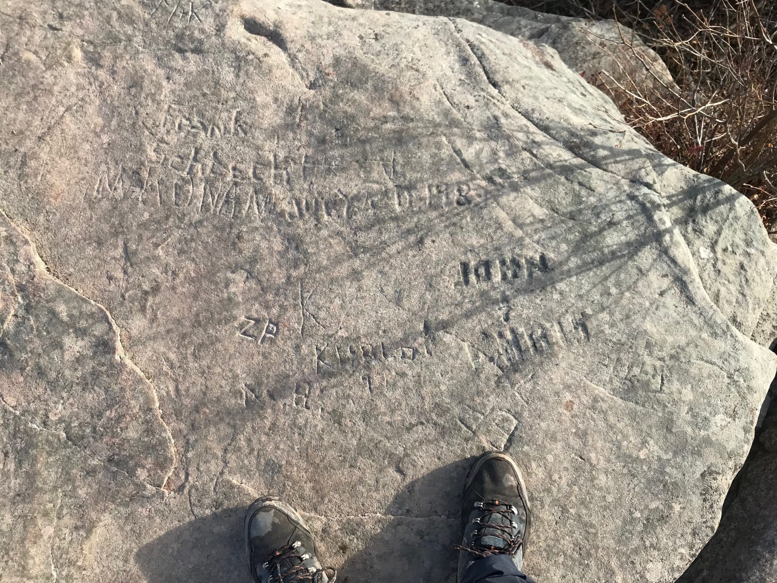
Note the rock graffiti on the ledge surface, some of it quite old. Please do not add to it, though — these days, we know better.
North Point: 3 More Viewing Spots
Besides the main view from North Point, which I remembered from before, I was excited to check out three more (new-to-me) viewing spots.
On this day, the weather was forecast to clear up before I got to the summit, but I did not have good luck — a lesson in how mountain weather can be. Mountain weather is notoriously changeable, even on lower peaks like North Point. This is why experienced hikers carry so much hiking gear.
I did at least visit all three spots to mark them for future hikes…
- Looking north, away from the lakes, you’ll see a herd path on the right. Follow it just a few hundred feet to an open area. The line of sight is toward the town of Cairo and, nearby, the low mound of Cairo Round Top;
Return to the main ledge, then climb past the signpost that says NORTH POINT, following the blue blazes of the Escarpment Trail toward Stoppel Point…
- Hike 500-600 feet west and you’ll come to an open ledge looking south;
- Hike another 500 feet or so west and you’ll come the final ledge, which is next to the junction of an unofficial trail which heads north / downhill — ignore that trail and enjoy the view from the last ledge.
The view from the last ledge is said to be even better than the more famous view from the first/largest rock ledge. I can’t wait to go back on a clear day to check it out.
Hike to North Mountain’s Summit
All the trails up here are deciduous and ferny, and lovely to hike. The climb to the highest point on the trail, which I took for the summit, takes only 10 more minutes.
I did not bushwhack to the summit proper on this hike because the undergrowth looked undisturbed and I did not want to be the first to disturb it.
Maybe in winter, when everything has died back, I’ll poke around up there.
Descent via Mary’s Glen Trail
Make your way back to the main ledge. Climb down and head back to the junction with Mary’s Glen trail. Begin following the red blazes west for a short distance before the trail turns south and heads downhill.
In the fog, this section was exceptionally beautiful…
Final Junction / Walk Out
After 20-25 minutes, you will arrive back at the day’s first junction (just above the ledge and waterfall).
Turn right and head southwest back along the Rock Shelter Trail, following the yellow blazes out to North Lake Road, 1.2 miles away.
Similar Hikes
This hike is on the tougher side of an easy hike or the easy side of a moderate hike.
It’s also one of the most beautiful and scenic hikes.
Get full access…
Get instant access to the full version of this site and enjoy great supporter benefits: full galleries, full trail notes, early access to the latest content, and more.
Hot on the website right now…
Follow for more…
Follow my @TotalCatskills content on Instagram for regular hiking inspo and safe, inclusive community.

North Point & North Mountain from Scutt Road Trailhead
Large popular lot.
Google Maps Location: 42.200724, -74.058216
The map below shows the exact topographic location of the trailhead
Cell Service
Okay service up high. My network is Verizon. YMMV.
The parent mountain for this hike is North Mountain.