Disclosure: This content may contain affiliate links. Read my disclosure policy.
Straight out-and-back. Steep and then very steep.
Hiking Trail Description
On Halcott Mountain in the Catskills, the main herd path is so now well-established it has become the de-facto route to the summit.
Big changes on this mountain over the last few years, since the pandemic pushed everyone to explore the great outdoors. We are transitioning out of the era when The Catskills were relatively un-known and un-hiked. Our high peaks are now very well-trod. You’ll see Halcott’s herd path marked clearly on GaiaGPS—and even the main route between Rocky and Lone is now fixed in position and solidified online.
Halcott’s herd path is relatively easy to follow, though there are some forks and options along the way. Good navigation skills are a must before heading out on this (or any other!) mountain route.
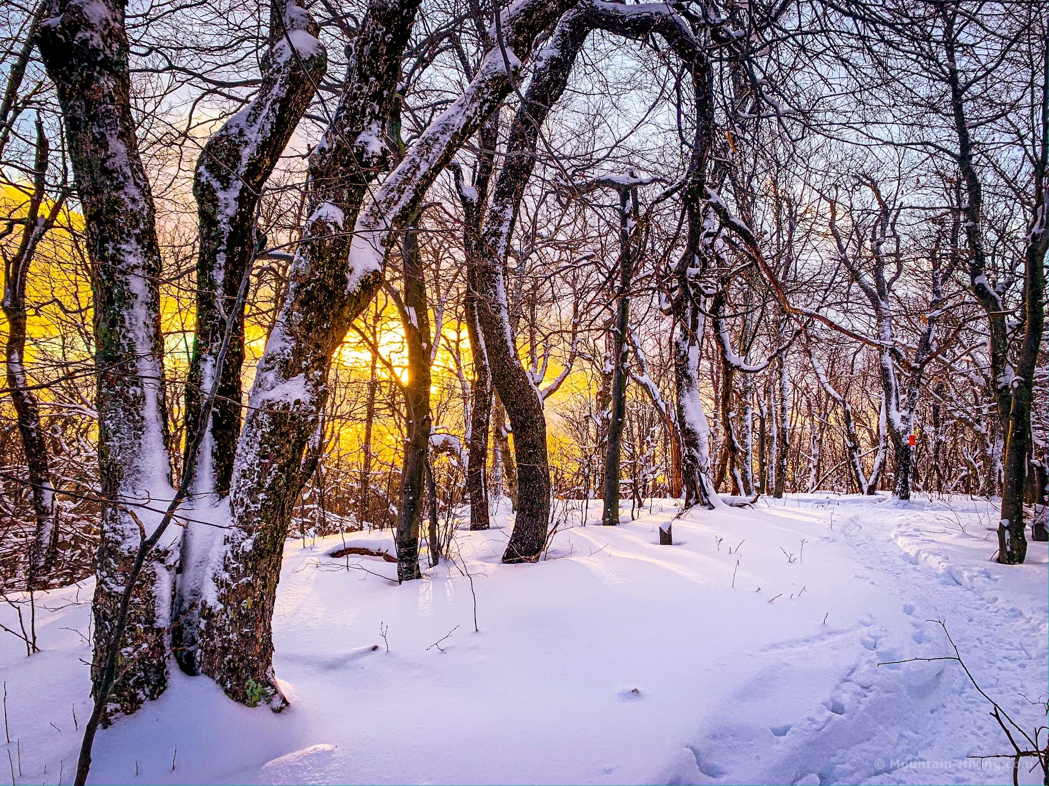
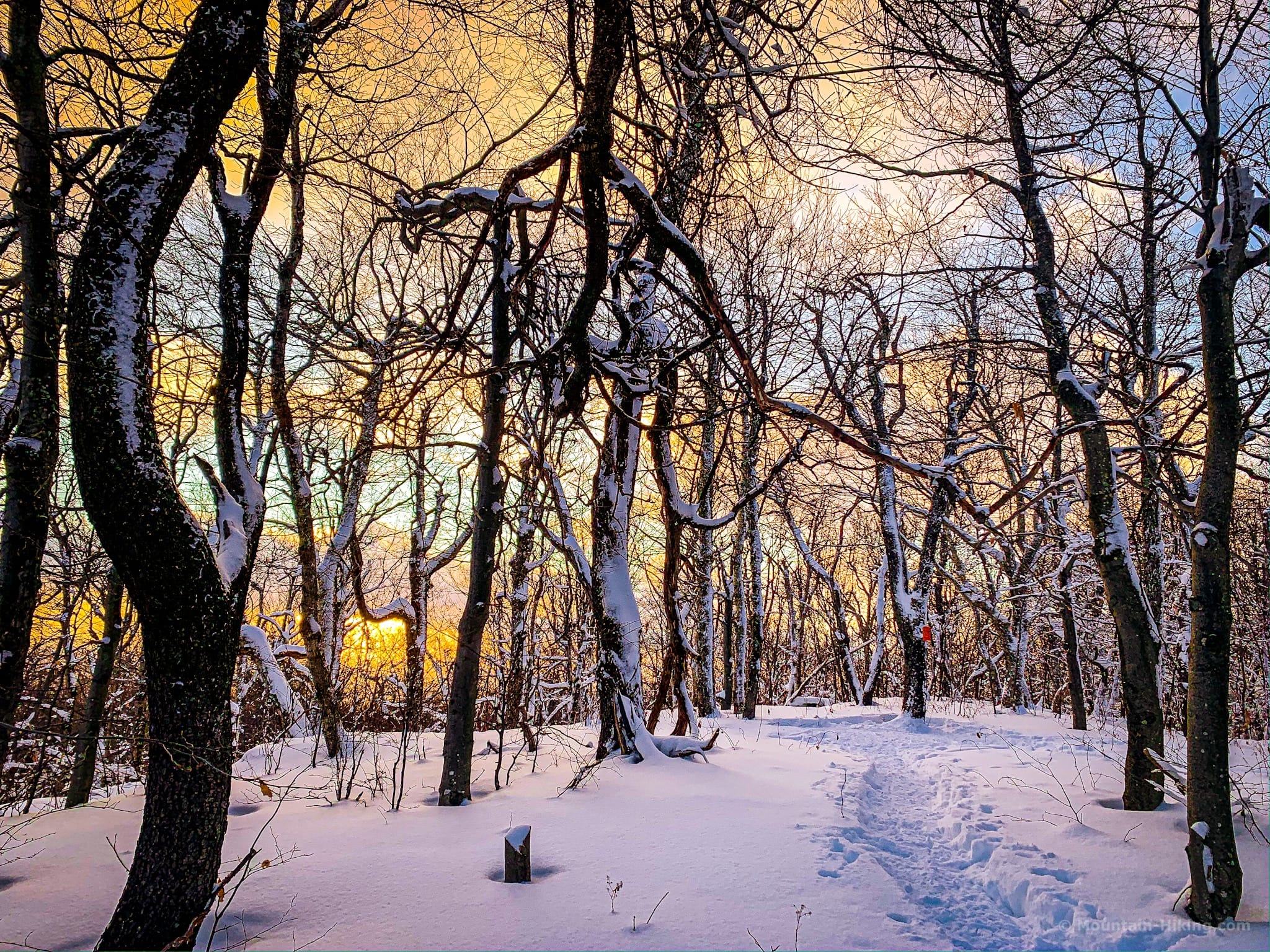
I didn’t think too much of Halcott when I first hiked it in the spring of 2019. Subsequent hikes in other seasons changed my mind. There’s a lot to see: the woods are spectacular, particularly the hemlock grove down low, and the ravines are precipitous and beautiful. While lush in summer, a deep winter snow brings out the best of this mountain IMO. In winter, at sunset, the summit is a Catskill photographer’s dream.
Halcott is one of two ‘beginner bushwhack’ peaks in The Catskills; the other one being Rusk. Both mountains make for steep but short hikes — great for practicing your basic backcountry navigation skills without a lot of the risks that come with more technical or more remote terrain.
BTW, you might also enjoy…
- ADK › Whiteface Mountain via Marble Mountain
- DANGER › 6 Feet Under? How Our Adirondack Hike Turned Deadly Serious (Substack)
- ADK › Hurricane Mountain Fire Tower
- CATSKILLS › Catskills Fire Tower Challenge 2025
- Follow › My Instagram @TotalCatskills
- Follow › My writing for Times Union
Hike Halcott Mountain’s Herd Path
There’s nothing tricky to contend with on Halcott: no ledges, cliffs, or scrambles — though a short undercliff diversion just south of the waterfall can provide adventure if you fancy.
The Halcott herd path includes…
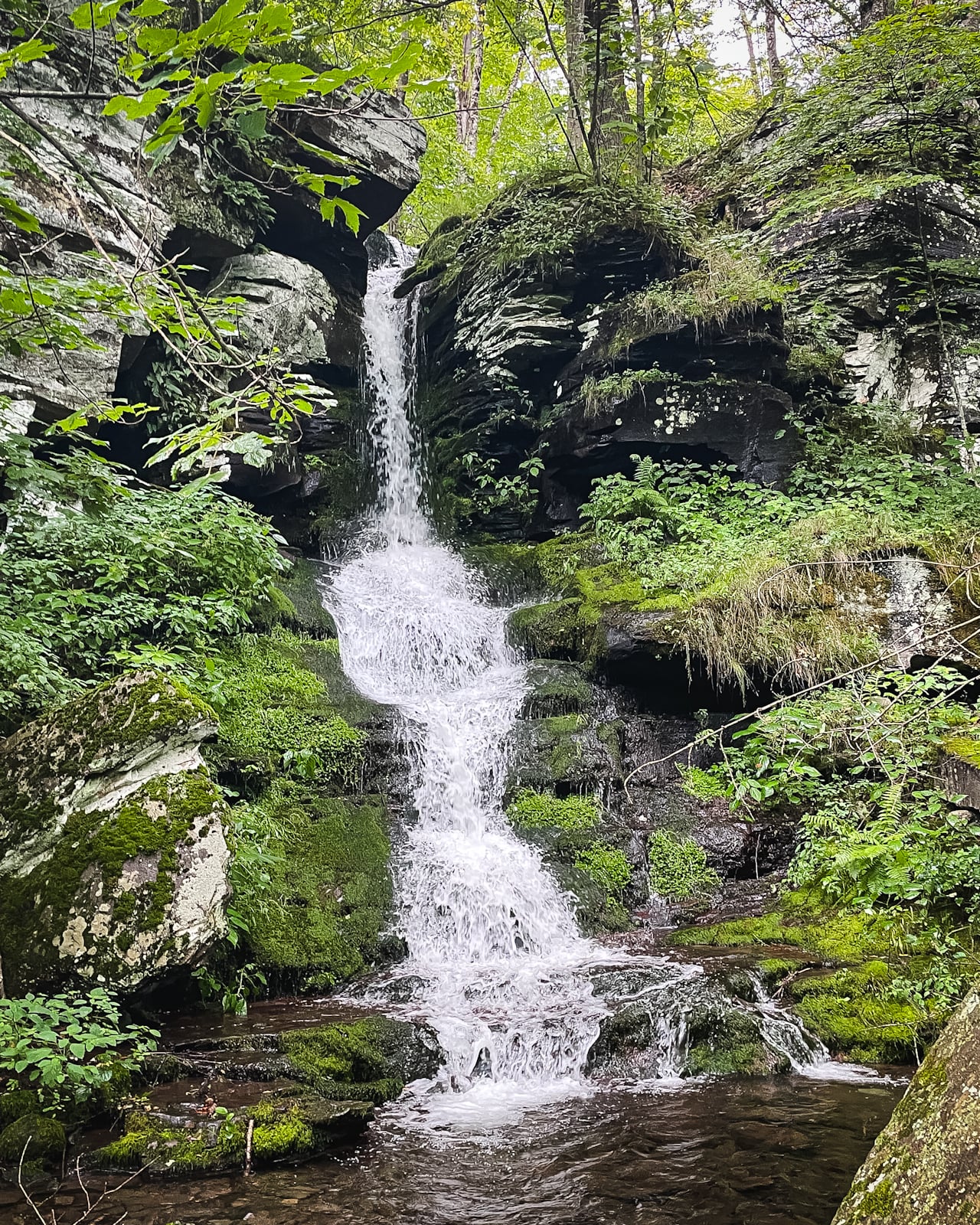
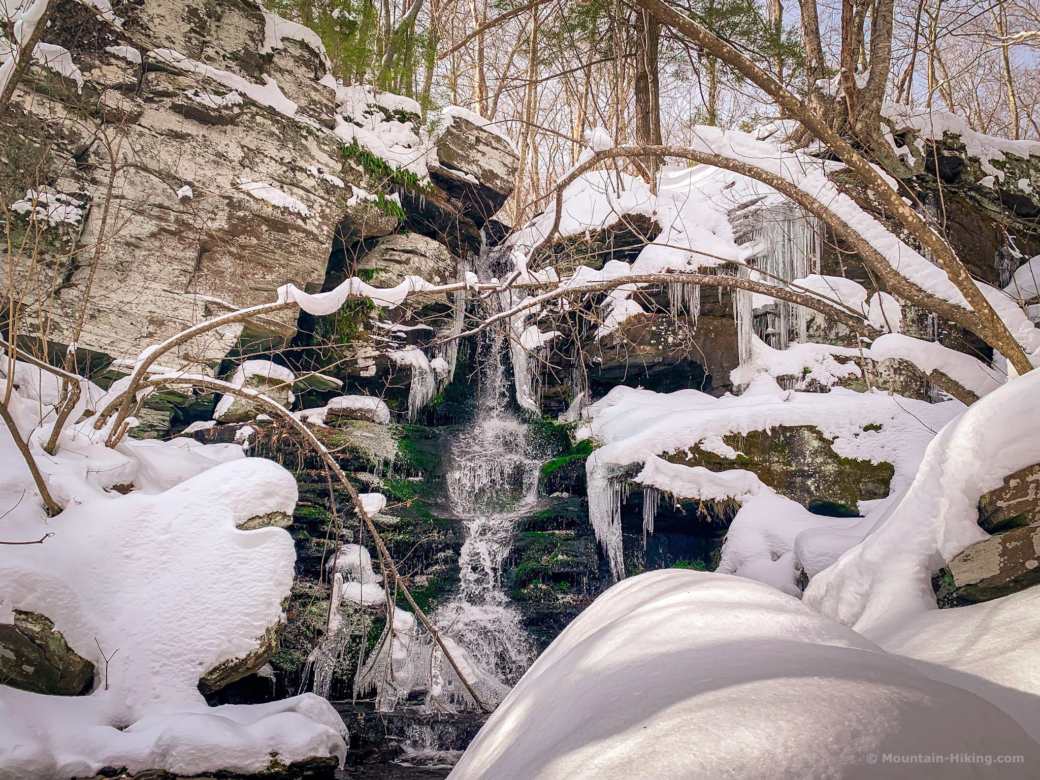
- A beautiful waterfall
- Hemlock grove
- Historical stone fences and cairns
- Steep inclines
- Plus some very steep inclines
A full breakdown is provided in the hike notes below, with 15 photos.
Halcott Hike Time
Allow 3-3½ hours for this hike.
Halcott Mountain Elevation Gain
The elevation gain for this hike is 1,650 feet (apx 500 meters).
Halcott Mountain Hike Notes & Gallery
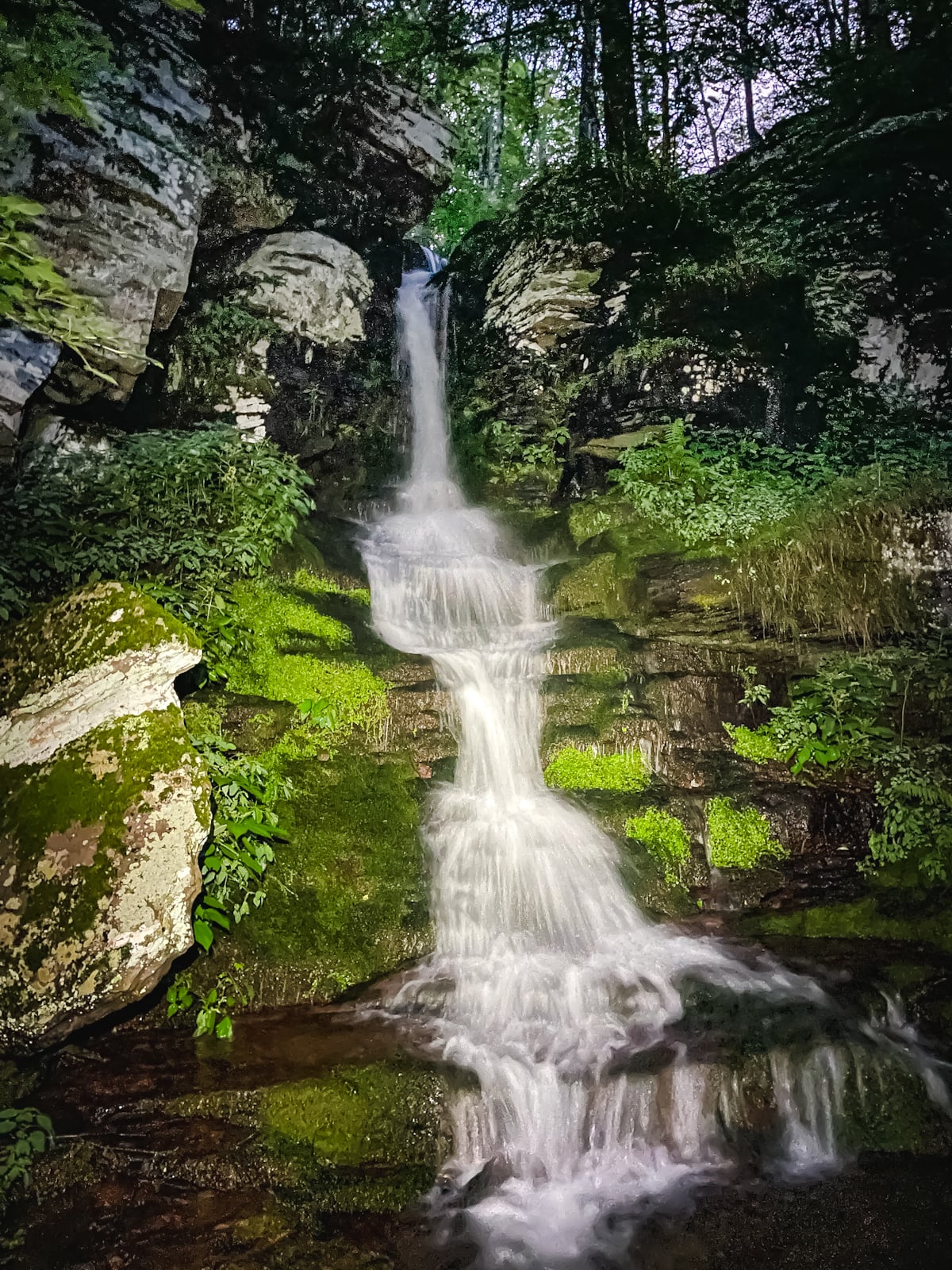
After parking your car in Route 42’s aptly-named Deep Notch, head past the notice board to the small-but-pretty waterfall at the base of the mountain. It’s about 200ft from the parking area.
Most of the time, it’s just a trickle, so try to visit in the days after a good rain has passed through…
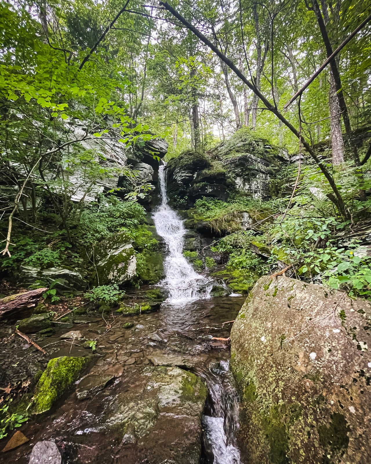
The safest way up is to the right of the waterfall. When you’re ready, head back, but only 75ft or so. Look for the herd path heading uphill on your left…
Climb up above the waterfall’s rim until the noise from below subsides.
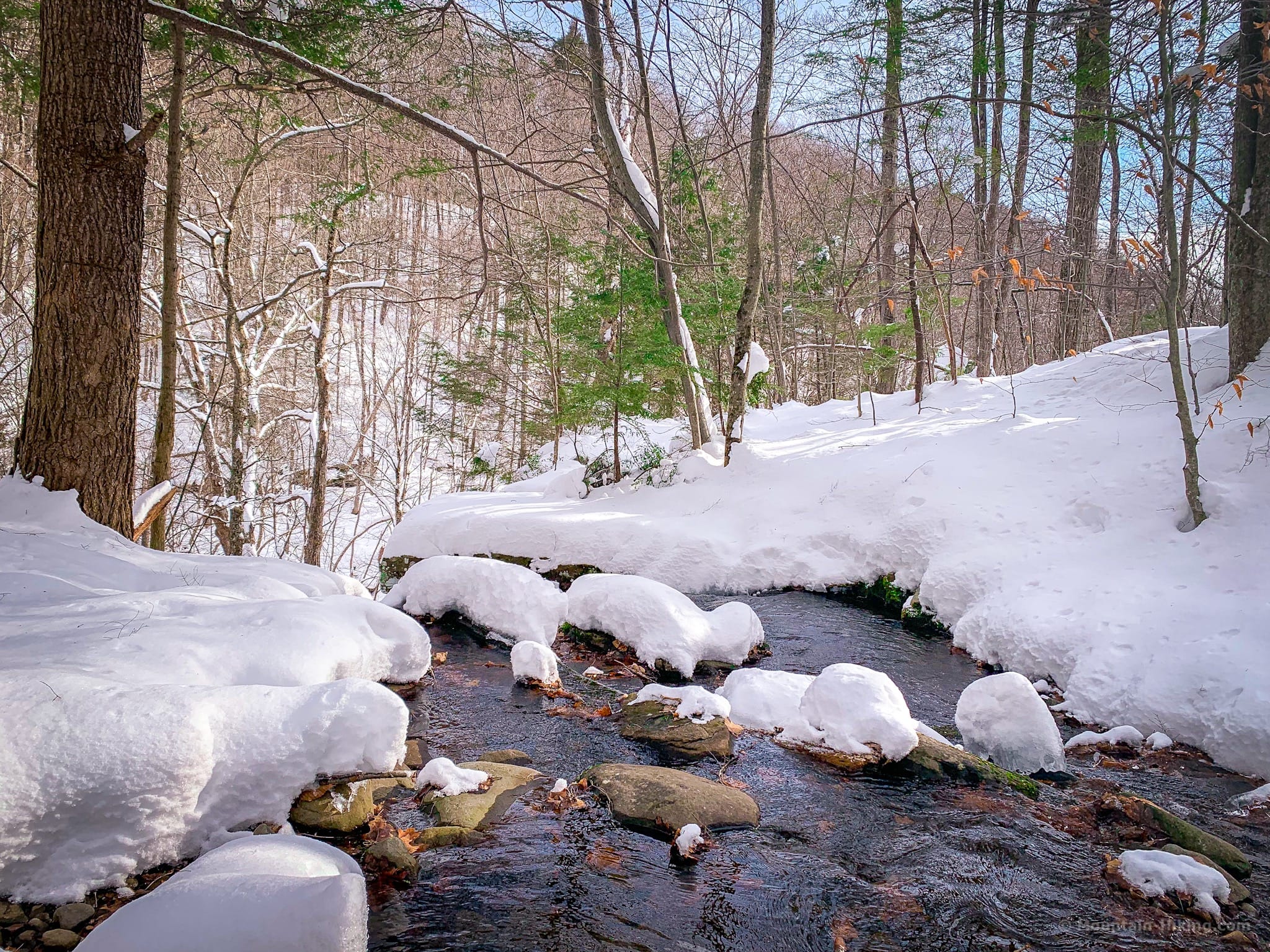
Cross the brook and head south.
There are options above the waterfall. You can see on my GPS track how I mistakenly followed the wrong herd path for a minute before deciding to turn back. Easy to do.
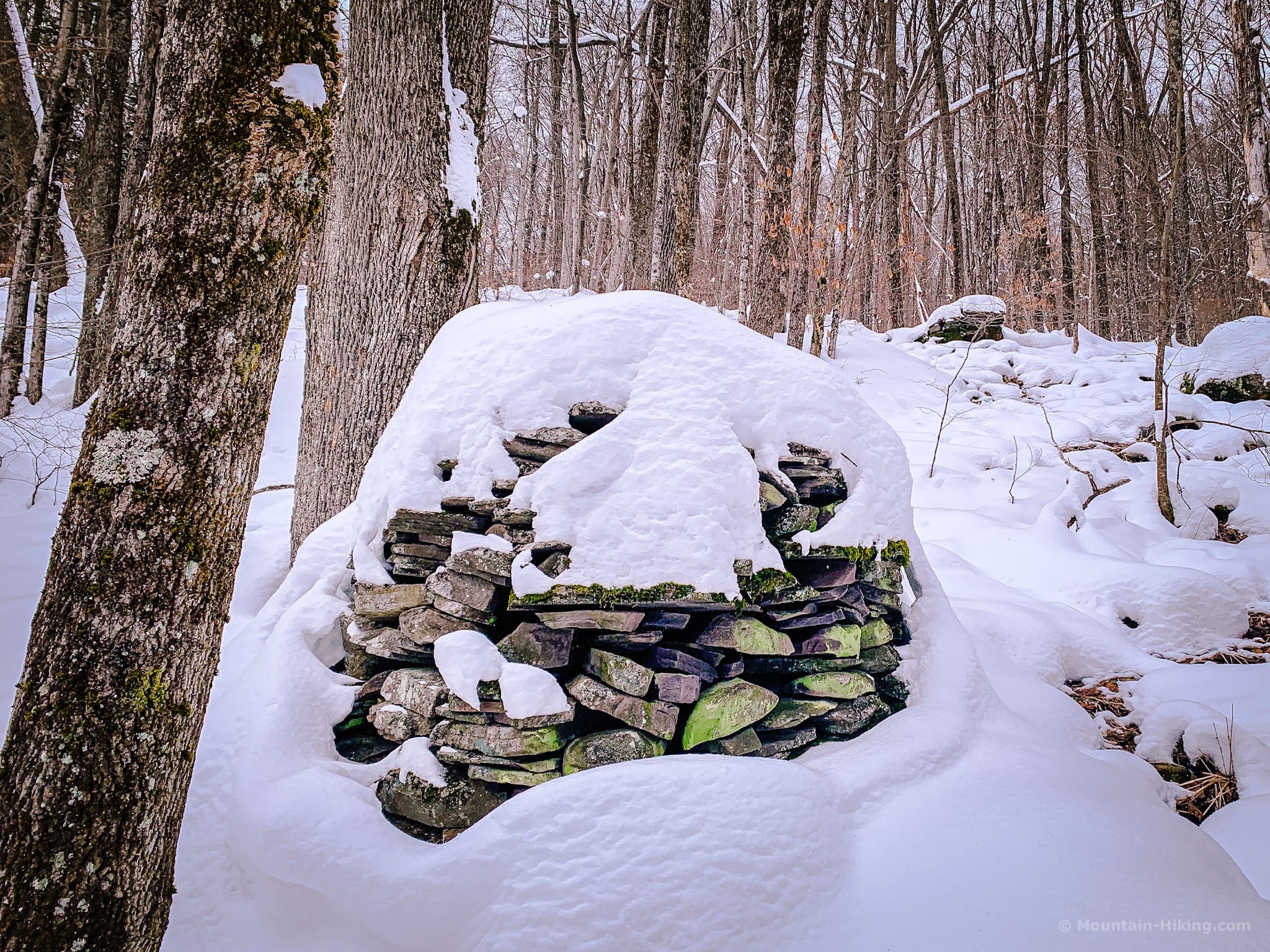
You may pass this cairn on the way, on your right.
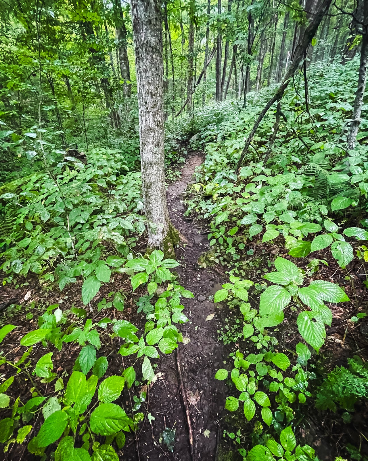
Nettles in Summer
In summer, Halcott Mountain is absolutely covered in nettles. This used to be a problem but, with the development of the herd path, it’s no longer an issue unless you’re wearing shorts. Just wear long pants and enjoy this short huffer of a hike.
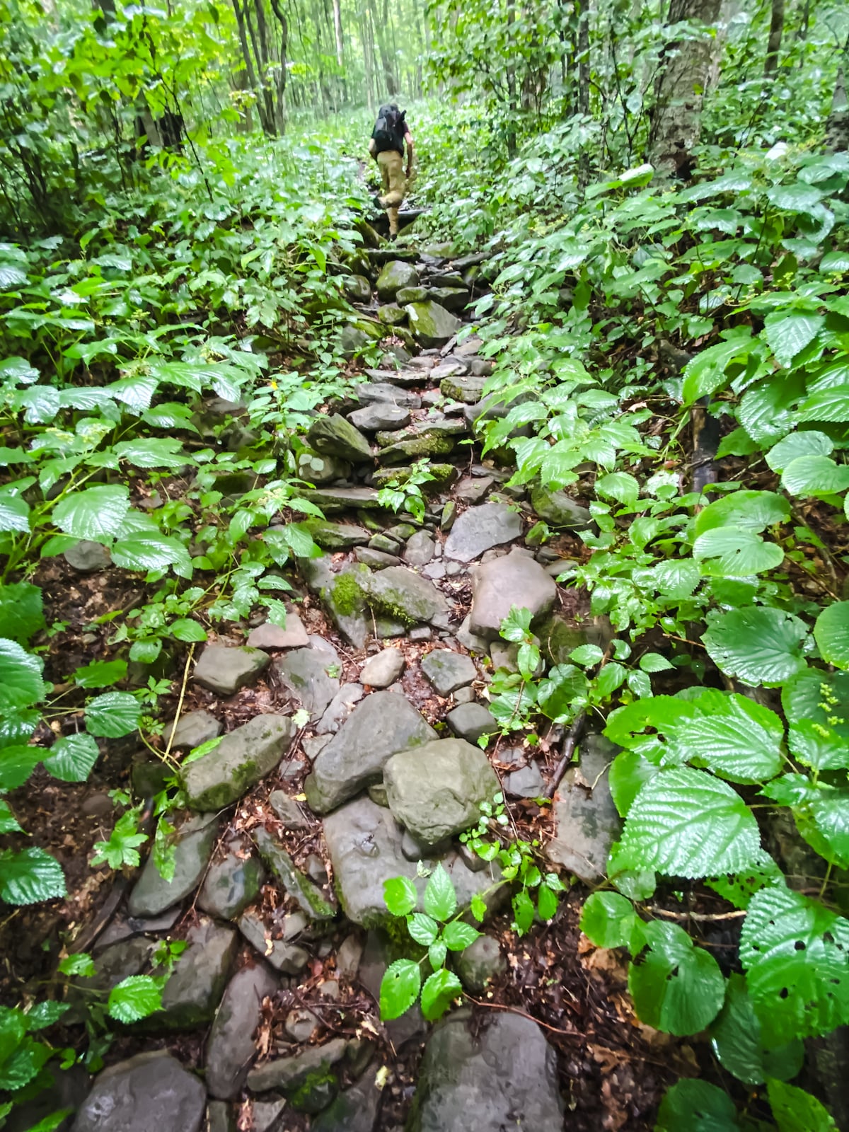
Hemlock Stand
My favorite section of the hike is this wonderful stand of mature hemlock tress that starts just below 2,000’ and extends upwards to 2,250’ or so. These are some of the oldest hemlocks in the Catskills.
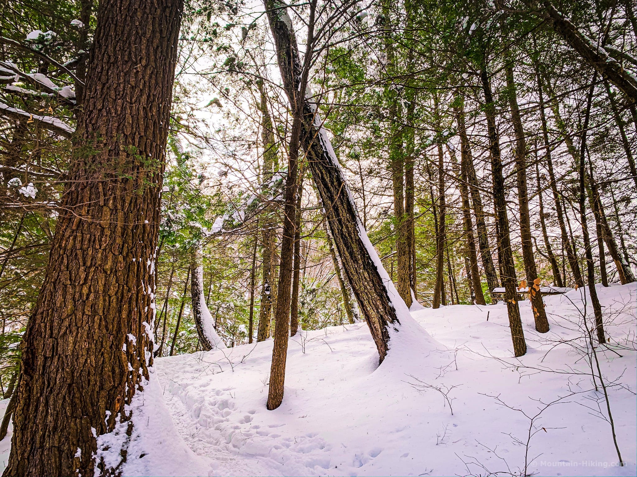
The terrain here is lovely, too, with many undulations, and water gurgling down the deep furrow to your left.
Not far above this section, the track bends left/southwest, crosses the drainage, and the real work begins.
The Final Incline
Starting just below 3,000’, the incline gets really steep; at times, the grade must be 120% or more. Your legs and glutes will feel it, here.
How to Hike this Section: Lean forward more than you’ve ever leaned forward on a steep grade. The weight of a backpack is more than enough to change a person’s center of gravity and, if you lean back here, you can easily tip backwards and start rolling downhill — and there is a lot of hill to roll down. So bend hard at the waist. Use your hands for extra balance and steadiness.
You’ll have plenty of stops to catch your breath. When the leaves are off the trees, you can see Sleeping Lion (on your left) which is connected to Halcott via the col between the two summits. On your right is Mount Sherrill.
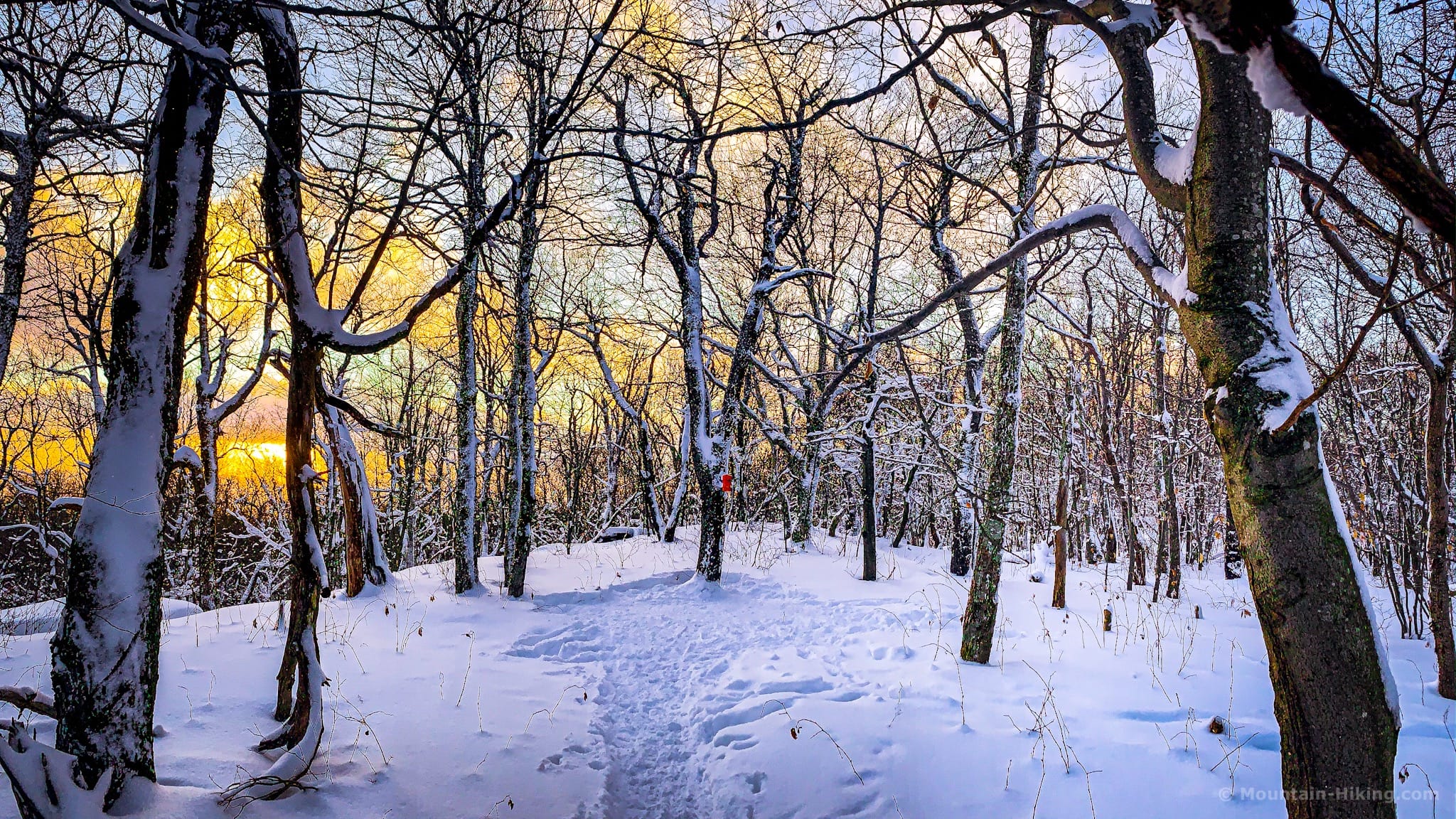
The woods in this area look like this…
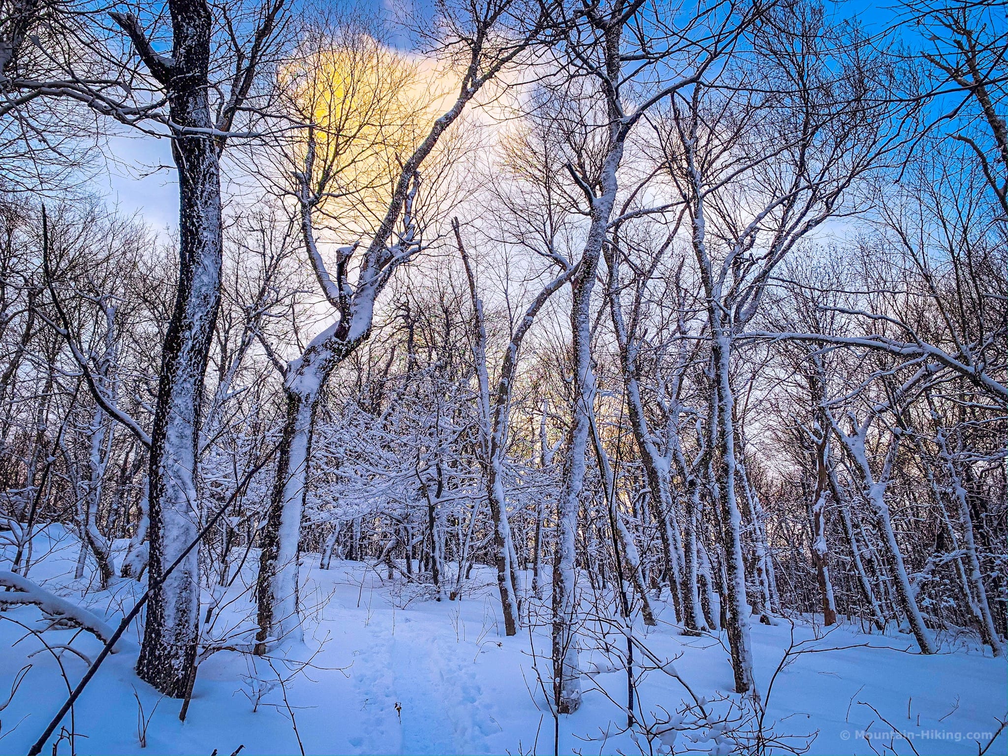
Above the steepest section, the trail winds through hobblebush for a while until, up ahead, you see the obvious summit knob.
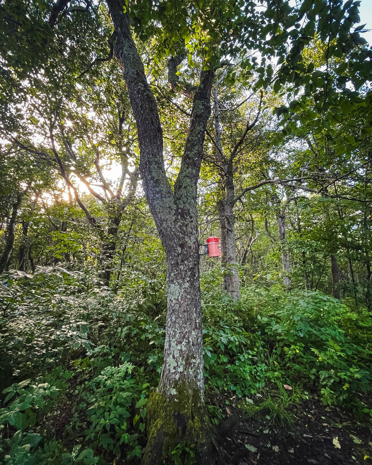
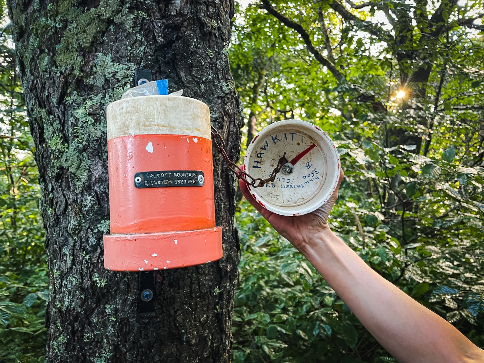
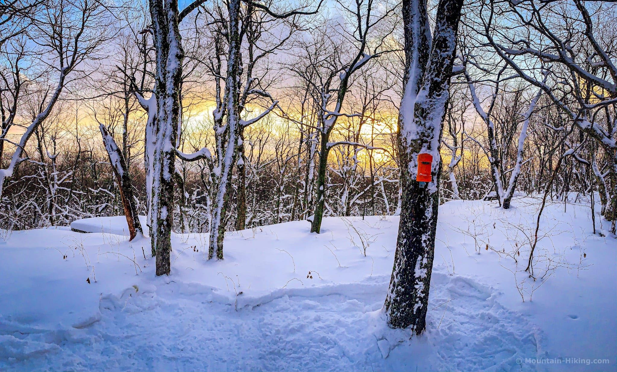
Halcott’s Summit
In the spring, when I approached the summit from the northeast, it felt like there were fifty false summits — just one fake-out after the next. But the now-standard approach from the east is a cinch.
You can simply follow the herd path right to the canister.
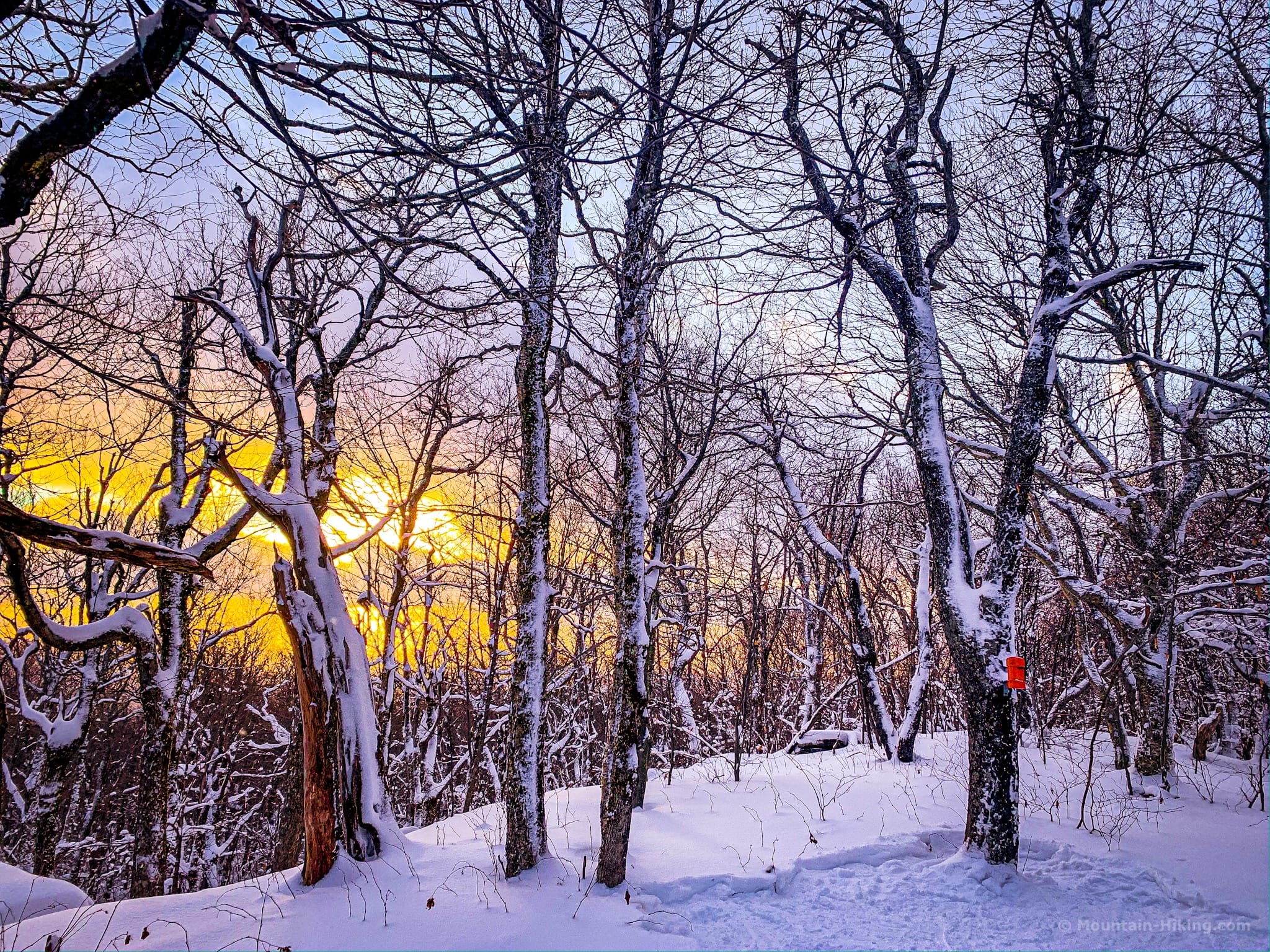
Summit in winter…
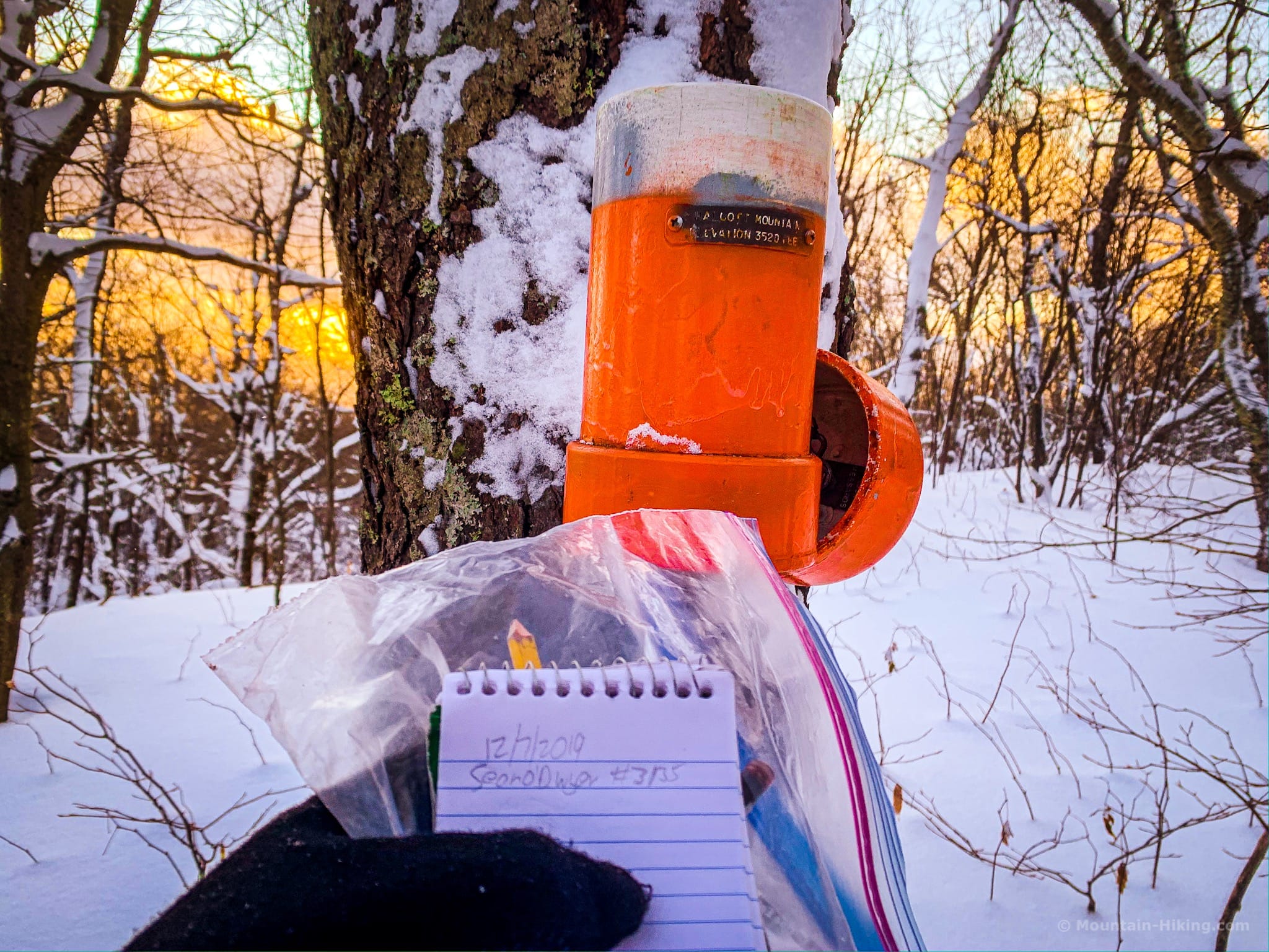
In summer, it took my hiking partner and me about 90 mins to get to the summit. In winter, it can take more like two hours to reach the canister. In 2019, the temperature on the summit was 15°F (-9°C) and I had fun times eating a frozen sandwich. Once the cold started to crush me, I took two swigs of summit whiskey and started back down. What I learned that day: frozen Snickers and whiskey is tasty medicine.
Descent
This is mountain is a great place to think about using trekking poles, especially for the descent. The terrain is so steep near the top that poles really help with steadying for balance, and with taking some of the strain off one’s knees. (And make sure you’re well-prepared for hiking in the dark. )
As it happens, in every season, Halcott is a wonderful mountain to descend. You’ll scoot back down to Route 42 in no time.
Similar Hikes
If you like steep hills with no blazed trails, Halcott, Rusk and Friday mountains are your new best friends.
Read More
Get instant access to the full version of this site and enjoy great supporter benefits: full galleries, full trail notes, early access to the latest content, and more.
Follow my @TotalCatskills content on Instagram for regular hiking inspo and safe, inclusive community.
Get full access…
Hot on the website right now…
Follow for more…
Halcott’s Herd Path Trailhead
This lot is tiny, with enough space for 5-6 cars max. But it’s not a crazy-popular destination. You’ll probably get a spot.
Google Maps Location: 42.184194, -74.414804
The map below shows the exact topographic location of the trailhead
Cell Service
The tiny parking area for Halcott is in a deep notch that’s literally called “Deep Notch”. Expect nothing. Coverage improves as you climb but the signal is weak and intermittent. I was able to text from the summit. My network is Verizon. YMMV.
The parent mountain for this hike is Halcott.