Disclosure: This content may contain affiliate links. Read my disclosure policy.
A straightforward out-and-back over really wonderful terrain.
Trailhead info at bottom of this post.
Hiking Trail Description
I was not prepared for how much I would fall in love with this hike. My plan was to check both peaks off my 3500 list and then just move on. Wrong. So wrong. 100% dead-ass wrong.
It’s a bit of a schlep out to Denning, but the last stretch of Denning Road is really something. You pass weird YMCA camps, weird yurts, and a large weird building with a Japanese-style roof. I don’t know what goes on in any of those buildings. Some of them give off a very strong Get Out vibe.
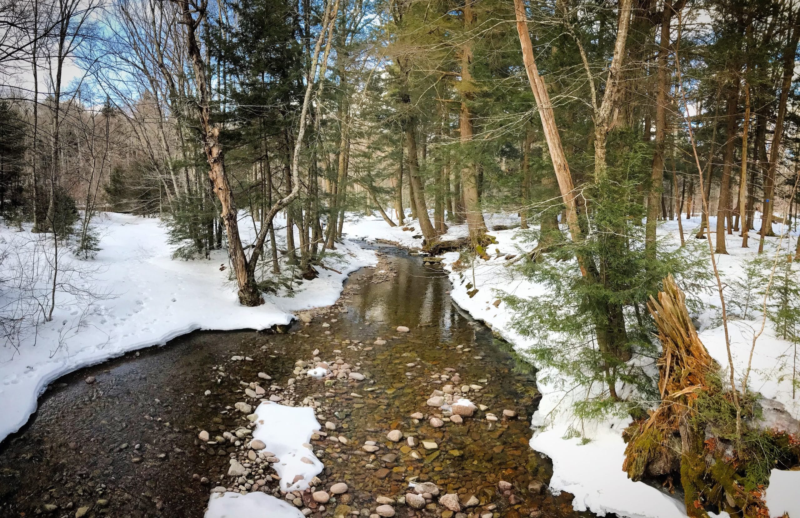
But as the road winds along the riparian corridor, through evergreen stands and over Neversink River, you start to feel like you’re arriving somewhere very, very special. Eventually, the road turns to classic Catskill iron-oxide red dirt. It ends in a large, sometimes-muddy lot.
The DEC register is right by the parking area. Judging by the number of entries in the register, this is a very popular destination for hikers. But it doesn’t feel like it. The whole area feels remote.
Denning & Neversink
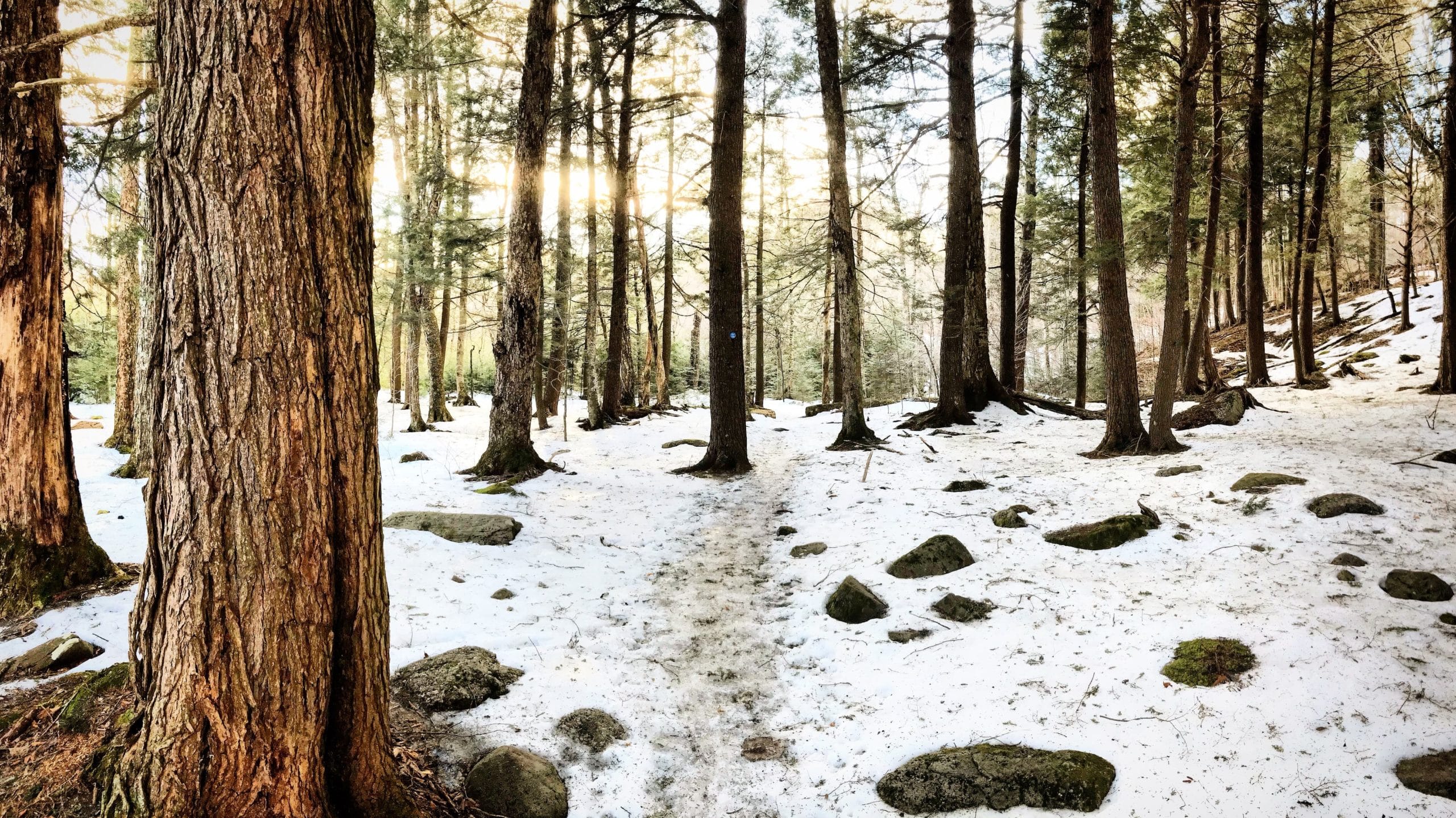
The first 1.2 mile section follows the Finger Lakes Trail gently uphill on a very wide trail that seems well-maintained. It’s partially on private property and seems to be an access road.
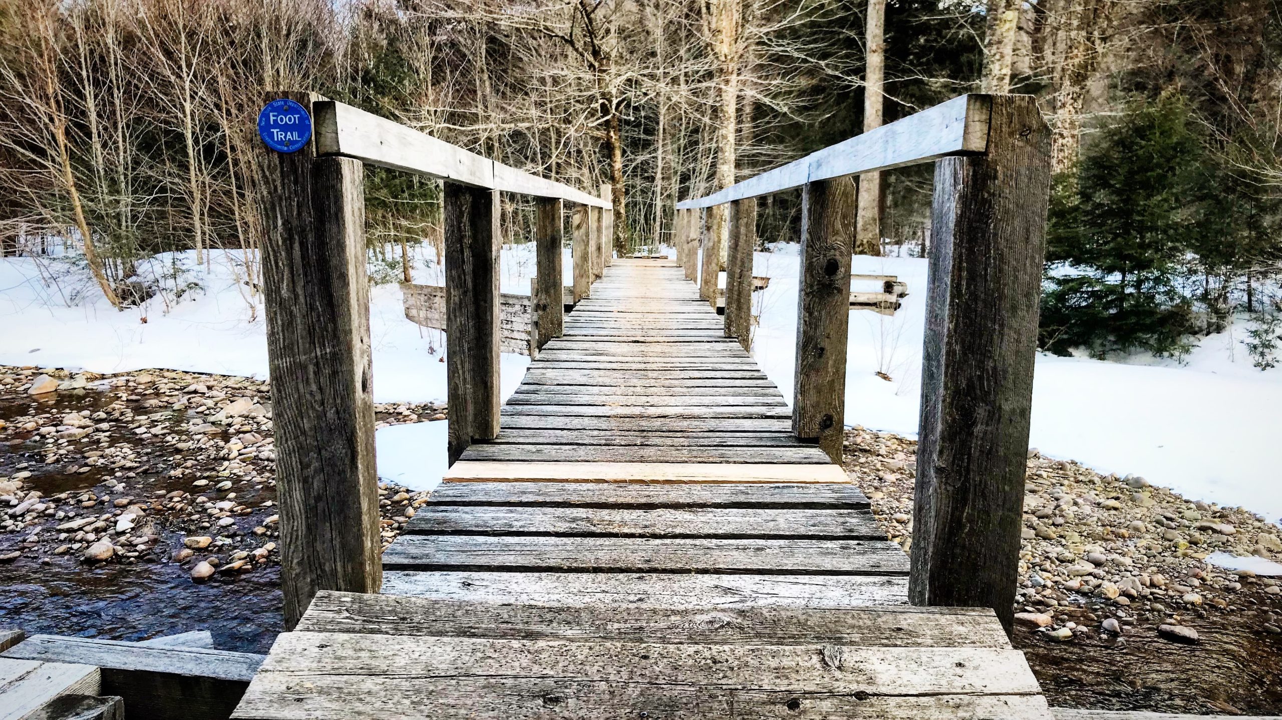
At the first junction, you leave the FLT and turn right, heading downhill. It’s a little rocky. This is really where the hike begins, as you cross the Neversink using two footbridges. It’s a lovely area, and there are several places to camp.
This is also where the Fisherman’s Trail starts, which hikers use to start their bushwhacks to Rocky and Lone mountains.
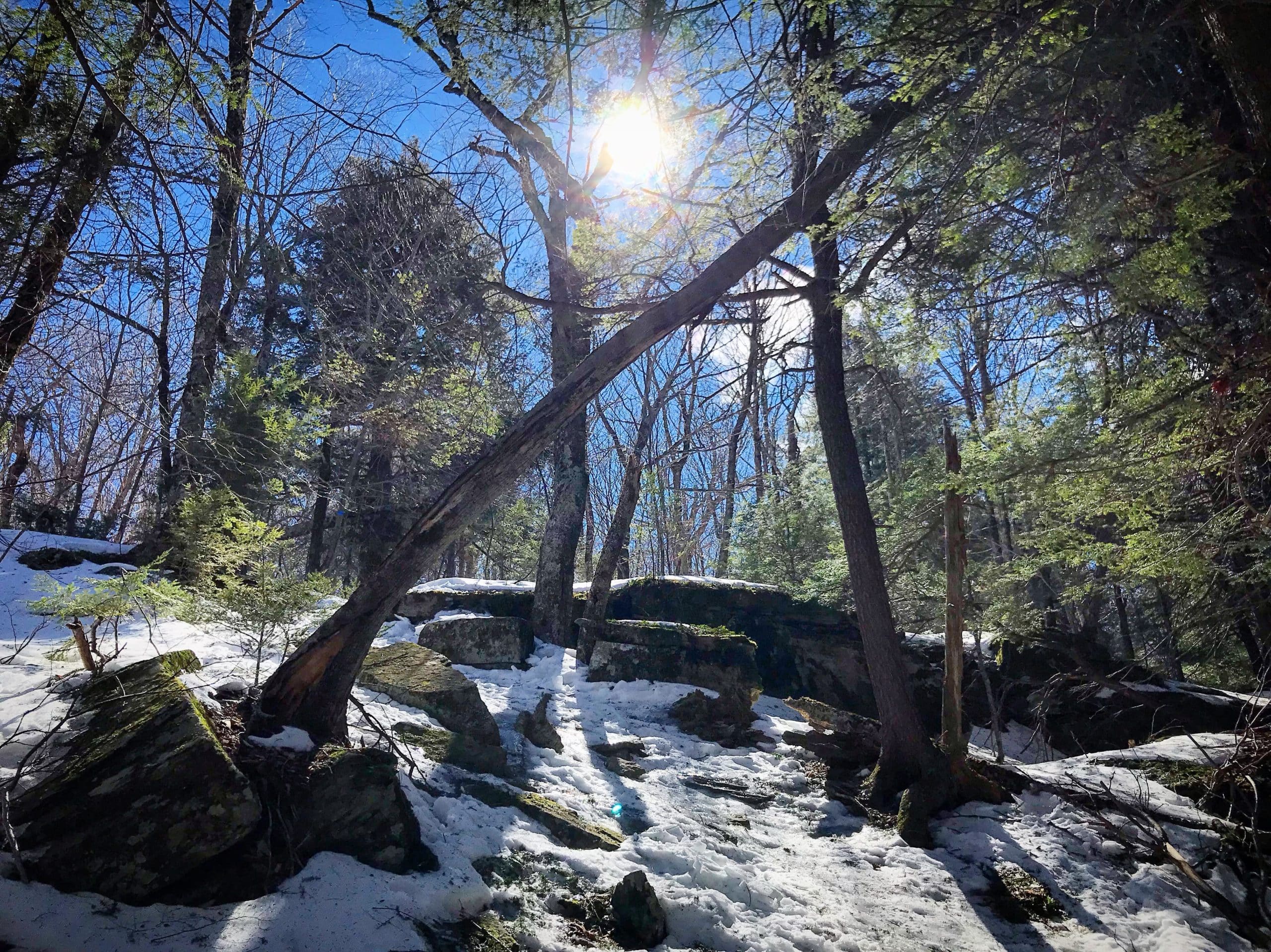
At around 2600’ you’ll come to two small ledge systems. Easy stuff, but very pretty.
After the trail turns east, at around 2750’, and just over a knob, you’ll pass two giant rock cubes — so huge, you can walk in between them. They’re so symmetrical, and so evenly arranged, I wondered if they were man-made.
On this day, I was solo hiking, so the photo below, with nothing to demonstrate scale, doesn’t do their impressive size justice.
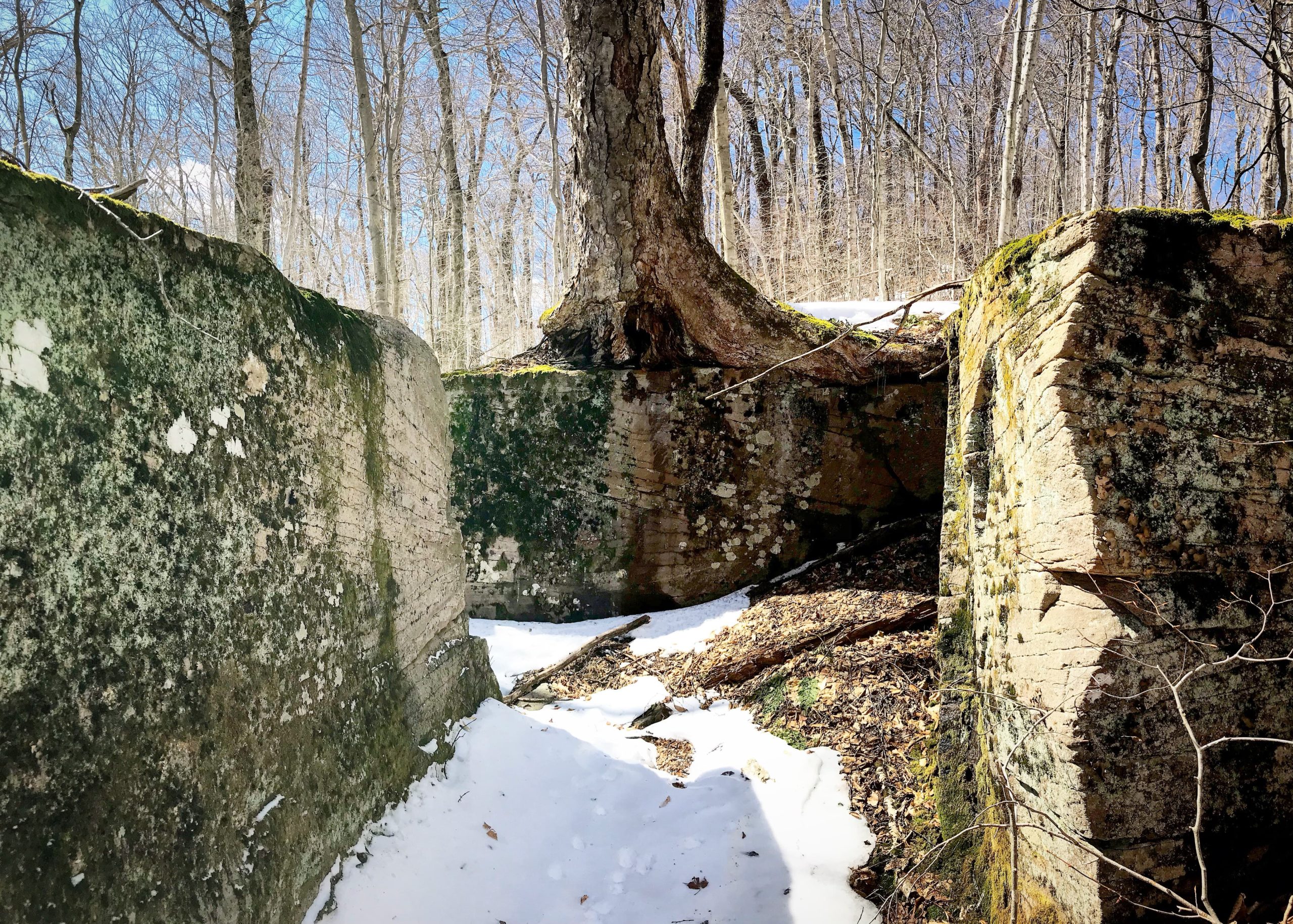
Note: in 2021, I re-hiked this route and got much better photos of this spot with a friend — see Table, Peekamoose, Lone & Rocky.
All along this trail, the terrain and woods change constantly — one of the things I loved so much about this hike. I’m not a huge fan of woods walks, but this whole area was just consistently varied and interesting.
About ⅕ mile after the cubes, and some elevation gain, you’ll start to see Van Wyck poke through the trees on your right. The scenic lookout marked on NYNJTC trail maps is off-trail, to the right. With fresh snow on the ground I didn’t see a spur so, for me, it was a micro-bushwhack.
The ledge there is small but offers a great view of Van Wyck. To your left, in the distance, you can also see Peekamoose’s ridge and summit.
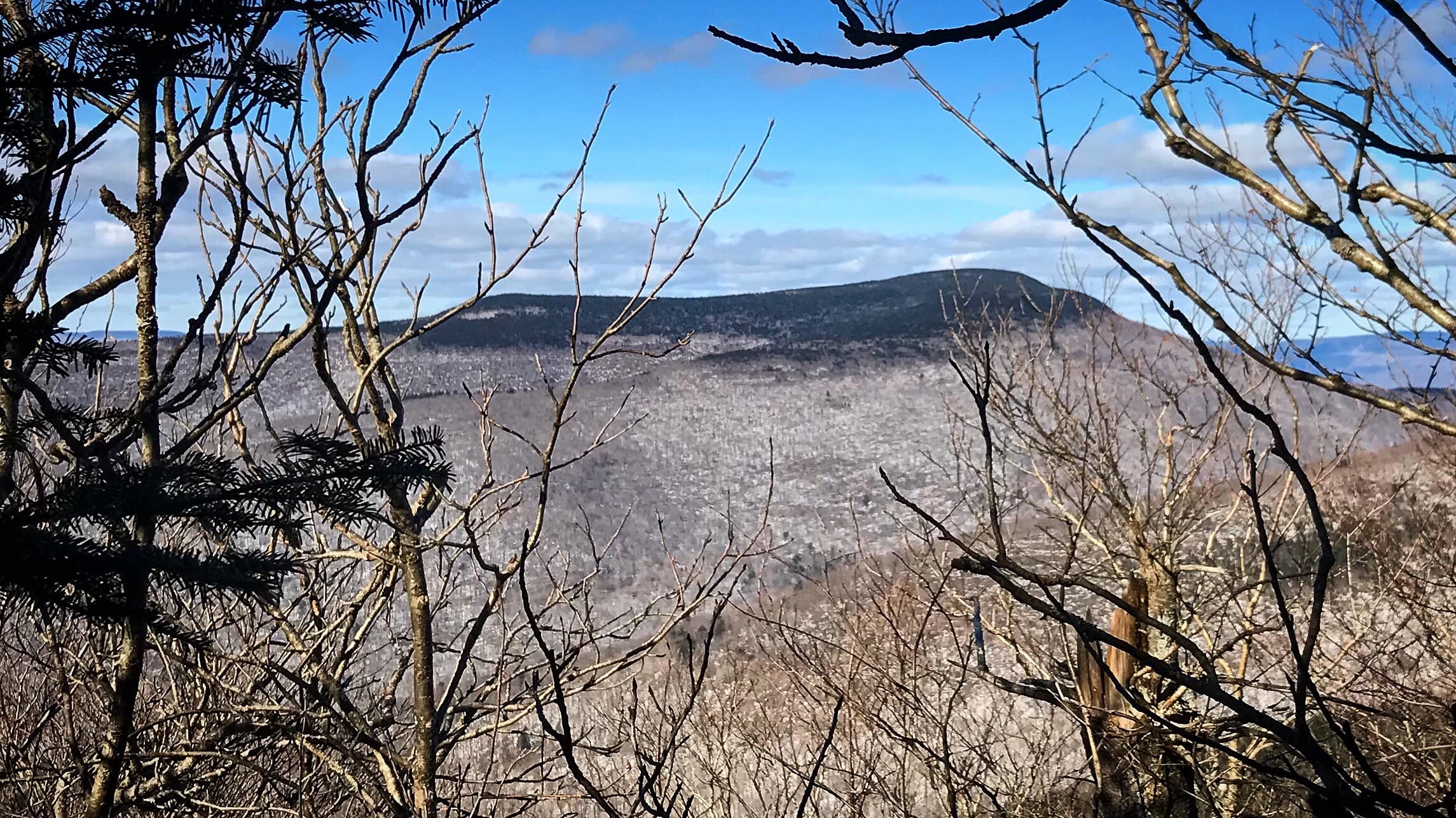
Table Mountain
On the way up to Table, I didn’t visit the spring or the lean-to, but I did stop to take in the view of Slide Mountain to the north. Table is likewise visible from the Curtis Ormsbee Trail on Slide.
Hiking from the north, you come upon Table’s summit almost immediately. It’s marked by a tree right in the middle of the trail.

Get full access…
Get instant access to the full version of this site and enjoy great supporter benefits: full galleries, full trail notes, early access to the latest content, and more.
Hot on the website right now…
Follow for more…
Follow my @TotalCatskills content on Instagram for regular hiking inspo and safe, inclusive community.
Hike Table & Peekamoose from Denning Trailhead
Large lot, often muddy.
Google Maps Location: 41.964887, -74.452586
The map below shows the exact topographic location of the trailhead
2 responses to “Hike Table & Peekamoose from Denning”
Your comments are welcome here…
The parent mountain for this hike is Table.

The large house at the end of the Denning road belongs to Tison family. It will go to the Frost Valley YMCA eventually in trust. My family, from Staten Island, built a cabin in 1976. It is just up the road from the “mansion”. As a child we had run of the area as all the families were friends in that area. There is a waterfall across from the house that was a lot of fun to swim in. There was a caretaker with a girl with a disability. We were friends with them and often would ride trikes (3-wheelers) around the fields. As young kids we had the best area to run around. We explored everywhere in the area. As an adult I love to go there and relive some of these memories. Now will be the time to get my 3500 peaks done in the area. The area is a true treasure.
How amazing. Thank you so much, Karen. Denning is such a stunning area, all right; I’m always happy when I’m heading over there. Thanks again!