Disclosure: This content may contain affiliate links. Read my disclosure policy.
A straight-forward run up Slide, then over the summit to a solid view. Return by the far more interesting Curtis-Ormsbee Trail.
Trailhead info at bottom of this post.
Hiking Trail Description
As you set out to hike Slide Mountain, the tallest peak in the Catskills, prepare yourself for an adventure that blends natural beauty, a sense of accomplishment, and a deep connection with New York’s wilderness.
Slide Mountain Wilderness is the crown jewel of the Catskills and a hiker’s paradise. This definitive guide to hiking Slide Mountain takes you through what I consider the best route, offering an experience that resonates with both seasoned hikers and enthusiastic novices alike.
Whether you’re looking to conquer your first Catskills summit or adding another notch to your hiking belt, Slide Mountain offers a backcountry experience that’s as enriching as it is exhilarating.
This route includes a fun ascent through varied terrain to incredible Catskills views, and then an efficient, quick walk out.
BTW, you might also enjoy…
- UPDATED › Best Bug Spray & Bug Repellent for Hikers
- CATSKILLS › Peakbagging The Catskills High Peaks (Ultimate Guide)
- STAY › Find Your Perfect Catskills Stay
- ADIRONDACKS › Wright, Algonquin & Iroquois Peaks
- LEARN › Teach Yourself How to Use a Compass
- ENTERTAINMENT › Best & Worst Hiking Movies
- Follow › My Instagram @TotalCatskills
- Follow › My Substack @TotalCatskills
- Follow › My writing for Times Union
Slide Mountain Hiking Trail
If you stick to the popular standard route when hiking Slide Mountain, you’ll see only a small amount of what this enormous and amazing mountain has to offer. Follow this loop route to squeeze way more out of your hike — with hardly any extra effort.
This Slide Mountain loop hike includes…
- A much better ascent
- A rock chasm
- A spruce tunnel
- Excellent Catskills views
- Old fire tower footing
- A great spot to rest on the summit
- A quick, efficient descent from the summit
- “Secret” view spots
Slide Mountain Hike Time
Allow 4-5 hours for this hike.
Slide Mountain Elevation gain
The elevation gain for this hike is apx 1,900 feet (apx 580 meters).
Slide Mountain Weather Forecast
Get the latest forecast for the summit of Slide Mountain.
Slide Mountain Parking
The Slide Mountain Parking Area on Oliverea Road / Route 47 — GPS coordinates at the end of this post — is quite large. But Slide Mountain is famous as “the tallest Catskill” and it’s also pretty easy to hike, so it attracts a lot of visitors. In summer, this is a busy busy destination. Plan to arrive early.
Start at the DEC Slide Mountain trailhead on Oliverea Road. After parking your car, check your ten essentials, and sign the trail register.
Next, you’ll need to check is if the Neversink River is passable…
Crossing the Neversink River
The name “Neversink” comes from an Algonquian phrase meaning “mad river”. Indeed, the river is sometimes dry, sometimes a brook, sometimes a stream, sometimes an uncrossable river, and sometimes a raging six-foot-deep torrent.
In fact, this is one of two Neversink Rivers, the East Branch Neversink. (The West Branch Neversink behaves somewhat similarly after rain. Its banks are hikeable but extremely tricky, following an unmarked herd path known as the Fisherman’s Path.)
I have turned back, here, due to the river being impassable, and hiked Giant Ledge instead, which is nearby and is an excellent Plan B to have up your sleeve.
Hike Slide Mountain in The Catskills
First, pass through some open woods, following the yellow blazes of the Phoenicia East Branch Trail. Then climb through a short rocky section…
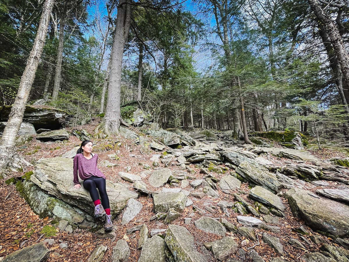
At the top of the stone steps, turn right, and walk along a short flat section which soon leads to the first junction.
Options…
- At the next junction, you can turn left, switching to the red-blazed Wittenberg Cornell trail. If you take this quick, standard route to climb Slide Mountain, you’ll make it to the summit in about 80 minutes. The next mile or so is pretty boring. It’s just a straight climb over rocky trail. It’s one of my least favorite miles in the Catskills and, usually, I chose to come down this way.
- Instead, I recommend continuing along the yell0w-blazed Phoenicia East Branch Trail until you get to the junction with the Curtis Ormsbee Trail.
Curtis Ormsbee Trail
Turn left, past a small granite marker, and follow the blue blazes up the mountain. This route provides both a gentler grade and a much more interesting trail…
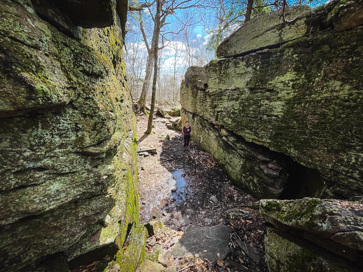
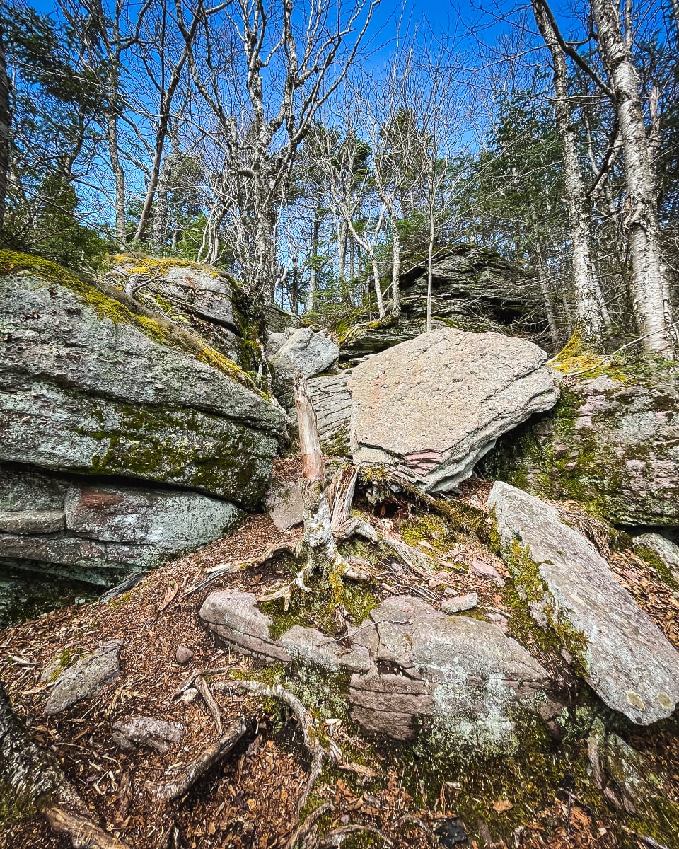
Keep an eye out for a wonderful rock chasm on your left as you ascend…
The terrain is mostly lovely and easy, but there are a few fun sections too…
The trail winds through several forest stands with some views of the surrounding high peaks, and eventually re-connects with the red-blazed direct-to-summit trail you passed earlier.
At the junction, turn right and head up through the…
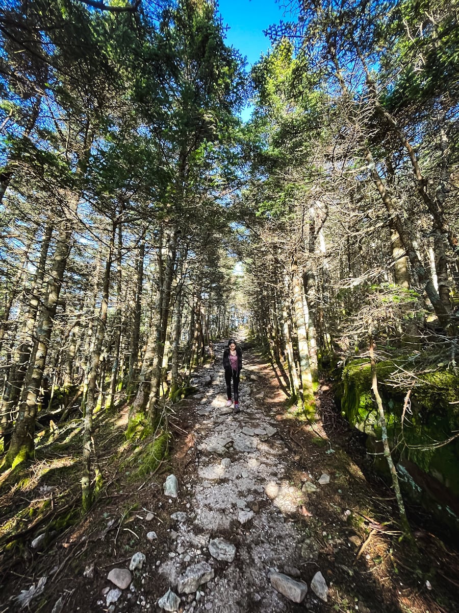
Spruce Tunnel
It’s basically a straight run, now, and a lovely ascent through spruce forest begins…
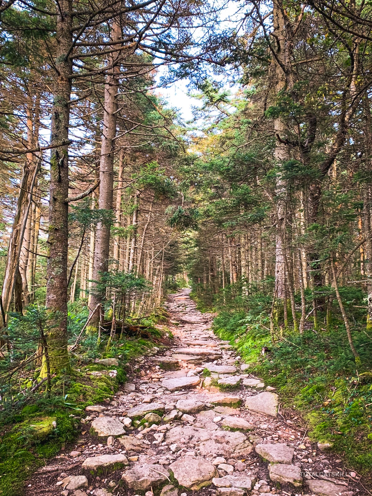
Continue upwards. The next ¾ mile is really special.
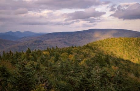
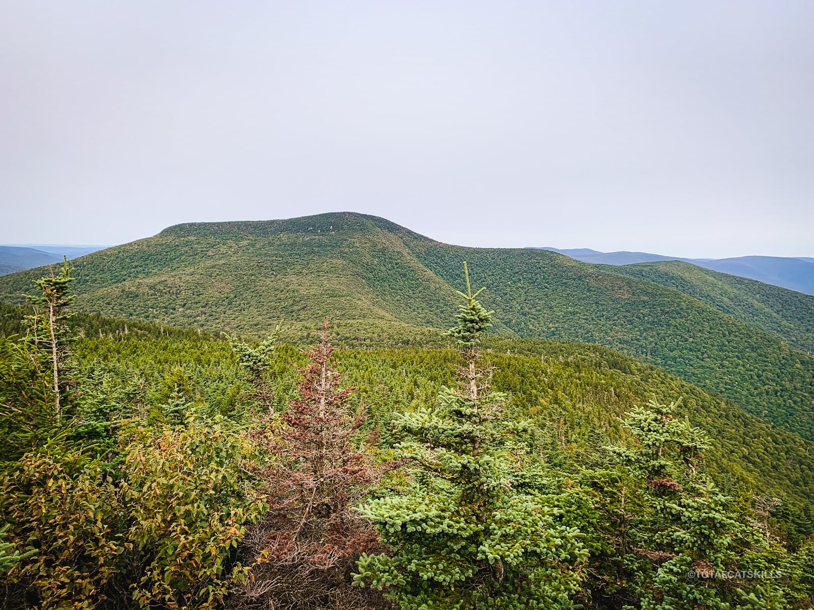
Slide Mountain Scenic Views
A short distance before the summit there’s a really great view (from an opening on the left) of Panther Mountain and Giant Ledge.
Summer view…
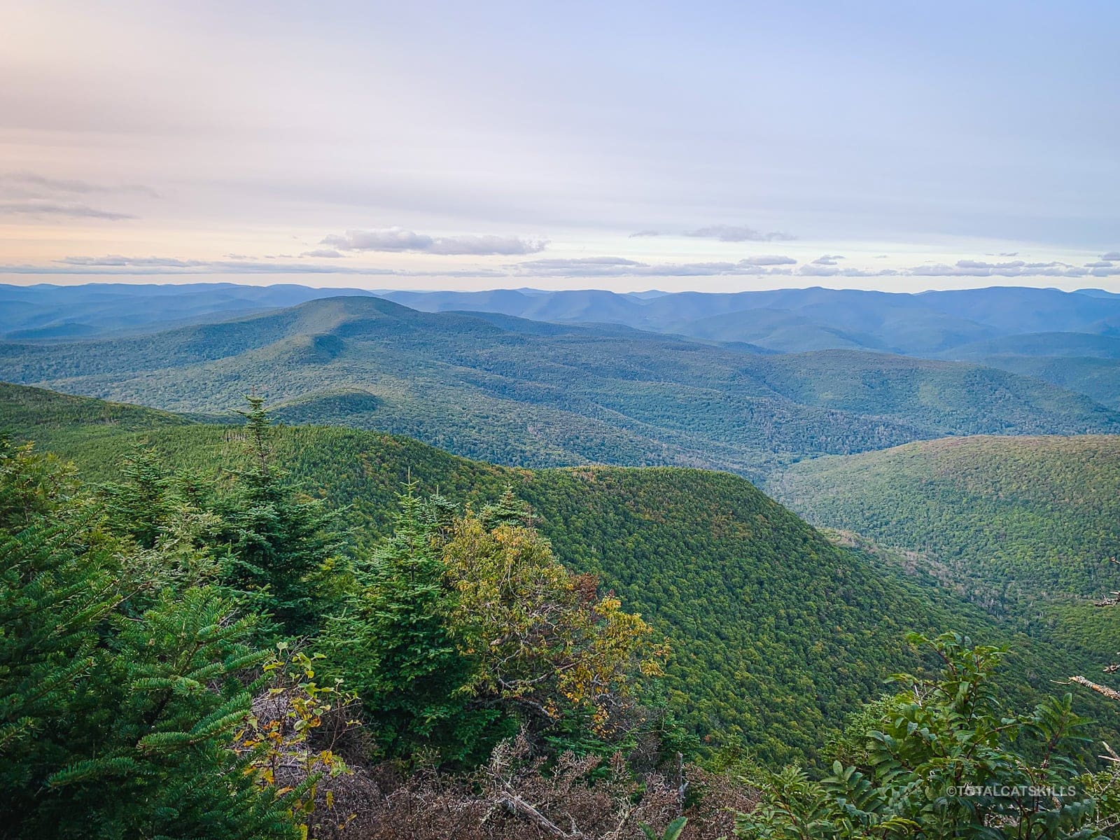
A little higher still is a second overlook, which is better for viewing Wittenberg and Cornell — and, in the distance, the Devil’s Path mountains.
This is also the last spot you’ll have cell coverage; there is none at the summit.
Slide Mountain Summit
The summit is marked by the one remaining footing of the old fire tower that used to stand there.
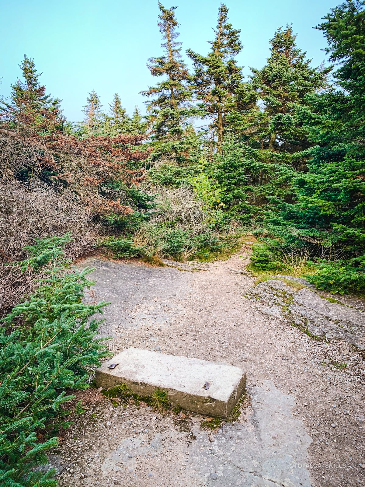
In deep snow, the footing will be covered and the summit may be hard to find if you’re not already familiar with it. But there is a somewhat obvious low mound in the area, on the left side of the trail. That is the actual summit.
There is no view here. However, continue on just a little more…
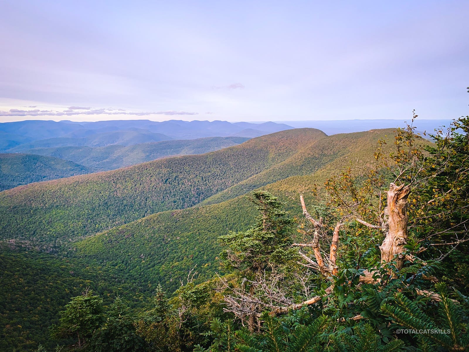
Open Rock
Not far past the summit, a large flat rocky area opens up. Here, you can rest, hang out, and snack — remembering to always Leave No Trace.
Through gaps in the trees you can see the Eastern Devil’s Path mountains — Indian Head and Twin are prominent. And far below, you can see the Ashokan Reservoir, so small and foreshortened, you might mistake it for a river.
The open rock ends at a ledge.
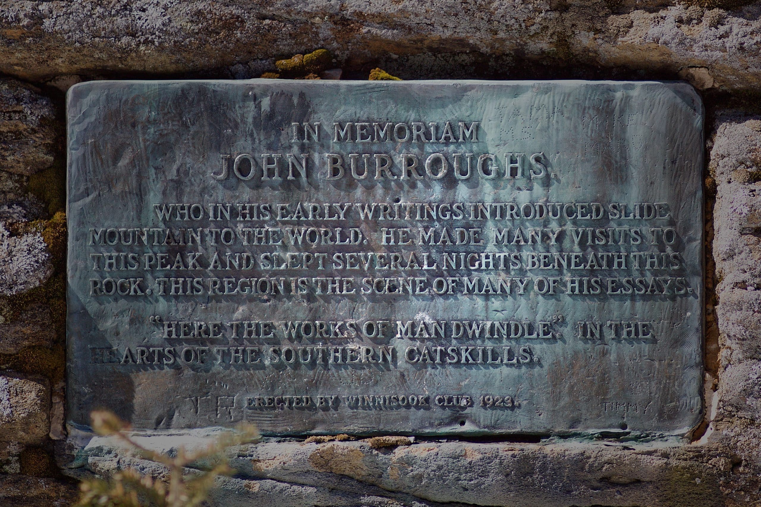
John Burroughs Plaque
Walk around the right side of the open area. Below, on the far side, you’ll find a plaque which commemorates John Burroughs who brought the Catskills area to fame. (The Burroughs Range is named after him.)
Descent from Slide Mountain
Turn around and head back up to Slide’s summit. From there, for a quick descent, follow the red trail all the way down.
30 mins or so from the summit, pass to the junction with the Curtis Ormsbee Trail. Continue heading straight down, following the red blazes through the spruce tunnel…
At the bottom of the red trail, turn right to follow the yellow-blazed trail back down to the parking area. Watch for a small sign that points to the left downhill. Otherwise, it’s easy to miss the final turn which leads you back down through the rocky section and out toward the Neversink and your car.
“Secret” Scenic Views on Slide Mountain
Most casual hikers don’t know about these views, but they are the best views from Slide Mountain and include some of its finest wilderness terrain…
 You’ve got the basic details, but there’s so much more…
Unlock this site now to get complete intel on every route, including my full photo galleries, personal insights and tips. Elevate your next hike with deep trail beta. Experience hundreds of amazing routes at their absolute finest. With Mountain-Hiking.com, you’re not just skimming the surface.
Sean

Similar Hikes
A very similar easy mountain hike is Balsam Lake — with the bonus that the fire tower at Balsam Lake’s summit has a truly amazing view.
For new mountain hikers, I always recommend Windham High Peak as one of the most accessible and rewarding Catskills High Peaks. You won’t be disappointed. You can also Hike the Catskills Fire Towers — excellent hikes!
If you want to add a little difficulty, have a think about hiking the very popular Giant Ledge or Indian Head. Both are exceptionally rewarding hikes.
These are the best hiking apps you can download right now. And here’s a list of the best places to eat in the Catskills for hikers.
Read More
Get full access…
Get instant access to the full version of this site and enjoy great supporter benefits: full galleries, full trail notes, early access to the latest content, and more.
Hot on the website right now…
Follow for more…
Follow my @TotalCatskills content on Instagram for regular hiking inspo and safe, inclusive community.

Slide Mountain (Best Route) Trailhead
Large lot, popular destination. Arrive early, especially at weekends and on vacation days.
Google Maps Location: 42.009183, -74.427463
The map below shows the exact topographic location of the trailhead
Cell Service
There is cell service just below the summit. Otherwise, the signal is patchy to non-existent — very typical for the Catskills Wilderness. My network is Verizon. YMMV.
The parent mountain for this hike is Slide.