Disclosure: This content may contain affiliate links. Read my disclosure policy.
Suggested route. For general reference only.
Trailhead info at bottom of this post.
Hiking Trail Description
The Fisherman’s Path is an unmaintained hiking trail in Denning, New York. It parallels and criss-crosses the East Branch Neversink river which flows down from the slopes of Slide, Friday, Rocky & Lone mountains. The entire trail is exceptionally beautiful.
The stream’s banks are popular with casual hikers for weekend campouts, and its banks and bed include some fantastic geological features. The trail is also a popular route used by 3500 hikers to access Rocky & Lone.
Experienced hikers should plan for a slow eight mile day, making sure to start early enough to make it back to the trailed section before dusk.
End to end, the trail itself is only about 2.5 miles in length, but the Fisherman’s Path is a tricky and confusing route, suitable only for experienced hikers and bushwhackers. Once on the “path” there are no blazes to follow or trail indications. Hiking here requires great care at all times.
Sometimes clear but often extremely faint, the Fisherman’s Path is sometimes also non-existent. There are also many stream crossings — bearing in mind that, depending on recent rainfall, this stream is sometimes a river which may not be possible to cross.
Trailhead Parking
The closest parking area for this hike is the DEC trailhead in Denning. (GPS coordinates are at the bottom of this post.) It’s a large, popular lot that sees a lot of action at weekends. The drive through Denning to this trailhead is one of my favorite drives in the Catskills. You pass through rural settings and then a series of strange buildings that are a mix of YMCA lodges and weird cult-like settings. I love it.
You could also hike in from the Slide Mountain trailhead on Route 47, which is another popular lot.
Warning! Cell service in Denning and all along the Fisherman’s Path is non-existent. Plan on having zero cell signal for the duration of this hike.
Hiking Trail to Fisherman’s Path
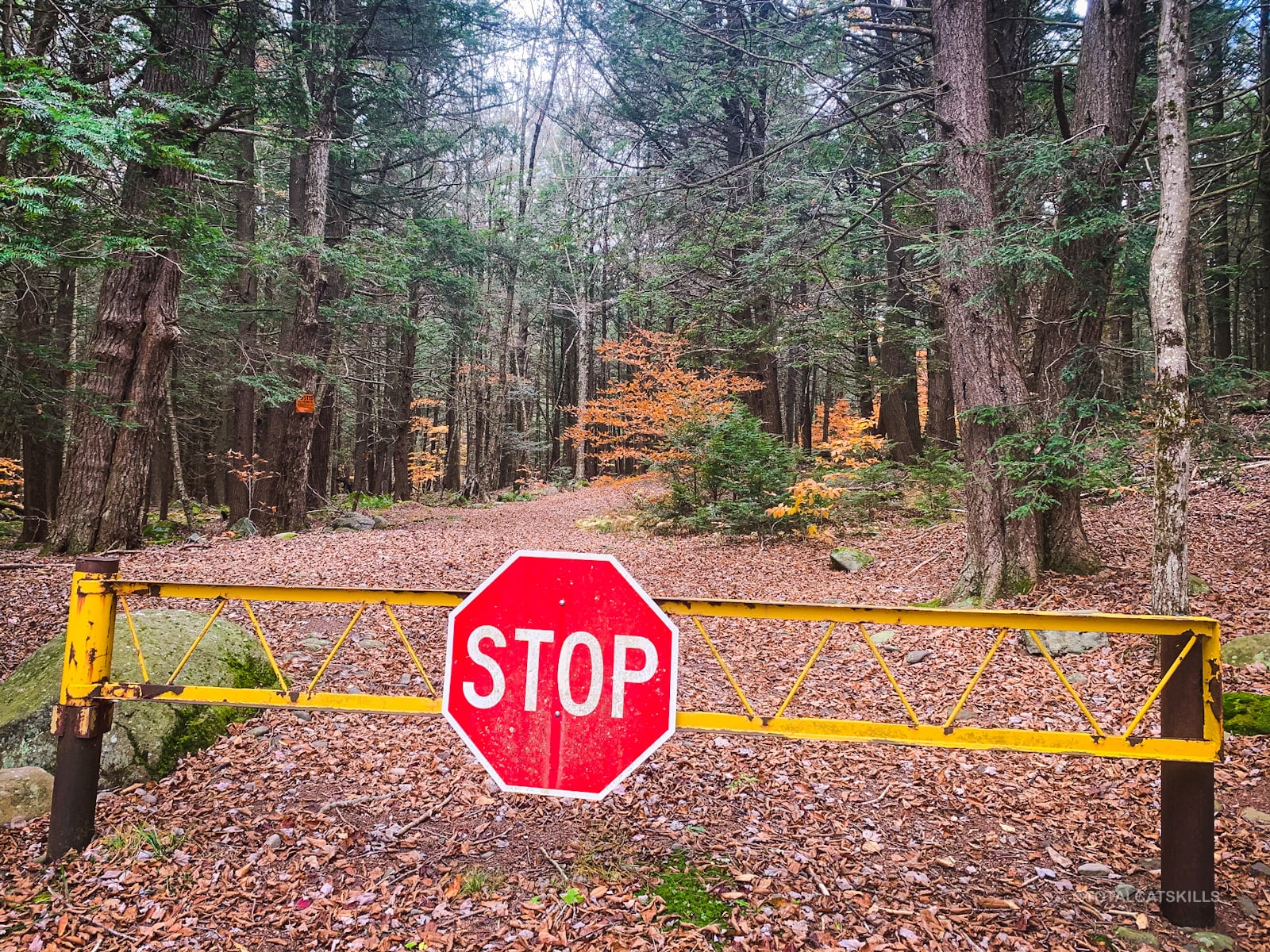
The trailhead lot is large and can get a little muddy. Sign in at the trail register and head for the iron gate, which marks the start of this hike.
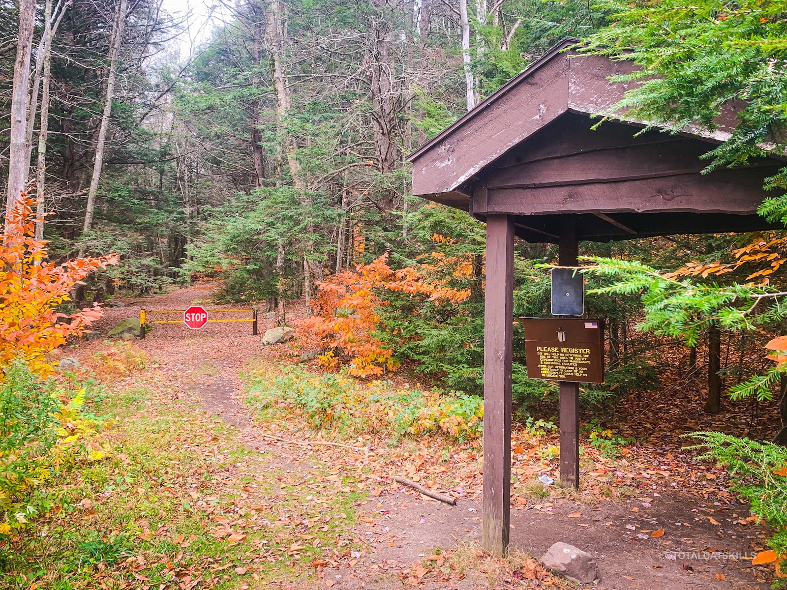
Walk around the iron gate…
The first 1.2 mile section of yellow trail to the first junction follows an old turnpike built some time between 1880 and 1892. It was never used by vehicles much. Kudish states it reverted to a foot trail more or less right away.
Follow the yellow blazes…
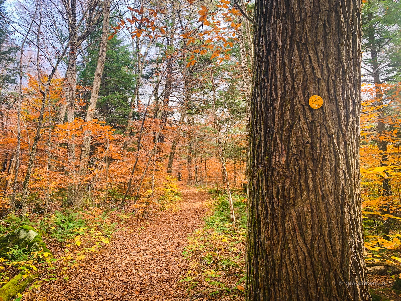
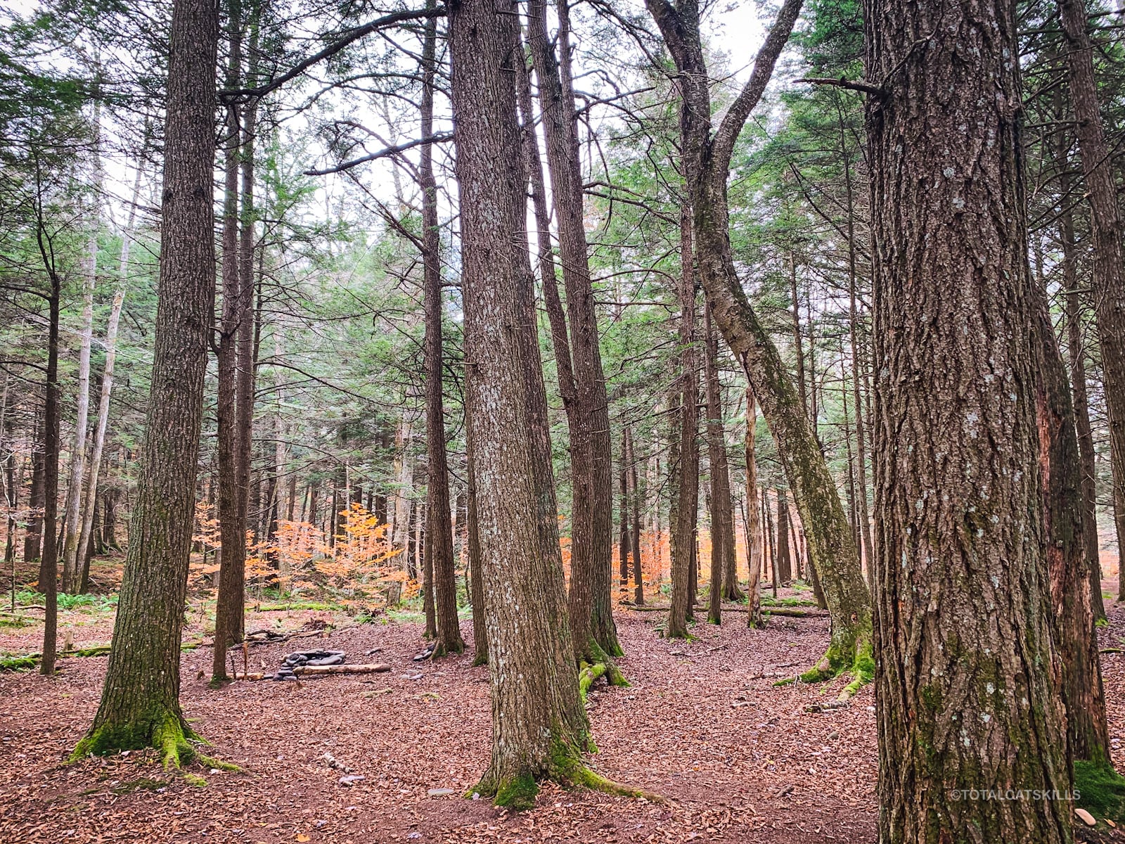
The trail here is wide and very easy going, with only a slight rise through the forest.
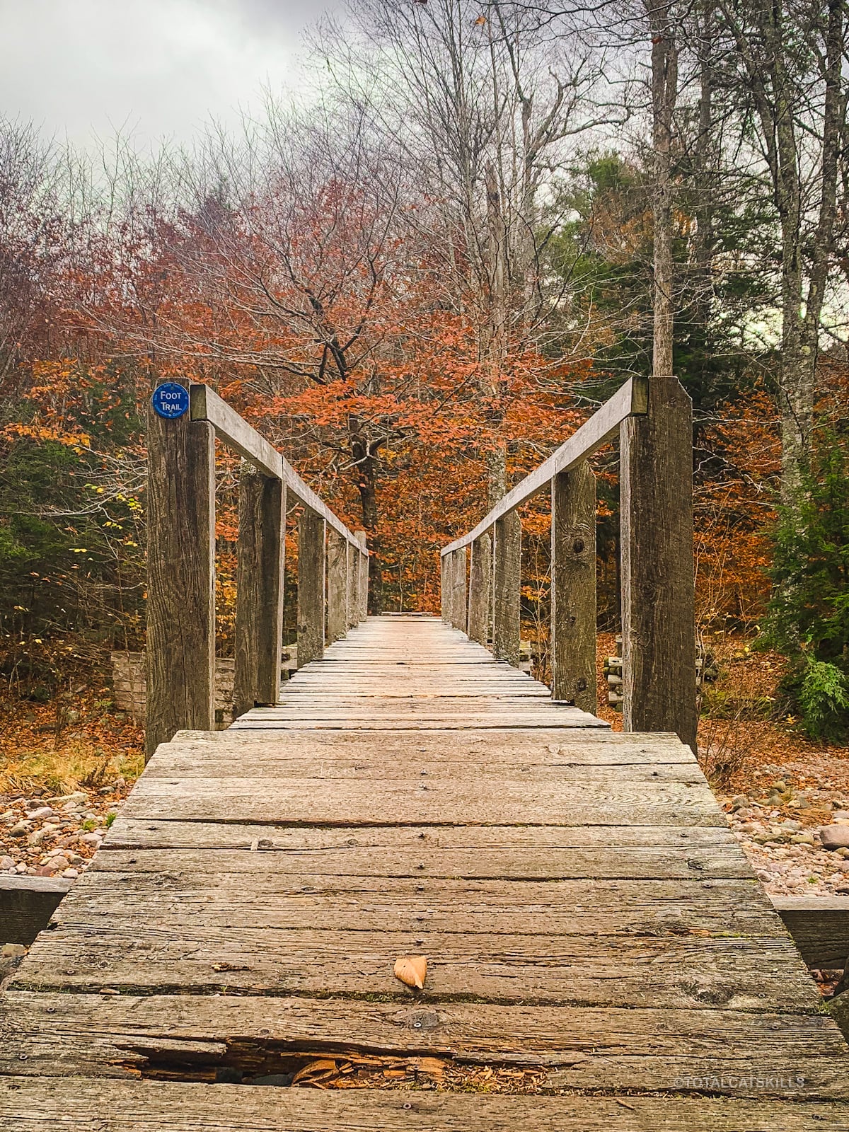
You’ll pass over this cute footbridge, one of three on this hike…
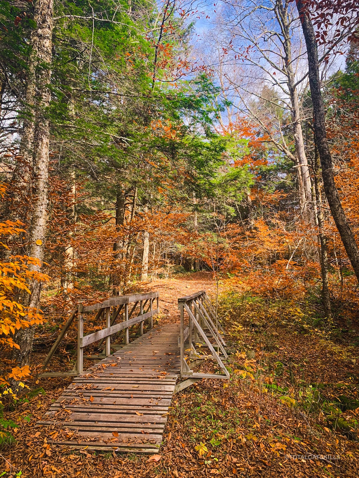
After half an hour or so, you’ll come up a rise to this junction…
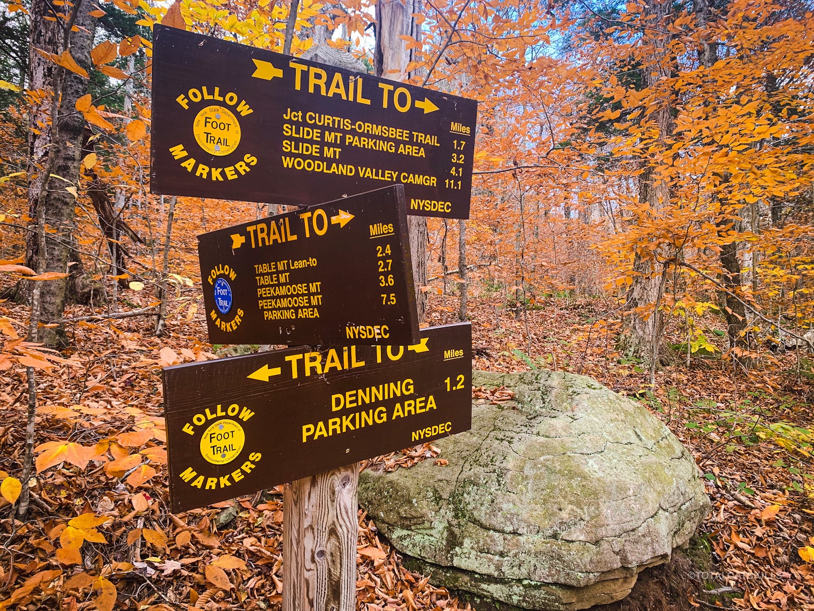
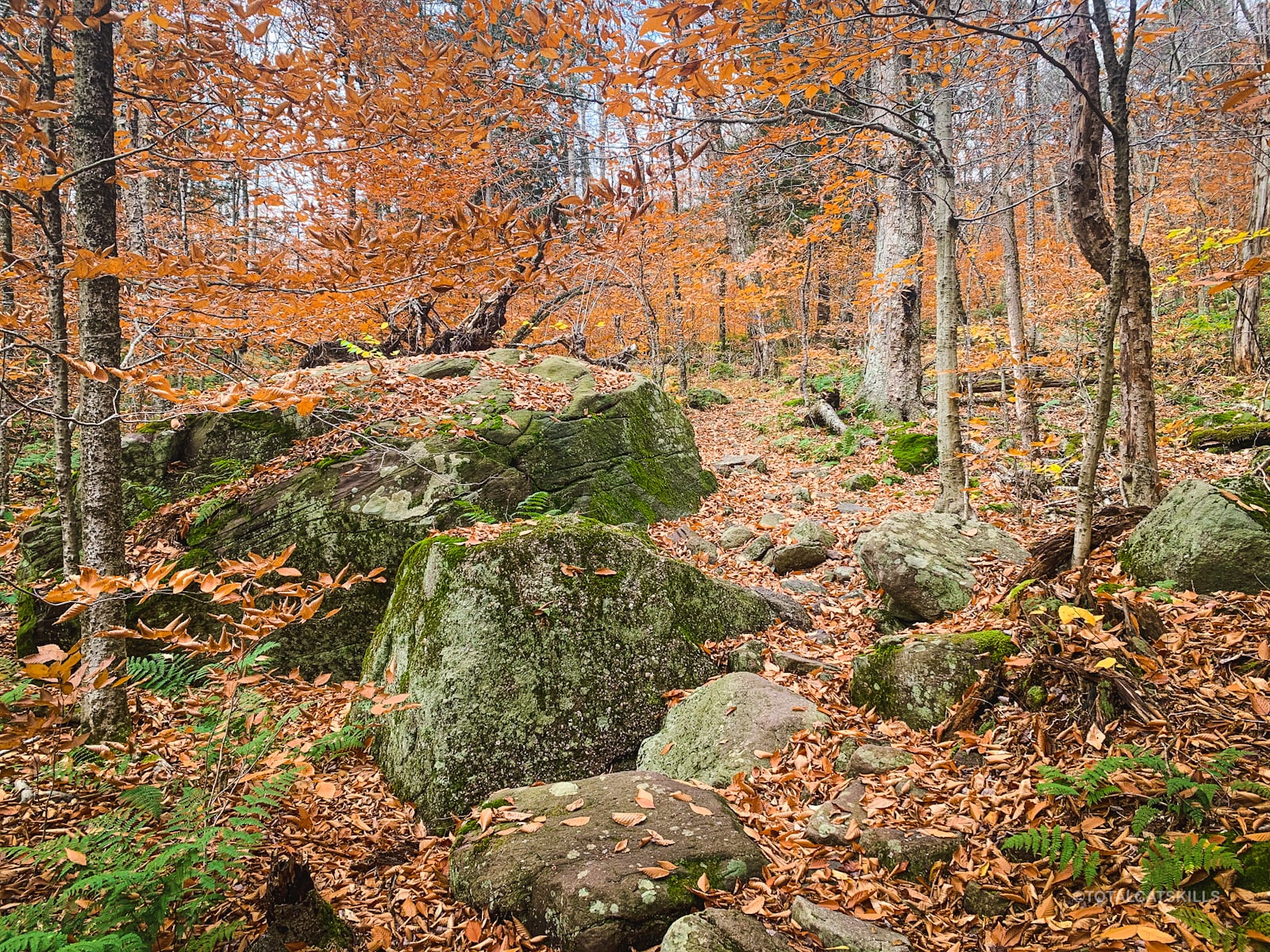
The trail continues straight ahead to Slide Mountain. But here you should turn right, switching to the blue-blazed Peekamoose Table trail. The blue trail descends, passing down through these boulders…
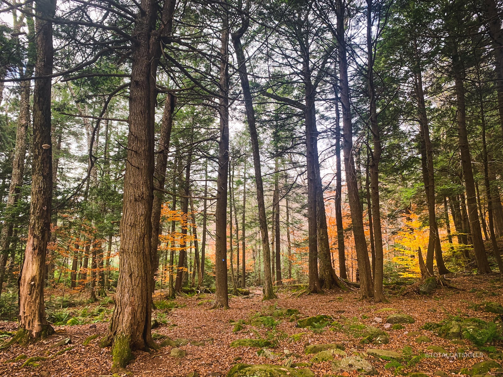
You’ll also pass through a small but very lovely hemlock grove…
Cross this second footbridge…
Soon after the second footbridge, you’ll come to a third (much larger) footbridge. This bridge crosses the widest and roughest branch of the East Branch Neversink. On this day, I could have walked across the stream bed, it was almost dry. I have yet to see it raging. It must be something.
Notice the tall tree on the opposite bank…
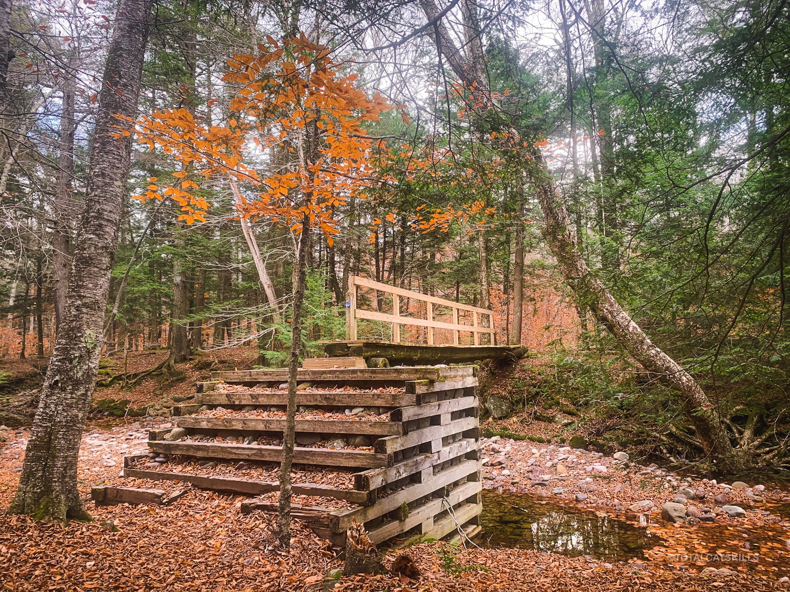
The tall tree looms over the footbridge dramatically…
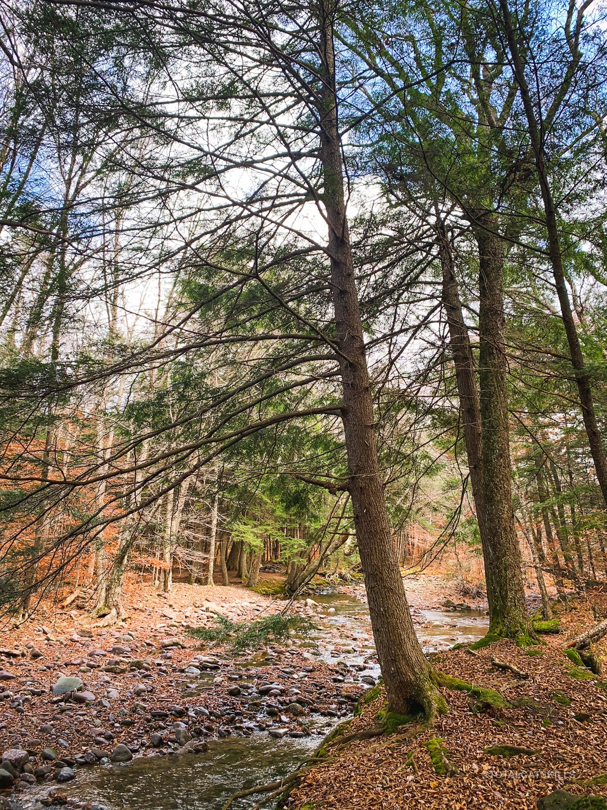
Fisherman’s Path Hiking Trail
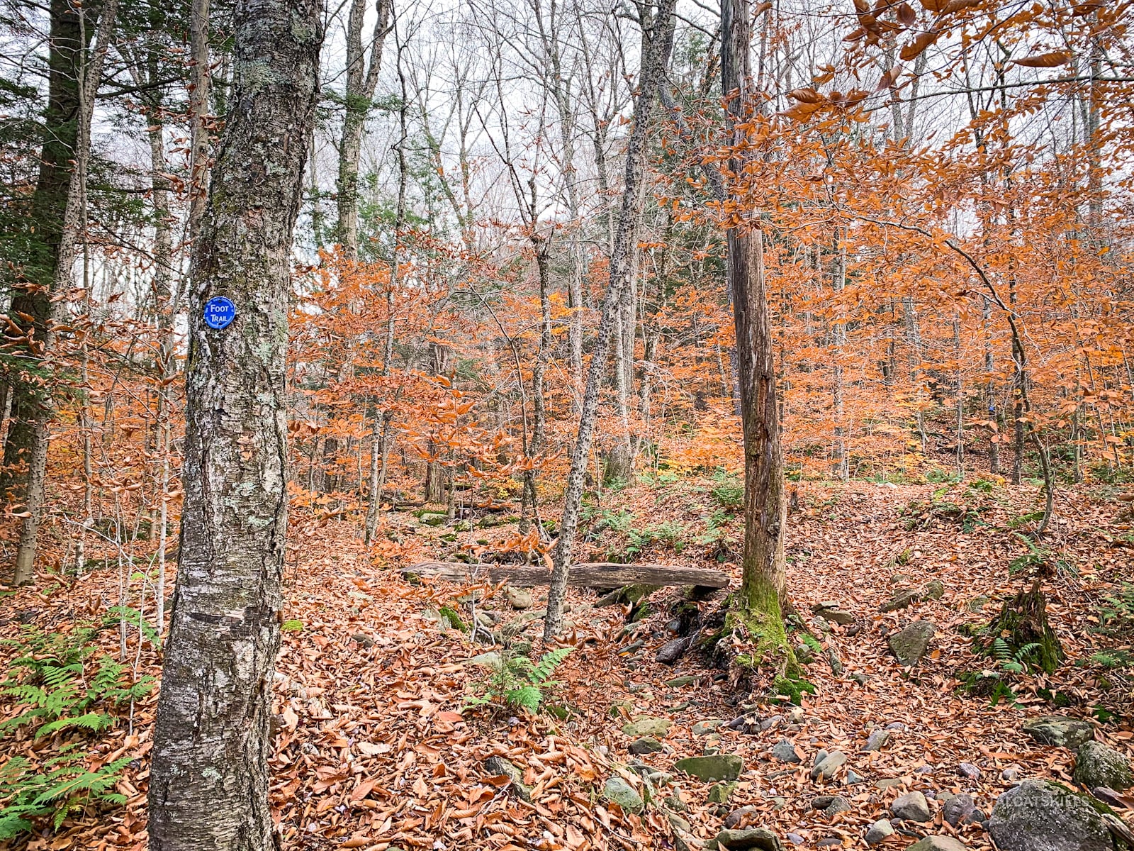
Soon after the third footbridge, I started looking for obvious places to get off-trail. I started at the spot shown below, which is roughly where the NYNJTC map shows the Fisherman’s Path begins. Gaia shows the trail starting a little further along the blazed trail, but, as it happens, I found the Trail Conference map to be super accurate all along this trail.
Warning! I waited for at least two days after the most recent rainfall to attempt this route. Many brooks and streams in the Catskills become torrential rivers after rainfall. You will see evidence of the power of water all along this trail.
Anyway, I began walking down along this small gully…
Very quickly I ended up on the Neversink. I started on the north/left bank, but quickly switched to the south/right bank. As I write this, I can’t remember exactly where I crossed the stream, or when, or how many times in total — but it was a lot.
What I do remember is how accurate the Trail Conference map seemed. Where the dashed red line crossed the solid blue line was where I crossed. Each time. Remarkable cartography.
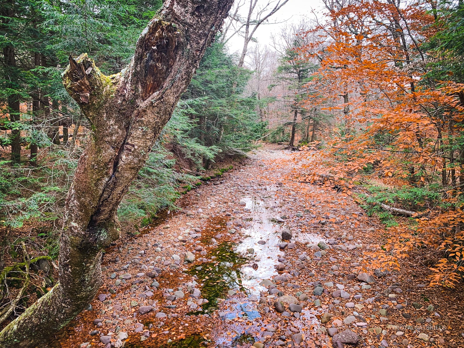
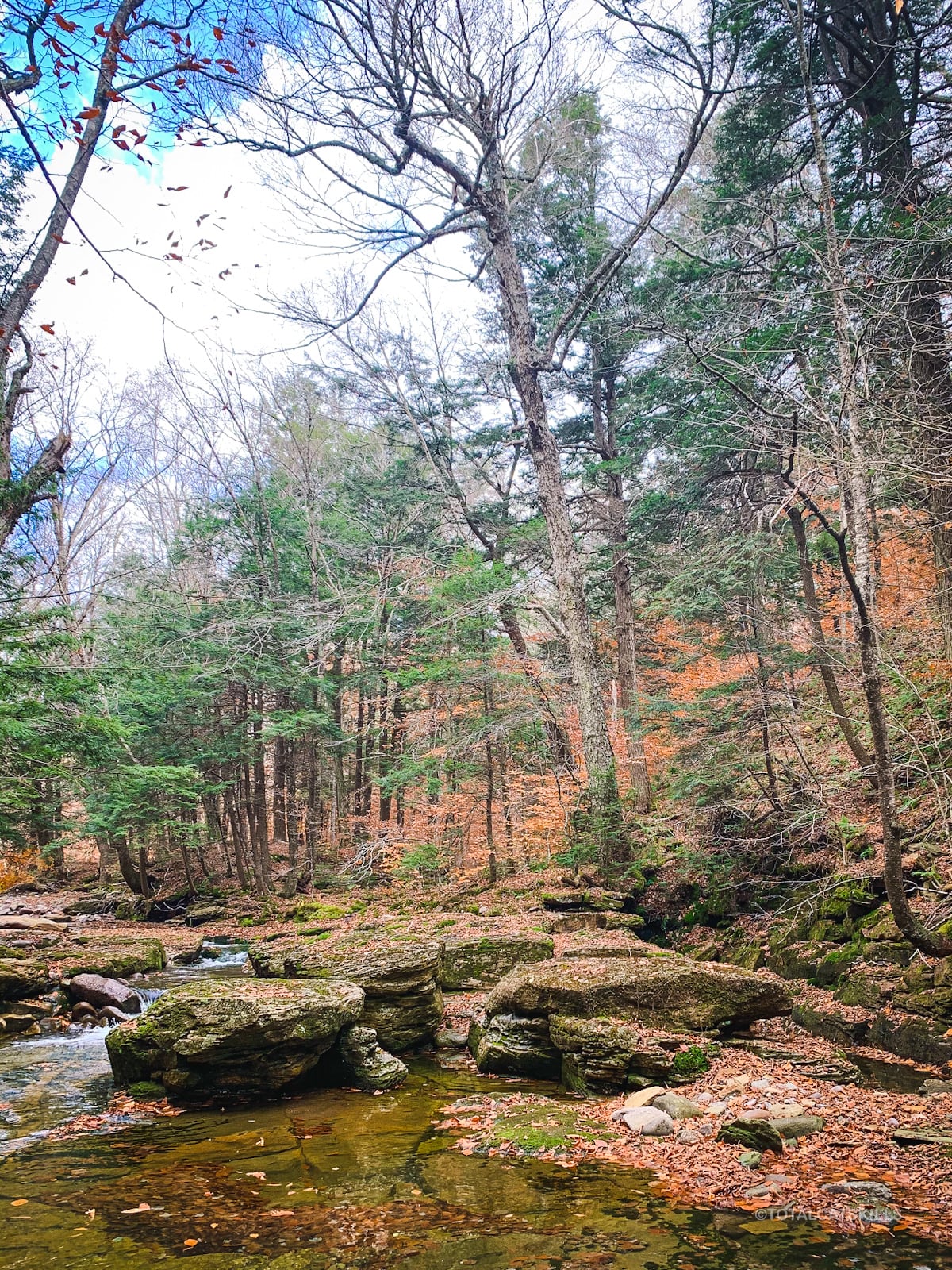
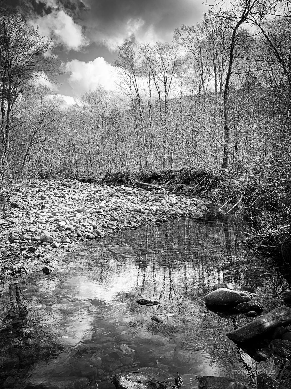
Right away, the “path” is spectacular, offering miles of deep riparian goodness…
There are several sections like the one below: open dry river bed, filled with large rocks, hefty boulders and tangled blowdown. Some are on bends, but some are on straight sections. All were tricky to navigate.
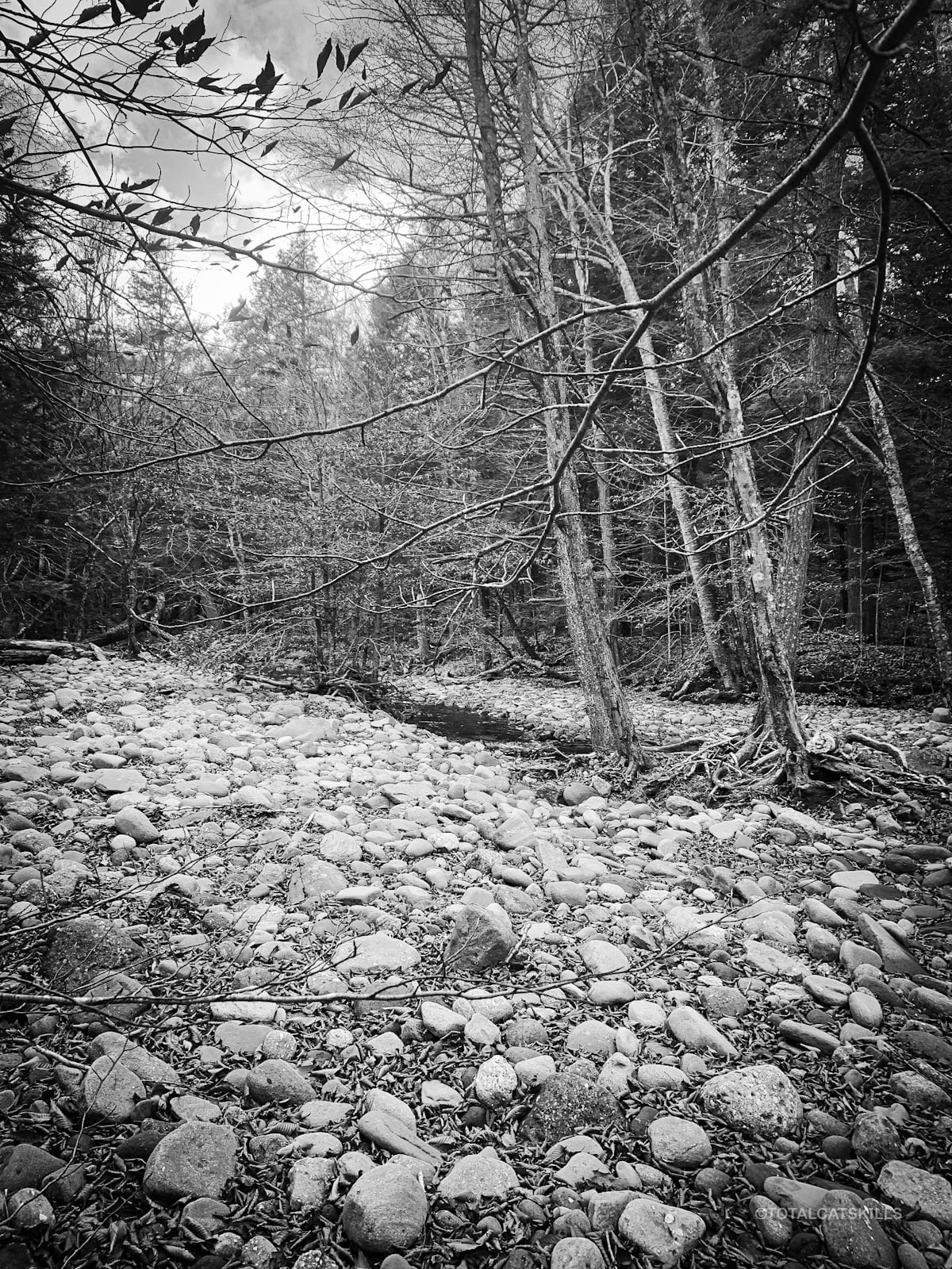
It can be difficult to spot the trail on the far side of crossings, even small crossings. And there are plenty of spots where the herd path either branches or disappears entirely.
There were plenty of moments when I was scratching my head. I tried to not check my location on my phone too much, so my full GPS track from this hike has many small diversions. At one point, on the return journey, I ended up heading down a river branch and had to double-back. It can be confusing.
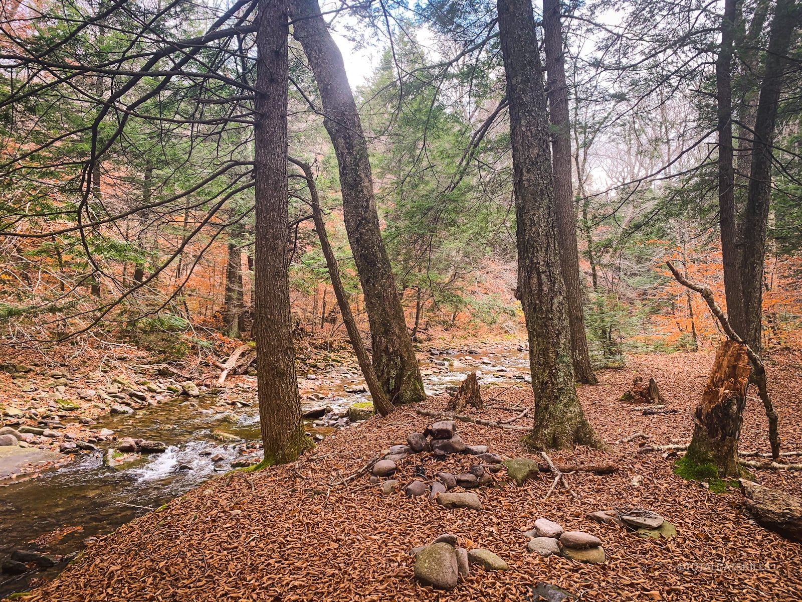
Fisherman’s Path Primitive Campsites
Within the first mile, there are many primitive campsites on both banks. Some are small, some are large. Many are well-established. Several are 150’+ from the water. Several are… not.
You will have to cross several sections like this…
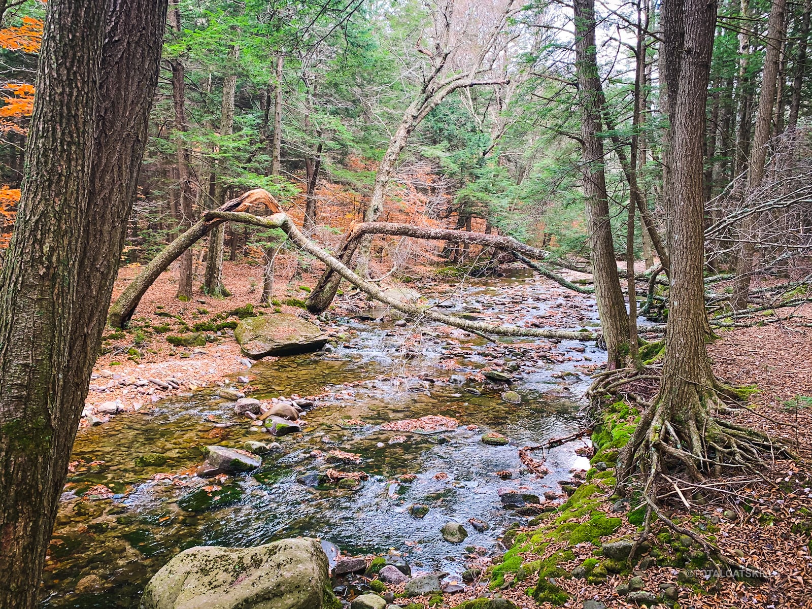
The Fisherman’s Path tracks alongside the stream quite closely. Sometimes, it wanders away, but never too far — the sound of the water is ever-present and a good aural handrail.
Pass through another primitive campsite…
Here, for example, the path was very clear and easy to follow…
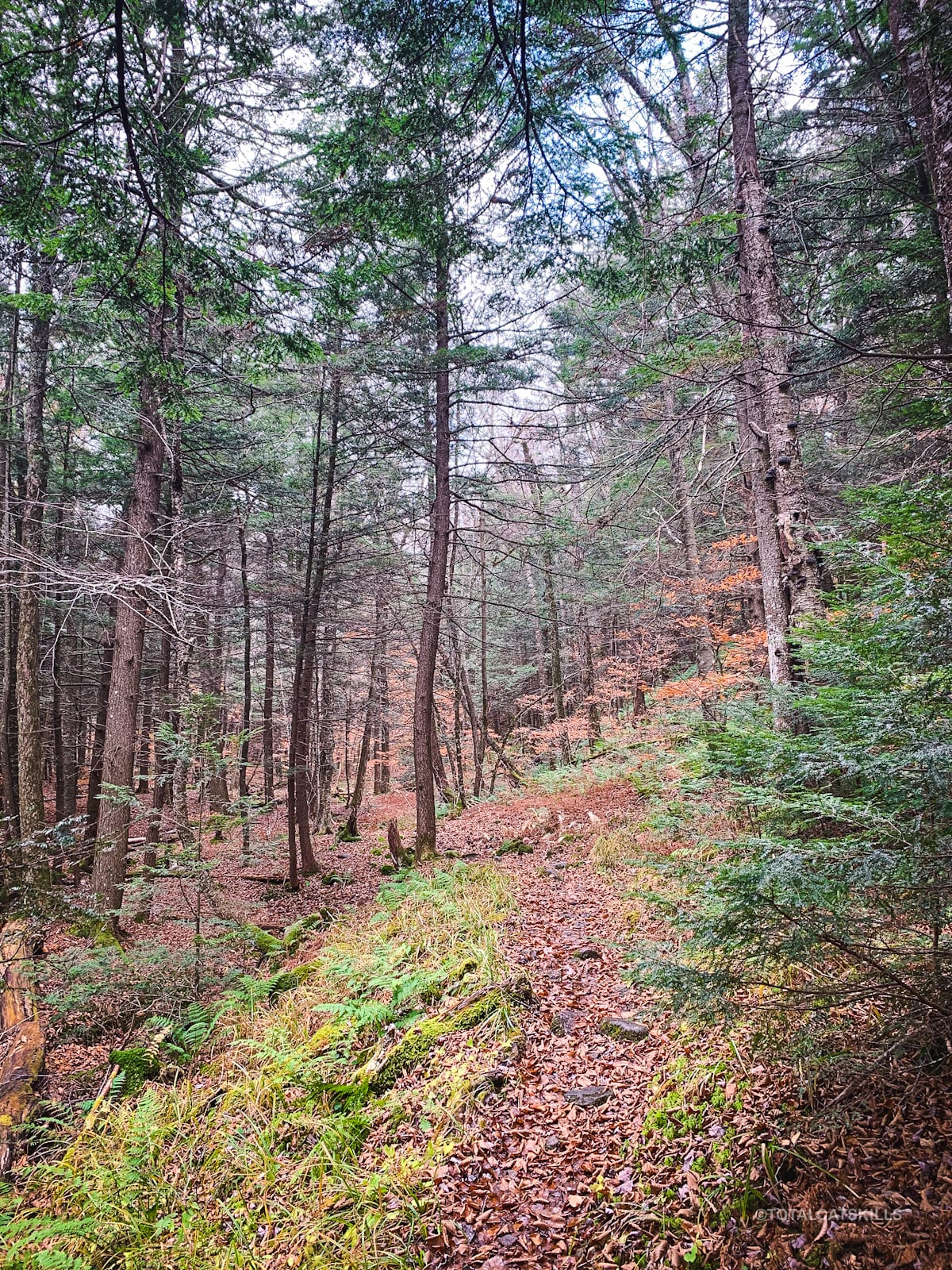
But sometimes it faded out and, for short patches, it would disappear completely.
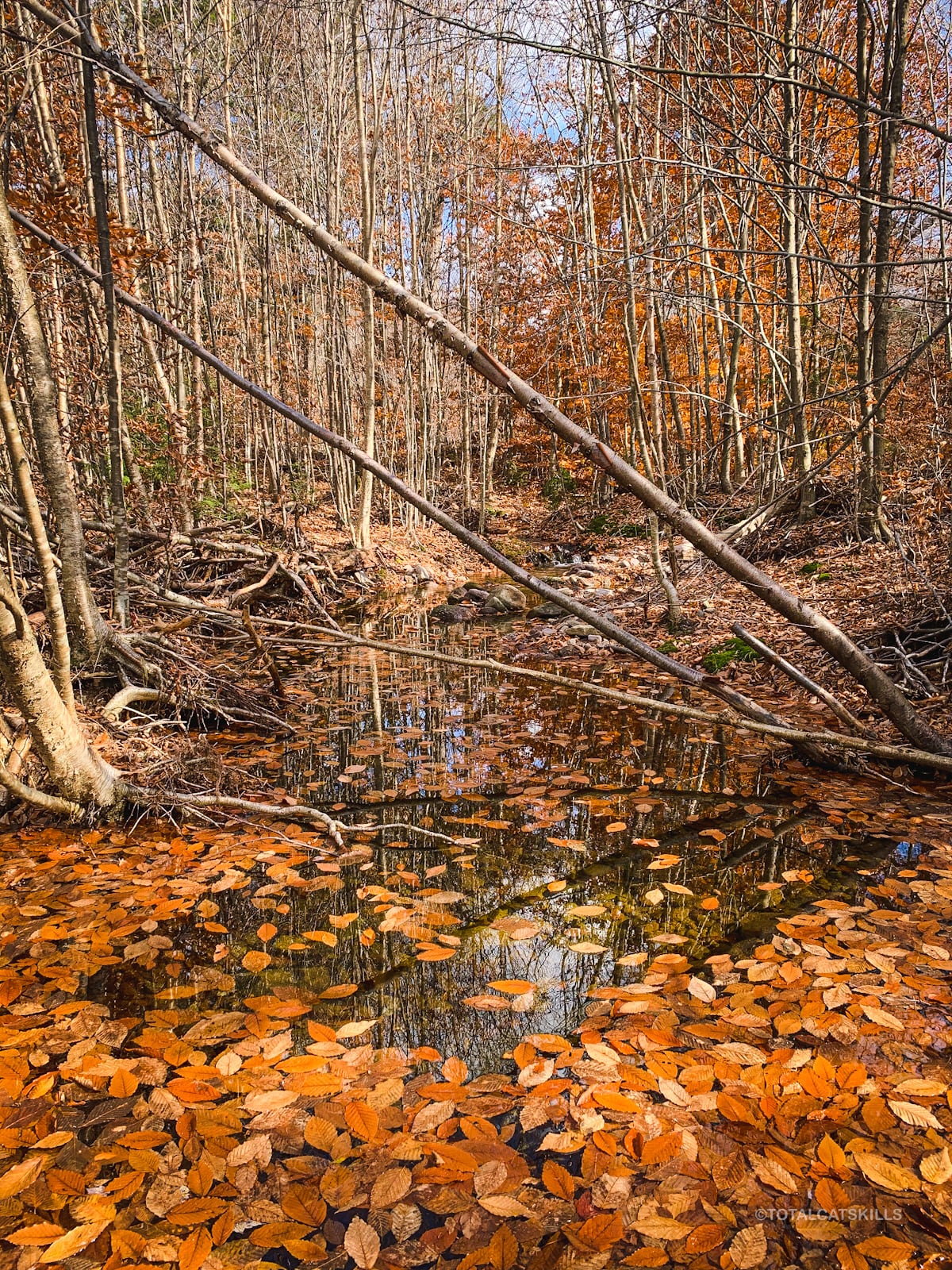
Autumn is a great time to visit this trail but I imagine any time of year is spectacular. The trail has a lot of ash and hemlock…
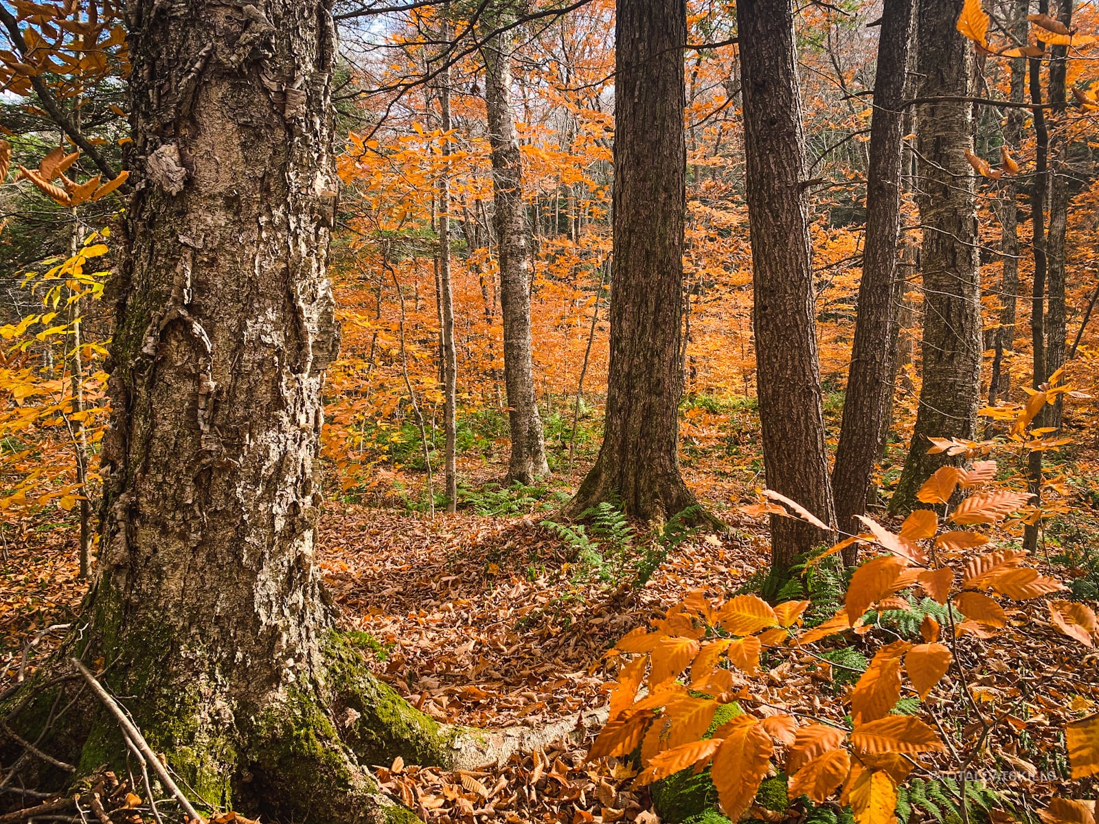
This spot, about a mile along the Path on the north/left side of the stream, marks the start of its most beautiful stretch. You’ll find yourself a little higher up, looking down.
Right after this is a small gully you must cross, after which you’ll come to an area I’ll call the River Rocks.
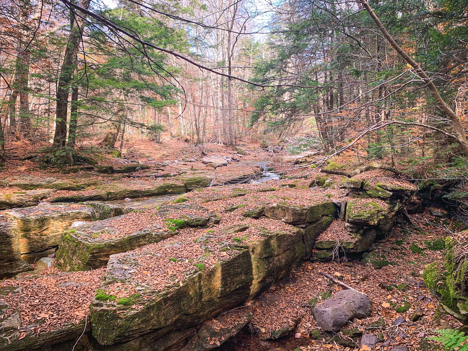
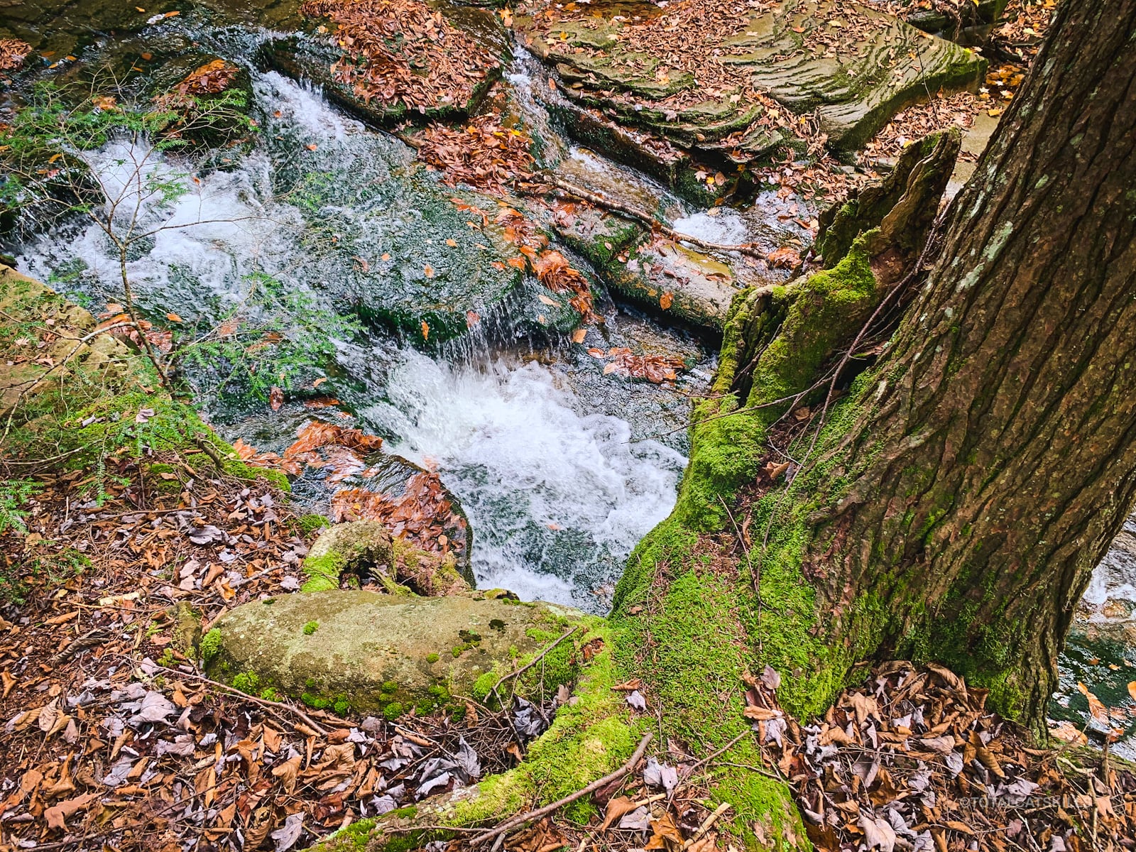
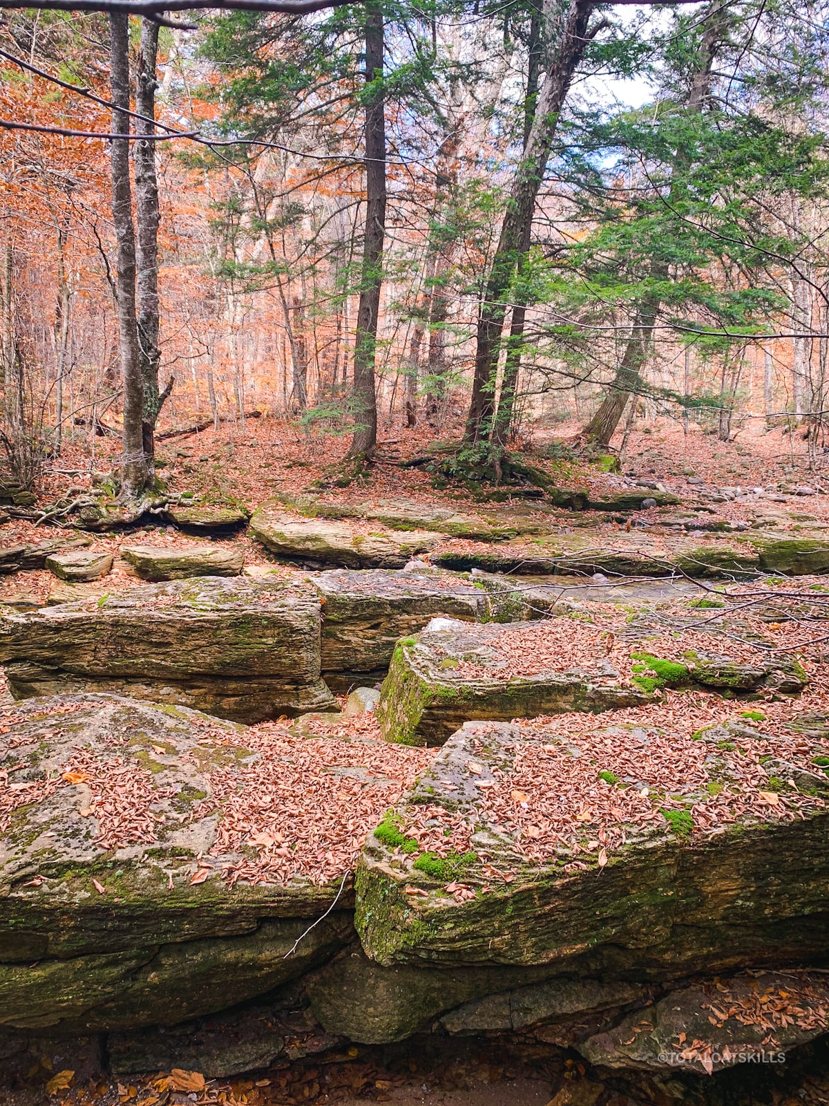
Fisherman’s Path: River Rocks
Make your way a little further along the north/left side of the Neversink, and then down to the stream’s edge. This whole area is so great.
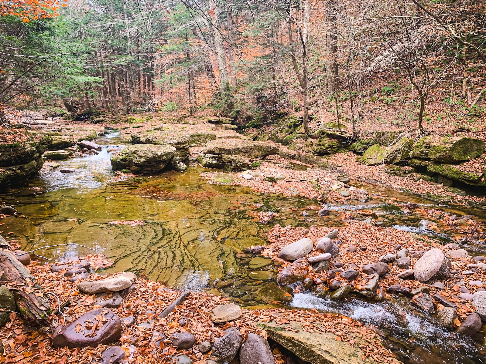
Continue making your way upstream, safely, toward the rocky area.
I asked in the Catskills Geologist Facebook Group — a great resource — about these formations. The consensus was that they are simple erosion features where water has worked on joints in the rock; and this valley has provided a lot of water flow over a long time.
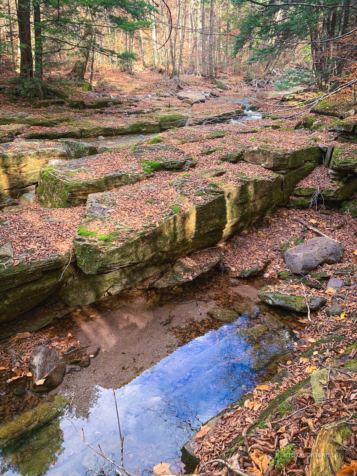
A good place to remind ourselves that these rocks are sedimentary and very ancient, hailing from the Devonian era (360-420 million years ago). They are spectacular to rock hop across and wonder about.
Fisherman’s Path: Second Half
After the River Rocks, the second half of the Fisherman’s Path is harder to follow. It’s fainter, more subtle, evidently far less used, and way more grown-in. Most people seem to come as far as the river rocks. The only reason to continue beyond them is probably to climb Rocky and Lone.
There are more tricky stream crossings…
I spent a lot of energy navigating here. I didn’t take too many photos.
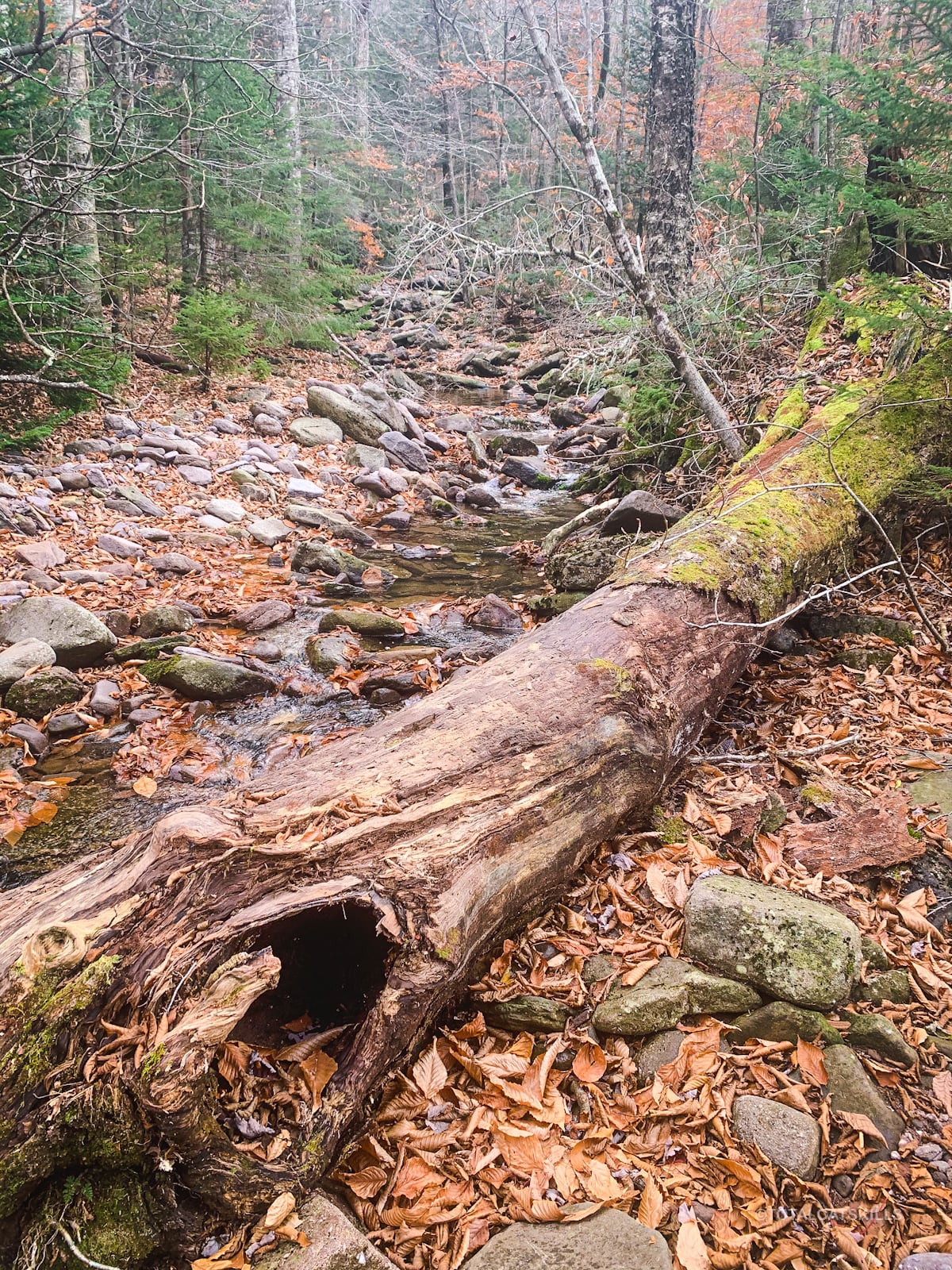
But there were patches of beauty throughout…
Most of the last section is on the north/left side of the Neversink.
However, for the final few yards you transfer once again to the south/right bank.
Fisherman’s Path Terminus
The Fisherman’s Path terminates at the mouth of a rugged drainage that runs downhill from between Rocky and Lone mountains.
Currently, a massive blowdown lies on the near side of the drainage’s mouth; the photo below does not do its size justice.
This spot is the starting point to hike Rocky & Lone — which, on this day, is exactly what I did next.
If you‘re not heading uphill, turn around and head back the way you came. The Denning trailhead is four excellent miles away.
Similar Hikes
This long, beautiful riverside hike feels unique in the Catskills. It’s like the hike along the Batavia Kill — but on steroids. It is less dangerous and even more enjoyable than the hike up Bear Hole Brook.

Fisherman’s Path Trailhead
Large but popular lot.
Google Maps Location: 41.964913, -74.452577
The map below shows the exact topographic location of the trailhead
Cell Service
Zero cell service on this hike. ZERO. My network is Verizon. YMMV.
The parent mountain for this hike is Slide.
