Disclosure: This content may contain affiliate links. Read my disclosure policy.
A very difficult hike that’s best tackled in a group with experienced hikers.
Trailhead info at bottom of this post.
Hiking Trail Description
This route is very long and very tough — still one of the toughest hikes I’ve done.
The ascent of Van Wyck is extremely steep. And the descent on the other side passes though a gnarly talus field that sits at the base of a steep cliff. After all that, the bushwhack from Van Wyck to Table — in black fly season — feels truly endless.
On the other hand, the first time I did this hike was with the Catskill 3500 Club and one member of our group was the lovely Marguerite — a septuagenarian, 420 gridder, and local hiking legend. It was a pleasure to spend time hiking in Marguerite’s company.
BTW, you might also enjoy…
- UPDATED › Best Bug Spray & Bug Repellent for Hikers
- CATSKILLS › Peakbagging The Catskills High Peaks (Ultimate Guide)
- STAY › Find Your Perfect Catskills Stay
- ADIRONDACKS › Wright, Algonquin & Iroquois Peaks
- LEARN › Teach Yourself How to Use a Compass
- ENTERTAINMENT › Best & Worst Hiking Movies
- Follow › My Instagram @TotalCatskills
- Follow › My Substack @TotalCatskills
- Follow › My writing for Times Union
Van Wyck Route Notes
Our group assembled at the trailhead for the Peekamoose-Table trail on Route 42, then hiked about ¼ mile west on the road to gain entry to Bear Hole Brook.
I don’t recommend this beginning. Instead of this very sketchy start, I recommend using the old woods road that begins about 300 ft further west on Peekamoose Rd. It’s quite easy to follow and soon re-joins the GPS route shown on this page.
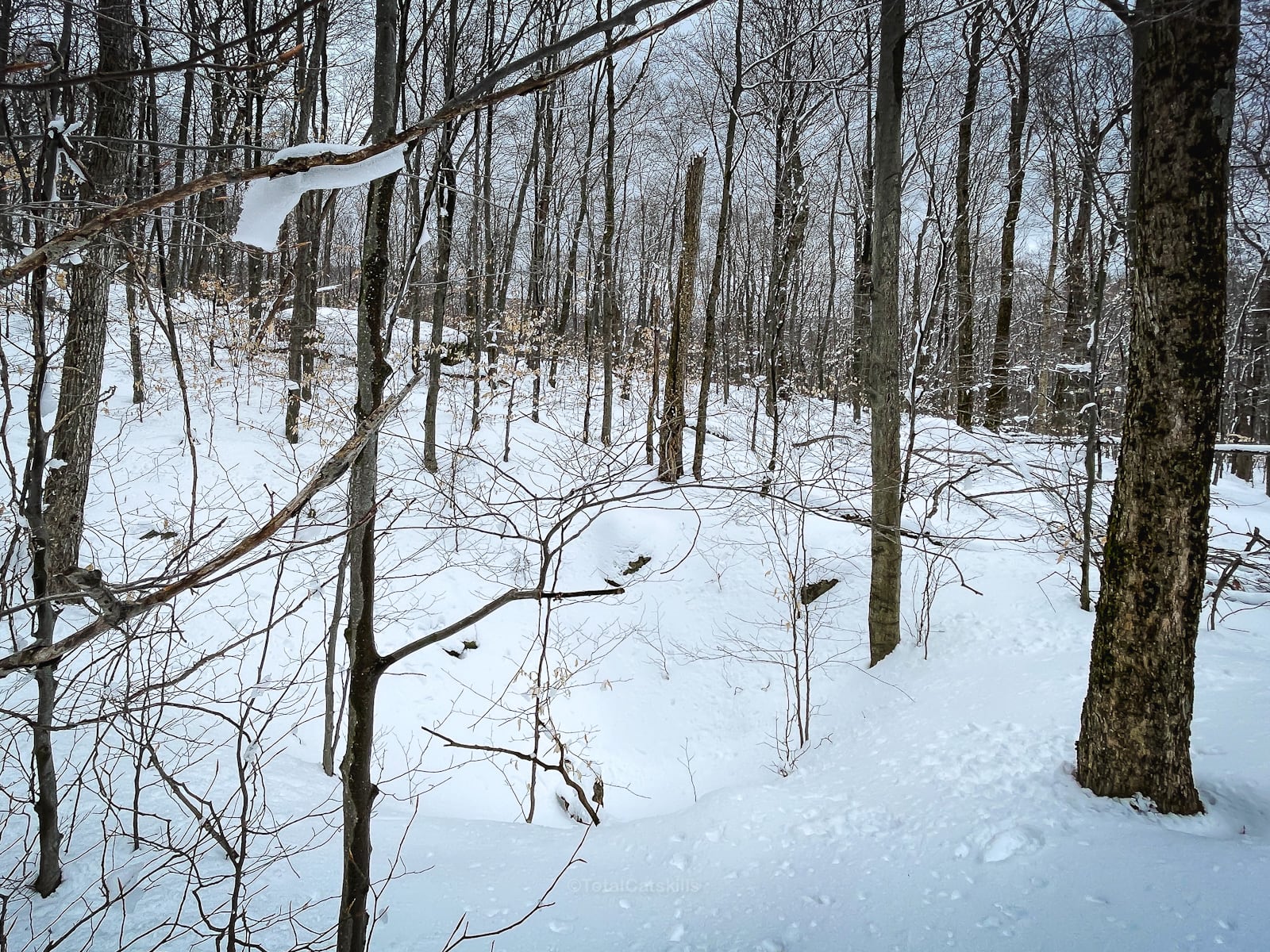
We began making our way up Van Wyck’s southern ridge. There are a lot of old woods roads here, and the area is dotted with stone ruins…
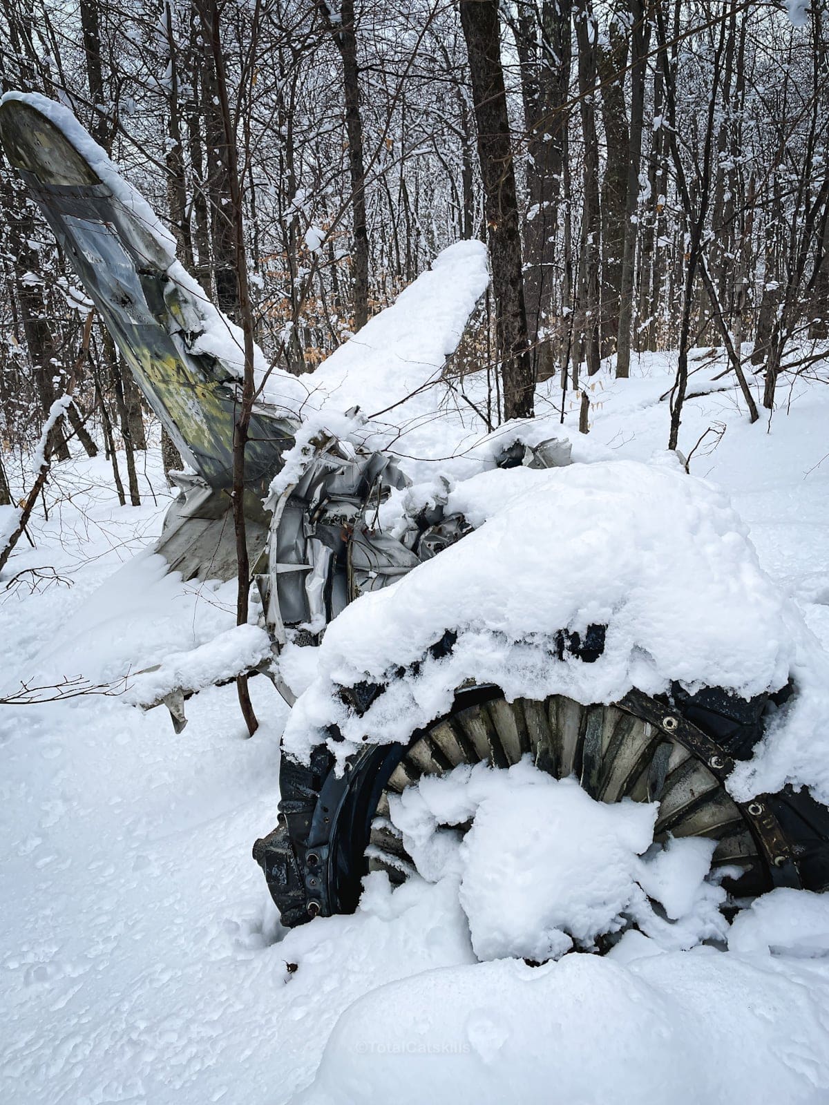
Van Wyck Plane Wrecks
Very quickly, we came to the first of two plane wrecks on Van Wyck.
The lower wreck is a single-engine T-33 military trainer jet that crashed during acrobatics testing in 1962. Both occupants were killed. The wreck is located at apx 2280’ / 41.92762 N, -74.43955 W.
The site is large and obvious, even in the spring growth. This is just a small part of it…
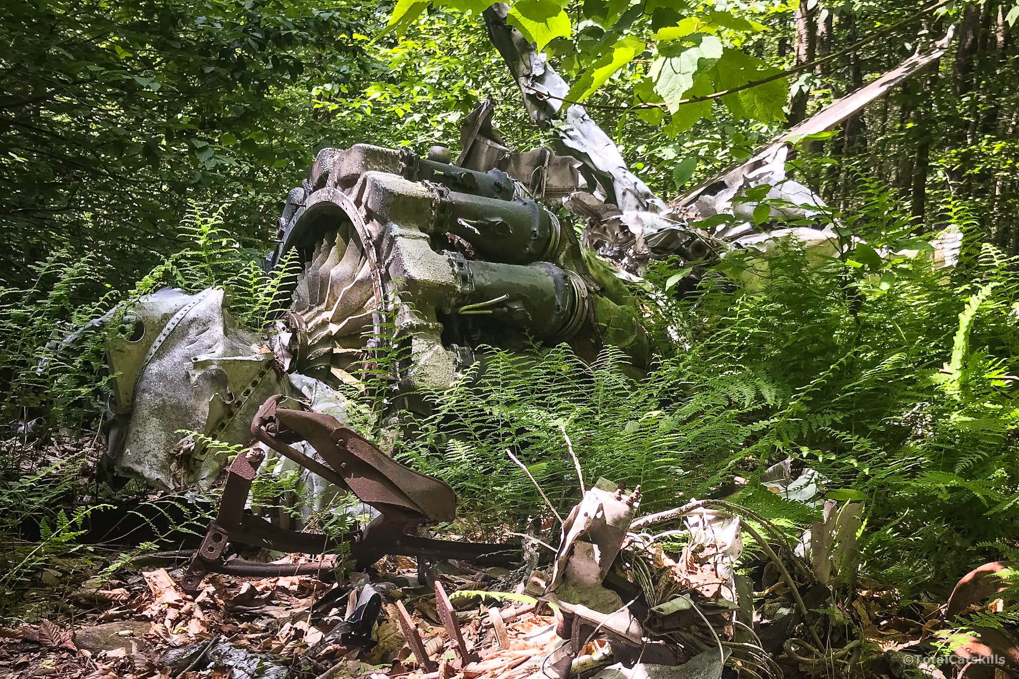
On my first hike, we did not find the second site, a civilian plane wreck from 1977.
In March 0f 2023, I re-hiked Van Wyck, with a tip for its location, and found the upper wreck easily at 2650’ / 41.945054 N, 74.437503 W.
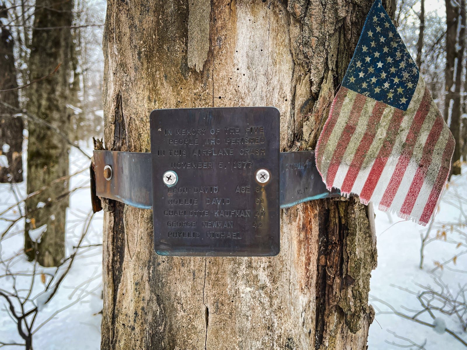
There are many wrecks in the Catskills. They are fascinating but tragic sites. Please be respectful.
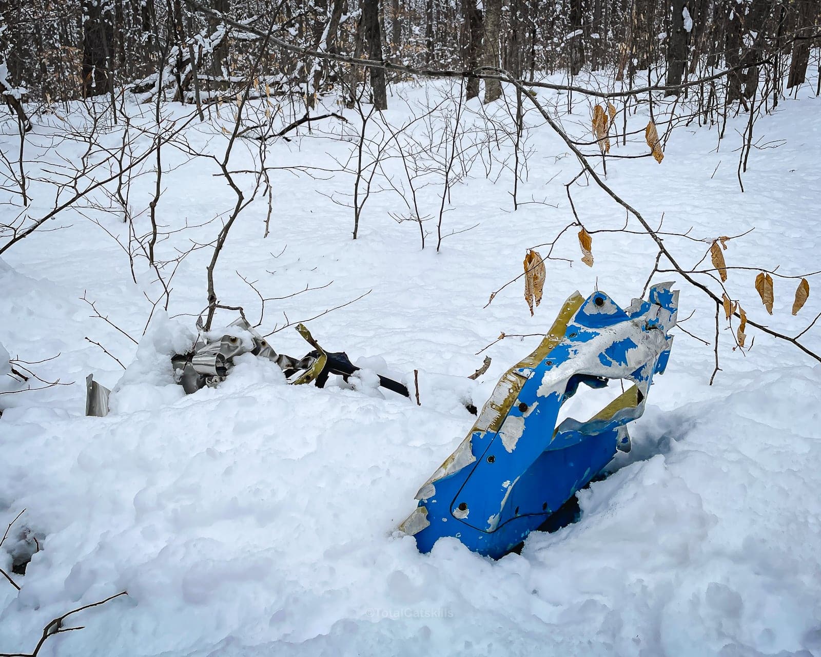
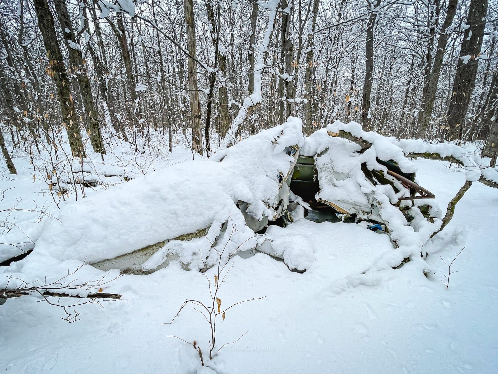
Both wrecks are on the the main ridge. It’s relatively easy to hit both on your way up.
Not far from the upper wreck, you’ll find two large…
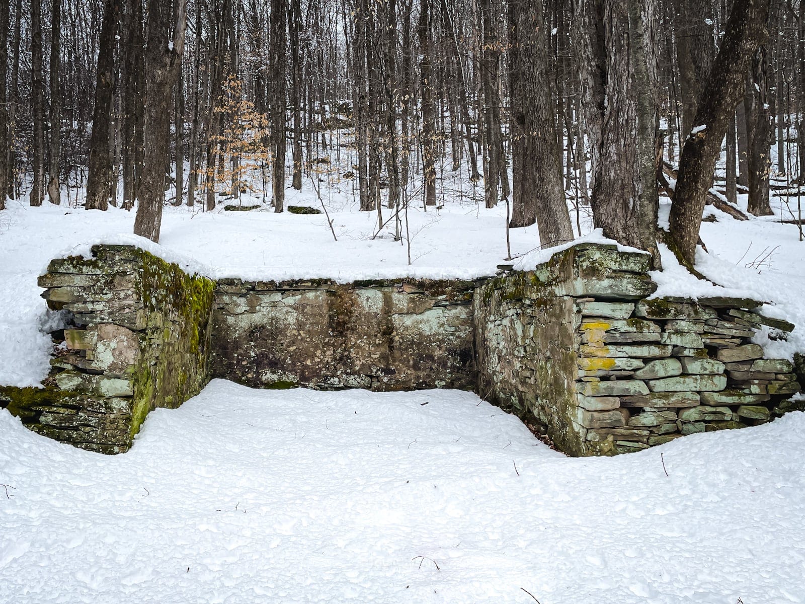
Bear Holes
The bear holes are at 41.94923 N, -74.43612 W. Basically, just two very large holes right next to each other. Quite odd to find in the woods.
Supposedly, they were used to trap bears, but I’m dubious. A bear would have no problem escaping either hole. Maybe they had steeper sides in the days of yore? Who knows.
They don’t photograph well, but here’s what one looks like in winter…
As it is, their proximity to each other, and their utility, are likely forever a mystery. Definitely worth checking out, though.
After the bear holes, the route to Van Wyck’s summit becomes intensely steep.
Van Wyck Summit Climb
In summer, it’s tough going. In winter, with snowshoes on, you’ll be hanging on for dear life.
At the 3000’ contour, look for a small cave.
Above 3000’ the hiking gets much easier, though the brush is very thick.
You may find a herd path or two.
Make your way to the summit, which is well treed-in but marked with a small cairn.
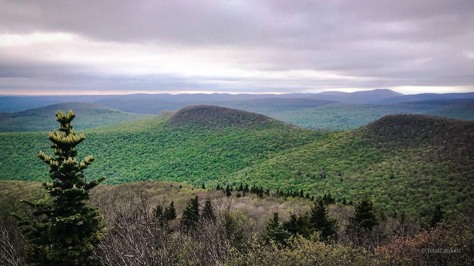
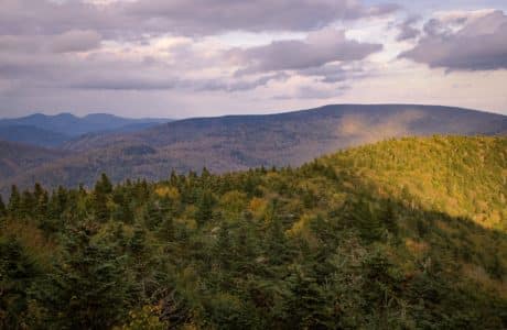
A little southeast of the summit is an absolutely wonderful open ledge that’s the perfect spot for lunch. The view is apx 180° and centers dramatically on Table and Peekamoose to the east…
 You’ve got the basic details, but there’s so much more…
Unlock this site now to get complete intel on every route, including my full photo galleries, personal insights and tips. Elevate your next hike with deep trail beta. Experience hundreds of amazing routes at their absolute finest. With Mountain-Hiking.com, you’re not just skimming the surface.
Sean

Similar Hikes
This is one of the most memorable and scenic Catskills hikes.
It’s also one of the hardest hikes in the Catskills.
You might also enjoy hiking Table, Peekamoose, Lone & Rocky as a loop.
Read More
Get full access…
Get instant access to the full version of this site and enjoy great supporter benefits: full galleries, full trail notes, early access to the latest content, and more.
Hot on the website right now…
Follow for more…
Follow my @TotalCatskills content on Instagram for regular hiking inspo and safe, inclusive community.

Van Wyck to Table & Peekamoose Trailhead
Small and busy. Get there early.
Google Maps Location: 41.914934, -74.429457
The map below shows the exact topographic location of the trailhead
11 responses to “Van Wyck to Table & Peekamoose”
Your comments are welcome here…
The parent mountain for this hike is Van Wyck.
i am planning to go and search for this crash site. I have an idea of where it could be but not 100 percent sure. is there a map on all trails app that i can follow to get to this site? can u email me with the exact location so it is easier for me to find it?
The exact locations of both plan wrecks are in the trail guide which is behind the Patreon paywall. I appreciate your support.
I don’t know if you’re still reading comments from this, but that first wreck was my grandfather. Is it easy to get to? I know my uncle and father were maybe wanting to visit it.
Hi Brooke. Yes, that lower wreck is relatively easy to get to for people with backcountry hiking skills. There’s no trail, so it requires off-trail navigation. I would love to know more about your grandfather, if you feel comfortable sharing. I would be happy to include some details in the post, if you like. Feel free to reply here or use the contact form on the site to start an email exchange. Whatever works for you. Thank you for writing.
I just plotted a route and it’s 1.7 miles from the trailhead to the site, with about 1,100 feet of elevation gain. So it would be a round trip of about 3.5 miles and take 2-3 hours depending on your speed. The route follows old woods roads for the most part, and the last half mile is wild forest.
Completed this hike 11/7/20. Used the old logging road for the first 1.5 miles or so that led directly into a herd path that has been blazed with cut out beer can bottoms nailed to trees for about another .75 of a mile. Not sure how recent this was done but the expiration dates on the beer cans were printed with a 7/20 date so Id imagine that this is fairly new. So essentially, the real bushwhack didnt start until about 2.5 miles in. Following the summit of Van Wyck through the leafless trees made the relatively flat trek fairly easy. With luck, we stumbled upon one of the plane crashes just before the ascent up. The debris field is absolutely massive with this wreck. Upon our poking around of the site, we noticed a small plaque strapped to a tree memorializing the 5 victims of the crash as well as the Nov 5, 1977 date the accident happened. The gps coordinates for the crash are 41.94505, -74.43769. This also happened to be exactly mile 3 of our hike. After that, it was an extremely steep ascent to the summit of Van Wyck where we found the stunning views of Table, Peekamoose and the ridge line we would follow to get there. The summit of Table loomed intimidatingly as we got closer but the climb never really got very steep to the summit. From there it was a very quick pace over to Peekamoose as we were finally back on trail which felt like a paved road considering the first half the hike. Definitely doing Van Wyck again….and again lol. Sorry for rambling but this was just a great hike!
Wow, great notes! Super helpful. Glad you nailed it. That’s a tough hike. The section between Van Wyck and Table is rough. 🙌
Beer can bottoms are still in place, as of March 2023!
Is this bushwacking in keeping with LNT principles? I worry that especially with the reach your page has, that people will trample and harm these lands.
Yes, it is, if done correctly. It is one of the best ways to experience wilderness. No-one should step off trail without being fully prepared in terms of knowledge, gear, and principles. LNT is about not trashing nature. It is not about not experiencing nature.
I have done this hike with a few modifications. I did not bother to hike up the brook but took the woods road for about .3 miles before heading NNW. After picking up the first crash site, I headed due north along a “spine”, hitting the second crash site and the bear holes.After that the climb up Van Wyck which is steep at 27%. This can be mitigated by heading slightly west and then up. After taking in the view from Van Wyck, I headed along Catskill divide which was pretty open until the final ascent up to Table or at least the trail to Table. This is interesting as you can easily see that the land drops off on both sides. This is about a 1.2 miles walk after the descent off Van Wyck or about 2 miles total. From There I went to the “summit” of Table and the followed the trail to Peekamoose and downhill all the way to the car.