Disclosure: This content may contain affiliate links. Read my disclosure policy.
Clockwise from Big Hollow. The hard way is the best way.
Trailhead info at bottom of this post.
Hiking Trail Description
This route crosses some of the most beautiful hiking trails in the Catskill Mountains. It starts with an easy stroll along the southern bank of Batavia Kill, then gradually increases in ruggedness as you climb Blackhead’s northern ridge.
Blackhead’s summit is a distinctive treed-in junction with three signs pointing in three directions.
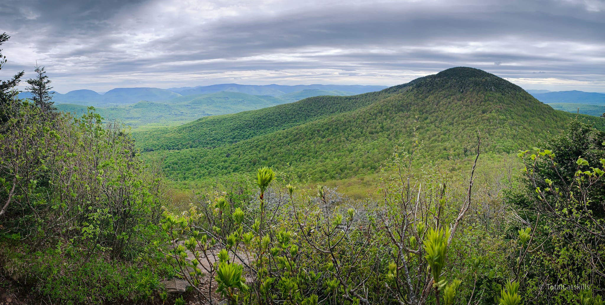
Between the two summits is wonderful hiking, two spectacular views, and some excellent rock scrambling. Finally, Black Dome has its own viewing ledge, close to the summit, with a dramatic view of Kaaterskill High Peak.
I’ve wanted to re-do Blackhead via this route for a long time. I first climbed it in winter, hiking it in the opposite direction: coming up the Black Dome trail to Lockwood Gap, then over the summit, and out via the Escarpment Trail and Batavia Kill. This route is the reverse. If you can handle it, I think this is the best route to hike Blackhead.
Blackhead is a beloved peak that sees a lot of foot traffic.
BTW, you might also enjoy…
- UPDATED › Best Bug Spray & Bug Repellent for Hikers
- CATSKILLS › Peakbagging The Catskills High Peaks (Ultimate Guide)
- STAY › Find Your Perfect Catskills Stay
- ADIRONDACKS › Wright, Algonquin & Iroquois Peaks
- LEARN › Teach Yourself How to Use a Compass
- ENTERTAINMENT › Best & Worst Hiking Movies
- Follow › My Instagram @TotalCatskills
- Follow › My Substack @TotalCatskills
- Follow › My writing for Times Union
On weekends in the warm months, the medium-sized parking area on Big Hollow Road fills up very quickly each morning.
Even in winter, when cars have to park an additional mile out from the medium-sized lot, the last section of paved road is always remarkably busy.
Blackhead via Batavia Kill Hiking Trail
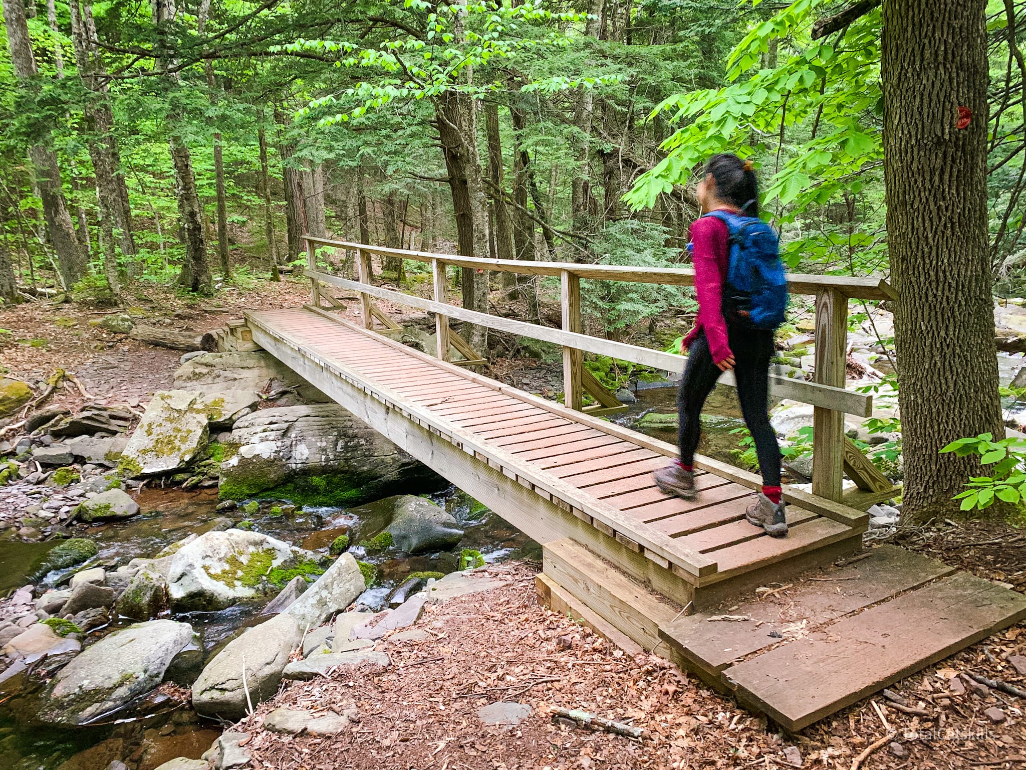
The ½ mile of trail between the parking area and the first junction is delightful. So easy and beautiful. Follow the red blazes. There are three sweet footbridges to cross. This is the middle one…
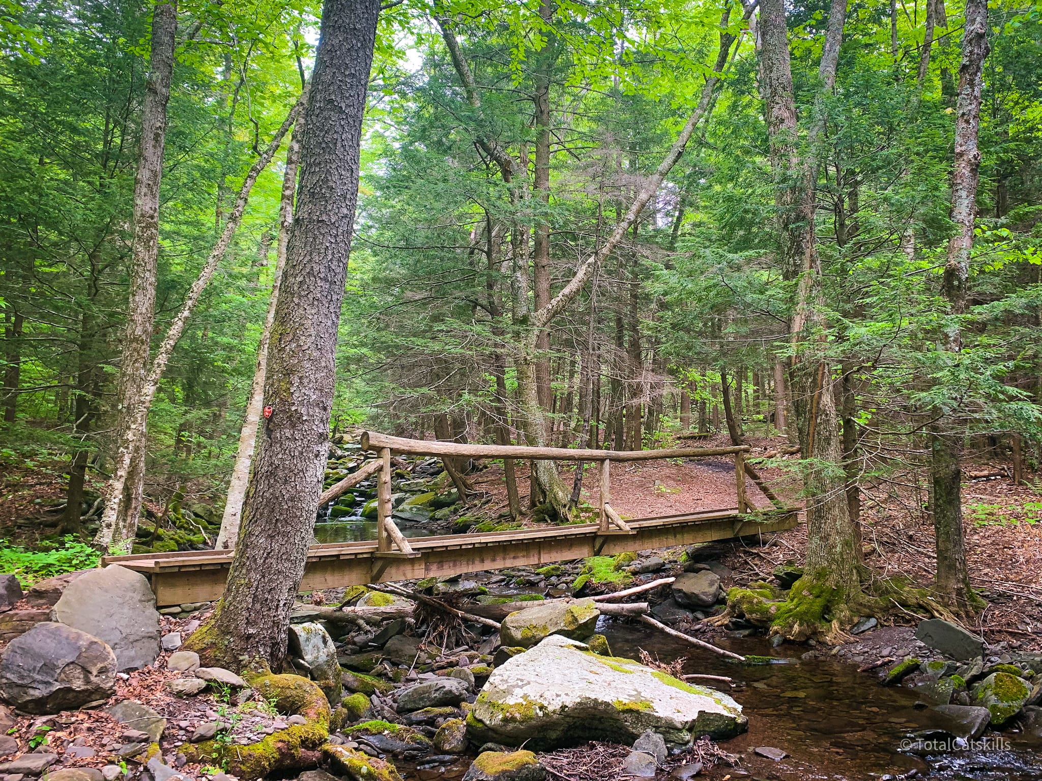
On the left side of the trail, Batavia Kill flows down from Blackhead after draining its northern ridge. At the first junction, switch to the yellow trail and head toward the Batavia Kill lean-to.
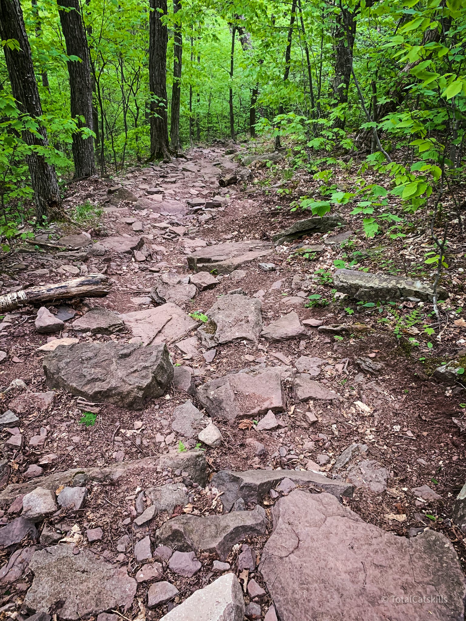
The first 1½ miles of the hike is easy, with only 600’ of elevation game. And it’s so picturesque.
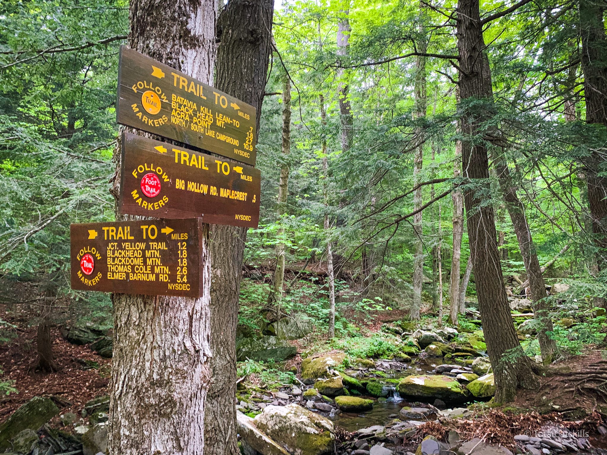
After the lean-to, the trail turns up a switchback, left then right, until you come to the second junction.
This is a good spot for a quick snack to fuel up for the rugged one-mile hike to the summit.
Turn right, switching to the blue Escarpment trail, and head up.
At first, the trail is easy enough, through mixed woods, and pretty level…
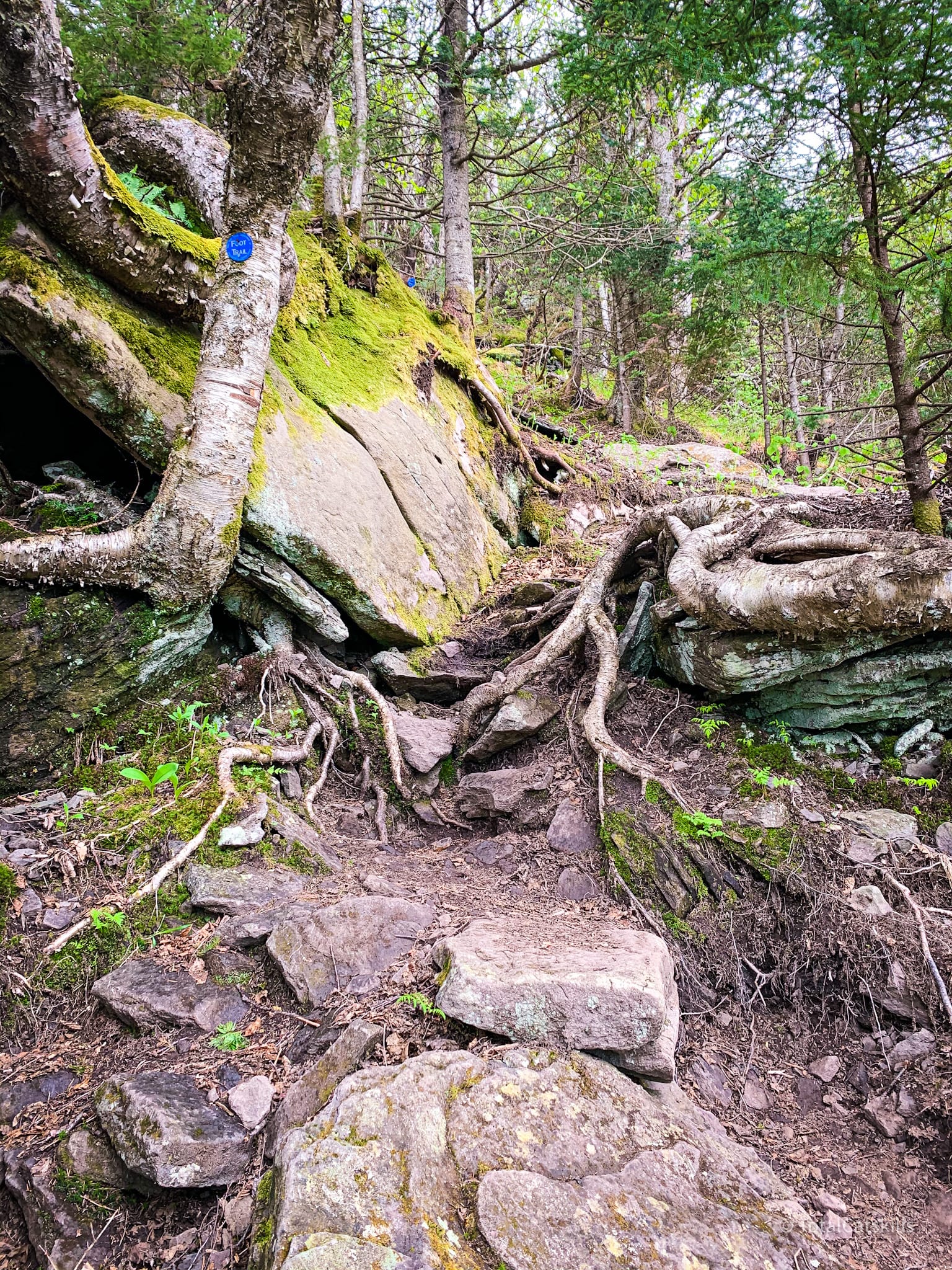
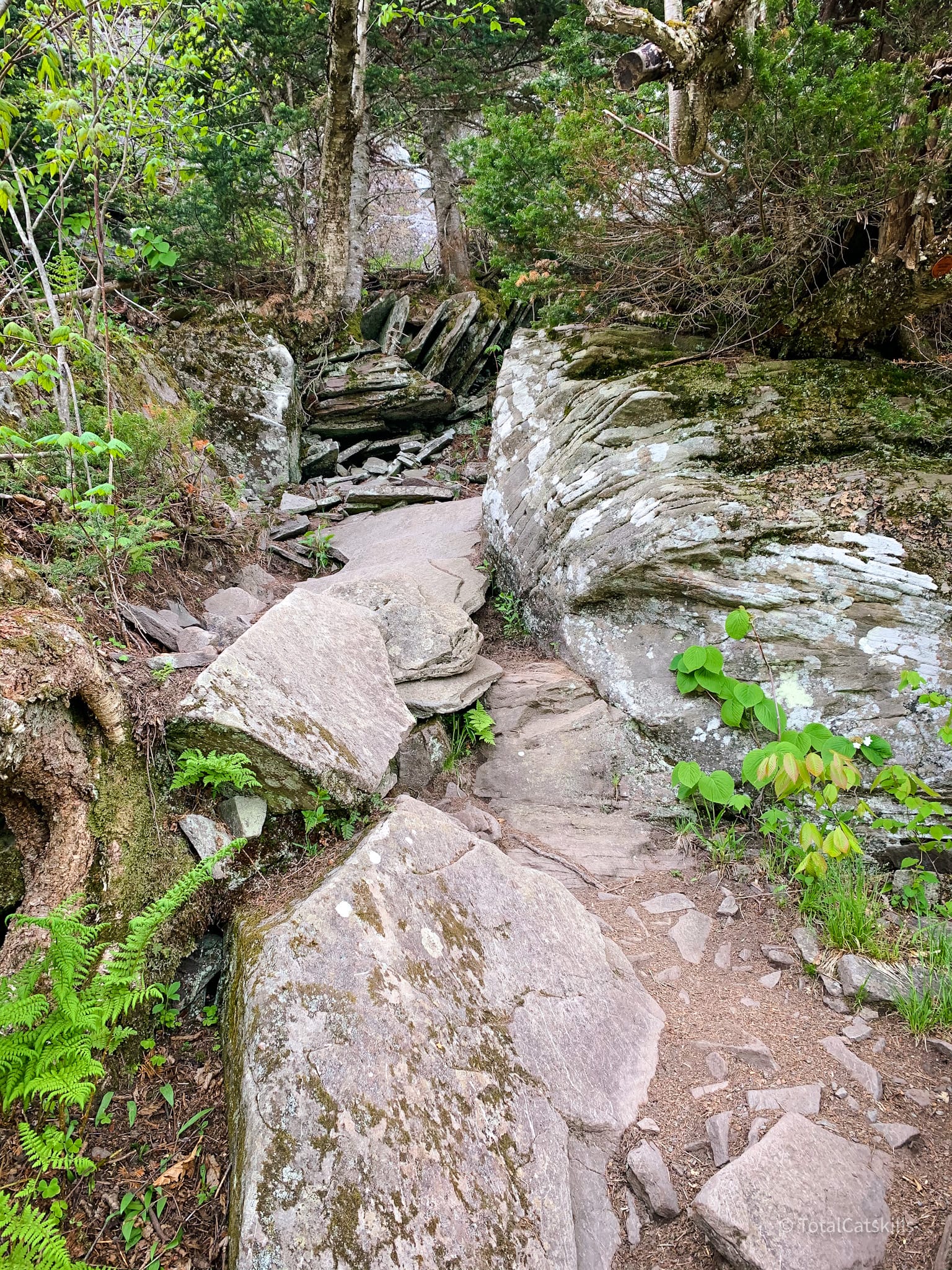
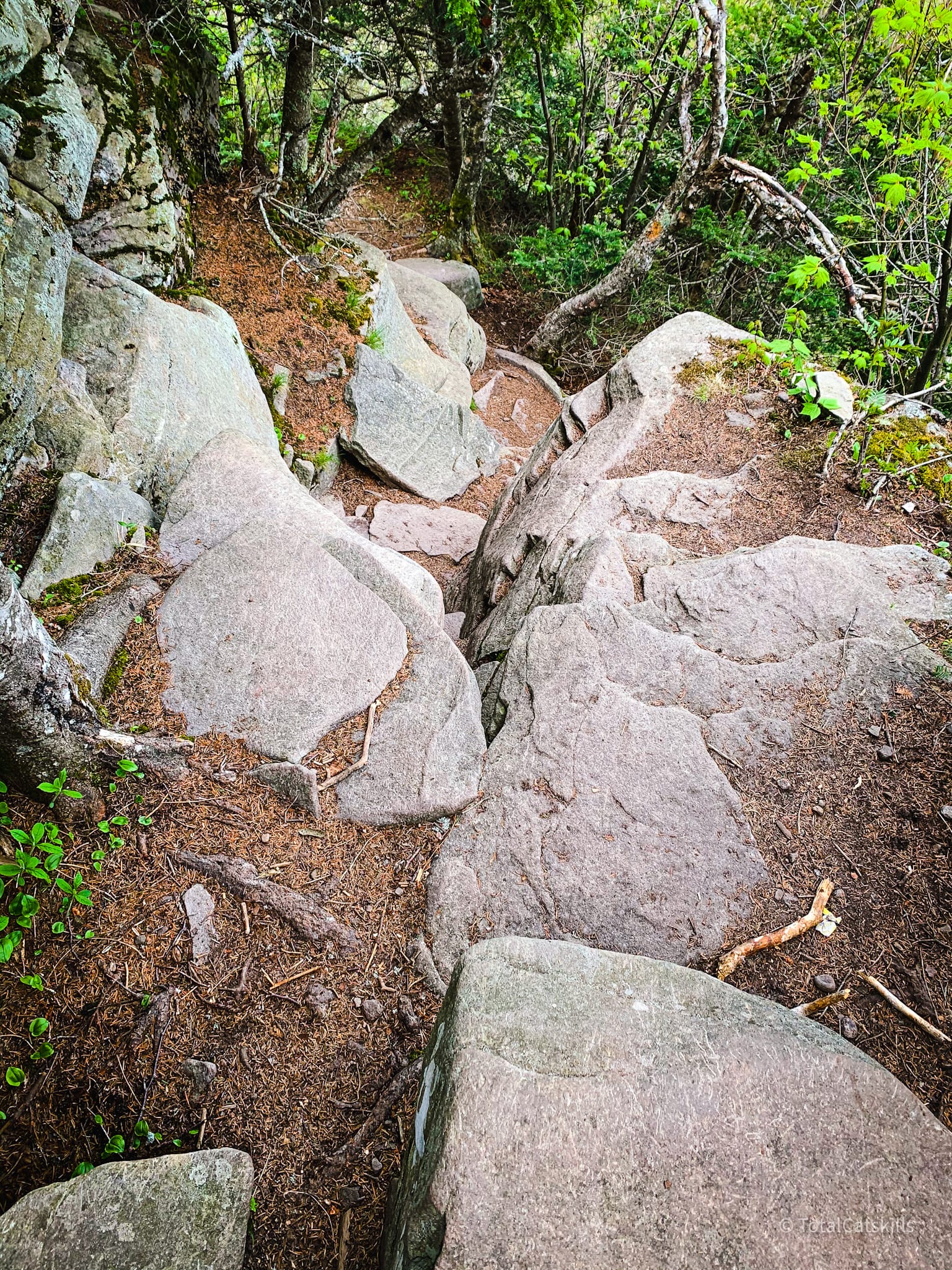
The higher you climb, the more rugged things get — in the best way.
Blackhead Mountain Above 3500’
Once you pass the 3500 FOOT ELEVATION sign, you still have 440’ vertical to climb.
The trail gets rougher and rougher…
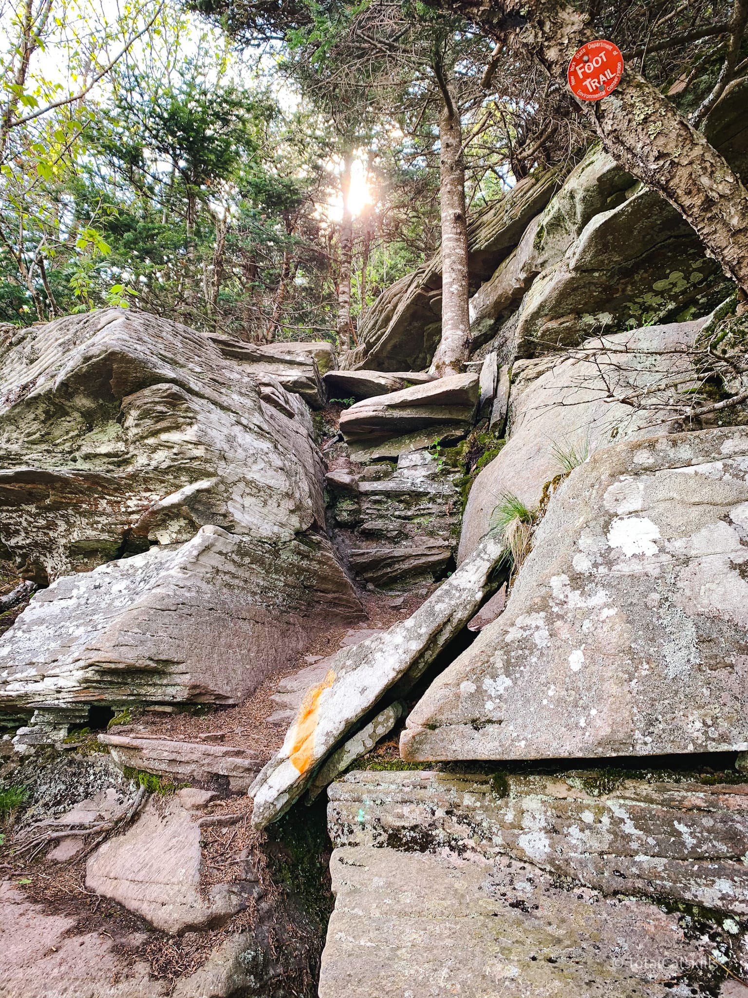
There is one very steep, jagged section (which is a lot of fun) right before things finally start to flatten out.
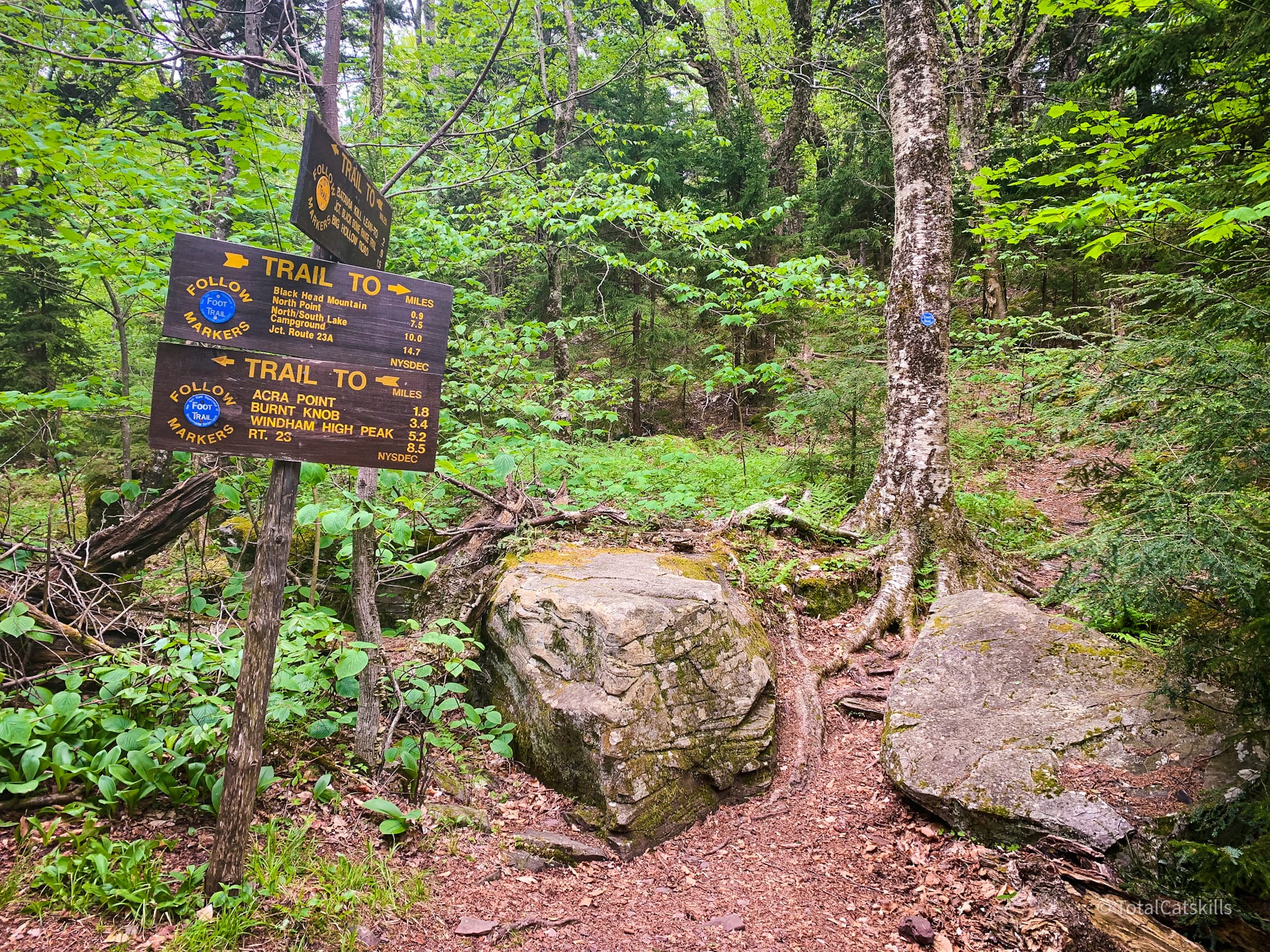
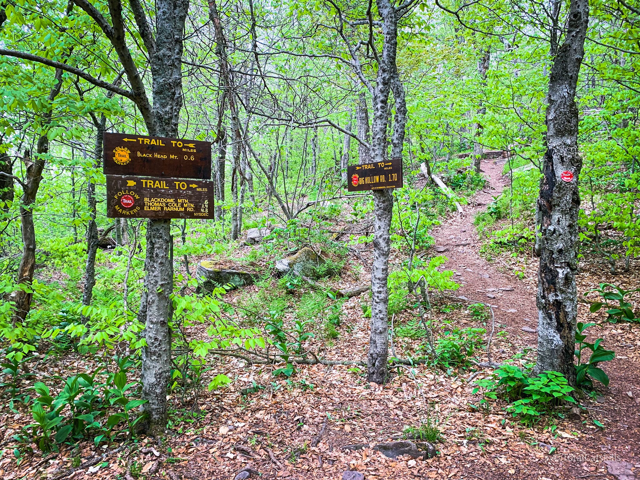
You’ll make your way to this exposed ledge, which marks Blackhead’s summit.
There are three wooden signs at this junction: one points back down the trail you came up, one points right toward Lockwood Gap and Black Dome, and one points left toward Dutcher Notch.
Camp Steel Lookout
I wanted to check out the lookout on the latter trail, which leads down to and over the hugely underrated Arizona Mountain. So my daughter and I hiked toward Dutcher Notch a little bit.
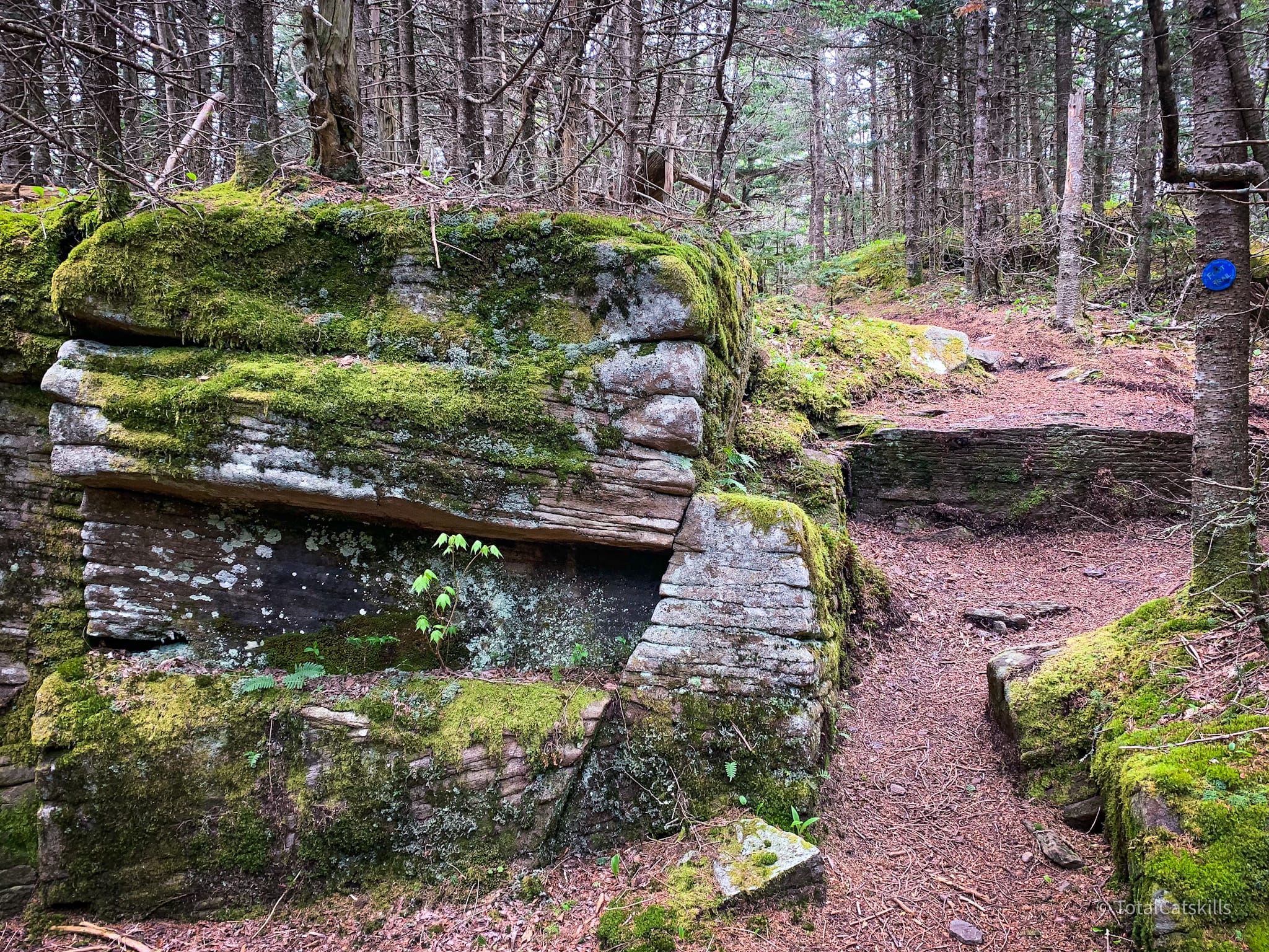
The trail is pure pine bed heaven. There are a few small ledges to climb down, but nothing hectic.
Soon you come to this modest ledge…
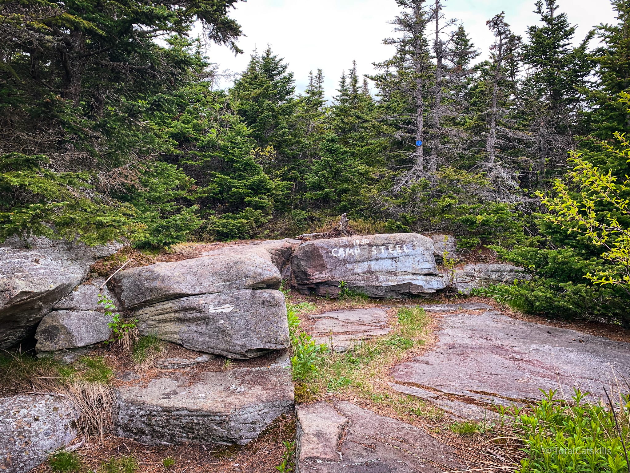
When the leaves are on the trees, the view from Camp Steel is nothing great. I’m looking forward to revisiting this spot in winter, to see if that improves anything.
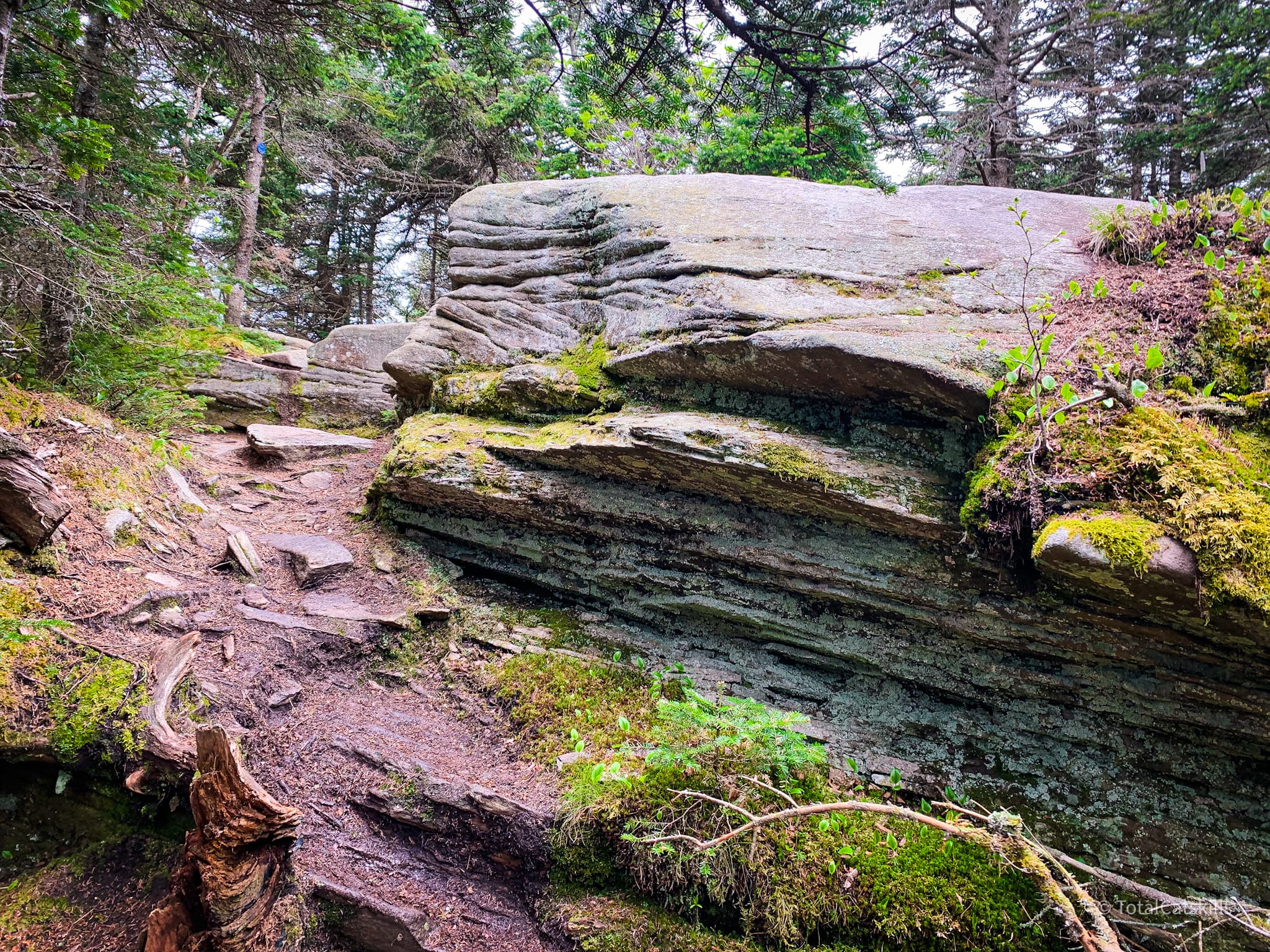
I love out-and-back routes. I love getting to see the same trail from the opposite direction. On our way down, we’d passed this glorious formation which I only noticed now, on the way back up…
From Blackhead to Black Dome
Back at the summit of Blackhead, turn left and follow the yellow trail down to the next junction at Lockwood Gap.
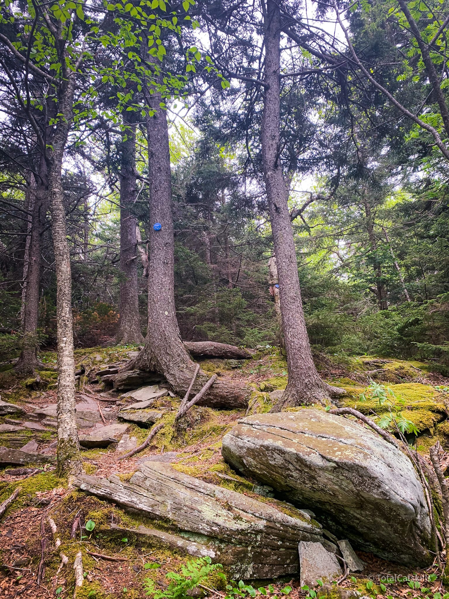
I’ve walked the summit ridge of Blackhead several times but this was my first time seeing it not covered in snow. More pine bed heaven. So lovely. It felt like discovering a whole new mountain.
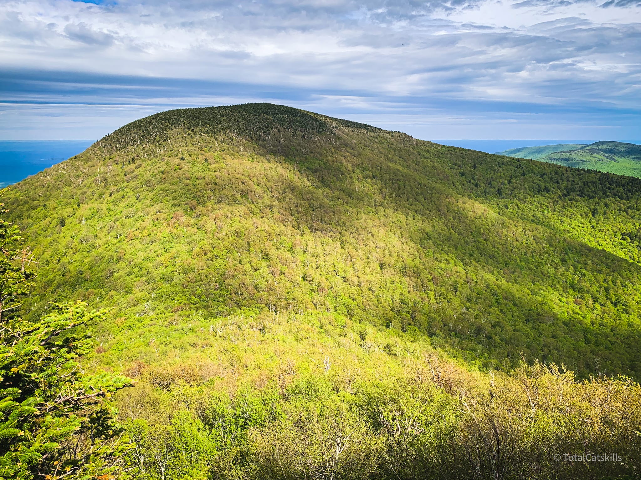
At 3730’ on the way down, you’ll come to a small sloped rock ledge with this fantastic view.
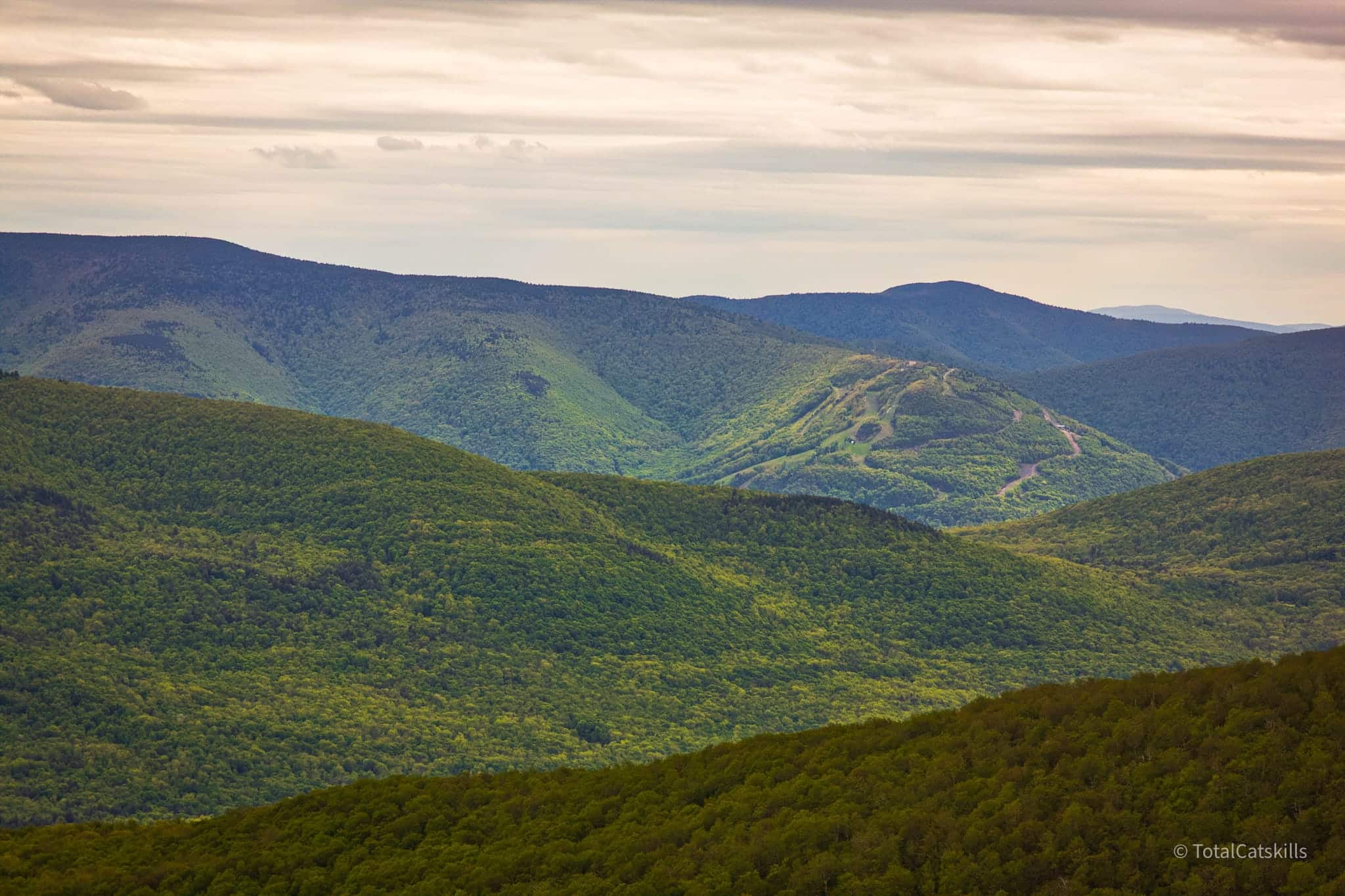
The view from this lookout takes in all of the Devil’s Path mountains, from Indian Head in the east to West Kill in the west. This is just one shot I took. It’s of Hunter Mountain’s ski slopes, with West Kill in the background.
From the lookout, the trail brings you down to the col between Blackhead and Black Dome.
Lockwood Gap
This is Lockwood Gap. It’s a little bigger than Jimmy Dolan Notch or Pecoy Notch, and there’s a designated primitive camp site close by. (I always forget to check it out, and I forgot again this time.)
Lockwood Gap to Black Dome
This is one of my favorite trail sections in the Catskills. I love it.
Like the earlier climb, it starts out lush and beautiful, but quickly becomes jagged and craggy — and the scenic view on the way up is one of the Catskills’ greats.
This tricky rock chute is right below the scenic lookout. I’ve climbed it in winter but, even without snow and ice, it requires concentration and care as you tackle it.
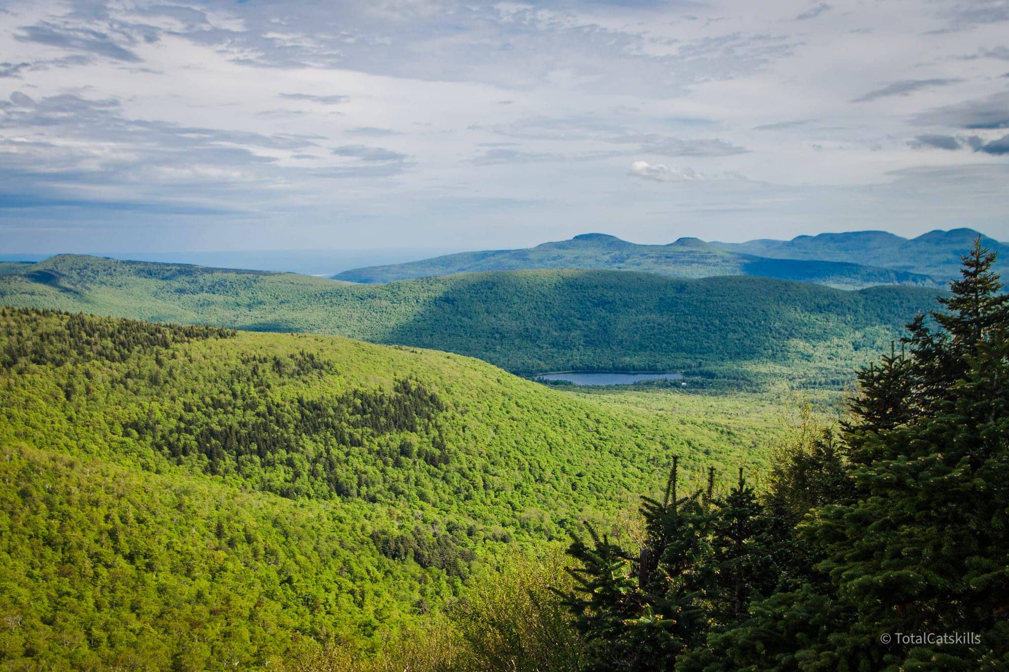
Right above the rock chute, look for a place to step down off the trail, to the right, where there’s a semi-hidden but decent-sized rock ledge at 3750’. This is about the same elevation as the scenic ledge on Blackhead Mountain.
The view looks right across to Blackhead.
On the left, you can see Acra Point, Burnt Knob and Windham High Peak. In the distance, out on the flats, Albany is clearly visible.
BTW, you might also enjoy…
On the right, the view looks across the col to Stoppel Point, Lake Capra, Kaaterskill High Peak, and the eastern Devil’s Path.
Return to the trail to finish your ascent.
There’s still lots of excellent rugged trail to climb, though the hardest parts of the day are all behind you now.
Black Dome’s summit ain’t much — but somehow it’s one of my favorites anyway. An old log on the south side of the trail marks the spot…
About 250’ beyond the summit, on the left, you’ll find a short spur trail that leads to a great view of Round Top & Kaaterskill High Peak.
Descent to Big Hollow
On my way back down to Lockwood Gap, just after the summit, I noticed a short herd path leading into the woods on the north side of the trail. (You can see it on my Gaia track.) I thought it might lead to another view, but it seemed to peter out near a very small open area. Maybe it’s an illegal camp site?
If hiking up is difficult, hiking down is dangerous
Here’s the view back down the rock chute at 3750’. It’s not too bad, actually. Just be sure of your footing and take your time.
At Lockwood Gap, turn left/north, and head down, following the red blazes. The trail is easy and not too steep.
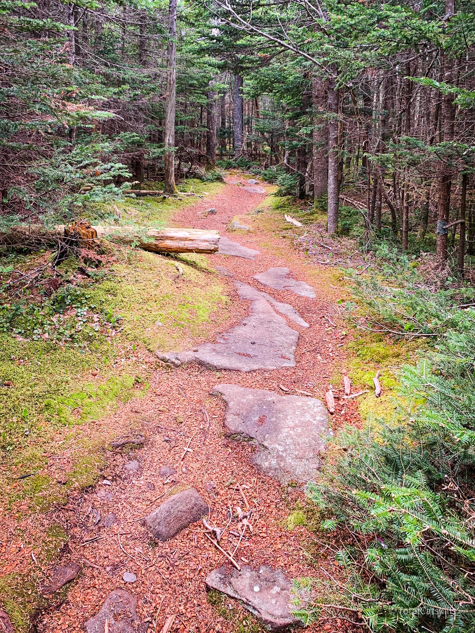
After the switchbacks, a lot of the trail looks like this…
This was the first time I‘d seen it without snow, another revelation.
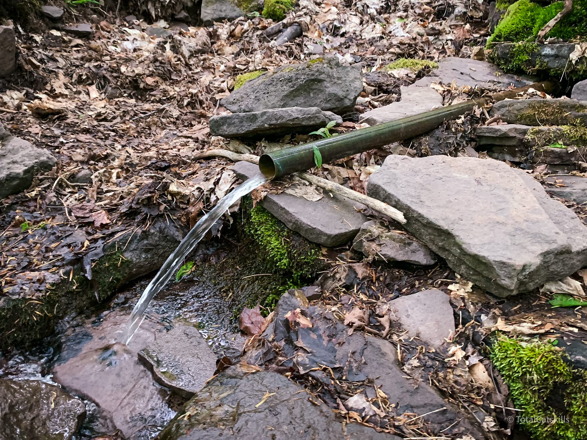
Piped Spring
I stopped to look at the spring on the Black Dome Trail, which I’d always skipped on my way up. It runs all year long, and is marked with a metal pipe.
The rest of the hike down is relatively easy trail. After the last junction, the final ½ mile to the parking area feels almost flat. And it has those three great footbridges to cross on your way out.
This is the final one…
From here, it’s only a few minutes to the trailhead.
Similar Hikes
Close by is a less challenging hike with amazing scenery: Acra Point and Burnt Knob.
For the Catskills, this hike is definitely difficult.
It is beautiful and dramatically scenic.
It is definitely one of the best Catskills hikes.
Read More
Get full access…
Get instant access to the full version of this site and enjoy great supporter benefits: full galleries, full trail notes, early access to the latest content, and more.
Hot on the website right now…
Follow for more…
Follow my @TotalCatskills content on Instagram for regular hiking inspo and safe, inclusive community.

Blackhead & Black Dome via Batavia Kill Trailhead
Medium-sized lot near the end of a dirt road which is not plowed in the snow. Popular. Arrive early.
Google Maps Location: 42.288926, -74.114889
The map below shows the exact topographic location of the trailhead
Cell Service
Service from up high on the escarpment and on exposed ridges, but none at the trailhead in Big Hollow. My network is Verizon. YMMV.
The parent mountain for this hike is Blackhead.
