Hike Wittenberg & Cornell from Woodland Valley

An extremely rewarding hike that includes one of the Catskills’ grandest vistas, the infamous Cornell Crack, and a breathtaking view of Slide, Giant Ledge & Panther.

Hike Length: 9.2 miles (14.81 km)

Total Ascent: 2,873ft (876m)

Intensity: Difficult Catskills Hike

Route Type: Out-and-Back

Includes: Blazed Trail

Parent Wittenberg

Similar Entries In: Catskills, The Best Hikes, The Difficult Hikes, The Most Popular Hikes, , , , , , .

Mark on Wittenberg, 2019

The ledge on Wittenberg’s summit opens onto an epic 180° vista — there’s a *lot* to point at

Disclosure: This content may contain affiliate links. Read my disclosure policy.

 A long out-and-back that mixes steep and easy trail sections.

Hiking Trail Description
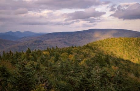
This is a long and tiring but incredibly rewarding hike. This hike was also memorable because my buddy and I met two hikers from New Jersey who got into serious trouble the same day, kicking off a massive rescue response.

The parking area is on the opposite side of the road from where the hike begins. Exit the lot, cross the road heading left toward the trailhead sign that says, “Wittenberg Mt 3.9”.

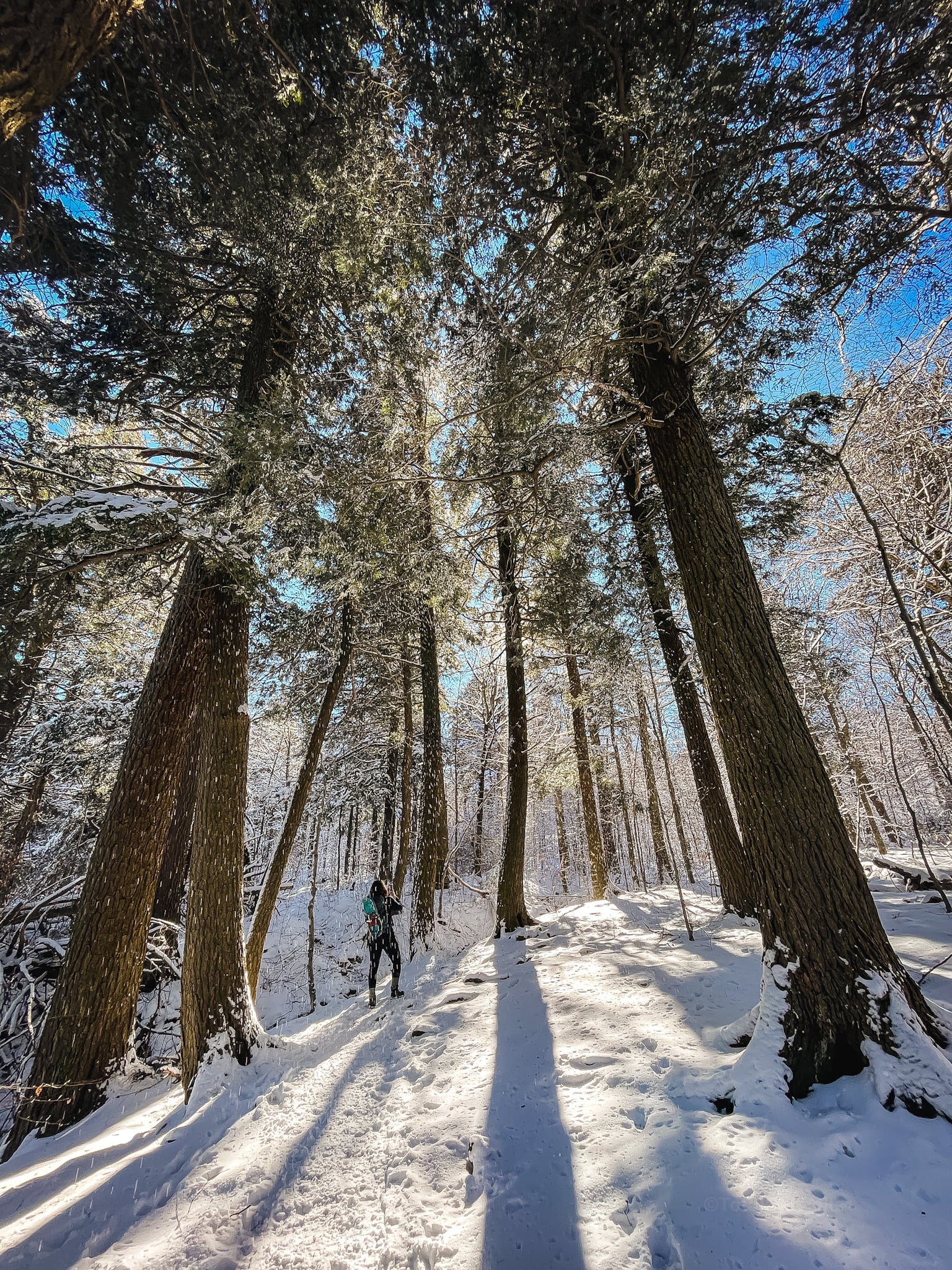
The first part of the hike is a mix of steep and gentle grades until you get to 2250’ when the trail levels out for a good while. 
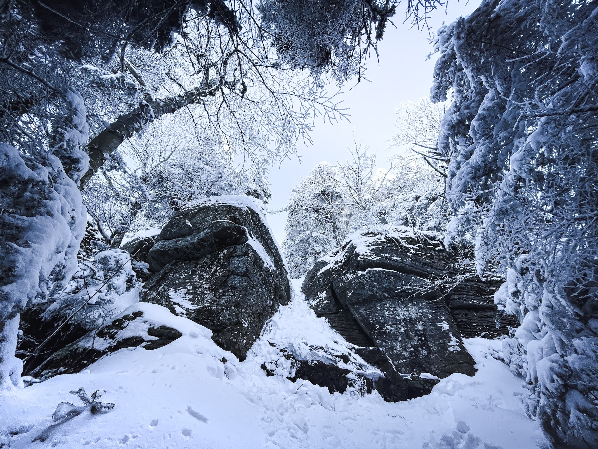
Follow the red-blazed trail. It’s a long hike in to the first junction but, along the way, you’ll hike through beautiful forest and pass many dramatic rock outcroppings.

You’ll see why this is such a popular hike. Lots of hemlock and pine. Lots of dappled light. Some tricky, technical bits to work through. 

At the first junction, turn right.

The second junction is only ⅕ mile after the first. Again, turn right.

You might also enjoy…

The next mile or so is mostly a fairly steep ascent through dense forest to Wittenberg’s summit.

Close to the summit, we passed two hikers. Let me tell you: I am slow and, if I pass you on a trail, you are very slow.

Wittenberg

Eventually, you come out onto Wittenberg’s famous ledge, which gives an amazing 180° view. To the left, you see the Devil’s Path mountains. Straight ahead is Samuels Point and the Ashokan Reservoir.

The Devil’s Path from Wittenberg
The Eastern Devil’s Path

To the right is Ashokan High Point, as well as Balsam Cap and Friday Mountain.

Ashokan High Point from Wittenberg
Ashokan High Point

After a few minutes, the two hikers arrived. One looked really exhausted. We chatted with them. Their plan was to do the big loop from Woodland Valley to Slide, to Giant Ledge, and back down to Woodland Valley. But it was already noon. The temperature was already 10°F (-12°C) and sunset was around 4:40pm.

We left them at the ledge, and made our way toward Cornell. We thought they’d follow us in a few minutes…

Cornell Crack

Right before Cornell’s summit, this enormous puzzle appears. This photo does not do justice to how intimidating it can feel to stand inside Cornell Crack, wondering how you’re going to climb it. There are bushwhack routes to the left and the right. However, equipped with full crampons and an ice axe, my buddy Mark chipped out some toe-holds and helped me climb up through the crack.

You can below see the walls are not iced up; there was good grip either side. If the walls are coated with ice, your best bets are to either call it quits for the day, or to bushwhack around. An injury here is very serious; you’re a long way from help.

Cornell Crack
My buddy, Mark, climbing Cornell Crack

Cornell

After this, it’s a few easy minutes to the summit. Cornell’s summit is just off the main blazed trail, down a short spur trail to the left. It’s well treed-in and has no view.

Make your way back to the trail, turn left, and head down the far side of Cornell.

Soon you come to a great scenic view. Looming straight ahead is the massive Slide Mountain.

To its right, in the middle distance, you see Giant Ledge and Panther.

View of Slide Mtn
Slide Mountain seen from Cornell

(On a later hike, I discovered there’s an even better view from slightly farther down the trail. So keep going…)

At this point, we turned around to head back to Wittenberg and Woodland Valley.

Mystery Men

The two hikers did not appear. We kept expecting to bump into them at any moment, but they never showed. We figured they’d called it quits and gone back to Woodland Valley too.

But then, just as we arrived back at Wittenberg, more than an hour after we’d left the ledge there, they appeared on the trail — they were only just leaving.

This was so odd. They’d only covered four miles in three hours and, by 1 pm, still had at least 11 miles to go — with some very tough terrain to cross. And it was so cold.

We checked they were prepared for such a long haul. Did they understand how long it was, how tough the terrain was? Yes. Did they have headlamps and extra batteries? Yes. One of them brushed us off with, “I‘ve been up this way before… I know the terrain…”

In hindsight, there are so many red flags here. But they were insistent, so we left them to it. We worried about them for the rest of the hike down. It cast a pall over our day.

Their day got a whole lot worse.

Wilderness Rescue

Here is the DEC Wilderness Rescue Report which speaks for itself:

Town of Shandaken, Ulster County, DEC Wilderness Rescue
On the afternoon of Jan. 13, two hikers in the Slide Mountain Wilderness Area reported to 911 that they needed assistance descending Slide Mountain. A subsequent call indicated both hikers were cold and one had suffered a hip injury. Later that day, another hiker reported to 911 that the injured hiker was now unconscious. Thirteen Forest Rangers responded to the scene in an attempt to rescue the group that evening or prepare for a helicopter evacuation at first light. By 8:30 p.m., Rangers reached the injured hiker and found three additional hikers who needed immediate evacuation due to the onset of hypothermia. As these hikers were led off the mountain, the injured hiker was treated for mild hypothermia and secured in cold weather gear. By 10:30 p.m., the three mobile hikers were safely out of the woods and returned to their vehicles. At first light on Jan. 14, Rangers determined the injured hiker could hike out with their assistance, and a helicopter rescue was no longer needed. By 9 a.m., the 23-year-old New Jersey man was off the mountain, evaluated by emergency medical technicians, and released to his own care.

A hip or a leg injury in the wilderness is super serious. In winter, it could mean death. The fact they called 911 and not the DEC shows they were not knowledgable about the best emergency procedure. The whole thing is a mystery to me, but their experience taught me to push back much harder when I come across hikers who seem unprepared.

This was an incredibly close call for everyone involved. Please set reasonable goals, make sure you always carry the ten essentials, and read up on basic wilderness safety.

Get full access…

Get instant access to the full version of this site and enjoy great supporter benefits: full galleries, full trail notes, early access to the latest content, and more.

Hot on the website right now…

Follow for more…

Follow my @TotalCatskills content on Instagram for regular hiking inspo and safe, inclusive community.

I also stay active on Facebook and Threads.

The parent mountain for this hike is Wittenberg.

If you do this hike, LMK how it went…

Your comments are welcome here…

Trailhead Info for this Hike

Park on the north side of the road. The trail is on the south side of the road.

Google Maps Location: 42.036109, -74.358244

The map below shows the exact topographic location of the trailhead