Disclosure: This content may contain affiliate links. Read my disclosure policy.
A long thru-hike in The Catskills.
Hiking Trail Description
The Escarpment Trail is a 23.9-mile point-to-point hike in the Catskill Mountains that runs from Scutt Road near North-South Lake to Route 23 near Windham.
Known for its continuous ridgeline and frequent viewpoints, the trail follows the edge of the Catskill Escarpment with fantastic views over the Hudson Valley and into the interior Catskills.
This route is a very popular option for backpackers looking for a two-day or three-day trip. There are established campsites and several water sources along the route. Most hikers complete the trail from south to north, passing over several major peaks including Blackhead Mountain, Acra Point, and Windham High Peak. But the trail itself is also gorgeous, and there are many more incredible views along the route than summits.
The route I’ve plotted here adds in a few short out-and-back spurs to some of the best views in The Catskills. You don’t want to walk right past these!
Although the Escarpment Trail is often hiked in sections, it can be tackled as backpacking adventure, and some friends have run it in a day. The full traverse provides a mix of steep climbs, exposed ledges, and wooded ridge walks. There are multiple bailout points and road crossings, which allow for flexible planning.
This guide outlines the full trail route, elevation profile, and key planning info for anyone hiking or backpacking the Escarpment Trail in the Catskills.
Frequently Asked Questions
Is Water Available on the Escarpment Trail?
Water is quite scarce but generally available at the following points:
- North-South Lake
- Batavia Kill lean-to near the base of Blackhead Mountain
The issue is that both of these are closer to the beginning and the end of the route than they are to the middle. Filtering or carrying extra H2O is absolutely advised. Keep an eye on rainfall patterns in the days before your traverse.
How Hard is the Escarpment Trail
I would say it’s long rather than hard. Definitely, it’s not nearly as tough as The Devil’s Path, even though it’s about the same length. There’s much less elevation gain, and far fewer scrambles. The challenge is really in its length, and the fact that water is about as equally scarce.
Escarpment Trail Hiking Trail
The Escarpment Trail hiking trail includes…
- Solid parking at both ends
- Mostly moderate trails
- Multiple bail-out points
- Incredible views on the reg
- Several campsites to choose from
- Not a lot of water en route
A full breakdown is provided below in the hike notes with 7 photos.

Escarpment Trail Hike Time
Allow 2-3 days for this through-hike.
Escarpment Trail Elevation Gain
The elevation gain for the Escarpment Trail is 6,100 feet (apx 1,860 meters).
BTW, you might also enjoy…
- UPDATED › Best Bug Spray & Bug Repellent for Hikers
- CATSKILLS › Peakbagging The Catskills High Peaks (Ultimate Guide)
- STAY › Find Your Perfect Catskills Stay
- ADIRONDACKS › Wright, Algonquin & Iroquois Peaks
- LEARN › Teach Yourself How to Use a Compass
- ENTERTAINMENT › Best & Worst Hiking Movies
- Follow › My Instagram @TotalCatskills
- Follow › My Substack @TotalCatskills
- Follow › My writing for Times Union
Escarpment Trail Trail Notes & Gallery
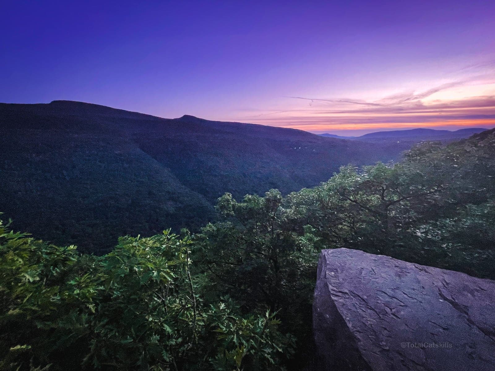
The southern trailhead is located just off Scutt Road, near the North-South Lake Campground. You’ll hike past Kaaterskill Falls and make your way down to Layman’s Monument, then up to the first incredible stretch of trail that runs along the top of Kaaterskill Clove. The view across the clove to Kaaterskill High Peak and Round Top is shockingly dramatic…
Inspiration Point is an intensely beautiful spot…
From here, you’ll make your way up past Boulder Rock to the site of the old Catskills Mountain House and North/South Lake.
The classic Escarpment Trail skips Sunset Rock, one of the classic Catskills views, so make sure not to pass that by.
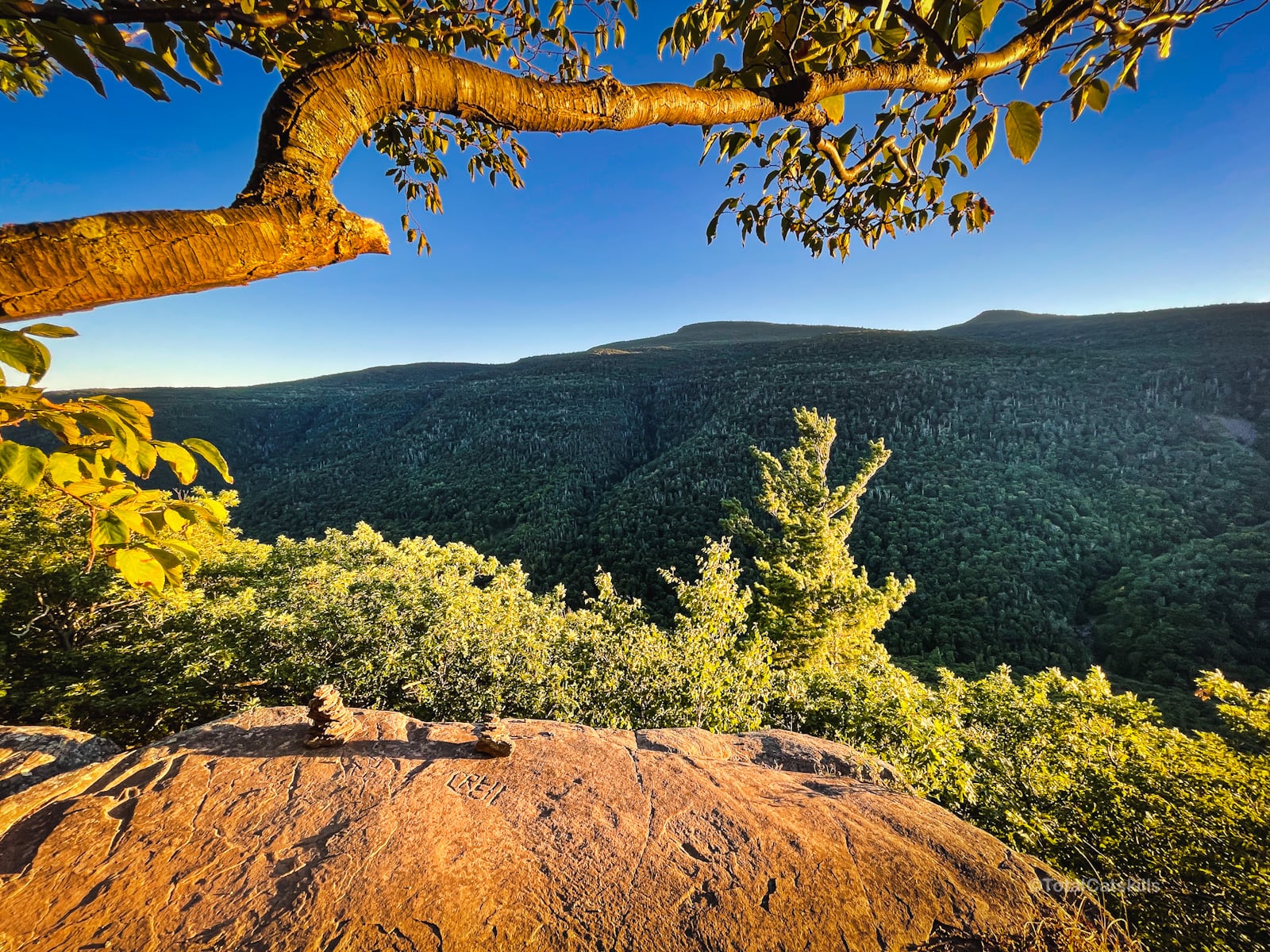
From there, head to Newman’s Ledge for one of the best Escarpment views.
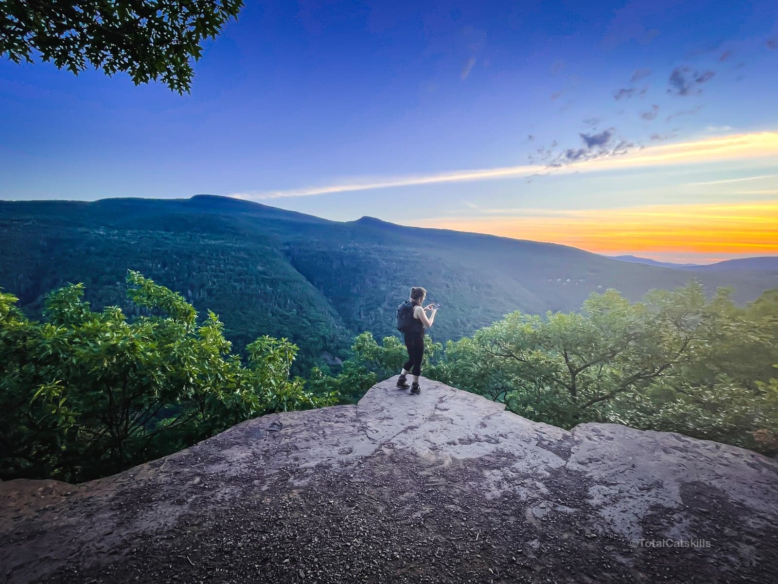
Head toward North Point, which offers perhaps the most famous Catskills scenic view. There are several lookouts to explore, here, and a primitive campsite.
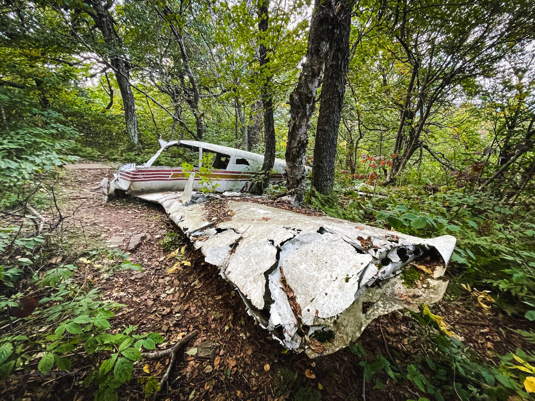
Pass over North Mountain and Stoppel Point, where you won’t be able to miss an old plane wreck just below the summit.
Next, head down to Milt’s Lookout, a lovely quiet ledge with a great view, and then to Dutcher Notch.
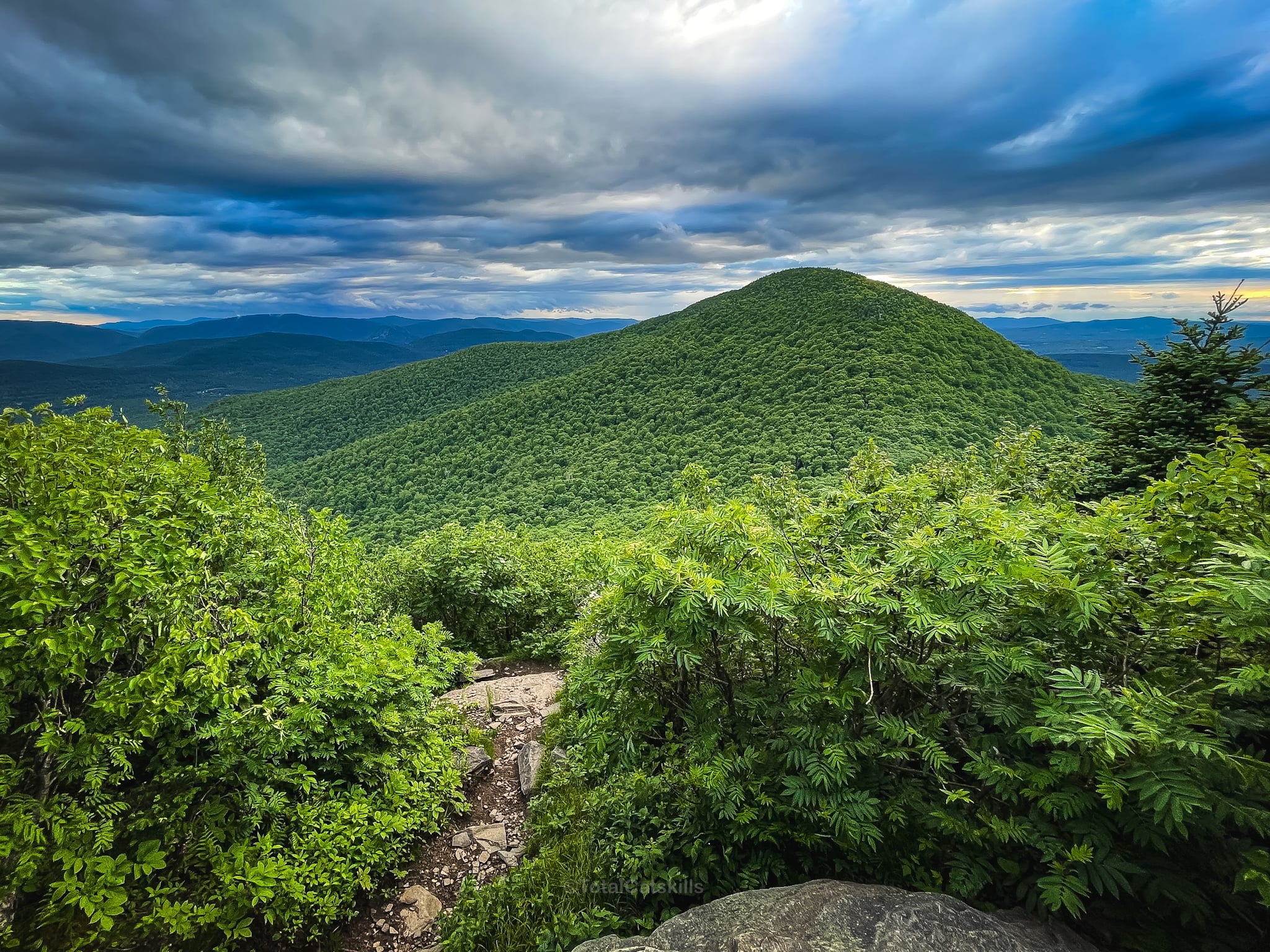
This starts the climb to Arizona Mountain, one of my favorite off-list mountains in The Catskills—hugely underrated with a rock portal to climb through, a great view, and a really sweet ridge walk.
From the summit of Arizona to the summit of Blackhead Mountain is about a mile and there are several wonderful lookouts along the way. (The best is the one below Camp Steel.)
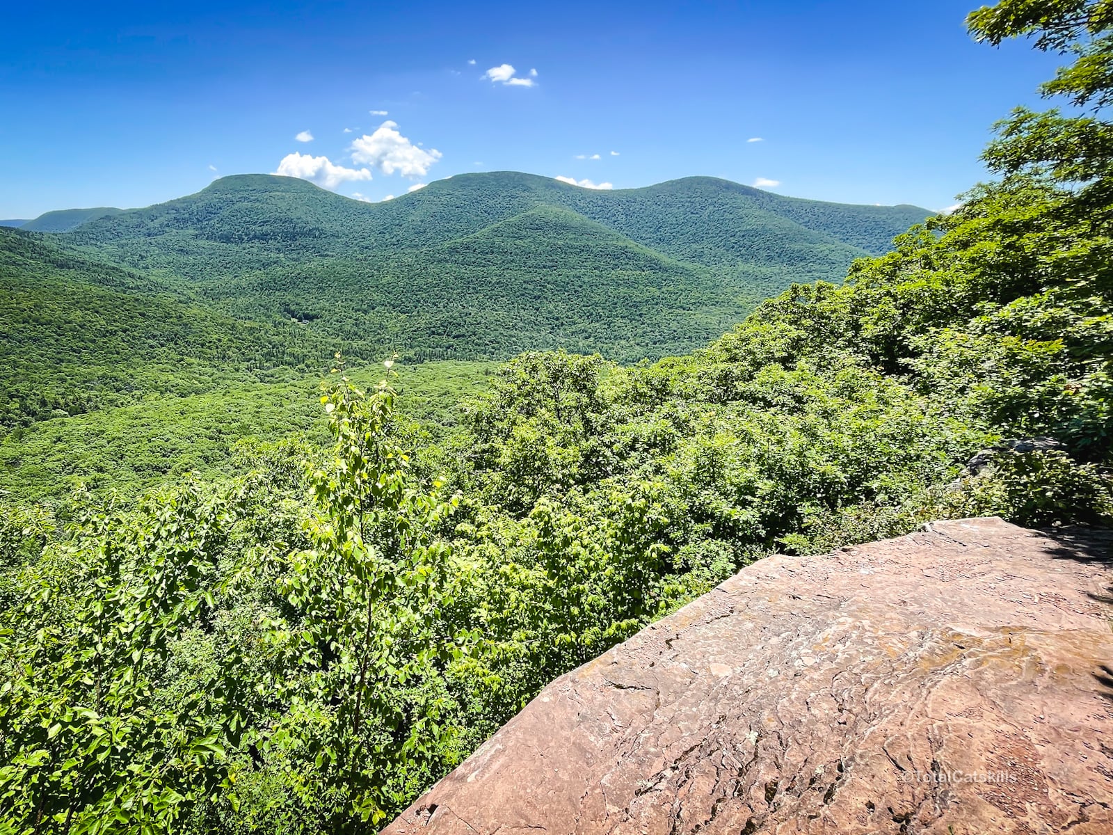
At the summit of Blackhead, take another short side-quest to the ledge at 3,780′ with it’s amazing view of Black Dome across the col and the Devil’s Path mountains to the south.
Head back to the Escarpment Trail and hike down Blackhead’s northern ridge. This is the most technically challenging section of the route, with an intense scramble until you get below 3,500′.
From here, head down to the junction and begin your climb toward Acra Point. The summit view has grown in but there’s a great view of the Blackheads a little past it.
Hike west toward Burnt Knob. Do not skip the off-trail view on its eastern ridge. It’s a banger.
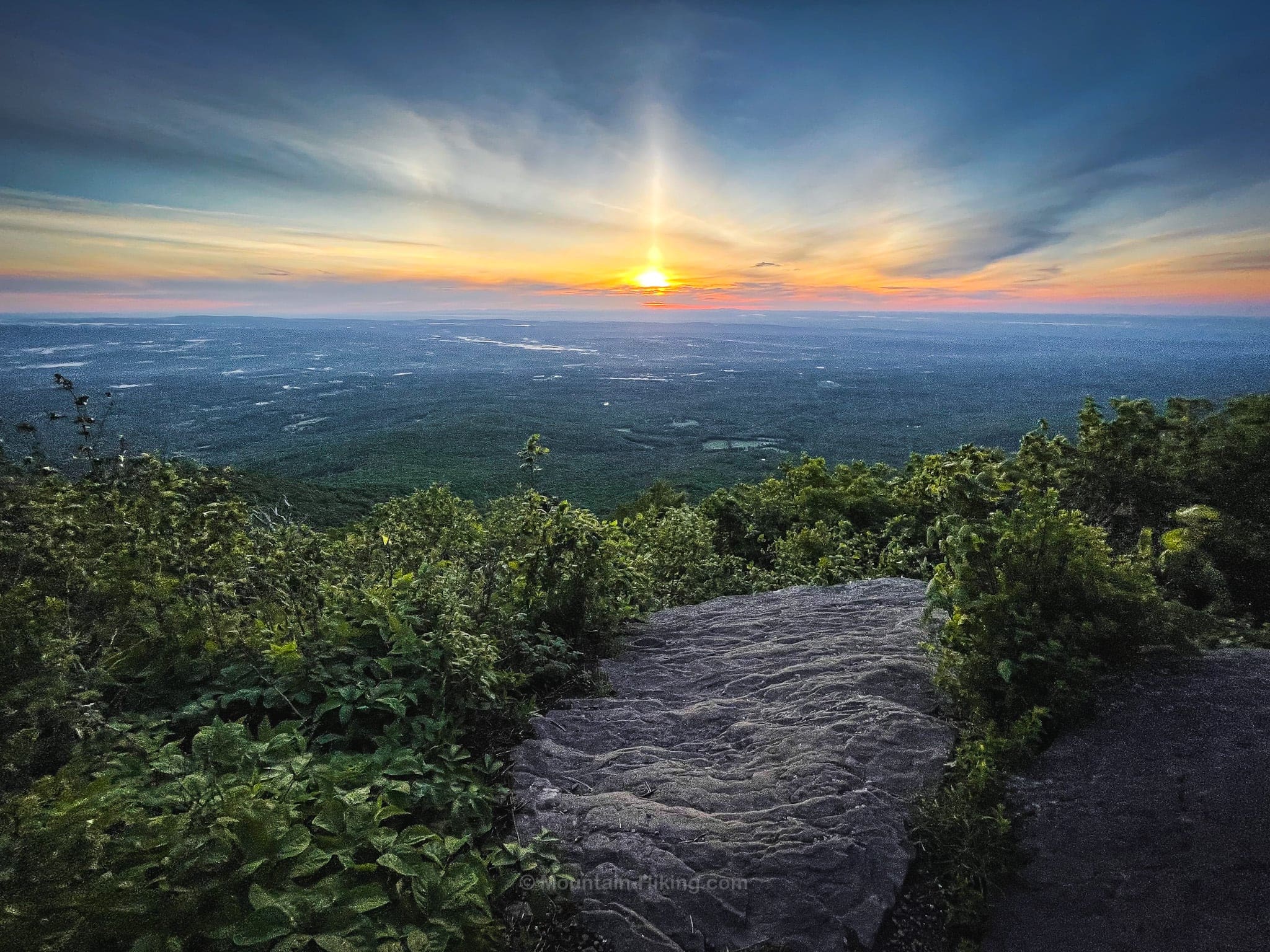
There are several more great views on the way to Windham High Peak, the last summit on the Escarpment Trail. There are three well-known views on the summit. This is the first…
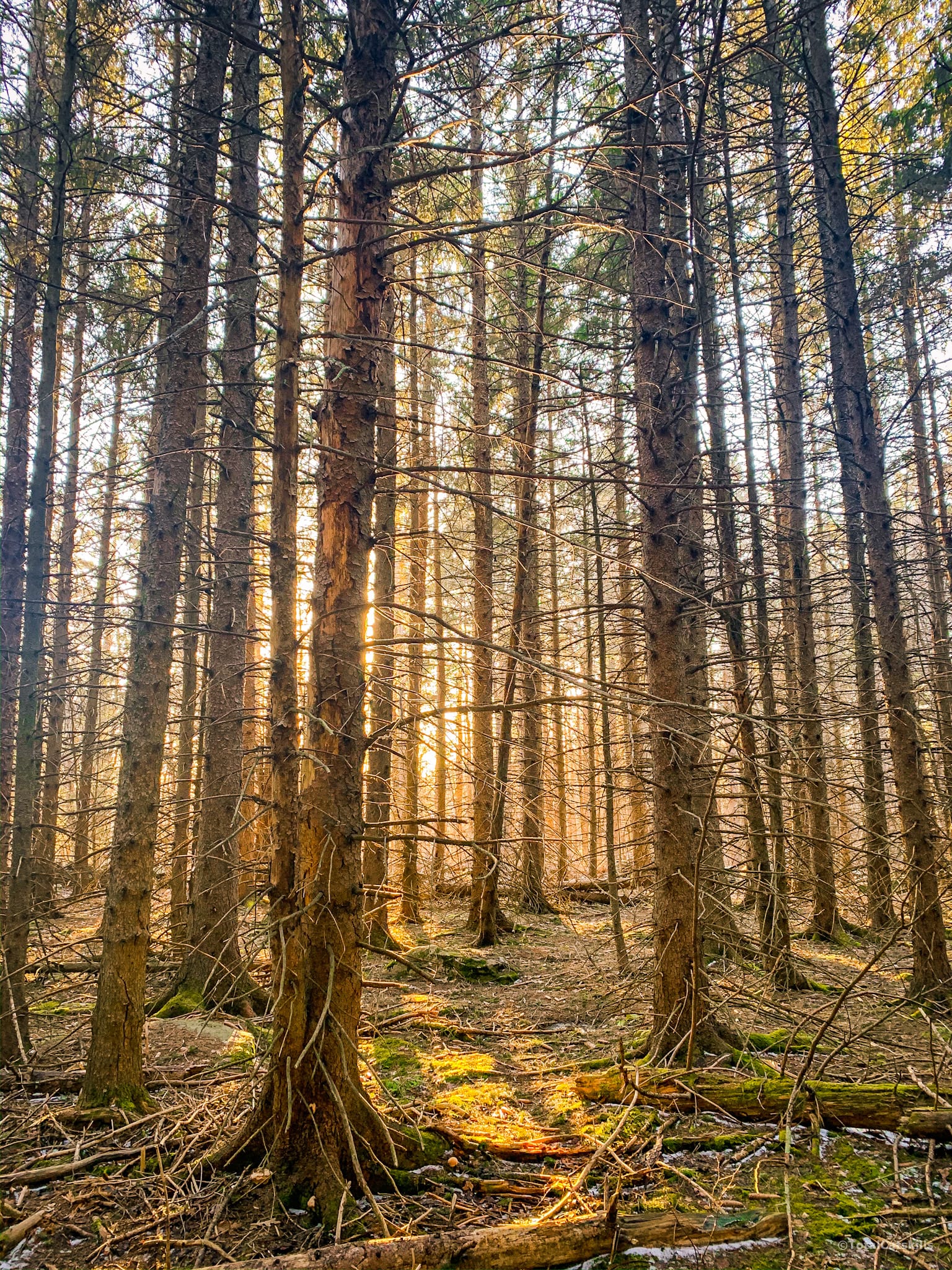
The descent is moderate and extremely pleasant, passing through a wonderful spruce plantation.
The final stretch of hike out to Route 23 is even easier and a very pleasant way to end your adventure.
Similar Hikes
Another wonderful long overnight hike can be done around Huckleberry Loop in the Western Catskills.
Want to take things up a notch? Maybe you’re ready for The Devil’s Path.
Read More
Get full access…
Get instant access to the full version of this site and enjoy great supporter benefits: full galleries, full trail notes, early access to the latest content, and more.
Hot on the website right now…
Follow for more…
Follow my @TotalCatskills content on Instagram for regular hiking inspo and safe, inclusive community.
Escarpment Trail Trailhead
Large double-lot, free parking.
Google Maps Location: 42.200492, -74.058185
The map below shows the exact topographic location of the trailhead
Cell Service
Overall quite good, especially on the main section that faces the Hudson Valley floor to the east, but there are patches where signal is very low or non-existent. My network is Verizon. YMMV.
The parent mountain for this hike is Blackhead.
