Disclosure: This content may contain affiliate links. Read my disclosure policy.
A straight-forward out-and-back, but this is a challenging trail.
Trailhead info at bottom of this post.
This short but difficult hiking trail to Balanced Rocks and the summit of Pitchoff Mountain can be done in 4-5 hours. Your hard work will be rewarded with exceptional views at many points along this beautiful trail.
Pitchoff Mountain is one of the nine Lake Placid 9er peaks.
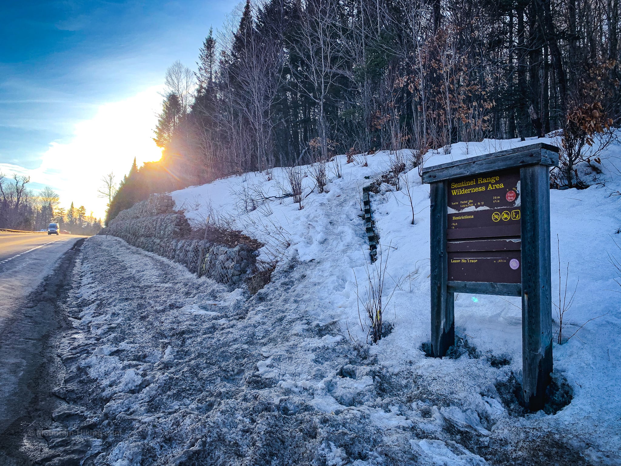
Pitchoff Trailhead Parking
Between Keen and Lake Placid, four small roadside lots close together on Route 73 serve some of the post popular hiking trails in the Adirondacks: this one and the amazing hike up Cascade & Porter mountains.
Two lots are east of the trailhead, and two are west.
Get there early-early.
Balanced Rocks Hiking Trail
The trailhead for this hike is on the north side of Route 73, accessible via a short road walk from any of the parking areas along this section of Route 73.
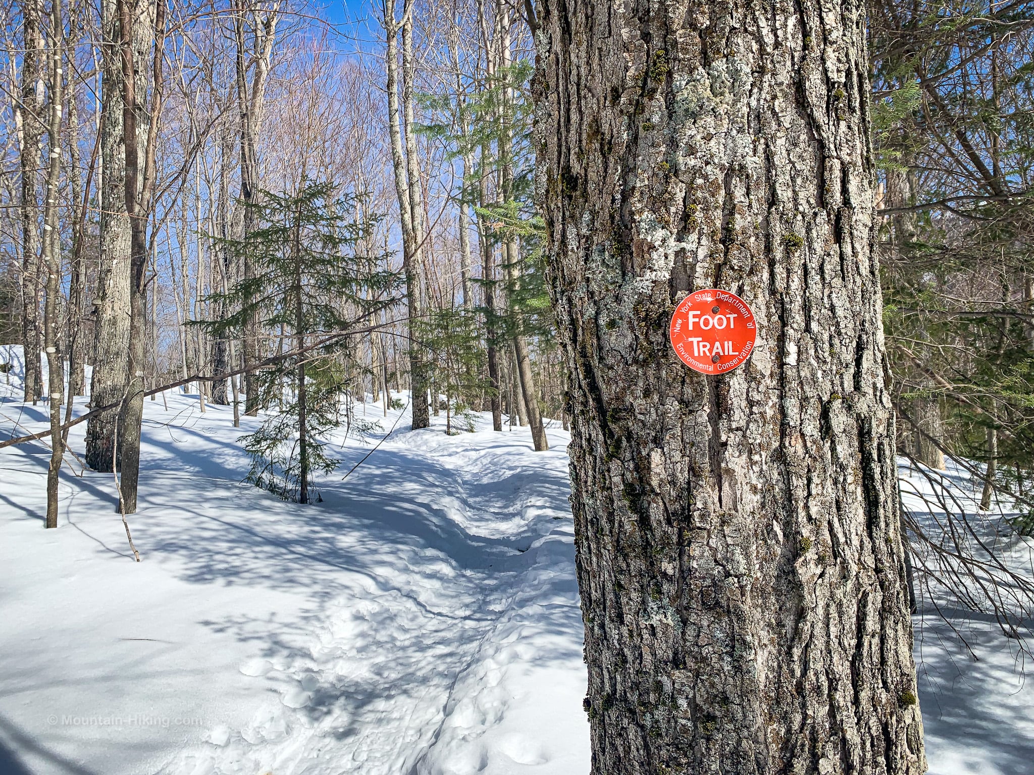
The trail register is just above the trailhead sign. Please sign in, following the directions posted.
Follow the red blazes, which are sparsely distributed. Luckily, the trail itself is easy to follow and there is only one junction.
Spurs & Views
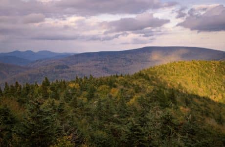
Along the way to Balanced Rocks, keep an eye out on the right side of the trail for several short spurs that lead to excellent lookouts. The mountain across the valley is Cascade Mountain and the two lakes below are Cascade Lakes.
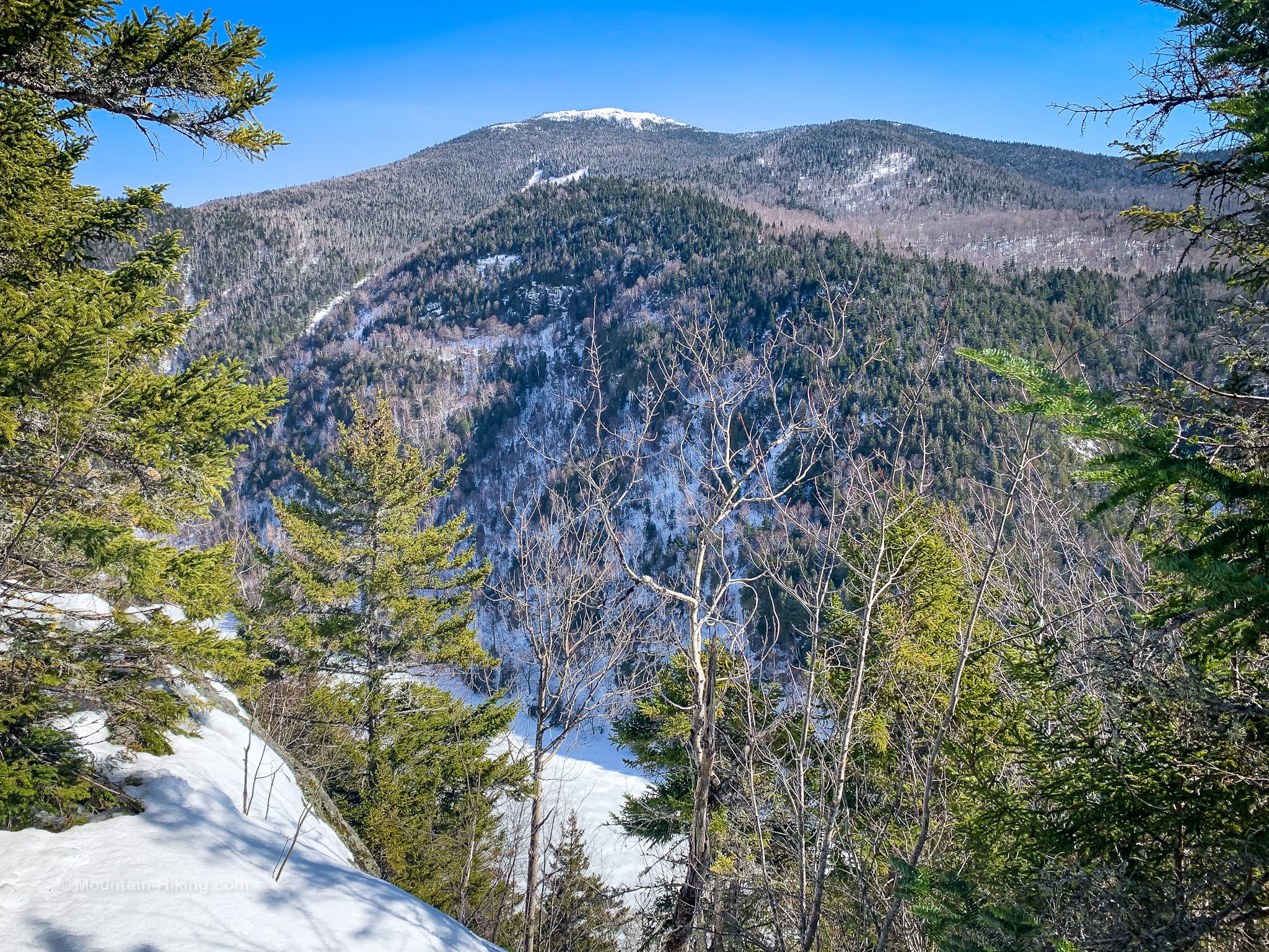
At first, the trail winds through mostly fir and spruce trees. There are a few moderately steep spots, but nothing strenuous.
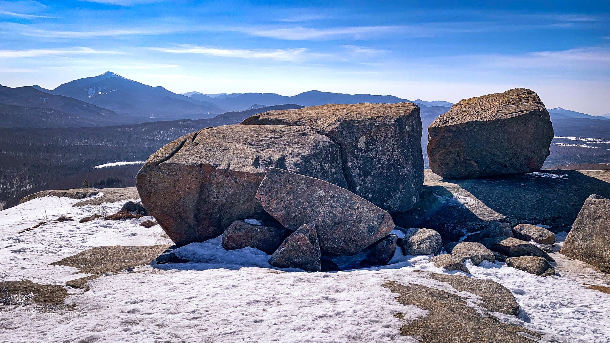
Cascade Slide
This is the best view of Cascade, seen from the top of the first knob you’ll cross, right before the trail descends into a small col between the knob and the summit proper.
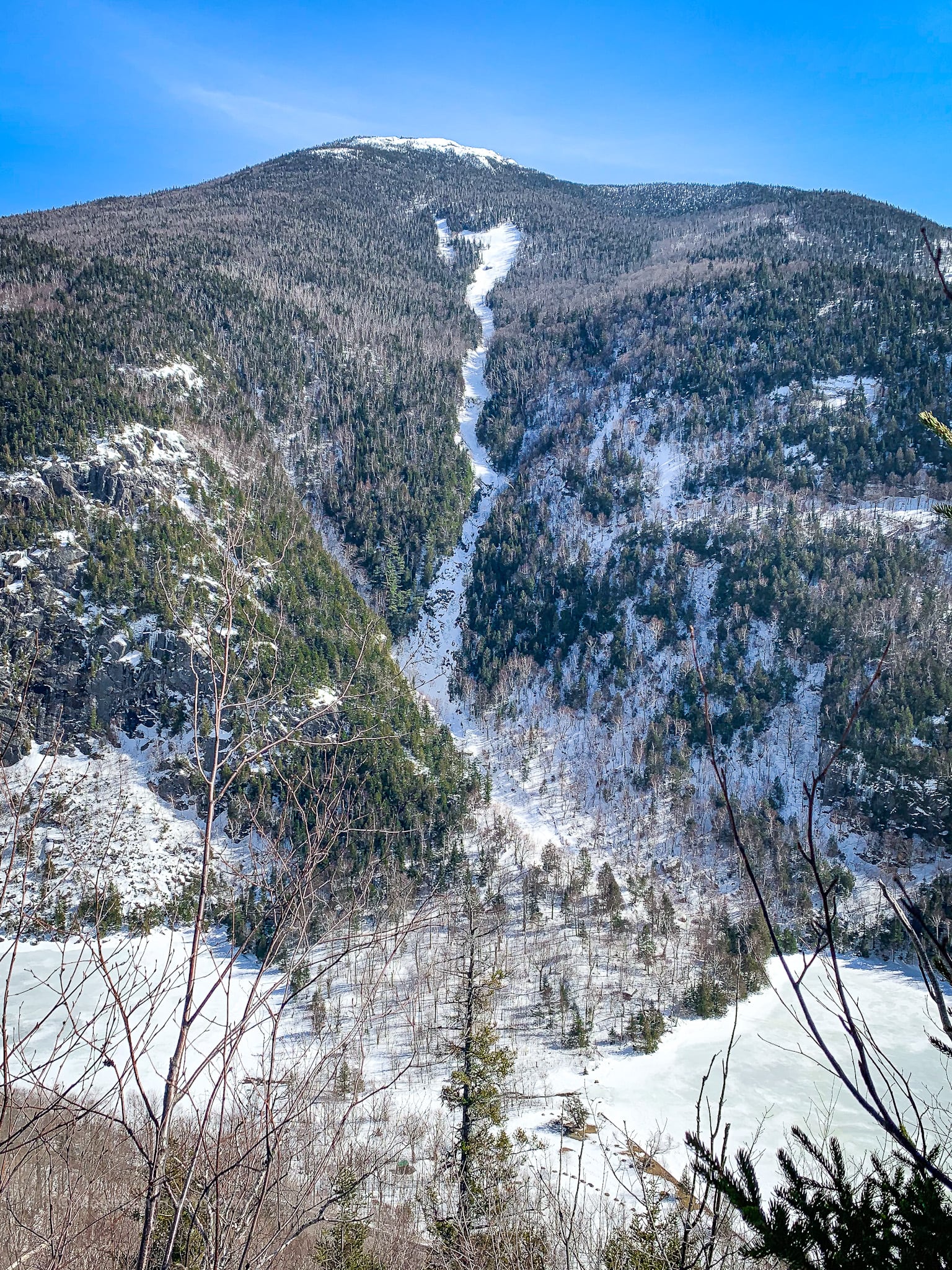
The slide shown here was originally a drainage. It was further cleared out in 2011 by Hurricane Irene. The bottom section is a waterfall (frozen over in this photo). Cascade Mountain’s bald summit is clearly visible.
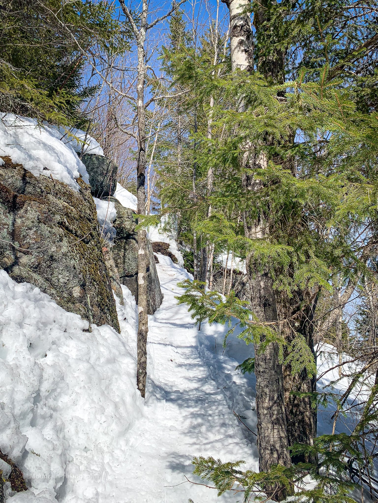
Tricky Section Below Balanced Rocks
After this view, the trail dips through a stand of paper birch trees and then heads northwest.
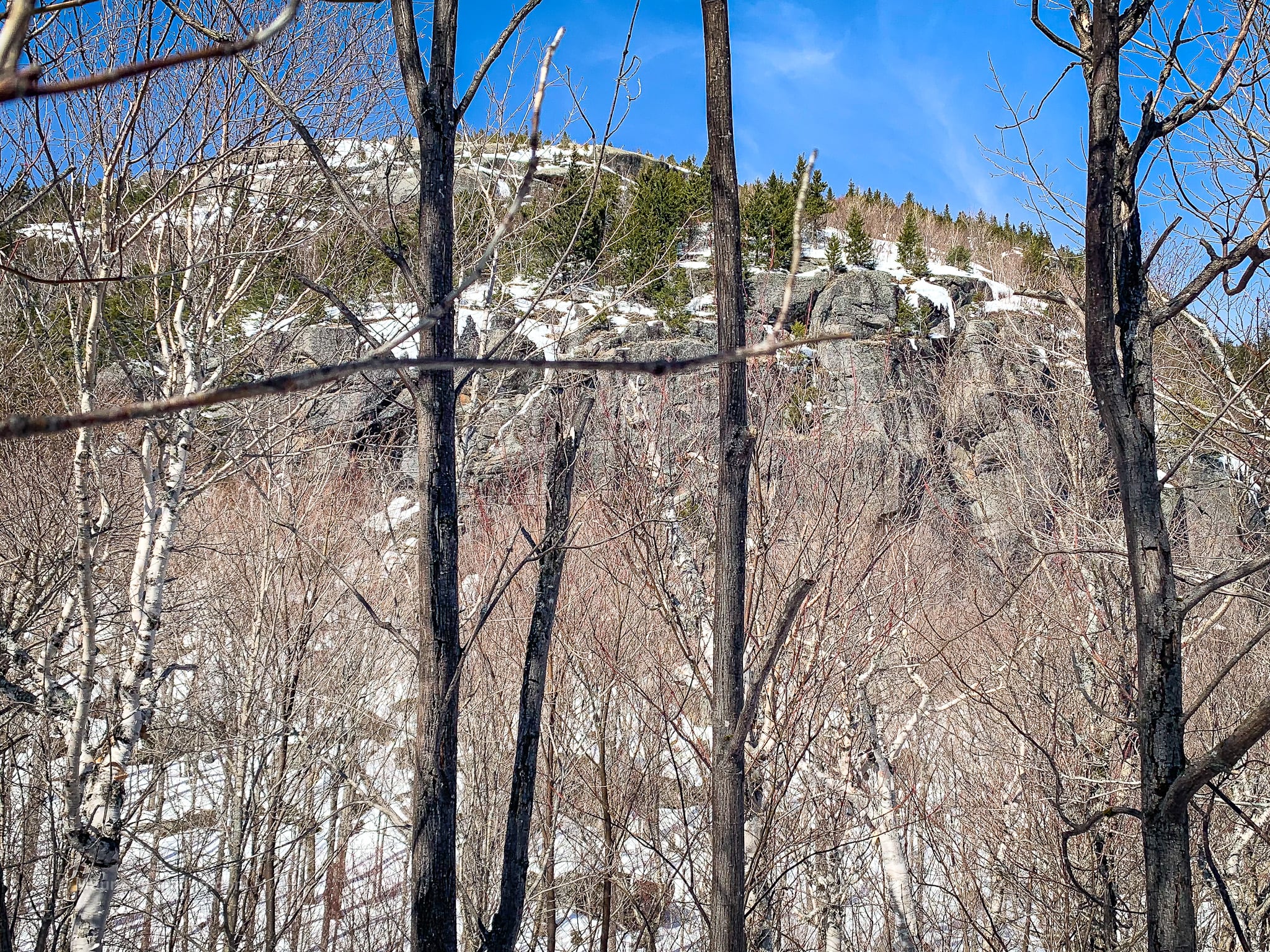
Through the trees, the rocky outcropping below Balanced Rocks comes into view…
Climbing this next section in snowshoes gave me pause. Two spots in particular are tricky. I thought, “I might have trouble here when I’m coming back down.”
I was correct…
Ascent to Junction
After the tricky trail section, which is about 500 ft long, the trail switches back and heads northeast. There are a few steep-ish sections, but nothing tricky. The forest returns to spruce and fir.
Eventually, at the top of a steep incline, you’ll come to the junction.
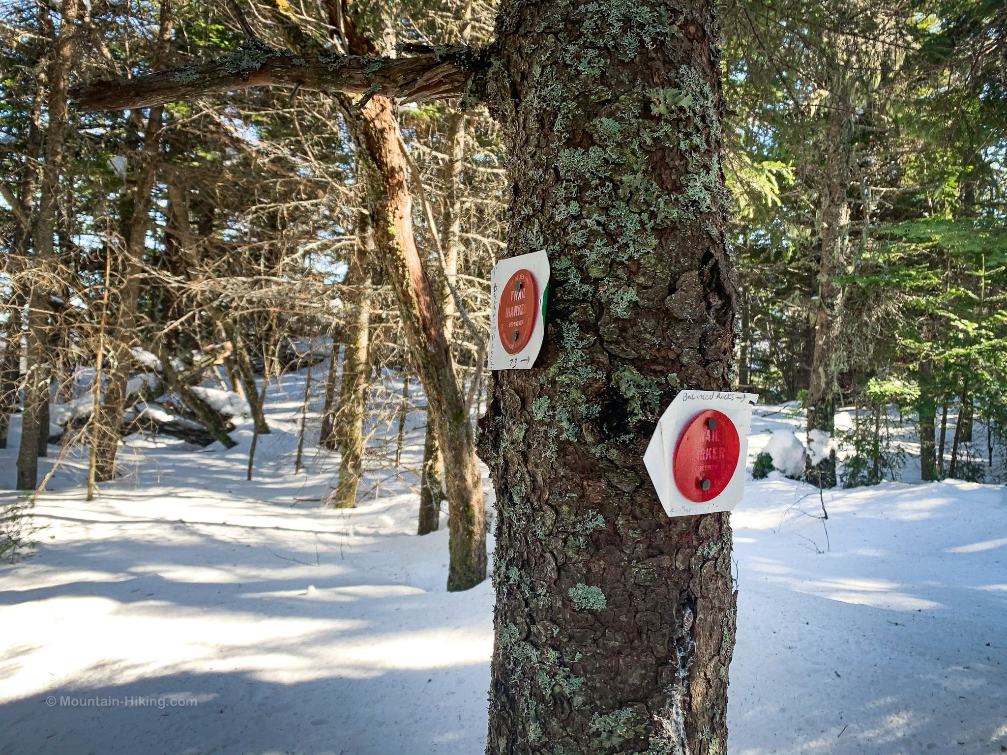
The junction for routes to Balanced Rocks and Pitchoff Mountain is currently marked with two official red blazes that have been enhanced with two unofficial… white plastic things. One points left toward the summit of Pitchoff. It also has handwritten “Balanced Rocks” and an arrow pointing right. The other red blaze points back downhill to Route 73. Yes, it’s confusing.
Turn right for Balanced Rocks. (Or turn left for Pitchoff Mountain.)
Hike to Balanced Rocks
To visit Balanced Rocks, turn right here and follow the herd path. It’s very short. (A short spur on the left side of the trail, just before the bend, gives a nice view east.)
After just 500 ft or so, you’ll walk out into the open.
I did not expect the view at Balanced Rocks to be as wide and spectacular as it turned out to be…

Similar Hikes
Right across the road from Pitchoff is the trail to Cascade & Porter mountains — one of the easiest and most popular Adirondack High Peak hikes.
Get full access…
Get instant access to the full version of this site and enjoy great supporter benefits: full galleries, full trail notes, early access to the latest content, and more.
Hot on the website right now…
Follow for more…
Follow my @TotalCatskills content on Instagram for regular hiking inspo and safe, inclusive community.

Balanced Rocks & Pitchoff Trailhead
Four small roadside lots close together that serve some of the post popular Adirondack hiking trails. Get there early-early.
Google Maps Location: 44.219249, -73.886938
The map below shows the exact topographic location of the trailhead
Cell Service
Mostly good throughout, from the trailhead to the summit. My network is Verizon. YMMV.
The parent mountain for this hike is Pitchoff.