Disclosure: This content may contain affiliate links. Read my disclosure policy.
An easy-to-follow loop.
Hiking Trail Description
The Bramley Mountain Fire Tower is back, and it’s one of the best new hikes in the Catskills.
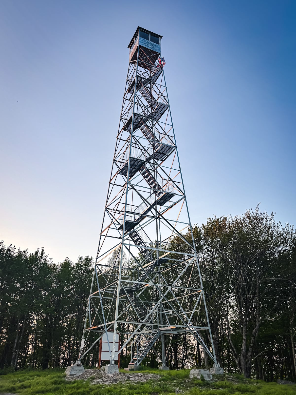
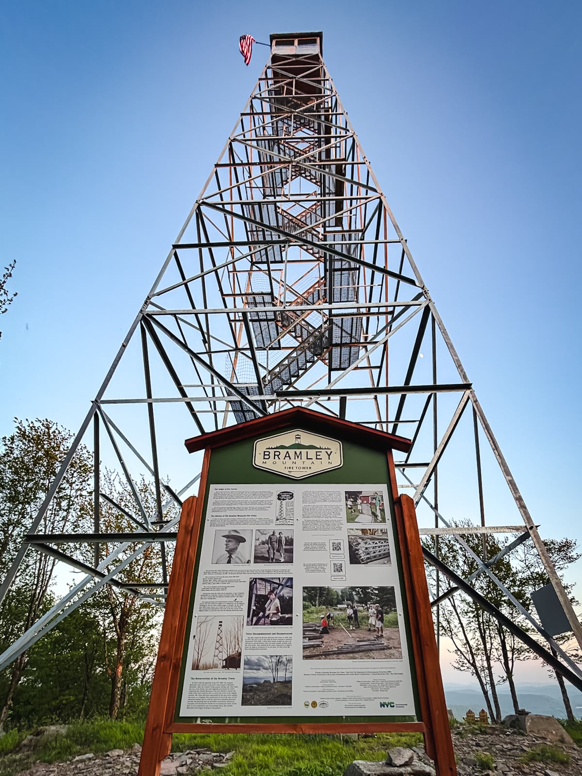
After more than 50 years in storage and several decades of passionate effort from locals, land agencies, and volunteers, the tower has finally returned to its original home at the summit of Bramley Mountain. This 2,817′ peak now offers hikers a full loop trail with a rich mix of forest, cliffs, caves, an old quarry—and sweeping 360° views!
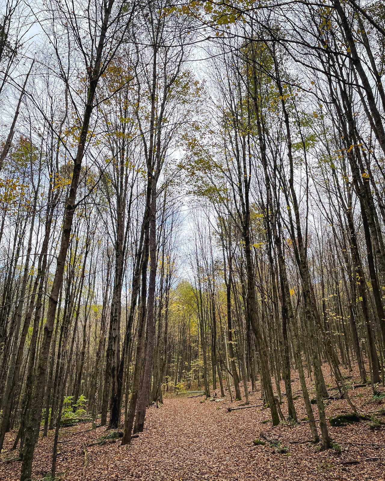
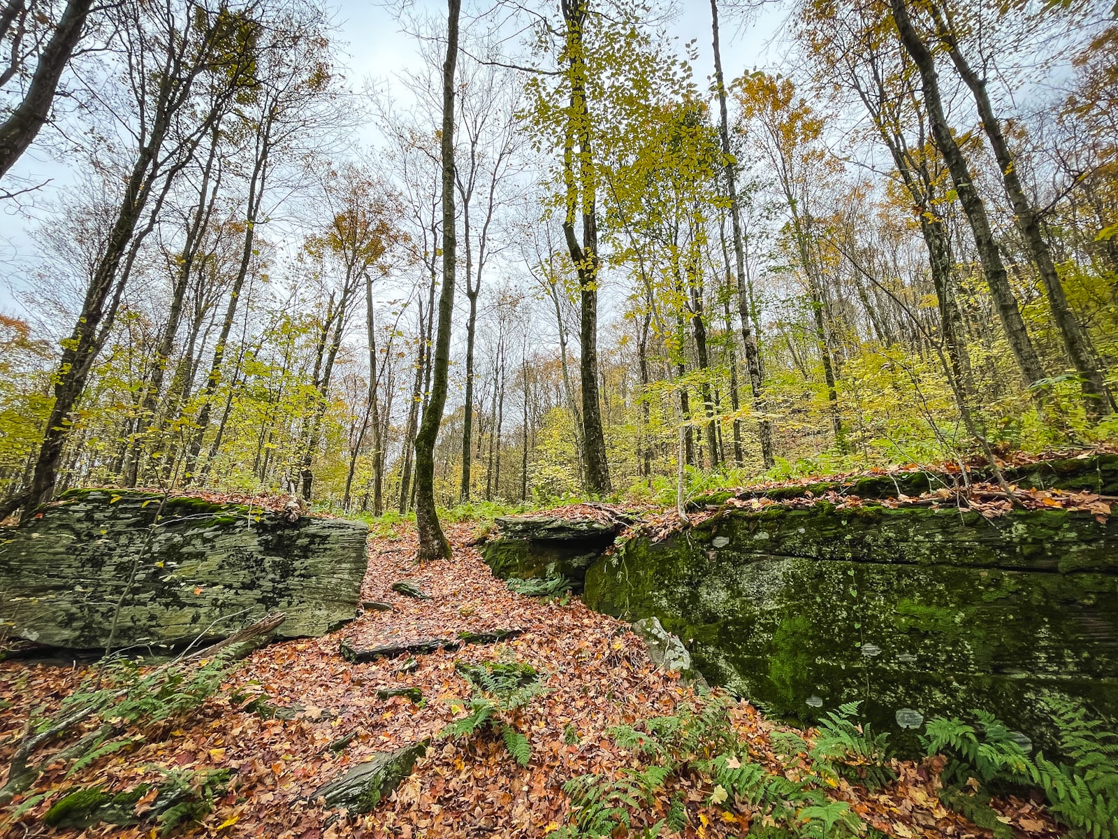
Located just outside the village of Delhi, NY, in the western Catskills, the Bramley Mountain Trail was designed by the Catskill Mountain Club in partnership with the NYC Department of Environmental Protection. The 4-mile loop climbs through hardwood forest, past historic stone walls and dramatic rock formations, and rewards hikers with one of the region’s most scenic and interesting summit experiences.
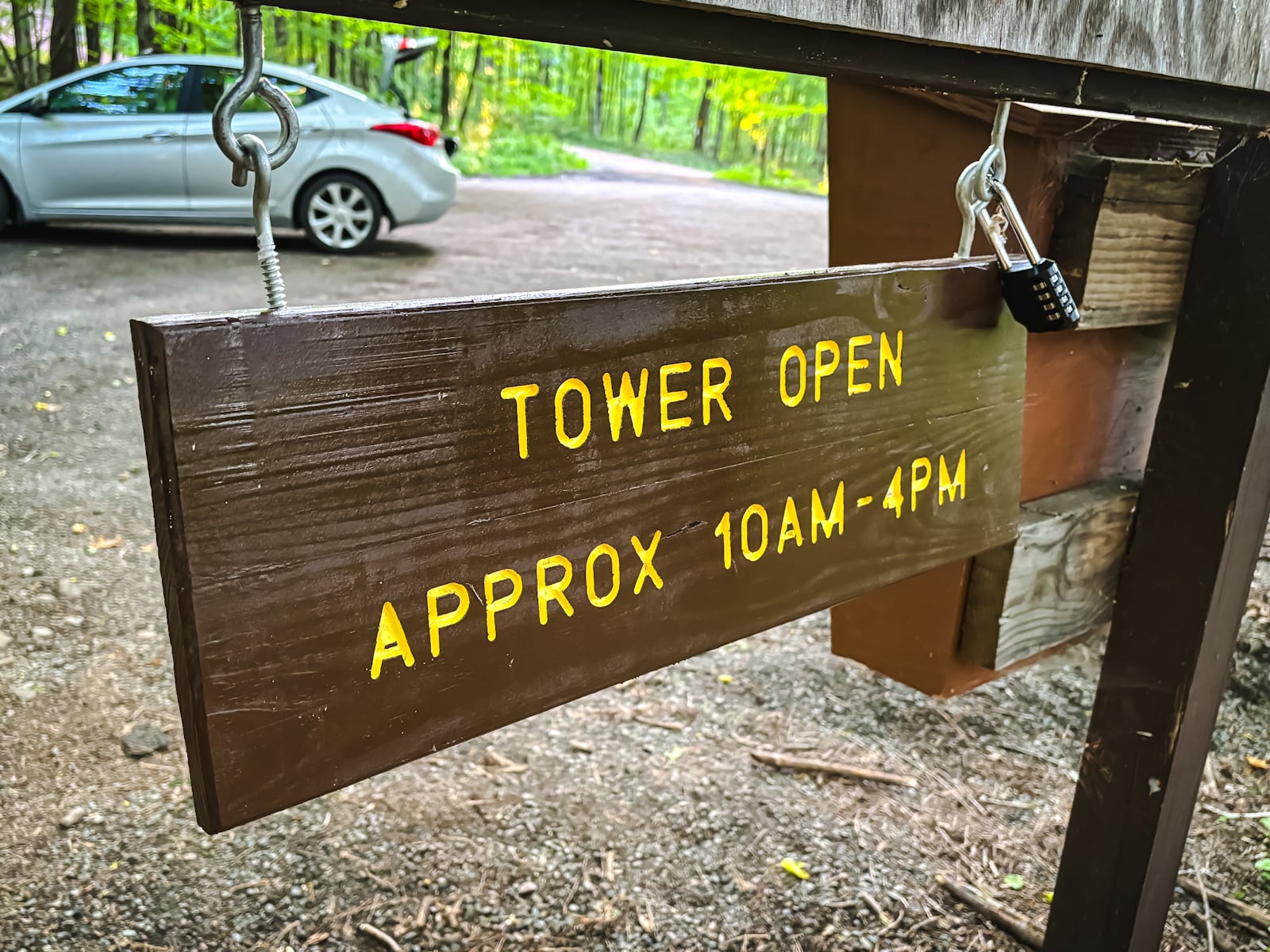
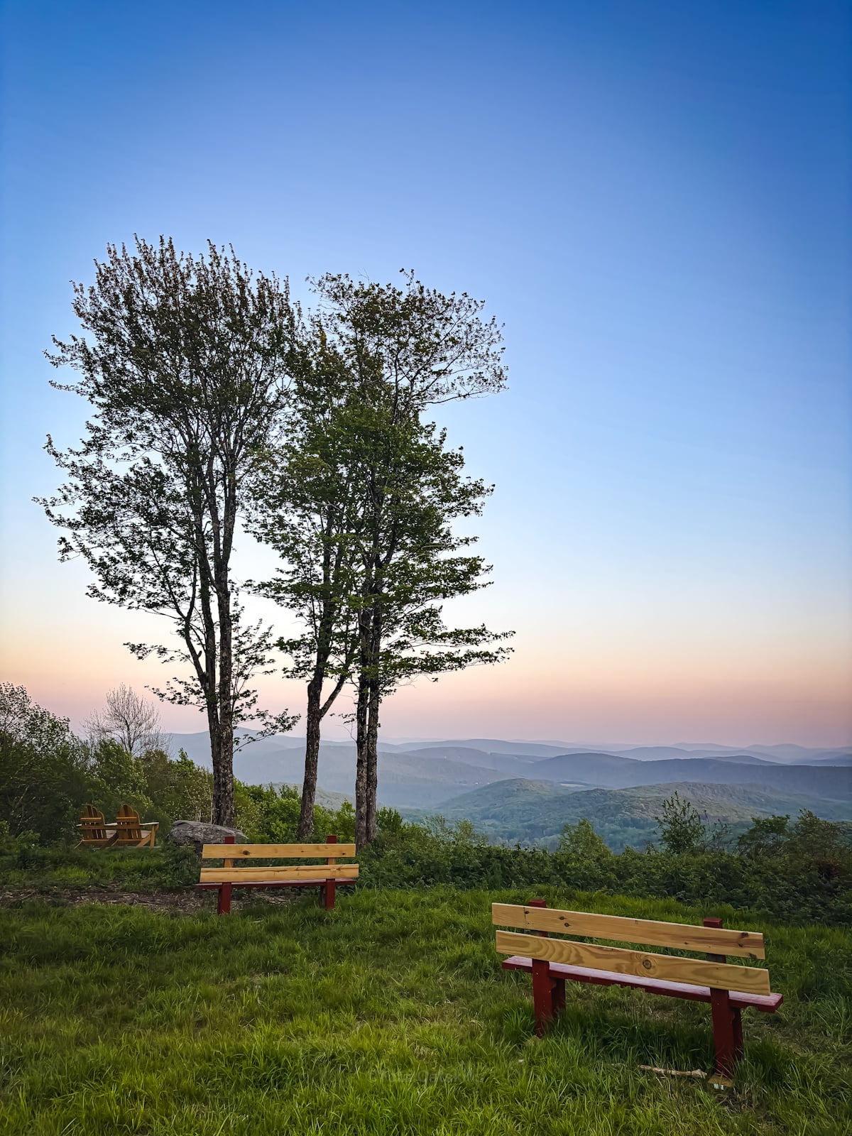
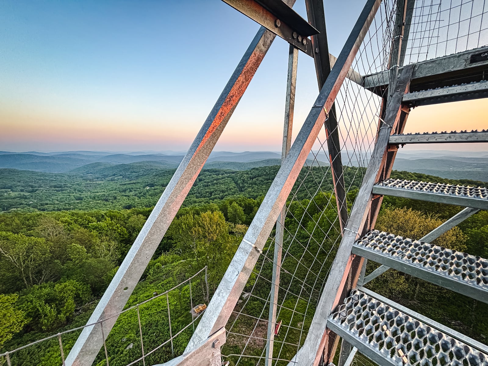
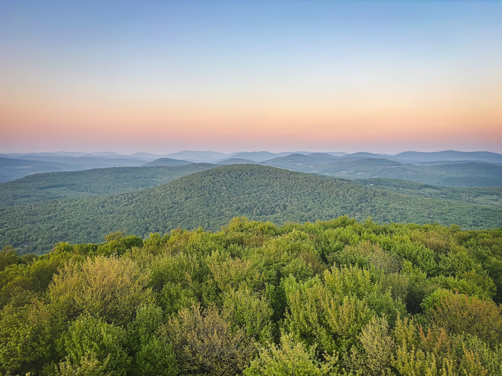
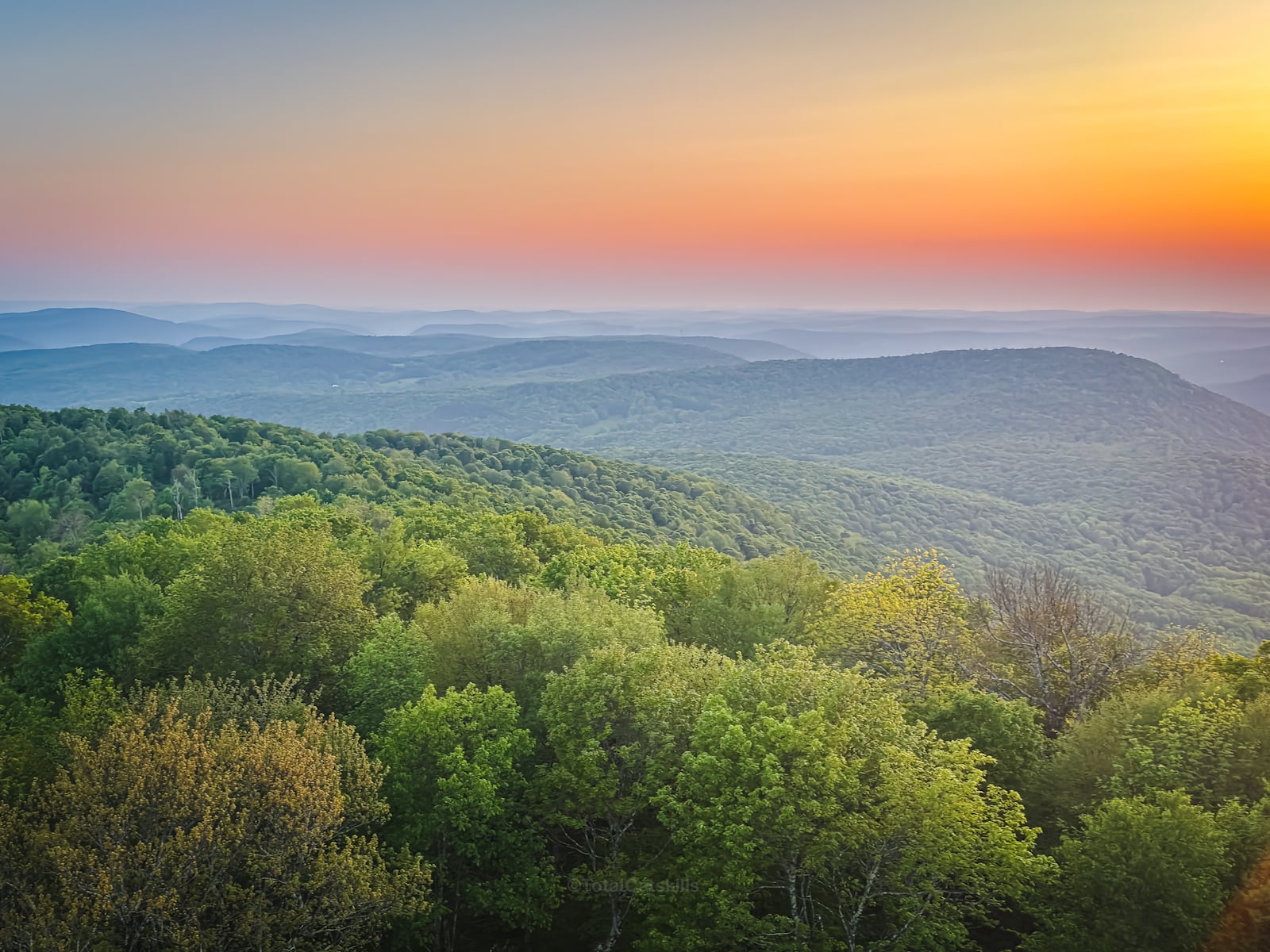
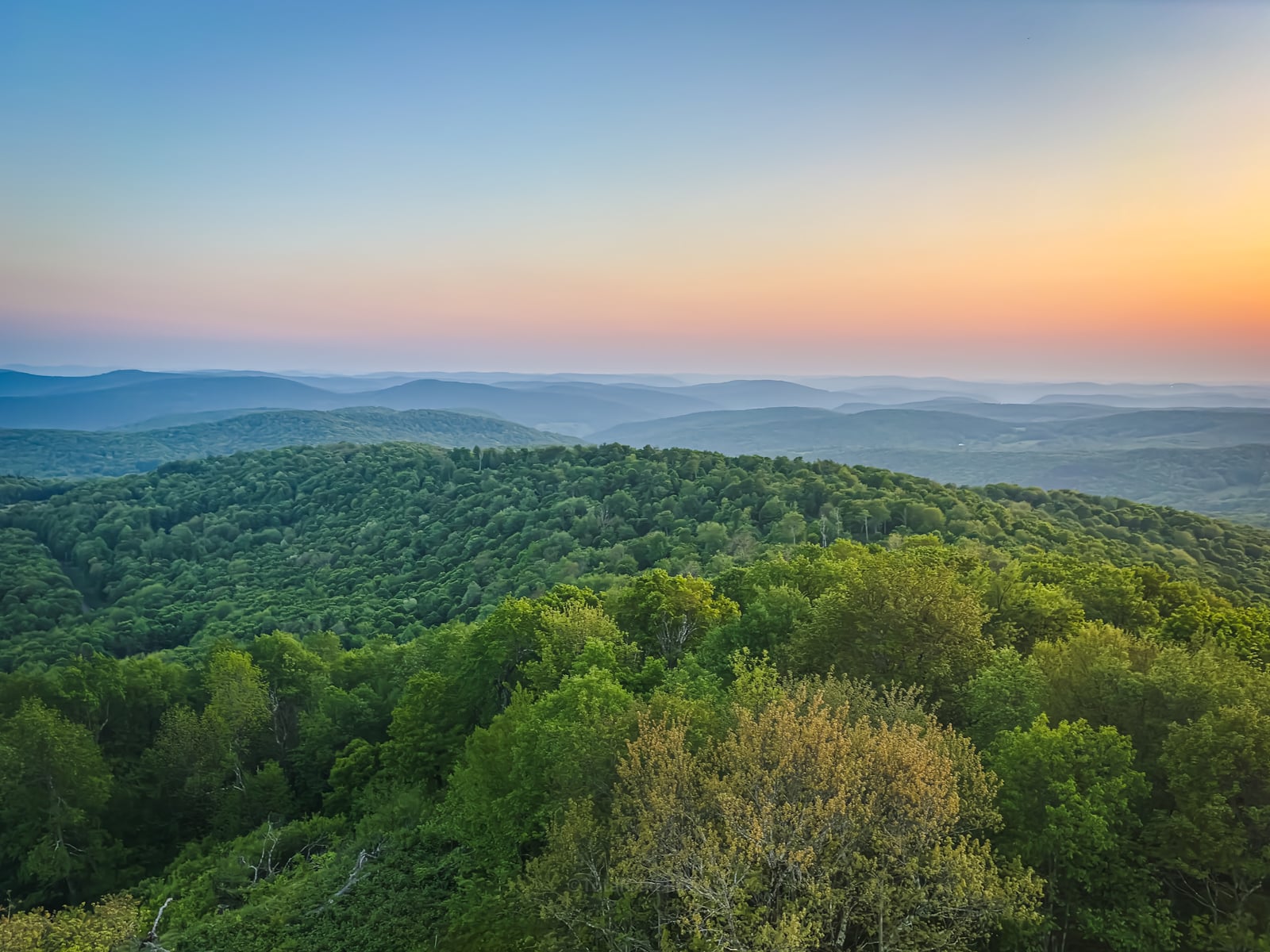
The fire tower is typically open to the public on weekends and holidays from Memorial Day Weekend through Indigenous People’s Day, thanks to a team of volunteer stewards. Visitors can climb the restored structure for panoramic views of the western Pepacton Range, Mount Pisgah, and the surrounding Catskill landscape. On clear days, the vistas stretch for miles. It’s also a fantastic spot for a sunset hike.
Bramley Mountain has always been special — and now, with its fire tower restored and trail network complete, it has become one of the most satisfying short hikes in the Catskills. Whether you’re exploring the cliffs and caves, checking out the abandoned bluestone quarry, or climbing the tower to spot your house from the cab, this trail delivers a deep sense of place and history.
Frequently Asked Questions
Is Bramley Mountain Fire Tower open to the public?
Yes. The tower cab is staffed by volunteer stewards on weekends and holidays from Memorial Day through Indigenous Peoples’ Day (10 AM–4 PM, weather permitting). Note: even if the cabin is closed, the upper steps of the tower afford truly excellent views.
How hard is the Bramley Mountain loop?
Moderate. The full loop spans about 4 miles with roughly 860 feet of gain. Trail surfaces range from woods roads and quarry footing to rocky experiences as you near the summit.
What can I expect to see along the trail?
Highlights include a disused bluestone quarry, rock outcroppings, caves, stone walls, cliffs—and, at the summit, panoramic views from the fire tower over the western Catskills and Pepacton valley
When was the fire tower rebuilt?
The original 80‑foot Aeromotor LS40 tower, removed in 1975 and preserved in storage, was reconstructed on the summit in late 2024. The rebuild was finished in early 2025 after securing permits and volunteer effort.
Where is the trailhead located?
Glen Burnie Road, Delhi about 0.7 mi from County Route 18 and about 3.3 mi north of State Route 28. The exact location with links to a Google Map is shown at the bottom of this post.
Bramley Mountain Fire Tower Hiking Trail
The Bramley Mountain Fire Tower hiking trail includes…
- Moderate trails with a few steep-ish sections
- Lots of ferns, lots of lovely woods
- Rock outcroppings and a quarry
- A cracking summit
- Stunning views from a fantastic fire tower
A full breakdown is provided below in the hike notes with 13 photos.
Bramley Mountain Fire Tower Hike Time
Allow 1½-2 hours for this hike.
This applies to whether you do the full loop (as shown above) or just go up-and-down one side of the mountain, as I did for my second visit.
Bramley Mountain Fire Tower Elevation Gain
The elevation gain for this hike is 860 feet (apx 260 meters).
BTW, you might also enjoy…
- NEW › Winter Skincare for Hikers
- CATSKILLS › Best Catskills Waterfalls
- STAY › Find Your Perfect Catskills Stay
- ADIRONDACKS › Hike Van Hovenberg
- ENTERTAINMENT › Best & Worst Hiking Movies
- Follow › My Instagram @TotalCatskills
- Follow › My Substack @TotalCatskills
- Follow › My writing for Times Union
Bramley Mountain Fire Tower Trail Notes & Gallery
Parking here is pretty good but note that Glen Burnie Road is an unpaved red-dirt road. My two-wheel drive Elantra has a little trouble getting up here. I would not attempt it in icy conditions. I recommend 4-wheel or all-wheel drive.
Pay attention to the trailhead signage and stay on trail for this hike. In tick and black fly season, bring your anti-bug a-game.
The summit can be approached from either direction. Most people tackle the mountain clockwise.
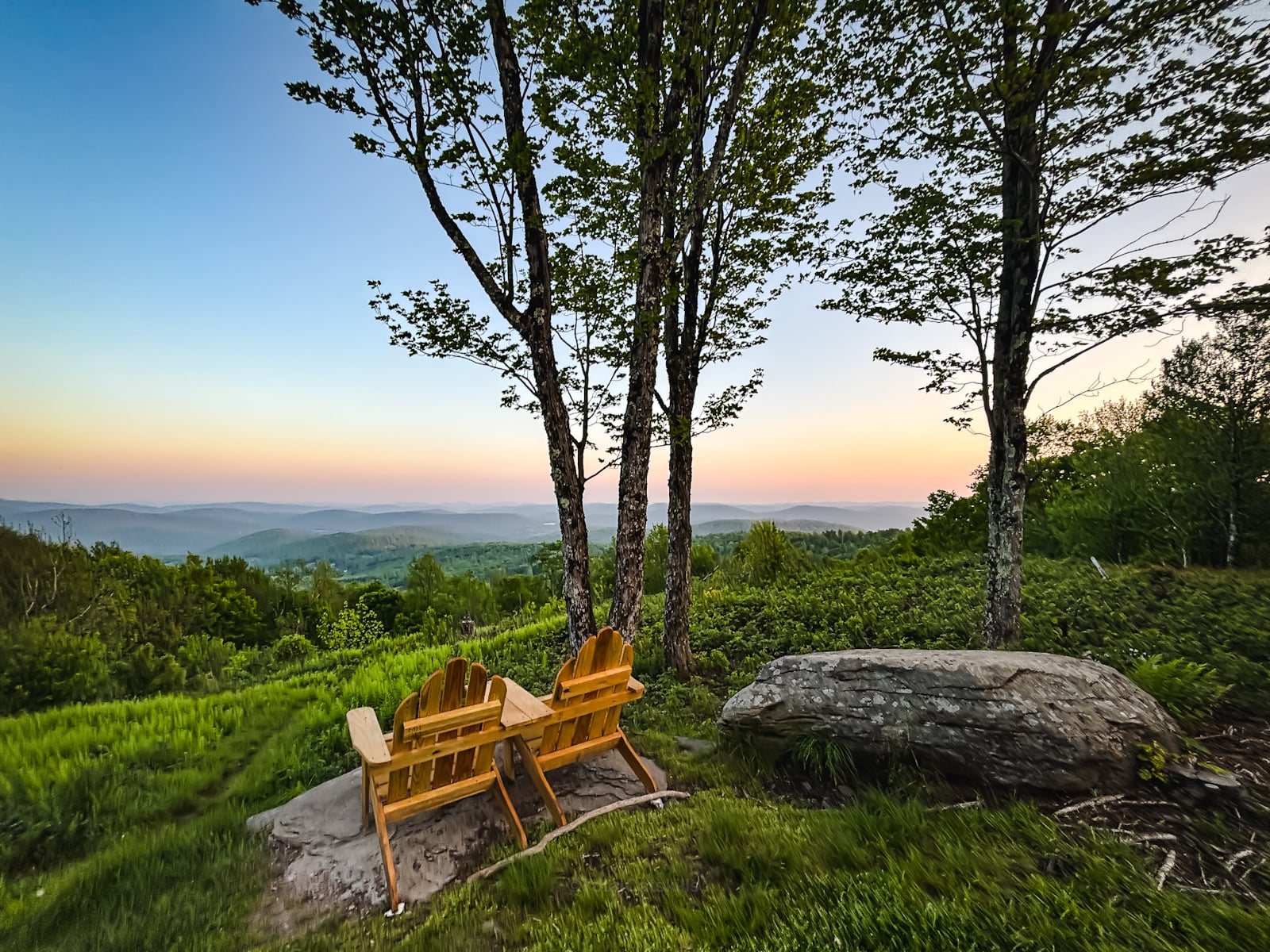
Bramley Mountain Summit
The summit is now one of the nicest summits in The Catskills. The folks who redesigned this area did an incredible job. If you don’t love heights, there are several benches and Adirondack chairs to sit on and enjoy the views—which are now wide open to the lands below. The difference between 2023, when I first visited it, and 2025 is shocking. It’s just so so lovely.
Bramley Mountain Fire Tower
Bramley Fire Tower Views
If this is why you came, you’ll be so glad you did…
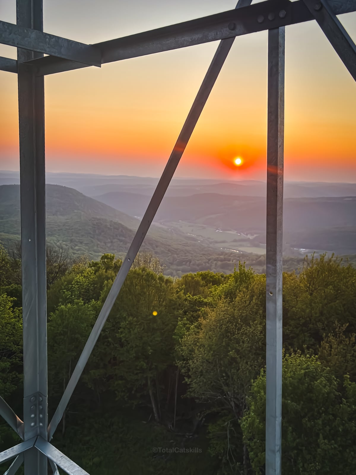
Yep, I was pretty happy with this hike!
Similar Hikes
Check out the other fire tower hikes I’ve done, Catskills and Adirondacks.
Read More
Get full access…
Get instant access to the full version of this site and enjoy great supporter benefits: full galleries, full trail notes, early access to the latest content, and more.
Hot on the website right now…
Follow for more…
Follow my @TotalCatskills content on Instagram for regular hiking inspo and safe, inclusive community.
Bramley Mountain Fire Tower Trailhead
Large-ish trailhead up a steep red-dirt road
Google Maps Location: 42.299202, -74.835813
The map below shows the exact topographic location of the trailhead
Cell Service
I had service up high. Patchy down low. My network is Verizon. YMMV.
The parent mountain for this hike is Bramley.
