Disclosure: This content may contain affiliate links. Read my disclosure policy.
Steep-ish out-and-back with sweet side-hikes.
Trailhead info at bottom of this post.
Giant’s Nubble is a dramatic Adirondack destination with amazing views of Giant’s Washbowl below and surrounding high peaks all around and above.
This route can include the short, easy side-hike to Roaring Brook Falls, either on the way in or on the way back out.
This route is considered a little challenging, and it does have some steep sections that will make you huff and puff.
BTW, you might also enjoy…
- UPDATED › Best Bug Spray & Bug Repellent for Hikers
- CATSKILLS › Peakbagging The Catskills High Peaks (Ultimate Guide)
- STAY › Find Your Perfect Catskills Stay
- ADIRONDACKS › Wright, Algonquin & Iroquois Peaks
- LEARN › Teach Yourself How to Use a Compass
- ENTERTAINMENT › Best & Worst Hiking Movies
- Follow › My Instagram @TotalCatskills
- Follow › My Substack @TotalCatskills
- Follow › My writing for Times Union
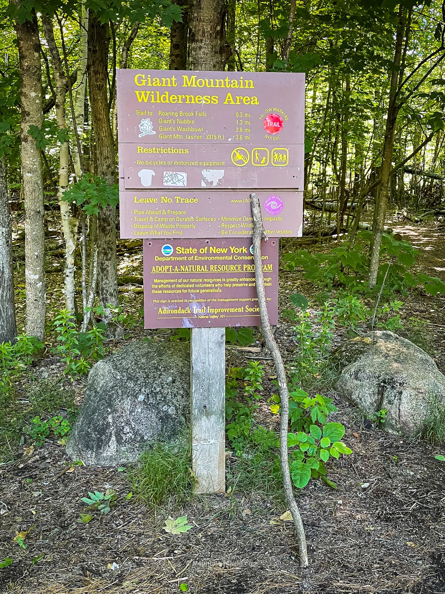
Giant Mountain Trailhead & Parking
There are several lots for the popular Giant Mountain hikes that kick-off from Route 73. The parking area for this hike is the most westerly lot for Giant on Route 73, about 1.5 miles west of parking area for the classic Ridge Trail Route.
The lot is on the right side of the road (if driving west), right after the lot for the Ausable Club on the other side of the road. Both lots are close together on a bend, so keep an eye out.
Note: Many of the classic road-side parking spots on Route 73 have been blocked off and, from May onwards, the AMR lot across the street requires a reservation. All of this puts additional pressure on the existing public lots, most of which are on the small side.
So arrive early, especially on busy weekends and summer days. (This is also an amazing spot for Fall Foliage season.)
Giant’s Nubble Hiking Trail
Start at the trailhead where there are some fairly rank portable toilets.
Head southeast, following the red blazes.
This route passes the turn-off for the bottom of Roaring Brook Falls which is a fun side-trip you can do on the way in, or on your way out.
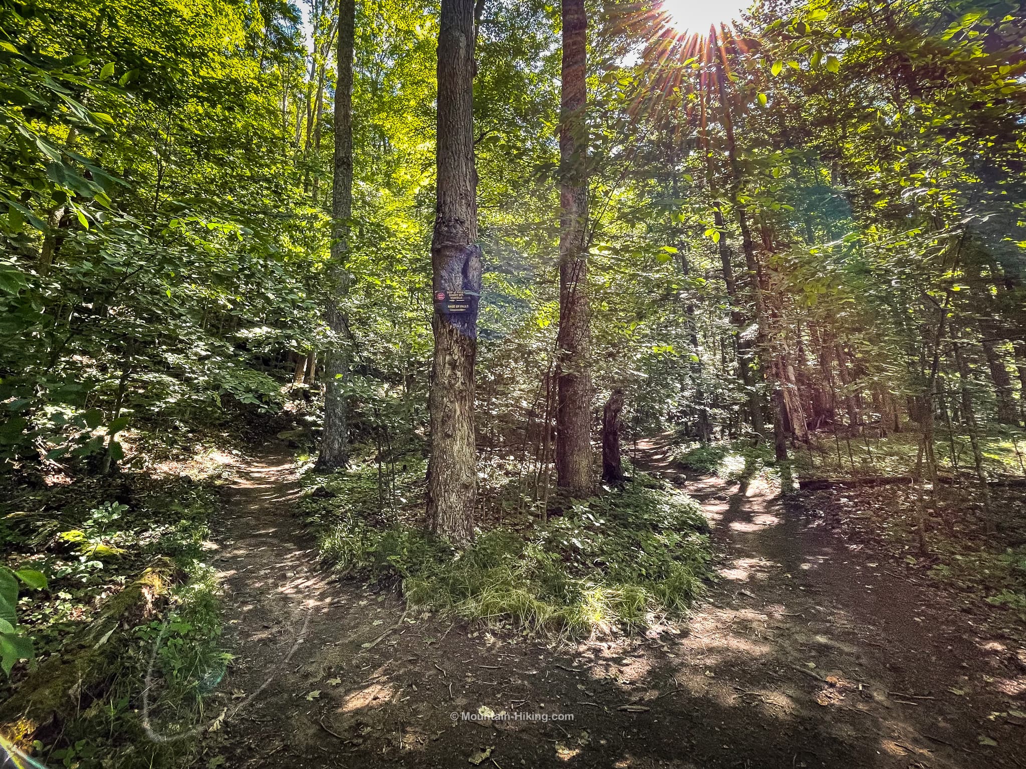
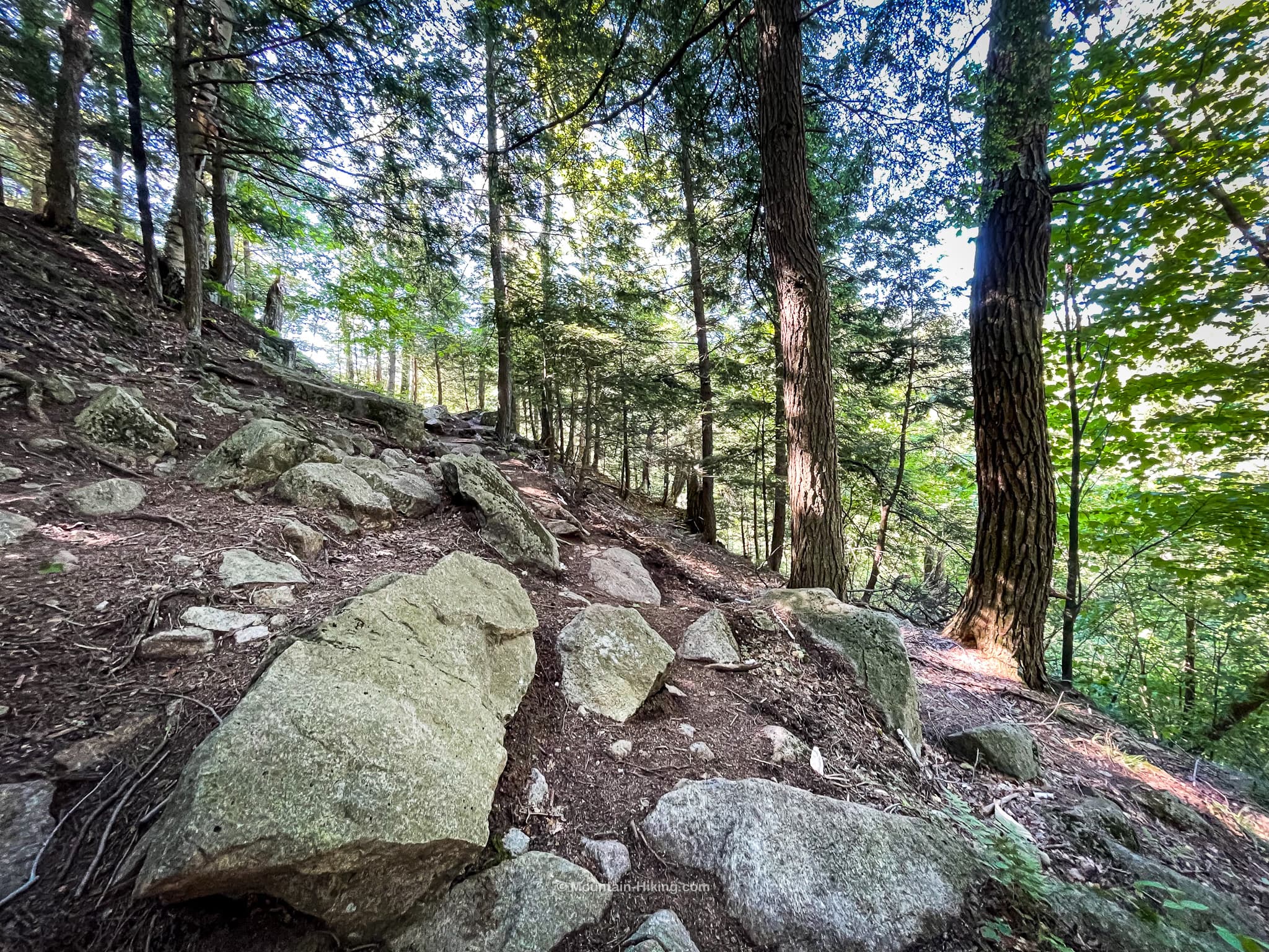
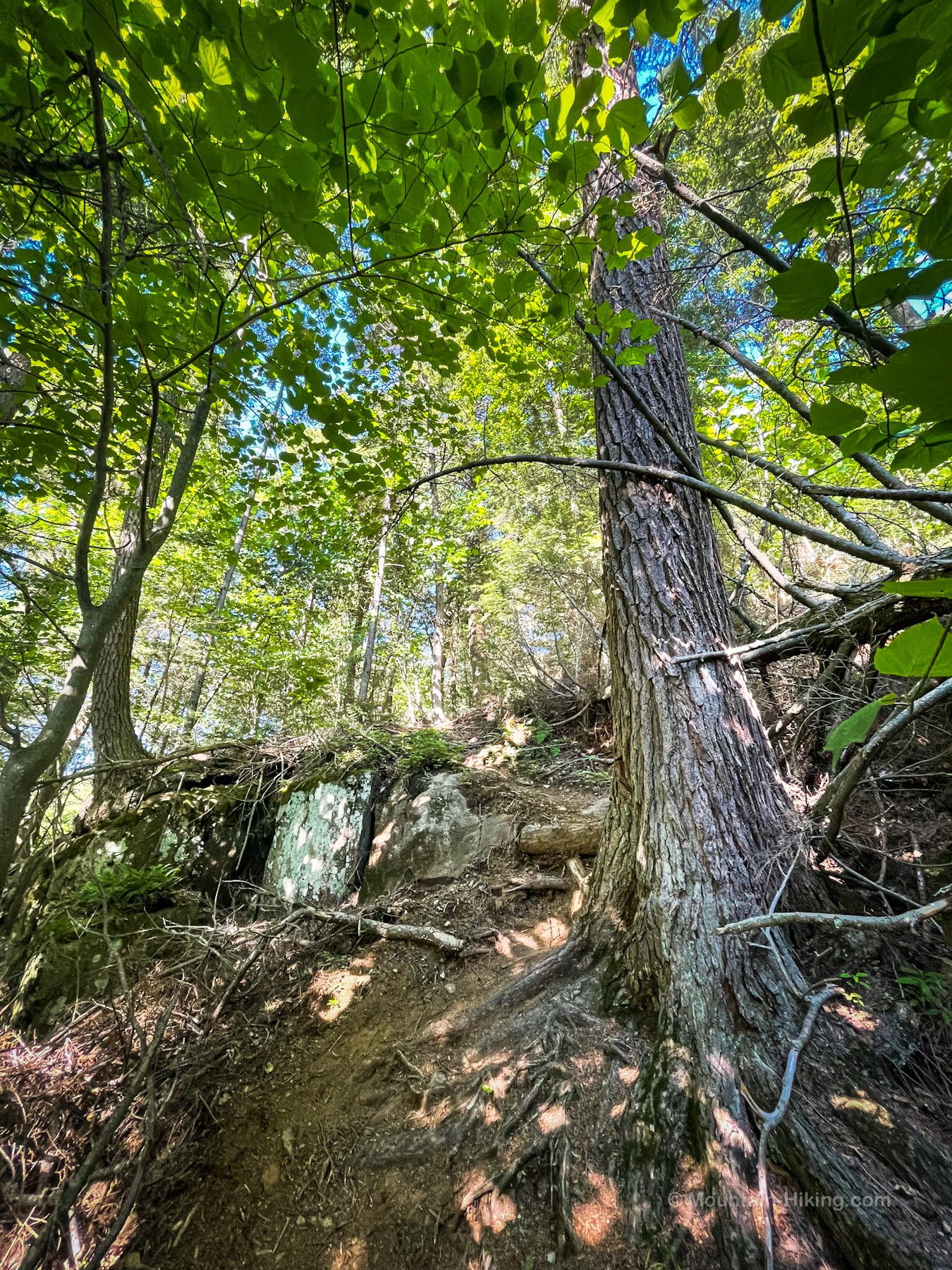
Continue left/uphill. The trail is steep and nubbly…
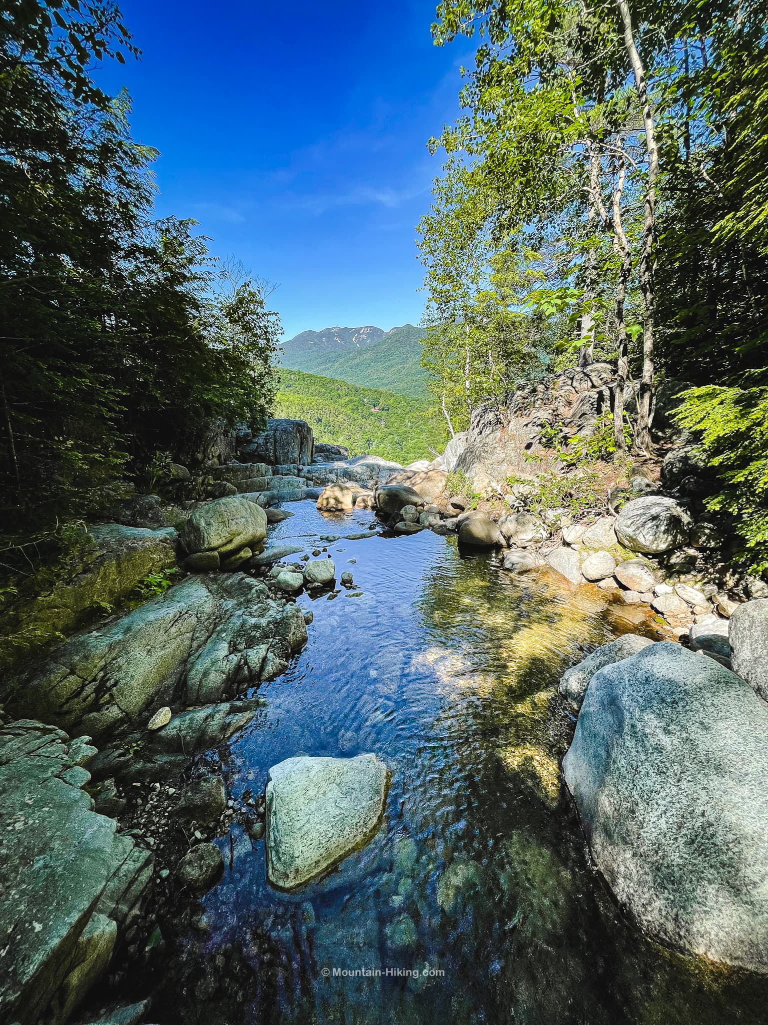
You’ll cross Roaring Brook itself not far from the top of the falls…
The top of Roaring Brook Falls has a grand view…
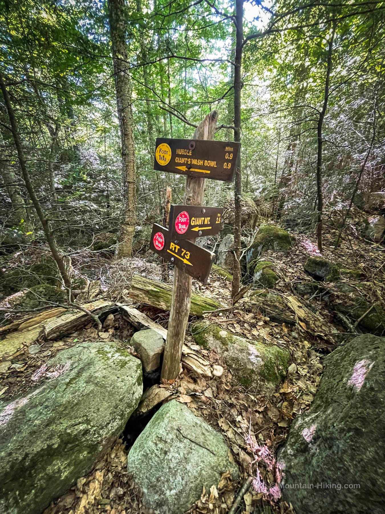
At this junction, start to follow the yellow trail blazes toward Giant’s Nubble and Wash Bowl
The trail is a little rugged but there are no technical bits or scrambles…
Continue to follow the yellow blazes.
When you get to this sign, pause…
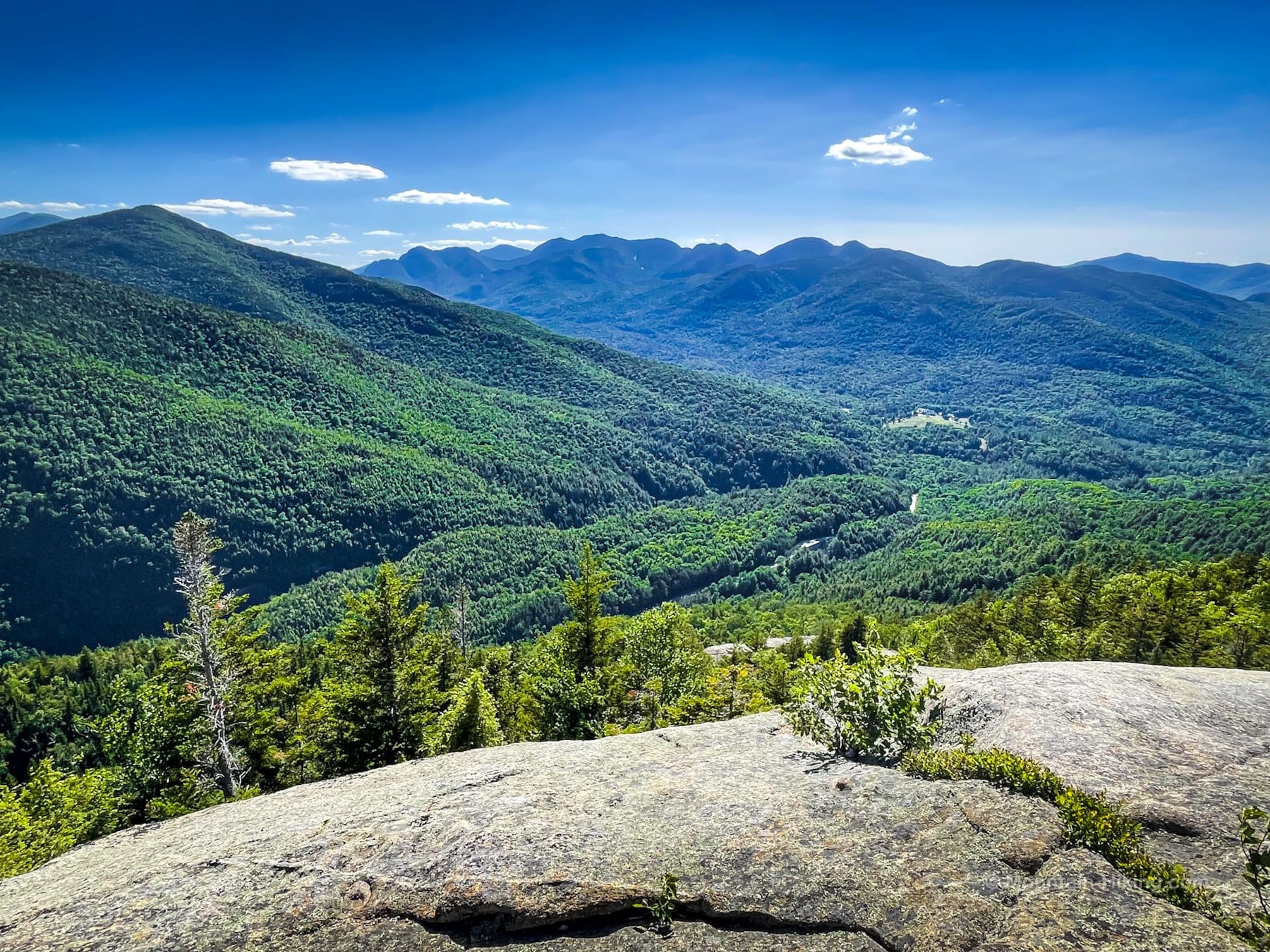
Continue east for just 500 feet or so to get to the classic Giant Washbowl Overlook with The Dix Range in the background…
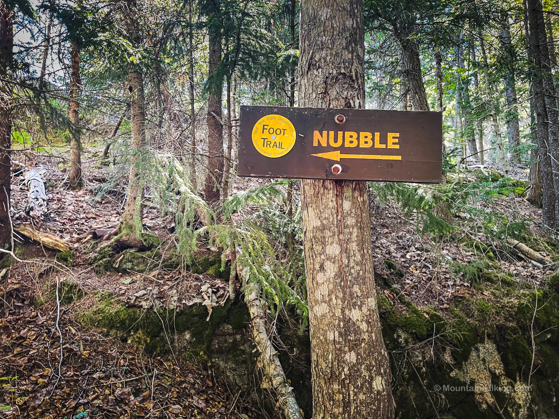
Return to the sign for Nubble and head uphill.
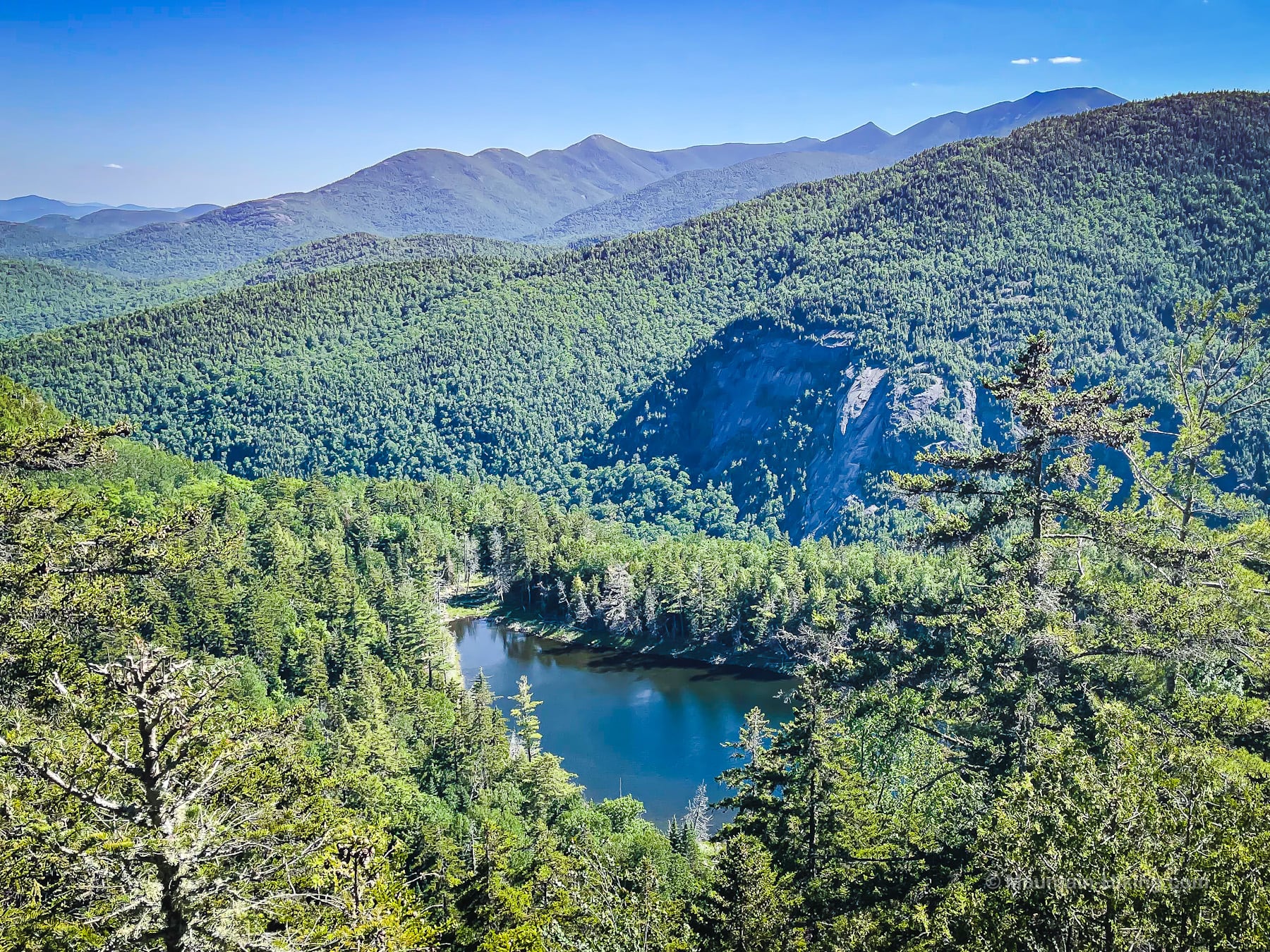
Giant’s Nubble Summit & Views
The views from Giant’s Nubble are spectacular: Round Mountain, Noonmark Mountain, The Dix Range, and Giant Mountain — plus the Route 73 corridor and St Hubert’s below…
Make sure to climb up on the Nubble itself, and explore the many open angles from on top and below the open rocky summit.
View of Giant Mountain…
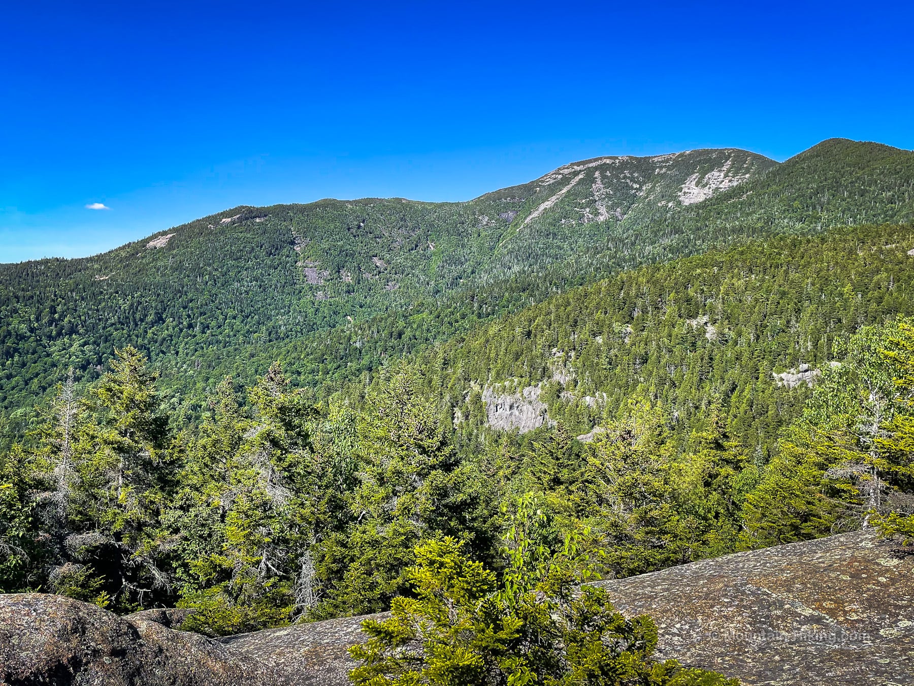
View of Round Mountain & Noonmark Mountain
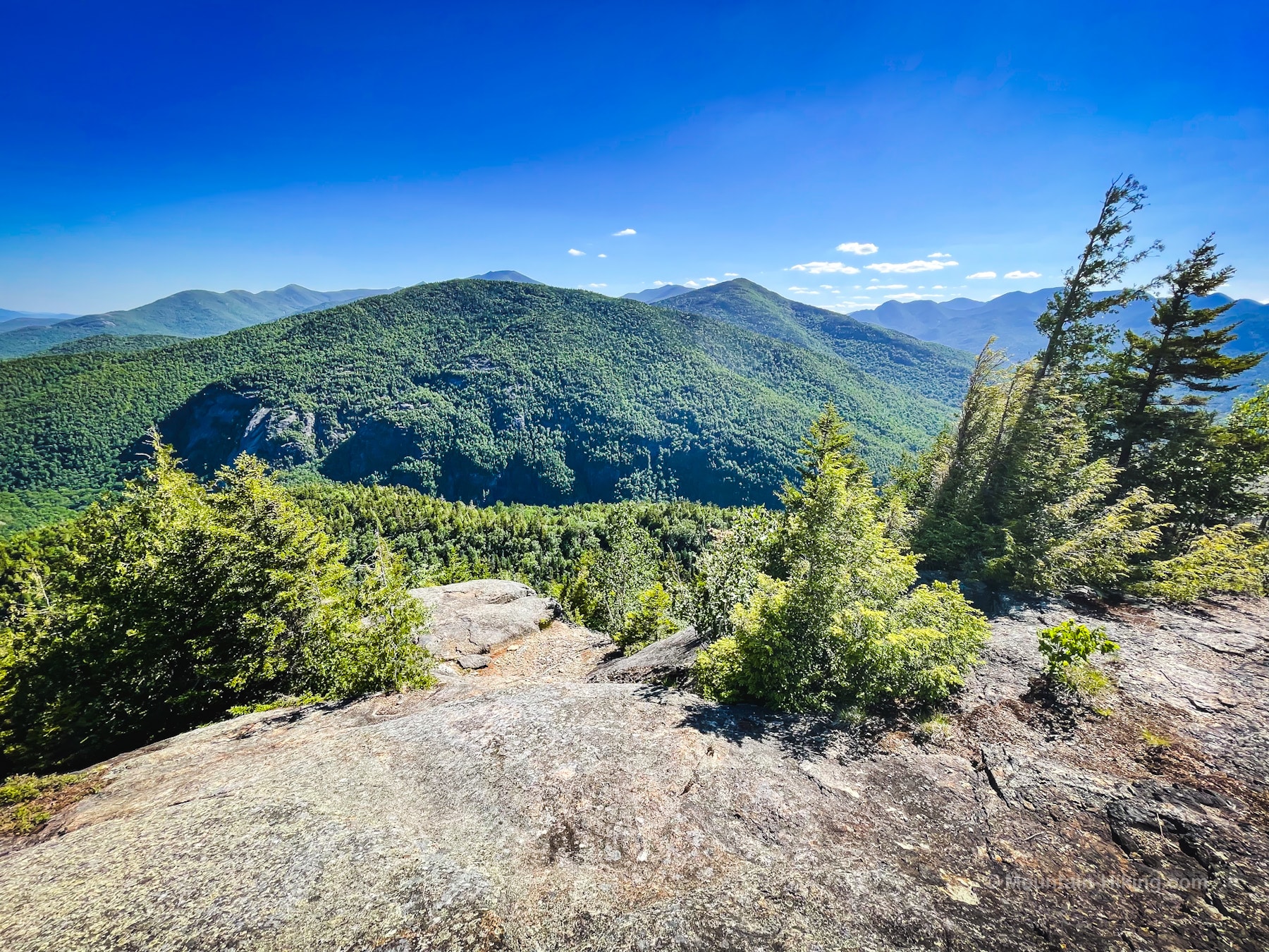
View of Noonmark Mountain & The Great Range
Lots of space up here to spread out and enjoy a picnic. Please Leave No Trace.
From the summit, head back down to the yellow Nubble sign, turn west/left, and return to Route 73 the way you came.
Similar Hikes
This is a fantastic scenic hike.
The short Adirondack hike to Big Crow also provides many excellent views, and is easier too. The short hike to Moxham Mountain also ends with an amazing valley view.
Get full access…
Get instant access to the full version of this site and enjoy great supporter benefits: full galleries, full trail notes, early access to the latest content, and more.
Hot on the website right now…
Follow for more…
Follow my @TotalCatskills content on Instagram for regular hiking inspo and safe, inclusive community.
Giant’s Nubble via Roaring Brook Falls Trailhead
Small-ish and very busy.
Google Maps Location: 44.150263, -73.767514
The map below shows the exact topographic location of the trailhead
Cell Service
None at trailhead. Very limited elsewhere. My network is Verizon. YMMV.
The parent mountain for this hike is Giant Mountain.
