Disclosure: This content may contain affiliate links. Read my disclosure policy.
Once you walk away from the trailhead, Google Maps reaches the limits of what it was designed to do. Is Google Maps good for hiking? In a single word: No.
Google Maps is one of the greatest navigation tools ever made. It gets tens of millions of people to trailheads every year, helps us all find gas stations and restaurants in unfamiliar places, and makes our road trips dramatically easier than they were a generation ago.
But it is not a hiking app. Not even a little bit.
That gap between driving app and hiking app just got a real-world stress test. Three teenagers set out on British Columbia’s Howe Sound Crest Trail after Google Maps put the hike at about five hours. Search and rescue called that estimate wildly optimistic. The actual route runs 12 to 14 hours of alpine terrain, scrambling, and exposure. The wrong number didn’t just mislead these kids. It set everything downstream in their planning off kilter: their start time, their food, their water, their expected return time.
Even Google says as much: after the rescue, a spokesperson pointed out the app is built for streets and recommended hikers use trail-specific tools instead.
Roads are predictable things: names, speed limits, traffic patterns, recalculating GPS. But a Google Maps car has never driven up a mountain trail.
Hiking trails are categorically different environments. There is no AI tool for the wilderness, and I doubt there could be, or ever will be. Even crowdsourced data of the kind you find on AllTrails are comically and notoriously prone to under-reporting a trail’s difficulty.
A relatively short three-mile hike can be an easy stroll or a half-day grind that tears you up—depending on footing, elevation gain, exposure, and local conditions that change by the week. Mileage alone tells you almost nothing. Neither does elevation gain. What matters—trail condition, scrambles, water sources, whether anyone’s hiked it recently—is exactly what a road-navigation app has no way of knowing.

Years ago, I bumped into a hiker on Giant Ledge in the Catskills. They couldn’t figure out how to get down off the mountain. I asked if they had a map, and they showed me their phone. Google Maps. Google Maps but no cell service, so the screen wouldn’t load properly. They weren’t far from the last junction but they were in a bit of a panic. I got them to the junction with a recommendation for AllTrails or GaiaGPS (both of which work without cell service once you’ve downloaded the terrain via a live connection: cell or WiFi) and set them free.
Is Google Maps good for hiking? In the outdoors, you can’t rely on regular cell service. If your plan depends on loading live map data as you go, you’re already in over your head. At the very least, download everything you need before you leave the house. Treat it like packing your bag.
- Also read: The Ten Essentials
BTW, you might also enjoy…
- CATSKILLS › Catskills Fall Foliage 2026
- ADIRONDACKS › Hike Cascade & Porter
- STAY › Find Your Perfect Catskills Stay
- UPDATED › Best Bug Spray & Repellent for Hikers
- LEARN › Camping in the Catskills
- Follow › My Instagram @TotalCatskills
- Follow › My Substack @TotalCatskills
- Follow › My writing for Times Union
What Apps to Use Instead of Google Maps for Hiking
- AllTrails — Established routes, elevation profiles, recent conditions, offline maps with the paid tier. Best starting point for most day hikes.
- GaiaGPS — More power, more learning curve. Topo maps, satellite imagery, public land overlays, route planning. What backcountry regulars and SAR volunteers actually use.
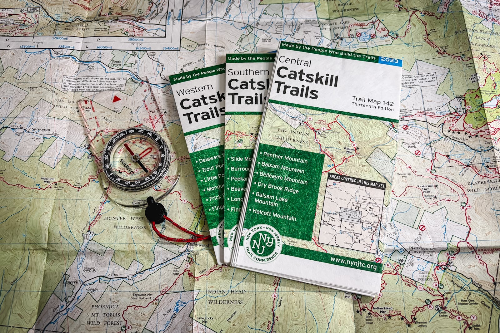
- Avenza Maps — For the Catskills specifically: download the NYNJTC’s official Catskill trail maps. Junctions, lean-tos, campsites, streams, elevation. It’s a level of detail a general nav app was never built to carry.
- A paper map — Not for nostalgia. For insurance. Phones die, crack, and overheat. Paper don’t need no battery.
Websites like this one with trail guides written by knowledgeable hikers who can tell you exactly what hiking a particular trail is like—and how it feels to hike a specific route—are another very useful tool to add to your regular research kit. [This site focusses mostly on hiking in New York’s Catskills and Adirondacks mountains but there’s a ton of how-to-mountain-hike-safely information here too, and it’s all free.]
Don’t Ask Google Maps About Your Hike
Trip reports and forum posts tell you what a trail is like today—not just where it is. Before anything long, remote, or above your usual difficulty, post your plan in a hiking Facebook group or on r/hiking and ask people to poke holes in it. This costs nothing and it’s the single best way to catch a bad assumption before it becomes a rescue call. Experienced hikers will tell you flat out if your timeline is delusional or your water plan is thin.
Can I Use Google Maps for Hiking Trails?
I could not advise against it more. For getting to the trailhead, sure. After that, no. It’d be like using a road atlas to bushwhack through a forest.
Is There a Google Maps for Hiking?
No. There are dedicated apps for hiking that are much more informative and safer for hikers to use. What is the best app to use for hiking?
- Check out the 12 Best Hiking Apps
Does AllTrails use Google Maps?
Only in the sense that it will provide a link to Google Maps for directions to the trailhead for a given hike.
How to Use Offline Google Maps for Hiking
You can’t. Terrible idea. Please don’t do this. It’s not made for that purpose.
Ask Online Hiking Groups Instead
There are dedicated, excellent subreddits for individual mountain ranges: r/Catskills, r/Adirondacks, r/WMNF for the White Mountains of New Hampshire, and so on. There is no doubt one for your local mountain range, or you can hit up the more general r/Hiking.
Facebook has a lot of similar group infrastructure you can tap into for local up-to-date knowledge.
The Real Issue Isn’t the Google Maps App
Phones have made hiking way more accessible; no argument there. But convenience and preparation aren’t the same thing. An app can’t tell you if you’re in shape for the climb, whether the afternoon storm rolling in changes your plan, or when it’s time to turn around. That’s still on you. It always will be.
Google Maps gets you to the trailhead. Nothing more. Good maps, offline downloads, current local knowledge, a paper backup, sound judgment—that’s the stack.
A Paper Map is Still Worth Carrying
This might sound old-fashioned in 2026, but paper maps still have one enormous advantage.
Their batteries never die.
Phones overheat. Screens crack. Batteries drain faster in cold weather; I’ve seen this happen to friends, though I’ve also seen it happen on very long hikes in the summer months. Electronics can fail at exactly the wrong moment.
A folded paper map weighs a negligible amount and provides an independent backup if everything else goes wrong. You may never need it. But if you do, you’ll be very glad you brought it along.
Final Hot Take
Is Google Maps good for hiking? Well, it’s great for getting to the trailhead! But once you walk away from the trailhead, Google Maps reaches its limits. Is Google Maps good for hiking? No. Not unless you want to end up as an Internet headline.
Mountain-Hiking.com is independently owned and supported by readers and a small group of sponsors. If you’d like to help me continue producing articles like this, please consider becoming a Patreon supporter.

More Good Stuff
Get full access…
Get instant access to the full version of this site and enjoy great supporter benefits: full galleries, full trail notes, early access to the latest content, and more.
Hot on the website right now…
Follow for more…
Follow my @TotalCatskills content on Instagram for regular hiking inspo and safe, inclusive community.