Disclosure: This content may contain affiliate links. Read my disclosure policy.
Long route with many junctions, so good nav skills are important. Includes a side-quest to Cantilever Rock on the way out.
Trailhead info at bottom of this post.
Approaching from Underhill State Park, the Mount Mansfield Loop trail climbs the western flank, offering a top-tier way to experience this iconic peak.
This route climbs through northern hardwood forest into increasingly rugged, rocky terrain before emerging onto the mountain’s spectacular alpine ridge line.
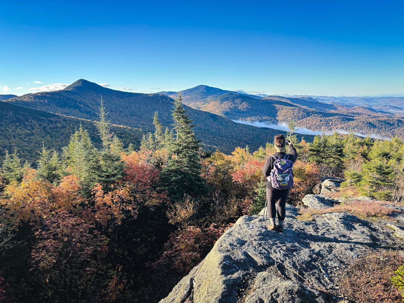
Above treeline, the landscape changes dramatically, with exposed bedrock, low-growing alpine vegetation, and sweeping views in almost every direction.
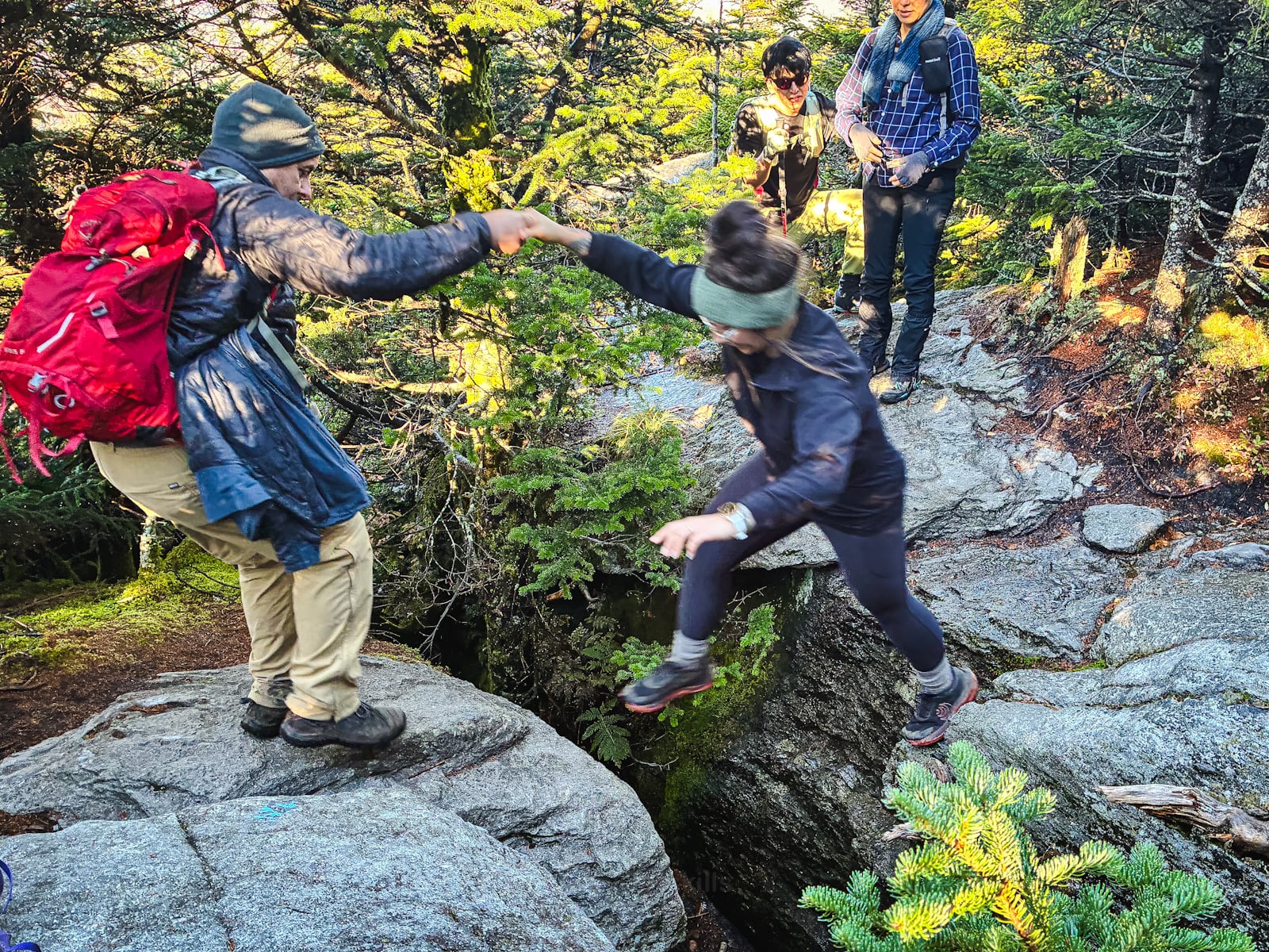
Heading up, there are two rock-scramble puzzles on this route. One is a sheer ledge with a narrow foothold and a tricky lift at the top. The other is a short jump across a small split rock crevice. Great fun with friends to help out but something to think about if you’re doing this route solo.
Note: Mount Mansfield supports one of the largest remaining areas of alpine tundra in Vermont, a fragile environment where plants survive harsh winds, freezing temperatures, and a remarkably short growing season. To avoid damaging this sensitive habitat, please stay on the marked trails and walk only on exposed rock.
On the way down, this route also includes a short side-quest to Cantilever Rock, which is well worth visiting.
This is quite a strenuous mountain hike, with sustained elevation gain, steep rocky sections, and significant exposure to wind and weather near the summit. The terrain demands care, especially when wet, and conditions on the ridge can be much colder and windier than at the trailhead.
This is definitely a Ten Essentials kind of hike.
For experienced hikers comfortable with steep mountain terrain, however, the Underhill approach delivers a banger combination of physical challenge, alpine goodness, and some of the best mountain views in New England.
Frequently Asked Questions
How long does it take to hike Mount Mansfield Loop Trail
Allow 6-8 hours for this hike, which includes time for an extended summit hang.
What is the elevation gain for Mount Mansfield Loop Trail
The elevation gain for this route is apx 2,700 feet / 820 meters.
Mount Mansfield loop trail parking
Park at Underhill State Park which requires a fee. Cash is best. We got there around 6:00am during fall foliage and picked up one of the last spots.
Mount Mansfield Loop Trail Hiking Trail Guide
This Mount Mansfield Loop hiking route includes…
- Paid parking at Underhill State Park
- Many turns and junctions, so good navigation skills are crucial
- Two tricky rock puzzles that require steady nerves
- Incredible jaw-dropping views from the ascent, ridge, and descent
- A worthy side-quest to an impressive geological formation
A full breakdown is provided below in my hike notes with lots of photos.
BTW, you might also enjoy…
- Catskills Fall Foliage Reports 2026
- 12 Best Fall Foliage Hikes in the Catskills
- Awesome Catskills Vacation Rentals
- Follow › My Instagram @TotalCatskills
- Follow › My Substack @TotalCatskills
- Follow › My writing for Times Union
Mount Mansfield Loop Trail Notes & Gallery
The walk in is long, and steep in spots, but soon enough the views from Mount Mansfield’s south western ridge open up and the rest of the kind is, frankly, quite amazing.
This is the second sketchy rock moment on the way up. It doesn’t look too bad, here, but I did have to screw up my courage to jump across this small ravine. Then I helped my friend, Shayna, and one of the hikers behind her. Good fun.
The views just keep getting better and better. The views extend to other ridgelines and out to the west toward Lake Champlain and the Adirondacks.
 You’ve got the basic details, but there’s so much more…
Unlock this site now to get complete intel on every route, including my full photo galleries, personal insights and tips. Elevate your next hike with deep trail beta. Experience hundreds of amazing routes at their absolute finest. With Mountain-Hiking.com, you’re not just skimming the surface.
Sean

Read More
Get full access…
Get instant access to the full version of this site and enjoy great supporter benefits: full galleries, full trail notes, early access to the latest content, and more.
Hot on the website right now…
Follow for more…
Follow my @TotalCatskills content on Instagram for regular hiking inspo and safe, inclusive community.

Mount Mansfield Loop from Underhill State Park Trailhead
Large paid lot. But VERY popular. Get there early-early in peak season.
Google Maps Location: 44.529070, -72.843382
The map below shows the exact topographic location of the trailhead
Cell Service
Good at elevation, and some down low too. But mountains are always a little patchy, so expect gaps. My network is Verizon. YMMV.
The parent mountain for this hike is Mount Mansfield.
