Disclosure: This content may contain affiliate links. Read my disclosure policy.
Mostly off-trail / strong backcountry navigation skills required
Hiking Trail Description
This Kaaterskill High Peak hike is for when you don’t want the full slog on one of the sloggiest Catskills high peaks, but you do want some the best views and side quests in the Catskills—all below the 3110′ contour.
This route begins by bringing you to Huckleberry Point via Paradise Point on an unofficial trail. It’s the fastest and most scenic way to get to Huckleberry Point, which is great; it’s the route I’ll be using from now on.
From there, my team for the day and I took regular trails north to try and find a view from the edge of Kaaterskill High Peak’s amphitheater.
After that, most of the team carried on to the summit but I doubled back and explored more on the way out.
Frequently Asked Questions
How long does it take to hike Kaaterskill High Peak Down Low
Allow 4-6 hours for this route.
What is the elevation gain for Kaaterskill High Peak Down Low
The elevation gain for this hike is 1,500 feet (apx 460 meters).
Kaaterskill High Peak Down Low Hiking Trail Guide
The Kaaterskill High Peak Down Low hiking trail includes…
- A short road walk to an unofficial trail
- A scenic hike up to the even more scenic Huckleberry Point
- Exploratory wanderings
- Close proximity to an old Mohawk camp and one of two plane wrecks on the mountain
A full breakdown is provided below in the hike notes with lots of photos.
BTW, you might also enjoy…
- NEW › Winter Skincare for Hikers
- CATSKILLS › Best Catskills Waterfalls
- STAY › Find Your Perfect Catskills Stay
- ADIRONDACKS › Hike Van Hovenberg
- ENTERTAINMENT › Best & Worst Hiking Movies
- Follow › My Instagram @TotalCatskills
- Follow › My Substack @TotalCatskills
- Follow › My writing for Times Union
Kaaterskill High Peak Down Low Trail Notes & Gallery
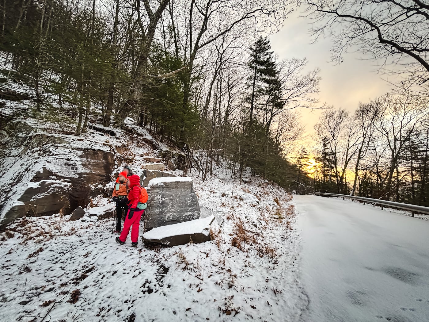
Park at the Huckleberry Point Trail head shown at the bottom of this post, then walk back out to Platte Clove Road, turn left, and walk just a little over ¼ mile to a small parking spot beside a boulder; see the featured image for this trail guide.
Poke around and you’ll see the the trail heading up the flank of the clove. There are a few markers…

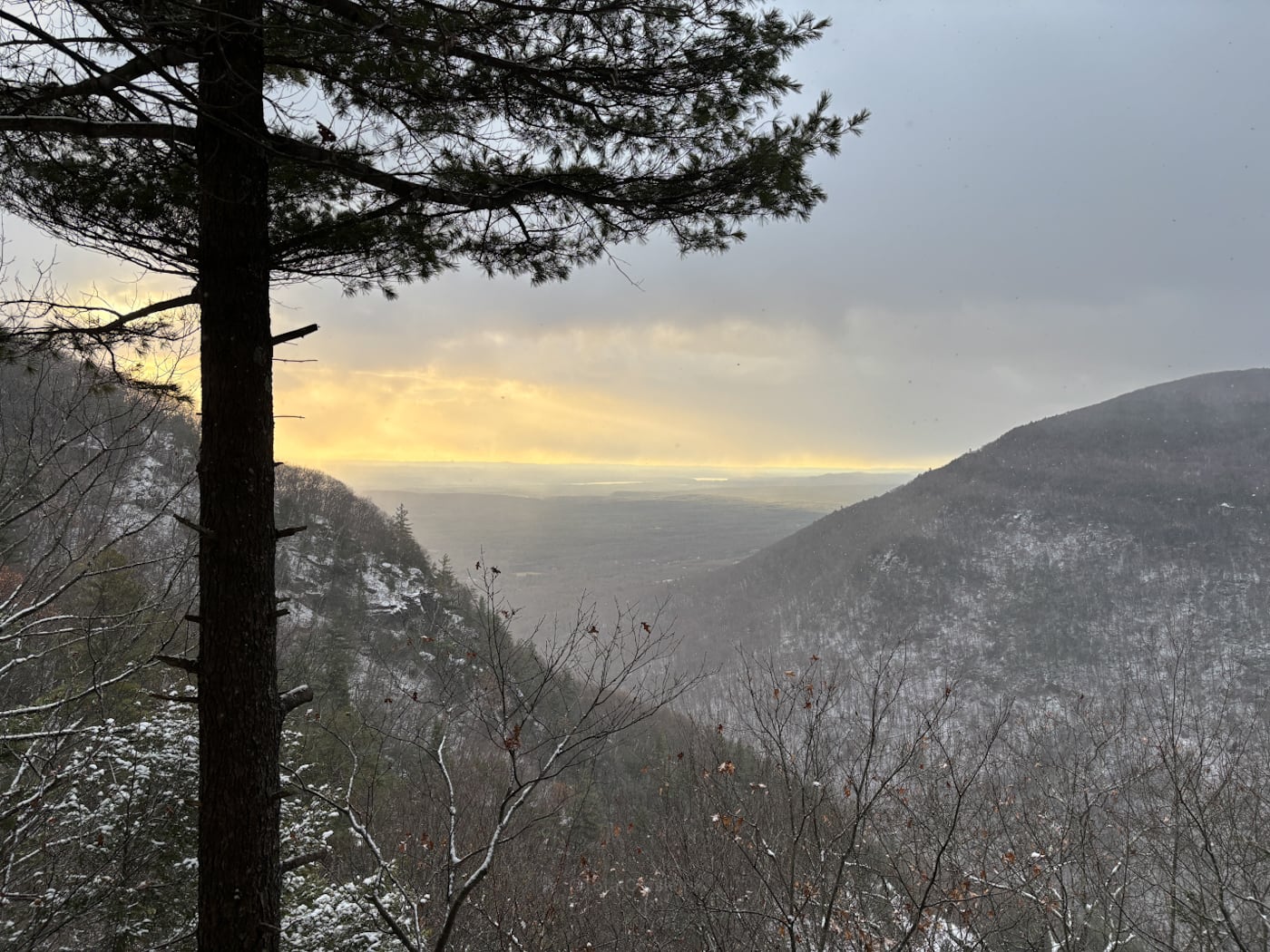
After another ¼ mile or so, you’ll come to Paradise Point, which has a sweet view out of the clove, toward the Hudson Valley floor…
…but also back to Plattekill, Indian Head, and Twin Mountains…

Here is the AllTrails track of the exact route I hiked for this trail guide.
From here, continue for another ¾ mile or so to get to Huckleberry Point (original route).


This is one of the most dramatic views in the Catskills at any time of year…

From here, you can either head back to your car — this makes for a very short hike to a very scenic payoff — or continue to explore the mountain.
More Points of Interest
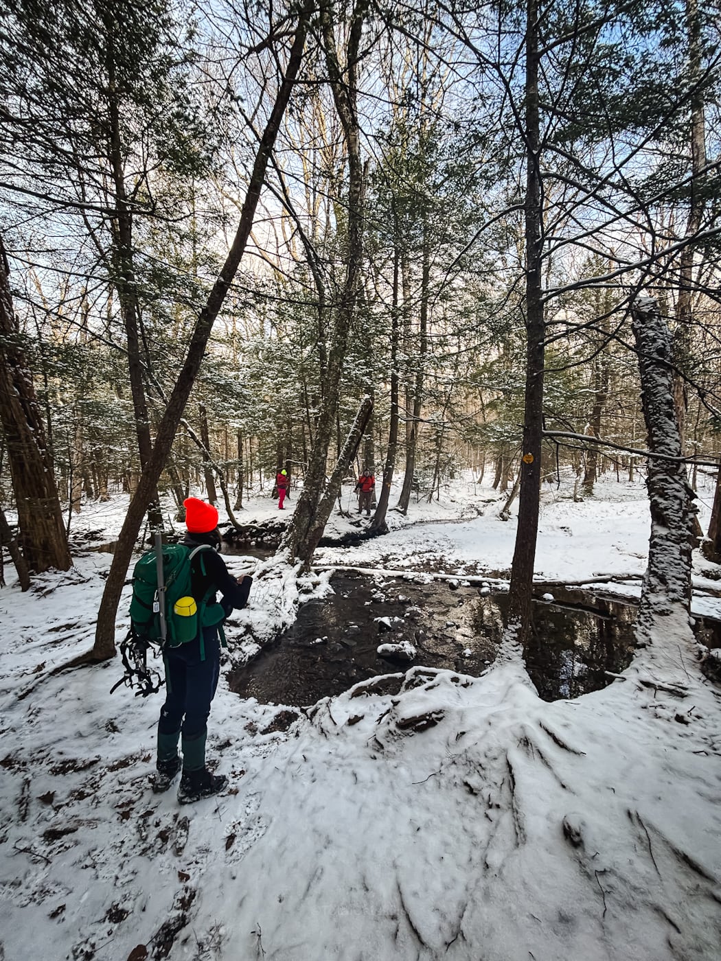
From here, we took the regular yellow-blazed spur trail back (1.4 miles) to the main trail that leads up and down the mountain.
There is so much to explore in this area that we didn’t get to on this day: an old homestead, a cairn, and Lucas Falls. For my next exploration—and I will flesh out this trail guide over time.
My group was heading up the mountain, and I’ve long wanted to explore the possibility of a good view from the edge of the amphitheater glacial structure on Kaaterskill High Peak. It requires a very short bushwhack east from the main trail.
If you’ve ever driven along Route 32 near here, the large scalloped structure on the side of the mountain is the amphitheater.
It seems like there would be a solid view from the lip of the structure but, alas, it’s very grown in and any views are partial and highly obscured.
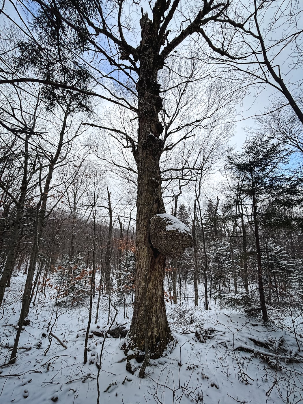
However, on the way back to the main trail, we did find the biggest burl we’d ever seen…
We got back to the main trail quickly. Right around here is the old Mohawak campsite and the lower plane wreck. You can read about them in this trail guide.
I headed down the mountain. Love this hemlock grove at 2,400’…

Not far above the trailhead and parking area, I took a few minutes to head down the sleep bank of mossy brook (around 2,100′) and it was worth the slightly sketchy descent…

From here, it’s just 3/10th mile to the parking area.
Bookmark this trail guide because Kaaterskill High Peak has a lot to offer down low. There’s even more history between Round Top and the summit of KHP I’ll be exploring later this year
[/ppp_patron_only]
Similar Hikes
Check out my list of the most scenic hikes, and this list of historic wrecks.
Read More
Get full access…
Get instant access to the full version of this site and enjoy great supporter benefits: full galleries, full trail notes, early access to the latest content, and more.
Hot on the website right now…
Follow for more…
Follow my @TotalCatskills content on Instagram for regular hiking inspo and safe, inclusive community.
Kaaterskill High Peak Hike Down Low Trailhead
Popular lot for Huckleberry Point and Kaaterskill High Peak
Google Maps Location: 42.133744, -74.082124
The map below shows the exact topographic location of the trailhead
Cell Service
Good in exposed areas, bad once away from the clove. My network is Verizon. YMMV.
The parent mountain for this hike is Kaaterskill High Peak.
