
Disclosure: This content may contain affiliate links. Read my disclosure policy.
An easy out-and-back.
Trailhead info at bottom of this post.
The moderately challenging hike to Lion’s Head lookout near Salisbury, Connecticut, in the Southern Taconics is the perfect hike to fit in before or after work. Also a pretty sweet first date hike.
Lion’s Head Trail in the Taconic Mountains is a popular hiking destination known for its stunning views and moderately challenging terrain. The trail is mostly very easy but provides hikers with a short workout as they climb to the summit.
At the top, a rocky outcropping offers panoramic views of the surrounding countryside, making it a popular spot for picnics and photo opportunities.
Despite its popularity, the trail remains rugged and natural, giving hikers a solid mountain hiking experience in the heart of the Taconics.
An alternate route from lower down the mountain, next to Route 41, offers hikers a longer ascent with more elevation gain.
Get access to hyper-detailed trail guides, insider tips, and expert advice. Join a vibrant community of like-minded hikers, receive exclusive content, and embark on unforgettable outdoor adventures. Whether you’re a seasoned outdoor enthusiast or just starting out on your hiking journey, this website provides invaluable resources to help you explore the best trails in the Catskills, Adirondacks, Hudson Highlands, Berkshires, and beyond. Get access now to all content on this website instantly and enjoy unique supporter benefits.
Lion’s Head Hiking Trail
This hiking trail includes…
- Easy walking
- A short rugged ascent
- Pitch pines
- Also spotted some Sassafras
- A wonderful summit with sweet views
Lion’s Head Trail Notes & Gallery
This trail is so short and sweet. The parking lot is large, and I had cell service the whole time.
The trial is quite flat, until the main ridge, and then there’s a short, rugged climb to the lookout.
At the junction, turn west/left and follow the Appalachian Trail to the summit.

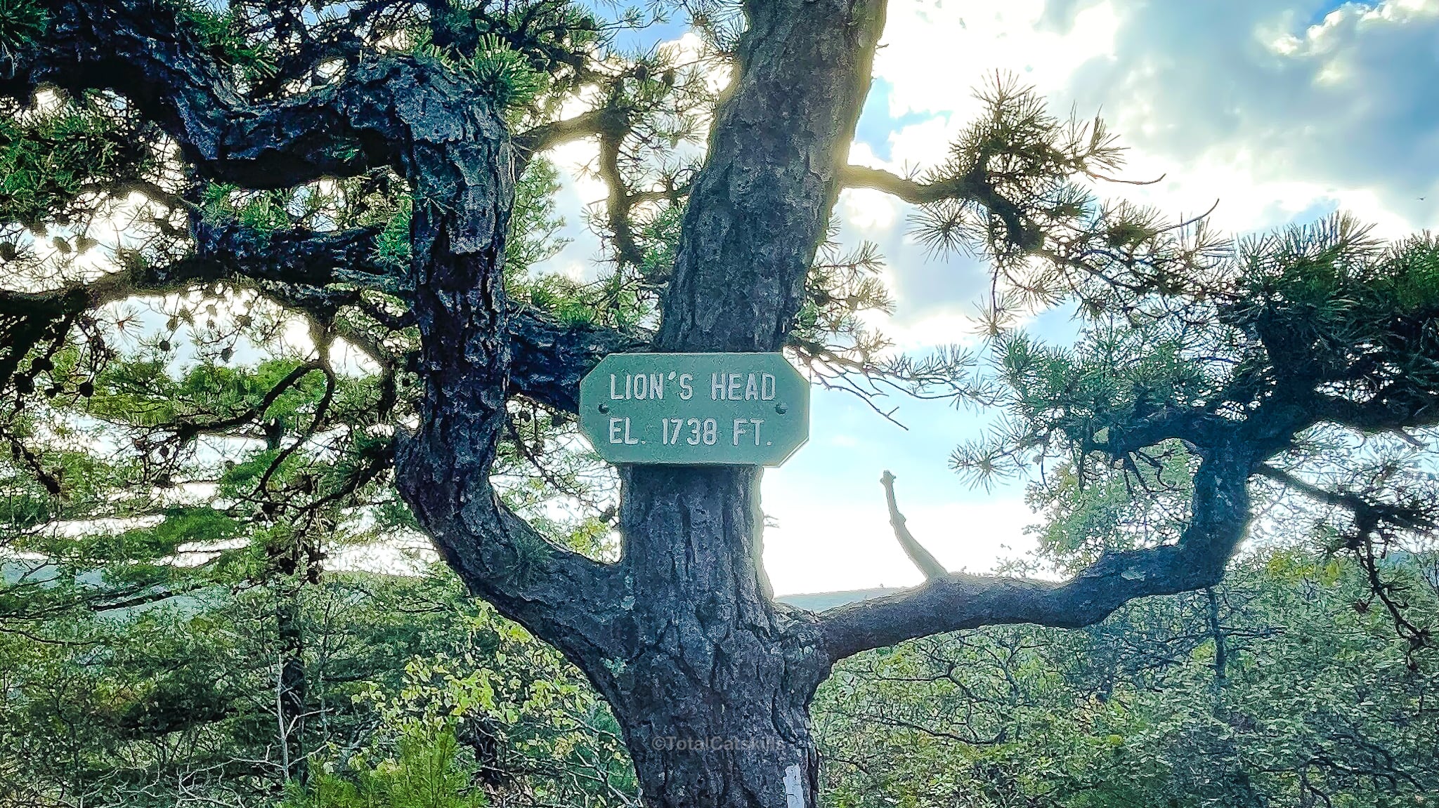
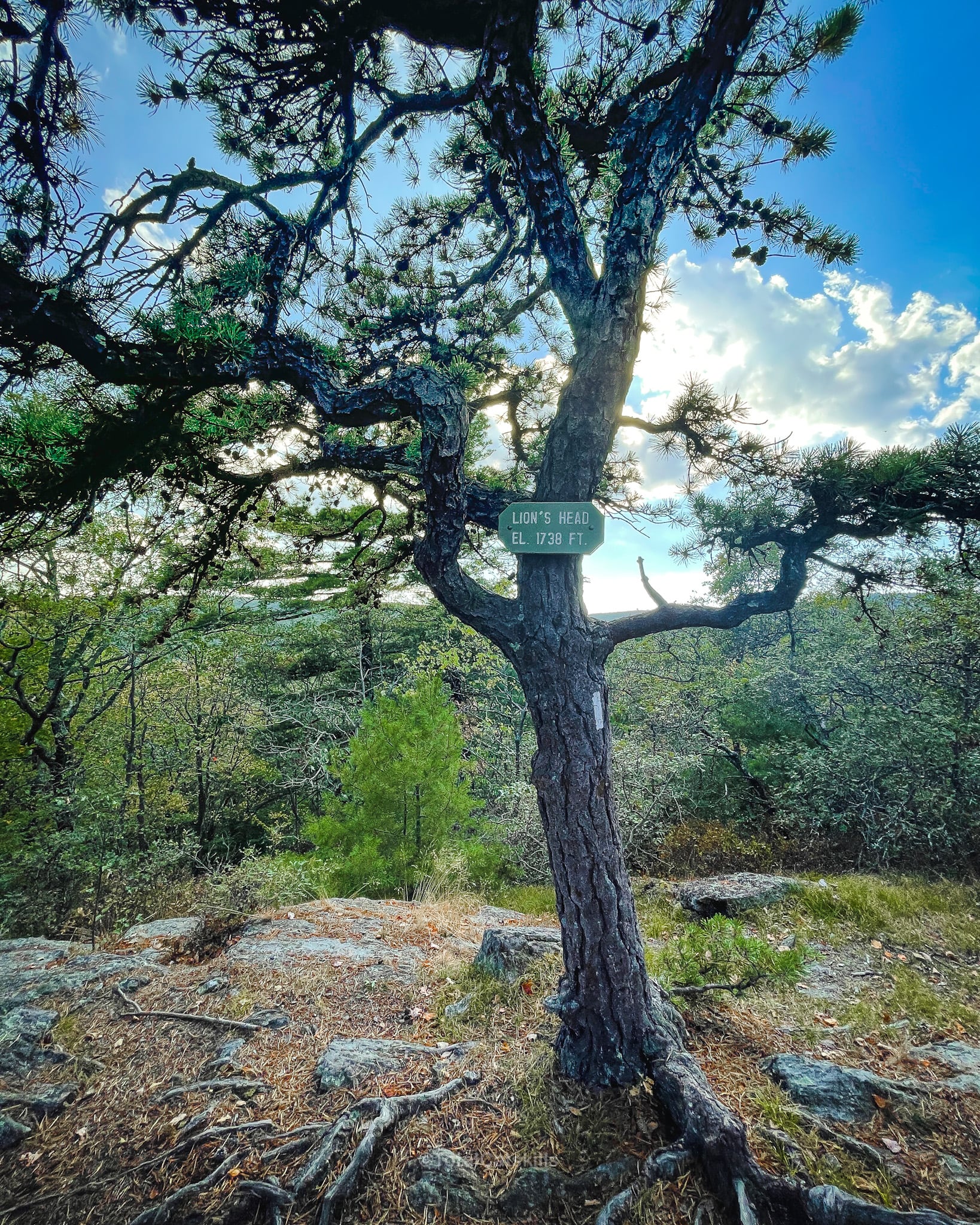
A rare sight for this hiker, Lion’s Head has an actual summit sign affixed to a wonderfully gnarly pitch pine…
The Lookout
The Lion’s Head itself is a rocky outcropping with excellent views onto the rolling valley floor below…

BTW, you might also enjoy…

From here, head back to your car.
Or you can explore the ridge a little more. There’s a lean-to shelter 0.8 miles further north, with some camping platforms close by, and Ball Brook Campsite campsite is another 0.06 miles above that spot.
Similar Hikes
The Taconics have so many fantastic short hikes with major payoffs like this one. Check out Bash Bish Falls and Sunset Rock.
Read More
Get full access…
Get instant access to the full version of this site and enjoy great supporter benefits: full galleries, full trail notes, early access to the latest content, and more.
Hot on the website right now…
Follow for more…
Follow my @TotalCatskills content on Instagram for regular hiking inspo and safe, inclusive community.

Lion’s Head Trailhead
Smallish lot, fits 8-10 cars max.
Google Maps Location: 41.998851, -73.438079
The map below shows the exact topographic location of the trailhead
Cell Service
I had cell service for the entire hike. My network is Verizon. YMMV.
The parent mountain for this hike is Lions Head.
