Disclosure: This content may contain affiliate links. Read my disclosure policy.
A weird start to a strange t-shaped hike.
Trailhead info at bottom of this post.
Hiking Trail Description
Richmond Mountain is an extremely quiet mountain, trailed with seriously grown-in sections of the Long Path. The route here is sometimes difficult to follow.
This hike was quiet and mysterious; these trails are not often used.
I looked for two scenic views and found only one, but it was a banger — a rare angle on the entire Blackhead Range from Blackhead mountain all the way across to Camel’s Hump.
I love the quiet northern Catskills and the infinite-seeming bucolic landscape that surrounds them. The drive up to these hills is as lovely as hiking the hills themselves.
There is also some interesting history attached to Richtmyer Peak, which you can read below.
Note: Be aware that the last mile/mile-and-a-half to this trailhead will present your car with a serious challenge.
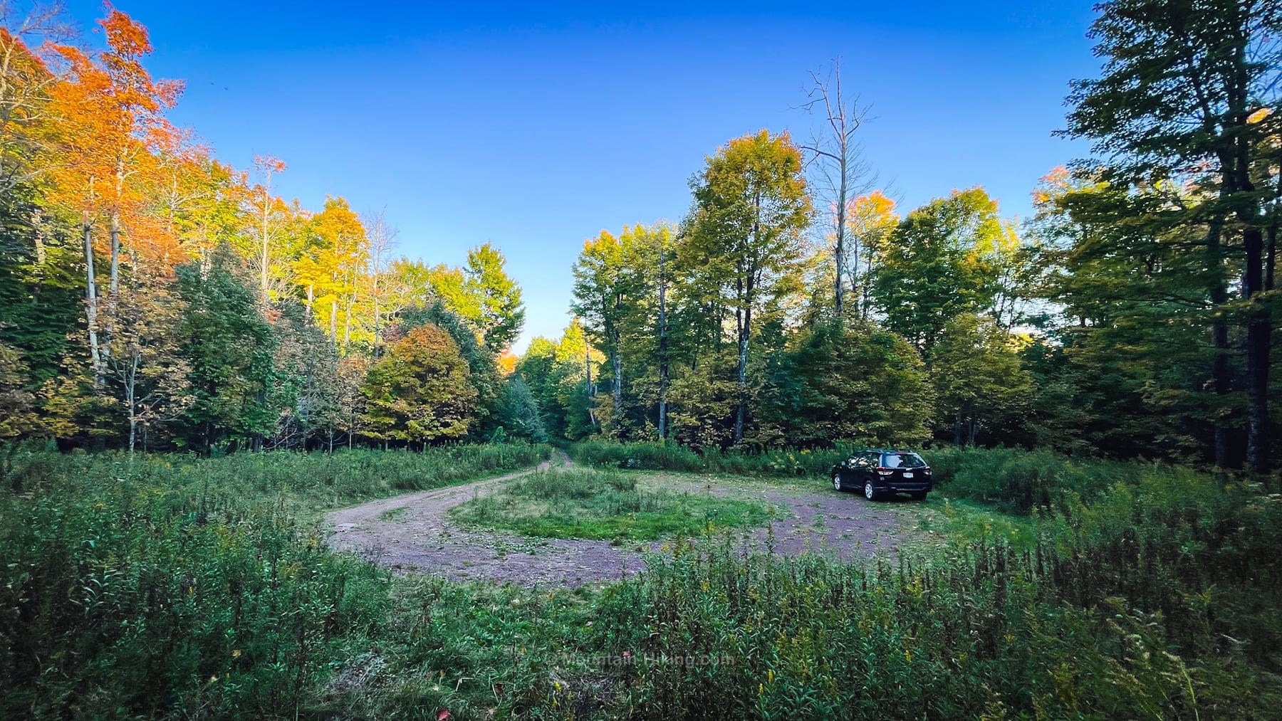
Richmond Mountain Trailhead & Parking
Is this the highest trailhead in the Catskills? It’s at 2740’, at the end of 1.3 miles of what might be the sketchiest dirt road in all these hills. The double-track is approximately 1.3 cars wide; if you meet another car on this narrow passage, one of you is backing up a long long way.
Seriously, do not drive up here without 4WD, or AWD, and a lot of clearance under your car.
Definitely would not try this in the winter. THiS wAs a BiG miStAkE!
The parking area itself is a large turning circle. There is no trail register.
Richmond Mountain & Richtmyer Peak Hiking Trail
From the parking area, head uphill — you may notice some very old State of New York yellow trail blazes.
After about ten minutes of huffing, I made it to the junction in the col between the two mountains. This area is heavily deciduously wooded and the forest has a lovely old wild quality.
To climb Richmond Mountain first, turn left and head southwest, following the aqua blazes of the Long Path.
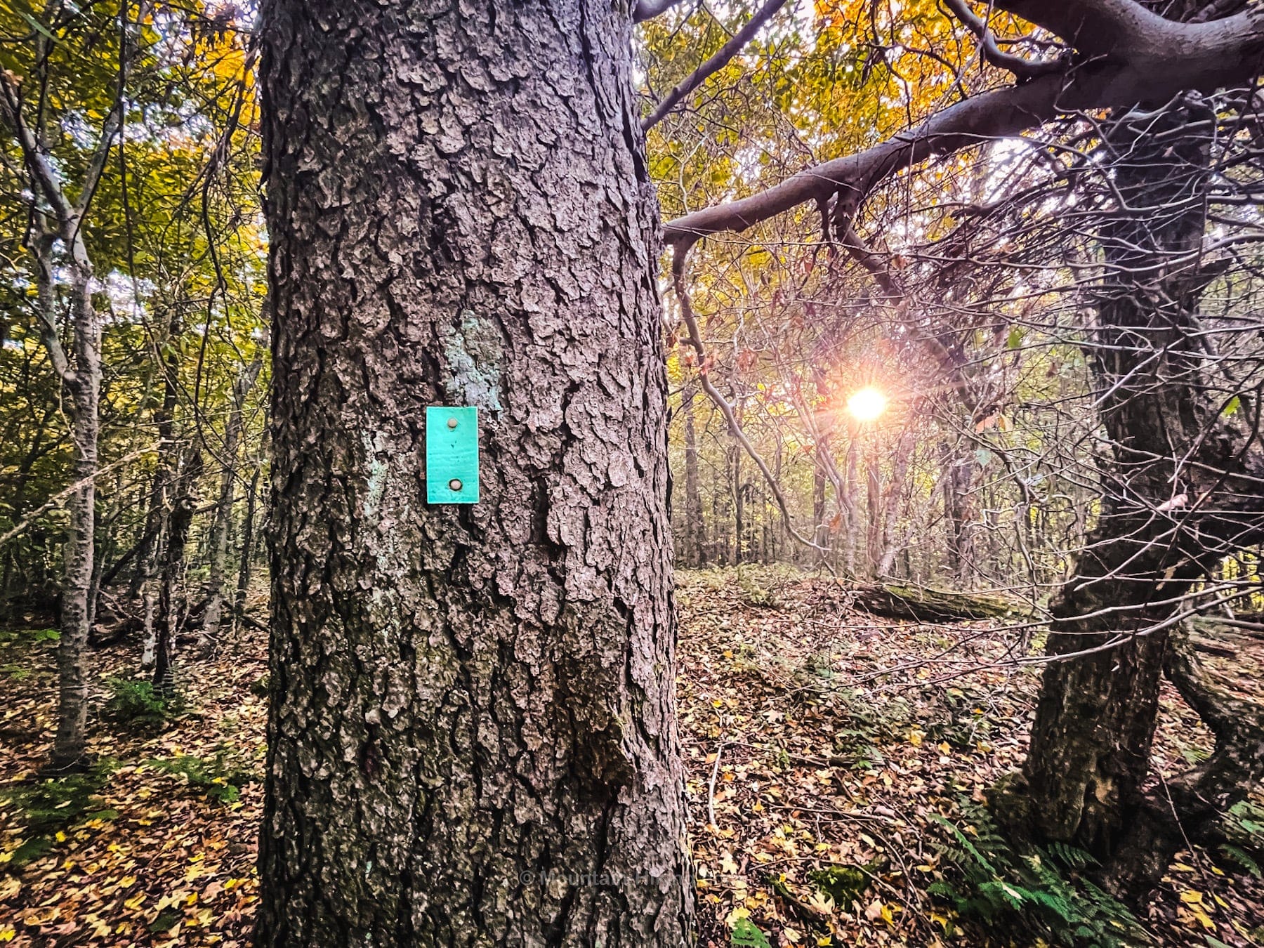
The blazing here is both sparse and non-reflective, so make sure to be off these trails well before dark — even with a headlamp, navigation would be very difficult.
Richmond Mountain Scenic View No. 1
About a quarter mile from the col, keep an eye on the left side of the trail for a short herd spur down to a small ledge. The view is unexpectedly magical. You’ll see the entire Blackhead Range, 10 miles distant…
The remainder of this trail guide is accessible to members who kindly support this content…

Similar Hikes
These northern Catskills are part of a long quiet ridge that includes very pleasant hikes over Huntersfield & Ashland Pinnacle and Ginseng and Mount Hayden.
Here is the official description for this section of the Long Path from NYNJTC which gives a good sense of the general area (and of the entire Long Path).
Get full access…
Get instant access to the full version of this site and enjoy great supporter benefits: full galleries, full trail notes, early access to the latest content, and more.
Hot on the website right now…
Follow for more…
Follow my @TotalCatskills content on Instagram for regular hiking inspo and safe, inclusive community.

Richmond Mountain & Richtmyer Peak Trailhead
Small round parking area at the terminus of one of the wildest dirt roads in The Catskills.
Google Maps Location: 42.373498, -74.262702
The map below shows the exact topographic location of the trailhead
Cell Service
I had LTE service for much of this hike. My network is Verizon. YMMV.
The parent mountain for this hike is Richmond.
