Disclosure: This content may contain affiliate links. Read my disclosure policy.
A fairly relentlessly steep out-and-back.
The trail to the summit of Rooster Comb in the Adirondacks is relentlessly uphill but also quite short. You will be rewarded with three fantastic lookouts, each more stunning that the last.
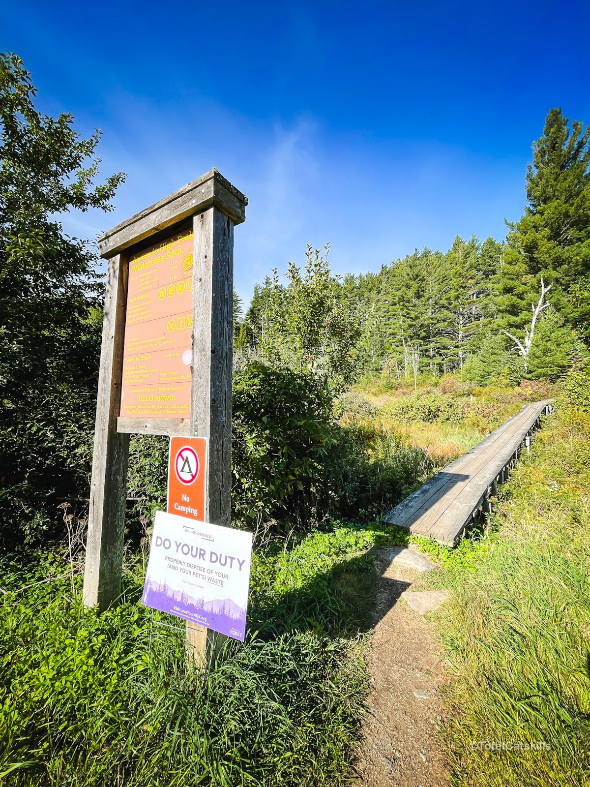
Rooster Comb has three trailheads along Route 73. This hike begins at the northernmost trailhead, and offers the shortest route up the mountain.
On this day, I’d originally planned to hike Big Slide Mountain. However, by the time I arrived at The Garden parking lot, it was completely full. Then I drove past the lot for Rooster Comb and it was completely empty. Something to think about.
For me, this hike was the perfect Plan B hike. It turned out to be one of the most rewarding Adirondack hikes I’ve done. The trail is fun and the views are killer!
It also provided an excellent starting point to hike out to Hedgehog and Lower Wolfjaw mountains — trail guides for those two coming soon.
BTW, you might also enjoy…
- NEW › Winter Skincare for Hikers
- CATSKILLS › Best Catskills Waterfalls
- STAY › Find Your Perfect Catskills Stay
- ADIRONDACKS › Hike Van Hovenberg
- ENTERTAINMENT › Best & Worst Hiking Movies
- Follow › My Instagram @TotalCatskills
- Follow › My Substack @TotalCatskills
- Follow › My writing for Times Union
Rooster Comb Hiking Trail
The Rooster Comb Adirondacks hiking trail includes…
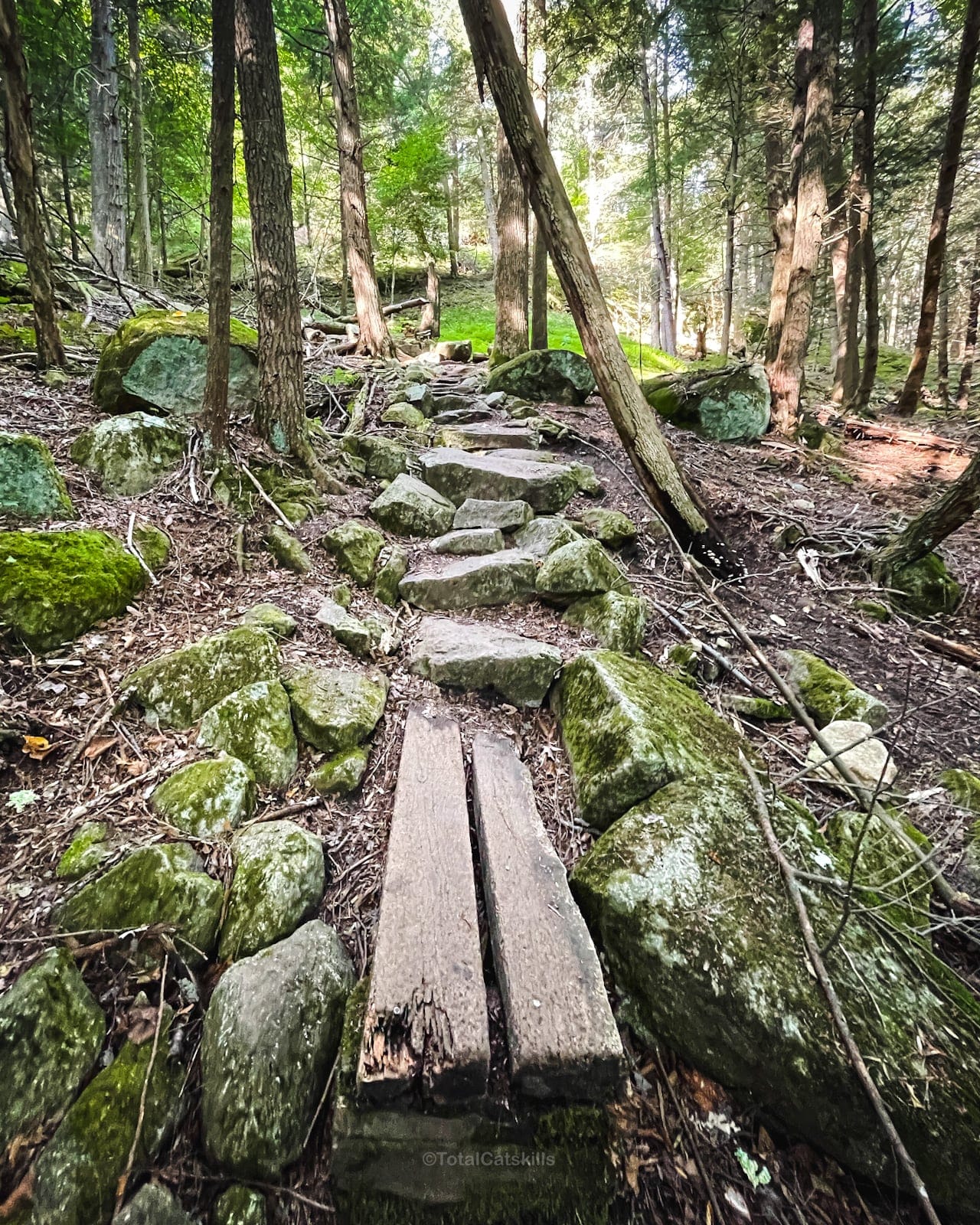
- Relentlessly uphill, well-worn trail
- Boardwalks and stone steps
- Lots of tree cover (good for summer hikes and dogs)
- Hemlock woods
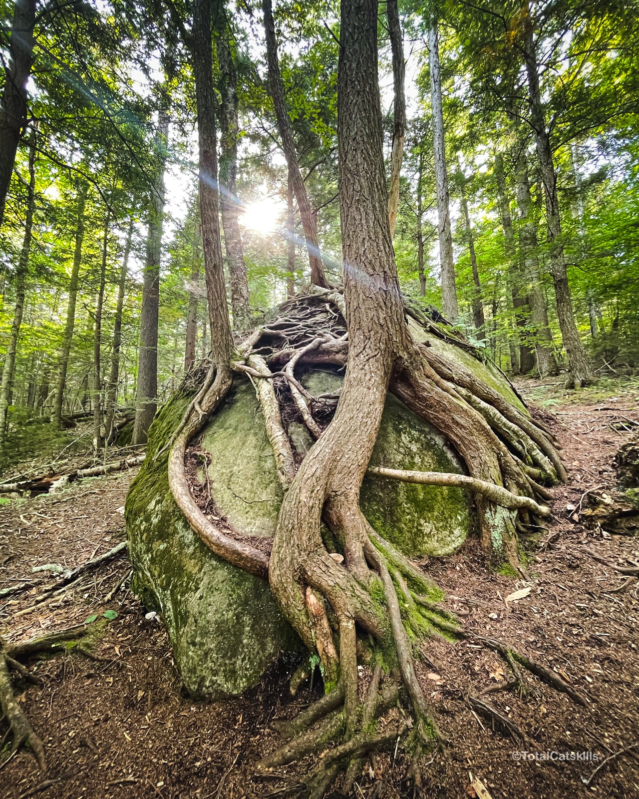
- Massive boulders
- Root-encased boulders
- Good cell service at trailhead
- Good cell service throughout
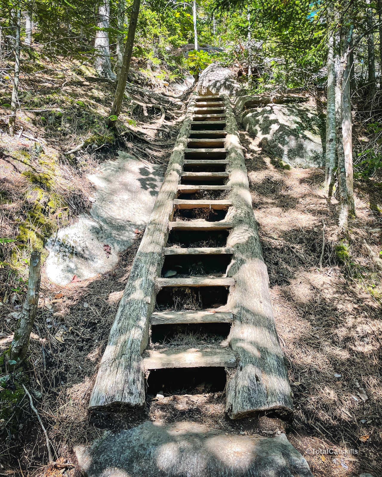
- A ladder
- Sections of rock slab that would be tricky in wet conditions / winter
- One good view
- One great view
- One amazing view
Rooster Comb Trail Notes & Gallery
The trail begins here, crosses a swampy area via boardwalks, and then winds around a large pond.
The trail is up-up-up the whole way. There are almost no flat spots where you can catch your breath. Just make sure to stop whenever you need to rest!
Follow the yellow blazes.
The trail passes many enormous, dramatic boulders. This is one of the smaller ones…

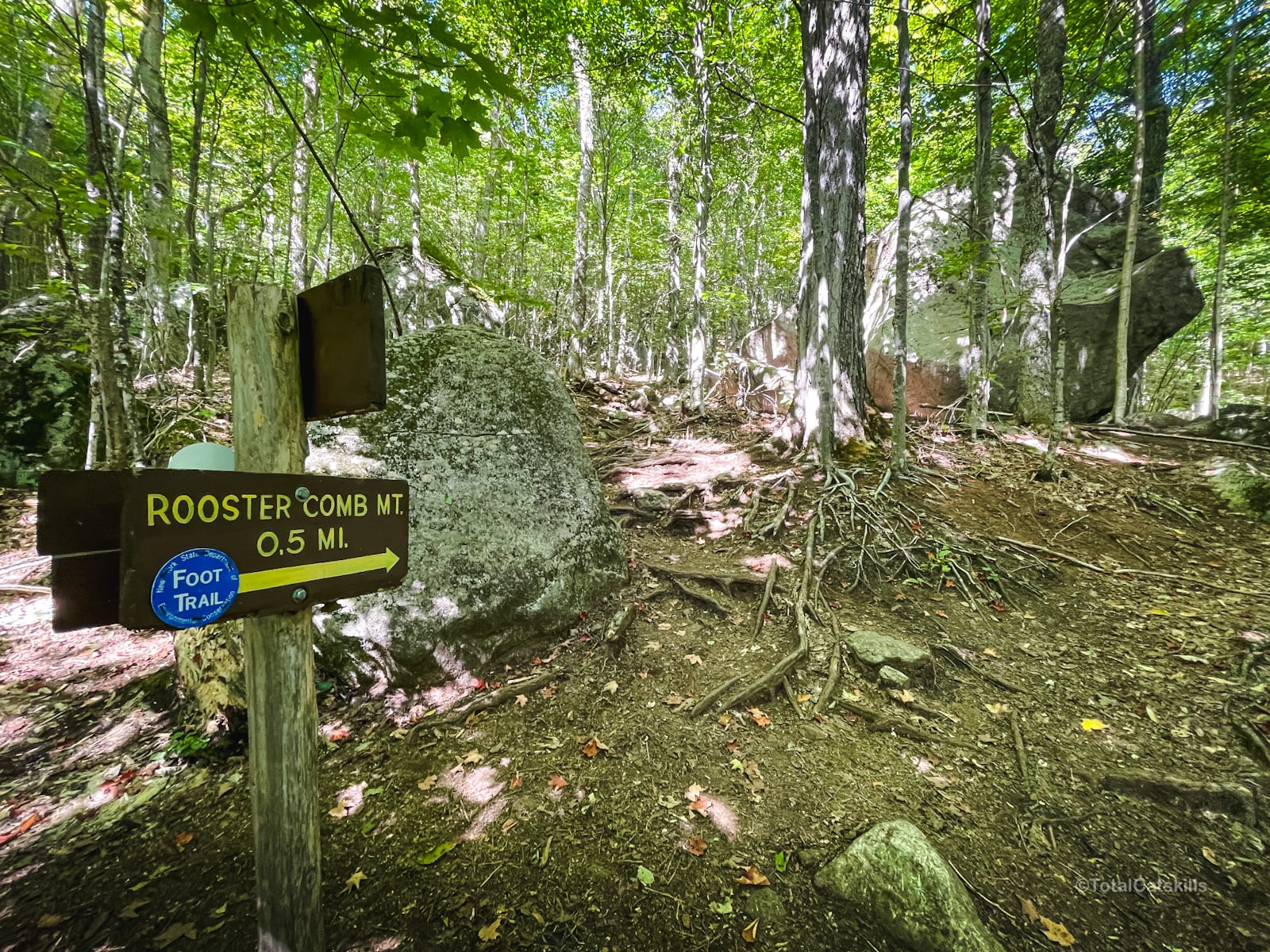
Eventually, you’ll arrive at a junction in field of enormous glacial boulders. Turn right, here, and head uphill…
Whereas, up to now the trail has been quite woods, the last ½ mile is increasingly Adirondackian — steep sections, open rock, a ladder, incredible views.
Begin following the blue blazes.
Valley View Ledge
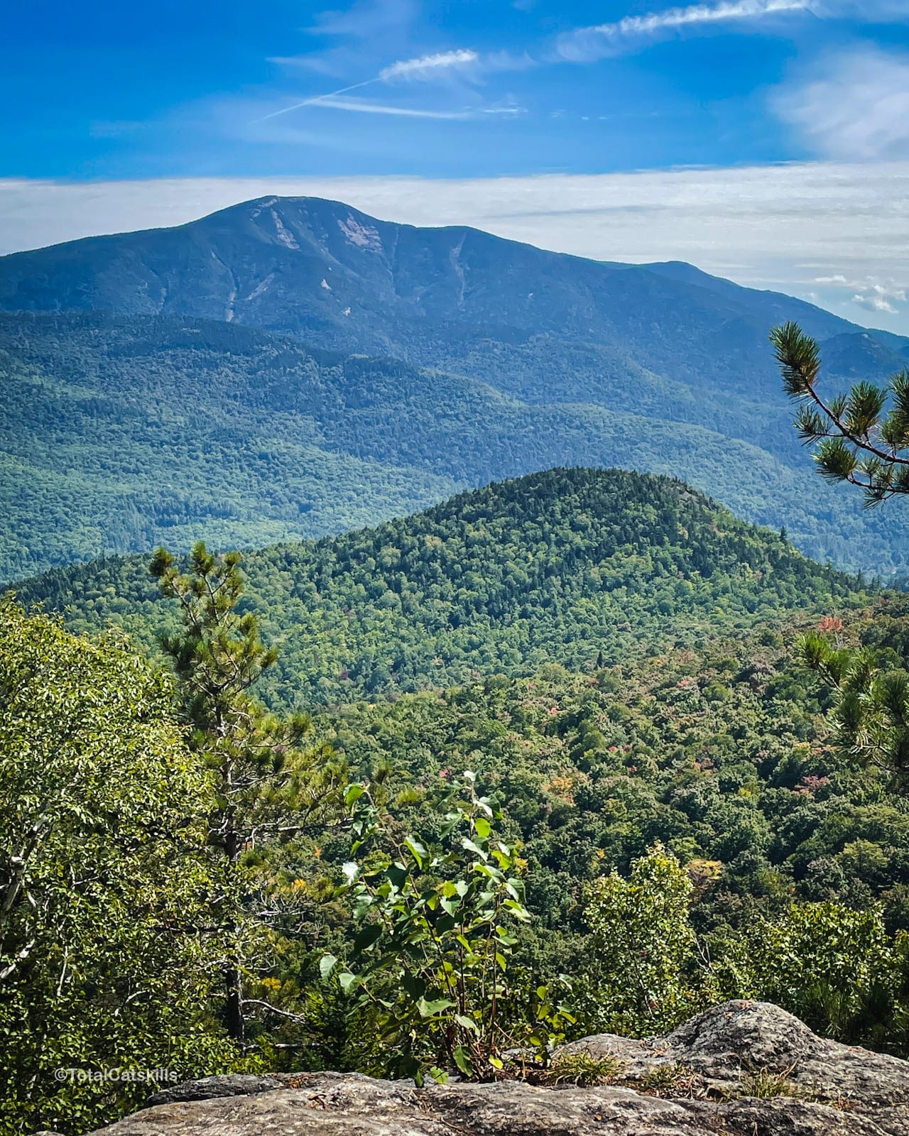
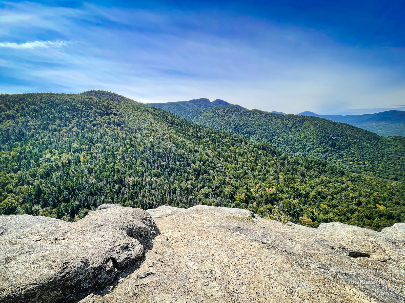
The first big view is down a 0.1 mile side trail to the right. Walk down a short distance into an open rocky clearing called Valley View Ledge. The view is of Big Slide Mountain (to the left) and, behind it, Porter Mountain.
You can also see the town of Keene Valley below (to the right) and Marcy Field.
Return to the main trail, turn right, and make your way up to the summit…
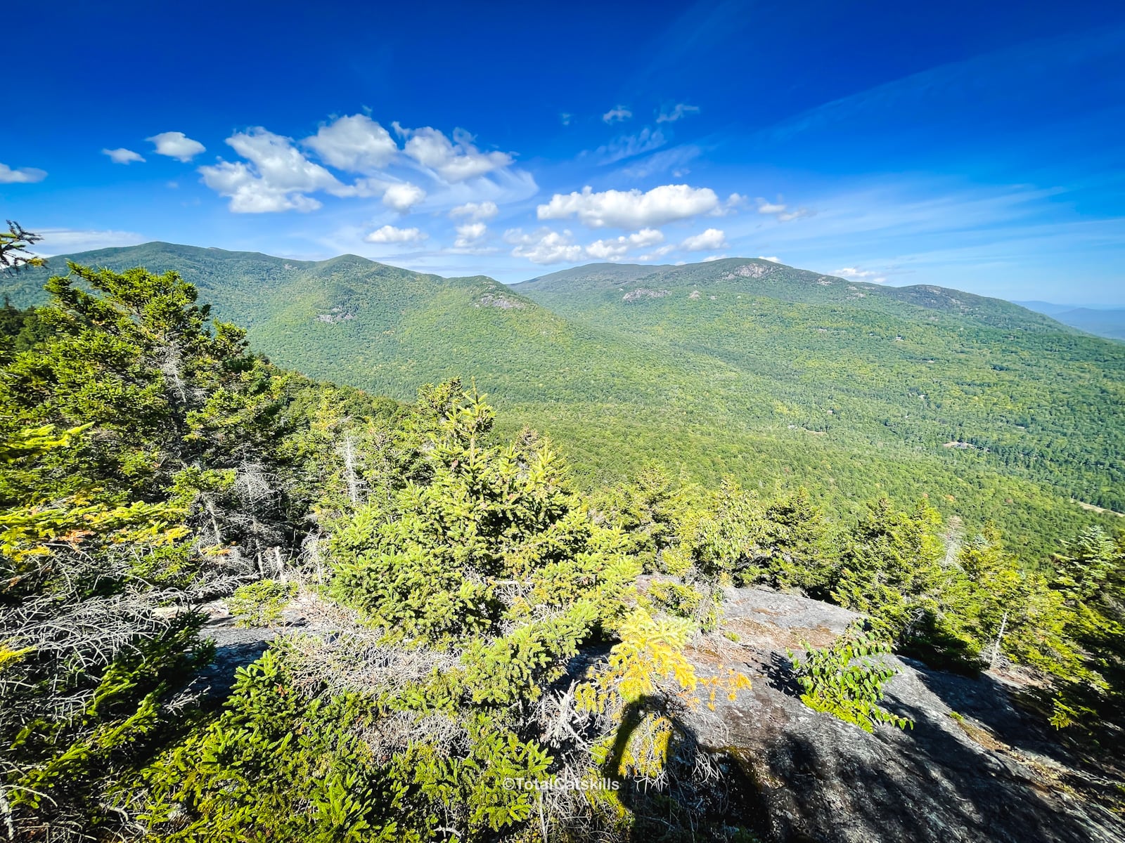
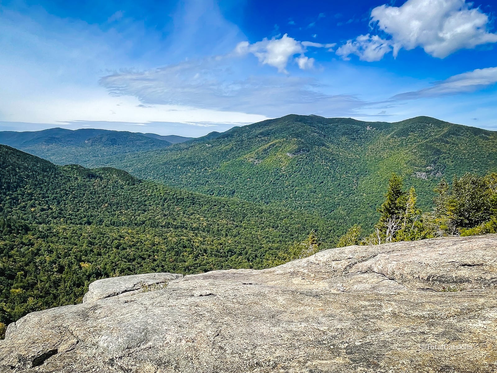
Rooster Comb Summit: Adirondack Heaven
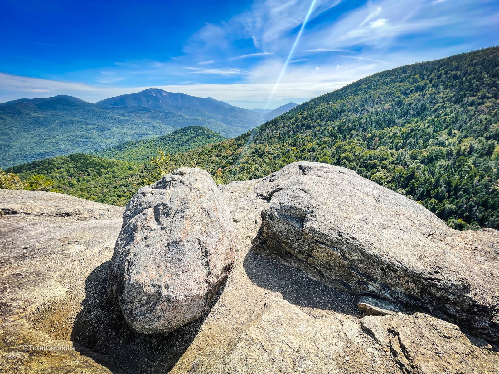
You’ll come to a modest ledge with a stunning view of Giant Mountain and the Route 73 corridor below, including even Chapel Pond.
But don’t stop there. The best views are yet to come.
Follow the trail to a large open rock viewing ledge…
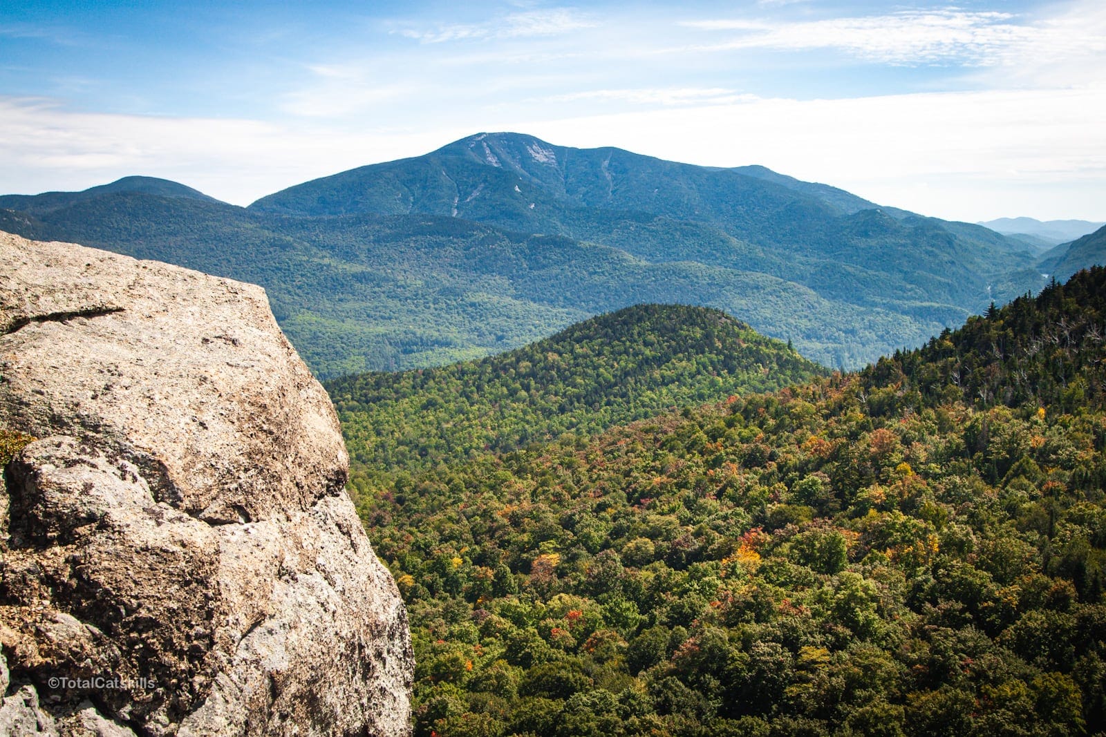
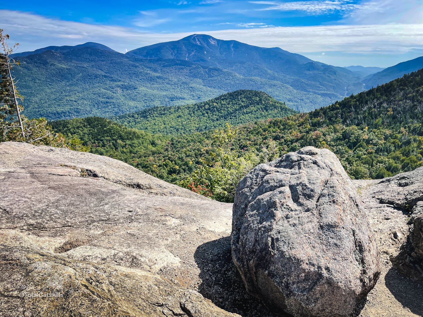
To the right is Hedgehog Mountain, with Lower Wolfjaw and Gothics in the distance…
Keep turning your head right to see Big Slide Mountain and the Johns Brook Valley below it…
This is an amazing place to rest, and snack, and take in the surrounding High Peaks.
From here, turn back and head down to your car — or or to the junction that leads out to Lower Wolfjaw and The Lower Great Range.
Similar Hikes
This hike packs so much bang-for-buck but there are many similar hikes in the Adirondacks: Baxter Mountain, Big Crow and Moxham come to mind.
Even Cascade, while a little longer and harder, is quite do-able and offers insane views.
Read More
Get full access…
Get instant access to the full version of this site and enjoy great supporter benefits: full galleries, full trail notes, early access to the latest content, and more.
Hot on the website right now…
Follow for more…
Follow my @TotalCatskills content on Instagram for regular hiking inspo and safe, inclusive community.
Rooster Comb Trailhead
Medium-sized lot but this is a popular destination
Google Maps Location: 44.185311, -73.786312
The map below shows the exact topographic location of the trailhead
Cell Service
I had cell service for most of this hike. My network is Verizon. YMMV.
The parent mountain for this hike is Rooster Comb.
