Disclosure: This content may contain affiliate links. Read my disclosure policy.
A short, easy, lovely out-and-back.
Trailhead info at bottom of this post.
Hiking Trail Description
This short hike to Silver Hollow Notch & Edgewood mountains — a quiet Catskills double-peak — proves how the Lower Catskills can often out-reward the Classic 3500 Peaks.

This quiet route starts rugged but then mellows out quite a bit. It has a few steep sections but they are very short. Overall, this is a lovely, soothing, do-able hike, perfect if you want a sweet nature bath that doesn’t take up the whole day.
Notch Inn Road Trailhead & Parking
The parking area for this hike is right off Route 214 on Notch Inn Road. The lot is not well marked. Don’t drive too far up Notch Inn Road. Don’t cross the bridge. Just look for a spot on the left.
On the day I did this hike, the lot had a lot of supplies dropped and it looked like the DEC was about to pull a nice upgrade at this location. (LMK in the comments below if, indeed, that turned out to be the case.)
The Notch Inn Road parking area is also the trailhead for the wonderful Daley Ridge hiking trail to Plateau Mountain.

If you try to park higher up on Notch Inn Road, you’ll end up on a private road by a large house — and your car will be towed. Please heed this warning sign…

Walk uphill about ⅓ mile, past the green warning sign above, until the large house is on your right. Do not approach the house. Instead, look left.
Trail Start
The trail begins here, at this unmarked spot…

Climb over the berm. There are yellow blazes along the trail, though I couldn’t see any from the road; I had to hike a minute before I found one.
The half-mile from the berm to the first junction is pretty lumpy…

The trail is an old road that has been washed out over and over. At one spot, it’s so bad, the trail has been re-routed through the adjacent woods.
But eventually, you make it to the junction. For hikers, the junction is actually a crossroads.
Behind you is Notch Inn Road. Directly ahead is the continuation of the old road down the other side of the notch (which eventually runs into private property). To the left, is the trail to Plateau via Daley Ridge.
Silver Hollow Notch Hiking Trail
To your right, up the incline, is Silver Hollow Notch mountain. (The sign points to Warner Creek / Tremper Fire Tower.) Follow the blue blazes uphill to your right.

This trail is a little steep in spots but, overall, this route makes for very mellow hiking.

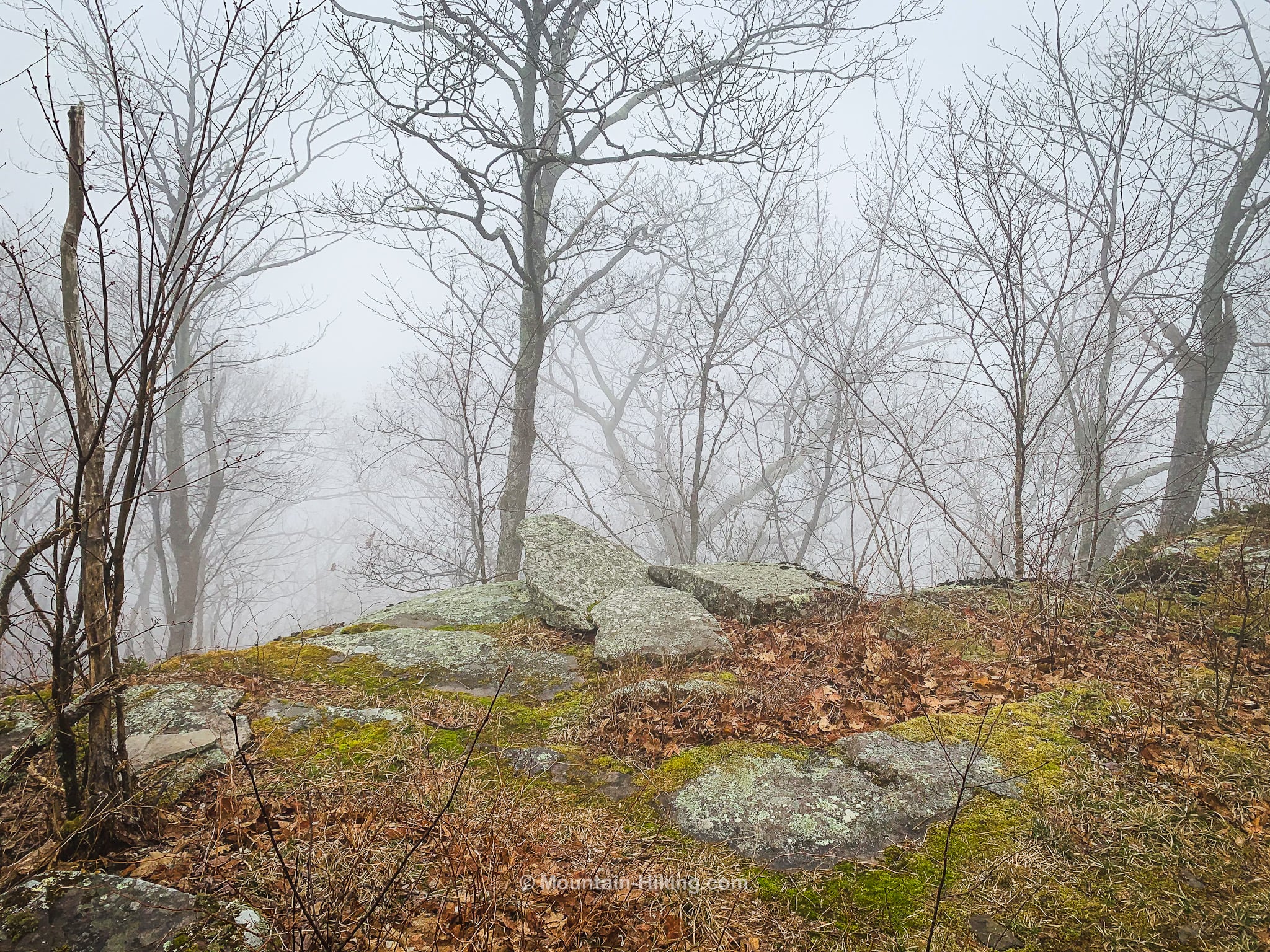
I love a good foggy hike. Fog brings such a strong mood to the forest…

Around 2600’, you’ll arrive at the top of a low cliff and begin walking along its top edge.
Here’s a video of me walking to the most scenic spot on this hike, which sits atop the cliff…
Some days are like this!
There was no view this day, but this is a super sweet spot. Looking at the contours on my NYNJTC trail map I can see the lines of sight, on a clear day, must be really lovely. The ledge looks across to Daley Ridge, Little Rocky and Olderbark mountains, and into the hollow between the Daley Ridge and Olderbark. I can’t wait to revisit this spot on a sunny day.

Not scenic, as advertised, but somehow even more beautiful…? Only for the fog, probably, I wouldn’t even have paid attention to this tree; I would’ve been looking right past it.

About 500 ft past the scenic ledge is a similar but much longer section of trail, flat and mossy, a great spot to rest.
All along, the trail is woodsy and mellow…

Pass down through this small rock squeeze…

It leads you down to a short walk along a low, mossy ledge that’s fun to walk beside…
The trail dips down a little until you reach the base of a hump. This section, with wet moss-covered boulders, took a little care in the snow and ice.

Pass over this false summit, and continue along. Neither summit is marked. You‘ll have to consult your GPS to get a sense of when you’re there, but GPS is never perfectly accurate so you’ll also need to look around and feel it out.
Silver Hollow Notch Mountain
The summit of Silver Hollow Notch is slightly off trail. The highest point around is marked with a remarkable old black cherry tree that looks like the foot of a god descending.

Edgewood Mountain
About 1000 ft farther along the trail, to the southwest, I decided that this high spot marked with some boulders was the summit of Edgewood Mountain.

I hiked on a little more down the far side of the mountain, for about 15 minutes, until I reached the col between Edgewood and a sub-summit.
From there, the trail descends steeply to Warner Creek where GaiaGPS shows a marker for some ruins…
Hike Out
After finding some coyote poop, I walked back uphill to the the summit of Edgewood Mountain. From there, the walk out to Notch Inn Road took just over an hour.
On the way out, when you get back to the junction, if you turn right and walk down the far side of the old woods road for about 1000 feet, you’ll come across two rusty old timey fridges sitting in the woods, riddled with bullet holes…

Similar Hikes
This route is a little more strenuous than a Nature Walk but has some qualities in common: mellow, short, not too much elevation gain, lots of variety.
It’s definitely short enough and easy enough to be a solid entry-level easy mountain hike.
Silver Hollow Notch & Edgewood Mountains Trailhead
Small and not well marked – but it looks like they’re working on it!
Google Maps Location: 42.140904, -74.212177
The map below shows the exact topographic location of the trailhead
Cell Service
A mix of 3G and LTE on this route, once you gain a little elevation. My network is Verizon. YMMV.
2 responses to “Silver Hollow Notch & Edgewood Mountains”
Your comments are welcome here…
The parent mountain for this hike is Silver Hollow Notch & Edgewood.

My parents owned 210 acres on the silver hollow side of SilverHollow Notch Mountain in the early 60’s. In good weather my brother and I would walk over the notch to catch the school bus to Hunter Elementary. No trail at the top of that mountain then.
Hi, George! I know we’ve chatted about this before. Glad to see you back here. Hope the photos jog some good memories.