
Disclosure: This content may contain affiliate links. Read my disclosure policy.
Long point-to-point hike that requires a car shuttle — or a bike.
Trailhead info at bottom of this post.
Hiking Trail Description
I wanted to do this hike for a long time, and it takes a long time to do this hike. It’s beautiful. It’s challenging. It ends in an explosion of fun. I’m so glad I did it.
I’ve named this route The Cross Mountain Meathook mostly of its distinctive shape — but also because the tip of the meathook will mess you up. After 9 miles of hiking, the last two miles coming down Wittenberg will test your legs. They’re steep and rugged miles. If you’ve ever done Wittenberg/Cornell, you know it’s the last two miles back down to Woodland Valley that wreck you the hardest. Same deal here.
On the other hand, this is one of the most beautifully trailed and scenic routes in The Catskills. There’s so much to describe.
You will need a car shuttle, or a bike, to complete this hike. So hike it with a friend, and stage one car in Woodland Valley and the other on Lane Street. Or do like I did, and stage your bike(s) in Woodland Valley for a super sweet 20 minute downhill ride.
BTW, you might also enjoy…
- UPDATED › Best Bug Spray & Bug Repellent for Hikers
- CATSKILLS › Peakbagging The Catskills High Peaks (Ultimate Guide)
- STAY › Find Your Perfect Catskills Stay
- ADIRONDACKS › Wright, Algonquin & Iroquois Peaks
- LEARN › Teach Yourself How to Use a Compass
- ENTERTAINMENT › Best & Worst Hiking Movies
- Follow › My Instagram @TotalCatskills
- Follow › My Substack @TotalCatskills
- Follow › My writing for Times Union
Cross Mountain Meathook Hiking Trail
The Lane Street › Romer › Mount Pleasant › Cross Mountain › Wittenberg › Woodland Valley hiking trail includes…
- Water source near the start
- Exceptionally stunning, sustainably designed trail
- Multiple stone staircases
- Lots of remote, quiet trail
- Long flat trail sections
- Mixed forest with many large multi-trunk oaks
- Amazing glacial boulder deposits
- A sweet rock chasm
- One of The Catskills’ most impressive views
- A sweet scenic angle on the Ashokan Reservoir
- An impressive panoramic view (unusual in The Catskills)
- An open slab rock view point (unusual in The Catskills)
- Great campsite above a cleft rock
- A steep and lumpy descent
- An insanely fun 5 mile downhill bike ride finish
Cross Mountain Meathook Trail Notes & Gallery
This hike begins in the small Lane Street lot in Phoenicia, New York. It fits only six or so cars. The trail goes up immediately along the back of the homes on Lane Street, until switchbacks take you away from the world of people.

In spots, the trail is just so lovely with open woods and easy hiking.
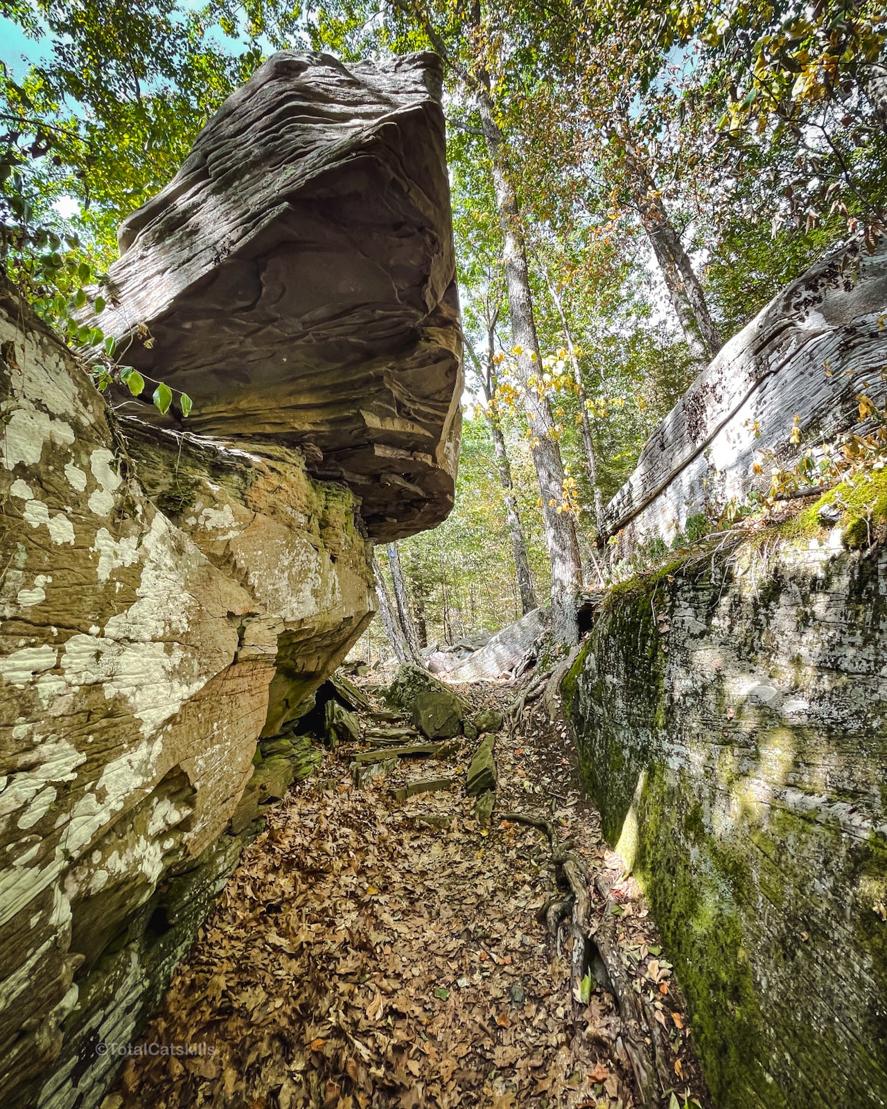
Chasm
This rock chasm/channel below the summit of Romer Mountain is always a treat…
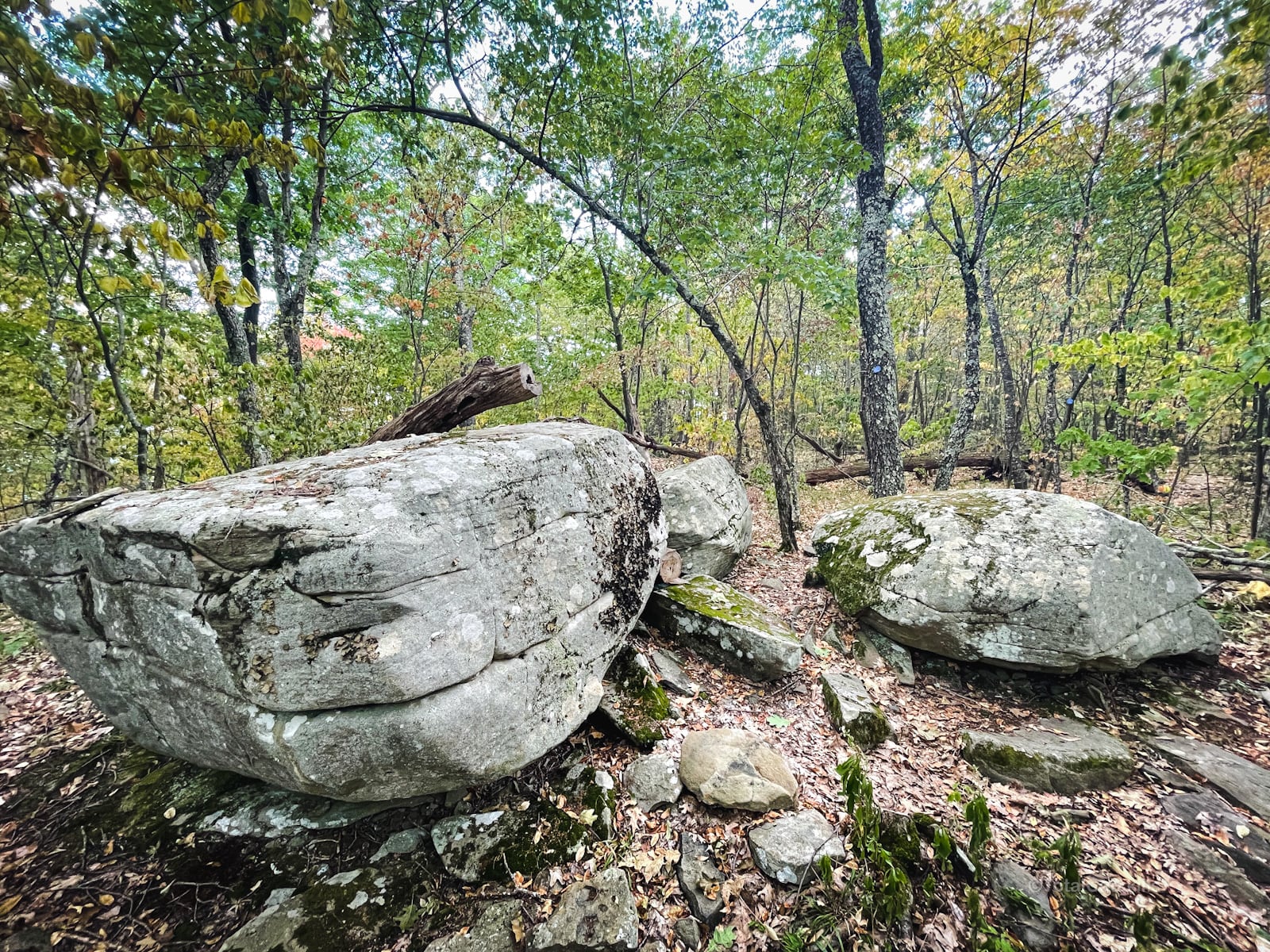
Romer Summit
The summit of Romer Mountain is marked with there large glacial boulders. The trail passes right through them, taking a sharp left and heading south toward Mount Pleasant.
Incredible View
The trail does not pass over the (unremarkable) summit of Mount Pleasant. However, not far below the summit is a large ledge that has one of the finest views in The Catskills, of Wittenberg across Woodland Valley (with Balsam Cap, Friday and Slide Mountain behind)…

And that’s Cross Mountain to the left, which you’ll soon be hiking across…

Also visible to the left are Samuels Point and Ashokan High Point.
BTW, as I approached this ledge, I scared away two gray vultures who had, apparently, spent several hours pooping on the ledge. This is one of the poopers…

From here, continue south along the trail towards Cross Mountain…

One of the best views is still to come…
The remainder of this trail guide is accessible to subscribers who kindly support this content. Get full access to this website and enjoy great supporter benefits!

Similar Hikes
In terms of how my legs felt, this hike reminded me of thru-hiking over North Dome and Mount Sherrill from Spruceton to Shaft Road. Also a pretty scenic route!
Get full access…
Get instant access to the full version of this site and enjoy great supporter benefits: full galleries, full trail notes, early access to the latest content, and more.
Hot on the website right now…
Follow for more…
Follow my @TotalCatskills content on Instagram for regular hiking inspo and safe, inclusive community.

Cross Mountain Meathook Trailhead
Small lot behind a suburban setting.
Google Maps Location: 42.078172, -74.319049
The map below shows the exact topographic location of the trailhead
Cell Service
Strong LTE signal in spots. Patchy to non-existent in other spots. My network is Verizon. YMMV.
The parent mountain for this hike is Cross.
