Disclosure: This content may contain affiliate links. Read my disclosure policy.
This thru-hike route is short on the miles but long on the legs. Requires a car shuttle.
Trailhead info at bottom of this post.
Hiking Trail Description
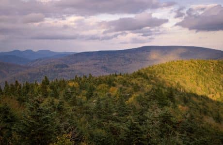
This thru-hike route over North Dome and Mount Sherrill can be done in either direction. Short on miles but long on legs, my friends and I really felt this epic hike.
This is one of the most difficult Catskills hikes. The route is 75% bushwhack and includes a very tough climb up North Dome’s notorious eastern ledges.
If you’re new to mountain hiking, this is a hike you should leave until you have gained solid bushwhacking experience. Apart from the sheer effort required, it’s easy to veer into dense evergreen forest on the west side of North Dome’s summit and get turned around. Map and compass skills are a must for this hike. Do not rely on your phone, here.
At 6.5 miles, this hike may not sound like much but, I swear, by the time you’re done, you’ll feel like you just hiked 10 rough miles.
Devil’s Path Terminus Trailhead & Parking
The trailhead for this route is the western terminus of the Devil’s Path on Spruceton Road. The lot there is small and fills up quickly.
There is some space for roadside parking on the opposite side of the road.
North Dome & Mount Sherrill Bushwhack Route
After a short climb to the trail register (please sign it), continue uphill a short distance. The trail levels out and becomes an easy, level hike through a field of wonderful glacial erratics.
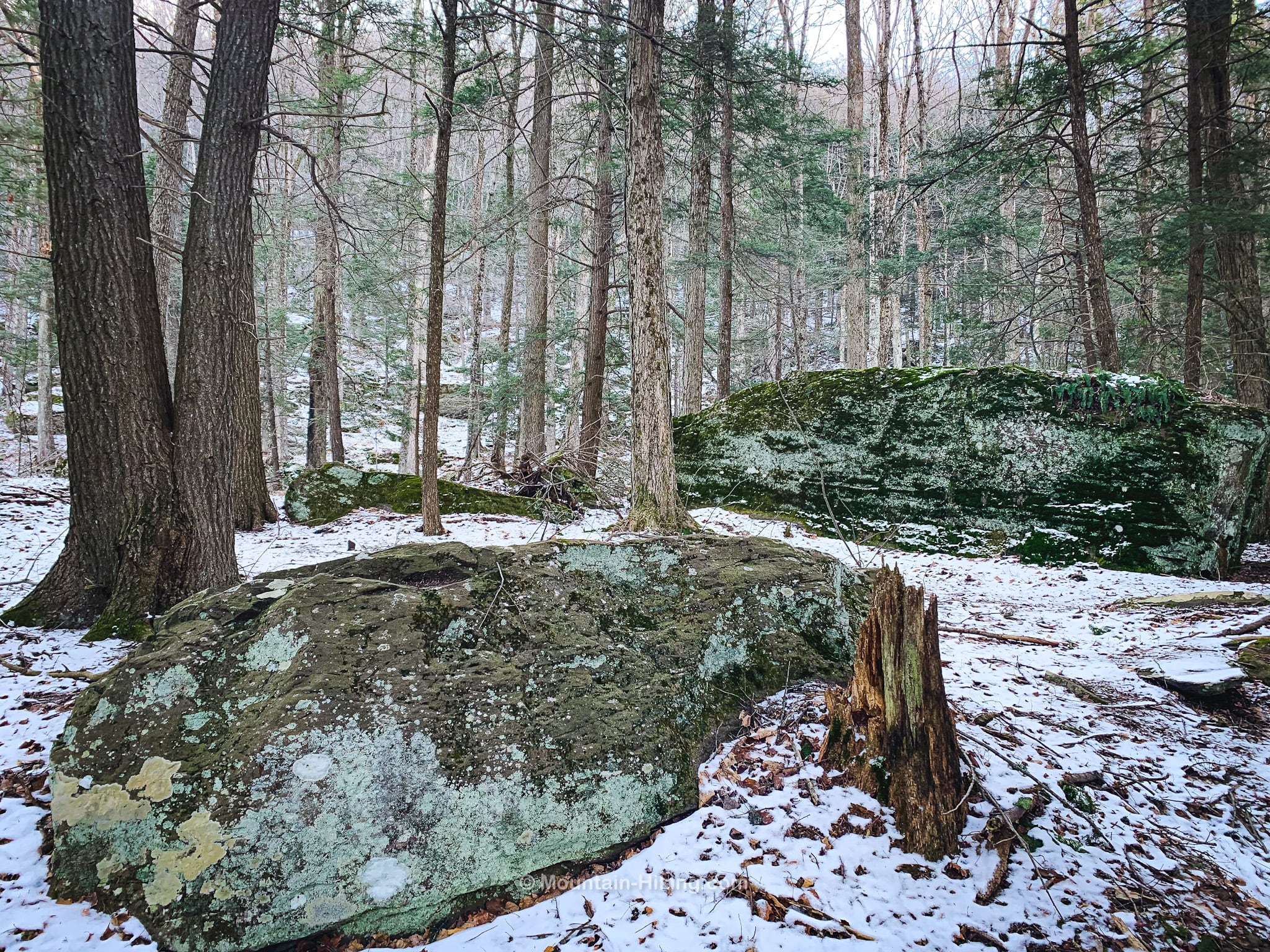
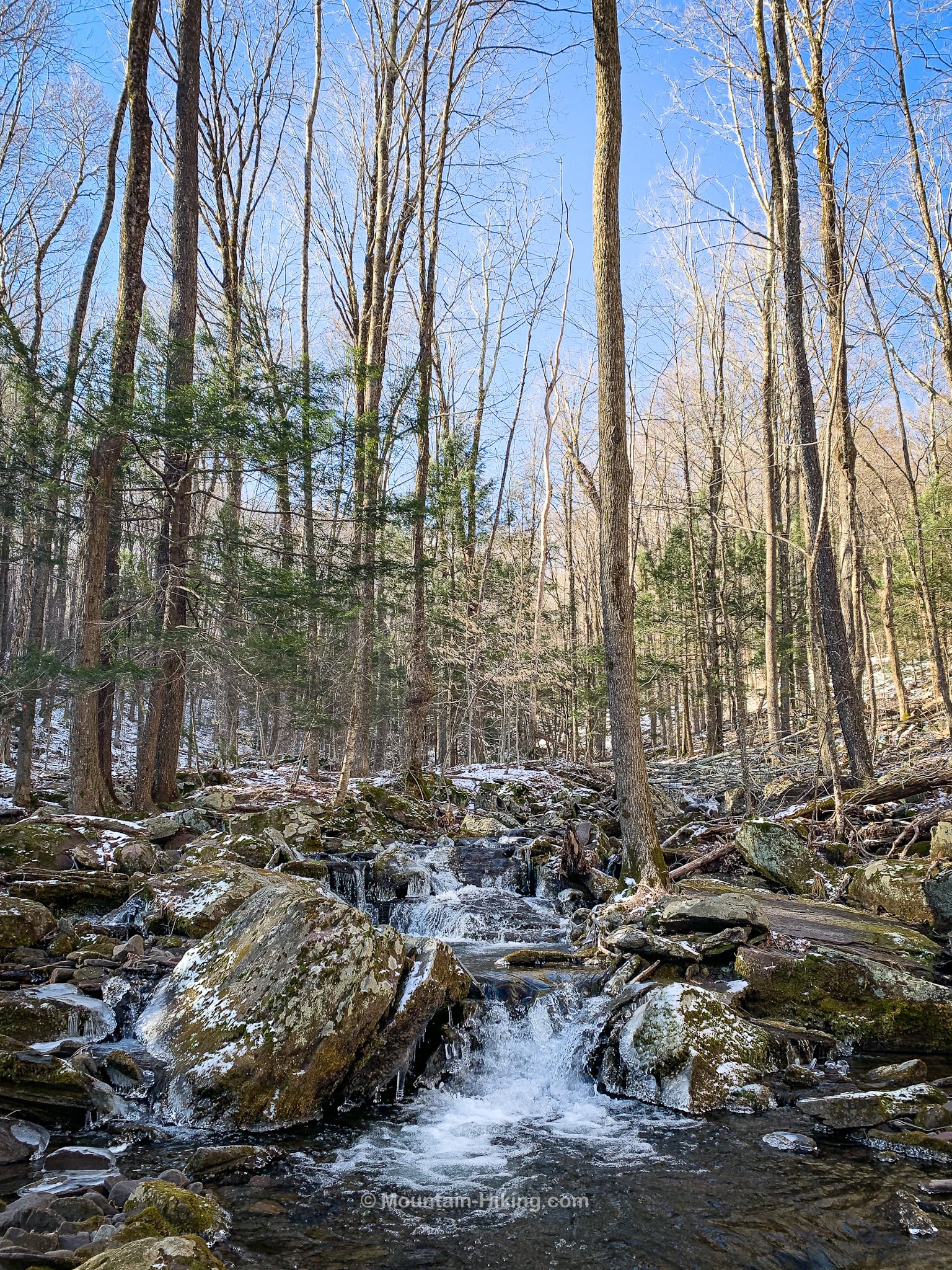
The trail follows Mink Hollow brook which begins in the col between North Dome and St. Anne’s Peak.
This first trail section is really lovely. It extends 1.55 miles from the trailhead to the first junction. However, for this hike, we left the trail after about a mile and crossed to the far side of Mink Hollow…
Confusingly, this is one of two Mink Hollows in the Catskills. Even more confusingly, both Mink Hollows are on the Devil’s Path; the other the Mink Hollow lies between Sugarloaf and Plateau.
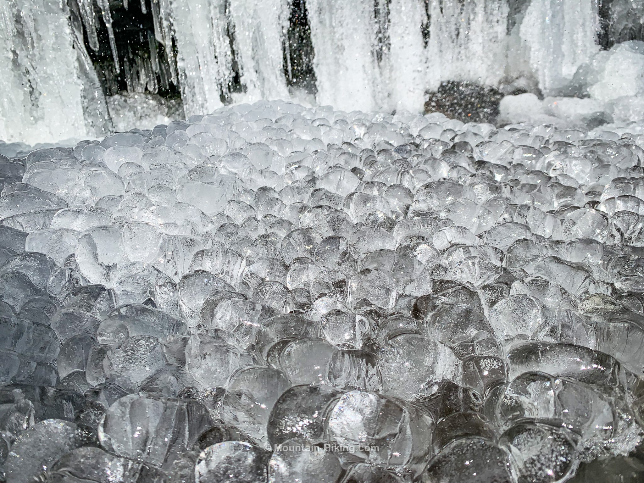
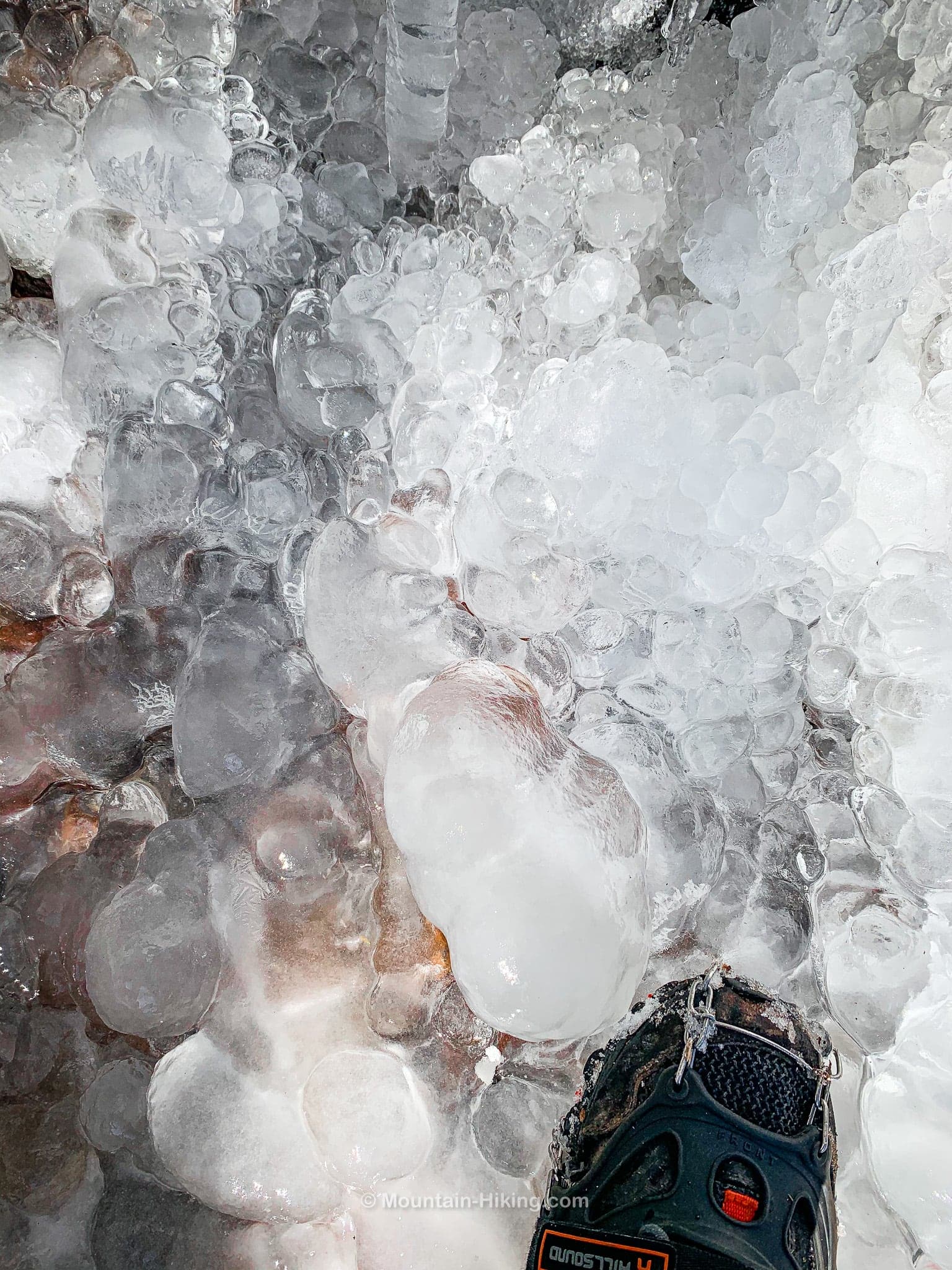
After a short climb, we came to this amazing icicle wall about 500 feet off-trail…
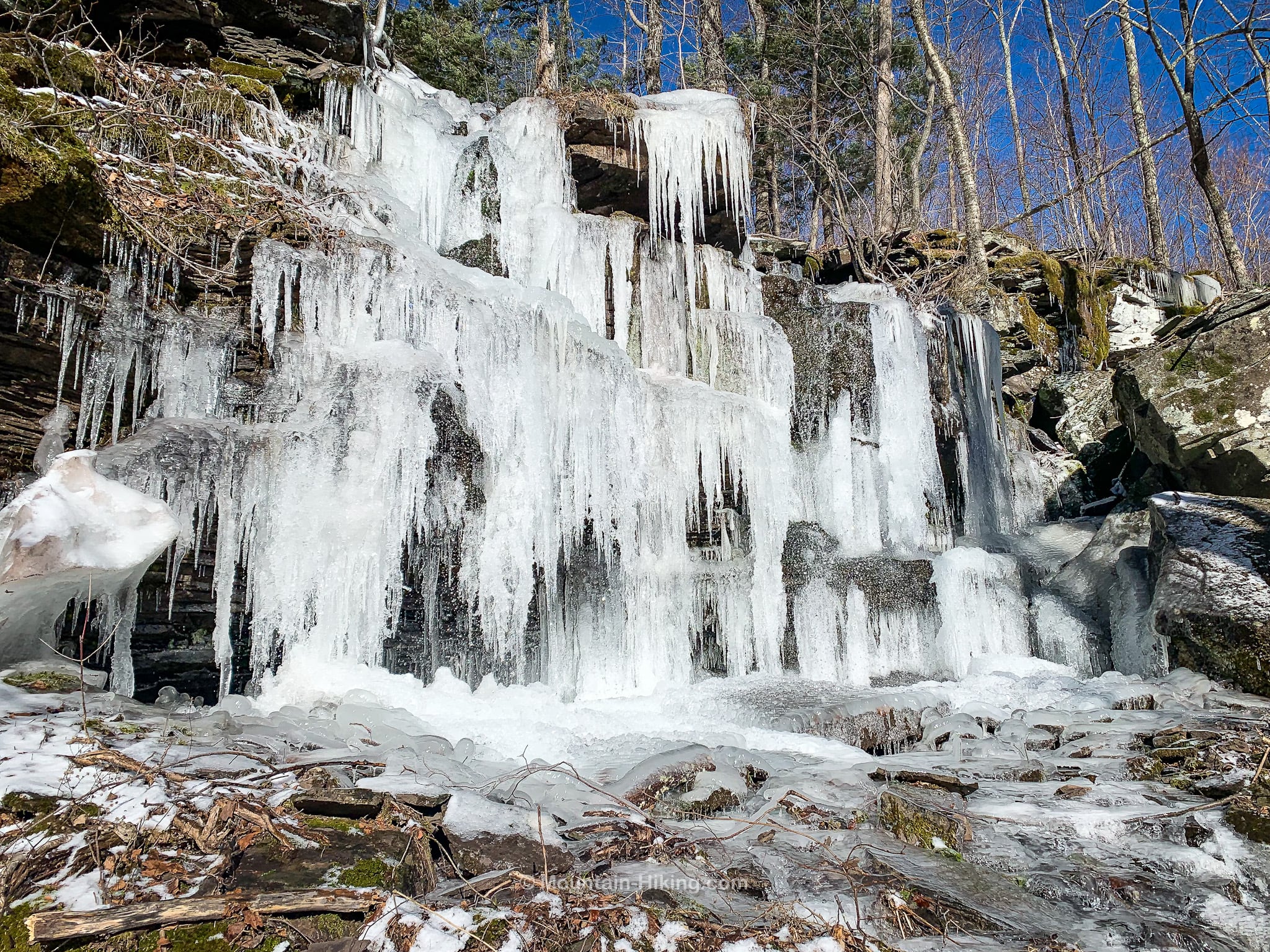
The base of the icicle-wall was a carpet of ice-balls…
Climbing North Dome
There’s still plenty of ice and snow in the Catskills in April. The night before, a fresh dusting of snow had fallen over the hills. Everything looked amazing.
It’s important to carry microspikes in the Catskills until as late as June.
Down low, North Dome’s ledges aren’t too bad. As you climb, they become increasingly rugged and steep. Depending on the route you take, you will deal with 5, 6, 7, 8 distinct ledges…

Similar Hikes
For more difficult Catskill bushwhack hikes that include two summits and a col try Rocky & Lone and Van Wyck & Table.
Get full access…
Get instant access to the full version of this site and enjoy great supporter benefits: full galleries, full trail notes, early access to the latest content, and more.
Hot on the website right now…
Follow for more…
Follow my @TotalCatskills content on Instagram for regular hiking inspo and safe, inclusive community.

Thru-Hike North Dome & Mount Sherrill Trailhead
Small busy lot that serves several mountains. Arrive early on busy days.
Google Maps Location: 42.192207, -74.324005
The map below shows the exact topographic location of the trailhead
Cell Service
Do not count on cell service on this route. You may get signal up high, but do not count on it. My network is Verizon. YMMV.
The parent mountain for this hike is North Dome.